The 50’s Flight and the 60’s Sweet Delight at the Drill Track
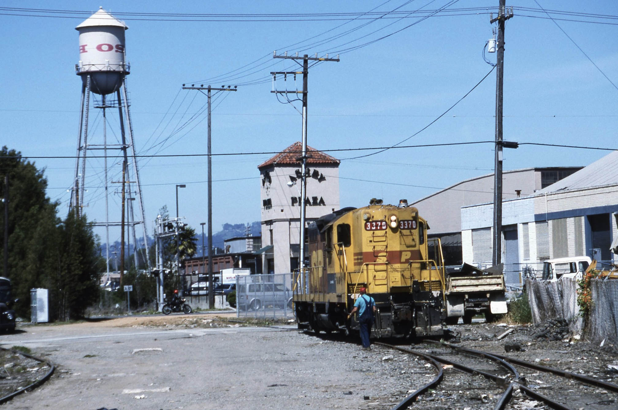
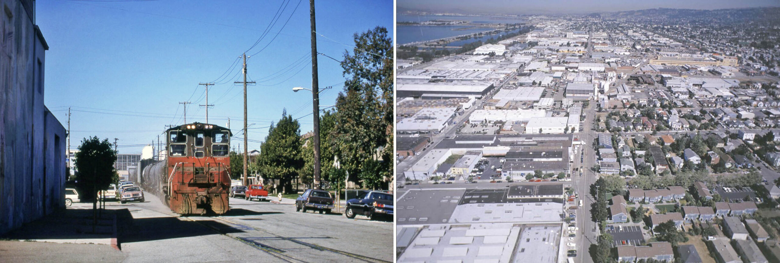
Bill Webb’s north view south of Ashby Ave. in 1995 with Southern Pacific, SP, GP9 “Kodachrome” switcher 3370 shows the turnaround point at that date for the Ninth St. freight branch, or as it became known, “Drill Track”. A perfect transition image in that includes elements of both old and new, sometimes intermixed. The last update concluded with the end of Interurban Electric Railway, IER, passenger service in mid-1941. This update will highlight the customers served during the Drill Track era to 2001, and key moments in the creation of the Emeryville-Berkeley 9th St. Greenway.
L328-05-Bill Webb Photo, Courtesy Bill Webb, (Image 1 of 45)

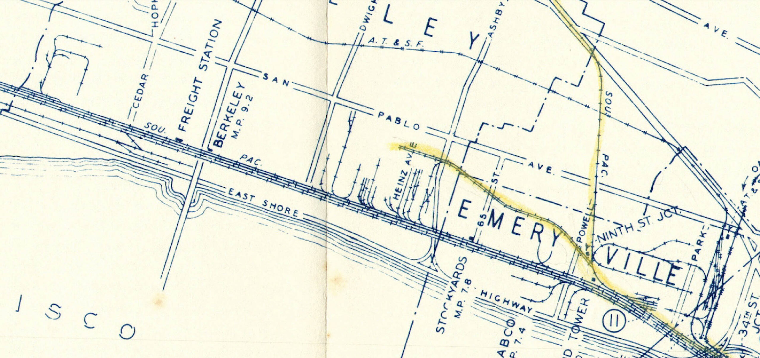
As Robert S. Ford recounted in his book “Red Trains in the East Bay”, Interurbans Press, Glendale, CA, 1977, the SP followed the cessation of the IER with preserving industrial centers for freight, and abandoning tracks that passed through residential neighborhoods when possible. For the abandoned IER line, that meant terminating the track just above Heinz Ave. as shown in this map from 1955. The track north of this would not be removed until after 1950, most of it incorporated in the Richmond Terminal Railway that operated during WWII.
L328-10-Courtesy BAERA, Western Railway Museum Archives, 245383sp, (Image 2 of 45)
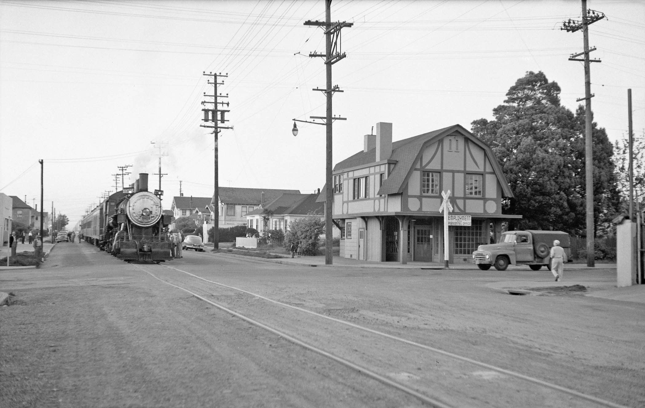
Although used for freight along with passenger service until mid-1941, the exclusive local industrial freight switching function that followed was not embraced by railfans who stopped photographing the line. The Apr. 8, 1956 SP excursion of a steam train retracing whatever IER trackage that remained the East Bay did result in this northeast view of the excursion train entering or leaving the branch at Ninth St. Junction, but no other photos on the actual line proper between here and Heinz Ave. were found.
L328-15-Robert Hanft Photo, Courtesy BAERA, Western Railway Museum Archives, 72581sp, (Image 3 of 45)
Several images of north views of Heinz Ave. of SP 1796 and passenger cars from the Apr. 8, 1956 excursion were found. Only a single track at this time existed heading beyond the Drill Track boundary. The fact that several photographers who took detailed images of the Shattuck, 7th St. and Alameda IER routes during this excursion and the one from Apr. 4, 1954 did not take images of the Drill Track proper supports the view that the line generated little railfan interest. To identify the businesses that used the freight line would require a different approach.
L328-20-Dudley Westler Photo, Courtesy BAERA, Western Railway Museum Archives, 120992sp, (Image 4 of 45)
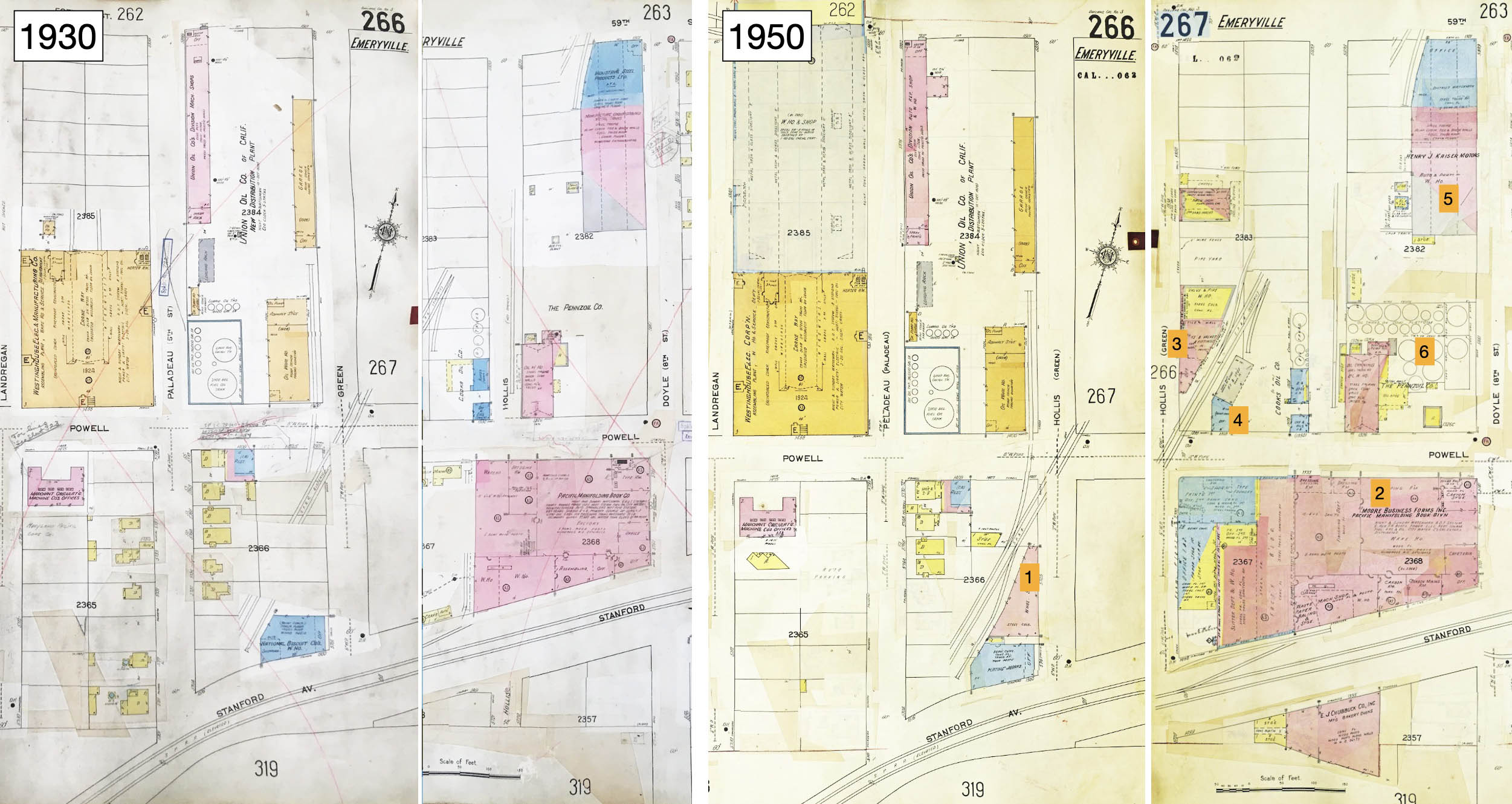
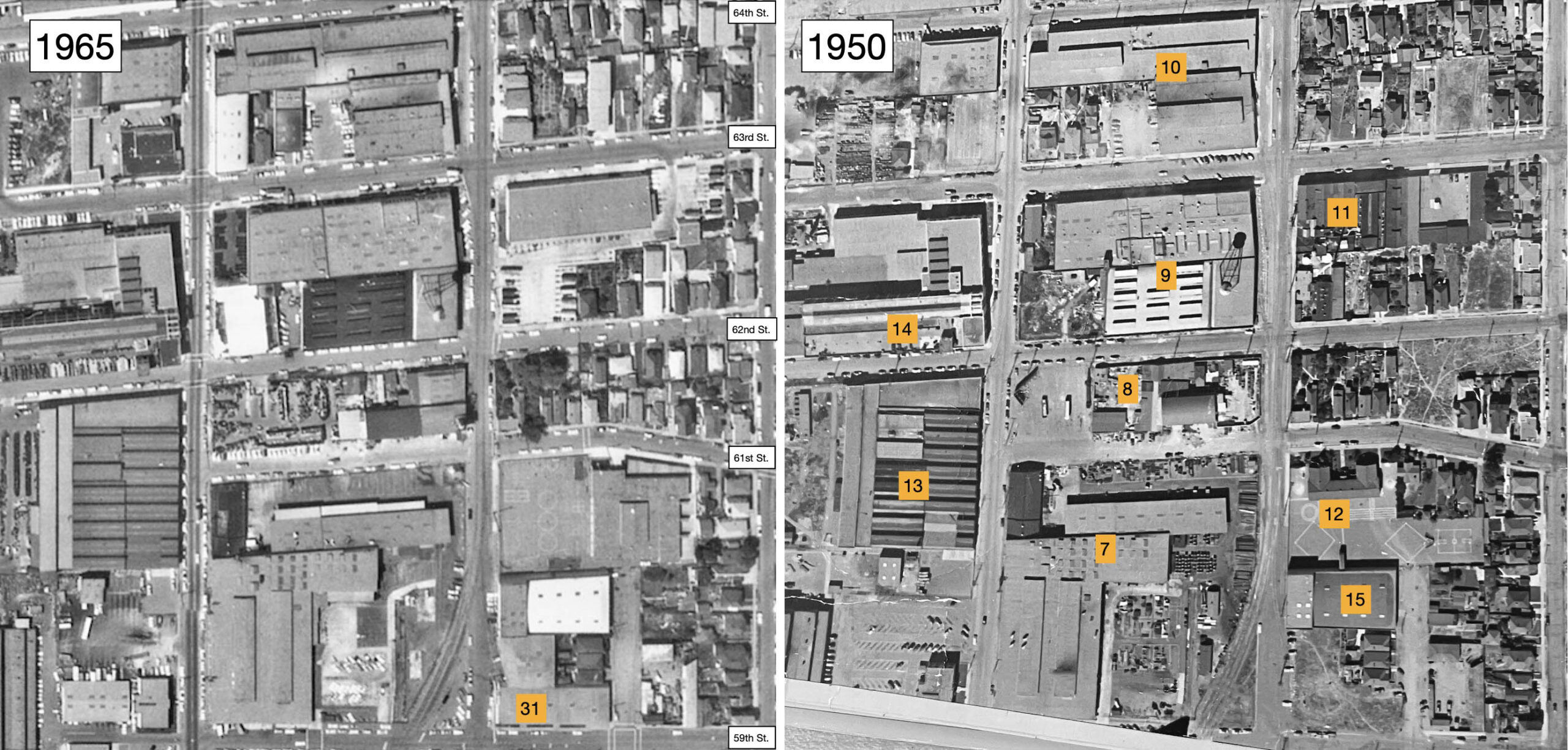
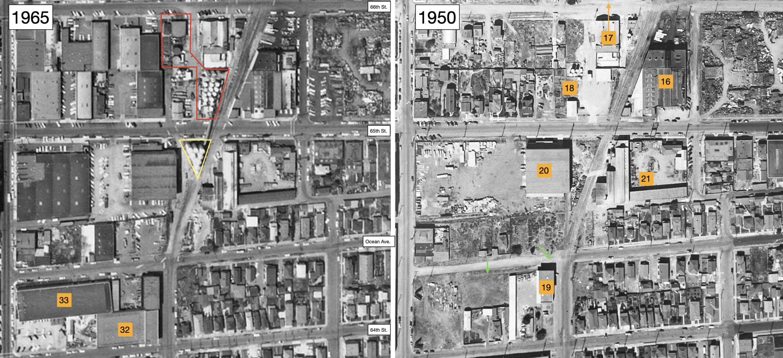
A vertical aerial view from 1950 of the Drill Track between Stanford Ave. and 59th St. from 1950 could not be found, so Sanborn maps are presented here. 1, Industrial Hard Chrome Plating Co., new building at no. 5725 Hollis St., listed in the 1950 directory as no. 5701, replaces Precison Engineering Co. that had moved to no. 701 Heinz Ave. by 1950; 2, Moore Business Forms, name of reorganized Pacific Manifolding Book Co. after 1945, served by the SP Shattuck branch; 3, The Thaler Pipe and Supply Co., no. 5812 Hollis St., building added in 1941; 4, Cooks Oil Co., no. 1350 Powell St., ca. 1940; 5, Kaiser Motors, now in Liberty Iron Works Building since 1945; 6, Pennzoil at no. 1326 Powell St., unchanged.
L328-25-Courtesy Oakland History Room, Oakland Public Library, l, Library of Congress, Geography and Map Division, Sanborn Maps Collection, 1911 to Oct 1950 Vol. 3 1950, r, (Image 5 of 45)
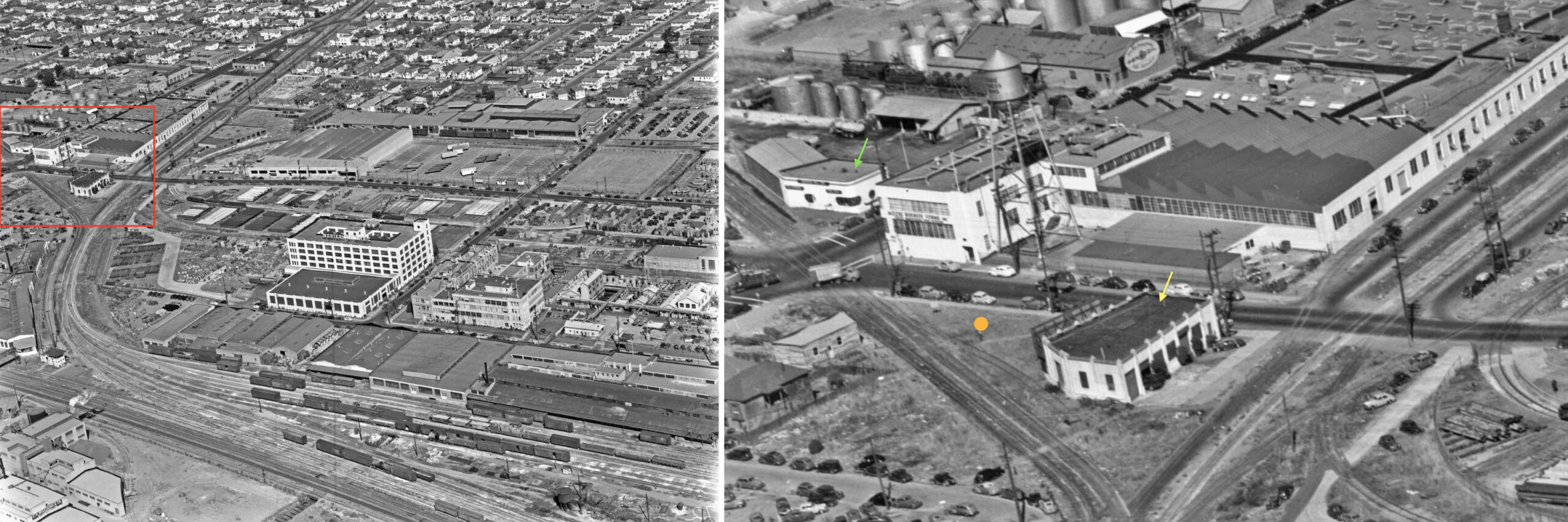
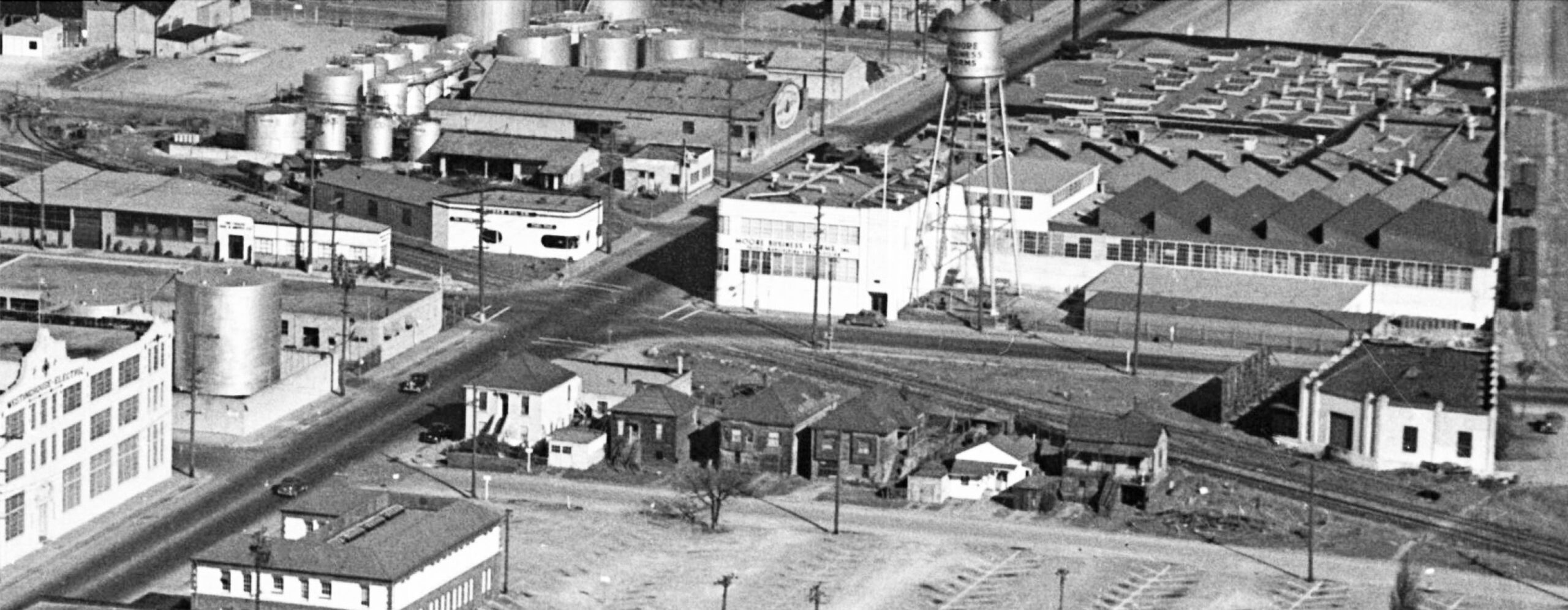
This northeast-directed oblique view from Sept. 1, 1946, left, has the area just reviewed outlined in red, magnified on the right. At this point in time, no. 5725 Green St. (soon to be Hollis St.) is still an empty lot, orange circle. Precision Engineering Co. of Oakland is at no. 5701 Green St., yellow arrow. Note the spur track. The water tower is still by the renamed Moore Business Forms, but will be moved to Doyle St. by 1950 where it sits in 2025. Penzoil is along the top, Cook Oil Co. below it, track-side, marked by the green arrow.
L328-30-Courtesy BAERA, Western Railway Museum Archives, 66793, (Image 6 of 45)
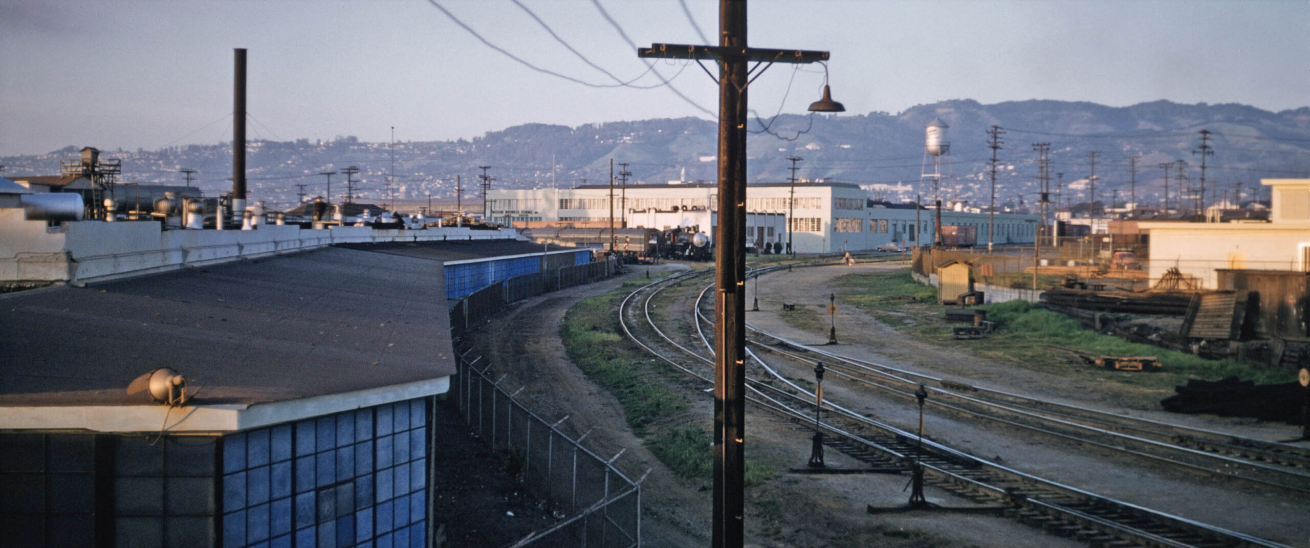
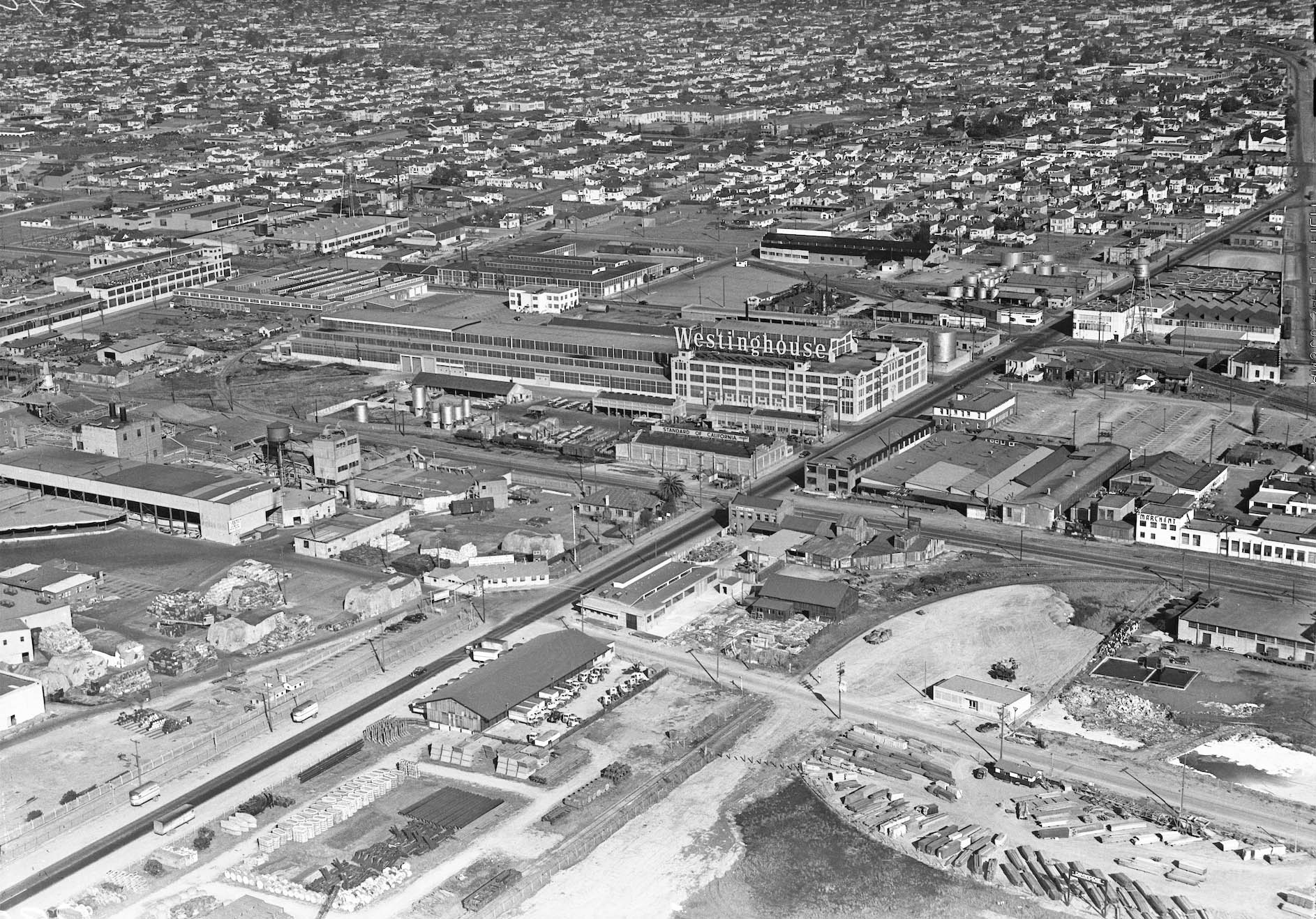
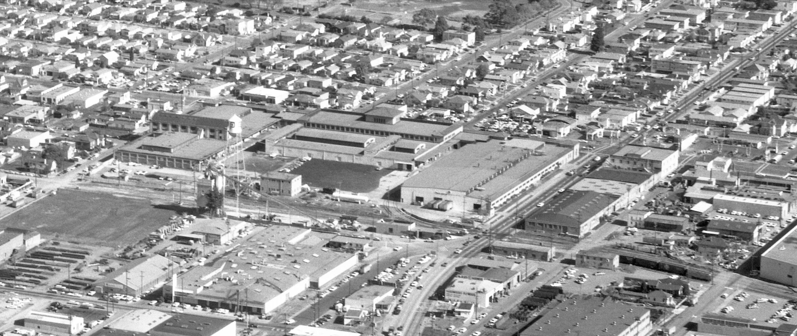
This second northeast-directed aerial, also from Sept. 1, 1946, documents the buildings surrounding the Drill Track from Stanford Ave. just short of 65th St. Details from this high quality image will be featured next.
L328-35-Courtesy BAERA, Western Railway Museum Archives, 66782, (Image 7 of 45)
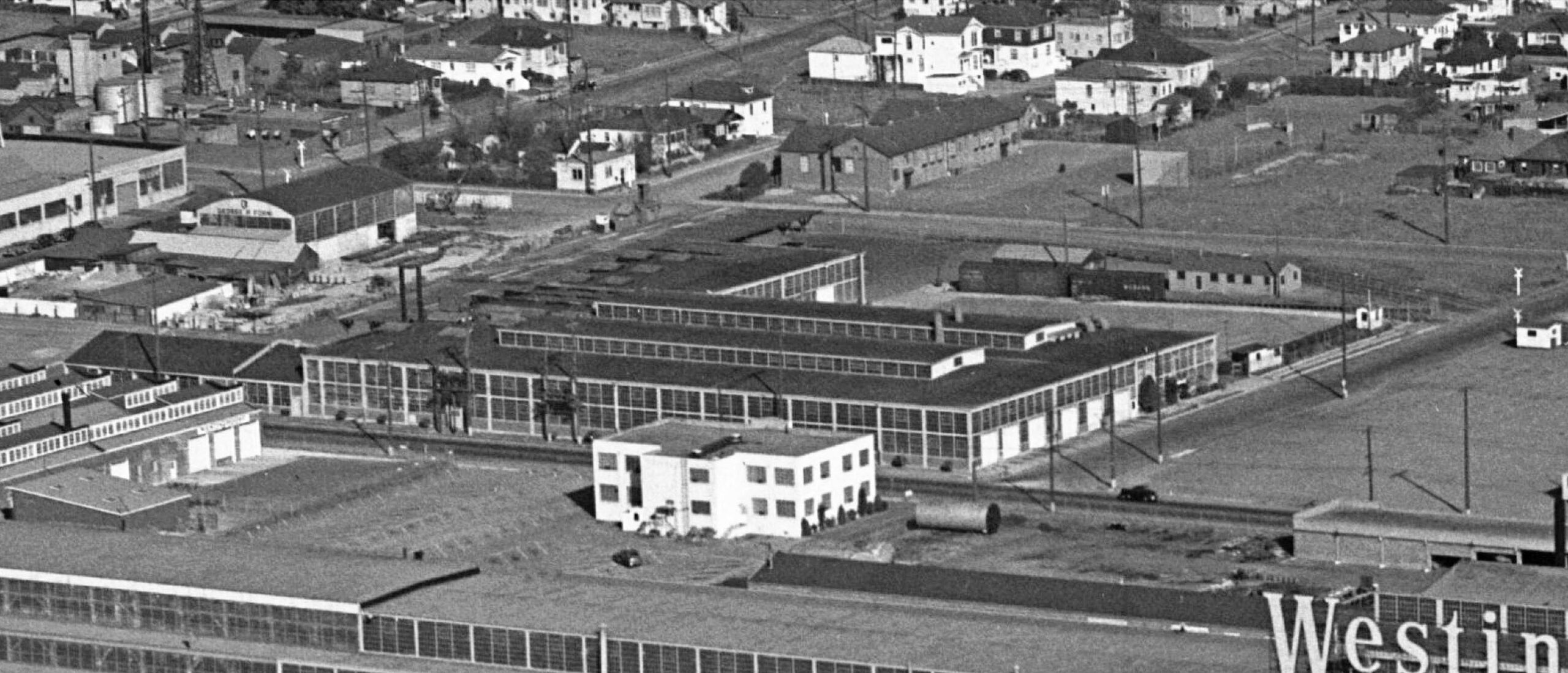
Starting along in the left lower corner and moving up into view comes Westinghouse Electric, serviced by the SP mainline along the Bay, Union Oil Co., Thaler Pipe and Supply Co., the Drill Track, Cook Oil, and Pennzoil. The writing on Moore Business Forms Inc. facilitates its identification.
L328-40-Courtesy BAERA, Western Railway Museum Archives, 66782, Detail, (Image 8 of 45)
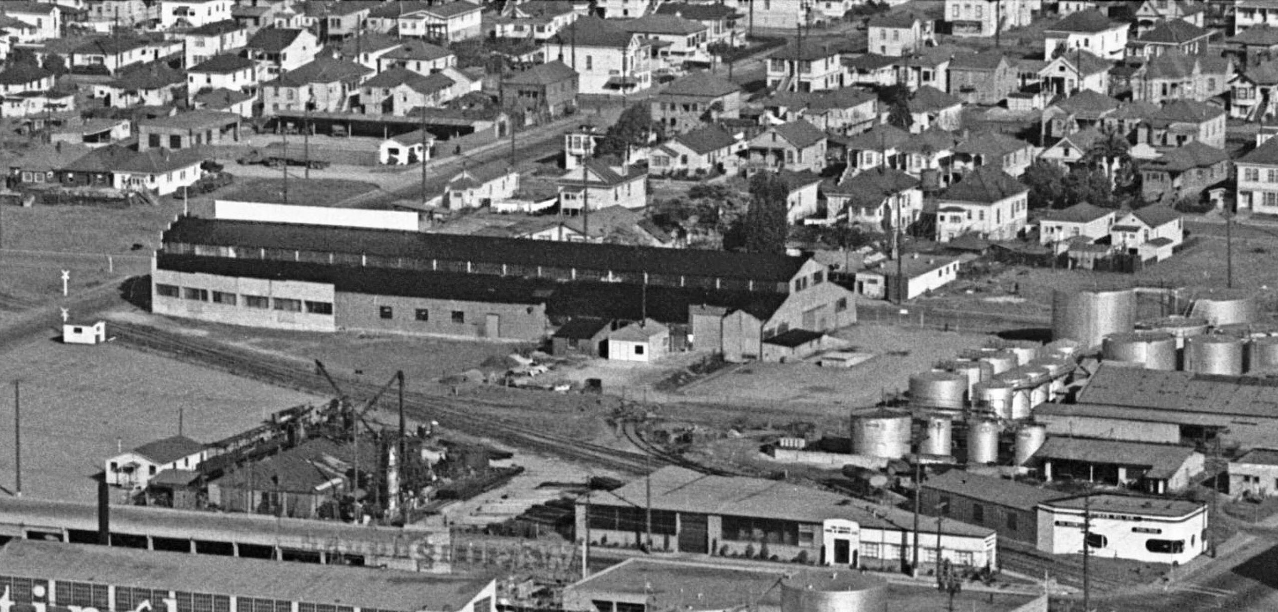
Further north in the 1946 northeast view is the ex-Liberty Iron Works building, at this time hosting the beginnings of Kaiser Motors. The fenced-off rail spur and lack of of any activity suggests that the car plant may not have as yet been up and running. Of all the commercial buildings seen in this view, only that building survives in 2025.
L328-45-Courtesy BAERA, Western Railway Museum Archives, 66782, Detail, (Image 9 of 45)
7, International Harvester, no. 1360 59th St., still owned by Associated Oil Co. who occupied Building in 1938, North Emeryville School building razed to expand; 8, Forni Manufacturing Co., no 1379 62nd St., expanded since 1938; 9, Crown-Zellerbach Paper Co., 63rd and Doyle Sts.; 10, Detroit Steel Products-Fenestra Steel Window Co. no. 1310 63rd St. expanded along 64th St.; 11, Pioneer Laundry, no. 1291 63rd St., unchanged; 12, Hawley School, name change from Sutter; 13, Grinnell Co., unchanged; 14, General Cable Corp., no. 6221 Hollis St., expanded; 15, 6, Merritt Distributors (Wholesale Alcohol) no. 5950 Doyle St., new building with spur track, red arrow.
L328-50-Harrison Ryker Photo V5-149, Courtesy California Department of Transportation, l, Clyde Sunderland Photo, Courtesy Earth Sciences and Map Library, UC Berkeley, G4364 B5 A4 1950 B4, r, (Image 10 of 45)
Back to the second northeast-directed aerial from Sept. 1, 1946, this detail shows the large facility being leased by International Harvester, dead center. Note the boxcars on the short spur from the Drill Track. One block north or left, the expansion of Forni Manufacturing Co. from 1938 is also appreciated in this view, the building with the glass windows being the concrete water box factory. Top center is the Hawley School. In the top left corner along 63rd St. is Pioneer Laundry.
L328-55-Courtesy BAERA, Western Railway Museum Archives, 66782, Detail, (Image 11 of 45)
Moving north, also from the northeast-directed aerial of Sept. 1, 1946, starting right to left from the lower right corner are Grinnel Co., then the expanded General Cable Corp. The next level up or east are Zellerbach Paper Co. with its inscribed water tower, then Detroit Steel Products-Fenestra Steel Window Co. Pioneer Laundry can now be appreciated in the upper right corner or further east. To introduce the next set of aerials, the former Janson Steel Works building at no. 1265 65th St. is at the very top left, unoccupied at this time, but not for long.
L328-60-Courtesy BAERA, Western Railway Museum Archives, 66782, Detail, (Image 12 of 45)
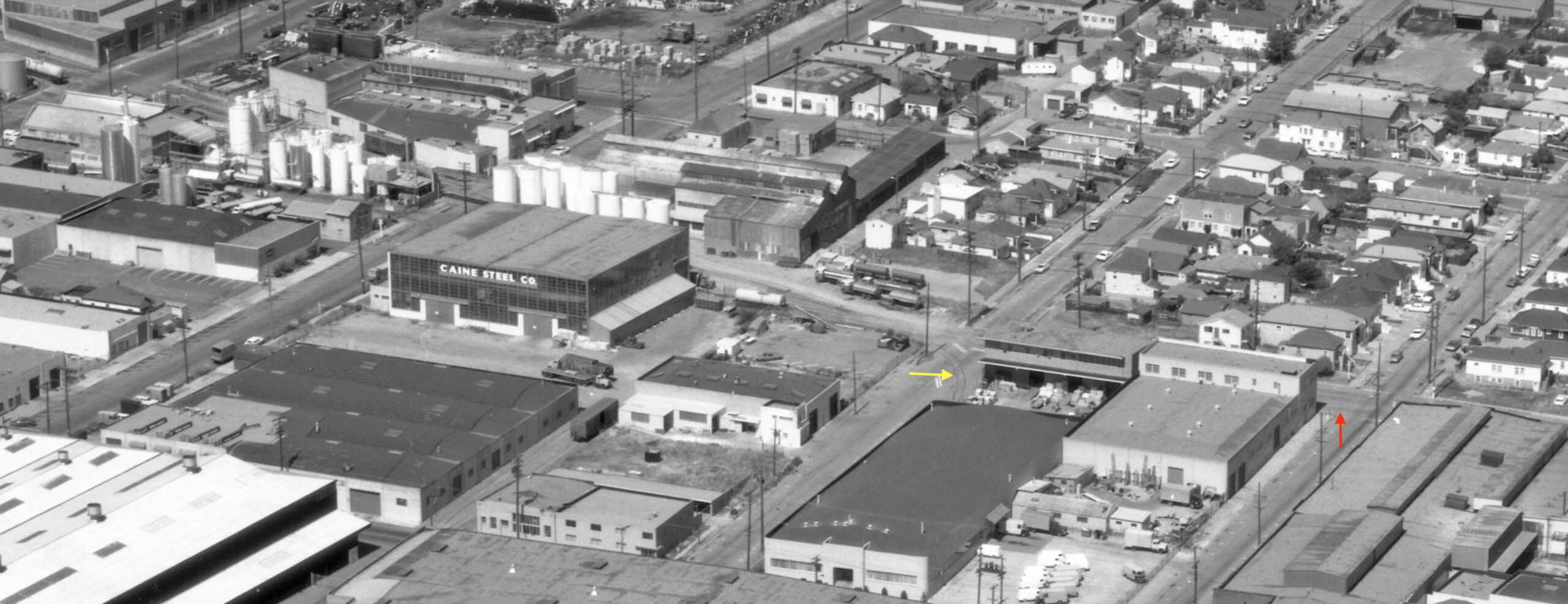
16, Oliver Tire and Rubber Co. no. 1200 65th St. replaces and expands upon Vitab Corp. and National Oils Products; 17, Diamond Alkali Co. no. 1269 66th St. replaces Emeryville Chemical Co. between 1938-1944 (continued above 66th St.); 18, Mohawk Petroleum Corp. Distributing Station, unchanged; 19, J. T. Thorpe and Sons, Inc. Masonry, no. 1351 Ocean Ave.; 21 The Alloys Co., no. 1265 65th, not listed in reverse directories 1938-1944; 22, Caine Steel Co., no. 1289 65th St., new building absent in 1944. Note the spur, red arrows, heading west on Ocean Ave.
L328-65-Harrison Ryker Photo V5-149, Courtesy California Department of Transportation, l, Clyde Sunderland Photo, Courtesy Earth Sciences and Map Library, UC Berkeley, G4364 B5 A4 1950 B4, r, (Image 13 of 45)
17, Diamond Alkali replaces Emeryville Chemical Co. at no. 1269 66th St (continued below to 65th St. as well); 22, Doughnut Corp. of America, no. 1255 67th St., first listed in 1941 directory; 23, F.A.B. Manufacturing, continued expansion from 1938; 24, Marchant Calculating Machine Co., this facility not listed, but 1941 by IER images, Marchant continued to be listed in directory in 1950 at the main facility at no. 1475 Powell St., a facility serviced by SP Mainline; 25, Folger Ave. Mill and Lumber Co. at no. 940 Folger Ave. expanded.
L328-70-Harrison Ryker Photo V5-149, Courtesy California Department of Transportation, l, Clyde Sunderland Photo, Courtesy Earth Sciences and Map Library, UC Berkeley, G4364 B5 A4 1950 B4, r, (Image 14 of 45)
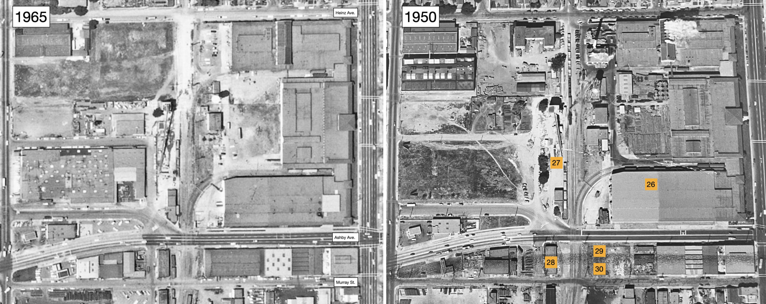
26, H.J. Heinz Co., expanded; 27, Charles S. Hughes Co. Materials, unchanged; 28, U.S. Plumbing Supply, no. 1000 Ashby-1001 Murray St., new building since 1938; 29, Western Newly Weds Baking Co., no. 1036 Ashby Ave., new building not listed in 1944; 30, Service Station Supply Co., no. 1035 Murray St., new building not listed in 1944. Note that in 1950, the track between Ashby and Heinz Aves, goes from two tracks to one track heading north as sen previously in the excursion image.
L328-75-Harrison Ryker Photo V5-149, Courtesy California Department of Transportation, l, Clyde Sunderland Photo, Courtesy Earth Sciences and Map Library, UC Berkeley, G4364 B5 A4 1950 B4, r, (Image 15 of 45)
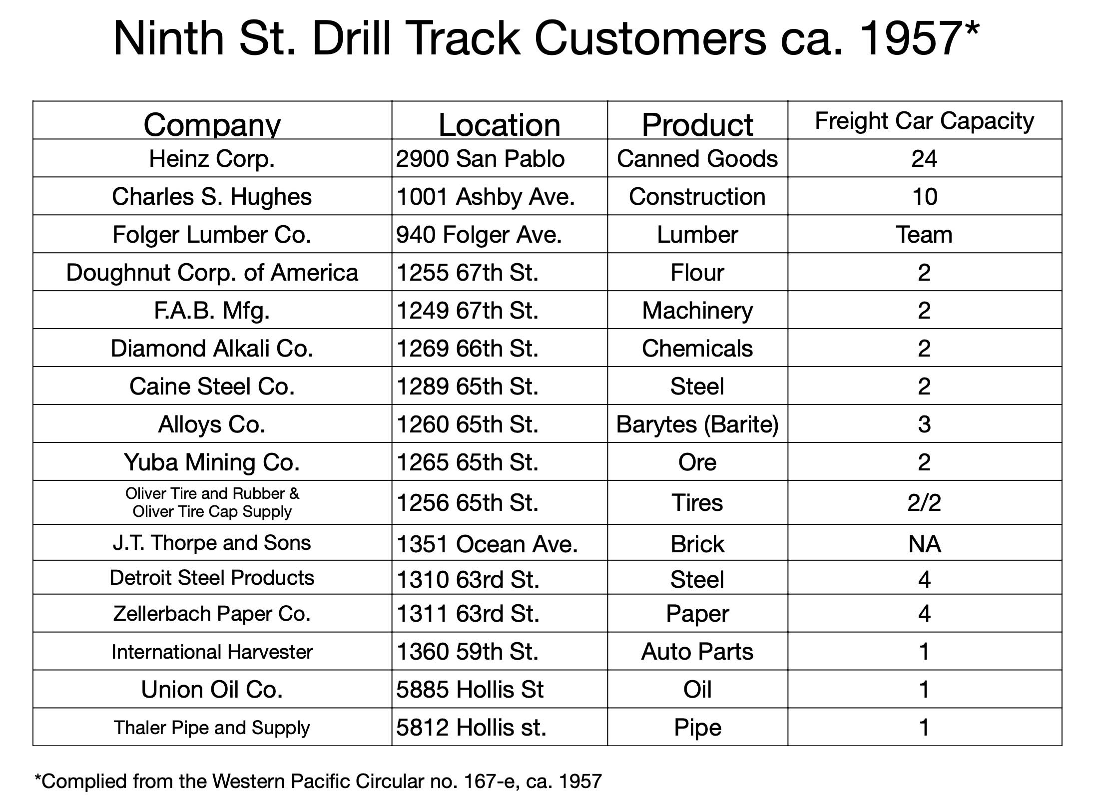
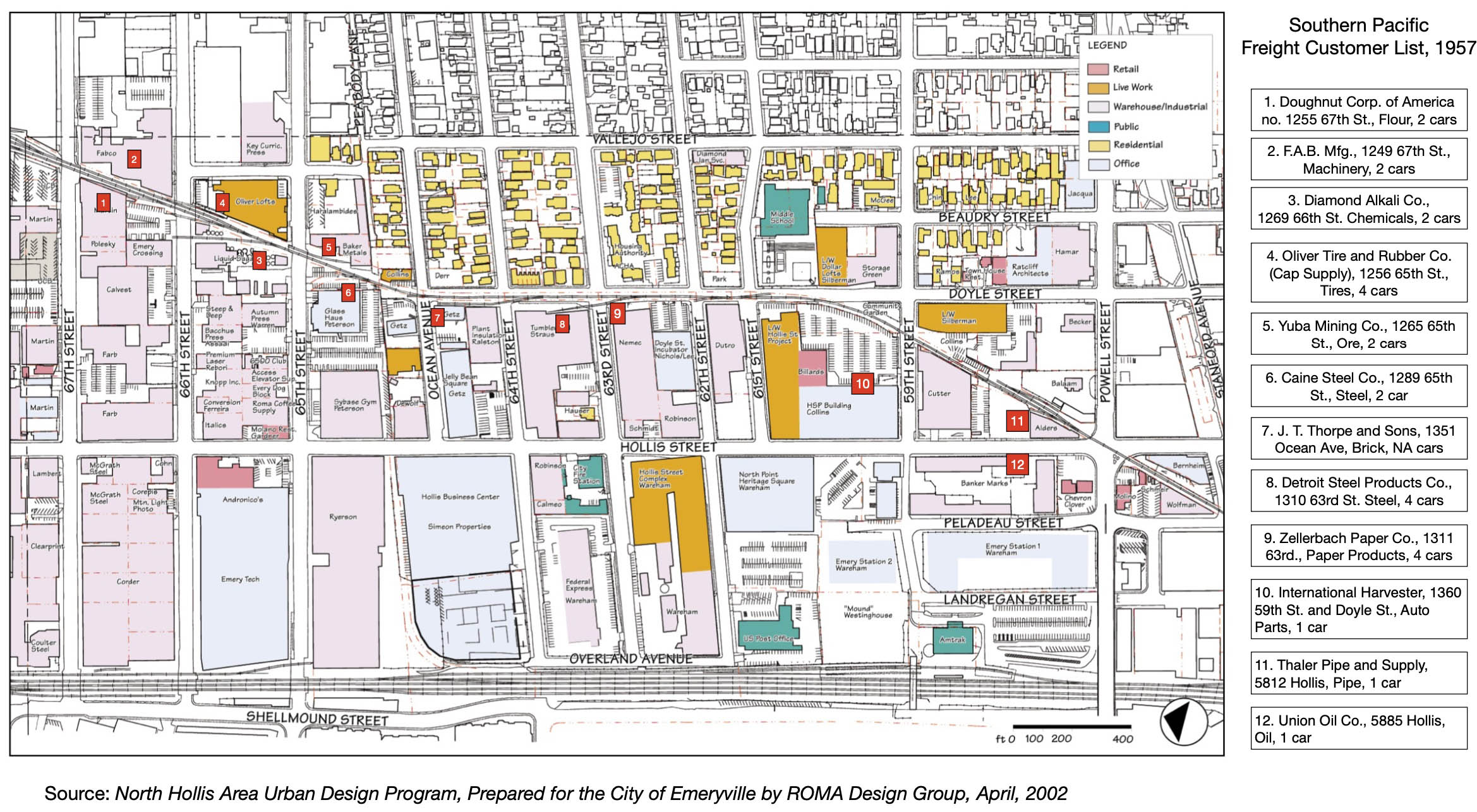
The comparative aerial review of 1938 versus 1950 just completed supports the list of customers the SP served by the Drill Track in 1957 shown here. This chart does not reflect the number of deliveries per week, but the business north of Ashby Ave. from Heinz and Hughes provided a lopsided share of the freight traffic. However, Heinz had already notified the SP in February 1955 of their move to Tracy to be done gradually over the next two years.
L328-80-Compiled by Stuart Swiedler, Source Document Courtesy Bruce Eldridge, (Image 16 of 45)
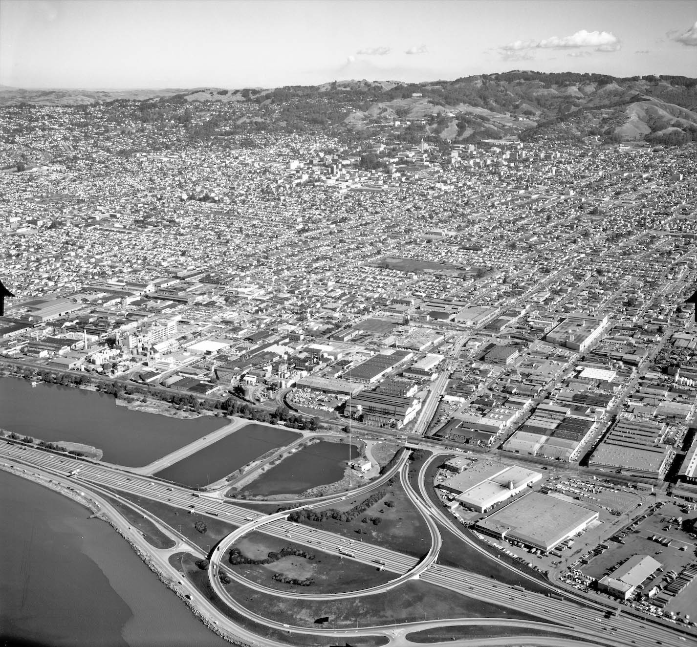
Moving ahead to 1965, the loss of Heinz and flight of other customers from the services of the Drill Track changed the dynamics of freight traffic on the line. This aerial from 1965 shows the entire track with south on the left, and north on the right. Next for a detailed review.
L328-85-cas-65-130_15-113-114, Courtesy of UCSB Library Geospatial Collection, (Image 17 of 45)
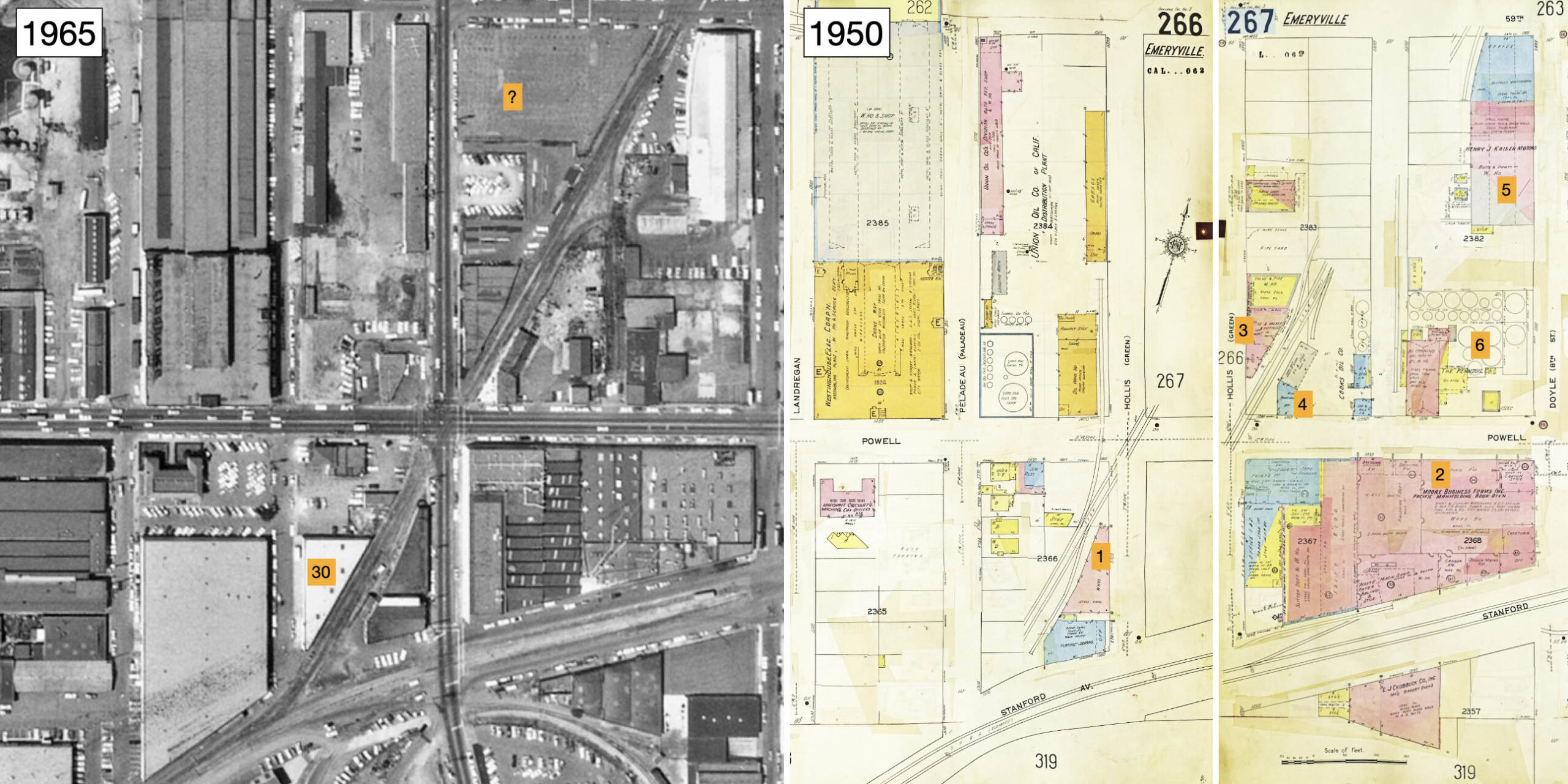
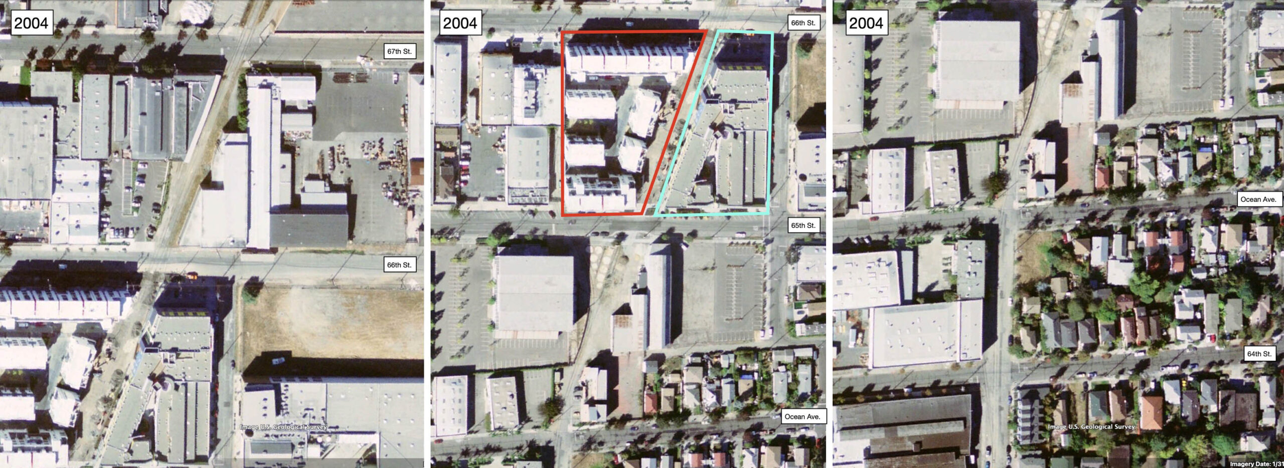
The analysis will use the same numbering system as in the previous 1938 versus 1950 comparison, and substituting 1965 for 1938 as shown here. 1, Bisphoric Products Co. replaces Industrial Hard Chrome Plating Co. at nos. 5701-5725 Hollis St.; 2, Moore Business Forms, unchanged; 3, The Thaler Pipe and Supply Co., unchanged; 4, Balaam Bros. Welding Supplies replaces Cooks Oil Co. at no. 1350 Powell St.; 5, Charles M. Bailey Control Valve Mfg. replaces Kaiser Motors as owners of no. 1301 59th St. in 1966 after the latter had leased the building for several years; 30, vacant, no. 1326 Powell St., formerly occupied by Pennzoil; 30, Laura Scudder’s, no. 5762 Peladeau St., new building.
L328-90-cas-65-130_15-114, Courtesy of UCSB Library Geospatial Collection, l, Library of Congress, Geography and Map Division, Sanborn Maps Collection, 1911 to Oct 1950 Vol. 3 1950, r, (Image 18 of 45)
Two outstanding aerial photos that by chance may be aligned by the red dot, the first from Nov. 12, 1968, right, a west view of the Drill Track between Powell St. and 59th St., and the second from May 30, 1968, left, a northeast view of the Drill Track from 59th St. to Ashby Ave. These will be used to gather additional information about customers served by freight. A detail from the former aerial follows to complement the information in the previous comparison, L328-90.
L328-95-Ed Brady-Aerospace 13876, Courtesy BAERA, Western Railway Museum Archives, 184137ev, (Image 19 of 45)
This detail from the Nov. 12, 1968 aerial shows the a single track crossing Powell St. at Hollis St. from the south in the right lower corner. The track then splits in two, the western one, green arrow, passing Thaler Pipe and Supply Co., and sending off a spur, turquoise arrow, supplying Thorsen Tool Mfg. Co. The eastern track, yellow arrow, collects spurs from Balaam Bros. Welding, orange arrow, Bailey Control Valve, blue arrow, and one to former site of Pennzoil, red arrow. It is not been determined if any of these spurs were active at this date.
L328-100-Ed Brady-Aerospace 13876, Courtesy BAERA, Western Railway Museum Archives, 184137ev, Detail, (Image 20 of 45)
7, Thorsen Tool Mfg. Co., no. 1360 59th St., replaces International Harvester, vacating in early 1960s, 8, Christy Concrete Products Inc., no. 1379 62nd St, replaces Forni Manufacturing Co., vacating in 1964; 9, Not listed by address or Zellerbach Paper Co., 10, No listing, Detroit Steel Products-Fenestra Steel Window Co announced closure at no. 1310 63rd St. on 07/14/1961; 11, Transbay Motor Express Co. Trucking, no. 1291 63rd St., replaces Pioneer Laundry, vacating in early 1950s; 12, Hawley School, unchanged; 13, Grinell Co., shown in 1950 Sanborn, but listed at no. 2230 Peralta St., Oakland; 14, General Cable Corp., unchanged; 15, National Dollar Stores, no. 5950 Doyle St., replaces Merritt Distributors; 31, Eng-Skell Co. Restaurant Supply, no. 1290 59th St., new building.
L328-105-cas-65-130_15-114, Courtesy of UCSB Library Geospatial Collection, l, Clyde Sunderland Photo, Courtesy Earth Sciences and Map Library, UC Berkeley, G4364 B5 A4 1950 B4, r, (Image 21 of 45)
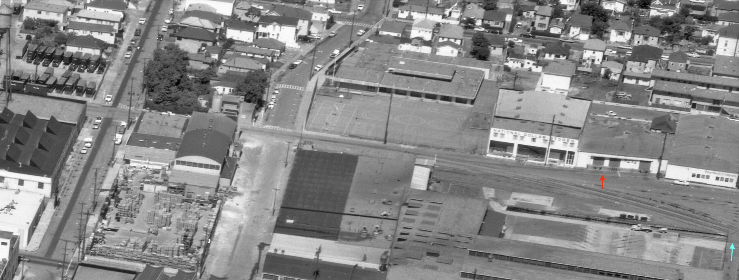
This detail from the Nov. 12, 1968 aerial shows Eng-Skell Co. on the right edge at the corner with 59th St., and the spur track originally built to service liquor distributor Merritt Distributors, red arrow, now extending just south of National Dollar Stores. Seen across Doyle St. is a continuation of the spur to Thorsen Tool Mfg. Co. shown previously, turquoise arrow. No documents were found to verify either spur was still used. Across 61st St. to the north or left is Christy Concrete Products Inc. that had replaced Forni Manufacturing Co.
L328-110-Ed Brady-Aerospace 13390, Courtesy BAERA, Western Railway Museum Archives, 233781sp, Detail, (Image 22 of 45)
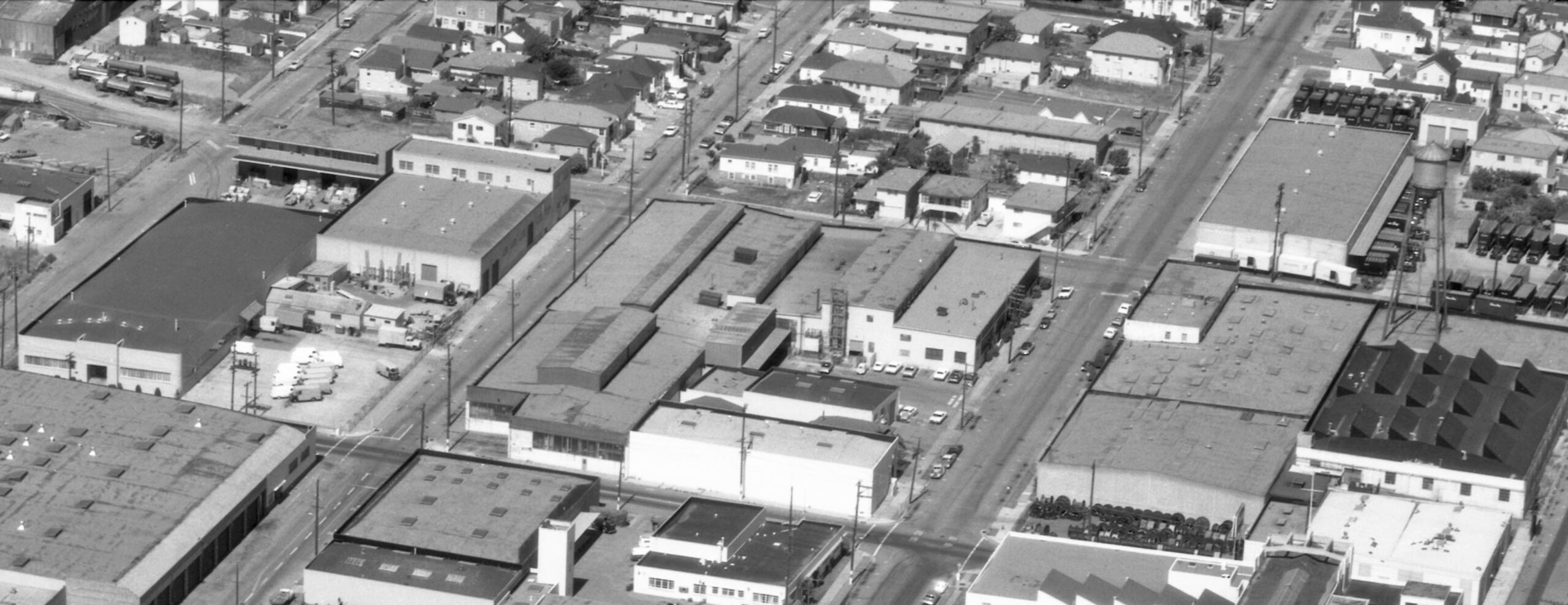
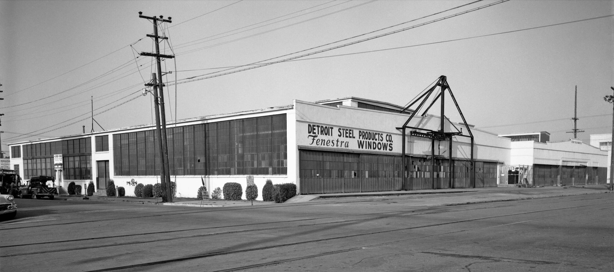
Moving further north between 62nd St. and 64th Sts., this details from the Nov. 12, 1968 aerial shows the trucking company that replaced Pioneer Laundry is in the upper right corner. The water tower that in 1950 had the Zellerbach name inscribed is now blank. Zellerbach invested in a huge facility in Antioch in 1954, but nowhere does it mention if the Emeryville facility was a casualty, although the address disappears from directories. Across 63rd St. is the building that once housed Detroit Steel Products-Fenestra Steel Window Co. More about the building to the north of it will be discussed soon.
L328-115-Ed Brady-Aerospace 13390, Courtesy BAERA, Western Railway Museum Archives, 233781sp, Detail, (Image 23 of 45)
This northwest view from Dec. 7 1961 shows the Doyle St. and 63rd St. corner and the Detroit Steel Products-Fenestra Steel Window Co., with the SP spur in view. Odd to see broken windows in a company that made windows, but the occupants had already departed as attested by the for sale or lease sign seen toward the left edge. As noted in the July 14, 1961 Oakland Tribune article, the introduction of aluminum windows that undercut the price of steel-framed windows.
L328-120-Herrington-Olson Photo, Courtesy BAERA, Western Railway Museum Archives, 159377ov, (Image 24 of 45)
16, Oliver Tire and Rubber Co. unchanged; 17, Diamond Alkali Co., unchanged 18, Mohawk Petroleum Corp., unchanged; 19, J.T. Thorpe and Sons Masonry, unchanged; 20, Caine Steel Co., no. 1289 65th St., unchanged; 21, Baker Metal Products, 1265 65th St., as well as Beasley Engineering, Coast Truck Lease, and four investment or real estate firms replace the Alloys Co.; 32, Plant Asbestos Co., no. 1300 64th St., new building; California Syrup and Extract Co. listed at no. 1299 65th St. and No. 1275 66th St. (garage) enclosed in red, possibly also tanks enclosed in yellow to be determined. The green arrows point to a spur to 33, Kaiser Refractories warehouse, no. 1372 Ocean Ave.
L328-125-cas-65-130_15-113, Courtesy of UCSB Library Geospatial Collection, l, Clyde Sunderland Photo, Courtesy Earth Sciences and Map Library, UC Berkeley, G4364 B5 A4 1950 B4, r, (Image 25 of 45)
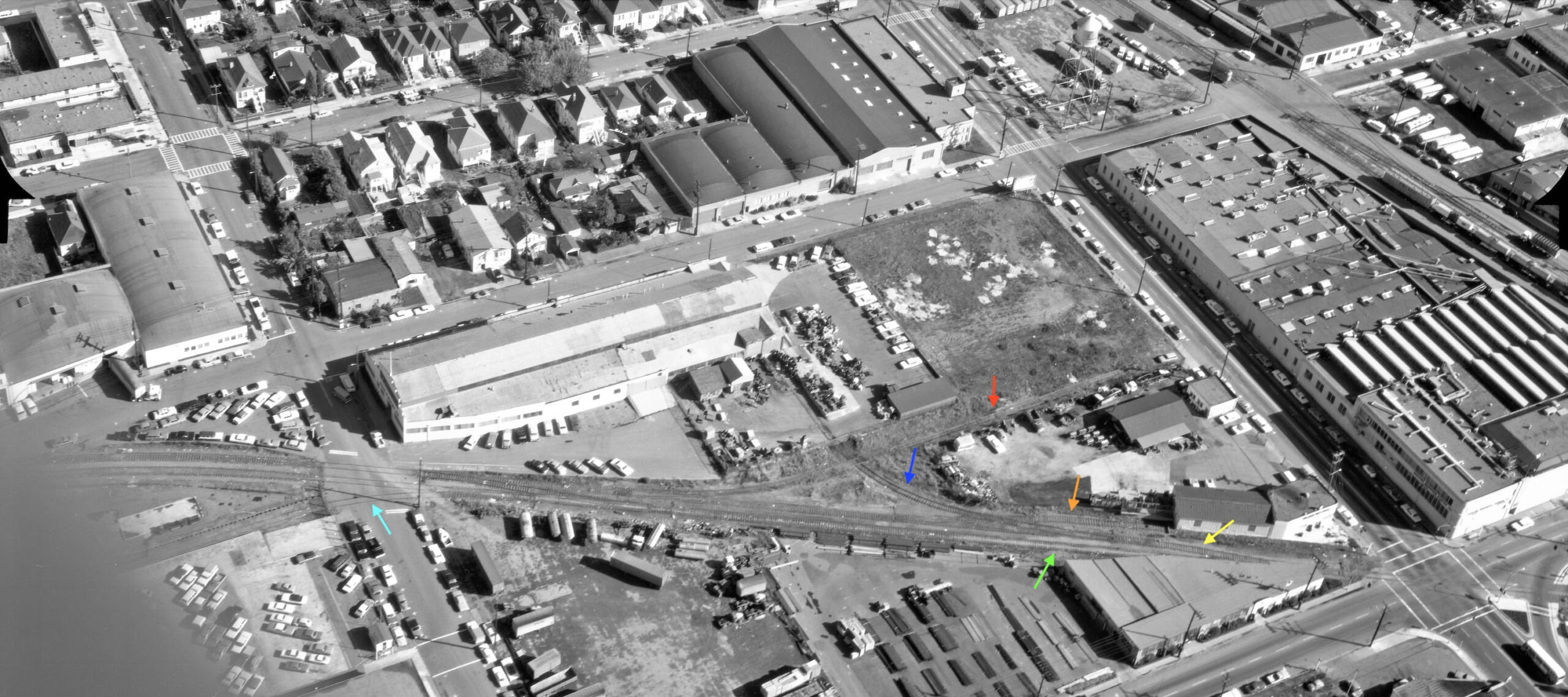
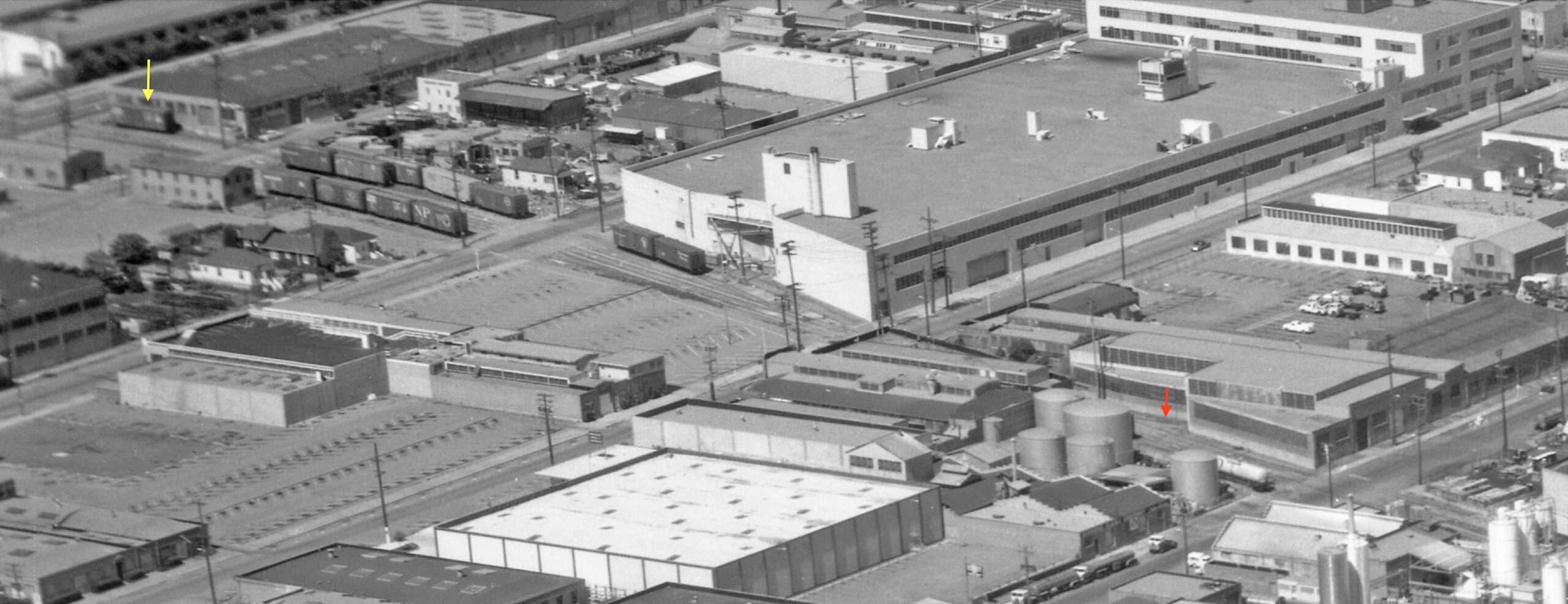
Back to the Nov. 12, 1968 aerial, the last building between 64th St. and Ocean Ave. on the west side of the Drill Track not covered in L328-115 is shown here. Note the spur to Plant Asbestos Co. and J. T. Thorpe along Doyle St., red arrow, and the spur to Kaiser Refractories coming onto Ocean Ave., yellow arrow. Unusual spur for the SP freight line in that it went down a side street in Emeryville, but only for one block due to the presence of the Breuner’s warehouse. Caine Steel is directly north on 65th St., and one block north are Diamond Alkali Co., Mohawk Petroleum Corp., and California Syrup and Extract Co. packed into the small space west of the track. To the east are Baker Metal Products on the south side of 65th St., and Oliver Tire on the north side or to the left toward the upper edge.
L328-130-Ed Brady-Aerospace 13390, Courtesy BAERA, Western Railway Museum Archives, 233781sp, Detail, (Image 26 of 45)
17, Diamond Alkali at no. 1269 66th St. unchanged (continued below to 65th St. and well); 22, DCA Food Industries, Inc., no. 1255 67th St. was a 1957 reincorporation of Doughnut Corp. of America.; 23, F.A.B. Manufacturing, no. 1249 67th St., unchanged; 24, Vacant in 1965, the now Smith-Corona Marchant Calculating Machine Co., closed this facility in 1962 after a huge expansion in 1958; 25, Parking Lot replaces Folger Ave. Mill and Lumber Co. that sold off inventory in mid-1957.
L328-135-cas-65-130_15-113, Courtesy of UCSB Library Geospatial Collection, l, Clyde Sunderland Photo, Courtesy Earth Sciences and Map Library, UC Berkeley, G4364 B5 A4 1950 B4, r, (Image 27 of 45)
Back to the final detail from the Nov. 12, 1968 aerial, this northeast view documents east of the Drill Track shows F.A.B., and its spur track, red arrow, between 66th-67th Sts., and between 67th St. and Folger Ave., the former Smith-Corona Marchant building at the Emeryville-Oakland-Berkeley border or “Three Corners”, the latter by this date the East Bay Skills Center. Across the way on the west side is the northern portion of Diamond Alkali Co. on 66th St. and DCA Foods on the 67th St. side. The occupants at this date of no. 1036 Ashby with the single boxcar on the siding, yellow arrow, could not be determined.
L328-140-Ed Brady-Aerospace 13390, Courtesy BAERA, Western Railway Museum Archives, 233781sp, Detail, (Image 28 of 45)
26, Packaging Corporation of America (PCA), purchased the H.J. Heinz Co. in 1960 after latter left area ca. 1956, loss of several buildings seen. 27, Sand and Gravel Division of Henry J. Kaiser Corp., purchased Gentry Building Materials (new name for Charles S. Hughes Co. in 1953) in 1958 after new concrete batch plant created in 1953; 28, U.S. Plumbing Supply, no. 1000 Ashby-1001 Murray St., unchanged; 29, Occupant Not Determined for 1036 Ashby Ave. 30, Service Station Supply Co., renamed WILCO Co. (the former a division of the the latter) at no. 1035 Murray St.
L328-145-cas-65-130_15-113, Courtesy of UCSB Library Geospatial Collection, l, Clyde Sunderland Photo, Courtesy Earth Sciences and Map Library, UC Berkeley, G4364 B5 A4 1950 B4, r, (Image 29 of 45)
This east view from Feb. 7, 1966 brings the tour to the end of the Drill Track in Berkeley. Next for some details.
L328-150-Ed Brady-Aerospace 10374, Courtesy BAERA, Western Railway Museum Archives, 155757sp, (Image 30 of 45)
A detail from the east view from Feb. 7, 1966 shows four boxcars on the Drill Track, the lead car obscured by the Hygenic Dog Food Co. building whose operation timeline was not found. Once past U.S. Plumbing Supply, the track in question crossed Ashby onto Potter St. The “P” on the ex-Heinz water tower is for Packaging Corporation of America or “of California” as the company said it would call it in 1963 when the plant become operational. The Kaiser conveyor belt is shifted from where the original Charles Hughes version landed onto the ground.
L328-155-Ed Brady-Aerospace 10374, Courtesy BAERA, Western Railway Museum Archives, 155757, Detail, (Image 31 of 45)
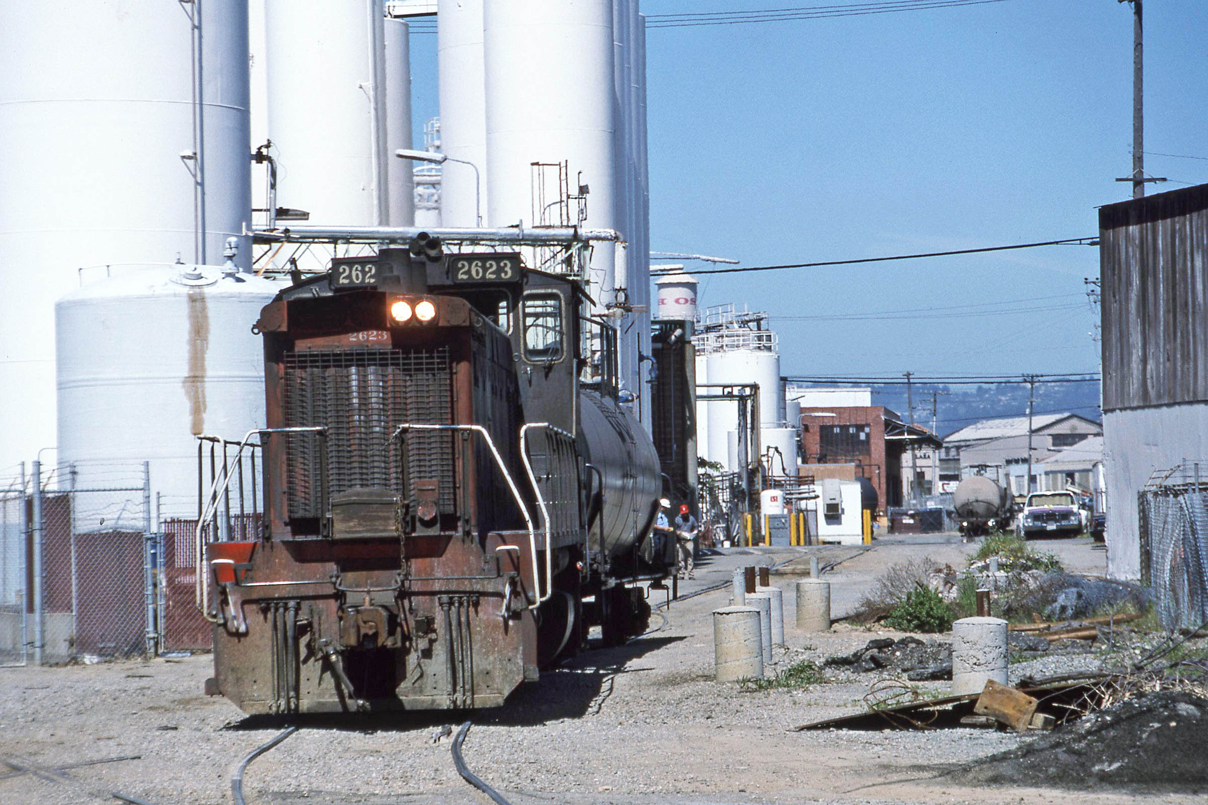
To close this sequence of comparative changes up to the 1960s, this Mar. 2, 1967 north view captures the entire Drill Track. The tall cluster of white tanks mark California Syrup and Extract Co. As business seemingly was declining south of 64th St. as reviewed, the large amount of business and expansion here alone was the main reason the Drill Track lasted until 2001, the only customer remaining at that time. More familiar with the name Liquid Sugars, Inc. as its became named in the 1970s onward, that name in the 1967 and 1969 directories is still listed at 6602 Bay St. If you want more information from another source, click here.
L328-160-Ed Brady-Aerospace, Courtesy BAERA, Western Railway Museum Archives, 219898ev, (Image 32 of 45)
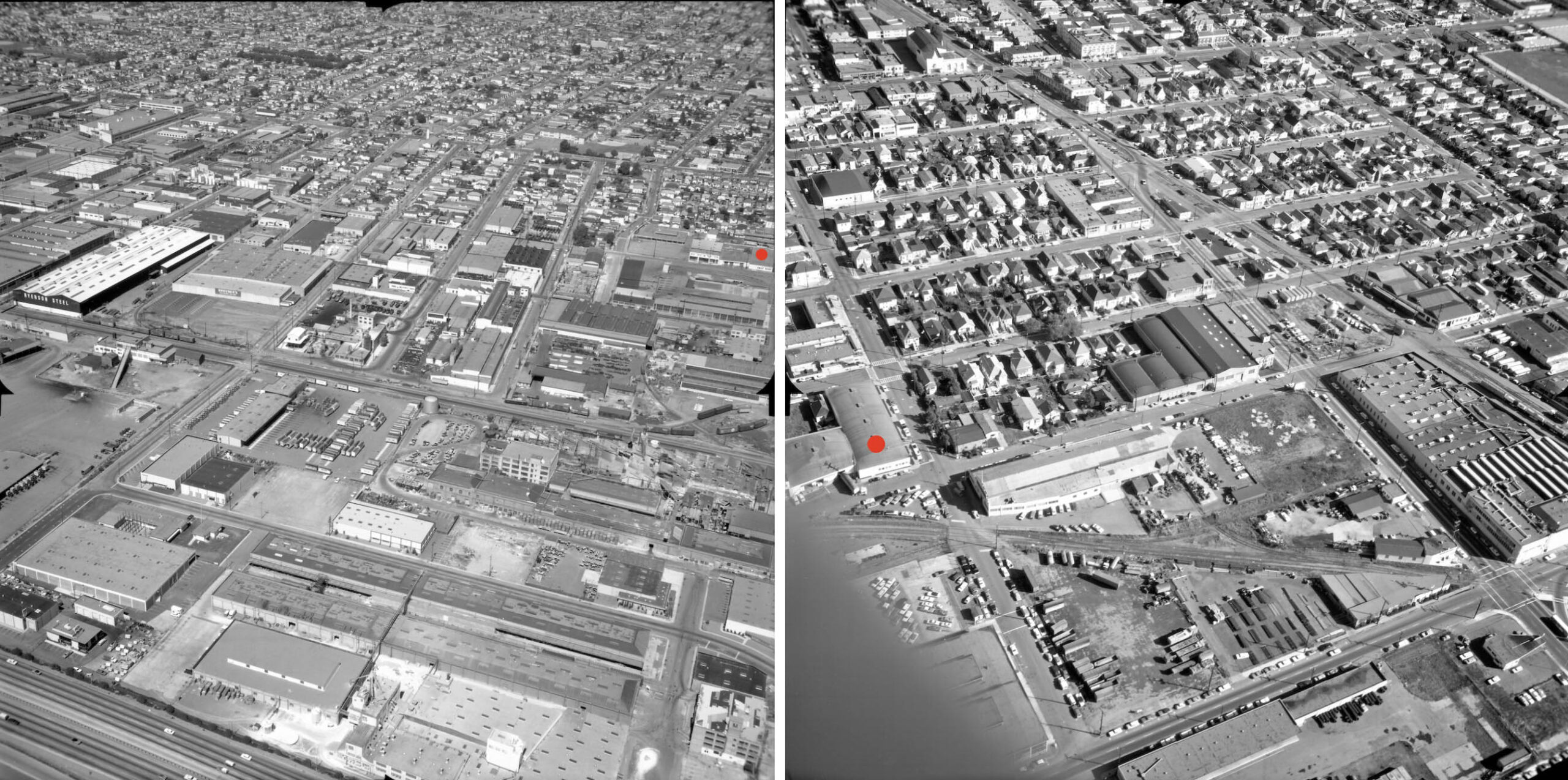
Images of the Drill Track after 1941 were not found until being connected with Bill Webb who had an interest in the line. His north view of a freight with SP 2623 heading south on Doyle St. at 62nd St. from Liquid Sugars in April 1988 is paired against an north facing aerial from 2002. The train image captures the original Caine Steel Co.’s heavily-glassed building between Peabody Ln.. and Ocean Ave., Liquid Sugars tall white tanks to the left of the train, and a tiny portion of the Jansen Steel Works building to the right of it. 62nd St. is not on the aerial, the southern-most intersection present being 63rd St. This image will be useful for what follows.
L328-165-Bill Webb Photo, Courtesy Bill Webb, l, Courtesy the City of Emeryville, prepared by the ROMA Design Group, r, (Image 33 of 45)
Next, a northeast view of SP 2623 in 1995 at Liquid Sugars. One year later the SP merged with Union Pacific, UP, Railroad, and service continued using the UP name.
L328-170-Bill Webb Photo, Courtesy Bill Webb, (Image 34 of 45)
Two north views on Doyle St. between 63rd and 64th Sts. are from 1995. On the left, SP 3370 and Liquid Sugars freight are passing apartments on the right or east that still occupy the southeast corner of 64th St. The freight with SP 2623 on the right has reached the intersection with 63rd St. Note the spur covered by the asphalt, the one seen by Detroit Steel Products-Fenestra Steel Window Co. in image L328-120. The distinctive coloring of 3370 or “Kodachrome” design was the product of the SP “GRIP” program, a rebuilding of their GP9 fleet to serve as switchers.
L328-175-Bill Webb Photos, Courtesy Bill Webb, (Image 35 of 45)
This north view from Bill shows where the track ended at Heinz Ave. in Berkeley in 1995, although the track north between here and Ashby Ave. hadn’t been used for an indeterminate number of years. The fate of the track north of Heinz Ave. that did not figure into the Greenway is an interesting topic to be covered elsewhere.
L328-180-Bill Webb Photo, Courtesy Bill Webb, (Image 36 of 45)
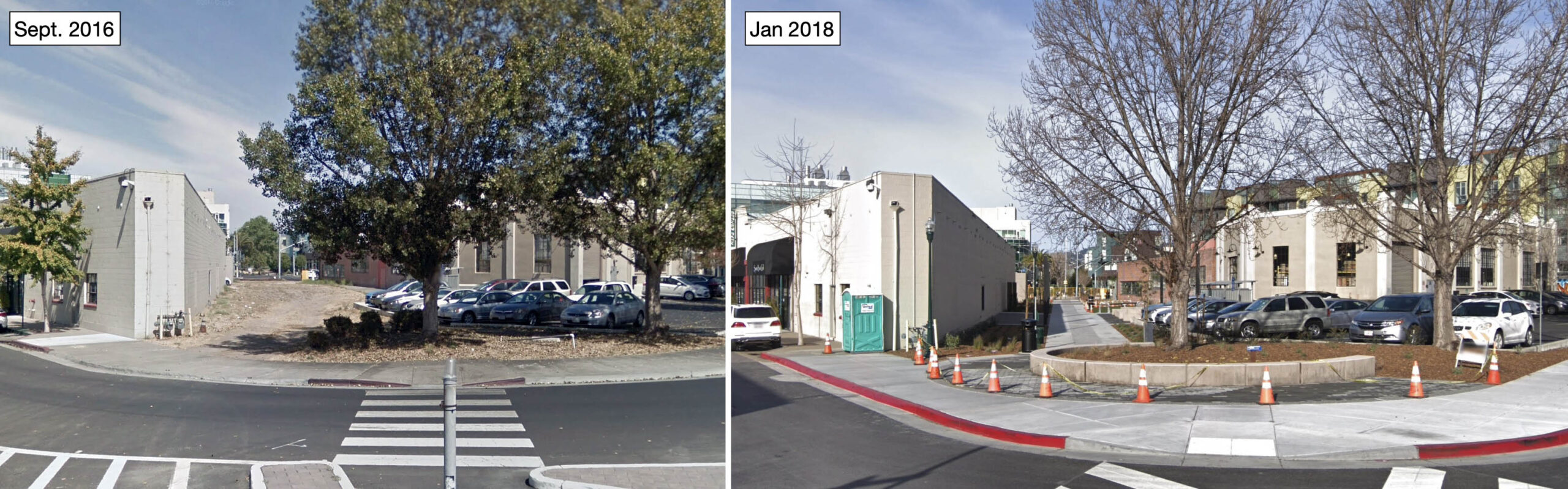
Once the Drill Track was cut back to Ashby Ave., the creation of Ashby Plaza in 1988 adjacent to the former Heinz-PCA facility was a major focus on the section between Ashby Ave. and Heinz Ave., left, OSH moving in to that space in 1991. The abandoned right-of-way, however, was left untouched at that time. On the right, conversion of the abandoned right-of-way south of Ashby Ave. to the Greenway, right, lagged slightly behind the progress made in Emeryville. More details on this last point will be presented next.
L328-185-Courtesy Google Earth, (Image 37 of 45)
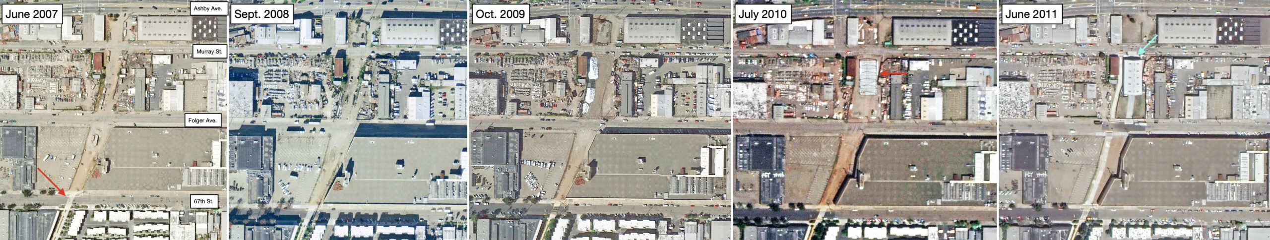
The sequence of north-oriented aerials shows that the north terminus of the Emeryville portion of the Greenway, plus the section in Berkeley up to 67th St., was completed by 2007, red arrow. North of this section to Ashby Ave. the path was cleared, but not completely paved. The image from 2011 shows the path was paved by 2011 in step with the construction of the Berkeley Fire Warehouse, turquoise arrow. The latter obliterated almost the original railroad bed with the exception of the Potter St. spur to the SP mainline, this narrow corridor now part of the Greenway.
L328-190-Courtesy Google Earth, (Image 38 of 45)
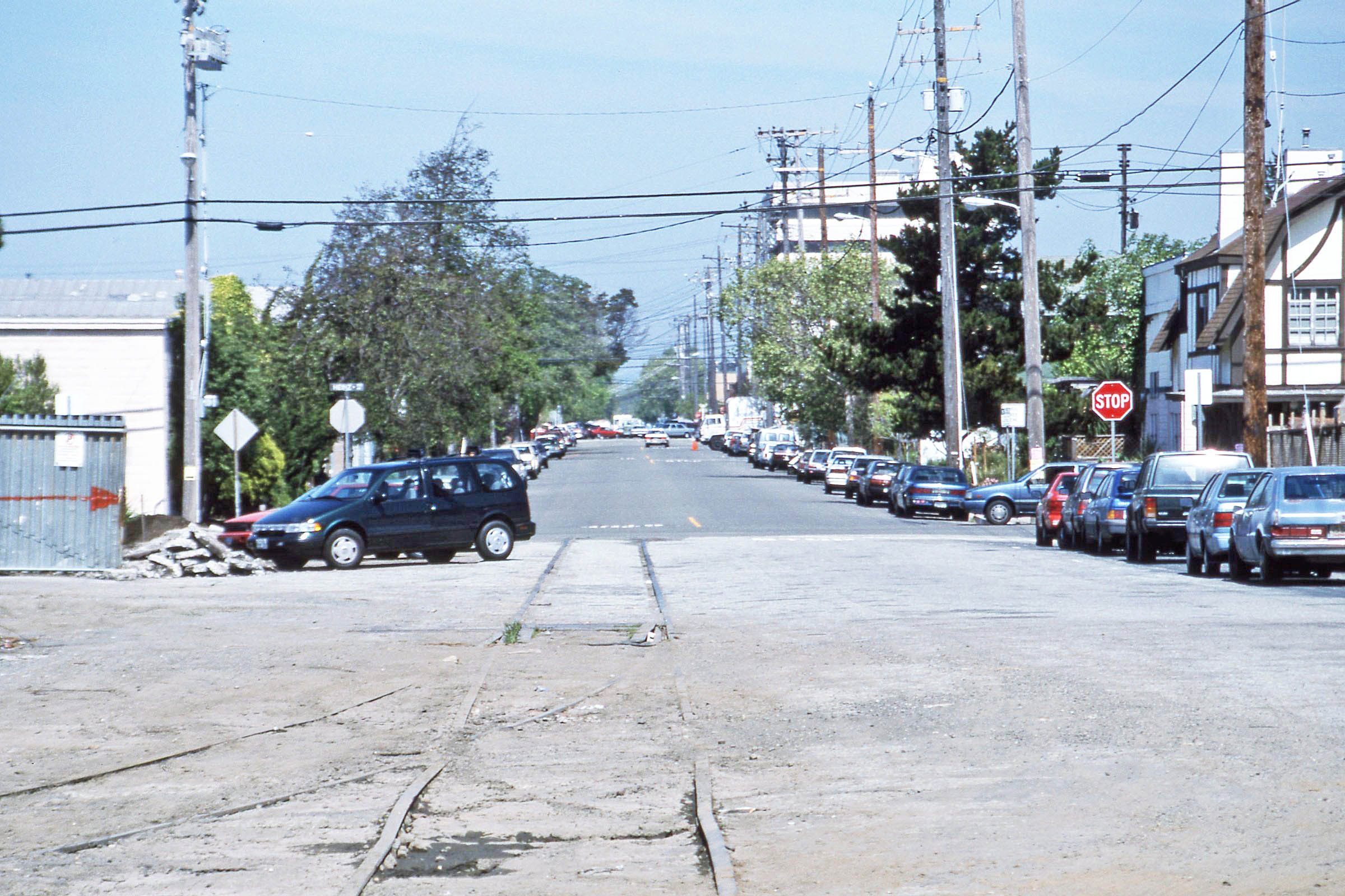
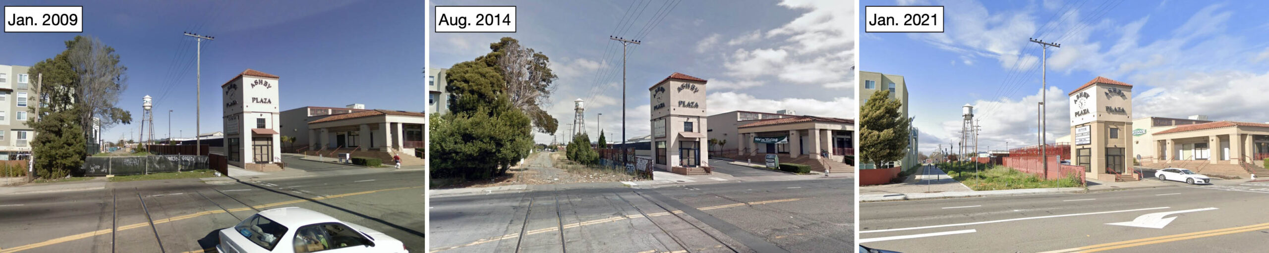
On the north side of Ashby Ave., the tracks remained across the road through at least Aug. 2014, but absent in the same view from Jan. 2015 (not shown.) The ballast-covered abandoned right-of-way was accessible, but was not paved until after Jan. 2021 as shown.
L328-195-Courtesy Google Maps, (Image 39 of 45)
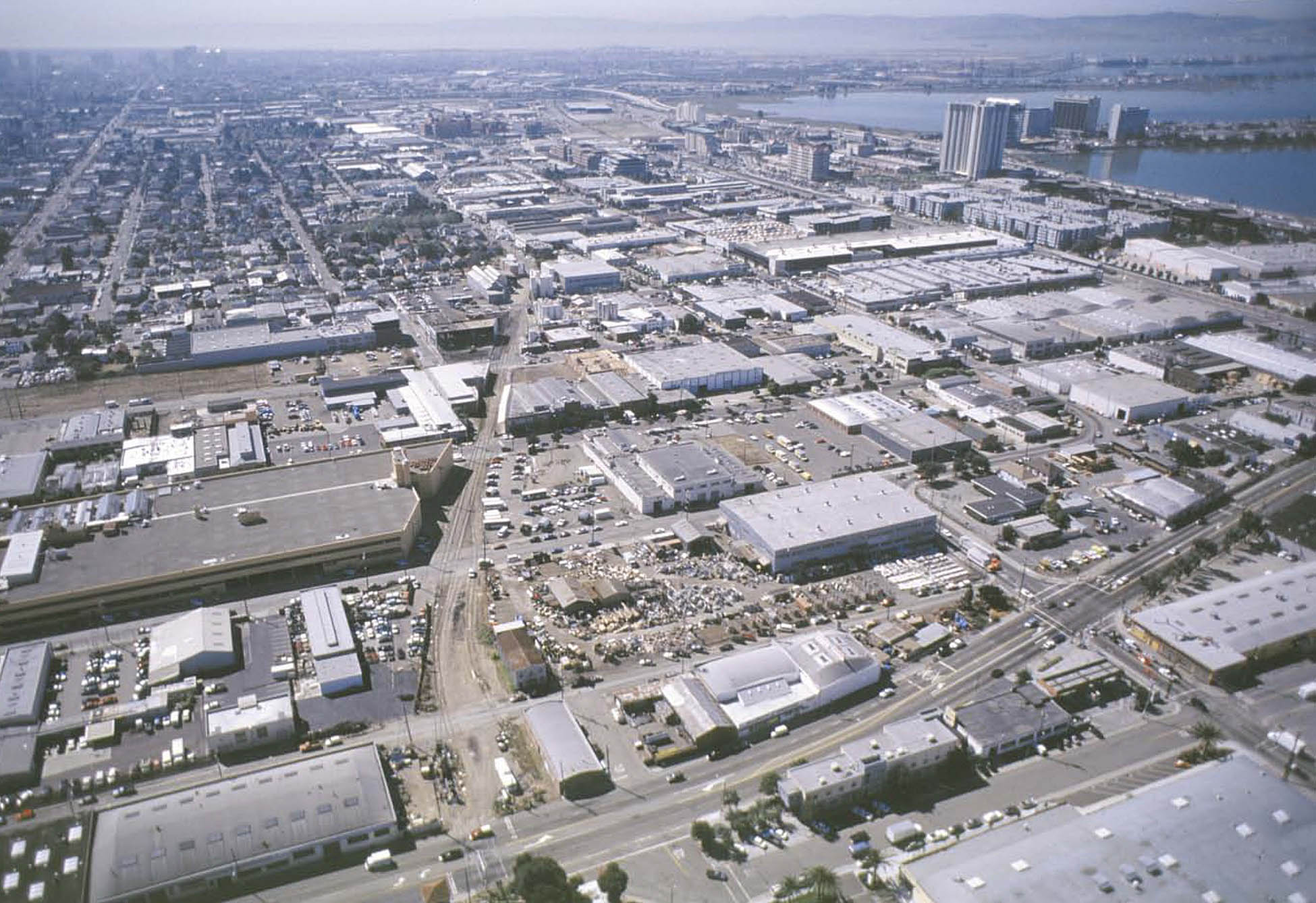
As for Emeryville, the sizable amount of land now available as a result of the UP abandoning the Drill Track incentivized the city to come up with a larger plan that would complement the conversion of the Key-Santa Fe yards for large commercial retail businesses, the approval to create a concentrated smaller retail area in Bay Street in 1999, and the creation of the Emeryville Peninsula in the late 1960s to increase residential units and park land. South view of the abandoned Drill Track from above Ashby Ave. ca. 2001.
L328-200-Courtesy the City of Emeryville, prepared by the ROMA Design Group, (Image 40 of 45)
The North Hollis Area Urban Design Program devised by 2002 took about two years to develop, transforming the abandoned rail corridor by maintaining more environmentally favorable light industry on the west side of Doyle St., and extending the eastern-most residential portion of the city to Doyle St., with some exceptions north of Ocean Ave. where residential units would also spill over to the west side. As seen in these images from the 2002 report, the best use of the the abandoned track itself was envisioned for pedestrians and bicyclists with a few slow streets interspersed to allow limited accessibility to cars.
L328-205-Courtesy the City of Emeryville, prepared by the ROMA Design Group, (Image 41 of 45)
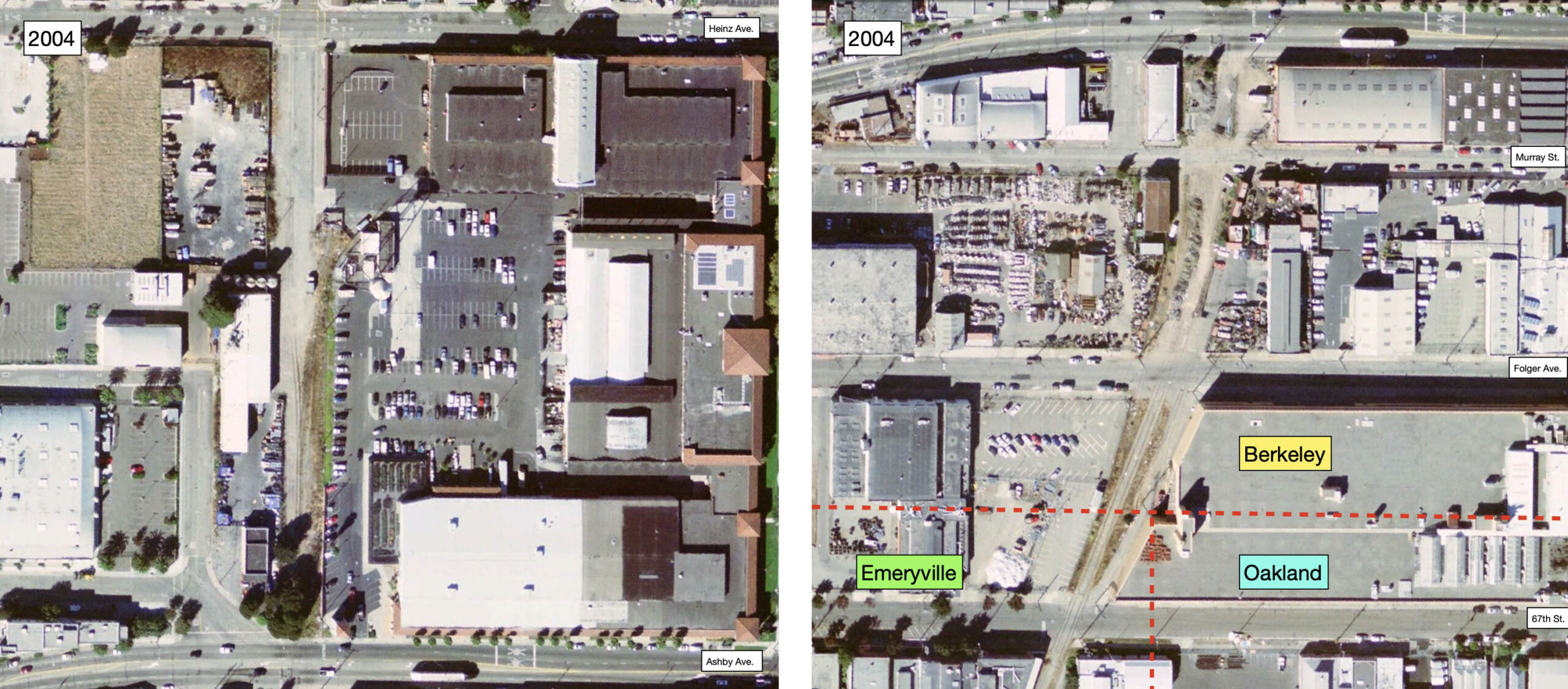
This page from the 2002 report provides a general view of the planned transformation of the area. The location of the businesses served by the SP in 1957 provides a contrast to the shift away from heavy industry that had occurred since 1965. By 2003, the City of Emeryville acquired the abandoned right-of-way for its portion of the Greenway with the exception of the portion between 59th St. and Powell St. A walk down the Greenway in 2025 shows the plan was executed beyond expectations, as has the extension to Horton and 53rd Sts. to the south.
L328-210-Courtesy the City of Emeryville, prepared by the ROMA Design Group, Annotated by Stuart Swiedler, (Image 42 of 45)
The first project along the rail line was the 50 residential unit Oliver Lofts incorporated into the framework of the the former Oliver Tire and Rubber building at 1200 65th St., enclosed in green. On the west side, the industrial facilities used by Liquid Sugars, inc. were cleared, the environmental issues addressed, and the 55 residential units of Liquid Sugar Lofts 1244-1204 65th St. completed, enclosed in red. Further progress followed this scheme of preserving as many structures as possible, but also clearing environmentally-challenged sites.
L328-215-Courtesy Google Earth, (Image 43 of 45)
As mentioned previously, the section of the right-of-way that was not part of the original acquisition from the UP was the portion between 59th St. and Powell St. The SP had sold this section, and continued using the track via an easement agreement. The owner of the property did not want to sell this parcel once the UP abandoned, so the city used eminent domain to recover this contaminated site by 2014. The final section of the Greenway corresponding to the former Drill Track was at the south end and was completed in 2018 as shown here in these northeast view of what today is called Peladeau Park.
L328-220-Courtesy Google Maps, (Image 44 of 45)
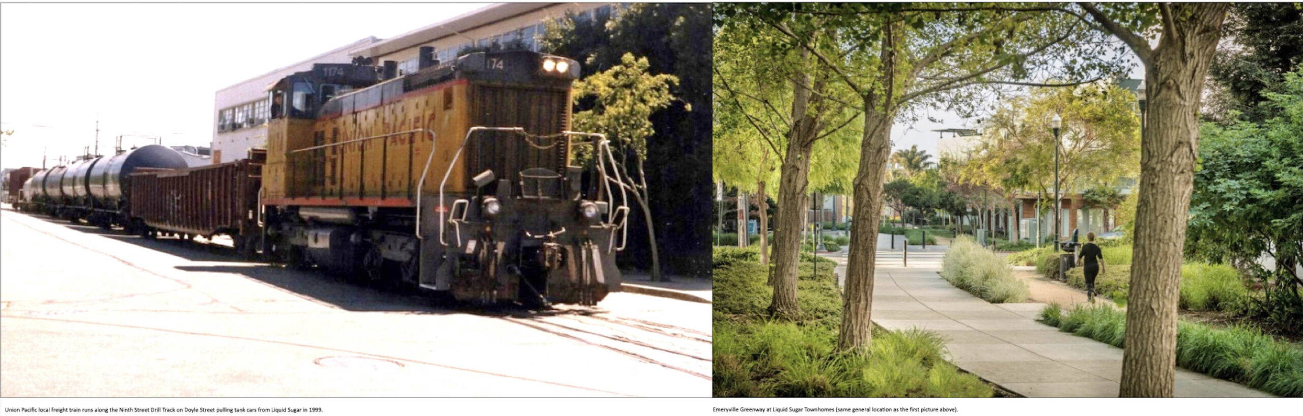
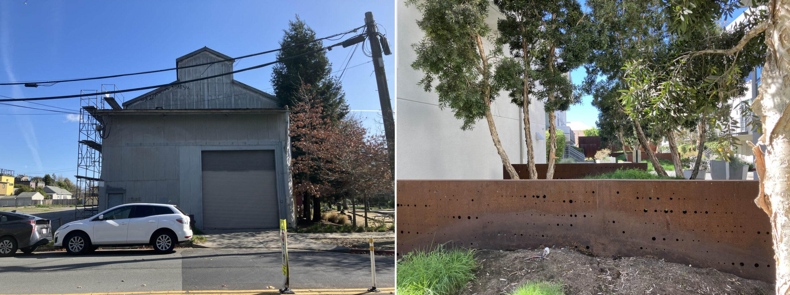
The Greenway continues to evolve, but reminders of the past remain. The image on the left from 2025 shows the conversion of the original Jansen Iron Works or Baker Metal building to residential units and a cafe. On the right, Groundworks Office created the weathering steel walls along the Greenway at Liquid Sugar Lofts with a series of perforated openings to invoke the process Liquid Sugars, Inc. used whereby sugar granulations were pressed through holes with immense heat to create liquid sugar. Appreciation and acknowledgement of the contributions of Daniella Thompson on Berkeley history, to Scott Inman for making the connection with Bill Webb, and to the latter for sharing his railroad images of the Drill Track.
L328-225-Stuart Swiedler Photos, (Image 45 of 45)