The Composite Equivalent, Combining the Key Sacramento St.- SP California St. Lines in 1933
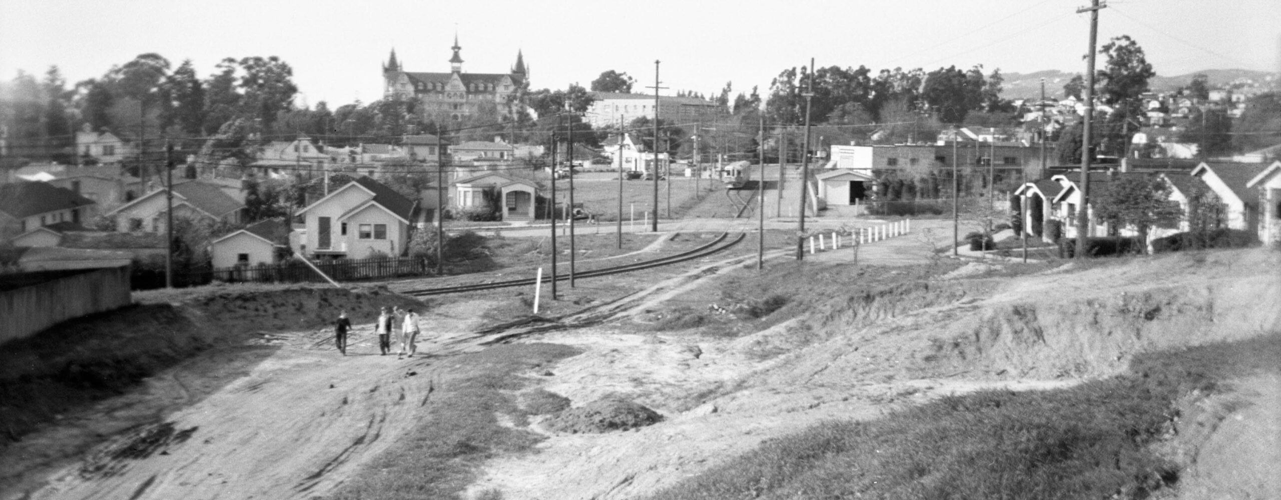
Railfan Howard Wolfe took this north view from what would in 2026 be the intersection of Rose St. and California St. in Oct. 1940. This provocative image reflects some major changes that occurred in the 1930s from events that would alter the East Bay forever.
L351-05-Howard T. Wolfe Photo, Courtesy BAERA, Western Railway Museum Archives, 245391ks, (Image 1 of 25)

A comparison with the the mid-1920s north view from approximately the same spot shown in a previous update provides the dramatic change that had occurred to this area in the early 1930s.
L351-10-Vernon Sappers Collection, 25355ier, l, Howard T. Wolfe Photo, 24539ks, r, Courtesy BAERA, Western Railway Museum Archives, 245391ks, (Image 2 of 25)
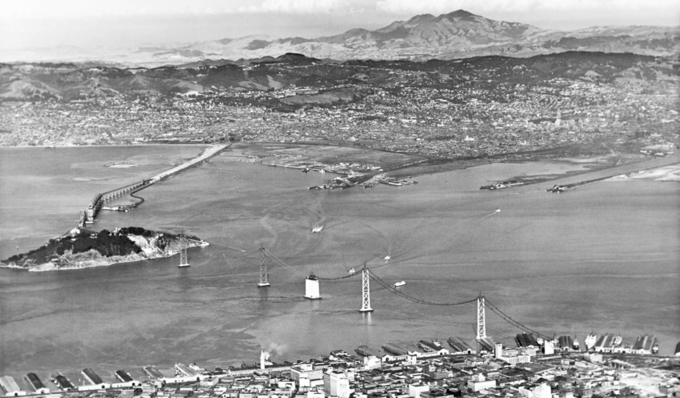
The major event that occurred in the 1930s that would alter the East Bay forever would be the construction of the Bay Bridge that began on July 9, 1933, and opened for vehicular traffic on Nov. 12, 1936, this east aerial view taken sometime during that interval.
L351-15-Courtesy East Bay Regional Park District, (Image 3 of 25)
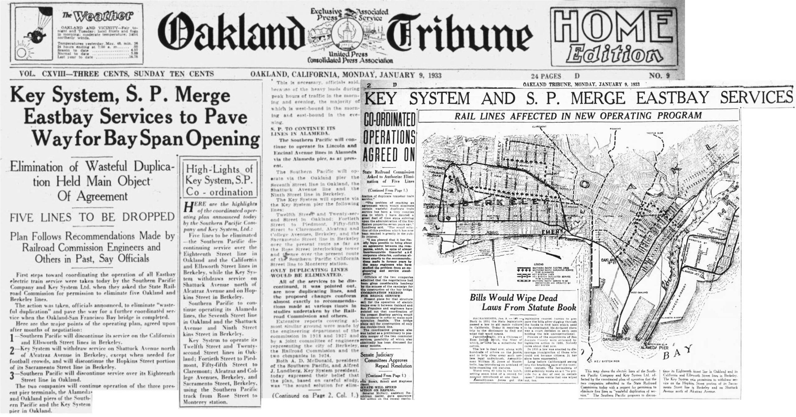
The imminent opening of the bridge was tied to the California State Railroad Commission, RRC, edict approved on Mar. 16, 1933 that would require the Southern Pacific, SP, and Key System, Key, to form a functional “Composite Equivalent” or CE that would eliminate or combine lines to reduce competition and eliminate the need to raise transit fares. This plan was made public earlier in the year as depicted in the press. To view the full RCC document, click here.
L351-20-Courtesy California Digital Newspaper Collection, (Image 4 of 25)
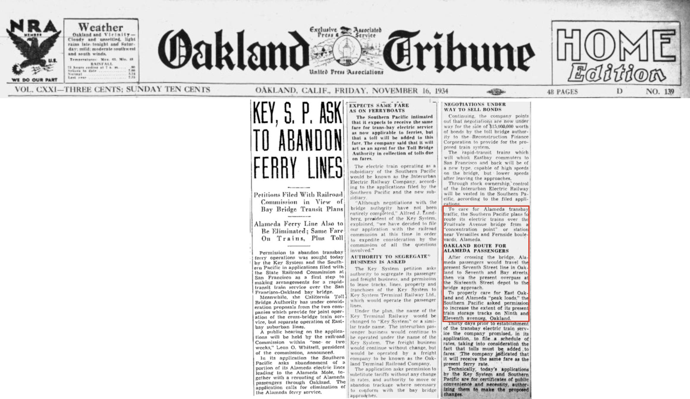
Following the CE decision, the RCC also mandated in 1934 the elimination of transbay ferries connected with train service when the bridge opened to rail traffic. Although this would benefit both the Key and SP lines into Berkeley by decreasing transit time across the bay and an East Bay landing closer to Berkeley, it would negatively impact Alameda residents by having all SP trains entering the island via the Fruitvale Bridge. The increase in transit time for West Alameda residents is a topic of another discussion, but the SP agreed in late 1938 to abandon the Alameda Pier in late 1938 as the opening of bridge for rail traffic was only months away.
L351-25-Courtesy California Digital Newspaper Collection, (Image 5 of 25)
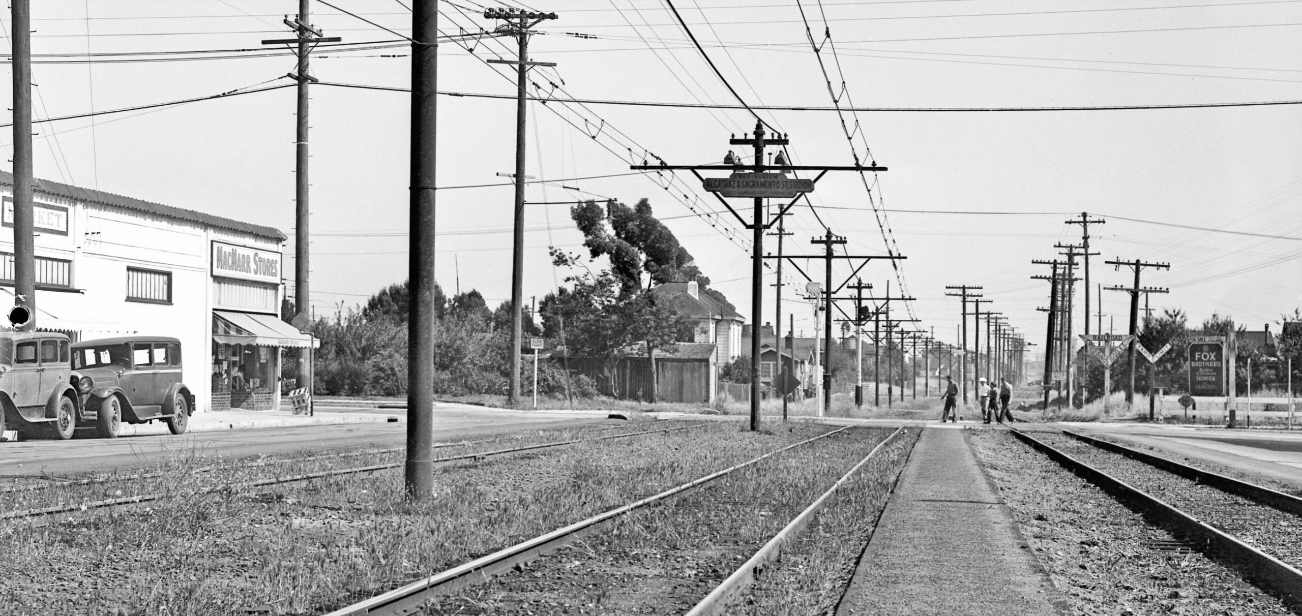
This update will feature the largest impact made by the RCC directive, the creation of a hybrid Key Sacramento St. – SP California St. line to be operated solely by the Key. Following along images from 1934 of this line in Berkeley running south to north will be historical information on the evolution of the CE derived from Robert S. Ford’s “Red Trains in the East Bay”, Interurbans Publications, 1977. To start, a south view at the entry of the Key Northbrae line into Berkeley at Alcatraz Ave. and Sacramento St. The track to the right is the Santa Fe.
L351-30-SP Official Photo, Sappers Collection, Courtesy BAERA, Western Railway Museum Archives, 171257ks, (Image 6 of 25)
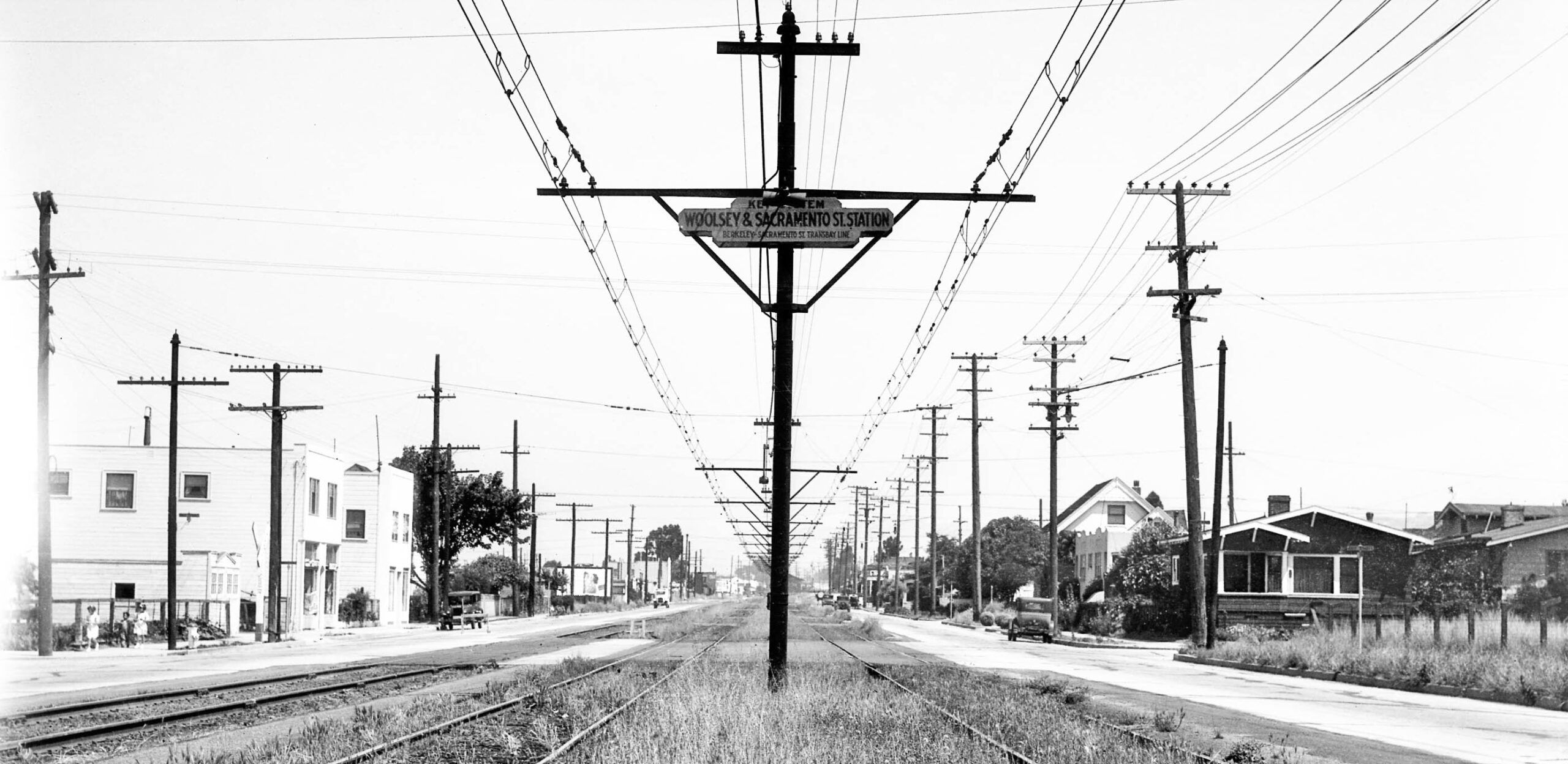
This north view from 1934 at the Woolsey St. stop features the corner house, no. 1501, on the right, and the two white buildings on the left that remain in 2026, except the latter one to the right has been expanded. According to Ford, the concept of a composite equivalent came about in Jan. 1918 after years of the Key and SP wanting to raise fares, the latter in the hole for $557,805 for 1917 alone, excluding the interest payments on the $26M invested in the system. The RRC proposed eliminating $10M of duplicate facilities providing $1M in annual savings that would keep fares low.
L351-35-SP Official Photo, Sappers Collection, Courtesy BAERA, Western Railway Museum Archives, 171258ks, (Image 7 of 25)
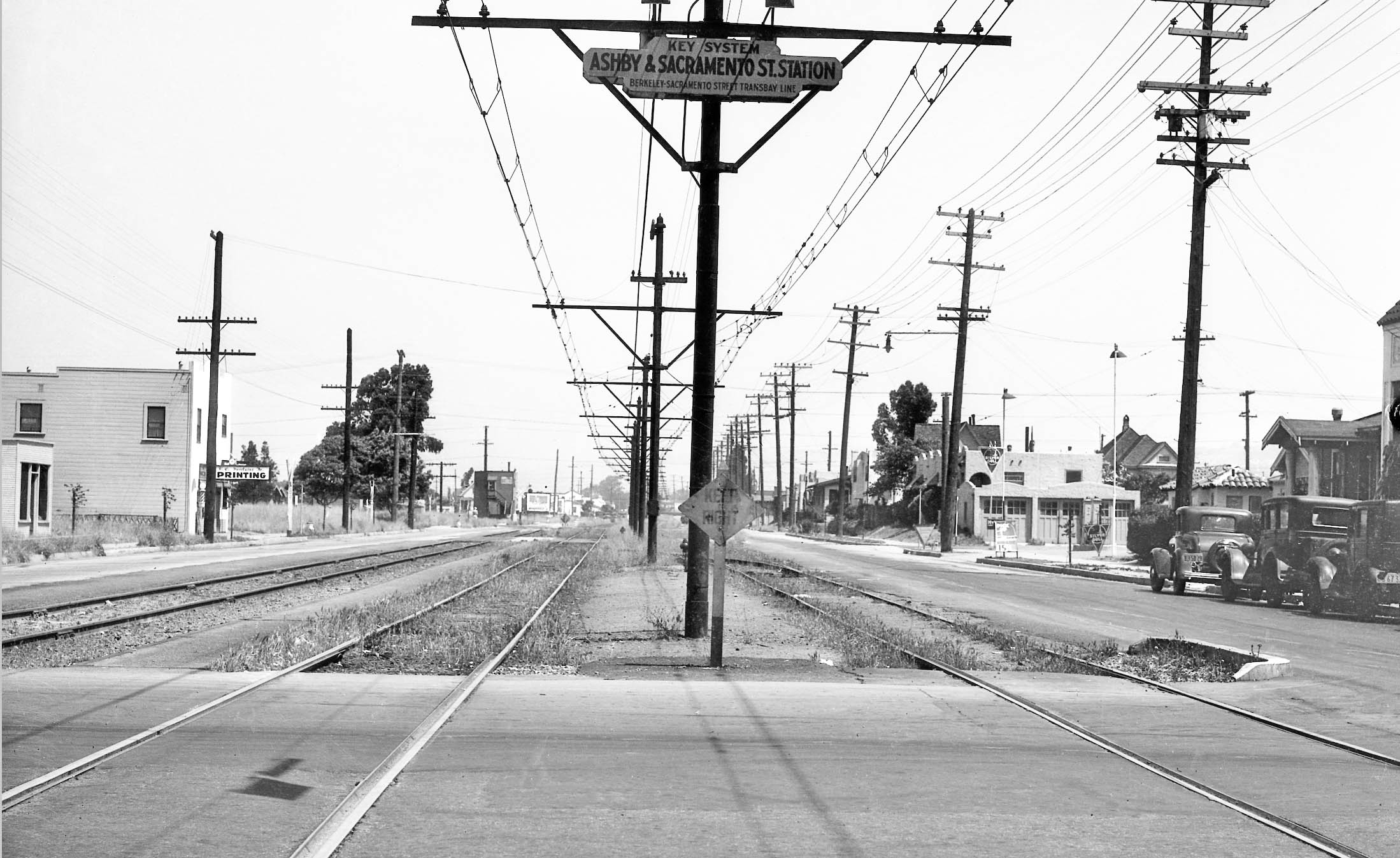
Nothing remains in 2026 from this north view from 1934 at the Ashby Ave. stop. More history. The 1918 plan looked very much like the one unveiled in 1933, except the Sacramento St.-California St. hybrid would run all the way to Thousand Oaks and be operated by the SP. At that point in time, the Harrison St. Bridge between downtown Oakland and Alameda existed giving the SP access to West Alameda directly. The RCC thought all trains could run through the Oakland Pier, since the Key would no longer have any interurban trains running to North Berkeley.
L351-40-SP Official Photo, Sappers Collection, Courtesy BAERA, Western Railway Museum Archives, 171259ks, (Image 8 of 25)
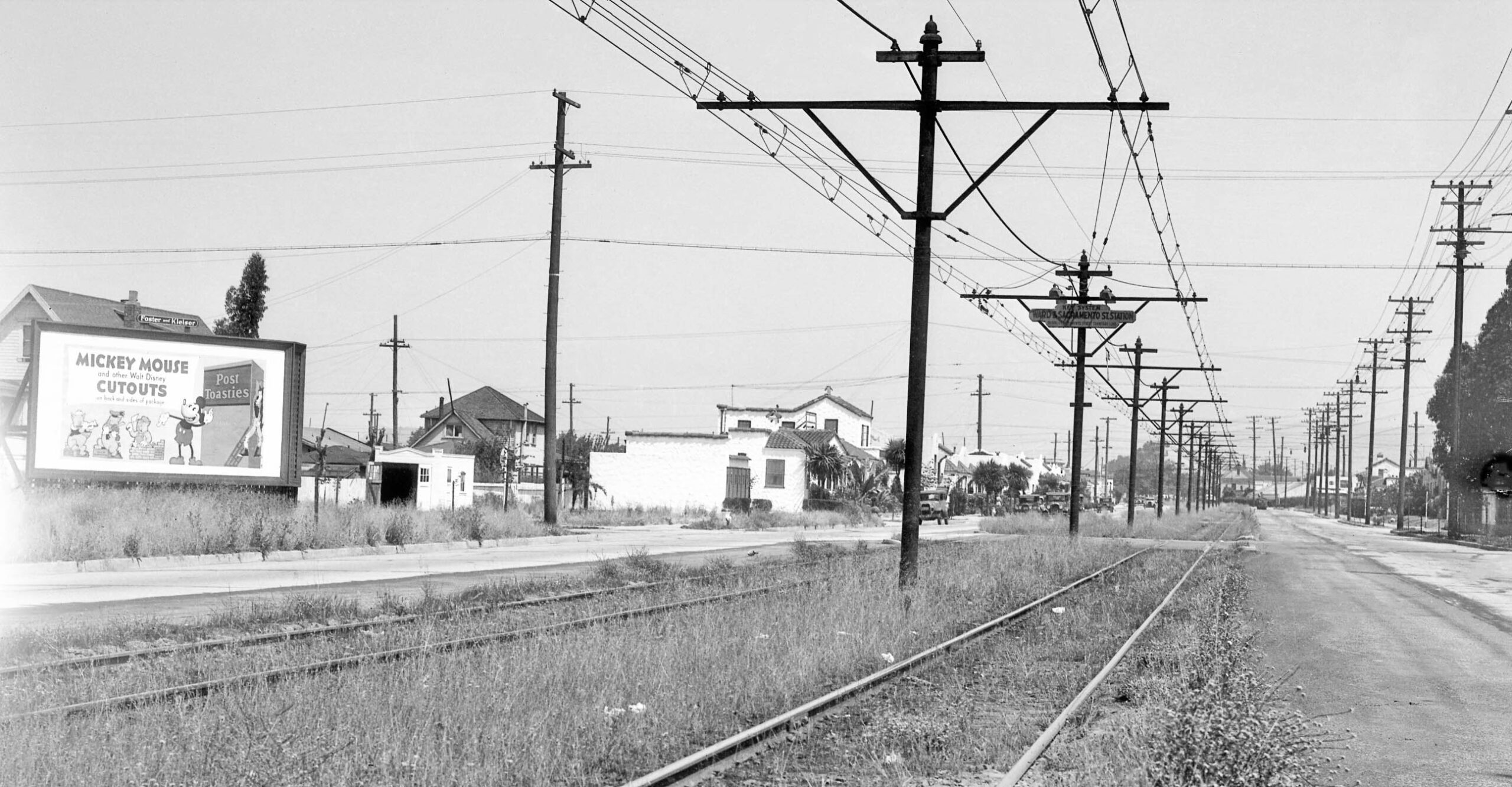
The next stop as seen on this north view from 1934 was Ward St. The Santa Fe had already turned off Sacramento St. north of Russell St. The two houses from the corner with the stylized stucco are gone in 2026, but those from the middle of the block to Derby St. remain. More history. The CE plan in 1918 had two other problems, first that the SP and Key used different voltages on their lines, and the fact that Key workers were paid like streetcar workers, and the SP was entangled by several railroad brotherhoods and paid much better.
L351-45-SP Official Photo, Sappers Collection, Courtesy BAERA, Western Railway Museum Archives, 171260ks, (Image 9 of 25)
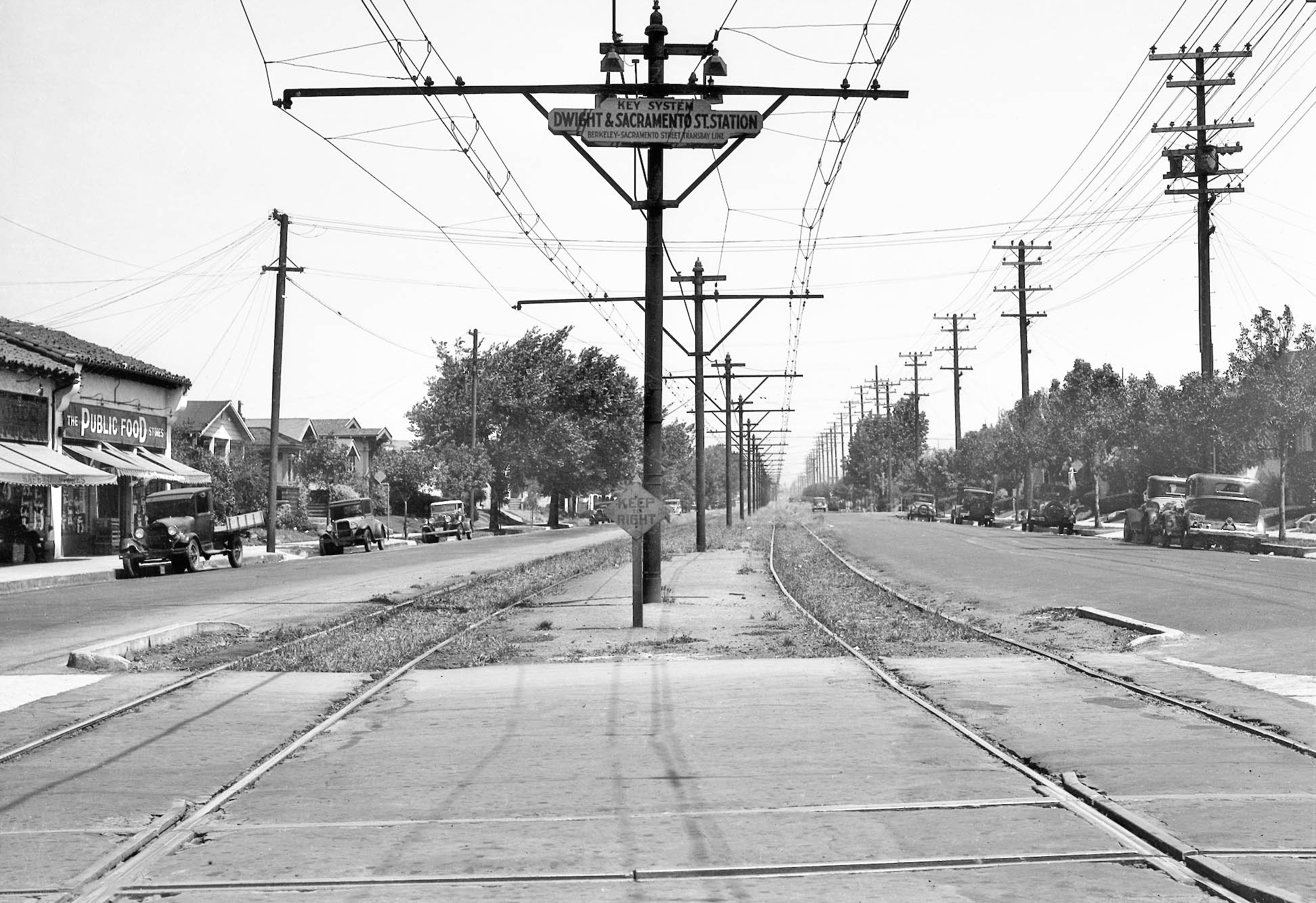
The next stop as seen on this north view from 1934 was Dwight Way with its Key streetcar tracks. All the structures on the left or west remain in 2026. More history. By Apr. 18, 1918, the RCC proposed leasing of all Key transbay facilities to the SP versus the CE. The SP and Key said that process would increase fares even higher as it was essentially a merger, so the discussion of the CE and other plans was dropped. Throughout the 1920s, the railways continued to ask for fare increases and battle the inequities of labor costs that extended to all the companies in the Bay Area.
L351-50-SP Official Photo, Sappers Collection, Courtesy BAERA, Western Railway Museum Archives, 171261ks, (Image 10 of 25)
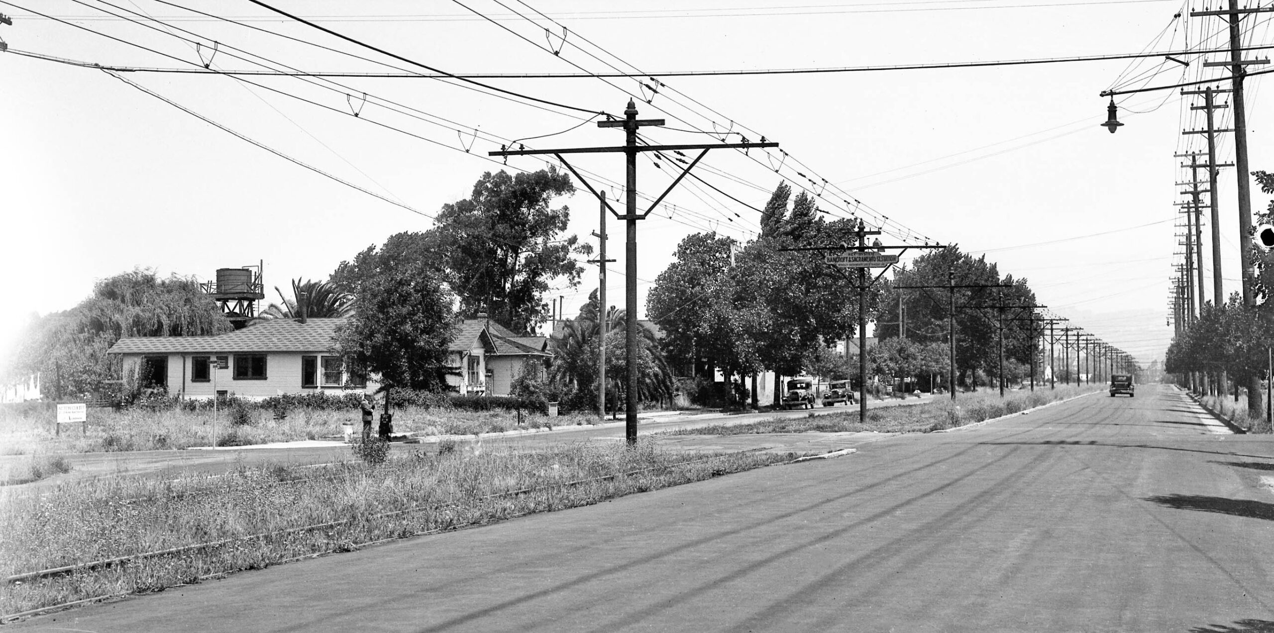
The next stop as seen on this northwest view from 1934 was Bancroft Way. More history. Talk of a merger continued into the 1920s, with the SP and Key. Again, the voltage requirement difference to run the equipment between the two companies would have resulted in increases in fares to create a single system. Losses for the SP in 1926 were over $1M, and ridership was not on the upswing.
L351-55-SP Official Photo, Sappers Collection, Courtesy BAERA, Western Railway Museum Archives, 171262ks, (Image 11 of 25)
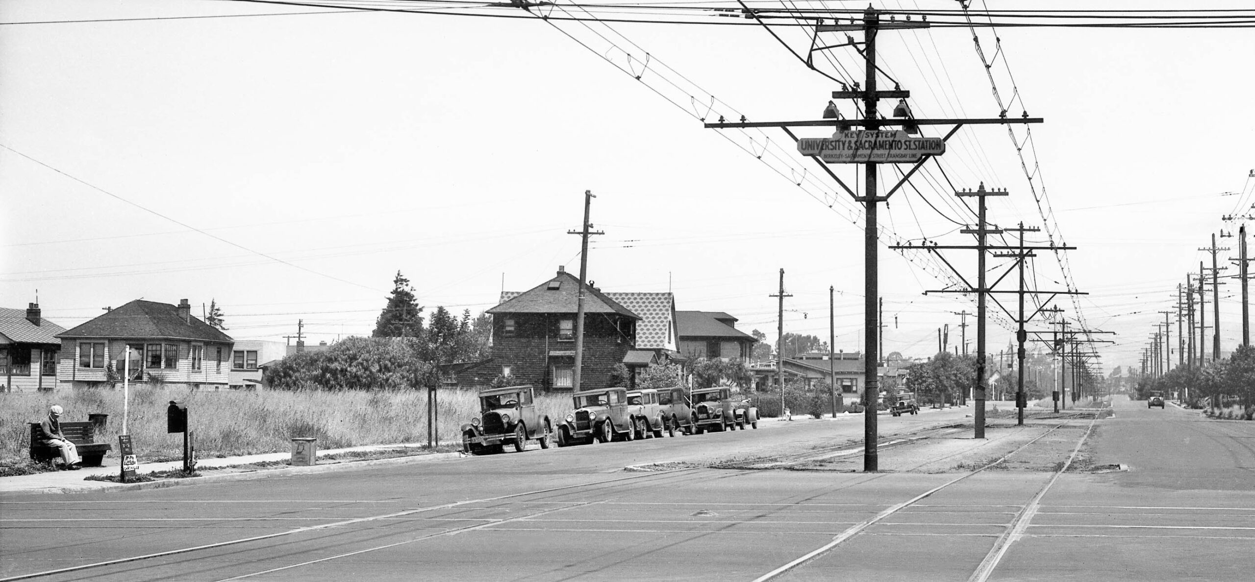
The next stop as seen on this north view from 1934 was University Ave. with its Key streetcar tracks. The Westbrae line terminated here, the switch track allowing Northbrae trains to go around them. For more details, click here. The dark colored house at Berkeley Way and the one beyond remain in 2026. More history. As momentum for building the Bay Bridge increased in 1929, SP President Paul Shoup and Key President Alfred J. Lundberg concluded that a a new operating company should be created to take over all transbay operations. But this never happened.
L351-60-SP Official Photo, Sappers Collection, Courtesy BAERA, Western Railway Museum Archives, 171263ks, (Image 12 of 25)
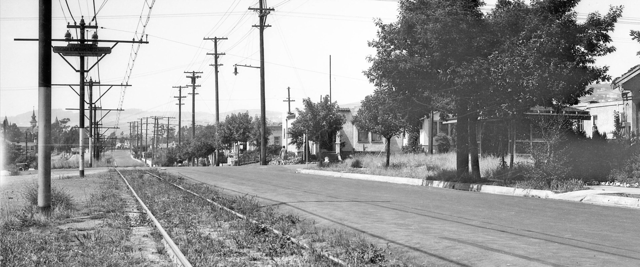
The next stop as seen on this north view from 1934 was Virginia St. with its shelter hidden by trees on the right. After the Westbrae line set off Sacramento St., the line was a single track with a passing track just south of Rose St. The corner house at no. 1501 Virginia remains in 2026. Note St. Mary’s College HS in the distance on left edge. More history. In 1926, the myriad tracks, poles and wires along Shattuck Ave. were of a concern to the Berkeley City Council. The SP proposed that it would voluntarily abandon its California St. and Ellsworth St. lines if the Key would abandon its Shattuck interurban line and reroute the Shattuck streetcar. The Key refused.
L351-65-SP Official Photo, Sappers Collection, Courtesy BAERA, Western Railway Museum Archives, 171265ks, (Image 13 of 25)
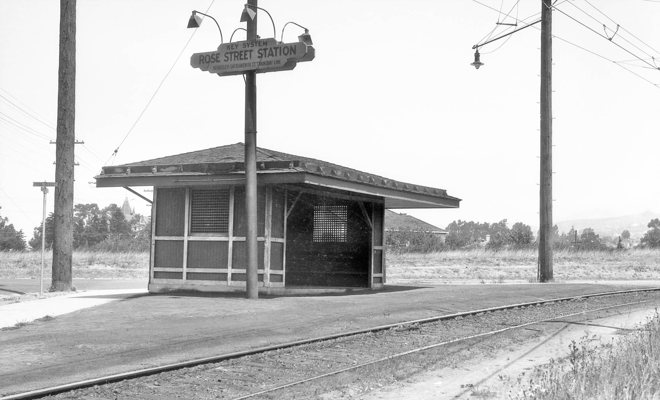
The next stop as seen on this northwest view from 1934 was Rose St. with its shelter. More history. Ahead to Mar. 16, 1933, the CE plan was approved by the RCC. Ford notes the general foundation of the plan was to divide the East Bay into territories based on which railway had the prior line. The Key would be kept out of the Adeline-Shattuck corridor in Berkeley, in return being awarded the Sacramento St.-California St. hybrid. The SP would also lose its 18th St. line. The Key Claremont line, Oakland lines, and the SP lines in Alameda and 7th St.-San Leandro line in Oakland were not paired back or divided.
L351-70-SP Official Photo, Sappers Collection, Courtesy BAERA, Western Railway Museum Archives, 171266ks, (Image 14 of 25)
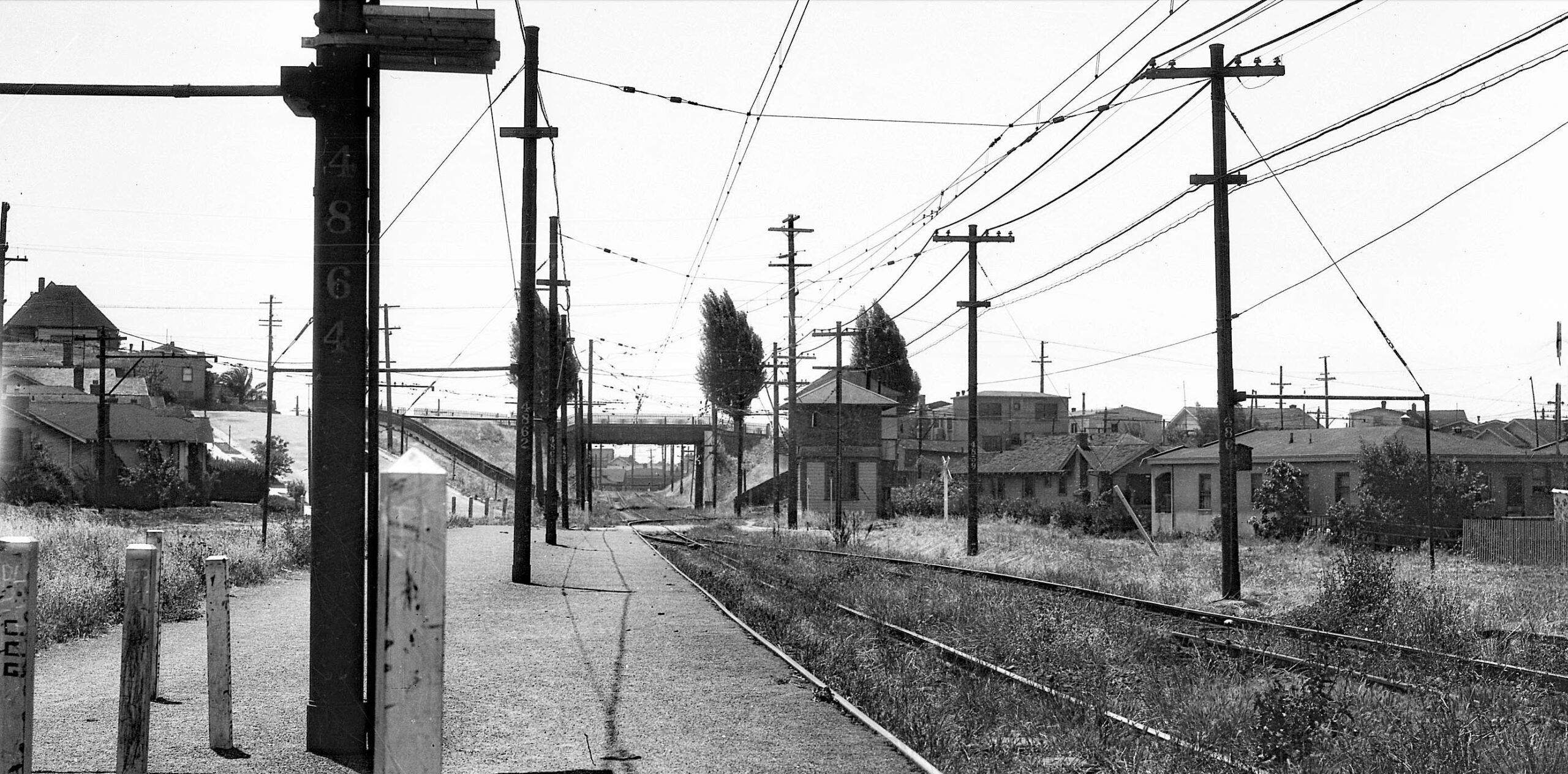
Next the main attraction, a south view taken south of Hopkins St. along the former SP line. The hook up with the Key is marked by the switch track. Otherwise, everything else was been left untouched as of 1934. In summary, the southern portion of the Key below Rose St. tower was connected to the SP portion north of the tower, and the Key portion north of the tower onto Hopkins Ave. to Sutter St. was abandoned. The southern portion of the SP below Rose St. tower would be abandoned, and the portion north of the tower retained, but terminated at Colusa and Monterey Aves. The portion further north to Thousand Oaks would be abandoned.
L351-75-SP Official Photo, Sappers Collection, Courtesy BAERA, Western Railway Museum Archives, 171268ks, (Image 15 of 25)
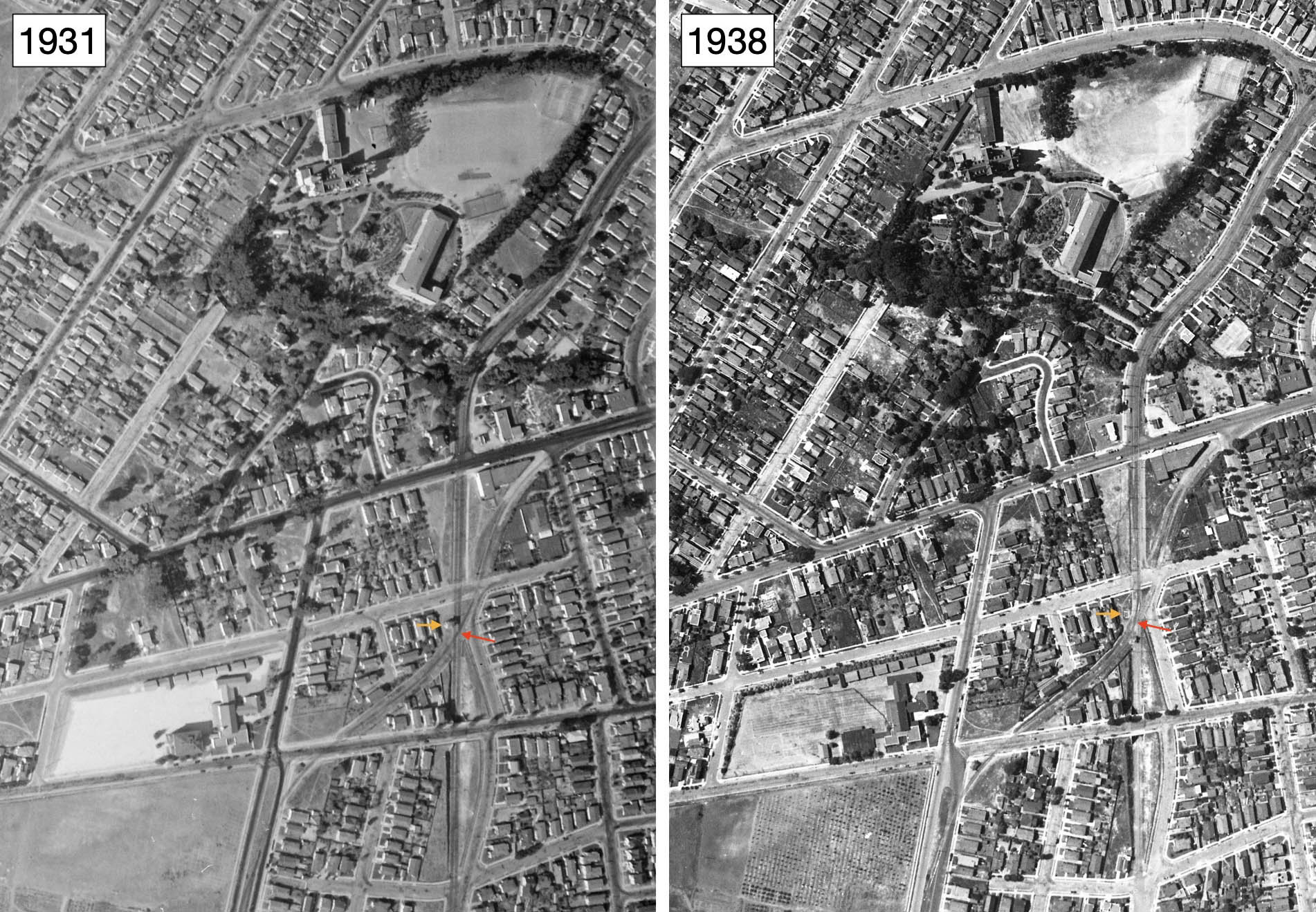
The 1931 north-oriented aerial on the left shows the Rose St. tower, orange arrow, and the SP-Key crossing marked by the red arrow. By 1938, right, the SP tracks have all been removed, and all that is left of the Rose St. tower is the foundation, orange arrow, and the new Key-to-SP connection that is easily visualized, red arrow.
L351-80-c-1820_61, Courtesy of UC Santa Barbara Library Geospatial Collection, l, Harrison Ryker Photo, Courtesy California Department of Transportation, r, (Image 16 of 25)
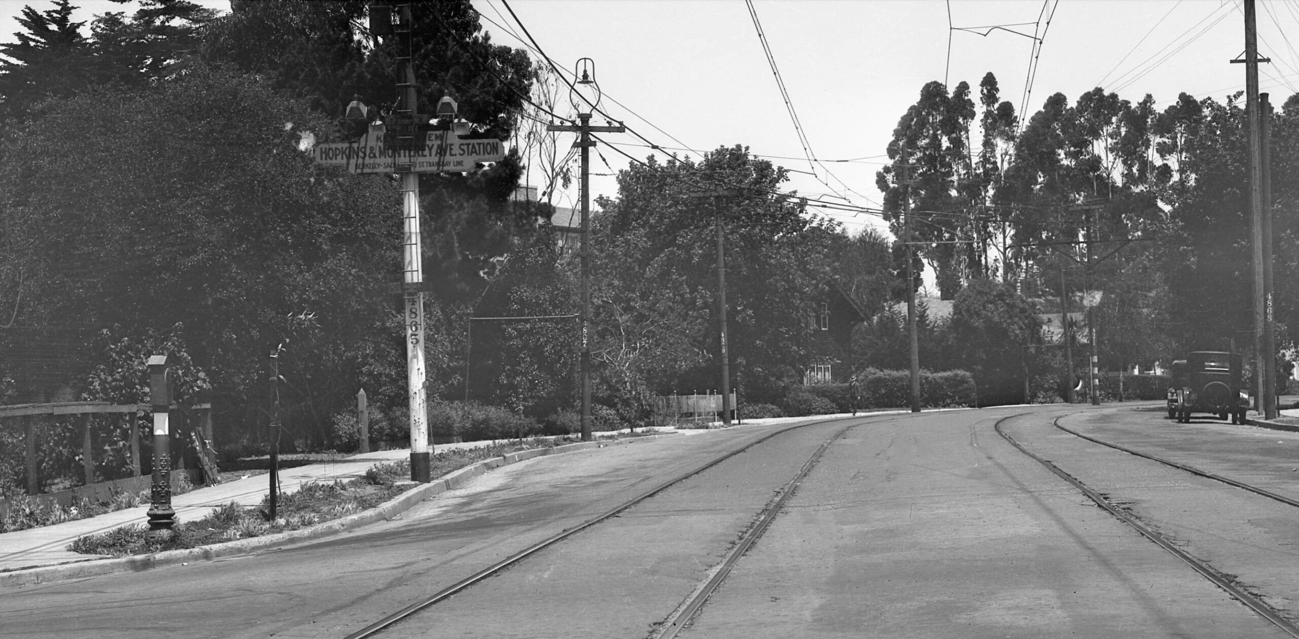
The next stop as seen on this north view from 1934 was Hopkins St. at Monterey Ave. More history. The City of Berkeley filed a protest with the RCC claiming that eliminating the SP California St. and Ellsworth St. lines would create longer distance for patrons to walk to catch a train. The RCC fired back that it would be no longer than a half-mile walk to the nearest station from anywhere in Berkeley near these abandoned lines. On Mar. 26, 1933, the new alignments were put into place.
L351-85-SP Official Photo, Sappers Collection, Courtesy BAERA, Western Railway Museum Archives, 171267ks, (Image 17 of 25)
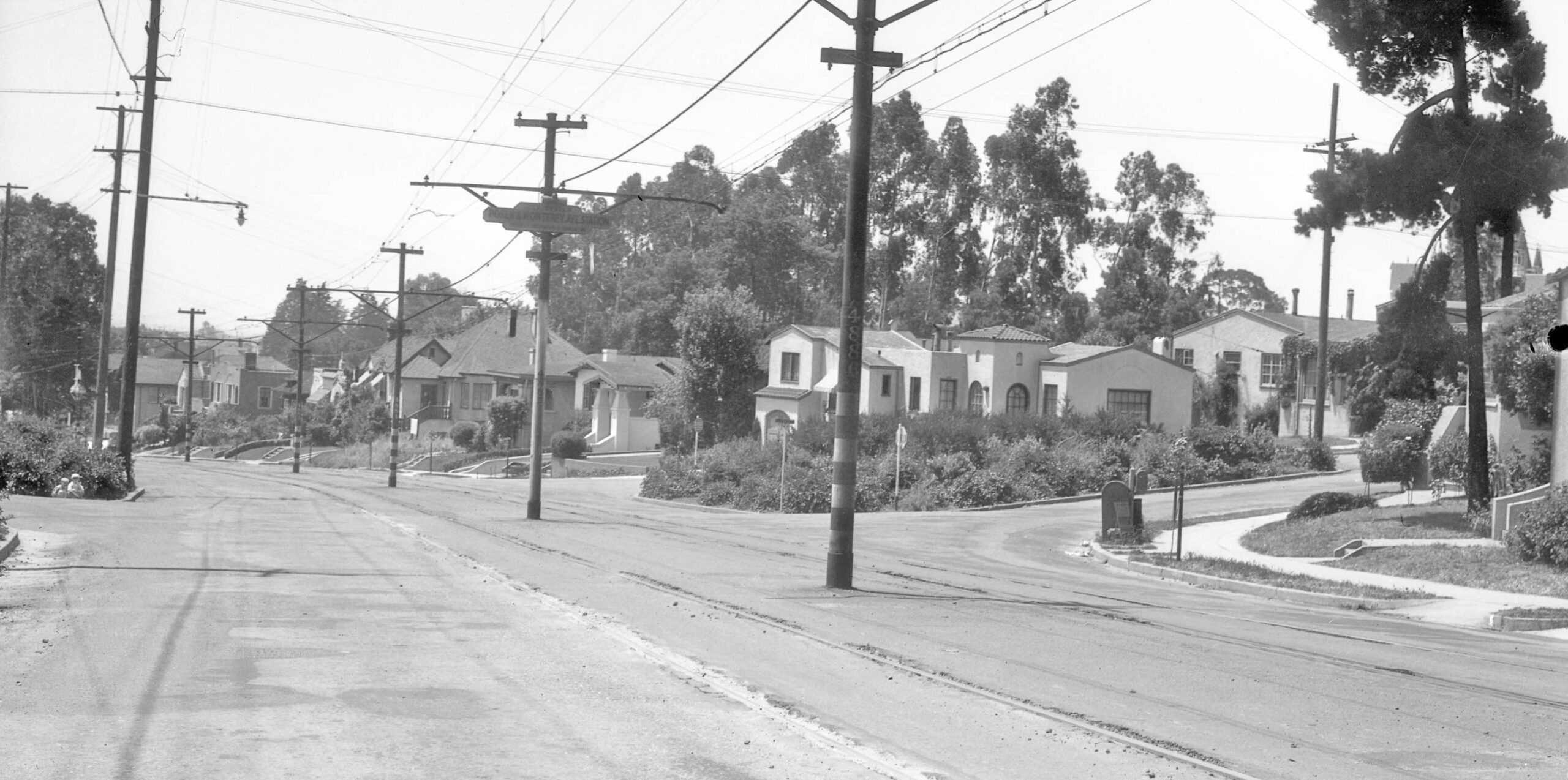
The next stop as seen on this north view from 1934 was Posen Ave. The house at no. 1574 Posen Ave. is featured here and everything else remains in 2026.
L351-90-SP Official Photo, Sappers Collection, Courtesy BAERA, Western Railway Museum Archives, 171269ks, (Image 18 of 25)
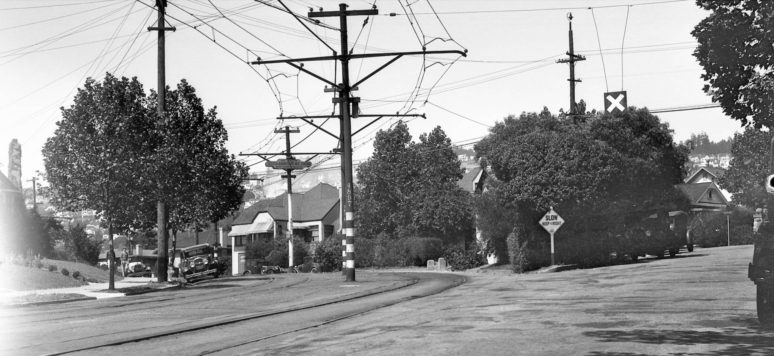
The last stop on the new line as seen on this north view from 1934 was just after the turn onto Colusa Ave., with the shelter hidden in this image by trees. All the houses seen here are present in 2026. The new arrangement meant the Key would have a very limited placement in Northbrae, providing the SP Shattuck line with almost the entire Northbrae area along with Thousand Oaks.
L351-95-SP Official Photo, Sappers Collection, Courtesy BAERA, Western Railway Museum Archives, 171270ks, (Image 19 of 25)
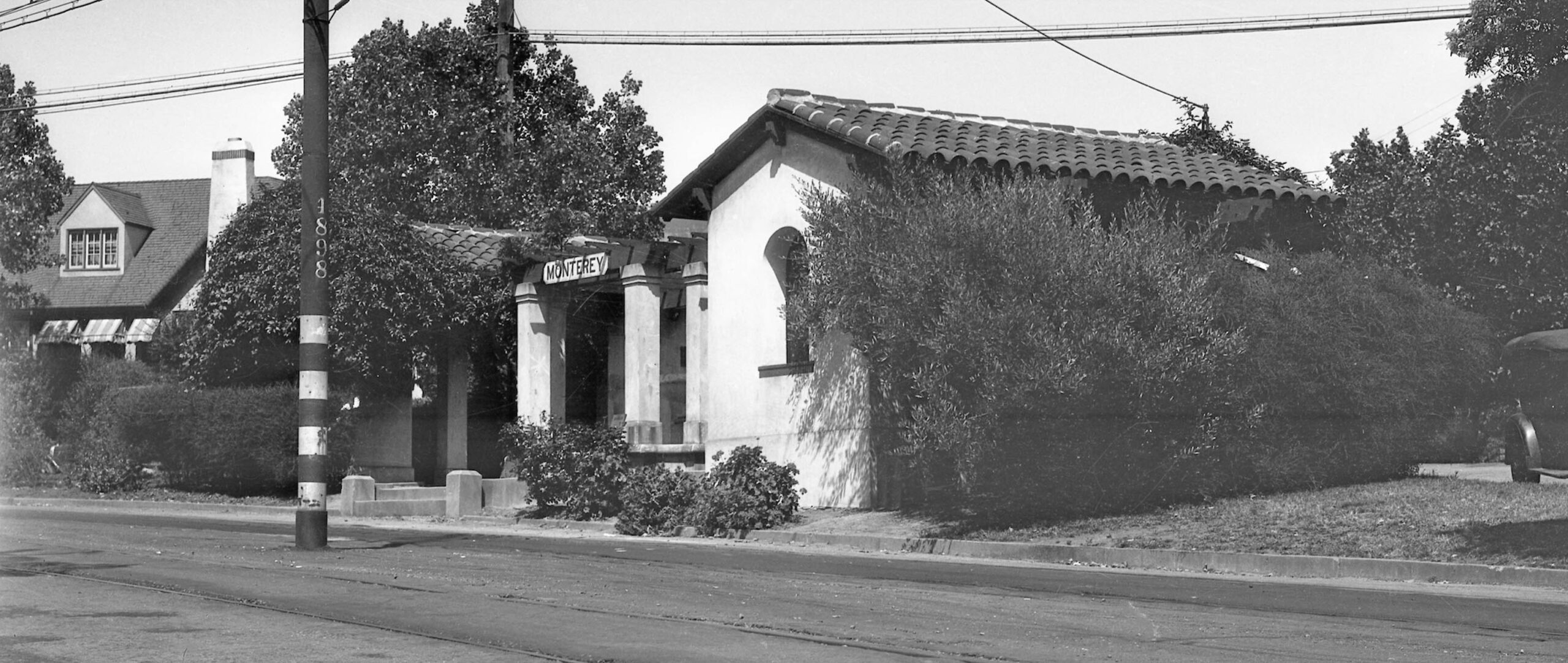
A closeup of the shelter next to No. 1037 Colusa Ave. is seen in this east view from 1934. The small fountain present within the structure can just be made out.
L351-100-SP Official Photo, Sappers Collection, Courtesy BAERA, Western Railway Museum Archives, 171271ks, (Image 20 of 25)
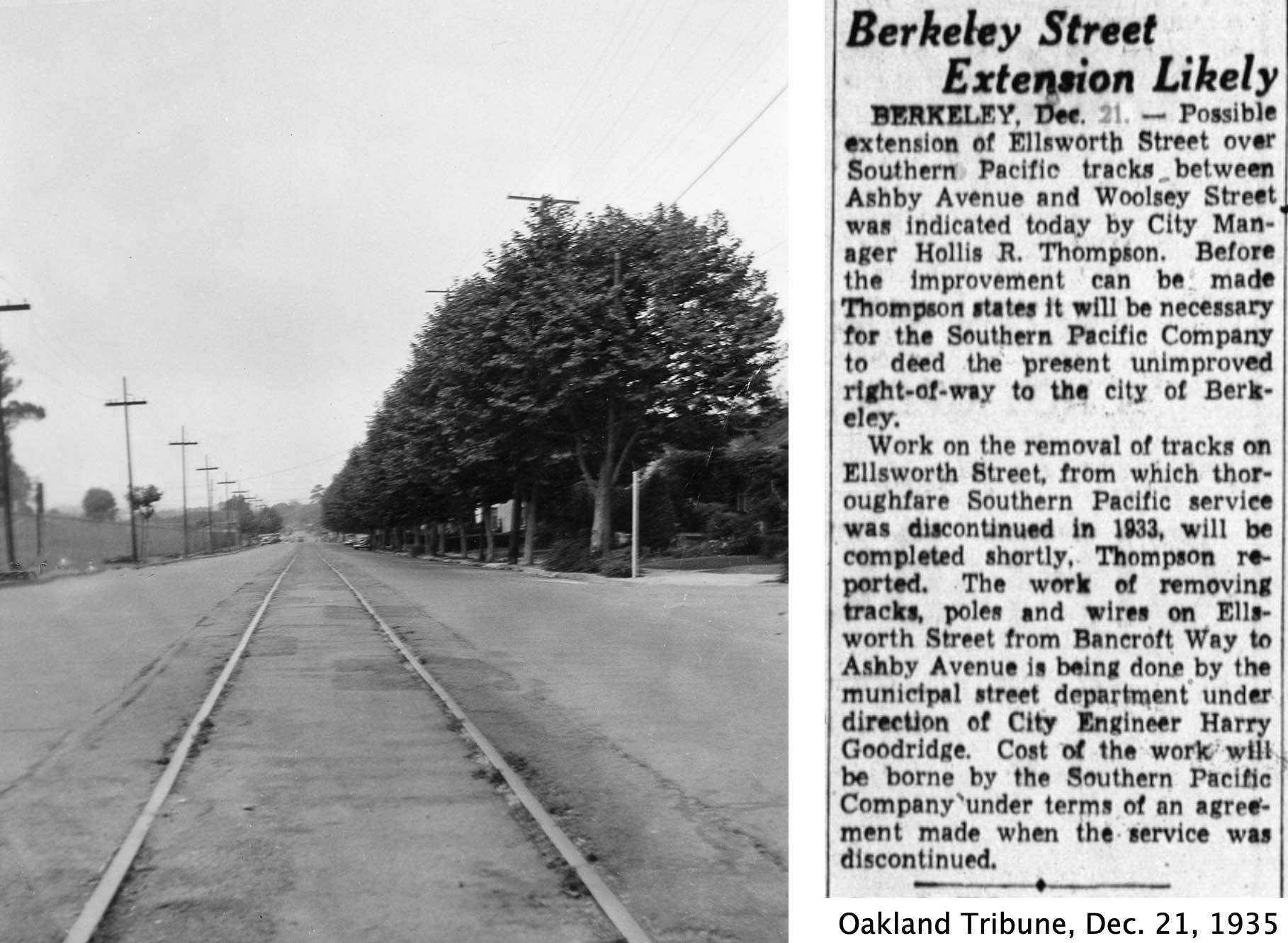
Once the RCC edict took effect, both the Key and SP were in no hurry to remove track. The southwest view on the left of Hopkins St. and Beverly Pl. along then Garfield Junior HS, now MLK, Jr. Middle School, shows the tracks remaining in the asphalt on July 26, 1936, some three years after their use had ended. Information on track removal on California St. was not uncovered, but the article on the right from late 1935 on Ellsworth St. trackage removal gives a rough idea as to how quickly track was being removed.
L351-105-Warren Miller Collection, Courtesy BAERA, Western Railway Museum Archives, 149448ks, l, Newspaper Archives, r, (Image 21 of 25)
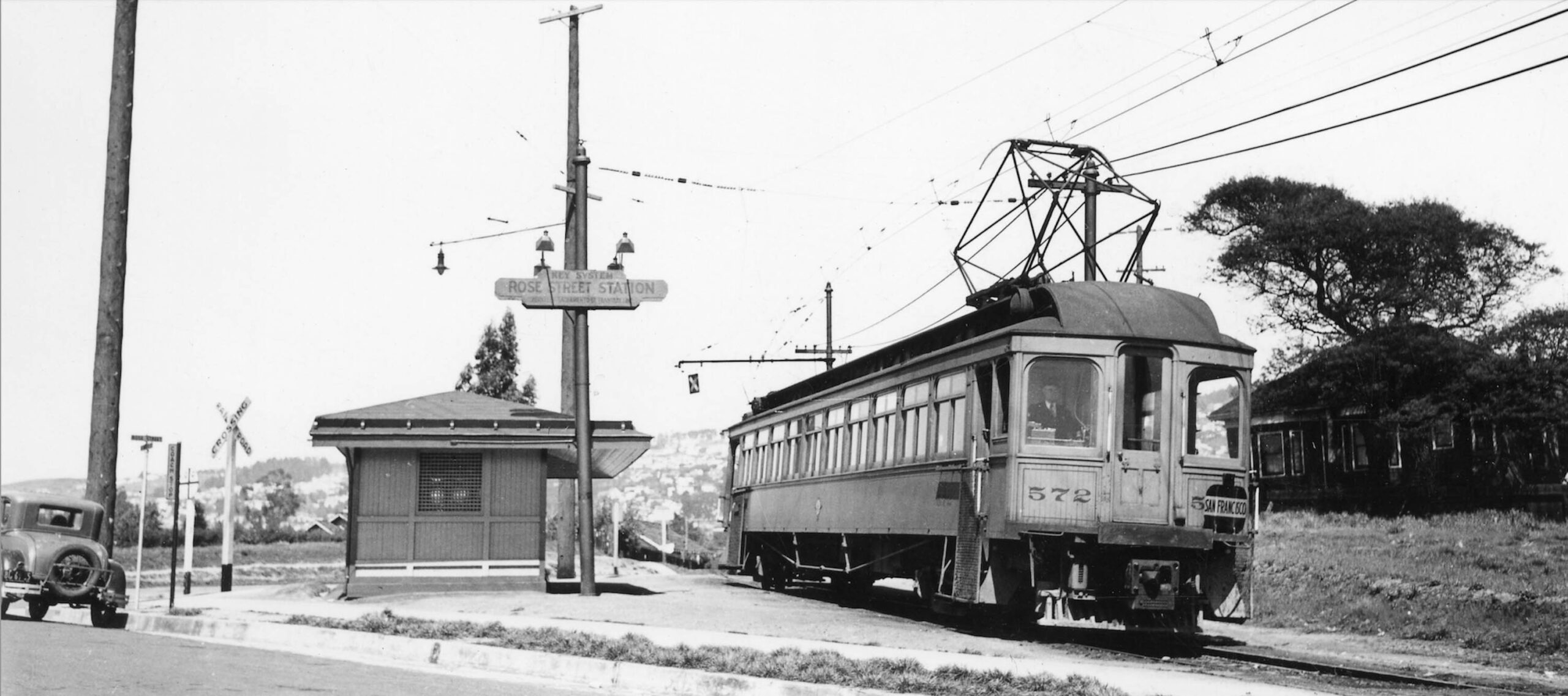
Images taken of the new hybrid line prior to opening of the Bay Bridge were hard to find, but this one northeast view of a single-car train KS 572 inbound at Rose St. Station includes a car with a license plate from 1937.
L351-110-L. J. Ciapponi Photo, William Billings Collection, Courtesy BAERA, Western Railway Museum Archives, 22119ks, (Image 22 of 25)
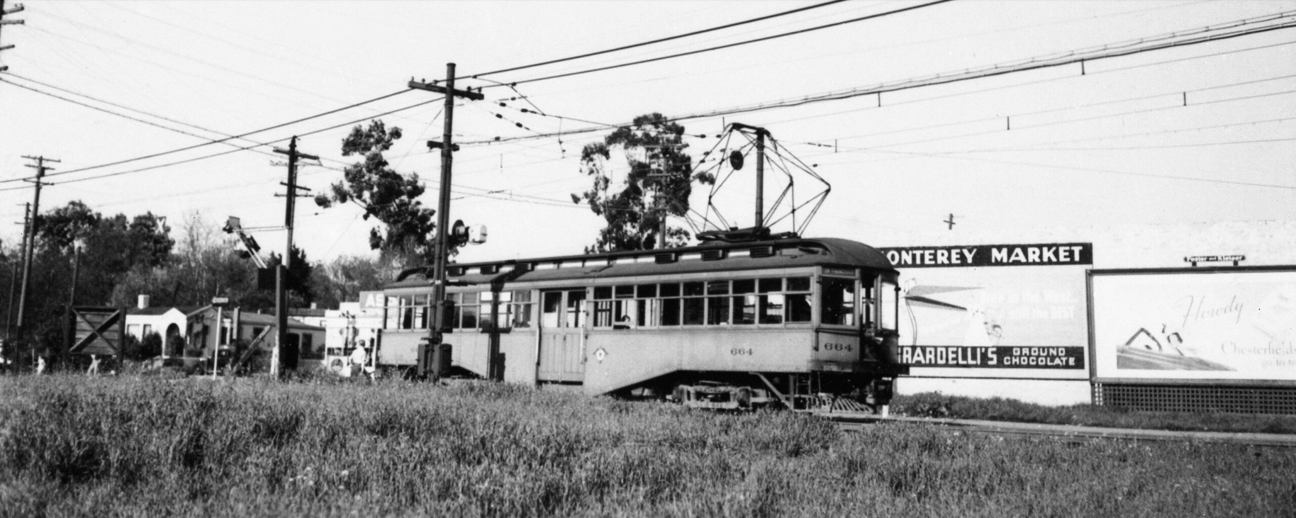
Another northeast view of a single-car train KS 664 places the car south of Hopkins St. ca. 1936. The sign for the Monterey Market has nothing to do with the business with the same name that is in place in 2026, this building being on the opposite side of the street.
L351-115-L. J. Ciapponi Photo, Escataille Collection, Courtesy BAERA, Western Railway Museum Archives, 105846ks, (Image 23 of 25)
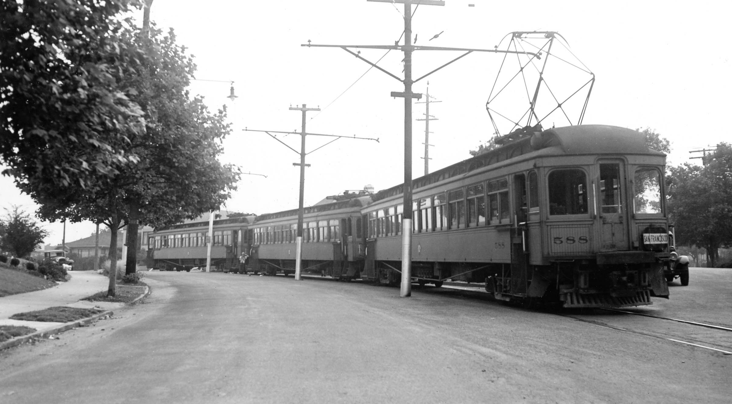
Not all interurban trains on the route were of the single-car variety as seen in this north view of KS 588 ca. 1937 at the Monterey Ave. and Colusa Ave. terminus. Note that by this time, the former SP south-bound or outbound track had been removed.
L351-120-Wilbur C. Whittaker Photo, Courtesy BAERA, Western Railway Museum Archives, 22135ks, (Image 24 of 25)
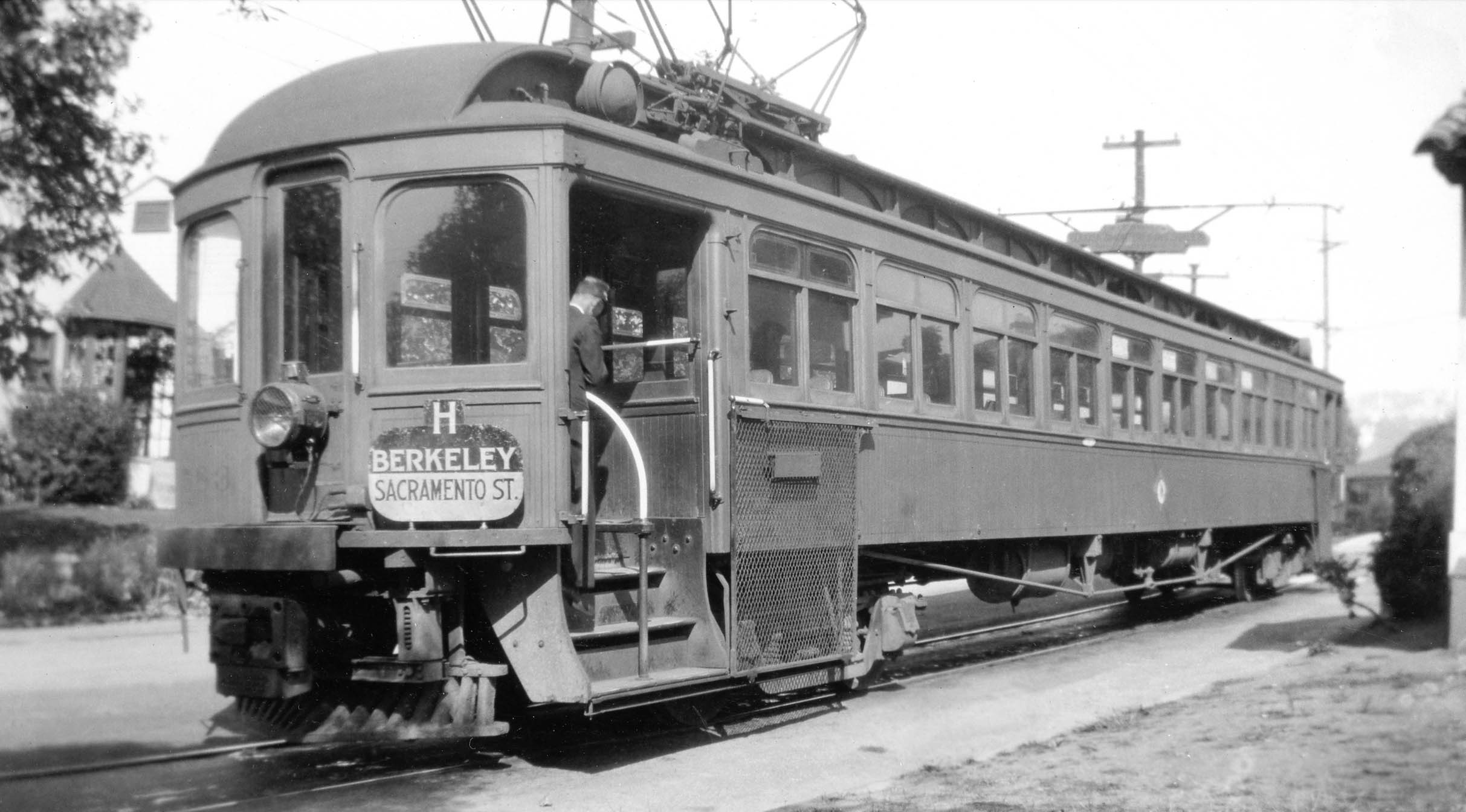
This northwest view taken at the Monterey Ave. and Colusa Ave. terminus shows KS 583 with the designated “H” representing the new nomenclature used to name Key routes once the repackaged and refurbished Key trains or “bridge units” were constructed and utilized over the Bay Bridge. This image was probably taken in 1937 as the new units were being completed. Next time, the gains by the SP on the Shattuck line based on the consolidation of the rail lines in 1933.
L351-125-Courtesy BAERA, Western Railway Museum Archives, 22136ks, (Image 25 of 25)