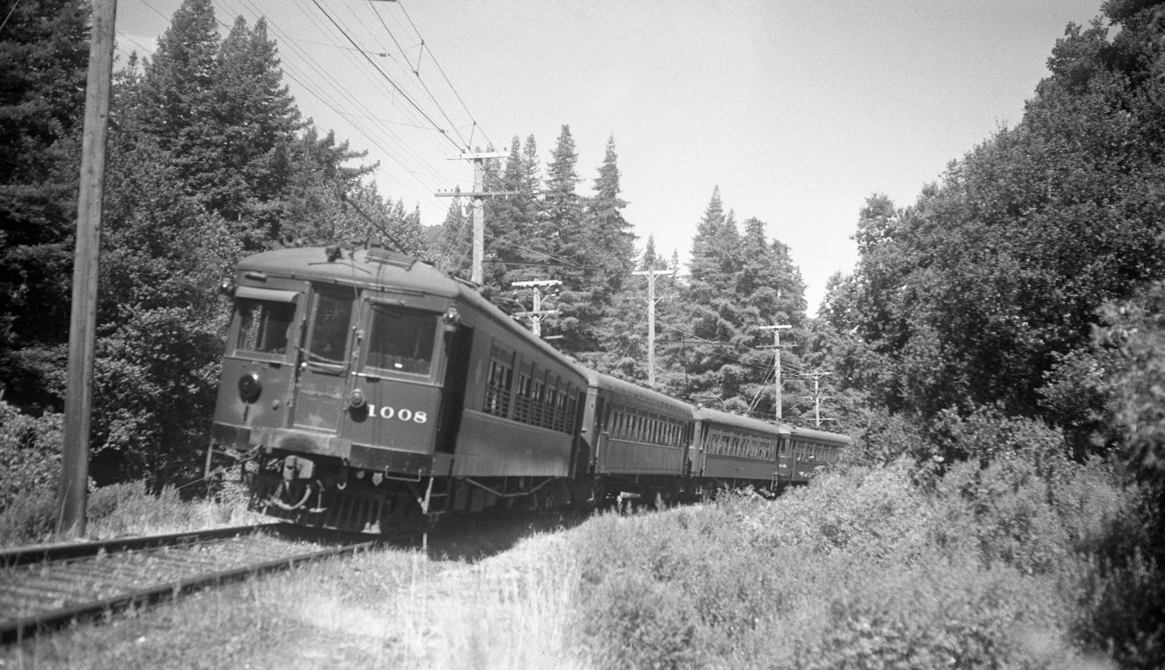
The Curve at Pinehurst and Reyes Cut

Heading to Pinehurst from Moraga as in this west view of a four-car train from 1941 meant passing first through Reyes Cut, then over Canyon Rd. trestle, and around the big curve to Pinehurst station. This update will focus on post-abandonment and early images from this area. See “Trestles in the Trees” for more on the trestle over Canyon Rd.
L93-05-Charles Savage Photo, Courtesy Tom Gray, (Image 1 of 15)

The portion of interest marked in red will complete the general survey of the Canyon-Pinehurst area. In the 21st century, the Moraga border meets Canyon Rd. to the west, or left, at the northeastern-most or top of this red line, but the area to the east remains unincorporated land that is primarily EBMUD watershed.
L93-10-USDA, AAA, Western Division Laboratories, BUT BUU-283-80, Panel 79, Courtesy EBMUD and others, (Image 2 of 15)

Oblique aerial perspectives, as in this northwest directed image circa 1935, failed to deliver a clear view of the tree-filled narrow canyon constituting the area in question. A survey using ground images will follow, beginning at the left arrow and ending at the right arrow.
L93-15-Pacific Aerial Suveys, Courtesy East Bay Regional Park District, USNPS-11-D, (Image 3 of 15)

Facing southwest, this post-abandonment, 1957 image shows the eastern end of the two-track section near the Pinehurst station shelter and the curve ahead to the trestle over Canyon Rd.
L93-20-EK Muller Photo, Courtesy BAERA, Western Railway Museum Archives, 69107sn, (Image 4 of 15)

A view of the curve from the other direction in this circa 1913 image reveals a more wide-open surroundings adjacent to the track.
L93-25-Eston Cheney Photo B-2600, Courtesy BAERA, Western Railway Museum Archives, 24191sn, (Image 5 of 15)

Back to 1957, the catenary wire no longer taut, this west view shows the trestle over Canyon Rd. and the mile 16 indicator. See “Trestles in the Trees” for more scenes of this structure during the SN period.
L93-30-EK Muller Photo, Courtesy BAERA, Western Railway Museum Archives, 77089sn, (Image 6 of 15)

Now further to the east, this west view of the trestle from 1957 also reveals the modification or sculpting of the hills on both sides of the track to allow placement of the trestle on this curve.
L93-35-EK Muller Photo, Courtesy BAERA, Western Railway Museum Archives, 77093sn, (Image 7 of 15)

This northeast view looking toward Moraga shows the trestle and right-of-way during test runs prior to the opening of this section in 1913. The cut to the north has been called Reyes Cut, the origin of which is obscure. Maps that pre-date this scene confirm the existence of the present Pinehurst Rd.-Canyon Rd. intersection prior to railway construction.
L93-40-Courtesy BAERA, Western Railway Museum Archives, 47387sn, (Image 8 of 15)

The cut is no longer as cleared out as it had been a century ago as shown in these northeast views.
L93-45-Stuart Swiedler Photos, (Image 9 of 15)

Past the cut, now looking south back toward Pinehurst, this undated southwest image shows the west wall of the cut. The fresh ballast between the rails and the design of the catenary poles are consistent with a SN predecessor timeframe. Compare L93-40 to the next image as well.
L93-50-Roger Heller Collection, from the collection of the Moraga Historical Society, Moraga, CA, 12, (Image 10 of 15)

In contrast to L93-50, the pole details and right-of-way in this southwest view mark the date, Apr. 16, 1934. Three railway workers, N Capitan (in charge of right-of-way), C James, and H Spect, right to left, respectively, are busy at work.
L93-55-Vernon Sappers Collection, Courtesy BAERA, Western Railway Museum Archives, 81974sn, (Image 11 of 15)

Inching closer to Valle Vista, again a southwest view, the pole details allow this to be dated earlier than L93-55. Take note of the block signals for the next image.
L93-60-Courtesy BAERA, Western Railway Museum Archives, 59246.5sn, (Image 12 of 15)

A repeat of image L83-35 from the Moraga Landmark, “Half Mile to Pinehurst and John R. Allen’s Home” shows the block signals by the curve just as the right-of-way comes into view. This south view from May 26, 1940 completes the link between Pinehurst and Moraga-Valle Vista.
L93-65-Charles Savage Photo, Courtesy BAERA, Western Railway Museum Archives, 77354sn, (Image 13 of 15)

Compare the upper north view from 1913 with that in the lower left panel taken one hundred years later. The trees obscure comparable landmarks to align the images, but they add to the tranquility of this still intact portion of the right-of-way. The lower right shows the right-of-way to the south from this point for completeness.
L93-70-Courtesy BAERA, Western Railway Museum and Stuart Swiedler, (Image 14 of 15)

One more image of interest is shown here with the description written by an unsuspecting author. The image was likely used by the railway to promote picnic trains to Pinehurst Park, but it is contrived. Although this image was derived from a glass plate negative, the plate shows a composite of photos. A great example of pre-Photoshop fabrication!
L93-75-Vernon Sappers Collection, Courtesy BAERA, Western Railway Museum Archives, 24189sn, (Image 15 of 15)