The Forgotten Road Beyond Peachton to Haselbusch
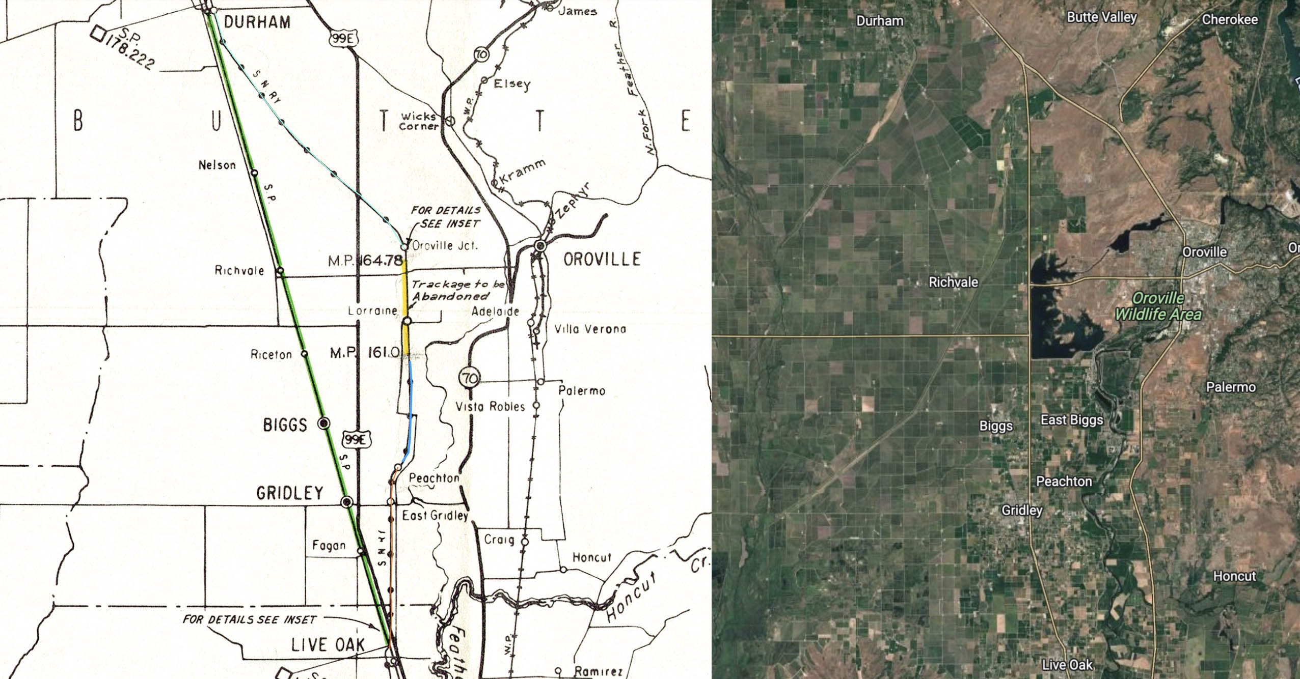
The last piece related to the loss of the Sacramento Northern Railway, SN, mainline between Durham and Live Oak secondary to the construction of the Thermalito Afterbay is the section between Peachton and south of milepost 161, namely Haselbusch, blue line on right. The documents presented earlier from ca. 1957 between the SN and Western Pacific, WP, provided no information on this segment, and no documents from the early 1960s have been found that address the decision to end the branch from Live Oak at Peachton.
L325-05-Courtesy BAERA, Western Railway Museum Archives, 39461 and Google Maps, (Image 1 of 34)

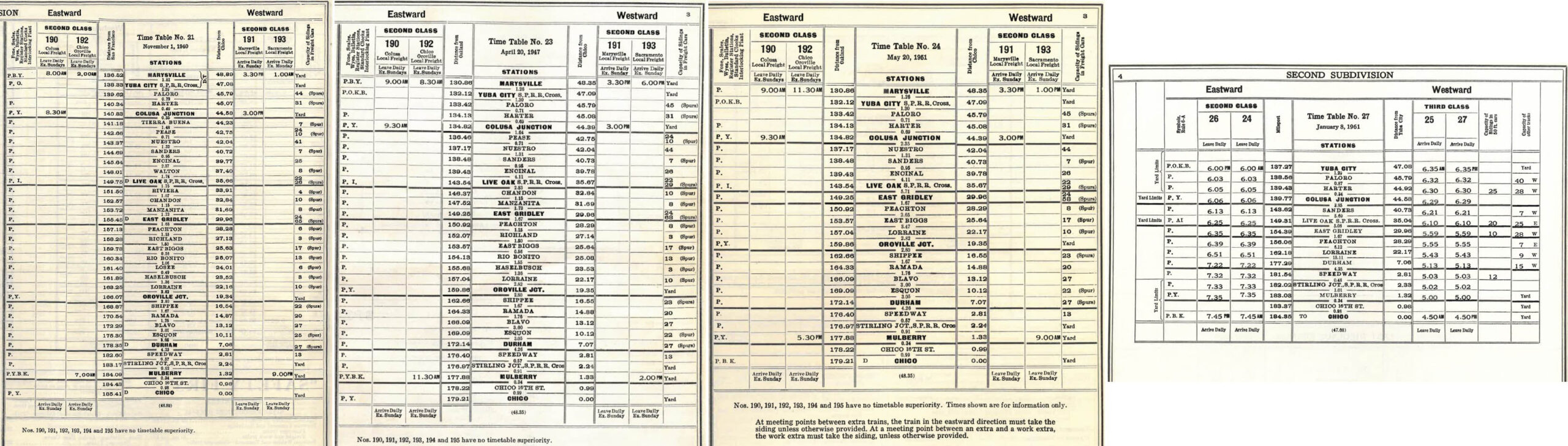
The five SN stops between Peachton and Lorraine noted in the 1940 employee timetable, left, included Richland, E. Biggs, Rio Benito, Losee, and Haselbusch, the same as in a timetable not shown from 1910. By 1947, left center, Losee was excluded, and by 1951, right center, only East Biggs remained. Finally, in 1961, right, no stops remained between East Gridley and Lorraine. When the creation of the two branch lines were announced, there was nothing said about the track north of Peachton, and no official document of abandonment could be found.
L325-10-Courtesy BAERA, Western Railway Museum Archives, 13477, l, 13481, cl, 13482, cr, 13488, r, (Image 2 of 34)
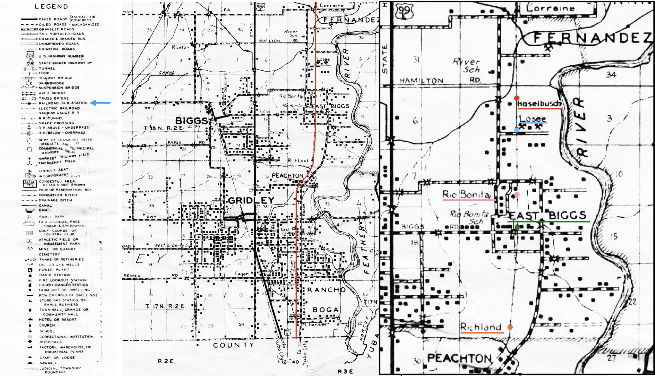
This map from 1946 provides the area to be covered, left. On the right, the detail shows the location and the names of the stations by matched by color. Ref: Map of Butte County, California. Compiled and published by Thomas Bros., copyright by Harry Freese. 1946. Chico Digital. G4363 B8 1946 T6, ca_2044
L325-15-Courtesy Meriam Library, California State University, Chico, ca_2044, (Image 3 of 34)
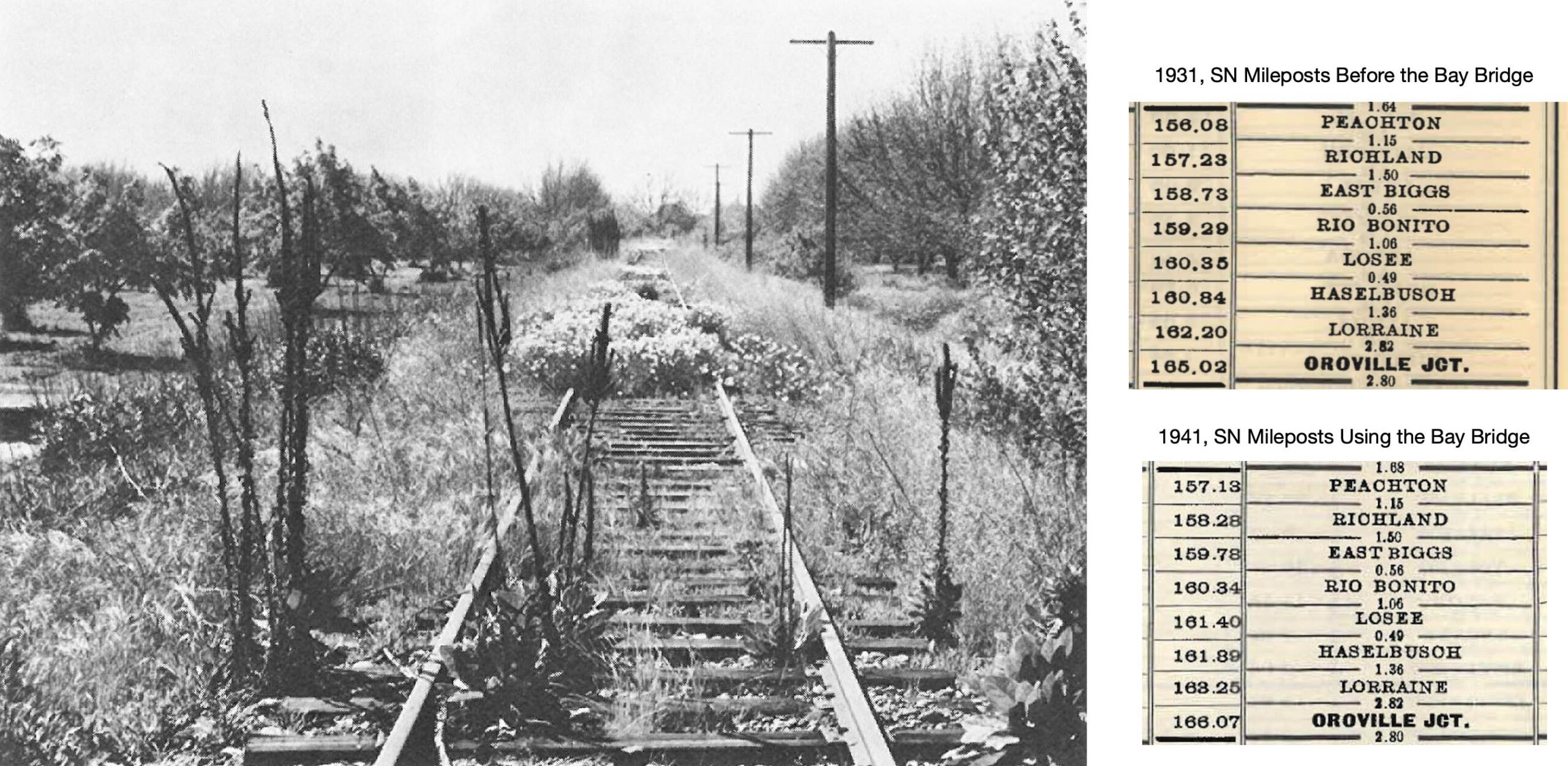
It should come as no surprise that this image taken by Ralph Demoro of East Biggs in 1969, left, strongly confirms that freights never went past Peachton when the branch was formed in April 1967. The mileposts used to follow will be those used by the SN before using the Bay Bridge, top right. Ref: “The SN” Parts 1 and 2 by Harre Demoro, The Bulletin National Railway Historical Society, Page 30, Vol 37, No. 6, 1972, l; Courtesy BAERA, WRM Archives, Timetable No. 13, Nov. 8, 1931 13466 and Timetable No. 21, Nov 1, 1940 13477, r
L325-20-Multiple Attributions, (Image 4 of 34)
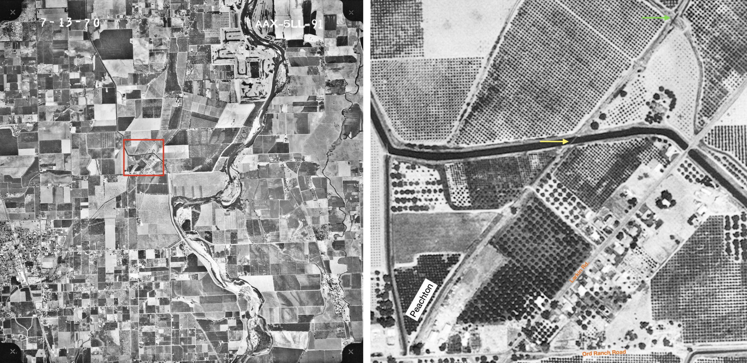
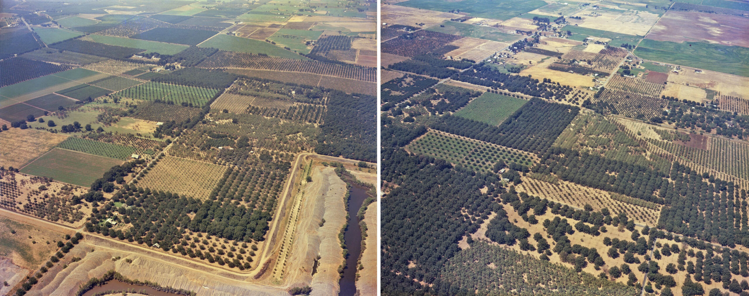
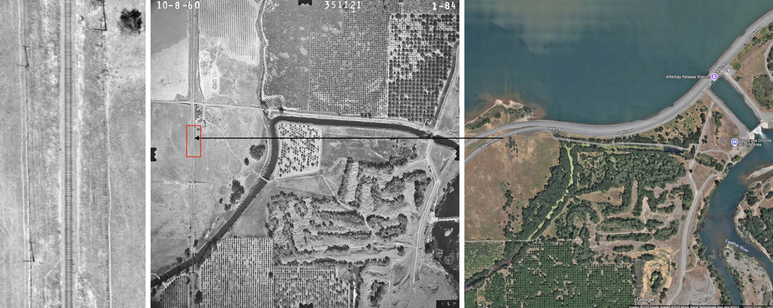
To start off with a detailed review of the section north of Peachton, the aerial on the left from 1970 has a red box enclosing the Peachton area and two trestles to the northeast that spanned two canals. No ground images have been found of these spans. This area is enlarged on the right, the two yellow arrows marking the two trestles.
L325-25-aax-1970_5ll-91, Courtesy of UCSB Library Geospatial Collection, (Image 5 of 34)
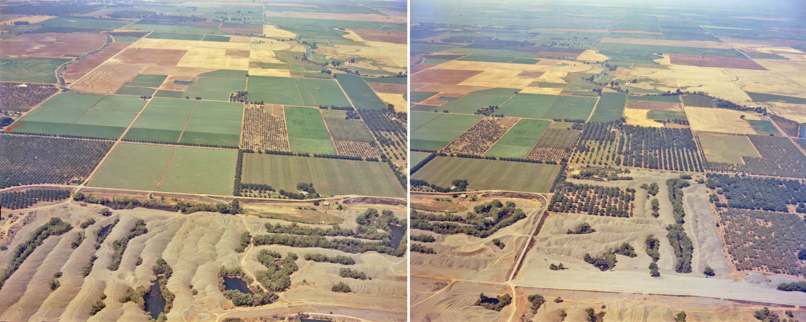
The two aerials shown here were part of a survey of the area conducted for the California Department of Water Resources, CDWR, on Aug. 20, 1964. The one on the left features Peachton and Richland, while the one on the right features East Biggs and Rio Benito. Appreciate that the two images are not continuous with one another, there being a less than half-mile gap in the vicinity of Palm Ave. and Watson Rd. That portion does not enter in the discussion. The SN location will be examined in more detail in two panels that follow.
L325-30-Courtesy California Department of Water Resources, 1964_08_20_VA_02268_003, l, 002, r, (Image 6 of 34)
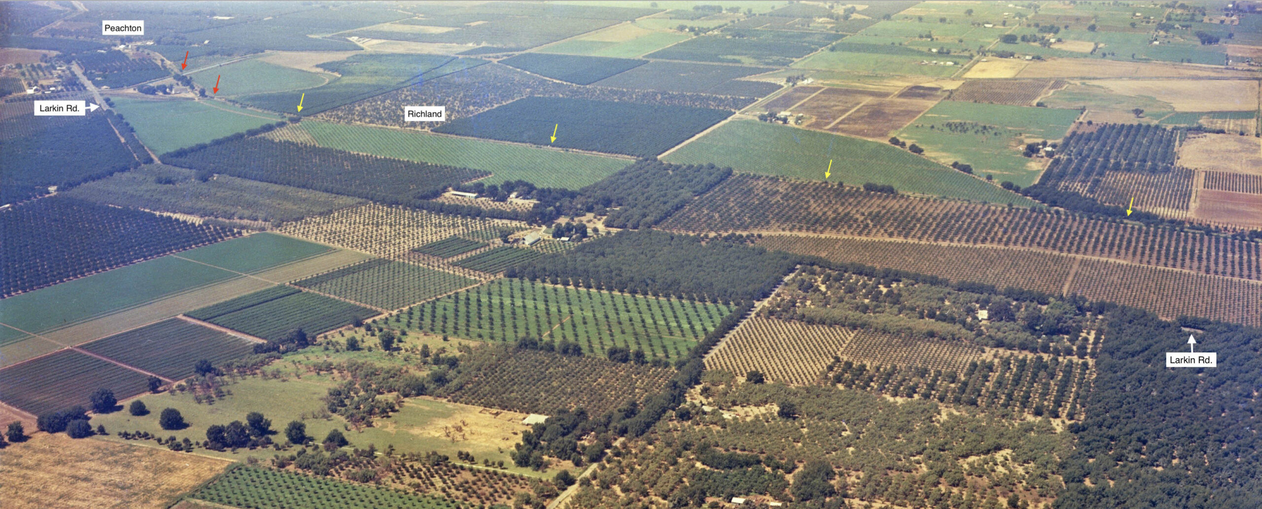
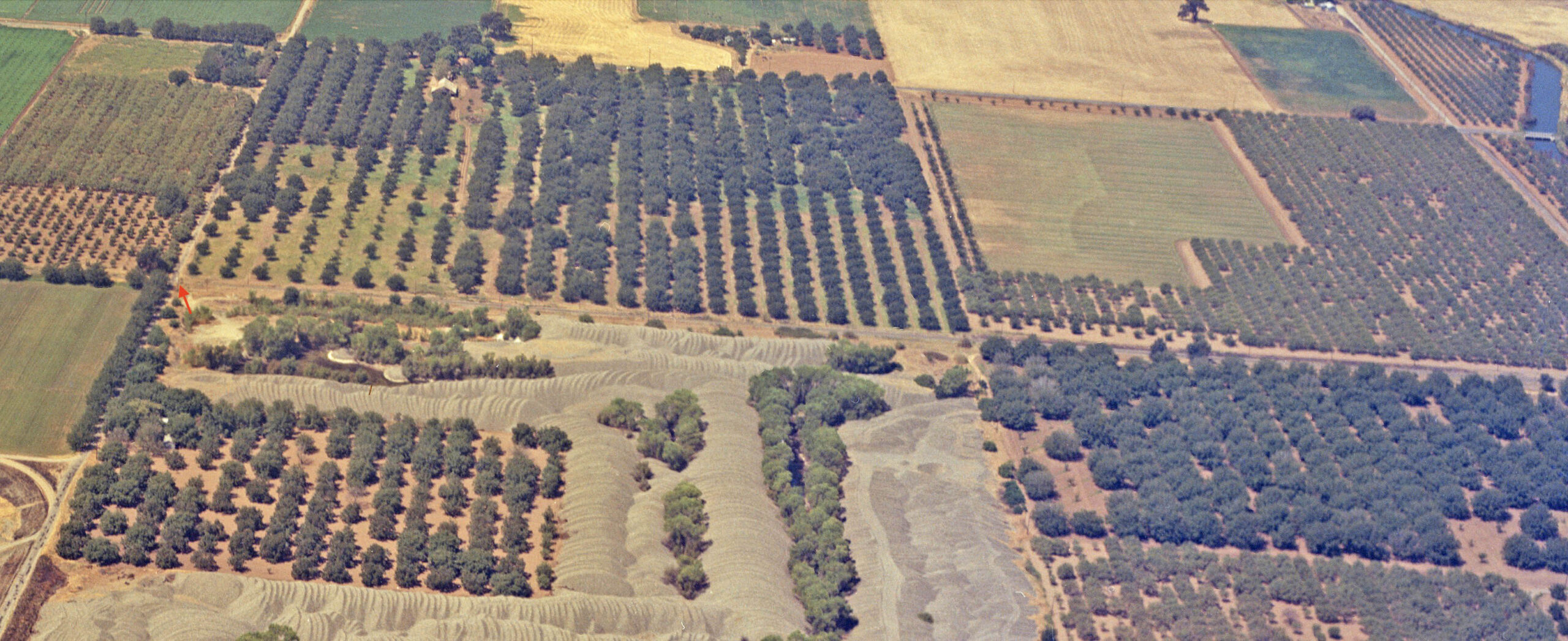
This southwest view is a detail from the previous left panel and covers the area from Peachton, to the left or south, to just south of Palm Ave. along the right margin, short of East Biggs. The approximate position of Richland is labeled, although there were no images or information found about this SN stop. The SN right-of-way is marked by the yellow arrows. The red arrows mark the crossings with the two trestles discussed previously.
L325-35-Courtesy California Department of Water Resources, 1964_08_20_VA_02268_003, (Image 7 of 34)
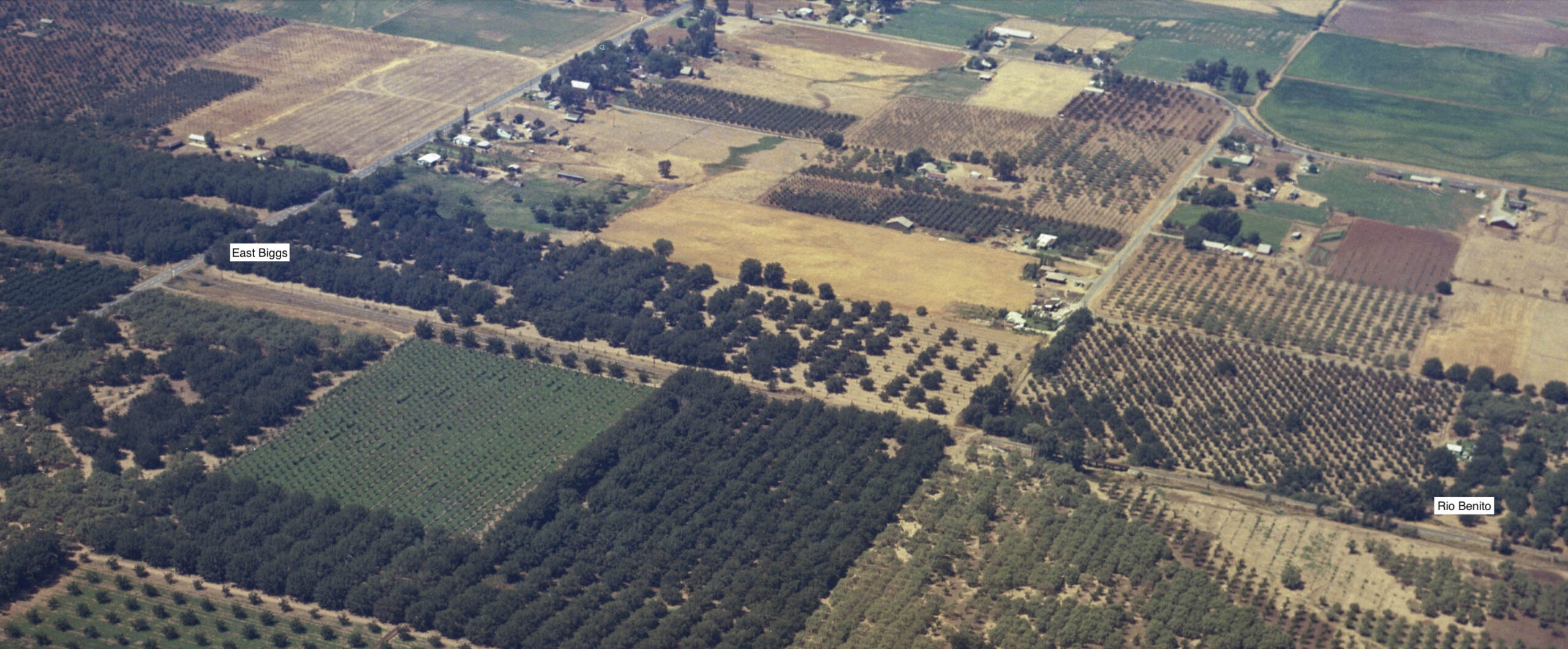
The next southwest view is from the previous right panel. Crossbucks mark the SN crossing of the Biggs East Highway in East Biggs. The approximate position of Rio Benito is based on the 0.56 miles difference between the SN station there and that at East Biggs, and independently by the map in L325-165. In between there is a decent sized trestle, and just to the left or south of it, a primitive grade crossing of the continuation of Lattin Rd. with no crossbucks.
L325-40-Courtesy California Department of Water Resources, 1964_08_20_VA_02268_002, (Image 8 of 34)
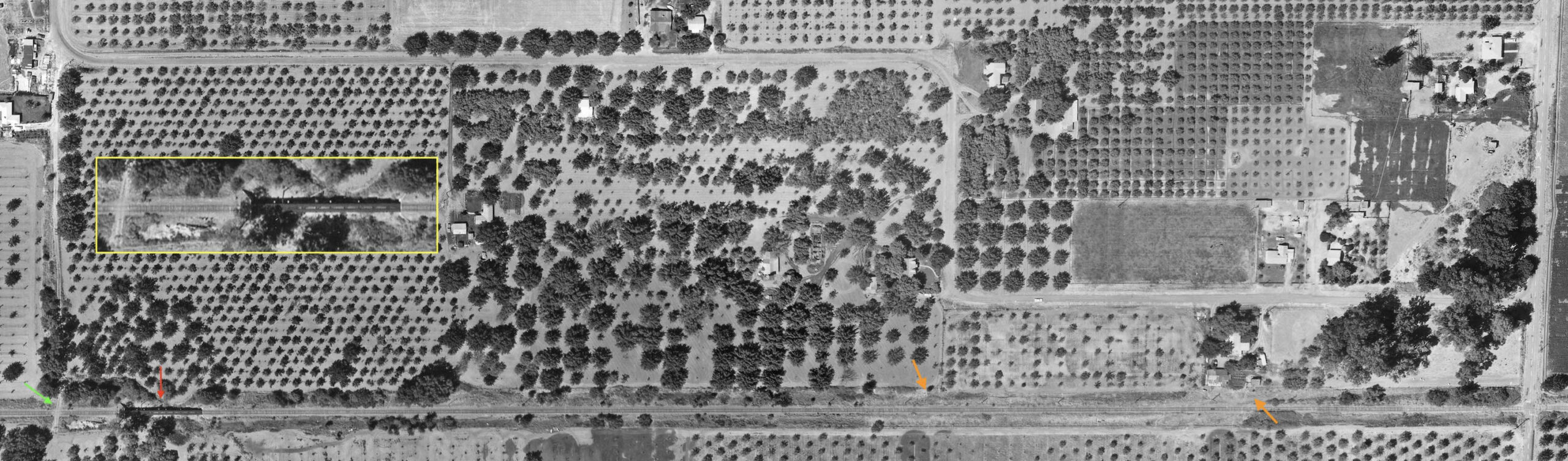
This west-oriented vertical aerial from Aug. 8, 1964 shows the trestle, red arrow, and the crossing to the south or left, green arrow. Larkin Rd. can be seen along the right edge. Rio Benito should be somewhere in between, with two possible candidates marked by the orange arrows based information to be supplied shortly. The insert, yellow box, shows a magnified view of the crossing and trestle. No good images of the station area at East Biggs from any time period were found. The next discussion will focus on the trestle just reviewed.
L325-45- Courtesy California Department of Water Resources,copy, (Image 9 of 34)
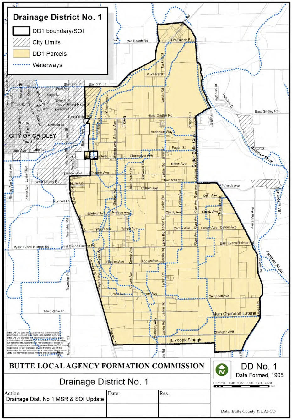
Before proceeding further, an observation about water management in this section of Butte County will be presented. This map of Butte County Drainage District No. 1, formed in 1905, covers the area reviewed in the last update on the Live Oak-Peachton Branch. Interestingly, there is no comparable entity managing water drainage north of this point to the Afterbay and east of Highway 99, and no reason could be found for this. Why this is of interest follows in the next image.
L325-50-Drainage District No. 1, Courtesy Butte Local Agency Formation Commission, (Image 10 of 34)
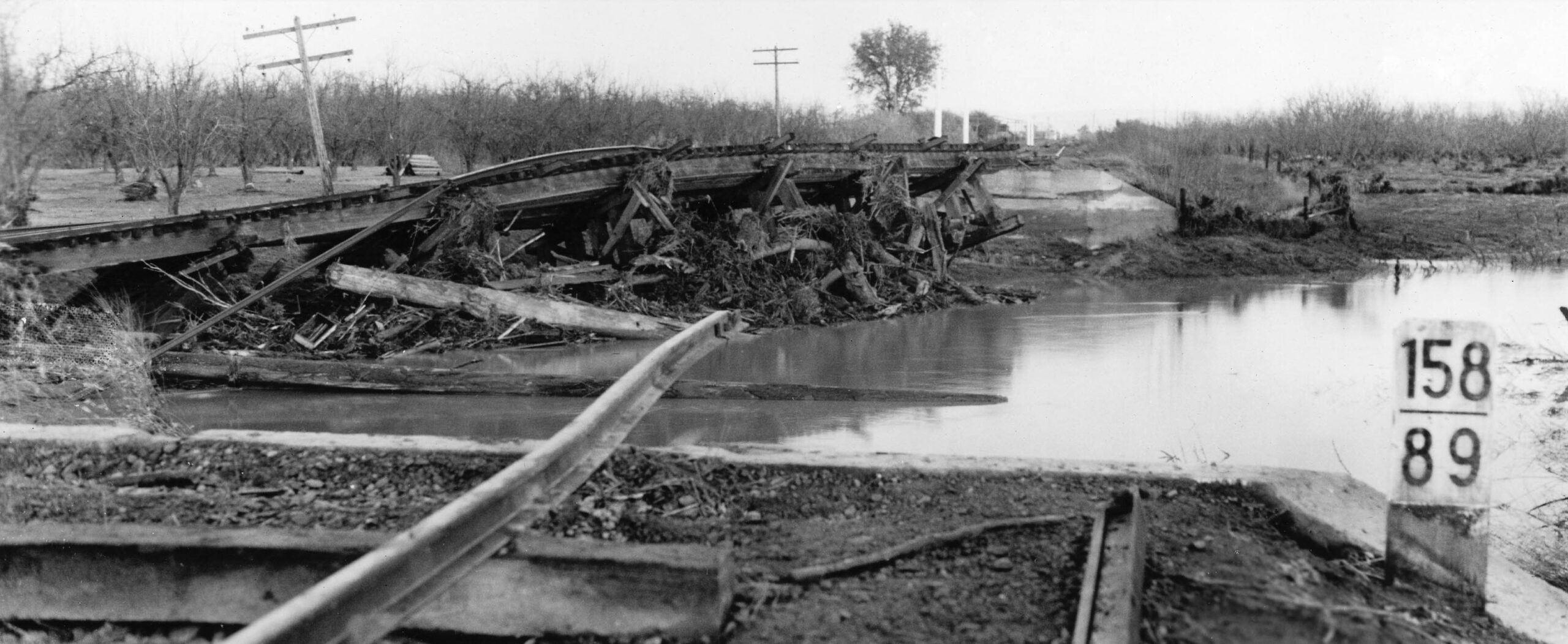
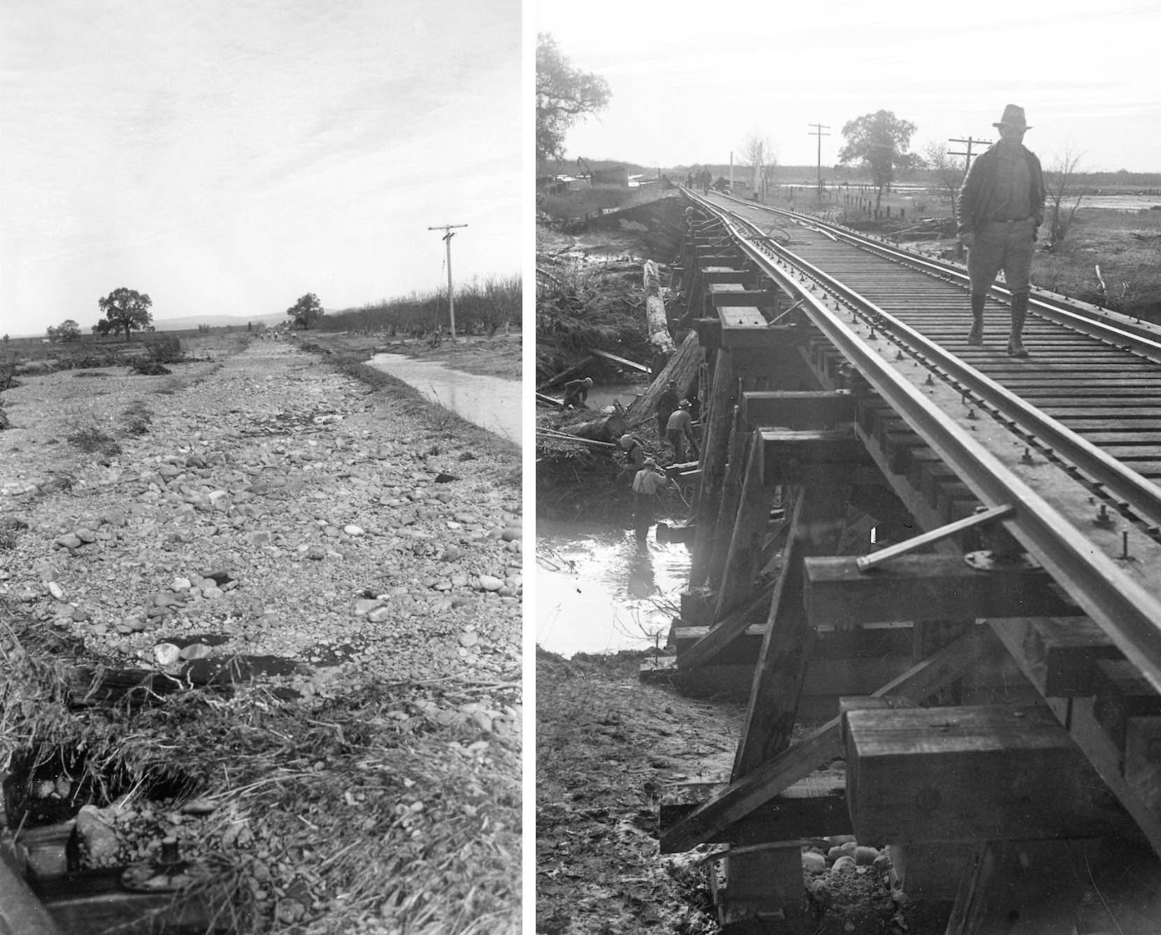
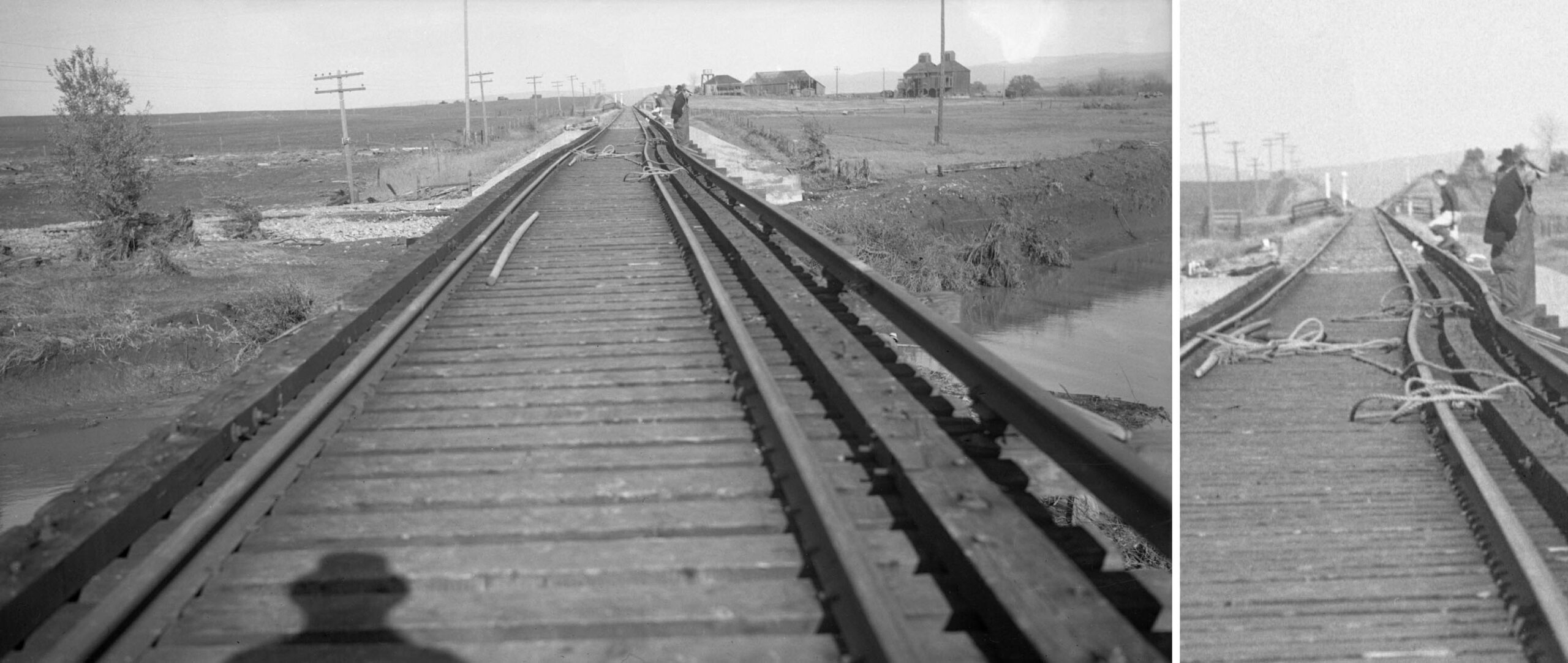
An anonymous photographer took several images of the extensive damage of the mainline caused by the Christmas Flood of 1937, and the repair process between East Biggs and Haselbusch. The north view from the trestle’s south abutment, milepost 158.89, confirms its position north of East Biggs (158.73), but south of Rio Benito (159.29). Aside from the flood images to follow, little else was found from here through Haselbusch, and absolutely nothing past 1940. Looking north, note the tree in the distance to the west or left of the track.
L325-55-Courtesy BAERA, Western Railway Museum Archives, 224637sn, (Image 11 of 34)
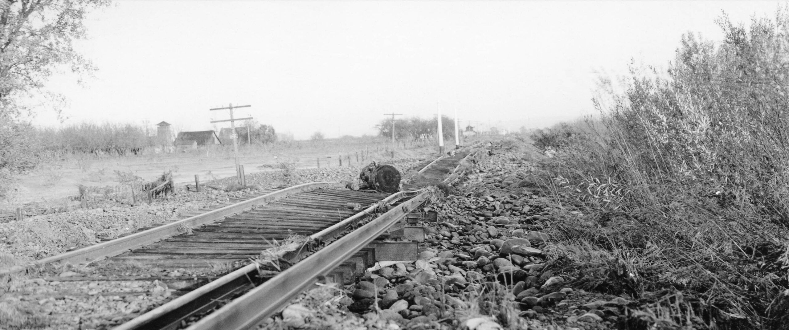
The tree seen in the last image is now seen along the left border, and the milepost 159 survived the onslaught of water. In the distance the Rio Benito Station area can be seen with a faint outline of the ridge of the eastern foothills visible in the background. Except for a few houses along the north-south portion of Lattin Rd., this area for the rest of the way appears similar in 2025 as it did in 1937, that is, solid agriculture.
L325-60-Courtesy BAERA Western Railway Museum Archives, 224649sn, (Image 12 of 34)
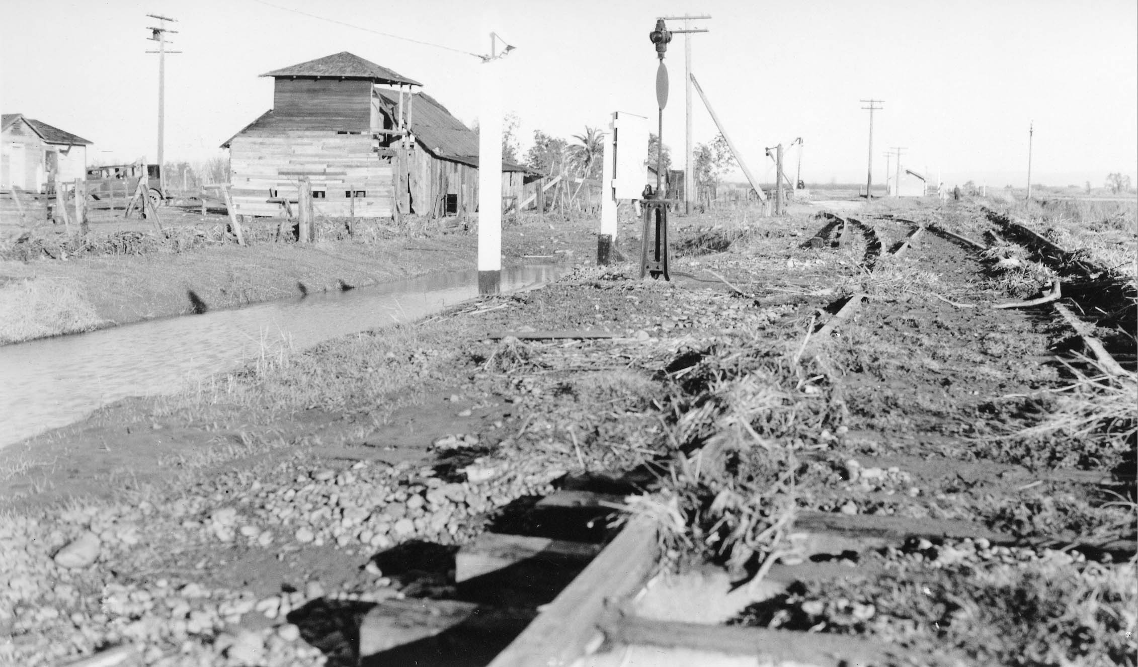
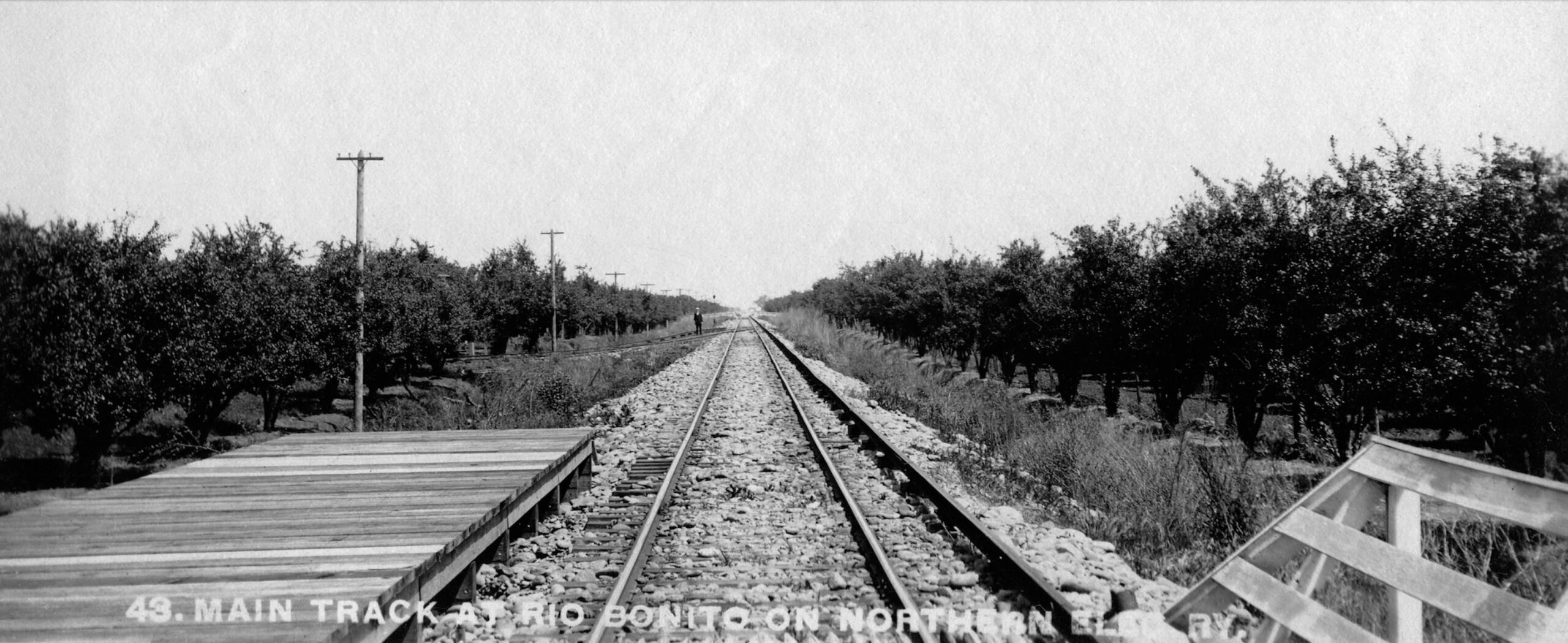
Continuing the northward trek and reaching Rio Benito, the area appears to have survived the worst of the flood. The switch track producing a spur track capable of handling 13 freight cars is followed by a small building, and then a grade crossing. Further to the north, the very faint outline of the foothills is again appreciated, as is a large tree just to the right of the right-of-way.
L325-65-Courtesy BAERA Western Railway Museum Archives, 224648snsn, (Image 13 of 34)
The Rio Benito Station area had gone through many changes from the Northern Electric Railway, NE, period shown here, to the end of the passenger era in 1940 as shown on the next image.
L325-70-Northern Electric Photo, Courtesy BAERA Western Railway Museum Archives, 241209sn, (Image 14 of 34)
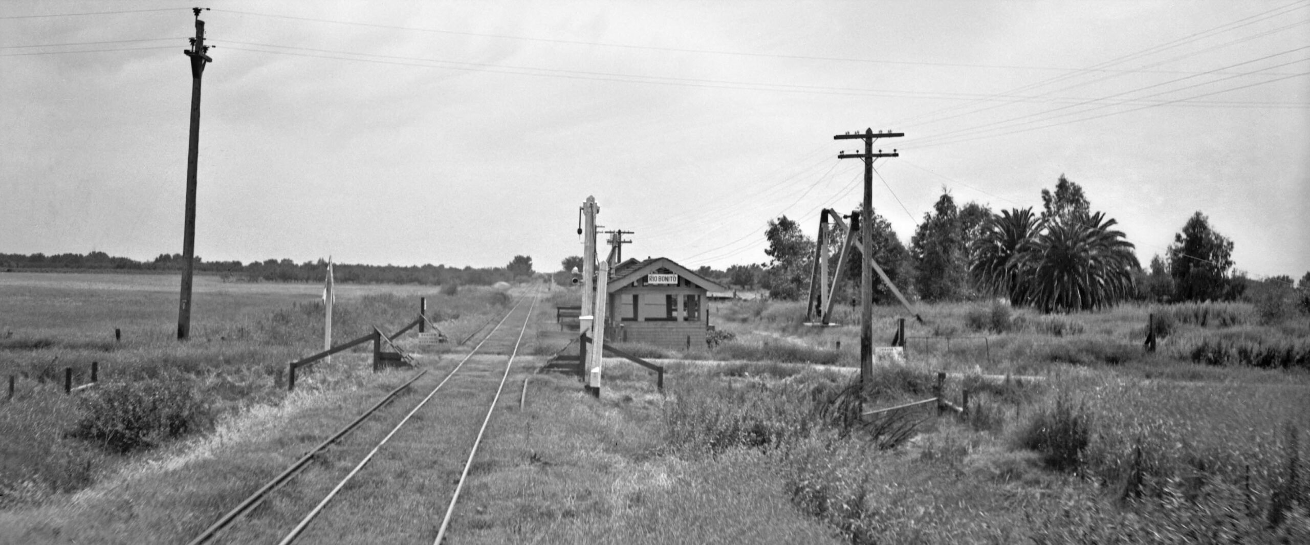
Howard Wolfe’s image of the shelter at Rio Benito from 1940 in a south view taken from the rear of a train north of the grade crossing. Here the station shelter is seen, obscuring the larger building seen in the last image. The switch track is way in the distance. The utility poles to the south are absent. As to the grade crossing and its exact location, Larkin Rd. would be too far north, and the detailed aerial in L325-45 does provide two possible candidates based on a possible grade crossing and a cluster of buildings.
L325-75-Howard T. Wolfe Photo, Courtesy BAERA Western Railway Museum Archives, 232732sn, (Image 15 of 34)
Two more overlapping west-facing oblique aerials from Aug. 8, 1964 feature the portion where Larkin Rd. turned to the west, crossing the right of way, just off the left or south edge, red arrow, and Vance Ave., along the right edge, left panel. There was no significant railway landmarks in this section. On the right, Vance Ave. is the road one third of the way from the left border, and Haselbush Ln., is partially seen along the top right border. Note the sculpted gold dredging tidings from the Feather River seen in the foreground of each of the images.
L325-80-Courtesy California Department of Water Resources, 1964_08_20_VA_02268_004, l, 006, r, (Image 16 of 34)
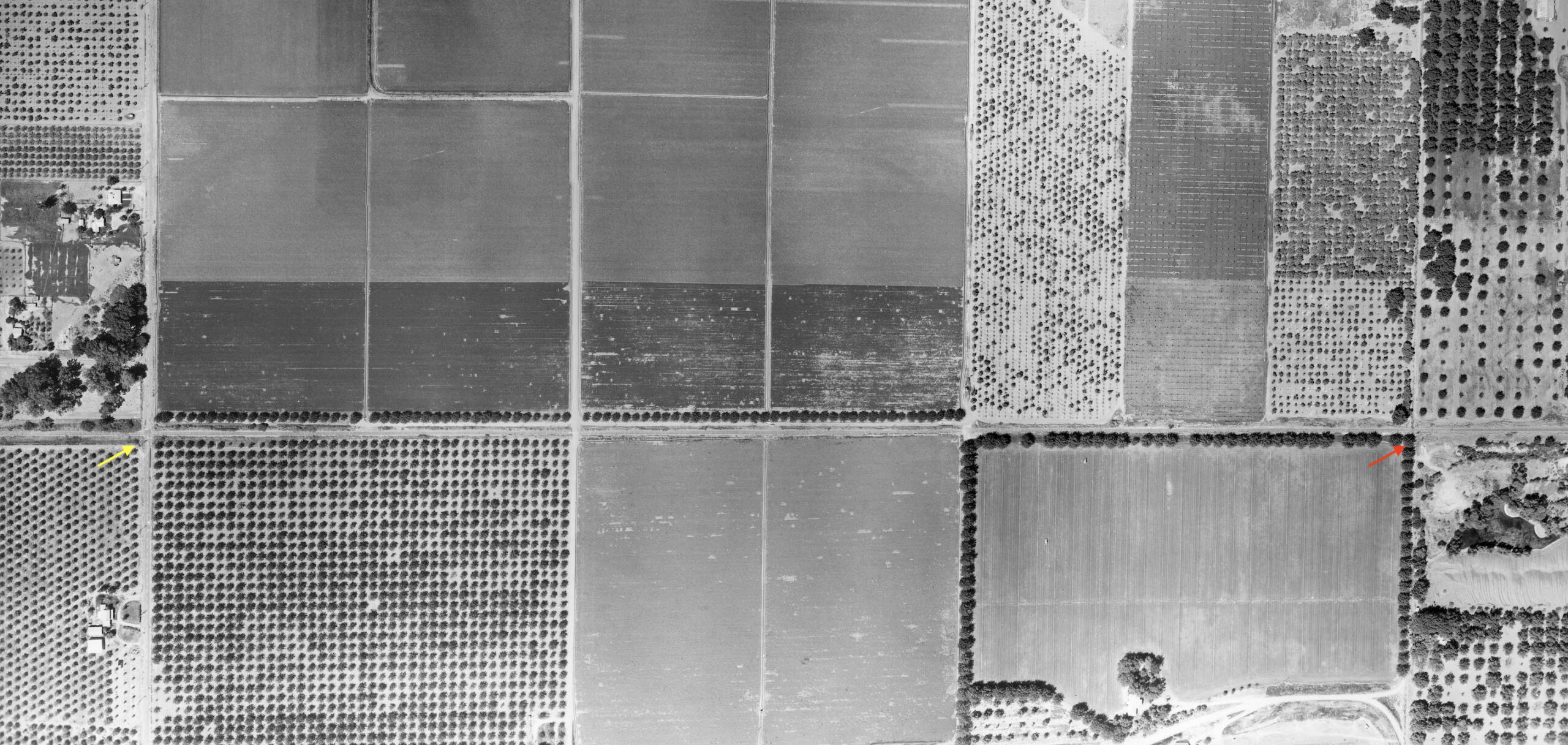
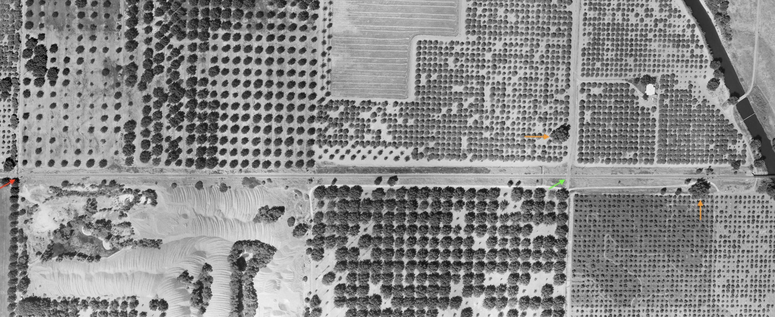
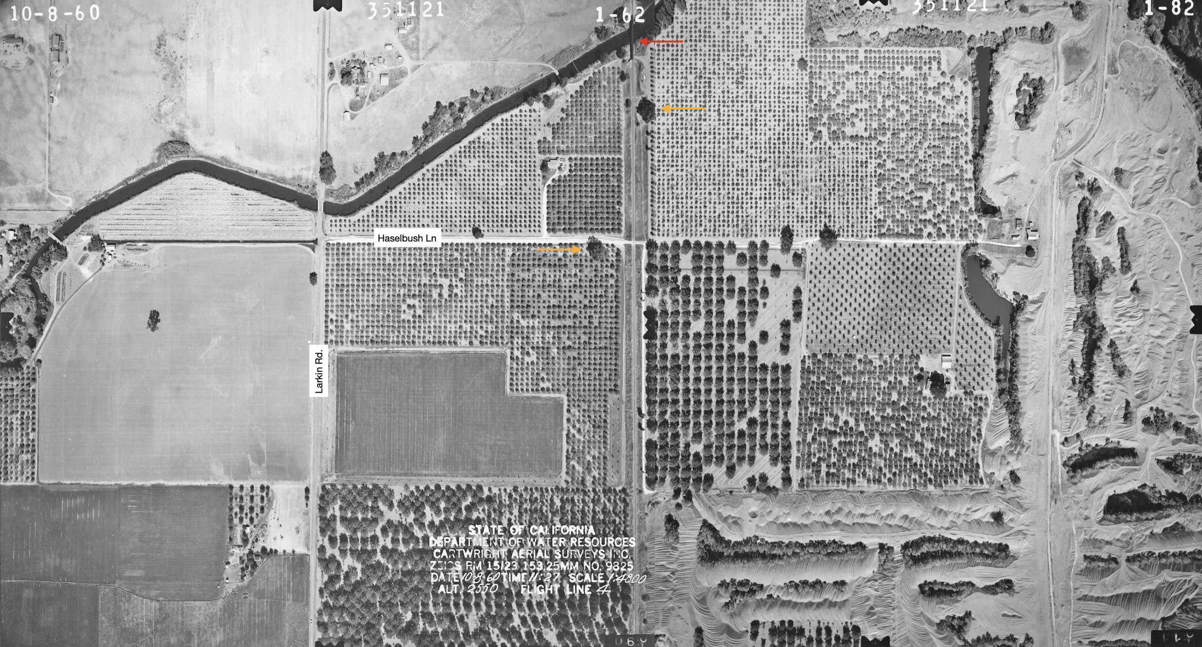
This vertical west-oriented aerial from Aug 8, 1964 shows the section of right-of-way from Larkin Rd., first road running top to bottom off the left border, yellow arrow, to Vance Ave., first road running top to bottom off the right border, red arrow. Again, no notable railway highlights here. It remains as wall-to-wall orchards in 2025. A unanswered question is why did CDWR have all these images taken of an area south of the soon to be built Thermalito Afterbay? Was there a concern that no Butte County Drainage District was assigned?
L325-85-Courtesy California Department of Water Resources, 2264A-(30, 31, 31 composite)_08_18_1964, (Image 17 of 34)
In contrast, here is a detail from the previous oblique aerial featuring Vance Ave. to the north short of Haselbush Ln., for a unknown reason spelled differently than the SN stop Haselbusch. The red arrow marks a single crossbuck at the Vance Ave. crossing. In 2025 the distance between Vance Ave. and Haselbush Ln. is 0.5 miles, and the two stations were 0.49 mile apart according to employee timetables. The previous 1946 map shows Losee as being north of the grade crossing with Vance Ave.
L325-90-Courtesy California Department of Water Resources, 1964_08_20_VA_02268_006, (Image 18 of 34)
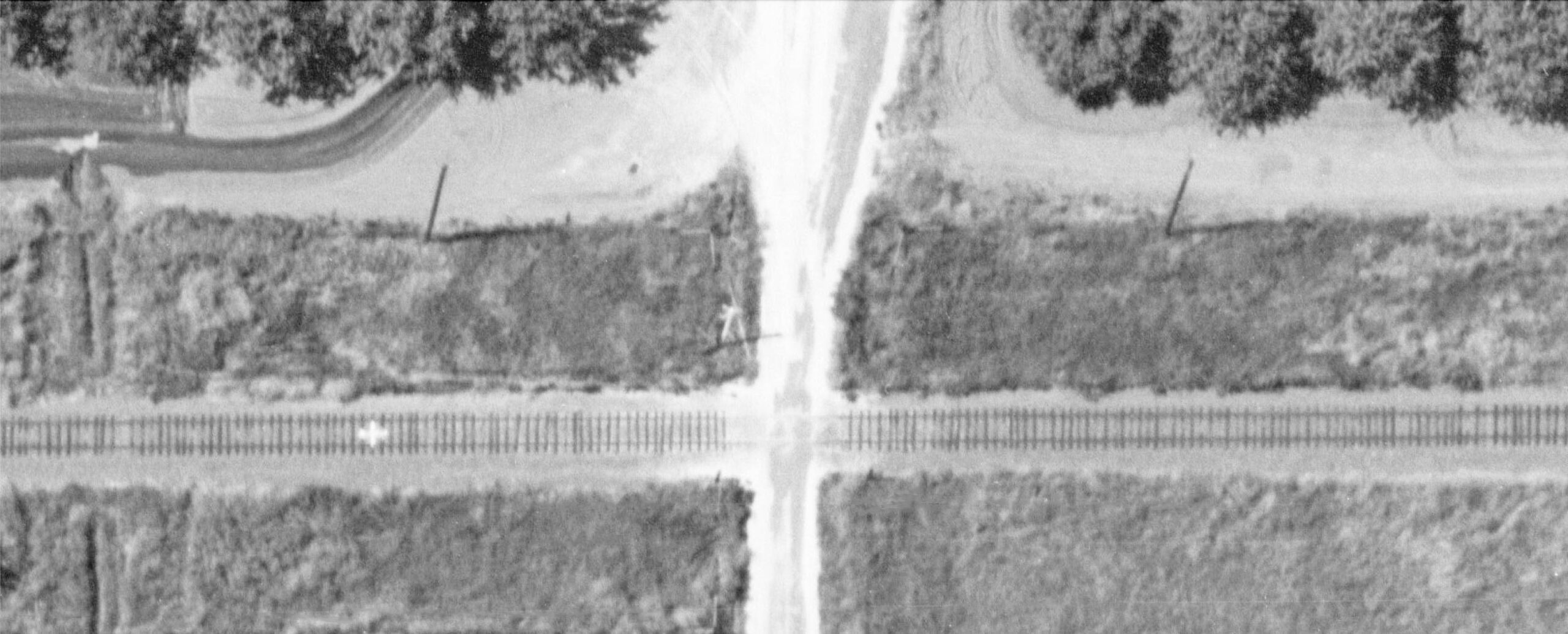
A close-up of the SN Vance Ave. grade crossing is shown from an aerial survey conducted on Oct. 18, 1960. The Losee freight stop is estimated to have been on the north or right side of the crossing. A difficult to discern single crossbuck is placed at the northeast corner.
L325-95-Cartwright Aerial Surveys, Inc. Photo, Courtesy California Department of Water Resources, 5_81, (Image 19 of 34)
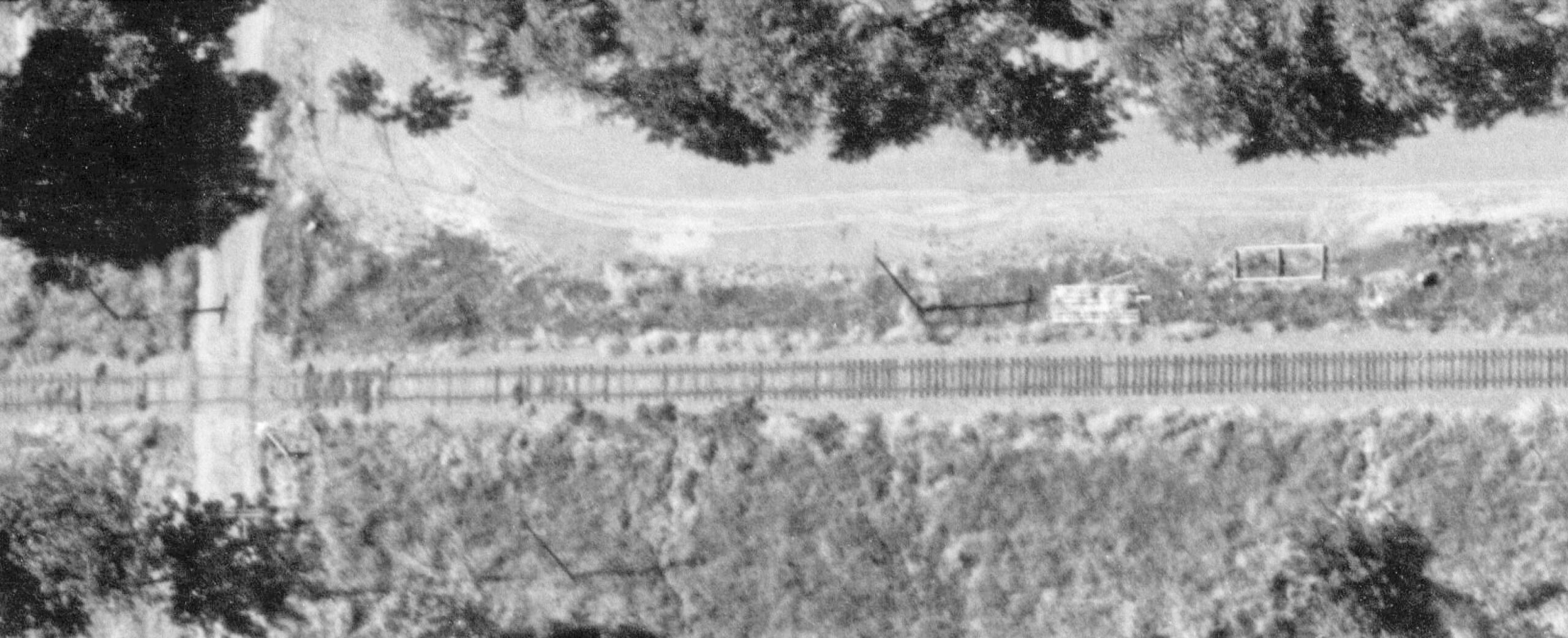
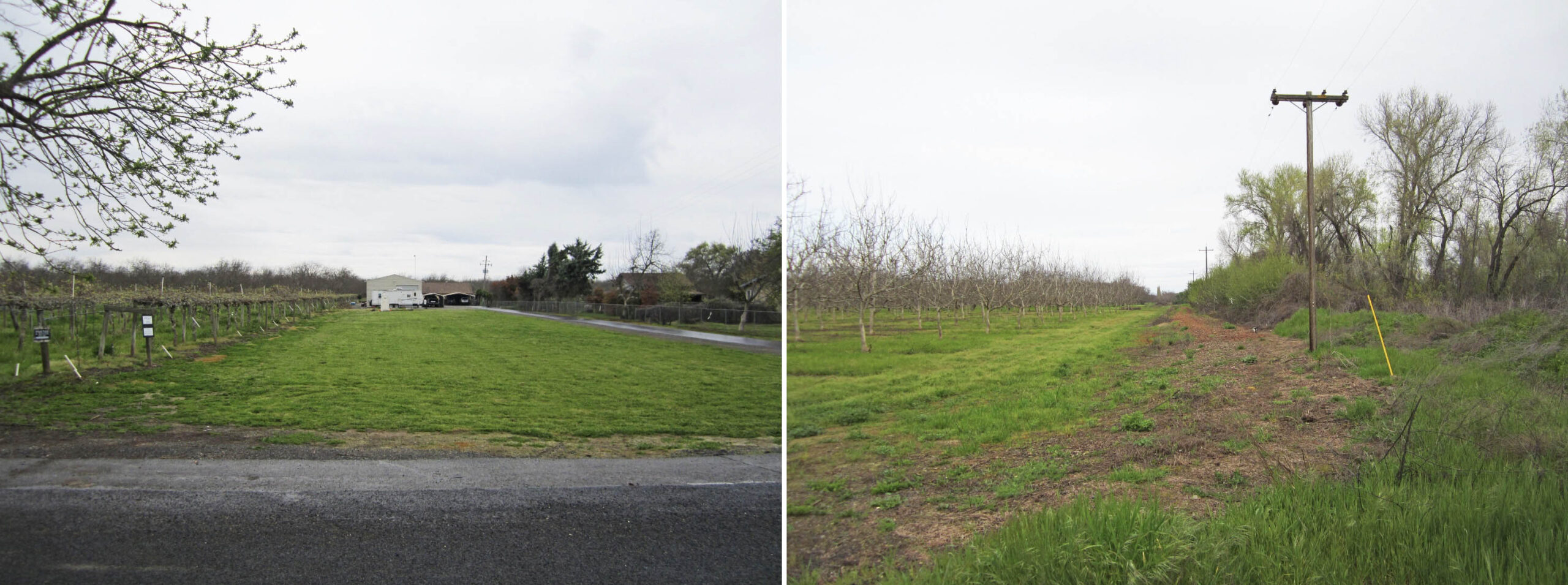
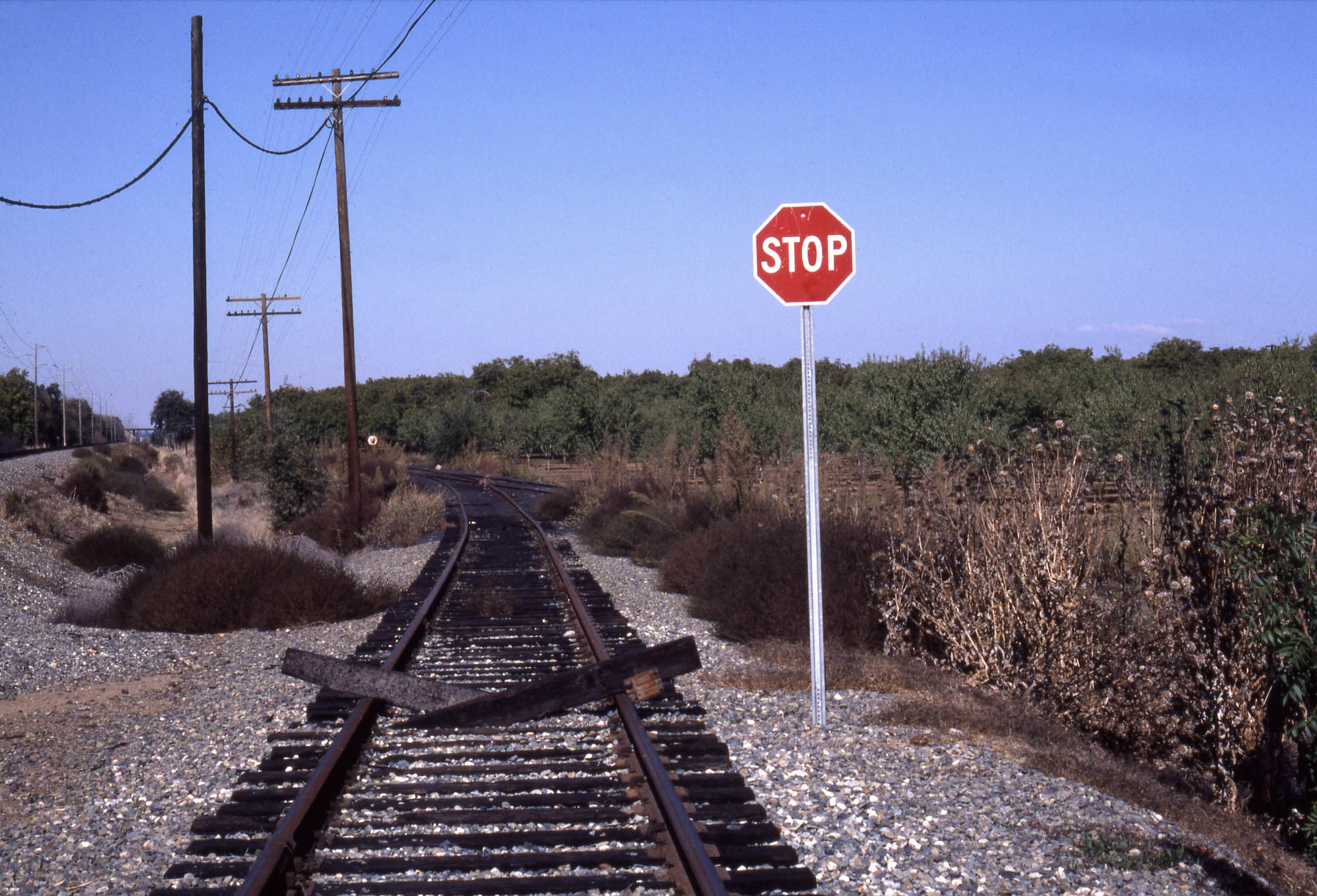
Standing on Vance Ave. at the former SN crossing in 2019, the view to the south, left, looks like most go what you see between East Biggs and here, that is, no evidence of a railway having past through here. However, a view to the north, right, yields utility poles to the west of a vastly overgrown shallow berm that the railway used here. Finally, signs of a former right-of-way.
L325-100-Stuart Swiedler Photos, (Image 20 of 34)
This vertical west-oriented aerial from Aug 8, 1964 shows the section of right-of-way from Vance Ave., first road running top to bottom off the left border, red arrow, and Haselbush Ln., first road running top to bottom off the right border, green arrow. To the north or right of Haselbush Ln. is a trestle shown crossing the unnamed canal. Note the utility poles remain to the west of the right-of-way, and the two trees marked by the orange arrows.
L325-105-Courtesy California Department of Water Resources, 2264A-(26, 27 composite)_08_18_1964, (Image 21 of 34)
The two trees in question can be seen in the north view from Losee, left panel, taken after the damaged tracks and ties were removed ca. early 1938. The tree to the left or west marks the location of the Haselbusch stop 0.49 miles ahead. On the right is a complementary south view from the relatively intact trestle just north of Haselbush Ln. showing the same two trees.
L325-110-Vernon Sappers Collection, Courtesy BAERA, Wesern Railway Museum Archives, 224659sn, r, 160823, r, (Image 22 of 34)
A close-up of the SN grade crossing of Haselbush Ln. is shown here from Oct. 18, 1960. The Haselbusch freight stop is estimated to have been on the north or right side of the crossing. Note the single crossbuck at the southwest corner. To reiterate a point, the road here is spelled Haselbush Ln., and the SN stop was spelled Haselbusch. The reason for this is difference has not been found, however this is not the first place where the SN may have misspelled a name, such as Conoway for Conaway on the Woodland branch, or Raliez for Reliez in Lafayette.
L325-115-Cartwright Aerial Surveys, Inc. Photo, Courtesy California Department of Water Resources, 5_82, (Image 23 of 34)
Next a review of the area just north of Vance Ave. from the aerial survey conducted on Oct. 18, 1960. These views provided more details of the area to the north and south of the SN mainline, and had superior resolution compared to the aerials conducted on Aug. 8, 1964. These views have been turned to show north at the top of the image. The two trees that served as landmarks are denoted by the orange arrows, and the trestle over the canal north of Haselbush Ln. is marked by the red arrow.
L325-120-Cartwright Aerial Surveys, Inc. Photo, Courtesy California Department of Water Resources, 5_82, l, 4_62, r, (Image 24 of 34)
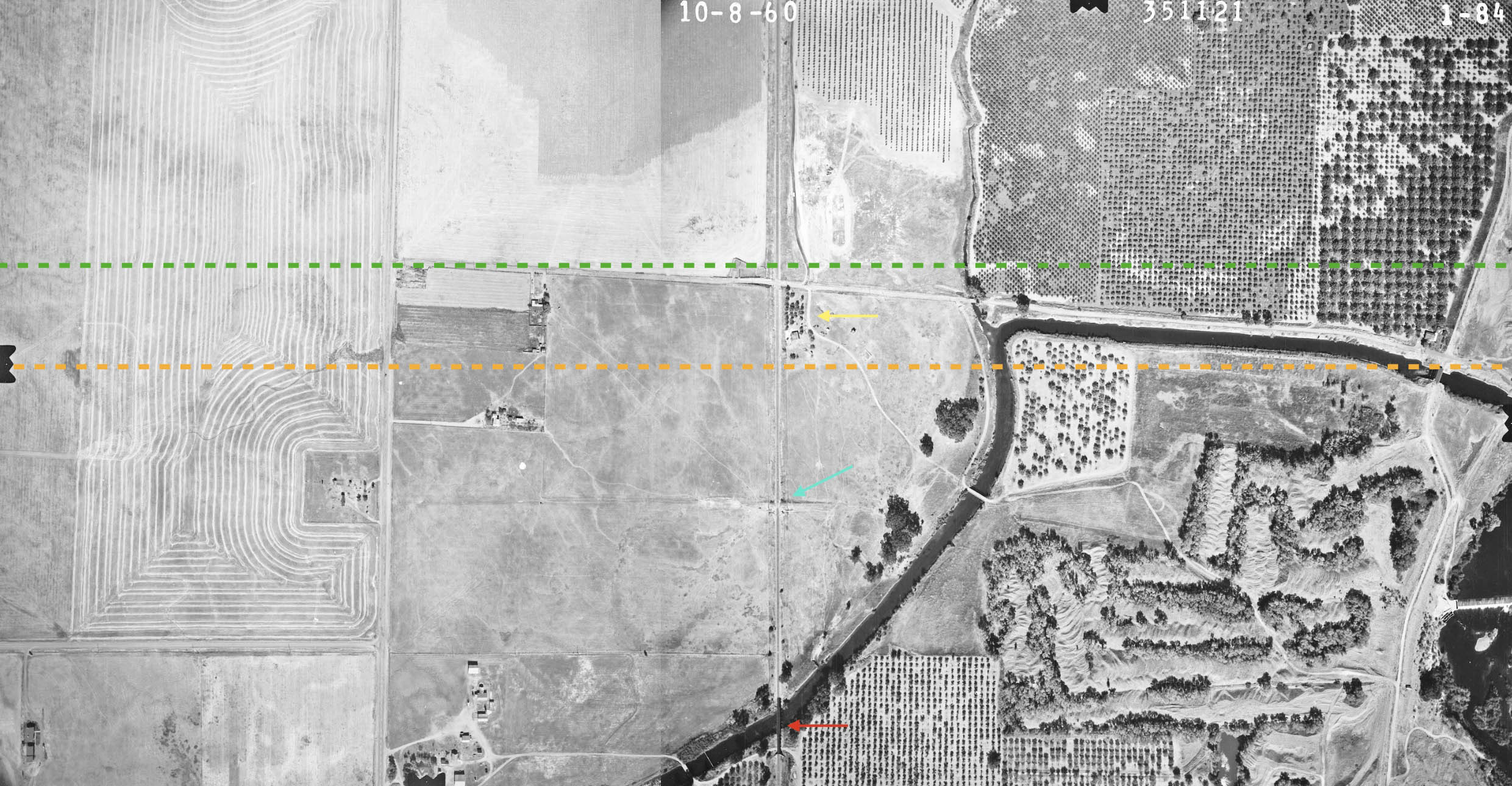
Further north, the trestle now sits at the lower or southern border of the image. The turquoise arrow points to an irregularity across the mainline that will be followed up shortly, the yellow arrow to the southern-most residence-ranch to be eliminated to build the Afterbay. The green line corresponds to the furthest point north the SN mainline was flooded, the orange line where the last view of the right-of-way that can be viewed south from Larkin Rd. In 2025. Next some details of the three items noted here.
L325-125-Cartwright Aerial Surveys, Inc. Photo, Courtesy California Department of Water Resources, 5_84, l, 4_64, r, (Image 25 of 34)
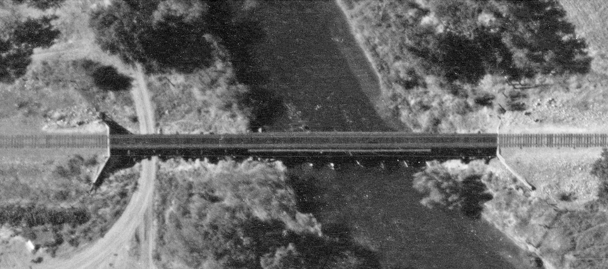
First, a detailed view of the trestle just north of Haselbush Ln., turned such that north is to the right.
L325-130-Cartwright Aerial Surveys, Inc. Photo, Courtesy California Department of Water Resources, 5_84, (Image 26 of 34)
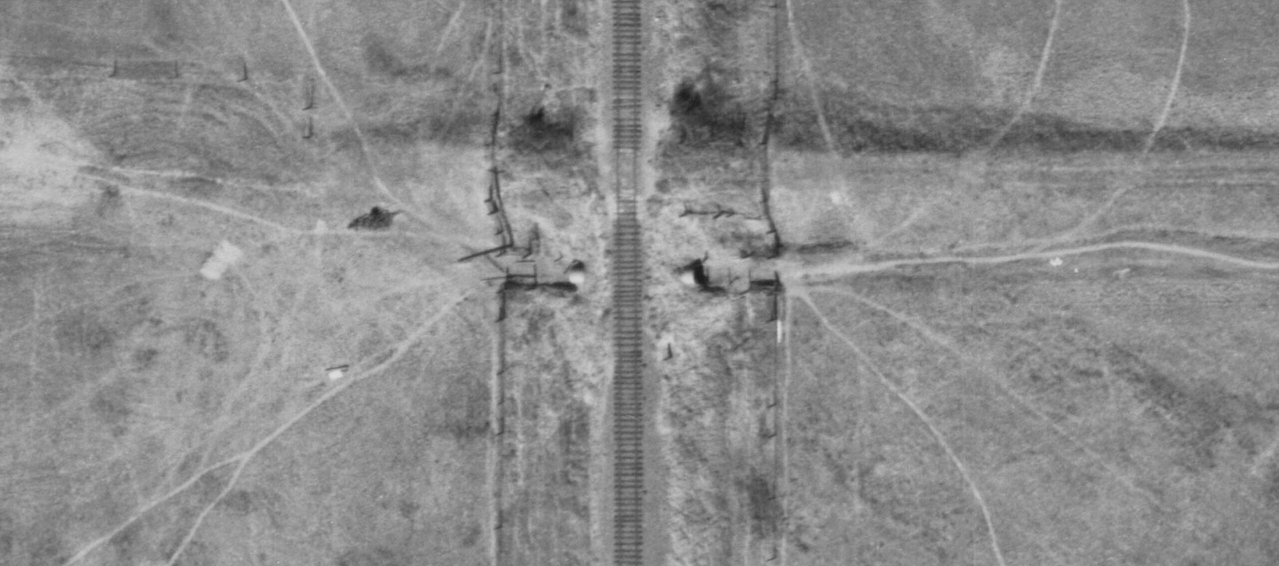
Second, the irregularity across the mainline appears to be a culvert of sorts or drainage ditch with a large pipe. This image is oriented such that north is to the top.
L325-135-Cartwright Aerial Surveys, Inc. Photo, Courtesy California Department of Water Resources, 5_84, (Image 27 of 34)
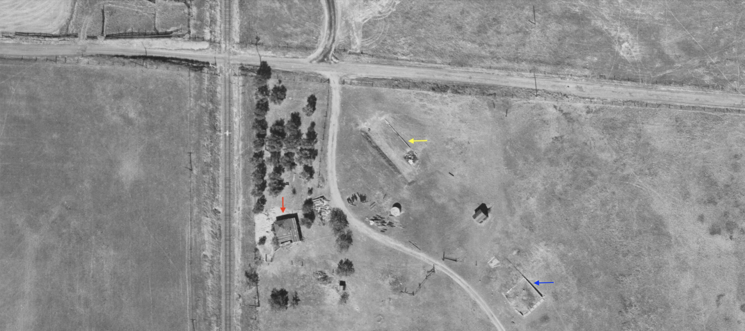
Finally, the southern-most residence-ranch to be eliminated to build the Afterbay, also oriented such that north is to the top. There appears to be one structure, red arrow, and two outlines of previous foundations marked by the red and yellow arrows, respectively. Keep those three locations in mind for later in the presentation.
L325-140-Cartwright Aerial Surveys, Inc. Photo, Courtesy California Department of Water Resources, 5_84, (Image 28 of 34)
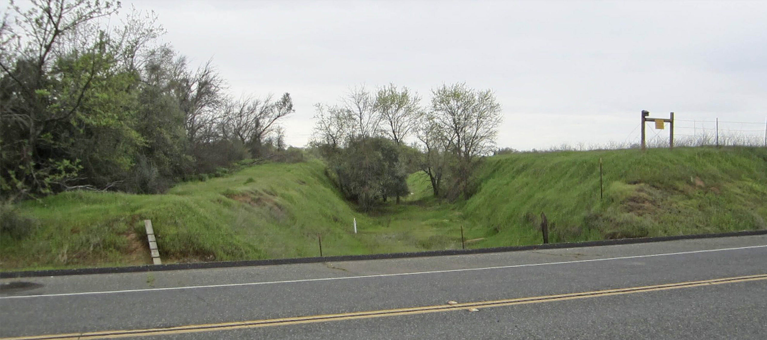
One last piece to resolve is the appearance of the right-of-way as seen here in a south view from Larkin Rd. In 2018. The path appears to be formed by a cut through a very slight ridge. To document this interpretation is correct, read on.
L325-145-Stuart Swiedler Photo, (Image 29 of 34)
Start with the aerial on the right from 2025 where the base of the black arrow originates from the location of the previous image, and follow where the arrow points to in 1960 to its left. This area is then magnified at the far left. Viewing a shallow cut from a vertical aerial is difficult, and this image does not even suggest such a structure.
L325-150-Cartwright Aerial Surveys, Inc. Photo, Courtesy California Department of Water Resources, 5_84 l, and Courtesy Google Maps, r, (Image 30 of 34)
Back to the anonymous photographer who chronicled the extensive damage of the mainline caused by the Christmas Flood of 1937. The north view on the left from the trestle just north of Haselbush Ln. shows the cut the railway passed through at that time. The cut is magnified in the detailed image on the right. In the image on the left, note the three structures to the right of the right-of-way. Then return to L325-140 to see what was there in 1960, to verify the foundations of two of those buildings.
L325-155-Vernon Sappers Collection, Courtesy BAERA, Western Railway Museum Archives, 160822sn, (Image 31 of 34)
That completes this set of presentations on “How the North End of the Sacramento Was Lost.” Some parts of the mainline were not lost, more appropriate to say sections were abandoned when the Chico Local was stopped at the end of 1985. Tom Messer’s northeast view at Durham from June 1, 1986 shows the connector between the SP and SN mainline is no longer accessible, retiring the section here to Chico Airport. Except for the portion from Durham to the beginning of catenary south of Chico, this section has been covered previously, click here.
L325-160-Tom Messer Photo, Coutrtesy Wayne Monger, (Image 32 of 34)
Likewise, the southern connector to the SP mainline at Live Oak seen here in a southwest view from June 1, 1986 retired the section between here and Colusa Jct. The additional piece left of true SN mainline left outside the Marysville-Yuba City axis (i.e,. discounting the use of the WP bridge over the Yuba River and revised Reed Branch alignment) would be the portion between Yuba City and Colusa Jct. That portion was covered in the final update on Yuba City, click here, and was abandoned on Sept. 15, 2004.
L325-165-Tom Messer Photo, Coutrtesy Wayne Monger, (Image 33 of 34)
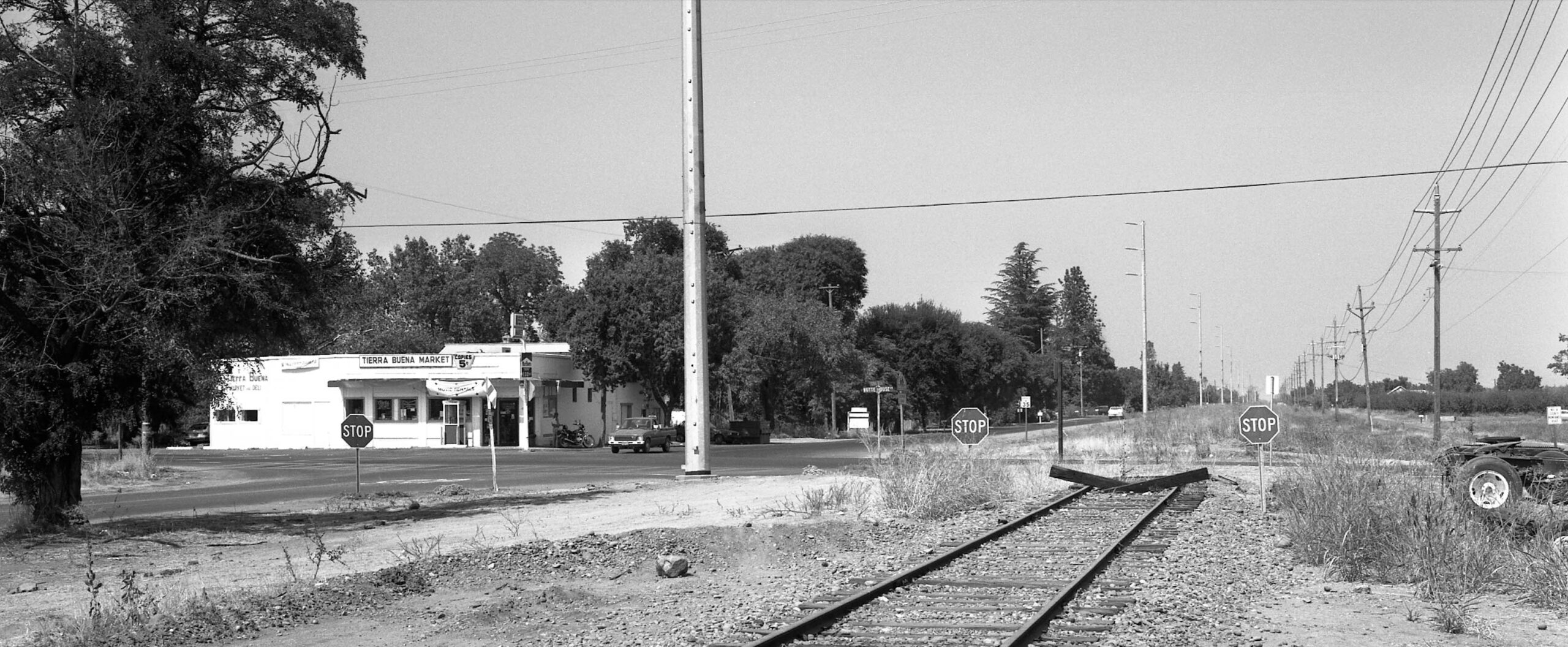
Harre Demoro’s north view at Butte House Rd. in Tierra Buena from Sept. 15, 1988 brings the discussion back to the section between Colusa Jct. and Live Oak. Although well covered in the 1970s-1980s in publications, a ride as a passenger along this section in 1940 is a subject planned for exploration when a continuation of SN North End history returns. Much appreciation to Wayne Monger, Tom Messer, John Harder and the California Department of Water Resources for their invaluable help and generosity in making this presentation possible.
L325-170-Harre Demoro Photo, Courtesy John Harder, (Image 34 of 34)