The Forgotten Trestle and Other Things Lost
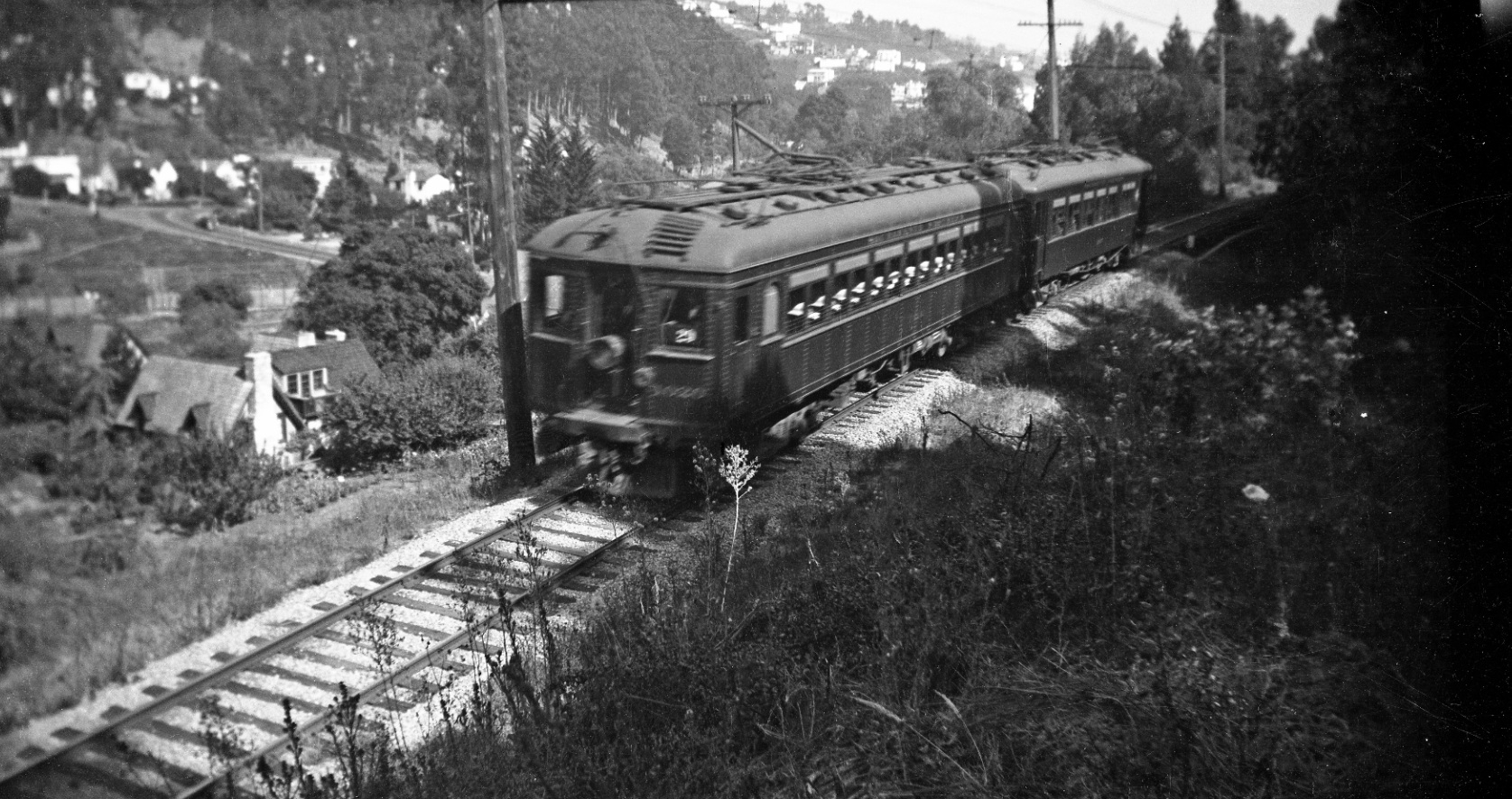
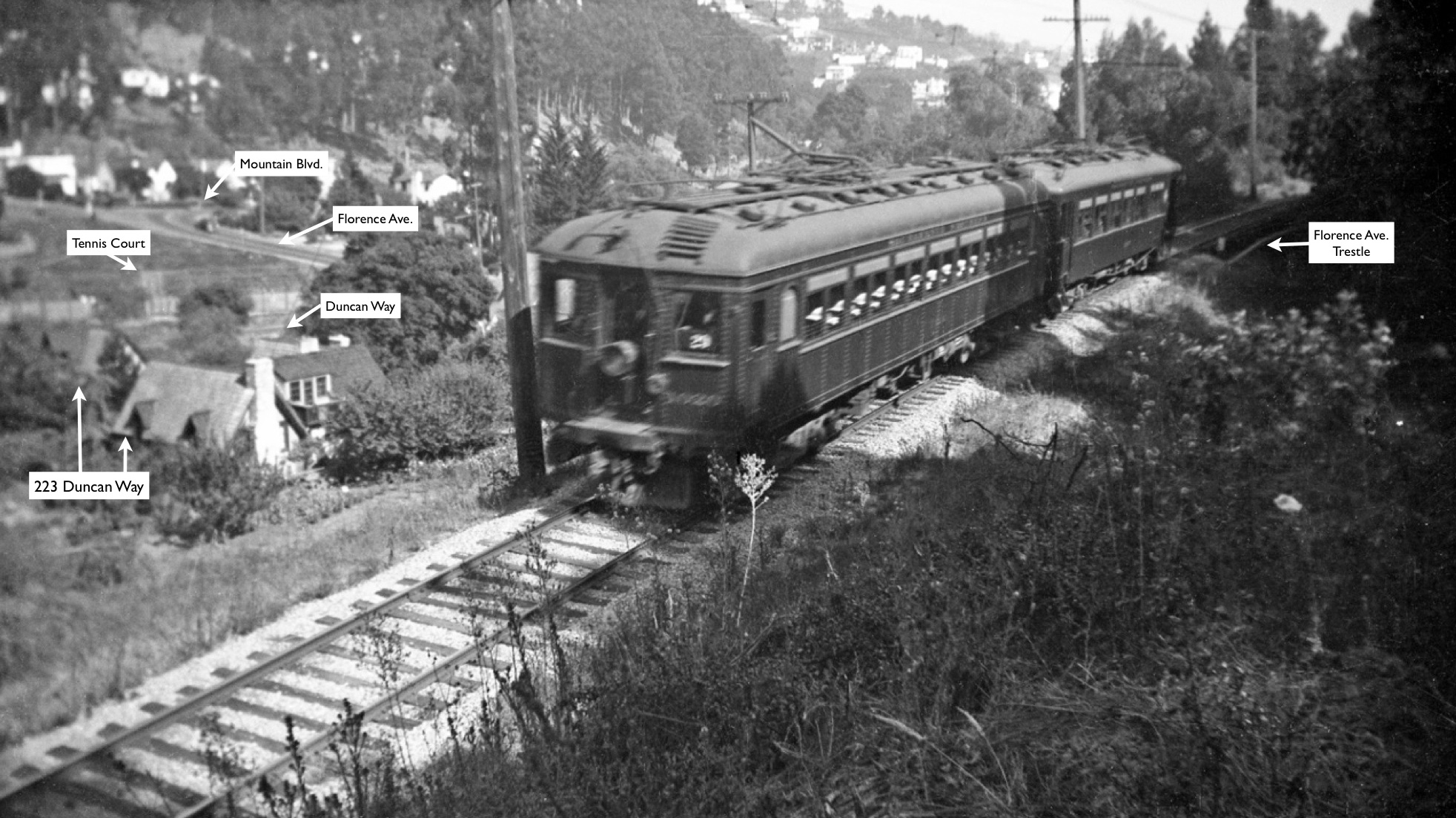
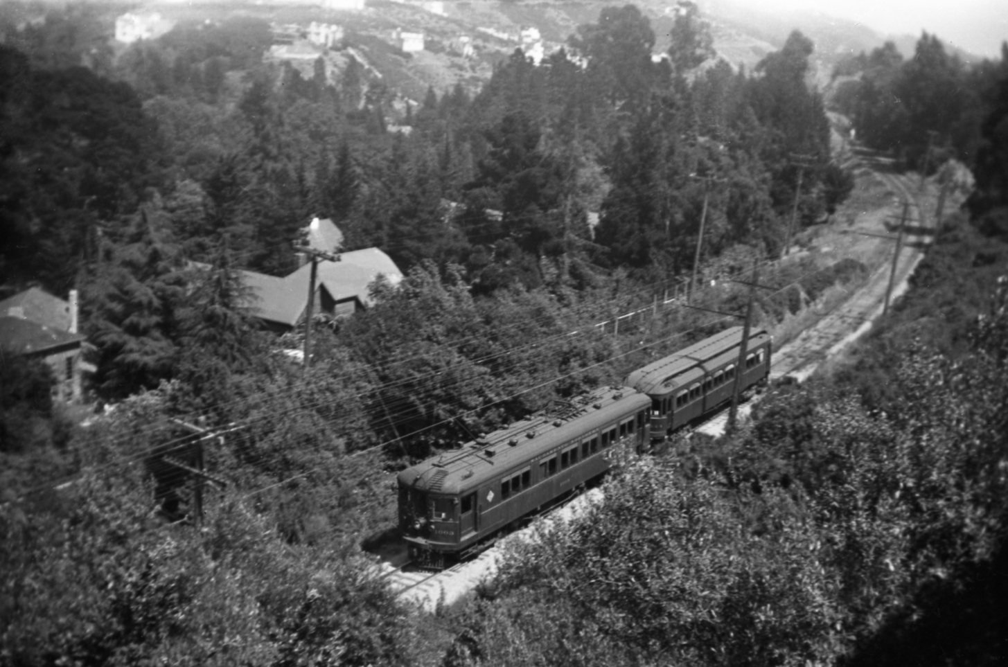
Wilbur Whittaker’s incomparable image of the forgotten trestle, west view June 19, 1939, portrays the calm before the storm. This update will allow for the identification of this location and what has since been lost as this area evolved in the mid-twentieth century.
L105-05-Wilbur C Whittaker Photo, Courtesy Arnold Menke and Garth Groff , (Image 1 of 31)

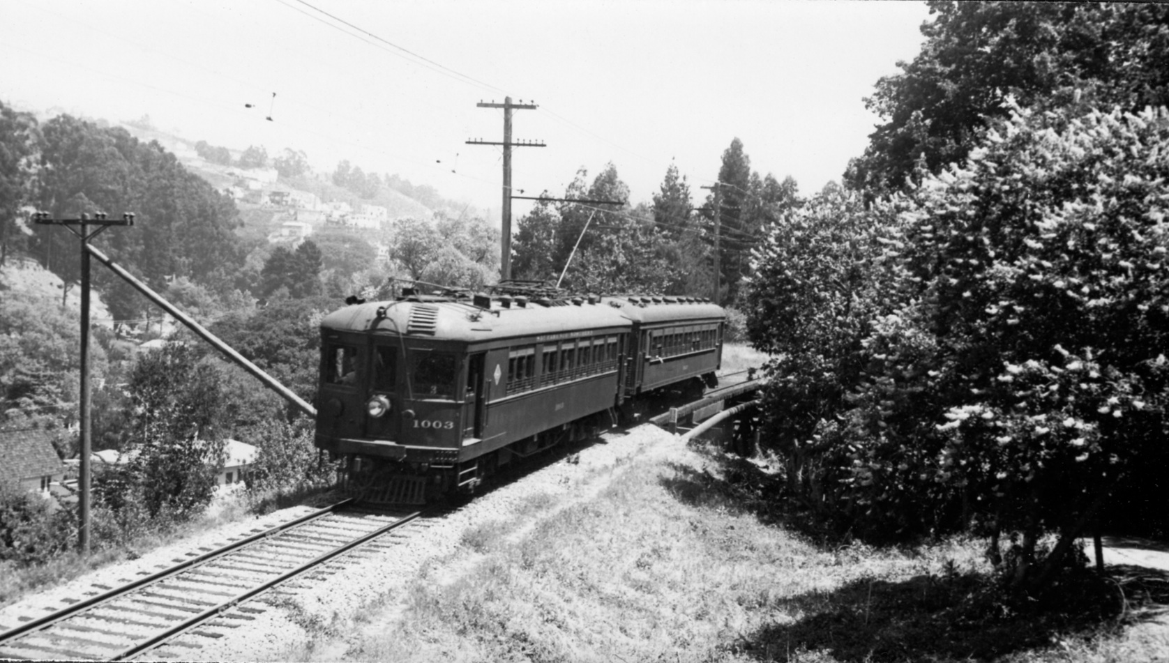
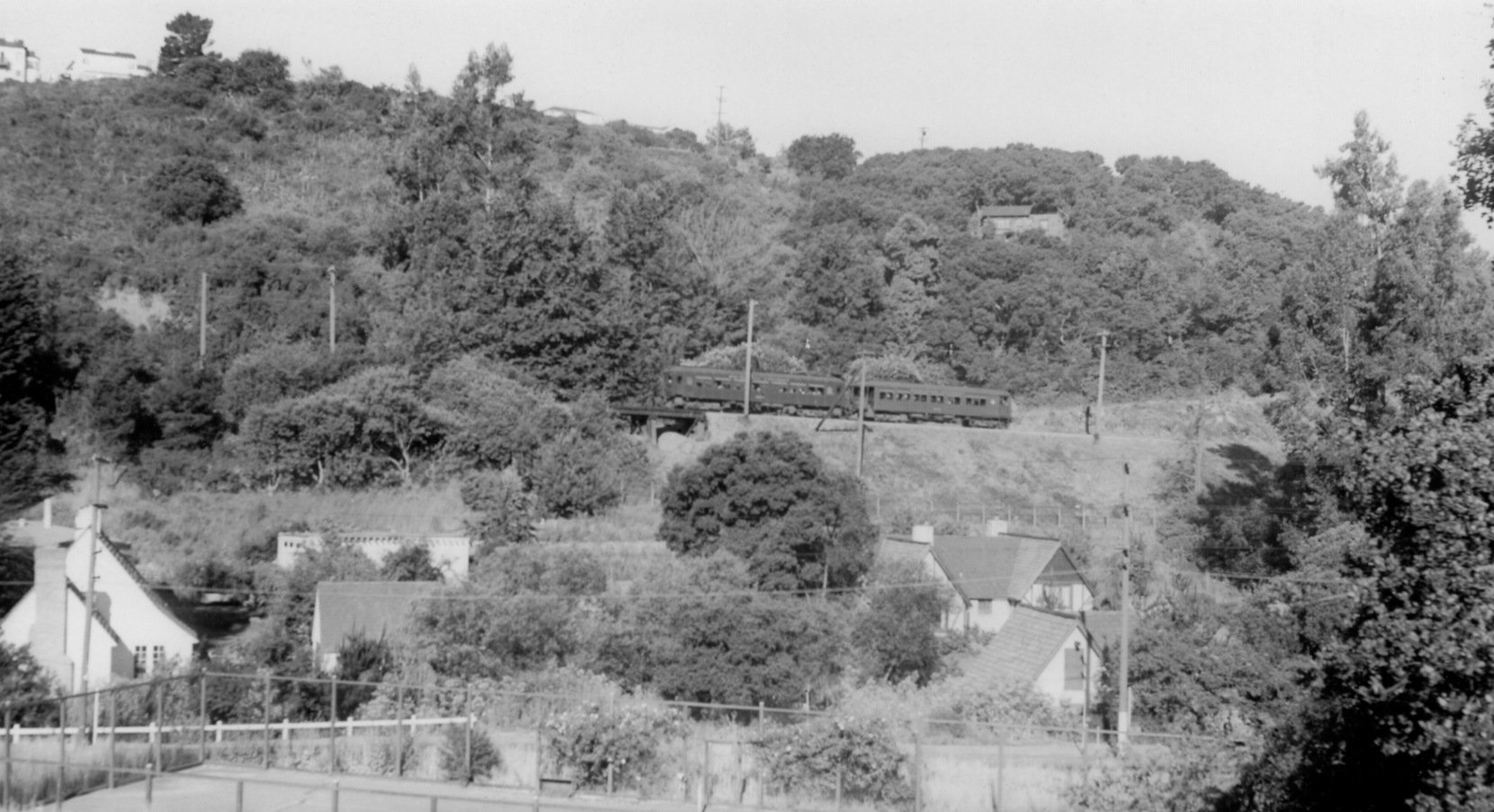
Equally remarkable is Ted Wurm’s documentation of the May 25, 1941 Cal-Nevada Excursion Farewell SN Trip between San Francisco and Chico, here on the return to the City. This southeast view shows where Wilbur Whittaker took the photo in L-105-05. From the Paul Smith Collection.
L105-10-Ted Wurm Photo, Courtesy BAERA, Western Railway Museum Archives, 85914sn, (Image 2 of 31)
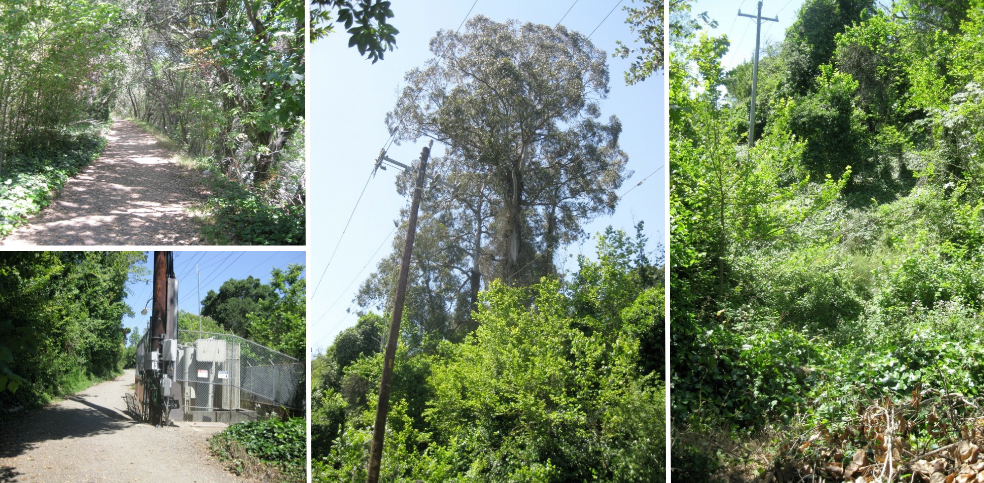
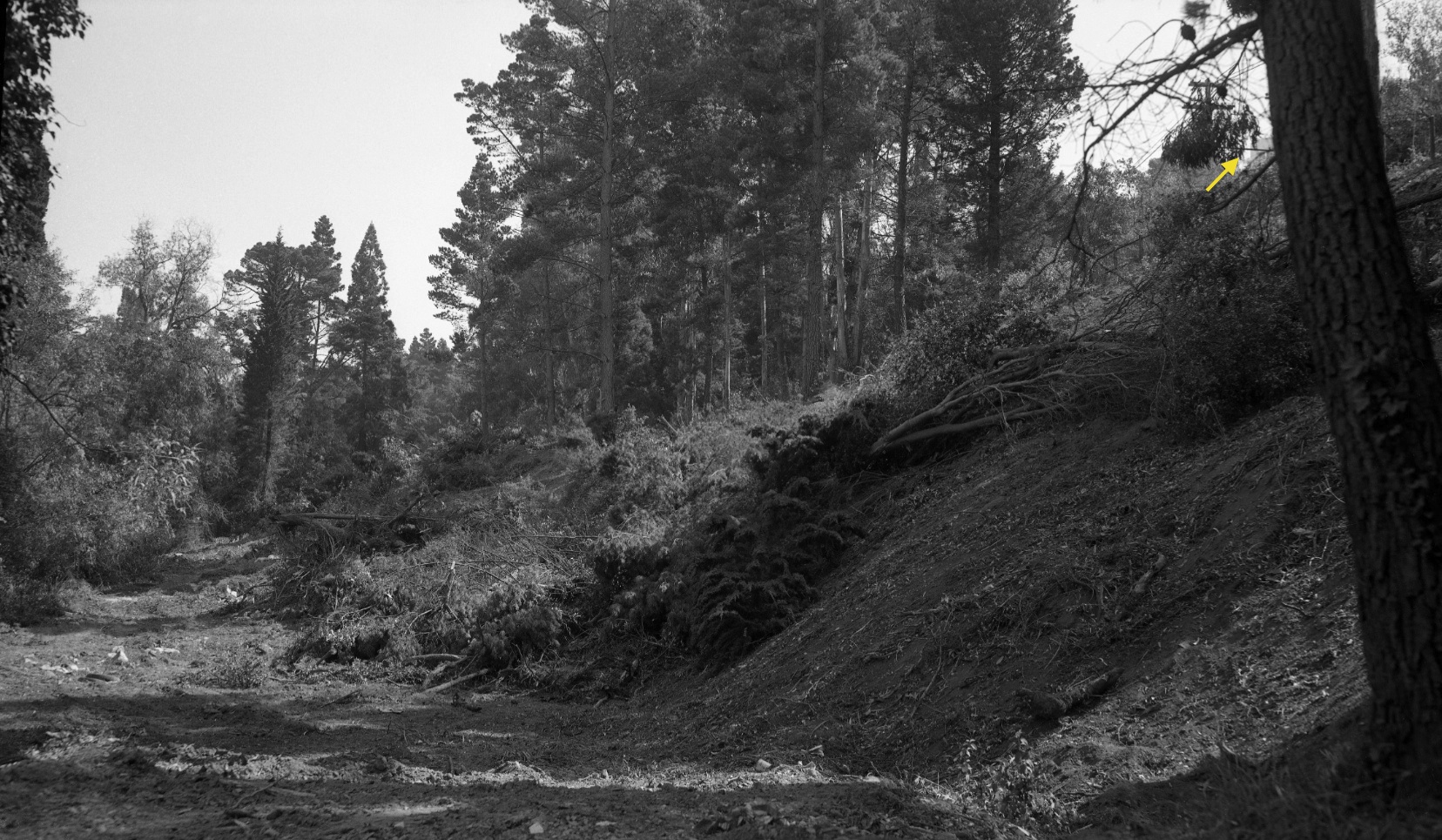
First order of business is the trestle. It was located on the right-of way, upper left, that begins from the north at the Broadway Terrace east on-ramp onto Highway 13, but is better accessed down the Florence Avenue path, lower left, that starts where the paved part of that road ends. The two paths meet at the PG&E substation. Look up and see the big eucalyptus tree, center, continue south a few feet on the right-of-way until you reach a gap, the site of the trestle, far right.
L105-15-Stuart Swiedler Photos, (Image 3 of 31)
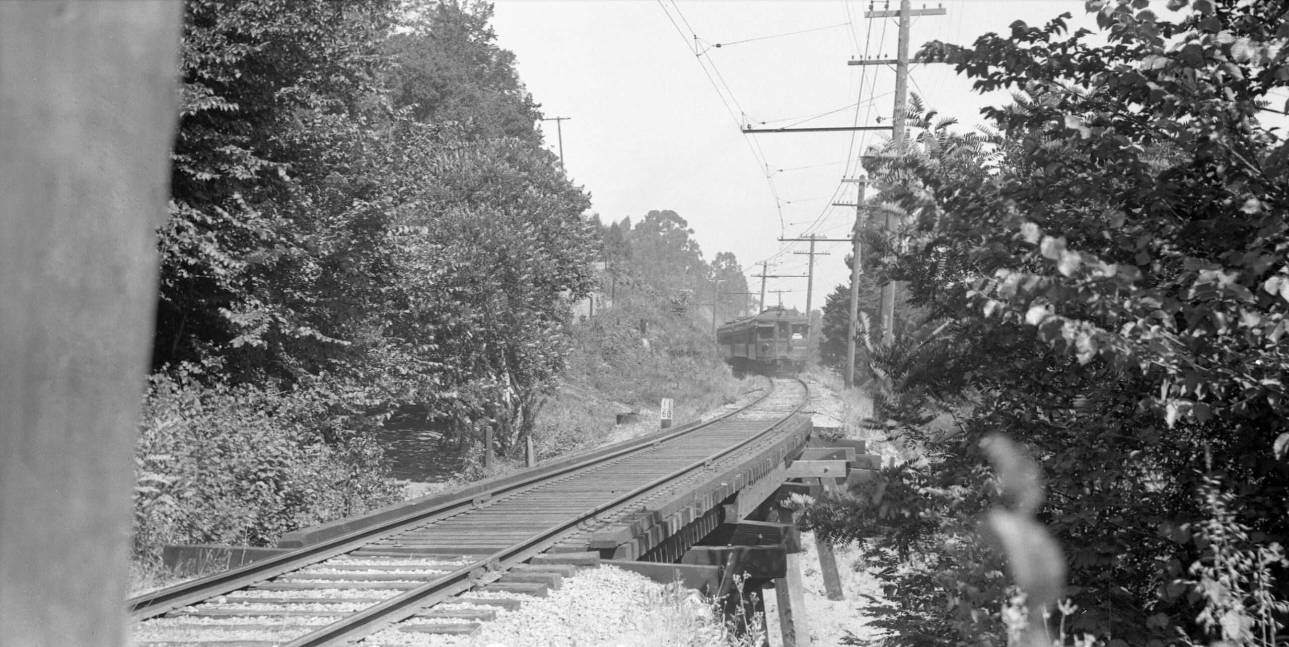
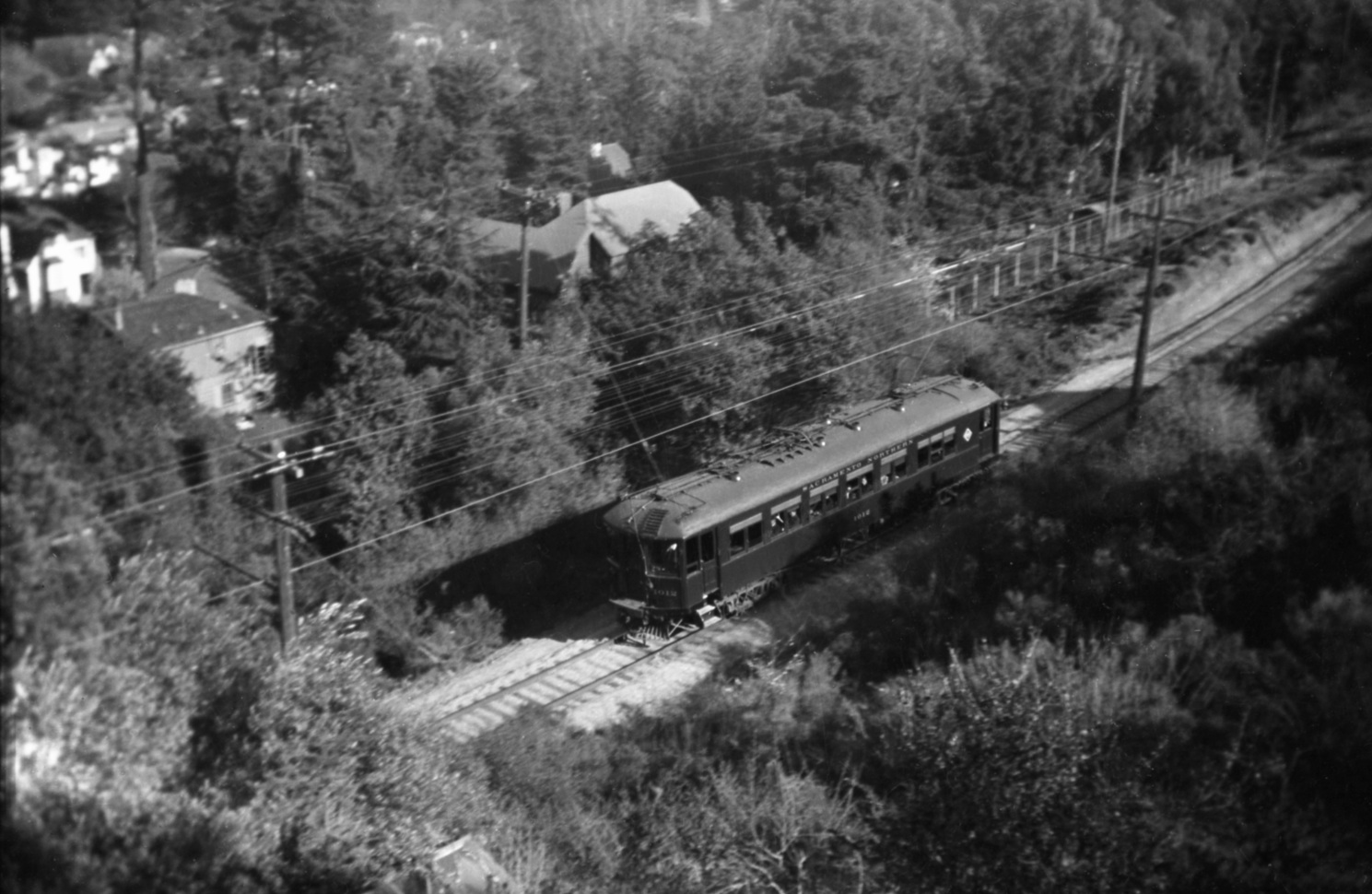
This northwest image from July 4, 1940 shows a three-car train composed of SN 1005, SN 1025 and SN 1008 to the north and the trestle at mile 11.60 along the SN route. A unique view of the descending Florence Ave. path along the edge of the bushes is also evident. If you lived to the west between Broadway Terrace and Moraga Ave., this was your shortest route to the east and Montclair prior to freeway construction.
L105-20-Roy Covert Photo, Courtesy BAERA, Western Railway Museum Archives, 240175sn, (Image 4 of 31)
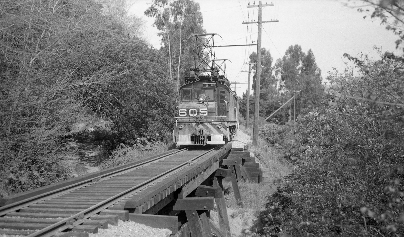
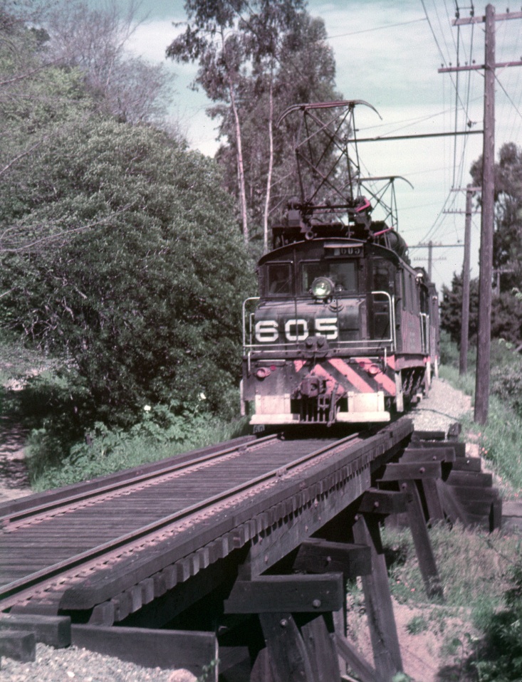
All looks peaceful when Tom Gray took this northwest shot of a SN freight with SN 605 on Apr. 22, 1950 while the canyon to the east was being cleared and sculpted for the new freeway. Note the power pole with the added pole for bracing off the hill, a key landmark of this section.
L105-25-Tom Gray Photo, Courtesy Tom Gray, (Image 5 of 31)
Since Tom Gray generally hitched a ride in Al Thoman’s Packard, it is not surprising that Al also took several shots of the same SN 605 from Apr. 22, 1950, here in living color, northwest view.
L105-30-Al Thoman Photo, Courtesy Al Thoman, (Image 6 of 31)
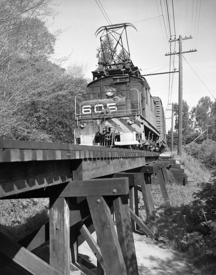
This image was taken seconds after L105-30 of the same SN 605 from Apr. 22, 1950, northwest view, provides a view of the path under the trestle itself.
L105-35-Al Thoman Photo, Courtesy BAERA, Western Railway Museum Archives, 52474sn , (Image 7 of 31)
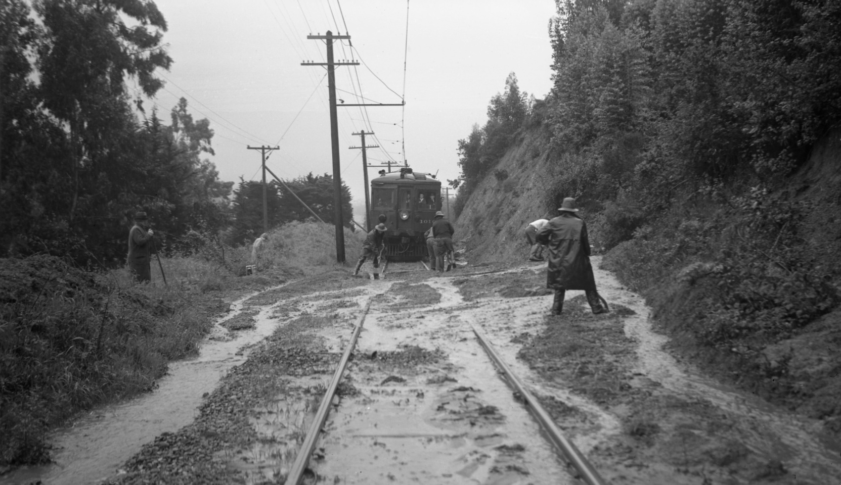
From the north and heading south, the power pole with the bracing signals the approach of the trestle. This southeast view documents a well-chronicled mudslide with SN 1010 awaiting a clear path on Mar. 30, 1940.
L105-40-Dudley Thickens Photo, Courtesy BAERA, Western Railway Museum Archives,, 85932sn, (Image 8 of 31)
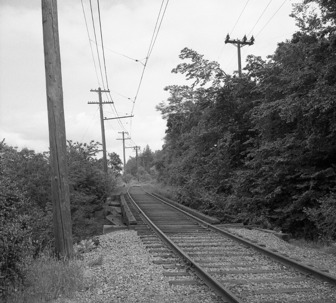
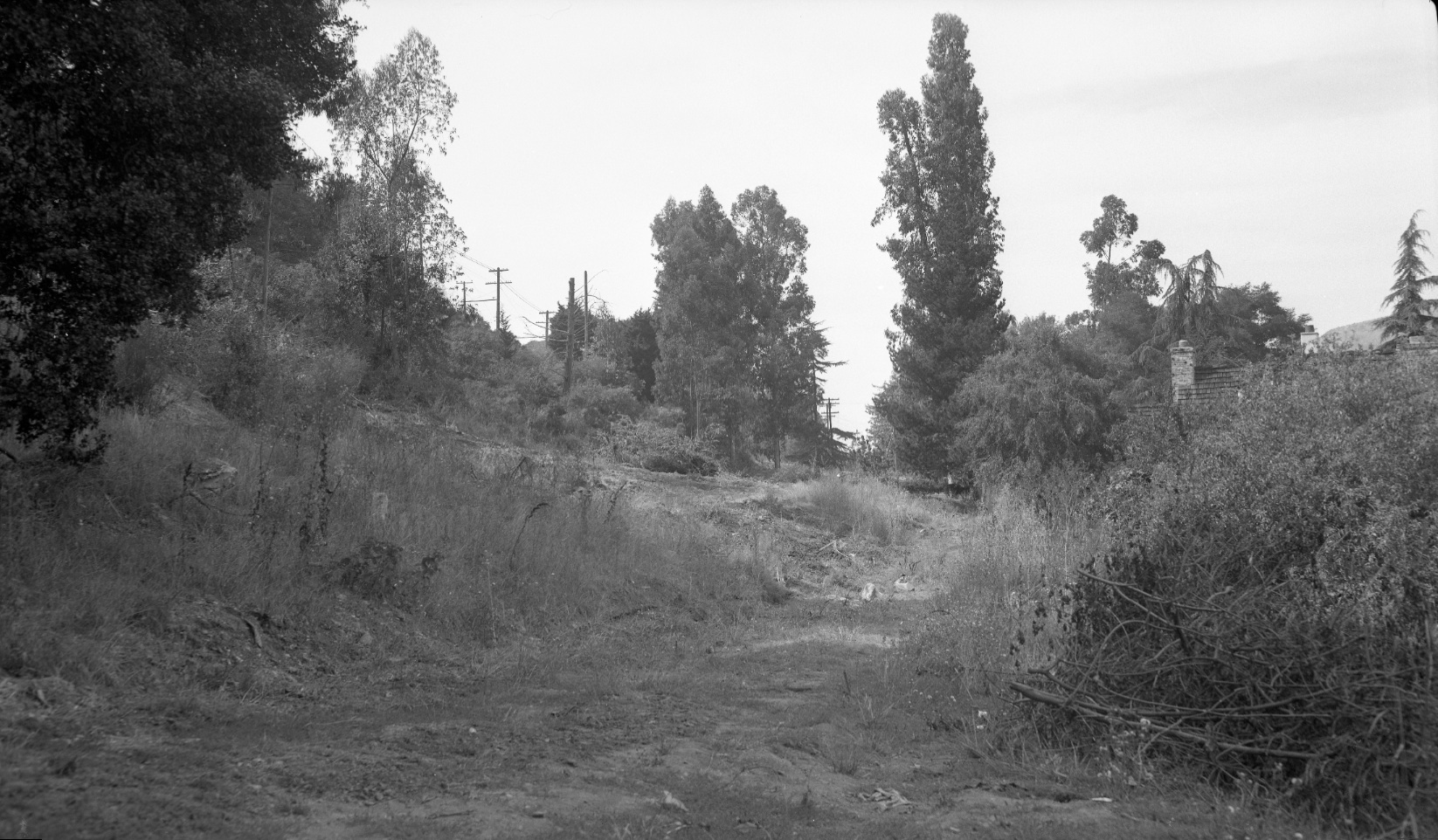
A final southeast view of the trestle post-SN abandonment in 1957.
L105-45-EK Muller Photo, Courtesy BAERA, Western Railway Museum Archives, 85908sn, (Image 9 of 31)
Based on the evidence presented, there should be no confusion as to the location of the forgotten trestle, but, just in case, a southeast aerial showing the trestle along the lower edge center, just to the east of the freeway, Feb. 1, 1956.
L105-50-Copyright California Department of Transportation, 4809-7 Detail , (Image 10 of 31)
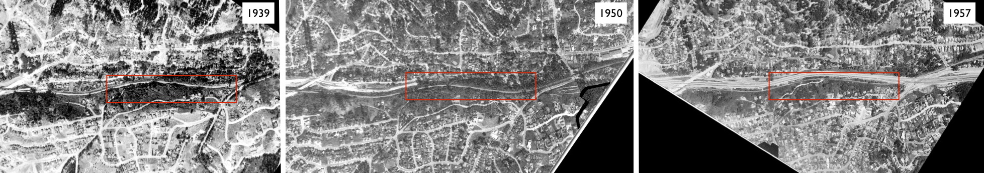
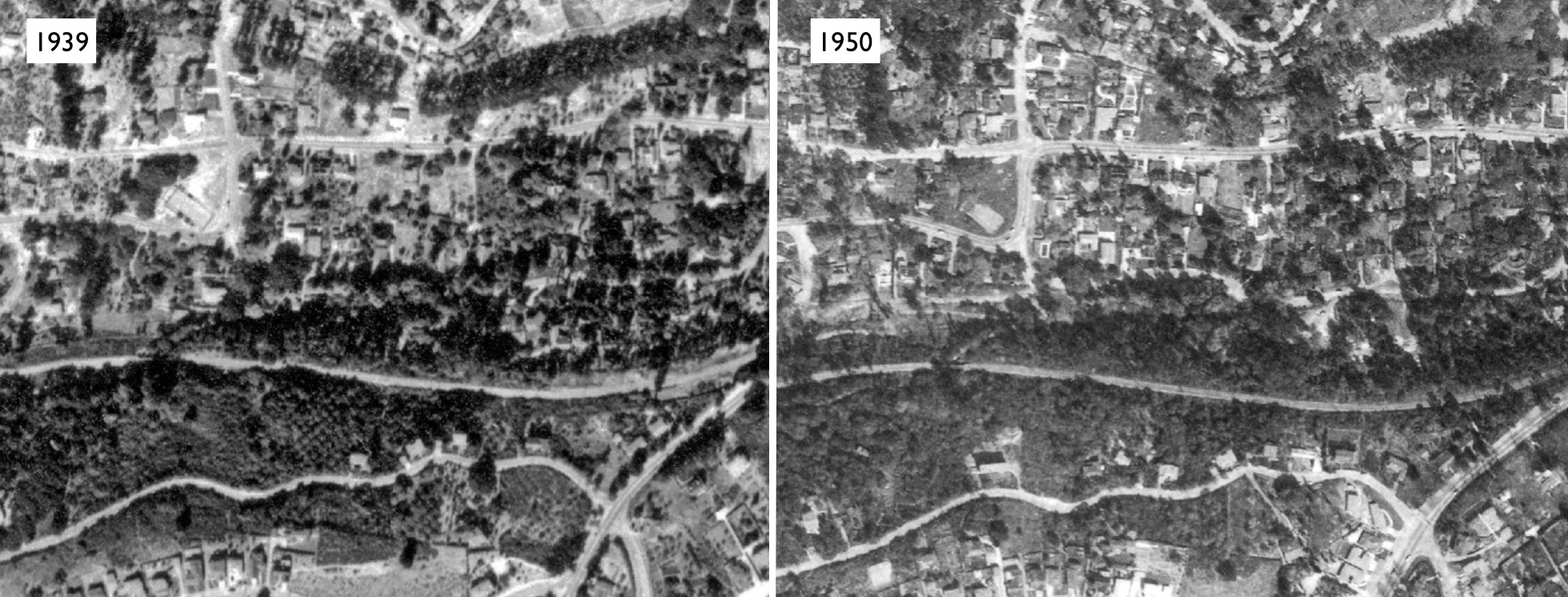
Comparative north-to-south, left-to-right, aerial views of the freeway: from 1939, prior to freeway construction; 1950, at the start of freeway construction; and 1957, after freeway construction. The red box marks the Fernwood Tract and accompanying SN right-of-way. Refs: left, USDA AAA Western Division BUT-BUU-289-66, Aug. 2, 1939; middle, USDA AAA Western Division BUT-8G-123, Mar. 30, 1950; right, AV 253 11-23, Hamman, Jensen, Wallen, AV 253 11-23, May 4, 1957.
L105-55-Multiple Attributions, See Legend, (Image 11 of 31)
Now for the things lost, those structures removed or moved to allow construction of the east side of the freeway. Start with this southeast view above the trestle, Feb. 1, 1956.
L105-60-Copyright California Department of Transportation, 4809-7 , (Image 12 of 31)
A detail of L105-60 provides a view of the abandoned tennis court of the once Fernwood Community Club, red arrow, the site today of 5565 Florence Terrace. The blue arrow marks the home at 5551 Florence Terrace, with its accompanying garage to the north, and a portion of 235 Duncan Way is marked by the green arrow.
L105-65-Copyright California Department of Transportation, 4809-7 Detail, (Image 13 of 31)
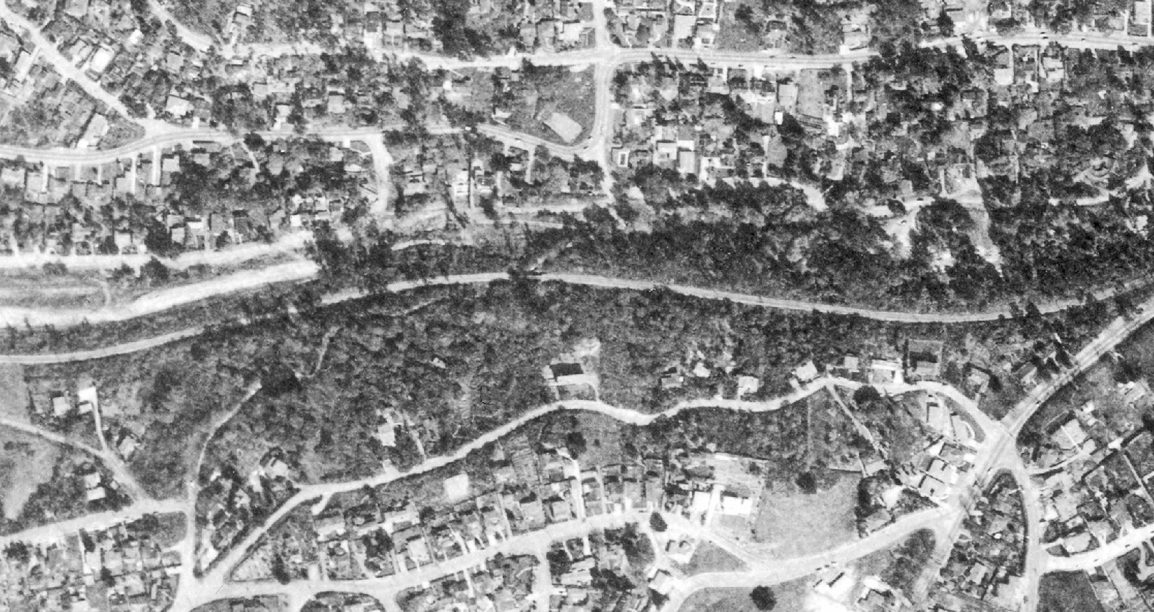
A north-to-south, left-to-right, aerial view of the freeway at the start of construction in 1950. See next image for annotated version. Ref: BUT-8G-123, Mar., 30, 1950
L105-70-USDA AAA Western Division Aerial, Courtesy East Bay Regional Park District, (Image 14 of 31)
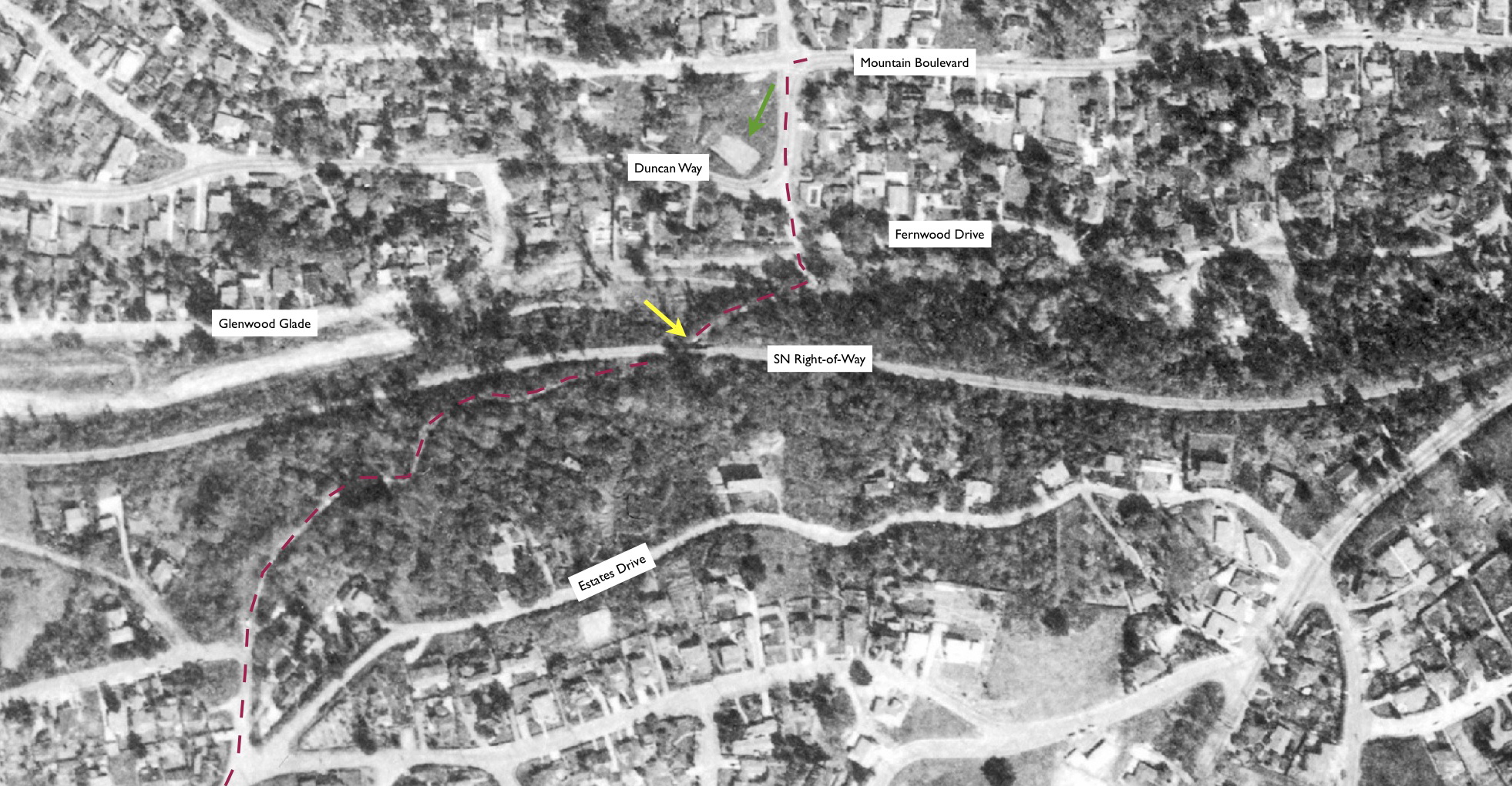
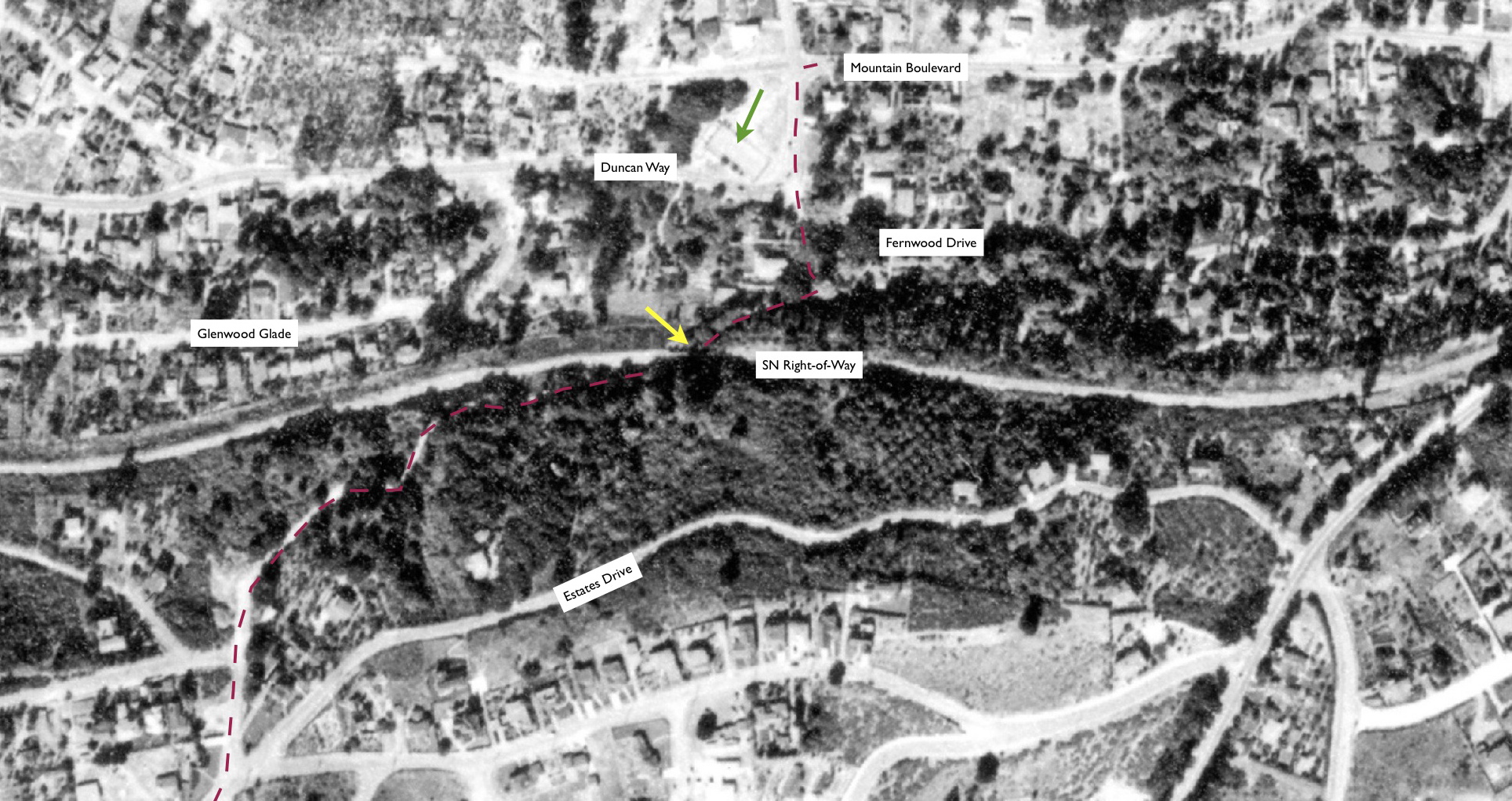
A north-to-south, left-to-right, aerial view of the freeway at the start of construction in 1950. A walk from the Florence Ave.-Estates Dr.-Proctor Ave. intersection via Florence Ave. to its intersection with Mountain Blvd. is shown by the red-dotted line. The homes abutting the freeway on Florence Ave. (now Terrace) and the east side of Fernwood Dr. have already been cleared for freeway construction. Fernwood Community Club tennis court, green arrow, SN trestle, yellow arrow. Ref: BUT-8G-123, Mar., 30, 1950
L105-71-USDA AAA Western Division Aerial, Courtesy East Bay Regional Park District, (Image 15 of 31)
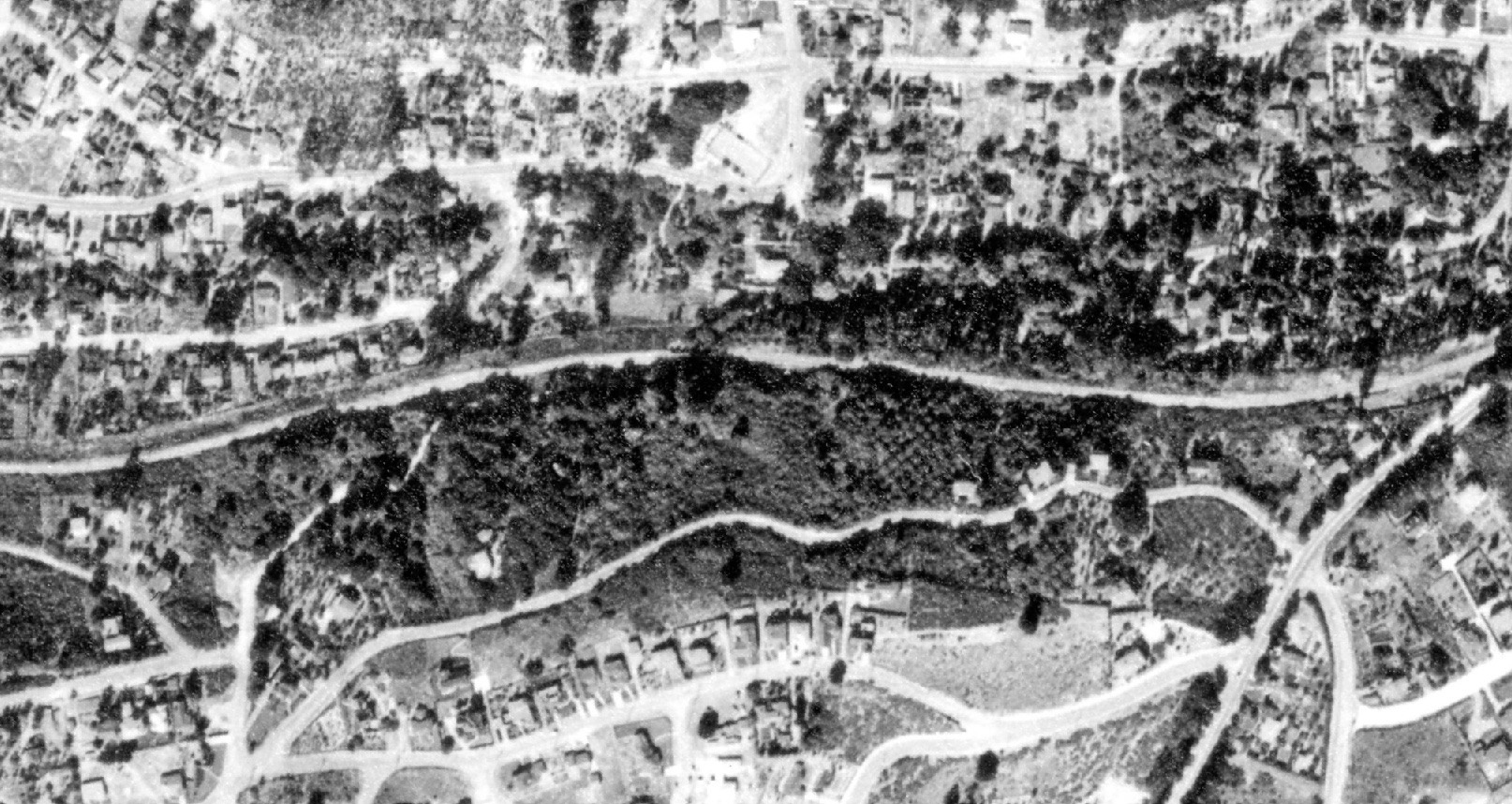
A north-to-south, left-to-right, aerial view prior to freeway construction in 1939. See next image for annotated version. Ref: BUT-BUU-289-66, Aug. 2, 1939
L105-75-USDA AAA Western Division Aerial, Courtesy East Bay Municipal Utility District, (Image 16 of 31)
A north-to-south, left-to-right, aerial view prior to freeway construction in 1939. A walk on Florence Ave. from where Florence Ave.-Estates Dr.-Proctor Ave. meet to its intersection with Mountain Blvd. is shown by the red-dotted line. Fernwood Community Club tennis court, green arrow, SN trestle, yellow arrow. Ref: BUT-BUU-289-66, Aug. 2, 1939
L105-76-USDA AAA Western Division Aerial, Courtesy East Bay Municipal Utility District, (Image 17 of 31)
And for those who find it useful to have both aerials side-by-side, here are the Fernwood tracts lined up, including the area more to the east of Mountain Boulevard. See previous images for references.
L105-80-USDA AAA Western Division Aerial, Courtesy EBR Park District and EBMUD, (Image 18 of 31)
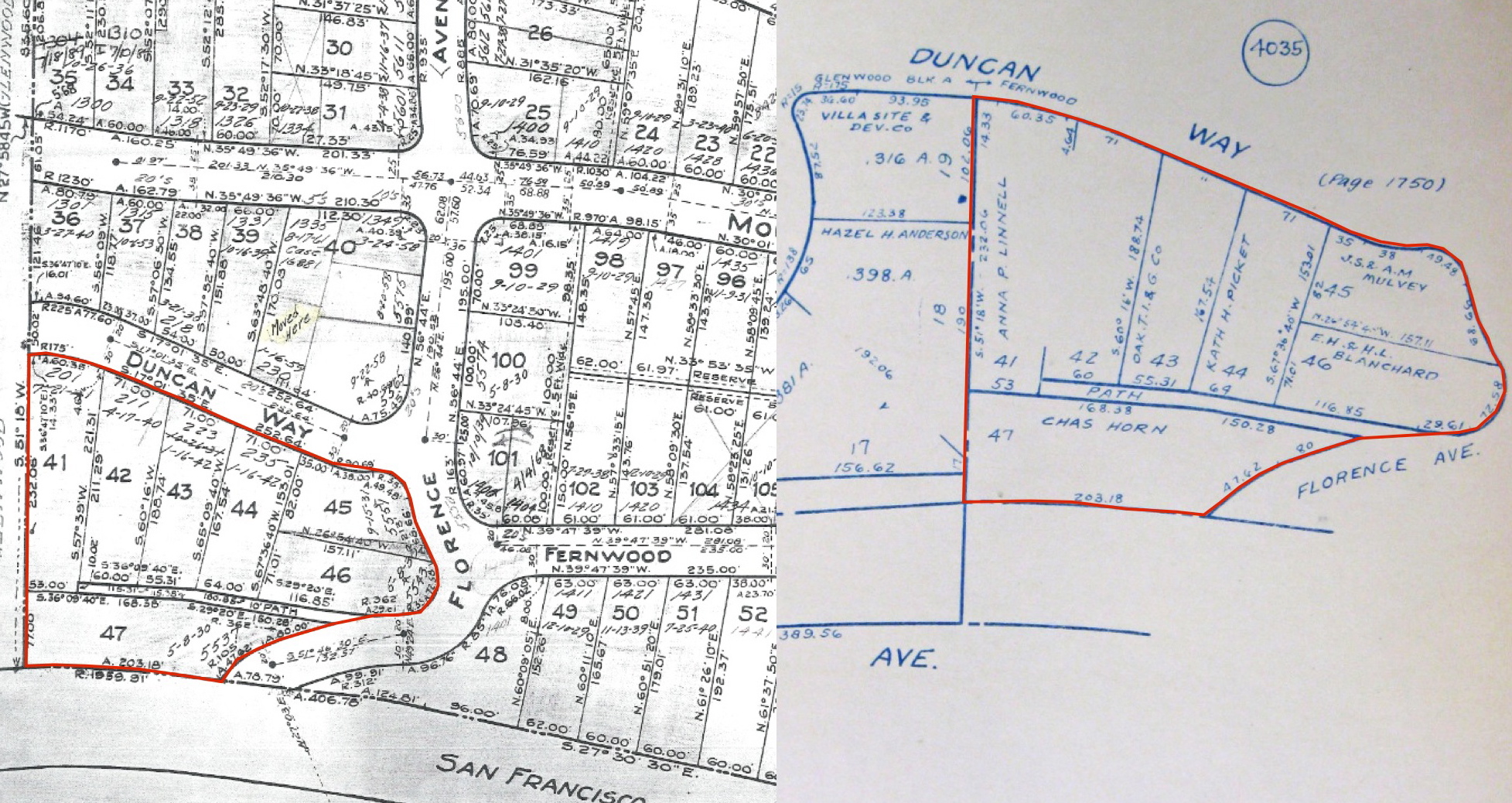
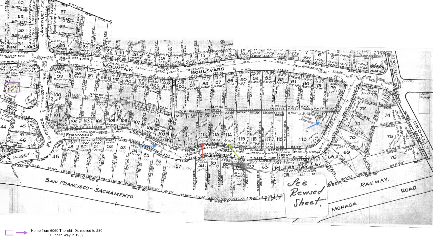
Other useful information are contained in the 1920s maps that charted the original ownership of the lots along Florence Avenue, right, and the disposition of properties on those lots, left. The area of interest is circled in red. Look closely at the dates on the lots in the left figure as they provide crucial information to understanding L105-05 and L105-10 that will follow in annotated form.
L105-85-Oakland Cultural Heritage Survey, Oakland City Planning and Oakland History Room, (Image 19 of 31)
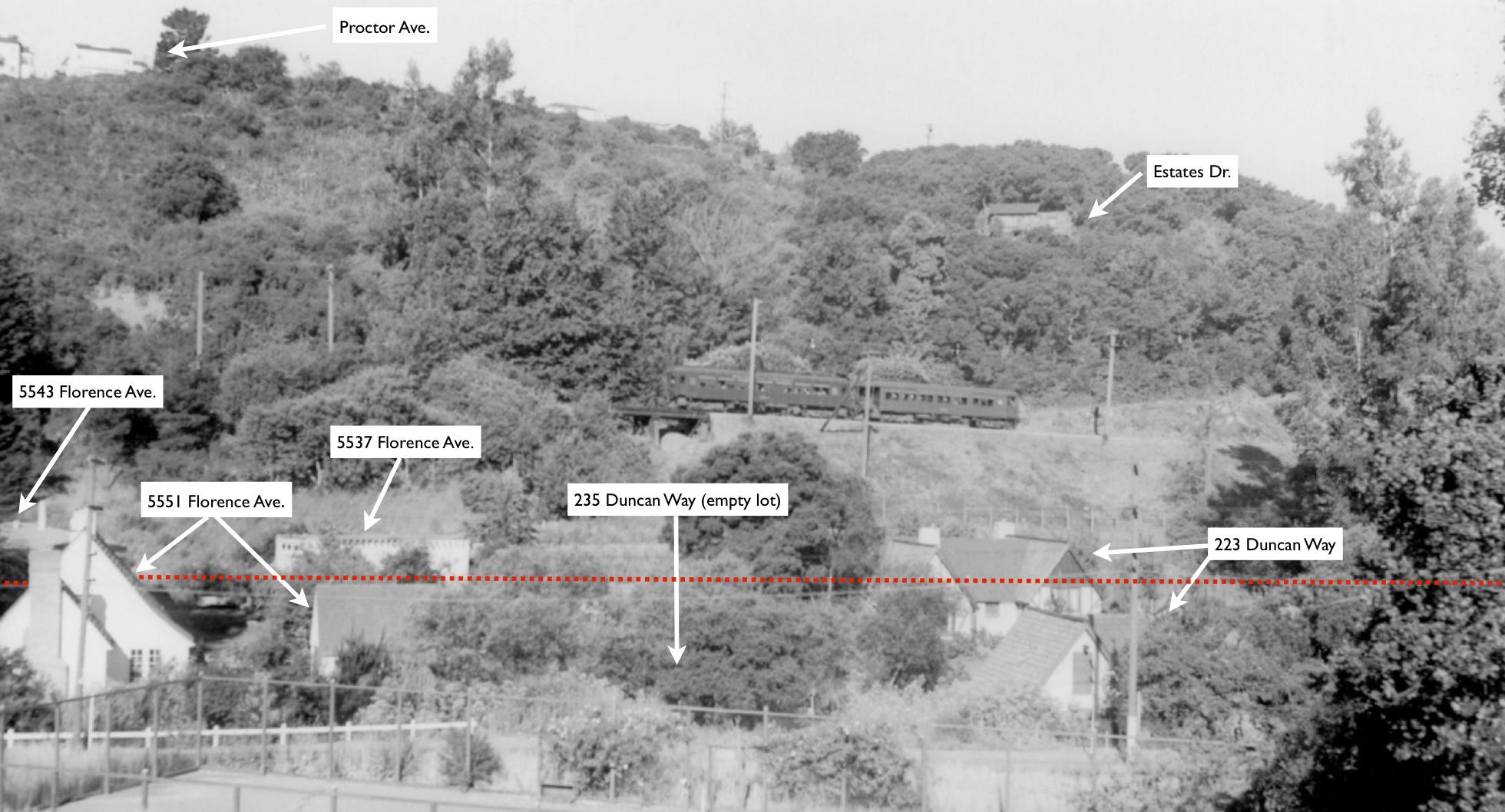
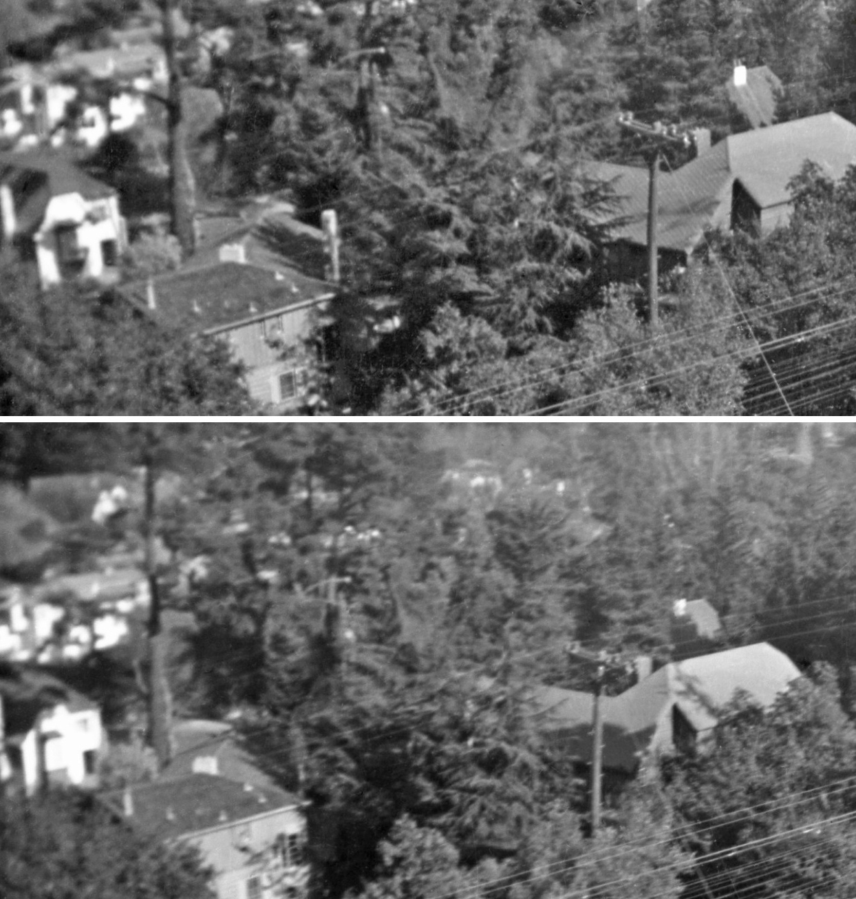
The image from Jun. 9, 1939, L105-05, was taken to the east of the tennis court of the club near Mountain Blvd. Everything behind or west of the red dotted line up to the SN berm was eventually cleared for the freeway. There were two homes at 223 Duncan Way, but the previous figure showed a single date of a home being placed on this lot, lot 43, as Oct. 26, 1931. This is crossed out and a date of Jan. 16, 1942 is given for that lot, as well as for lot 44, no. 235.
L105-90-Wilbur C Whittaker Photo, Courtesy Arnold Menke and Garth Groff , (Image 20 of 31)
This southeast view from May 25, 1941, L105-10, complements the findings from the previous image. The second home at 223 Duncan Way, now in the foreground, is right in the path of the future freeway.
L105-95-Ted Wurm Photo Courtesy BAERA, Western Railway Museum Archives, 85914sn, (Image 21 of 31)
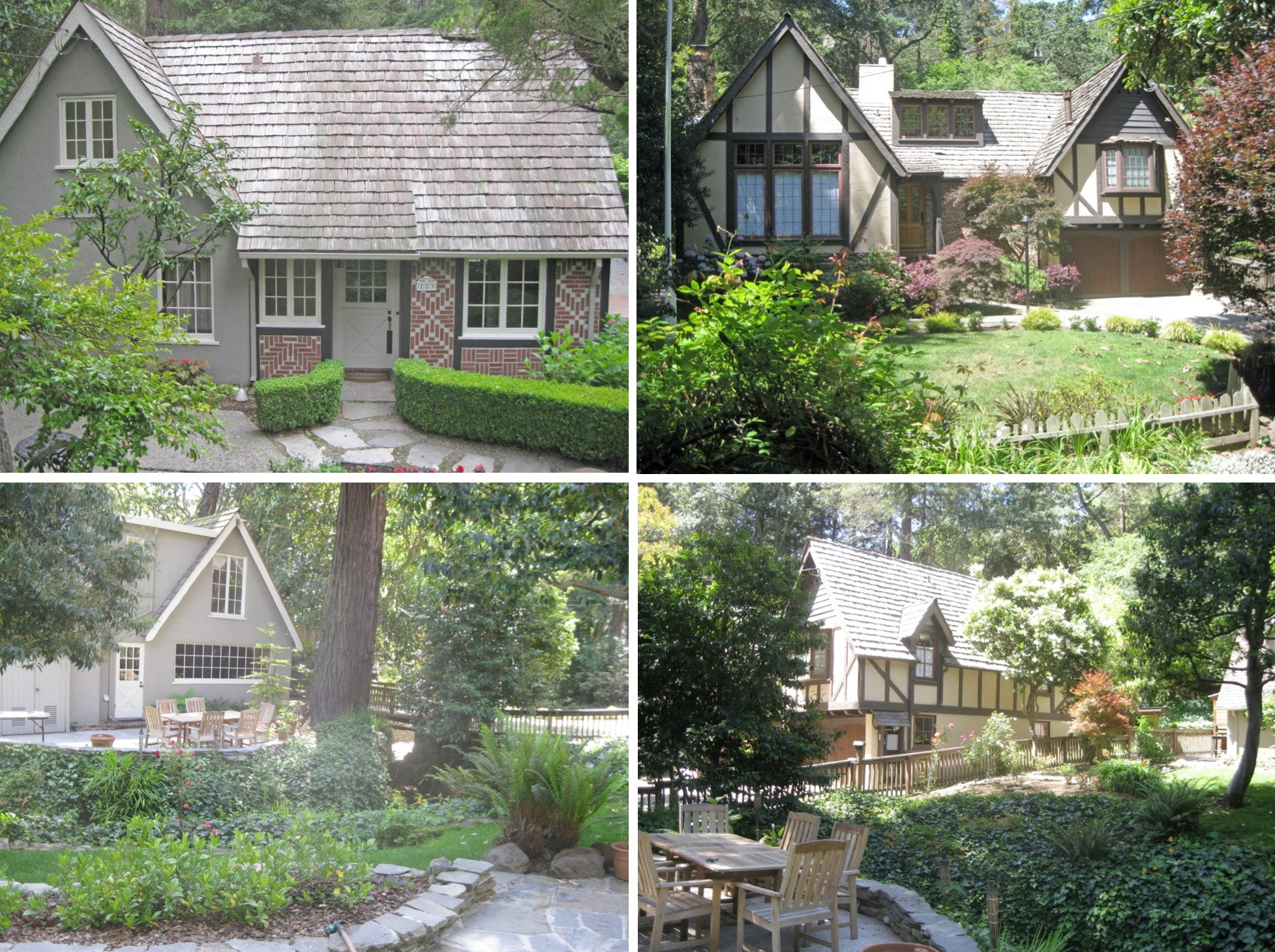
Views in 2015 of 223 Duncan Way, left, and 235 Duncan Way, right, reveal that the home on the west side of 223 Duncan in 1939 was moved to the adjacent lot at 235 Duncan Way in 1942. City permits show, A. Lester Peters, a carpenter and contractor, built a one-story, 45 by 35 foot, 5-room house at 223 Duncan for himself and his wife Elsa in 1931. In 1936 he added a garage for $350. In 1941, he bought the lot at 235 from a Legris, and sold the rear of the lot to the Joint Highway District 26.
L105-100-Stuart Swiedler Photos, (Image 22 of 31)
Pre-construction north view at the level of the forgotten trestle, 1949. Between 1941 and 1945, Peters sold both homes, and disappeared from local records; California Death Records show an Andrew Lester Peters who died in Sonoma County at age 82 in 1981. No permit to build the rear house has been found, only one to move it to 235 Duncan Way in Mar. of 1942 for $800.
L105-105-Public Works Photo, Oakland Cultural Heritage Survey, Oakland City Planning Department, (Image 23 of 31)
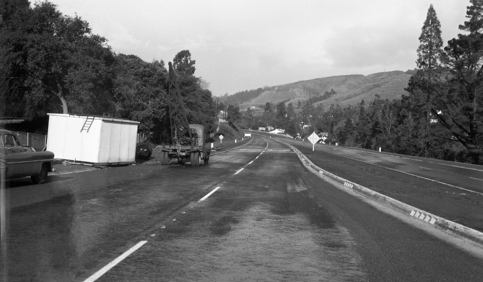
Completed freeway north view, 1952, from just north of Moraga Ave. with the big eucalyptus tree by the trestle in view. Finally, it is not known if Peters ever lived in the home now at 235 Duncan. Records indicate he sold the home at 235 Duncan Way to the Veterans Welfare Board, and in 1945, he sold the house at 223 to Asenath Rugland.
L105-110-Public Works Photo, Oakland Cultural Heritage Survey, Oakland City Planning Department, (Image 24 of 31)
Next a south view from south of the trestle toward Moraga Ave., 1949. The yellow arrow points to a catenary support whose pole is east of the SN track.
L105-115-Public Works Photo, Oakland Cultural Heritage Survey, Oakland City Planning Department, (Image 25 of 31)
If you have any doubts about the location of the image in 105-115, match the tall trees in the background, left, in that image with those along the east of the freeway in this south view from late 1951.
L105-120-Public Works Photo, Oakland Cultural Heritage Survey, Oakland City Planning Department, (Image 26 of 31)
Before leaving the area of Florence Ave., here shown is another southeast view from Wilbur Whittaker, also from June 9, 1940, the angle of which is consistent with the homes in view as being 5543 and 5551 Florence Ave., both lost when the freeway was built. Note the Florence Ave. trail at the right edge of the image.
L105-125-Wilbur C Whittaker Photo, Courtesy Arnold Menke and Garth Groff , (Image 27 of 31)
Moving further south is the Fernwood Tract, developed by Oakland Title Insurance beginning in 1923. What can be said about what was lost from that area due to freeway construction? The image shown is an east view circa 1938 of SN 1012 passing several homes surrounded by a high density of trees.
L105-130-Paul Smith Photo, Courtesy BAERA, Western Railway Museum Archives, 86176sn, (Image 28 of 31)
The location of the homes in L105-130 becomes clear from this east view circa 1938 of SN 1003 leading a two-car train on the curved section from the Thornhill shelter. The curve corresponds to where the tracks paralleled Moraga Ave., and later where it crossed the freeway. Paul Smith took this and many of his photos from his sleeping porch at 5644 Estates Dr. That location is key to understanding what comes next.
L105-135-Paul Smith Photo,Courtesy BAERA, Western Railway Museum Archives, 86175sn, (Image 29 of 31)
A similar east view to L105-130, top, with a detail from L105-130, bottom, show two homes closest to the SN track, most likely nos. 1525 and 1533, left to right, two homes lost on the west side of Fernwood Dr. when removed to build the freeway. The home along the left border is 1524 Fernwood, since modified as seen today, but, importantly, next to an empty lot in 1938. Keep reading ...
L105-140-Paul Smith Photo,Courtesy BAERA, Western Railway Museum Archives, 86177sn and 86176sn, (Image 30 of 31)
This map of the Fernwood Tract pre-freeway shows three homes documented to have been moved from the west to the east side of Fernwood Dr. Lots 49-65 were cleared for the freeway with lot 66, no. 1581, the survivor at the border. The green arrow shows no. 1541, lot 61, moved in 1949 to the empty lot 114 to become no. 1532, next door to 1524 Fernwood or lot 113. Nos. 1525 and 1533, are lots 59 and 60, respectively. Much thanks to contributions by Gail Lombardi, Betty Marvin, Craig Sundstrom, Charles Chapman and Tom Niedernhofer.
L105-145-Courtesy Oakland Cultural Heritage Survey, Oakland City Planning Department, (Image 31 of 31)