The Garden of Eastport
Upon reaching the Contra Costa County side of the tunnel in Redwood Canyon, a traveler must have felt as if they had entered the Garden of Eden. East view, May 31, 1951.
L20-01-HM Stange Photo, Courtesy the Krambles-Peterson Archive, (Image 1 of 20)

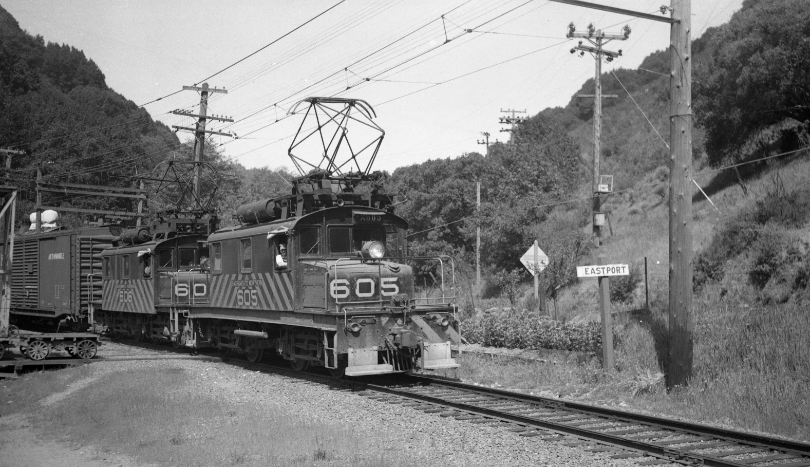
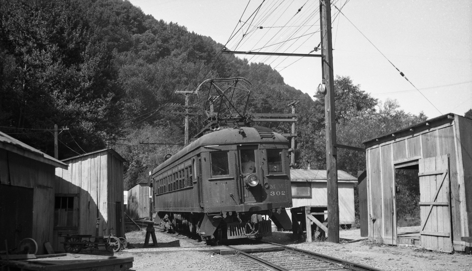
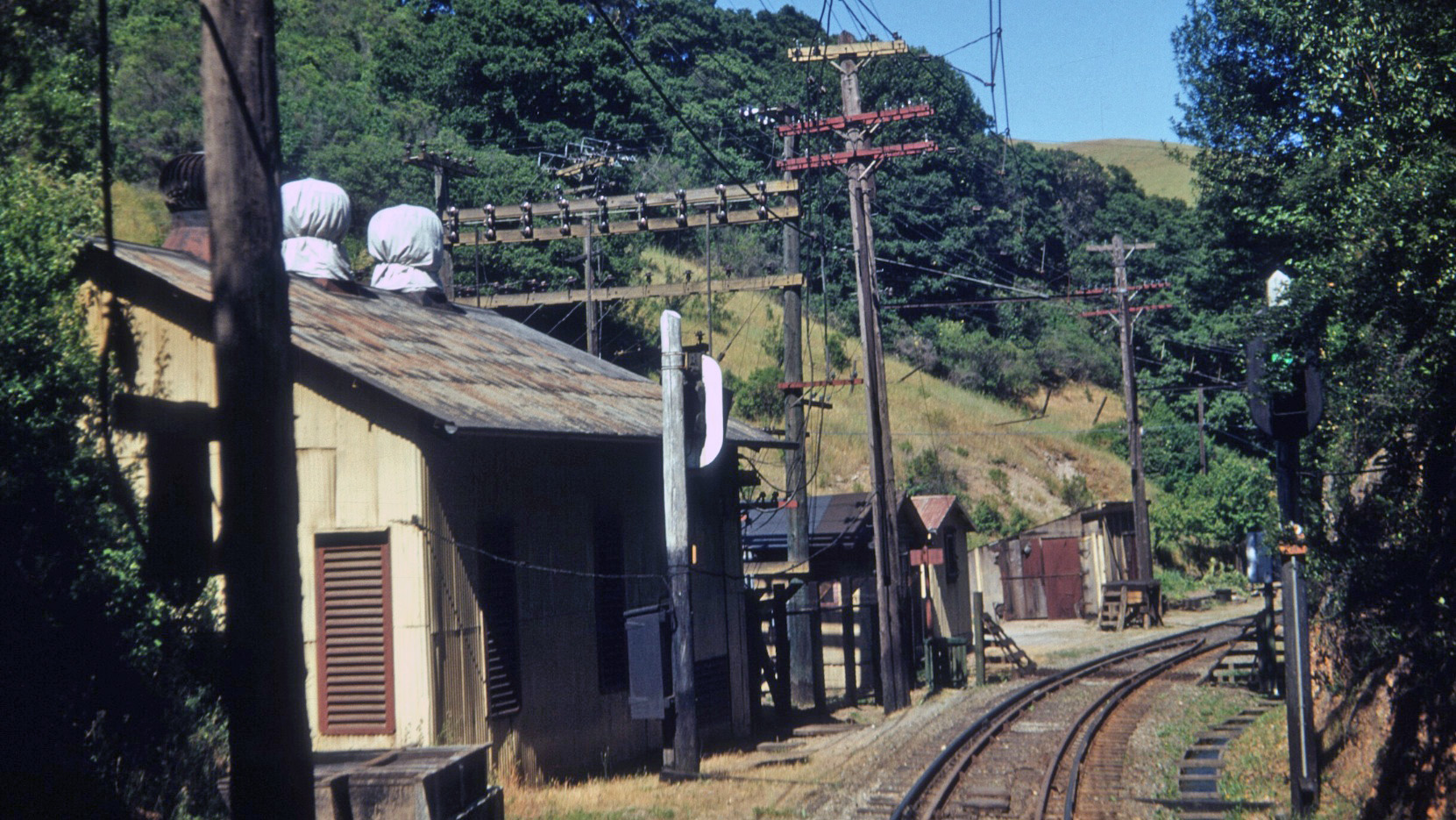
Actually, it was the Garden of Eastport, a reference to a small garden maintained by the SN workers at the east portal of the hills tunnel, aptly called Eastport. The close proximity to Pinehurst Road is indicated by the road sign. Northwest view, SN 605 and 606, Apr. 22, 1950.
L20-05-Tom Gray Photo, Courtesy Tom Gray , (Image 2 of 20)
Eastport was not an actual town, but was an important center of SN operations. Once abandoned, only a plugged tunnel portal remained as indicated in the insert. Note the relative position of the first switchback of Pinehurst road above the portal. Chris Price of Canyon noted that the silver reflective objects are beehives that were kept by Les Garibaldi, a bee keeper with his warehouse on the drive that is now the lower entrance to the Huckleberry trail. West view, Apr. 22, 1960.
L20-10-Copyright California Department of Transportation, Detail 7453-8 , (Image 3 of 20)
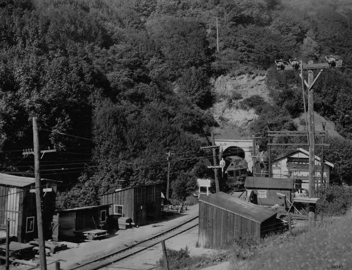
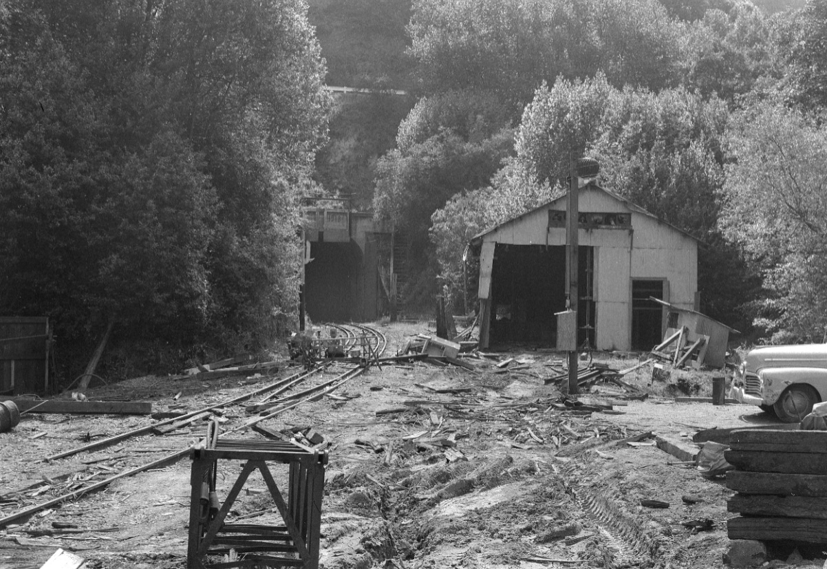
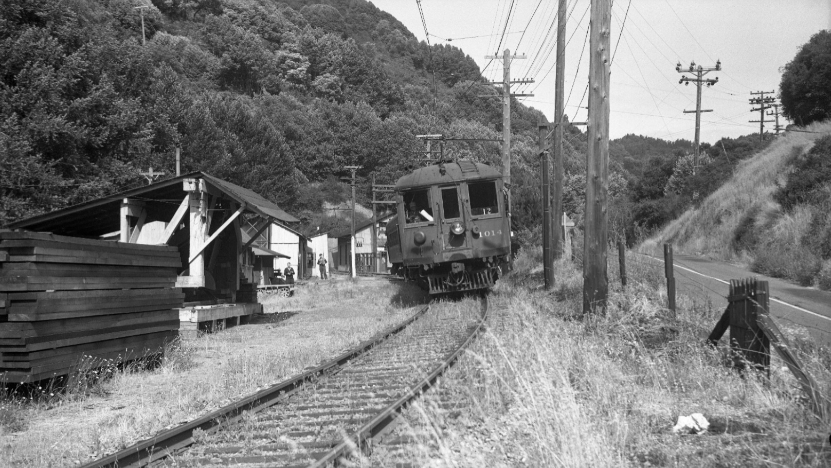
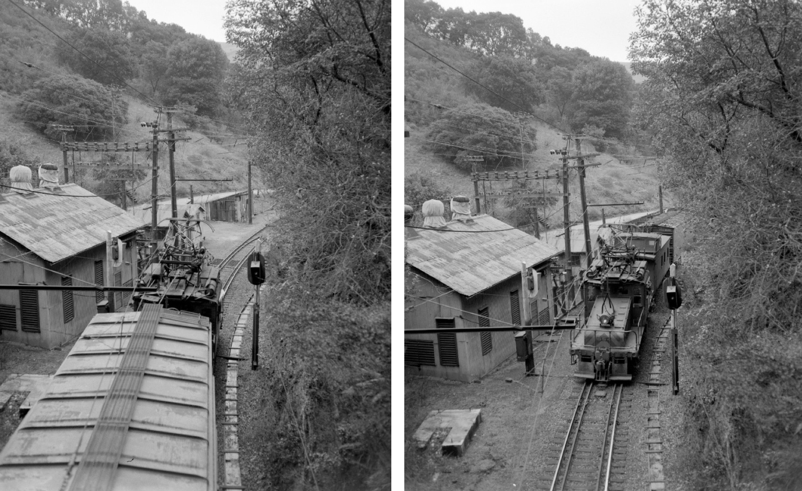
In full operation, Eastport contained a power station, far right, and other wooden support structures for maintenance of the tunnel. The tunnel portal is marked 1918, suggesting work completed five years after the tunnel was in operation. West view, SN 1014, 1925.
L20-15-Sappers Collection, Courtesy BAERA, Western Railway Museum Archives, 54145sn , (Image 4 of 20)
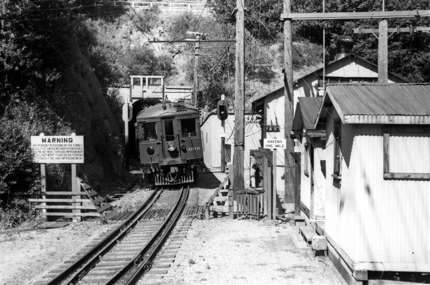
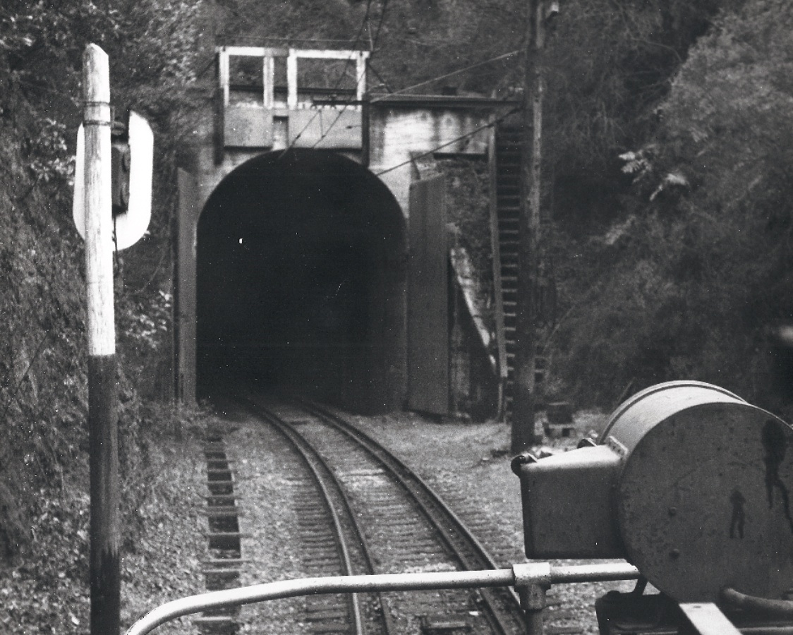
The SN also included a warning for tunnel trespassers and the distance to the next station in Shepherd Canyon, Havens. Note the 1918 date above the tunnel is now obscured. West view, SN 1006, July 1940.
L20-20-Waldemar Sievers Photo, Courtesy John Harder , (Image 5 of 20)
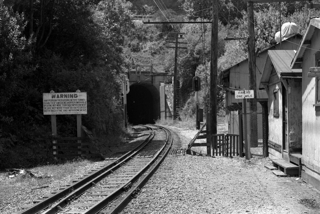
Now ahead to 1955, and very little has changed in this same west view. Even the amount of the tunnel trespassing fine has remained stable. Note the light in the tunnel.
L20-25-John Harder Photo, Courtesy John Harder, (Image 6 of 20)
Once the SN was abandoned, however, little remained. No more garden, lights, and, certainly, no warnings about entering the tunnel. West view, Apr. 1957.
L20-30-John Harder Photo, Courtesy John Harder, (Image 7 of 20)
The east portal did not suffer the problems with moisture and shifting earth that was experienced by the west side portal. The single glow is evidence for light in the tunnel, confirming the same glow as in L20-25. West view, circa 1952.
L20-35-Reginald McGovern Photo, Courtesy Reginald McGovern, (Image 8 of 20)
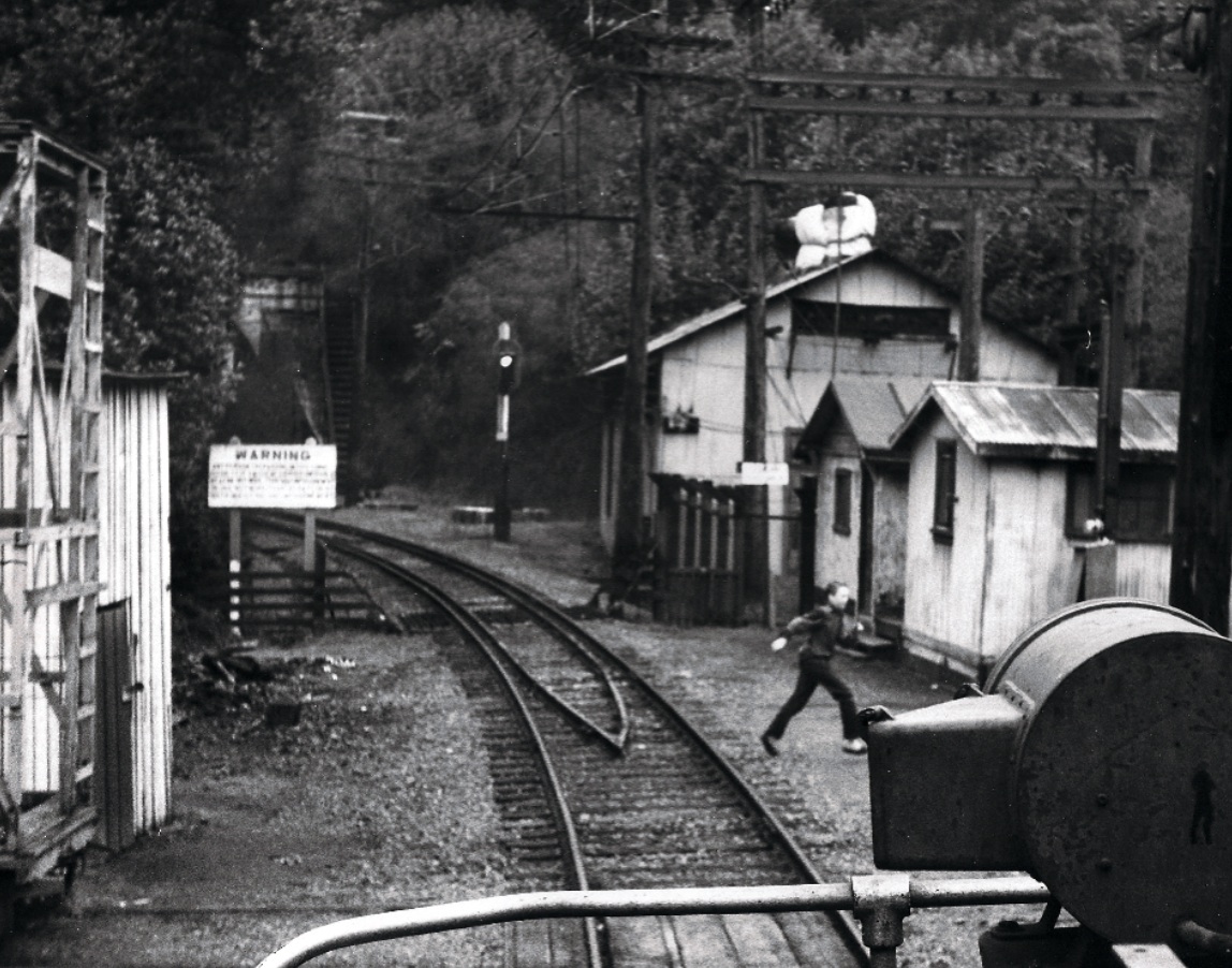
Moments after capturing L20-35, Reg McGovern caught this young boy making his way across the tracks. The area was enclosed along Pinehurst Road with a simple wire fence, but did not employ barbed wire or other mechanisms to prevent entering the right-of-way. West view, circa 1952.
L20-40-Reginald McGovern Photo, Courtesy Reginald McGovern, (Image 9 of 20)
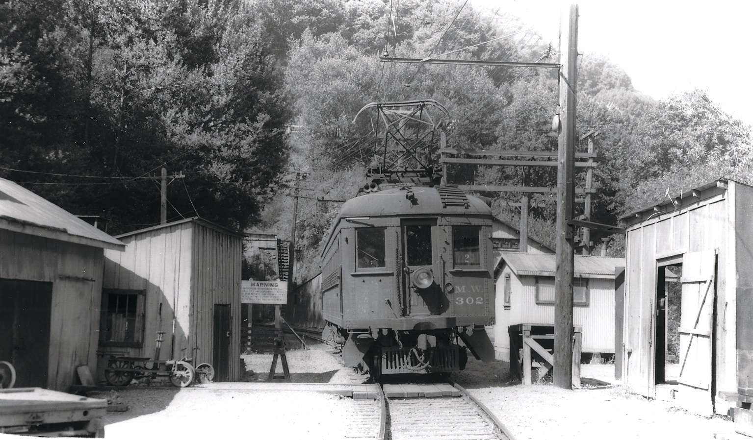
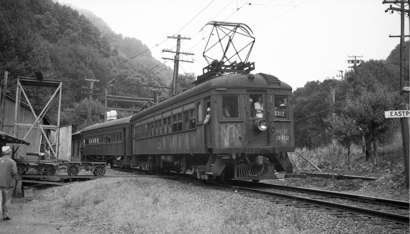
Rail excursions always stopped at Eastport, accounting for the existence of many images of MW 302 or SN 1005. Rail societies such as BAERA kept records of the dates of these trips, and this has facilitated dating of the images. West view, 9/12/48.
L20-45-Arthur Lloyd Photo, Courtesy Arthur Lloyd, (Image 10 of 20)
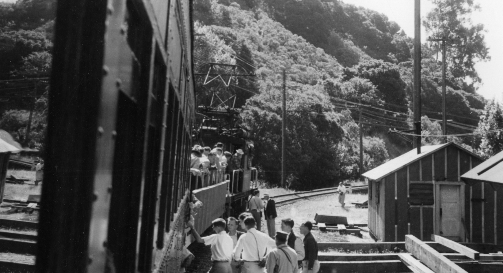
Excursions tended to produce multiple photos of the same moment in time. This is unfortunate, since there were many other scenic sections in the Canyon area that never got documented properly. West view with MW 302, 9/12/48
L20-50-Tom Gray Photo, Courtesy Tom Gray , (Image 11 of 20)
Interestingly, this image from a July 4, 1950 excursion with MW 302 and Salt Lake & Utah Parlor car 751 shows the garden in somewhat poor condition relative to L-20-05, the same image taken less than 3 months before.
L20-55-Tom Gray Photo, Courtesy Tom Gray , (Image 12 of 20)
Excursions did capture important details, such as in this mid-1950s southeast image showing the relationship of the facilities to the trestle over Pinehurst Road, the latter located by the 14 mile marker just to the right of the photographer in the background.
L20-60-Dave Gumz Photo, Courtesy BAERA, Western Railway Museum Archive, 55759sn, (Image 13 of 20)
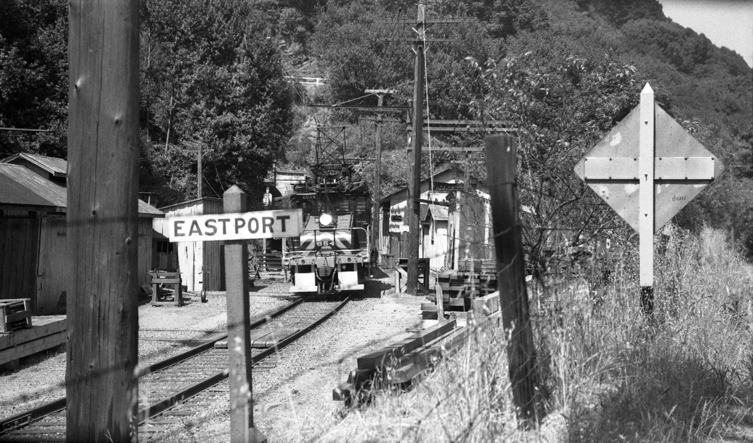
Nothing topped the image of a moving train at the portal, here of SN 654 in the late 1940s taken from Pinehurst Road, facing northwest.
L20-65-Tom Buckingham Photo, Courtesy BAERA, Western Railway Museum Archive, 54289sn , (Image 14 of 20)
One last view of SN 1014, northwest view from July 22, 1941. This is to remind us how close the SN right-of-way hugged along the border of Pinehurst Road relative to Eastport's structures. The train then crossed Pinehurst Road, fully revealed in Landmark's "Trestles in the Trees"...
L20-70-Dudley Thickens Photo, Courtesy BAERA, Western Railway Museum Archive, 55760sn, (Image 15 of 20)
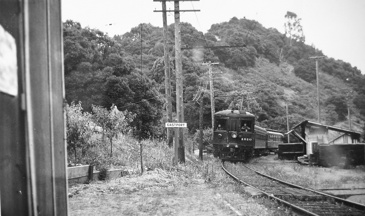
An added image from the early passenger era to support the existence of the garden over several decades. Great view of the canyon as well. Undated, southeast view with SN 1010.
L20-75-From the Collection of the Moraga Historical Society, Moraga, CA, (Image 16 of 20)
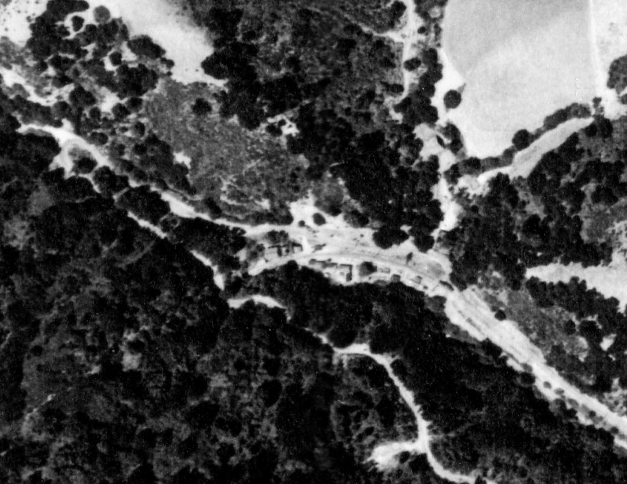
Combining the information provide in this Landmark, and the previous Landmark "Trestles in the Trees", the relationship of structures and landmarks in this 1939 view of Eastport should be apparent. Full reference BUT BUU-283, Panel 79, 7/30/39. But in case you need more information ...
L20-80-USDA AAA Western Divsion Laboratories, Courtesy East Bay Municipal Utility District, (Image 17 of 20)
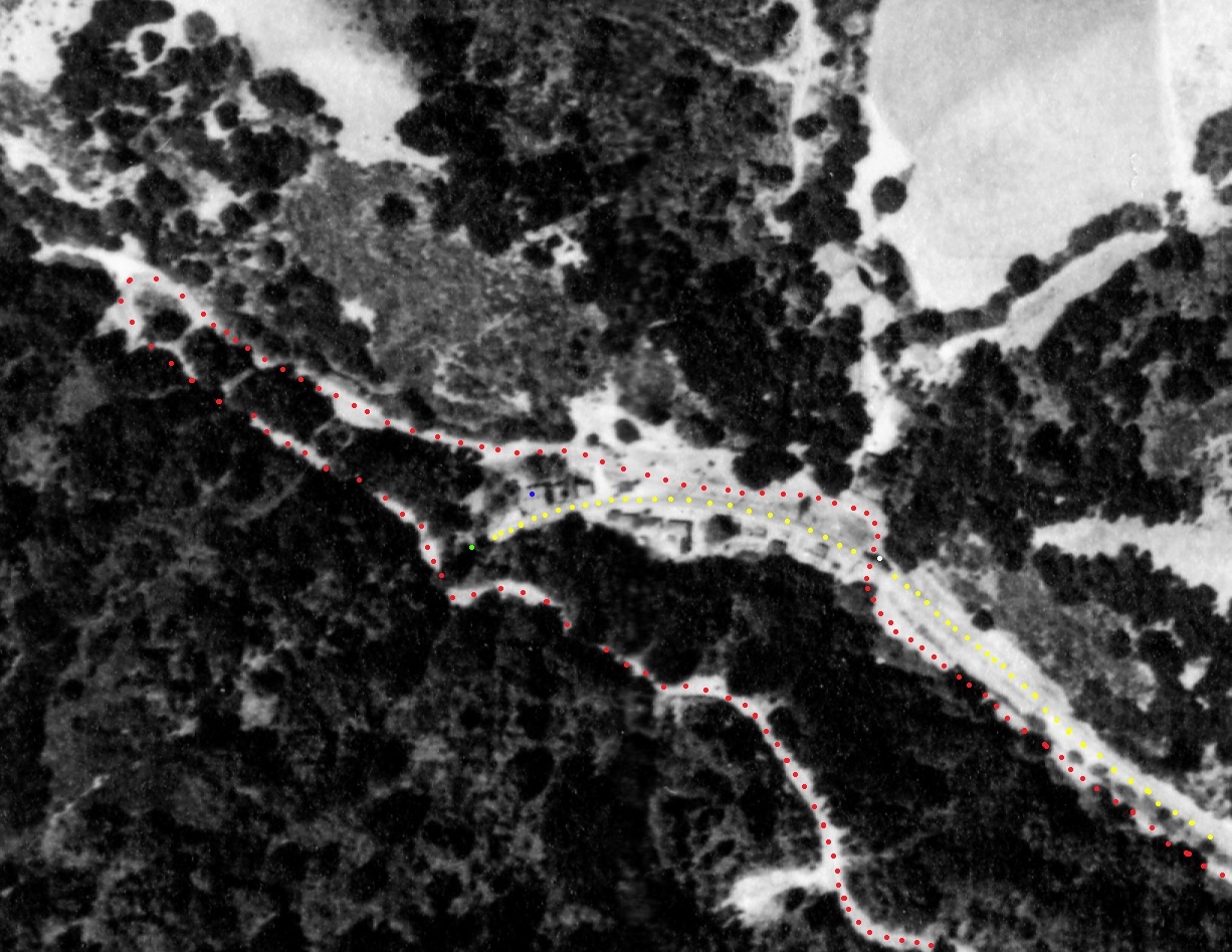
Annotated version of L-20-80. Pinehurst Road, red dots, SN right-of-way, yellow dots, concrete overhang of tunnel portal, yellow dot, SN power substation, blue dot, trestle over Pinehurst Road, white dot. Full reference BUT BUU-283, Panel 79, 7/30/39.
L20-81-USDA AAA Western Divsion Laboratories, Courtesy East Bay Municipal Utility District, (Image 18 of 20)
Fred Matthews climbed above the tunnel to catch SN 652 heading southeast, left, with SN 654 on the rear, right, in east views from Feb. 1, 1957, off to the next destination, Wilcox.
L20-83-Fred Matthews Photos, Courtesy Anonymous Donor, (Image 19 of 20)
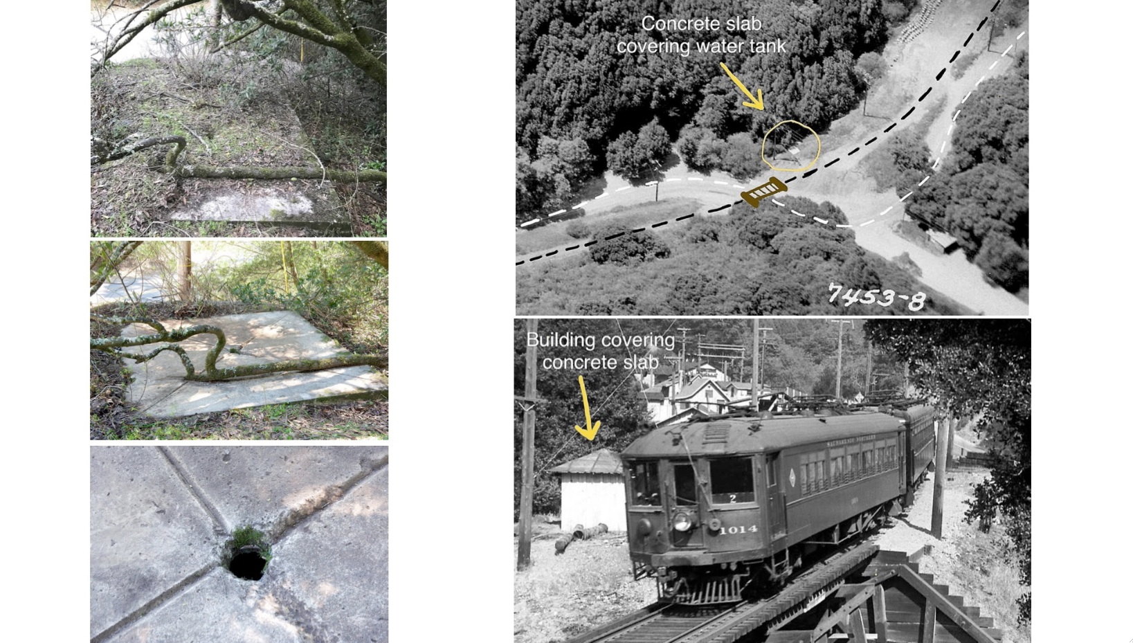
Much appreciation to Robert Capra who documented the remains of a concrete slab on the northwest side of the trestle over Pinehurst Rd. in 2020. It appears to have been the base of a small shelter that served as a water supply, possibly from creek water to use in case of a fire in the area.
L20-90-Courtesy Robert Capra , (Image 20 of 20)