The Holland Branch – The Road to Sorroca
The ride on the SN Holland Branch continues into Yolo County stopping at Valdez, Sorroca and Silverdale.
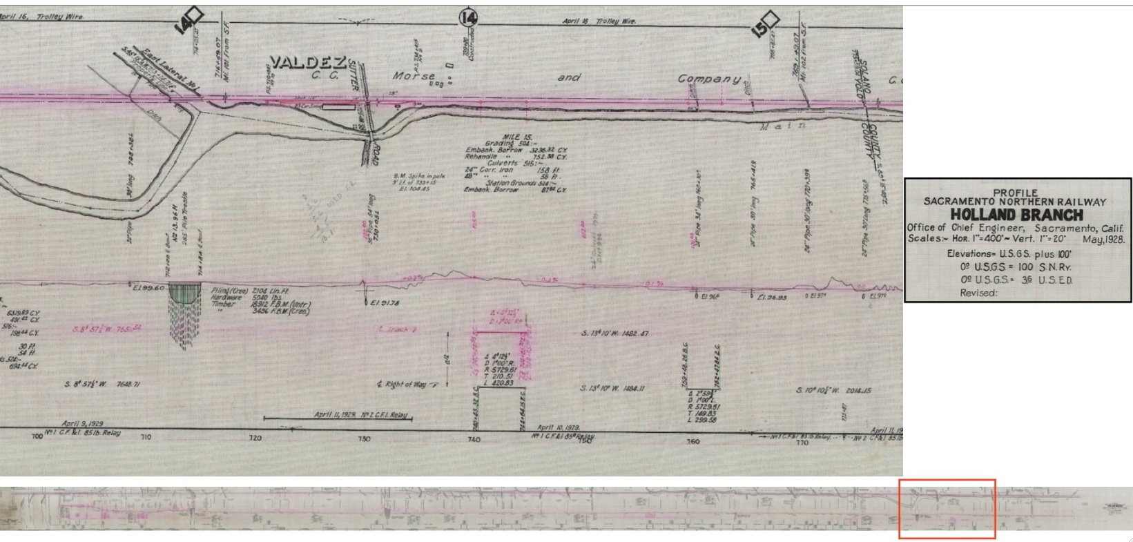
L224-05-Courtesy Map Collection, Shields Library, University of California, Davis, (Image 1 of 41)

From Oxford to the Yolo County border, the track ran along the Main Drainage Canal to Valdez. This section is designated by the orange rectangle on the long map of the entire route placed along the bottom of the page. Just to the north, the track crossed an eastern lateral of the canal on the road to Sorroca.
L224-10-Courtesy BAERA, Western Railway Museum Archives, 64588 , (Image 2 of 41)
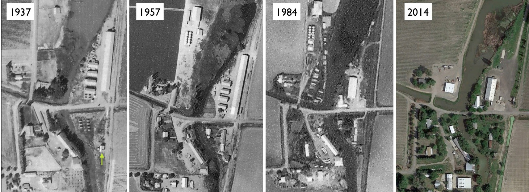
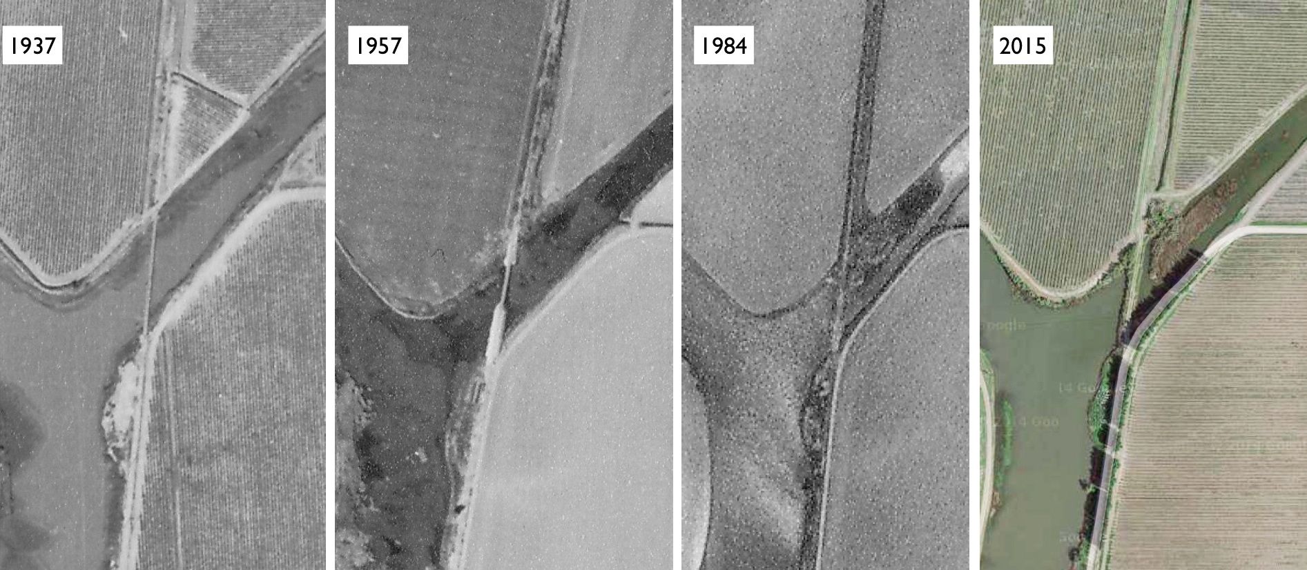
Valdez had many agricultural-related structures on either side of Sutter Rd. The SN tracks ran to the east or along the right border of each north-oriented aerial view. The green arrow points to the SN substation. When did the shift in warehouses between 1957 and 1984 occur? UC Davis Refs: 1937, ABB-112-72, 10-06-1937; 1957, ABB-70T-9, 9-18-1957; 1984, WAC-84C 5-149, 3-20-1984; 2014, Google Maps
L224-15-Courtesy Map Collection, Shields Library, University of California, Davis and Google Maps , (Image 3 of 41)
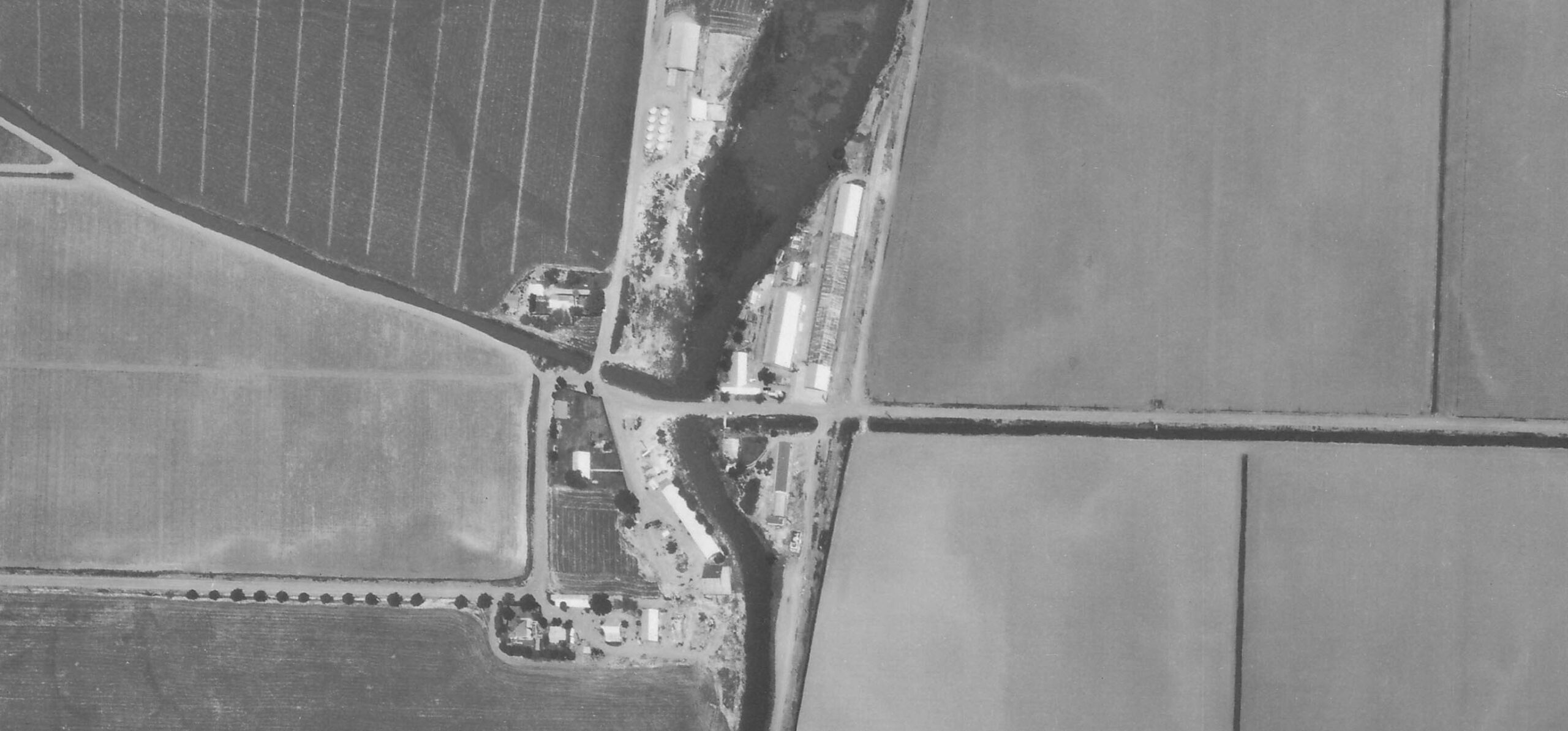
This north-oriented aerial from May 18, 1965 offers one clue. The roof of the longer warehouse from 1957 appears to be in the process of being dismantled, as the shorter warehouse of the future is now present. Changes that occurred in the early 1960s will be presented shortly indicating the SN was pulling out of its active oversight of the warehouse here.
L224-17-Courtesy The National Archives of San Franciso, (Image 4 of 41)
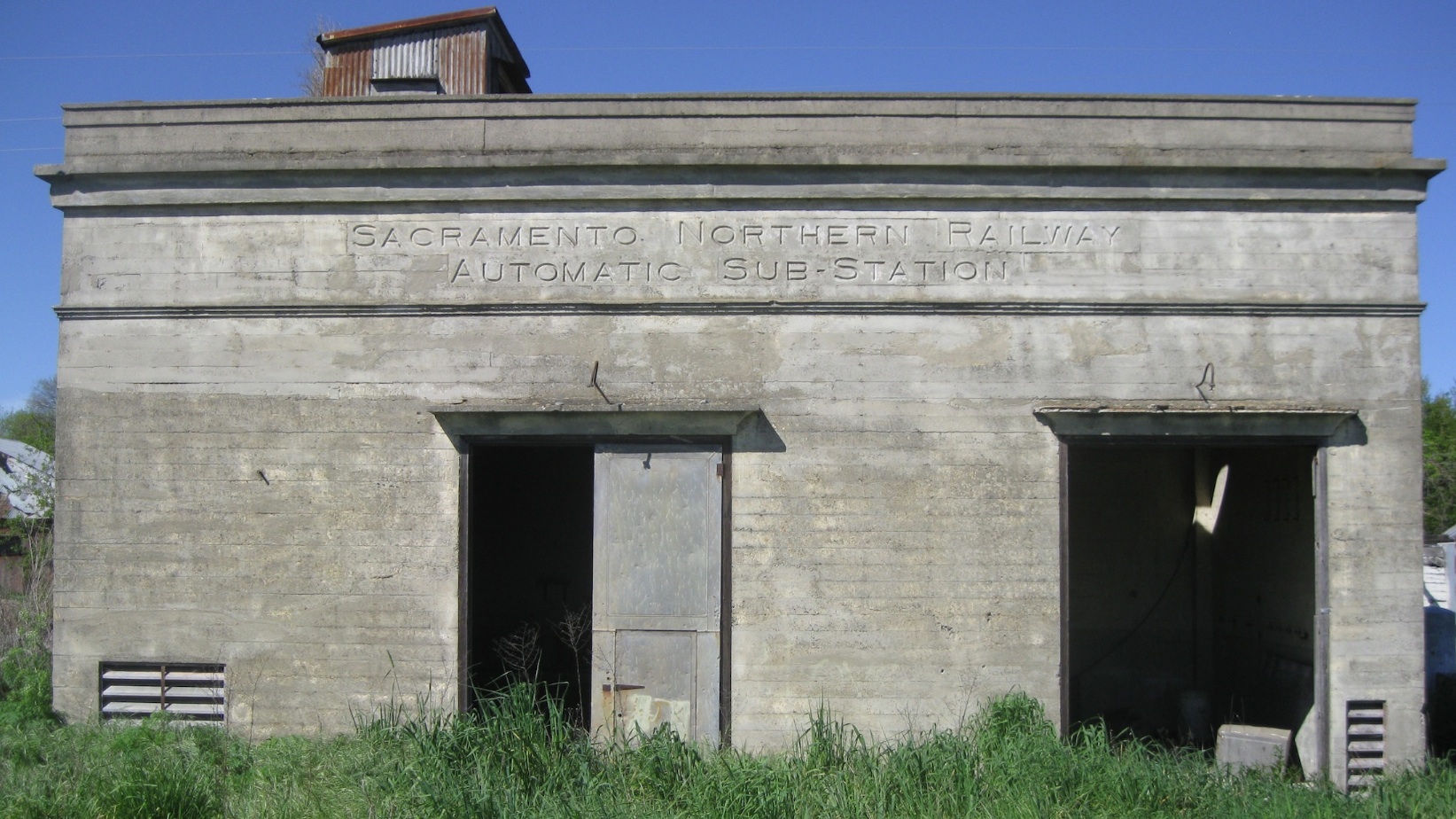
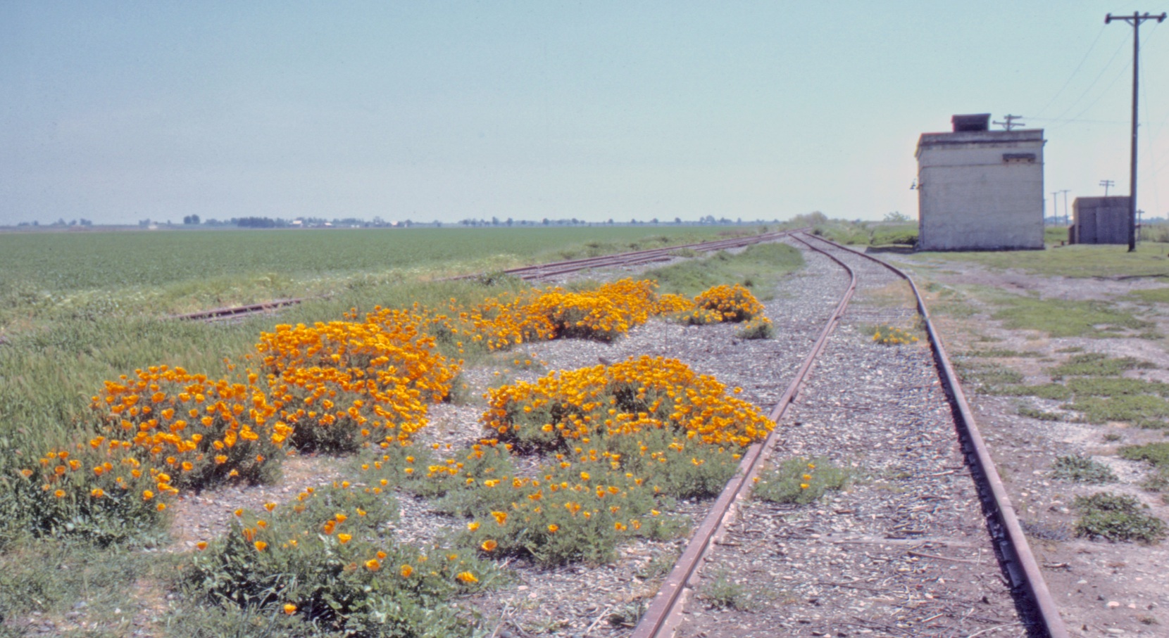
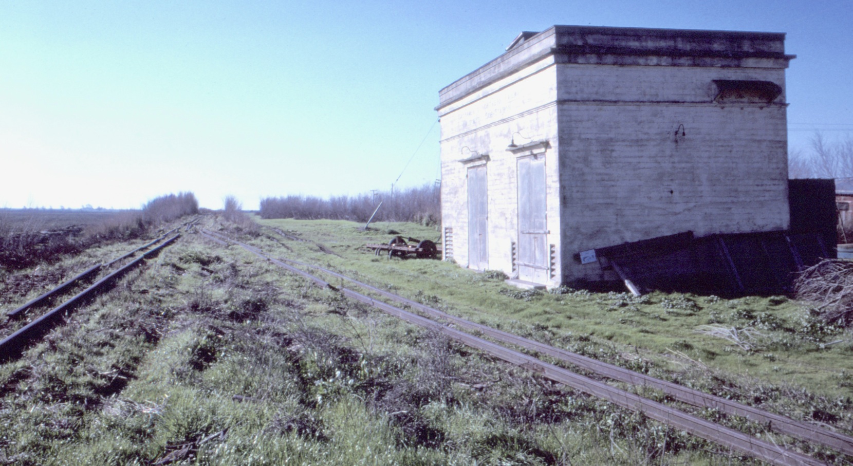
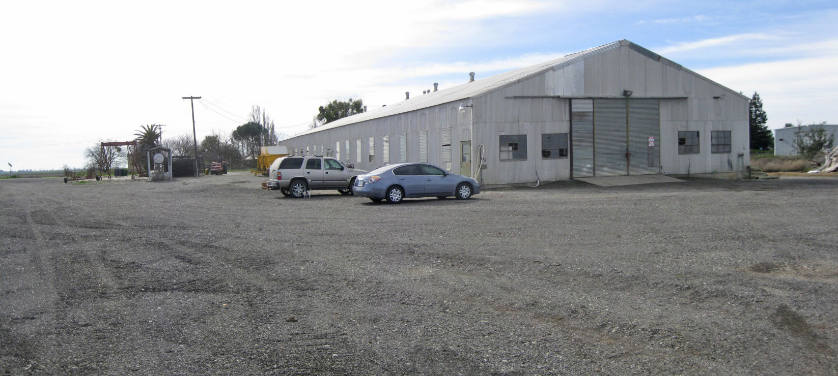
The SN substation supplied power to the overhead wire for the entire line until diesel engines took over in 1953. More on this facility coming up. West view, 2015.
L224-20-Stuart Swiedler Photo, (Image 5 of 41)
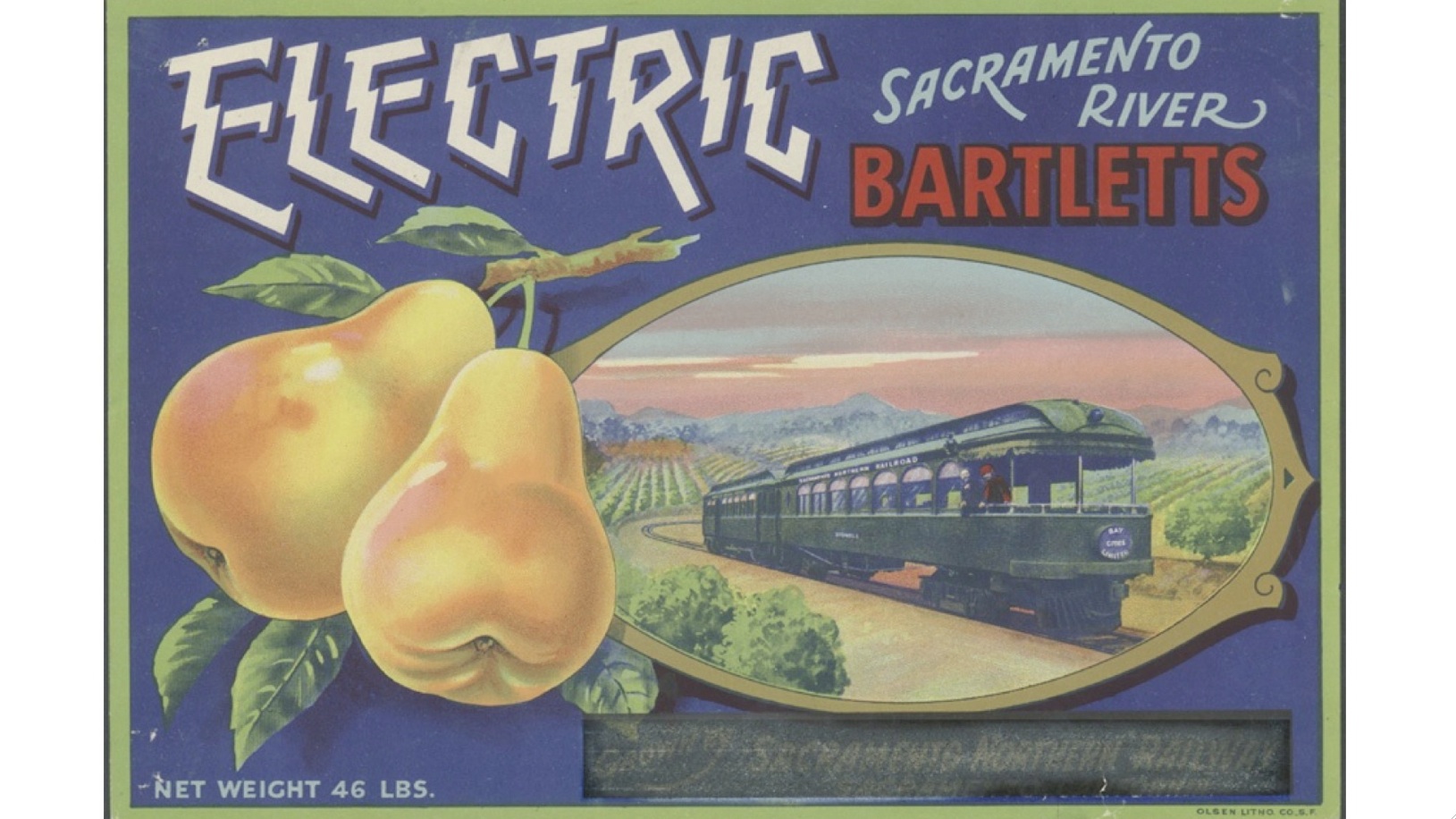
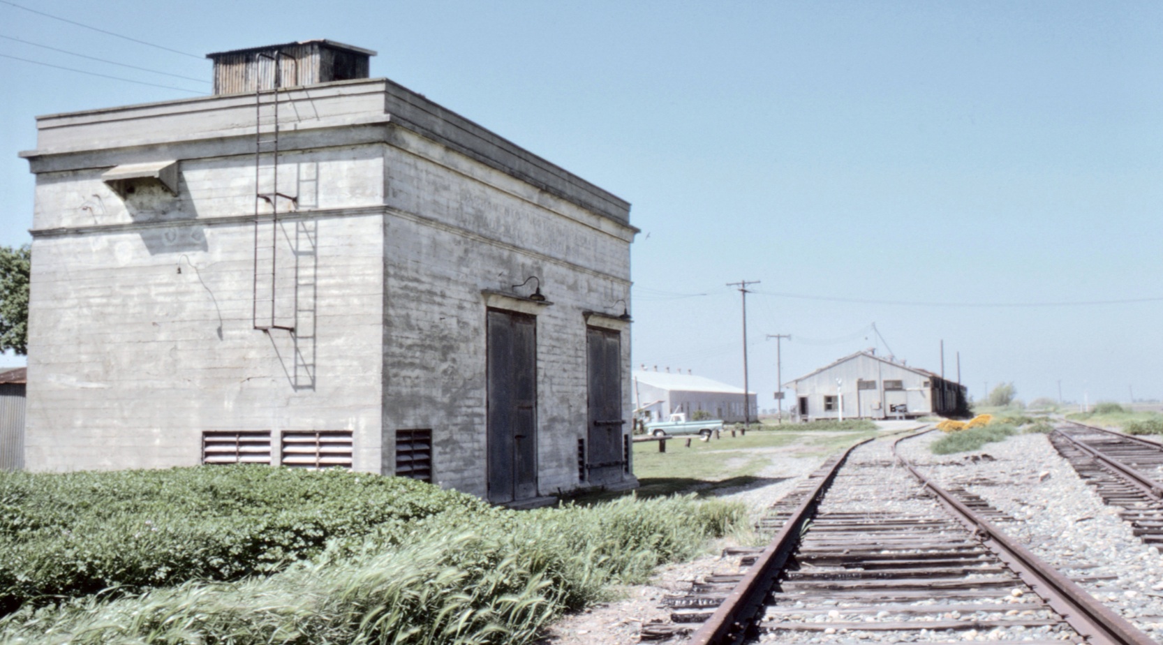
According to the 1957 Western Pacific, WP, Circular No. 167-E, Sacramento River Growers shipped their pears from this location with a capacity of 10 boxcars.
L224-25-Courtesy Thomas Pat Jacobson, (Image 7 of 41)
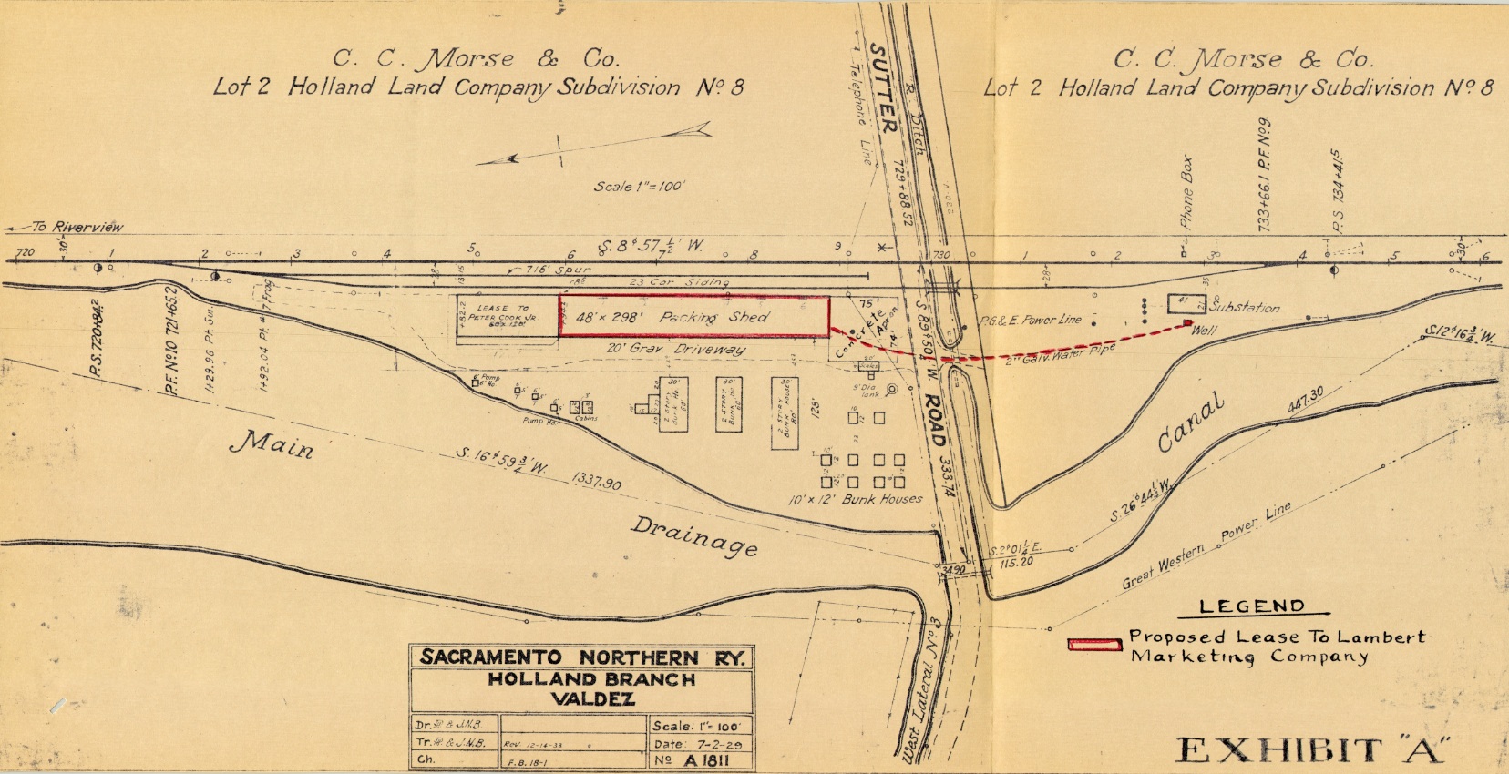
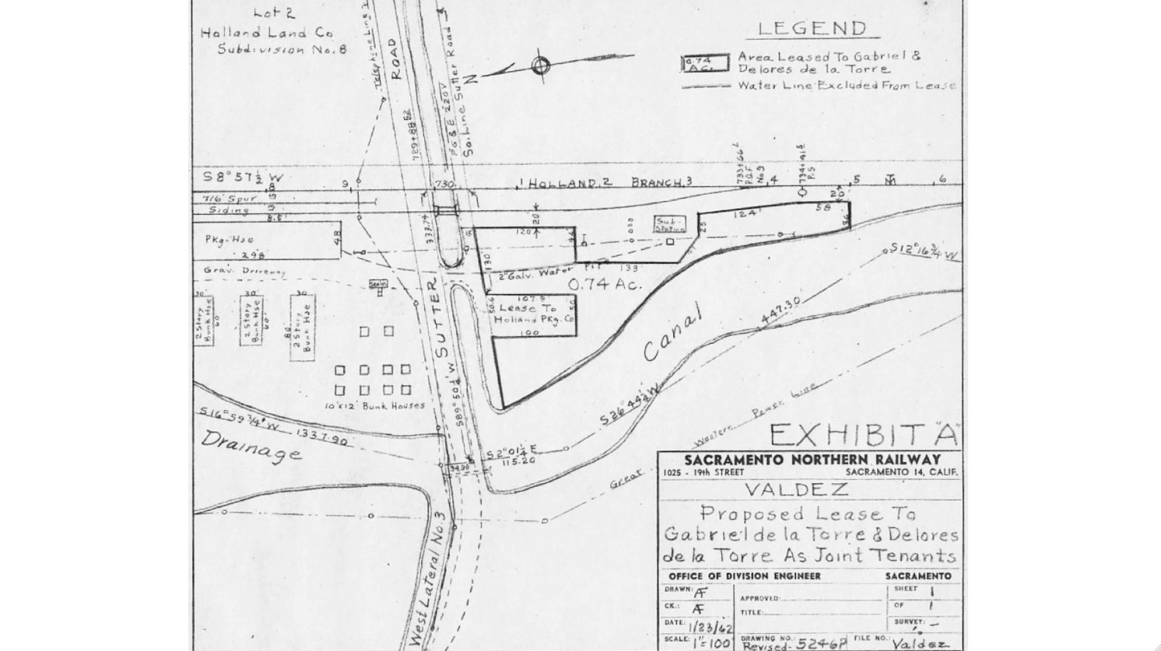
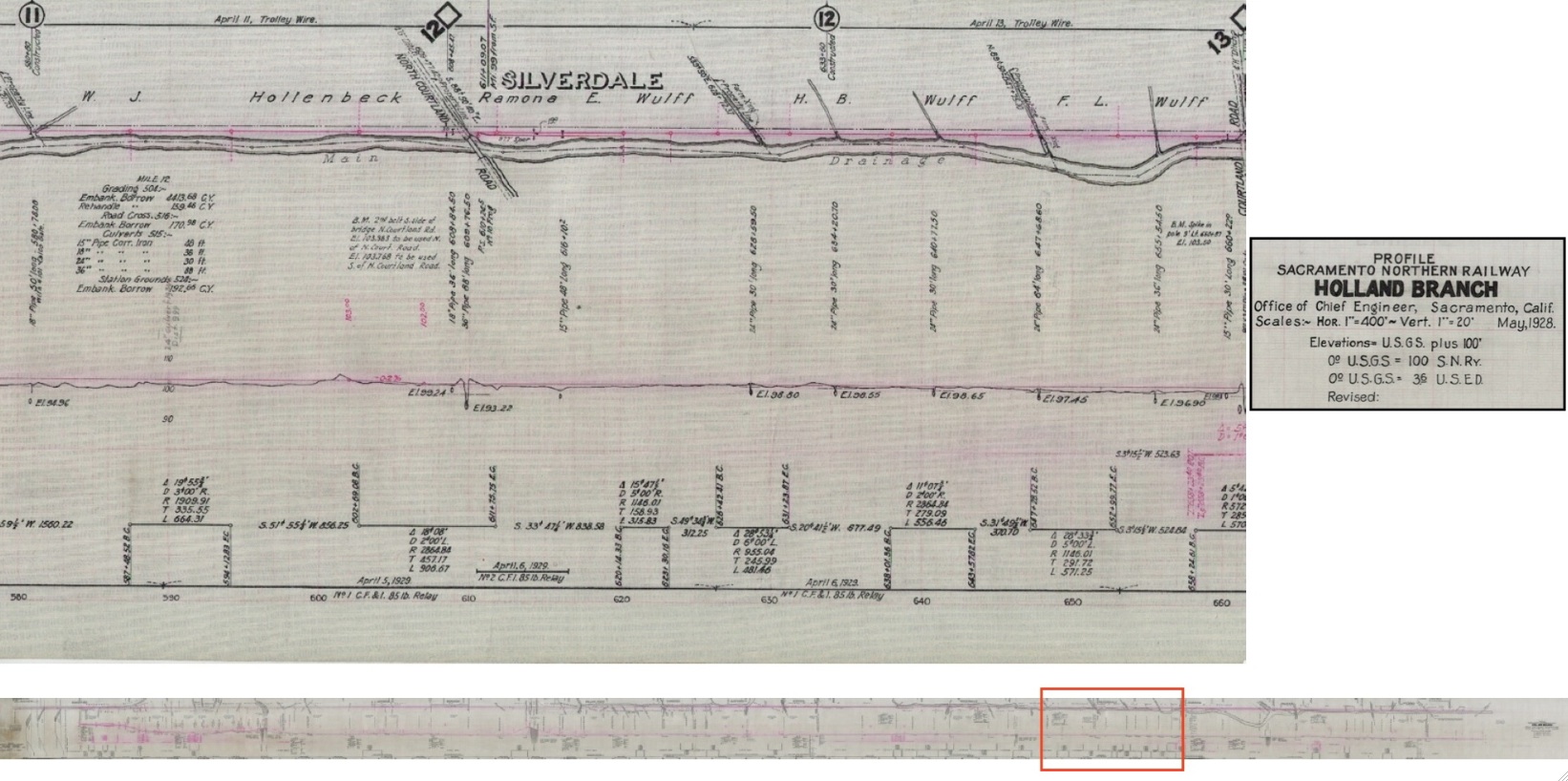
Starting with this figure from July 2, 1929 and revised in 1938, the evolution of the use of the area will be presented.
L224-30-Courtesy BAERA, Western Railway Museum Archives, 39101, (Image 8 of 41)
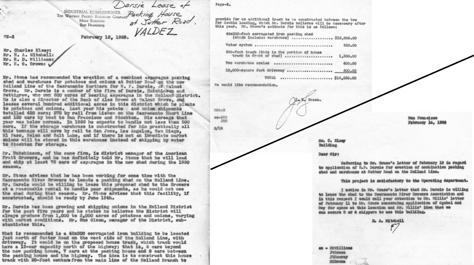
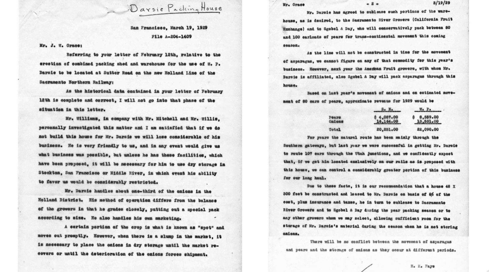
First, this correspondence from the WP’s Industrial Commissioner, J.W. Grace with prospective clients Darsie, Hutchison and Pettigrew, with some color in a separate letter from Harry A. Mitchell, the SN’s VP and General Manager, and by August, its new President.
L224-35-Courtesy BAERA, Western Railway Museum Archives, 47020, (Image 9 of 41)
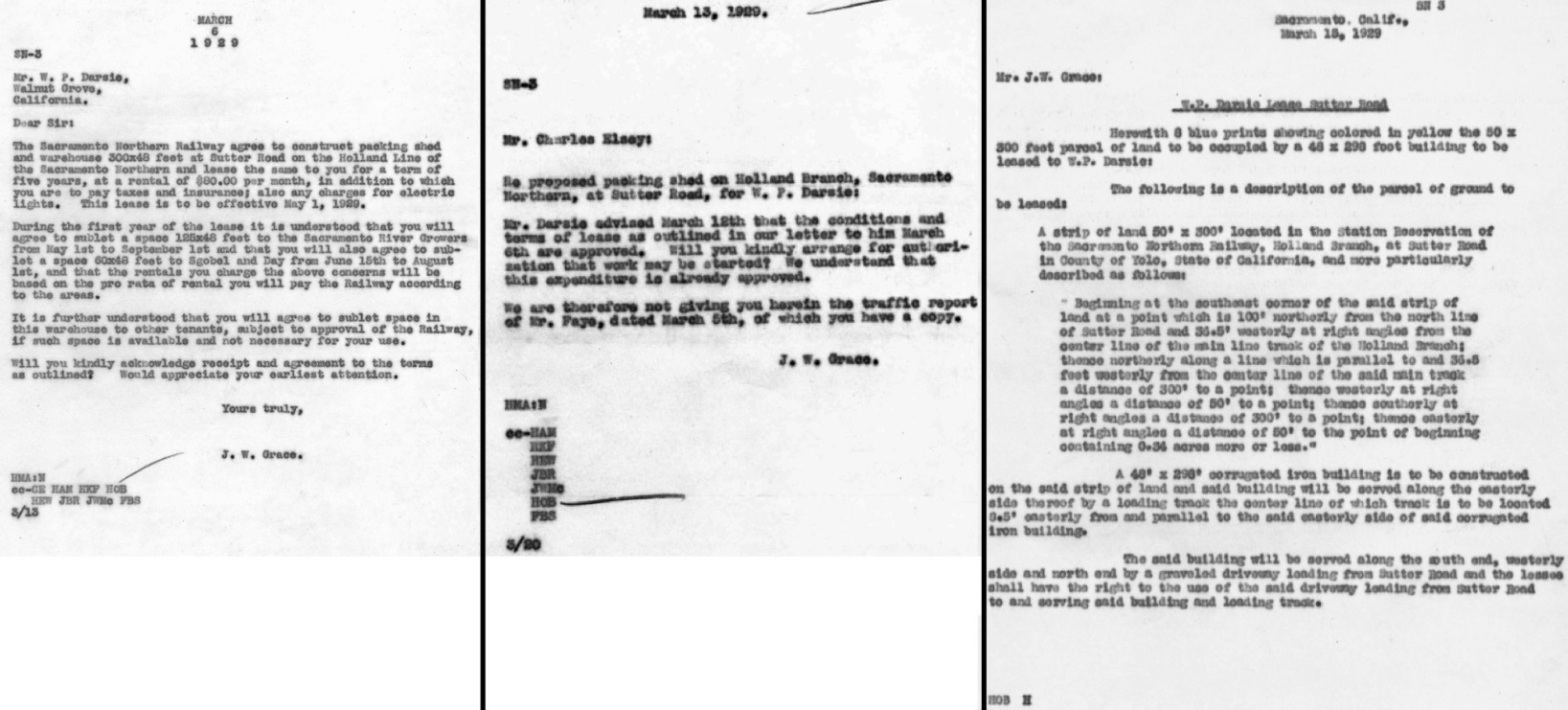
These three correspondences show that within a month, the deal was sealed with Darsie et al. Note the WP paid for the shelter. Read on to find out why.
L224-40-Courtesy BAERA, Western Railway Museum Archives, 47020, (Image 10 of 41)
This letter from Mr. Faye of the WP was found in two versions; one from Mar. 5, 1929, and this later one. This version provides a little more detail. It explains why it was an easy financial decision to build the shelter, and it provided revenue until service stopped there in the early 1970s.
L224-45-Courtesy BAERA, Western Railway Museum Archives, 47020, (Image 11 of 41)
In 1962, the SN leased some of the grounds to a couple to set up a labor camp for the local agricultural concerns. Possibly true for Silverdale as well, but that documentation was not found. The labor camps housed workers for the intensive harvests and plantings. Eventually the government attempted to regulate how these houses had to be kept, and how much space had to be allotted to farm workers.
L224-50-Courtesy BAERA, Western Railway Museum Archives, 39102, (Image 12 of 41)
No images have been identified that show Valdez during active SN operations there, but Dave Stanley did document the line on May 8, 1975 with his south view from Sutter Rd. of the substation and the south end of the passing track ...
L224-55-Dave Stanley Photo, Courtesy Dave Stanley, Copyright 2018 , (Image 13 of 41)
... and with this north view south of the substation showing the two warehouses, also on May 8, 1957.
L224-60-Dave Stanley Photo, Courtesy Dave Stanley, Copyright 2018 , (Image 14 of 41)
He returned on Feb. 7, 1986 to capture the final stage of the abandonment process, with a south view north of the substation ...
L224-65-Dave Stanley Photo, Courtesy Dave Stanley, Copyright 2018 , (Image 15 of 41)
... and with a north view south of the substation, also from Feb. 7, 1986.
L224-70-Dave Stanley Photo, Courtesy Dave Stanley, Copyright 2018 , (Image 16 of 41)
Finally, a north view from Feb. 7, 1986 showing Sutter Rd., and documenting the loss of the long warehouse-storage facility from the railway days.
L224-75-Dave Stanley Photo, Courtesy Dave Stanley, Copyright 2018 , (Image 17 of 41)
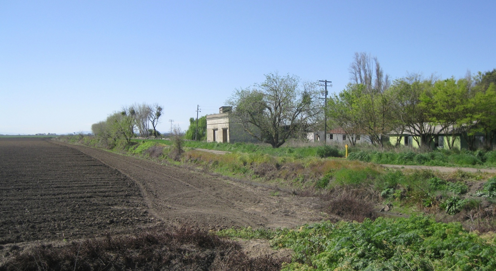
Not much has changed since, looking towards the substation in 2015, southwest view from Sutter Rd.
L224-80-Stuart Swiedler Photo, (Image 18 of 41)
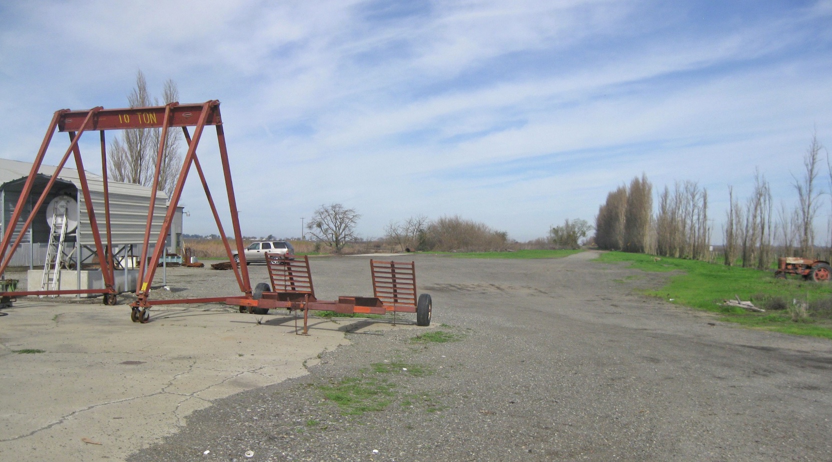
A southwest view at the surviving warehouse-storage unit is seen here in 2015.
L224-85-Stuart Swiedler Photo, (Image 19 of 41)
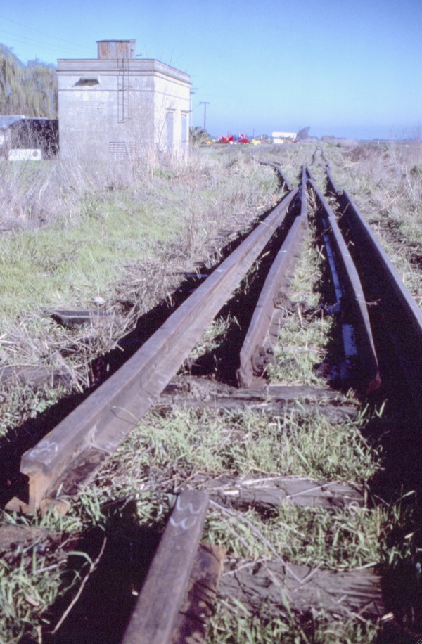
A north view from 2015 looking towards the next destination, Sorroca. No signs of any railway ever having been here in that direction.
L224-90-Stuart Swiedler Photo, (Image 20 of 41)
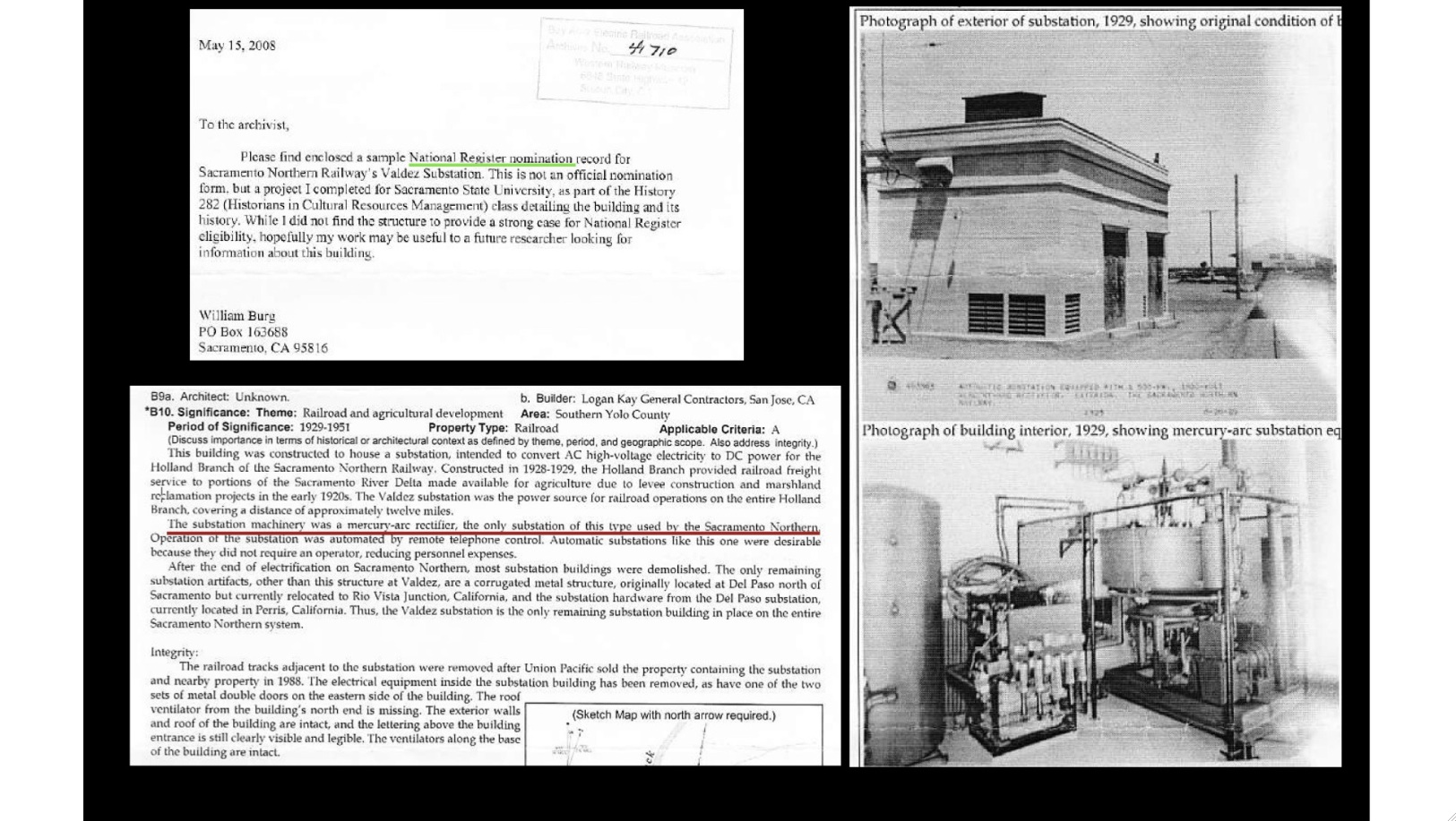
The legacy of the substation, written up and shown here, by William Burg. Hopefully the outer structure will remain intact as a reminder of the railway’s contribution to the area.
L224-95-Courtesy BAERA, Western Railway Museum Archives, 41710, (Image 21 of 41)
Heading north, as shown in these north-oriented aerials, the trestle over the eastern lateral of the main canal was filled in partially during railway operation, and totally enclosed by the end of service as it remains in the 21st century. Refer to the references in L224-15.
L224-100-Courtesy Map Collection, Shields Library, University of California, Davis and Google Maps , (Image 22 of 41)
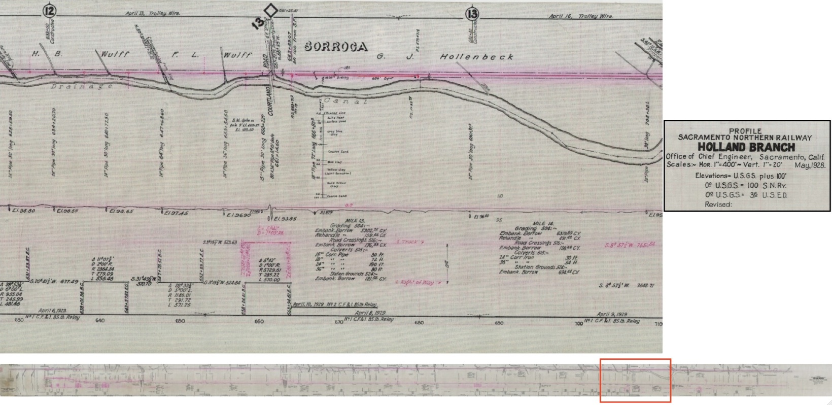
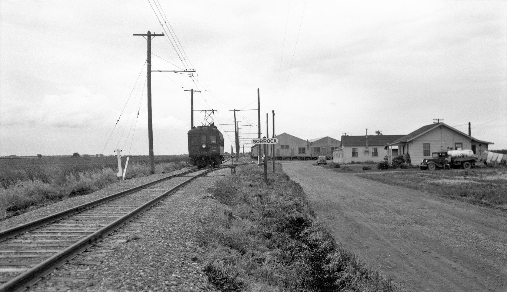
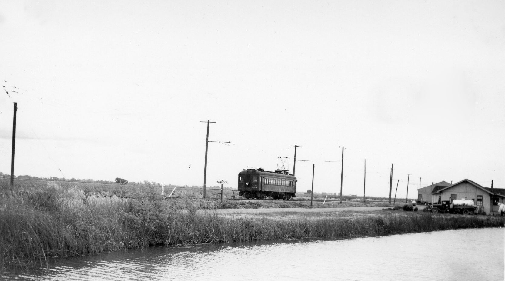
The next agricultural center along the Main Drainage Canal is shown here, Sorocca.
L224-105-Courtesy BAERA, Western Railway Museum Archives, 64588 , (Image 23 of 41)
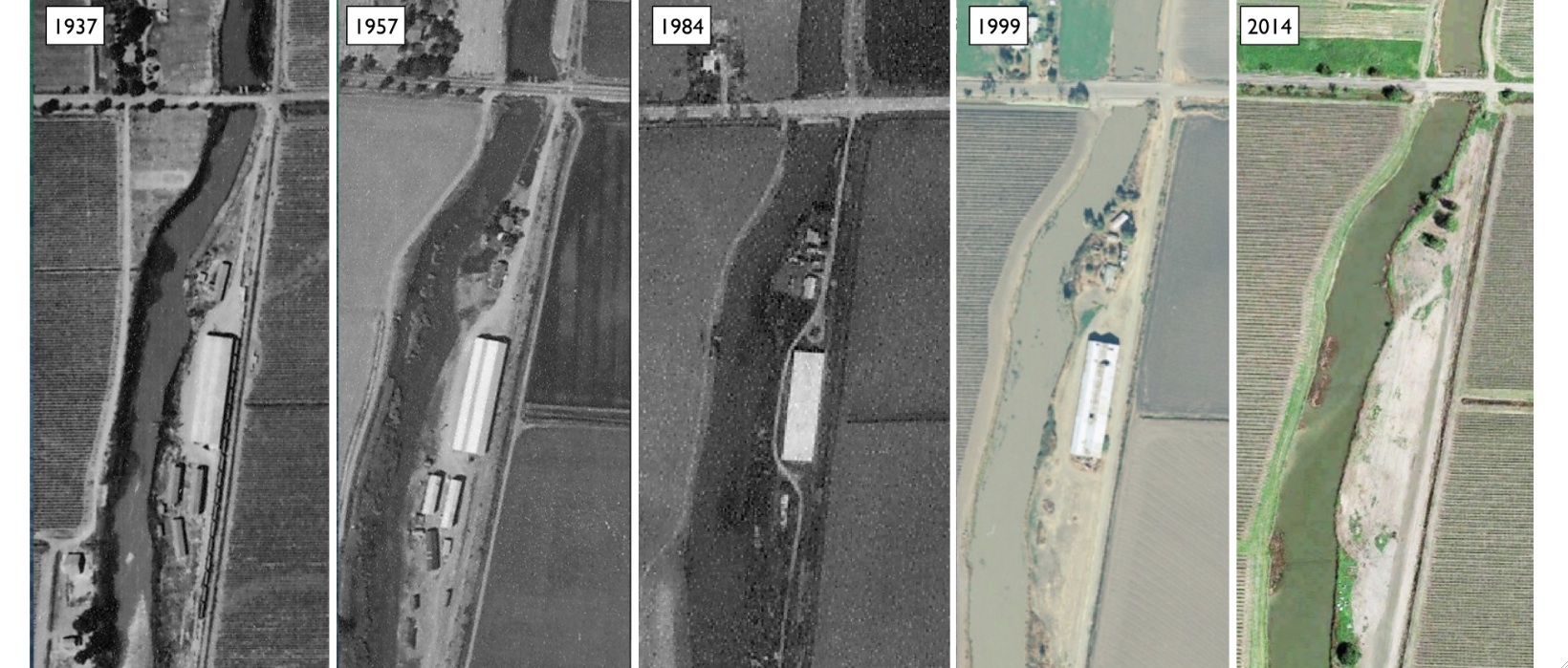
The main structure at Sorroca from the SN period survived until the early 21st century as shown in these north facing aerials. UC Davis Refs: 1937, ABB-112-71, 10-6-1937; ABB 70-T-94, 9-18-1957; 1984, WAC-84C 5-150, 3-20-184. UC Santa Barbara Ref: hm-1999-usa_1003-206; 2014, Google Maps
L224-110-Multiple Contributors, (Image 24 of 41)
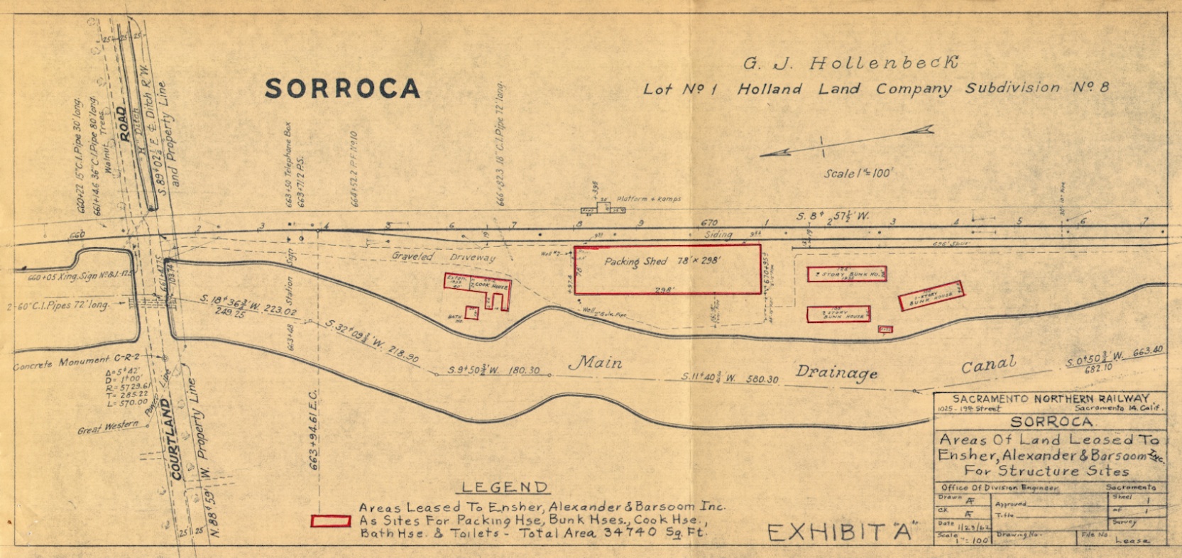
The layout for the Sorroca facilities in 1962 is shown here. According to the 1957 Western Pacific, WP, Circular No. 167-E, Ensher, Alexander, Barsoom stored vegetables here with with a capacity of 10 boxcars for shipping.
L224-115-Courtesy BAERA, Western Railway Museum Archives, 39536, (Image 25 of 41)
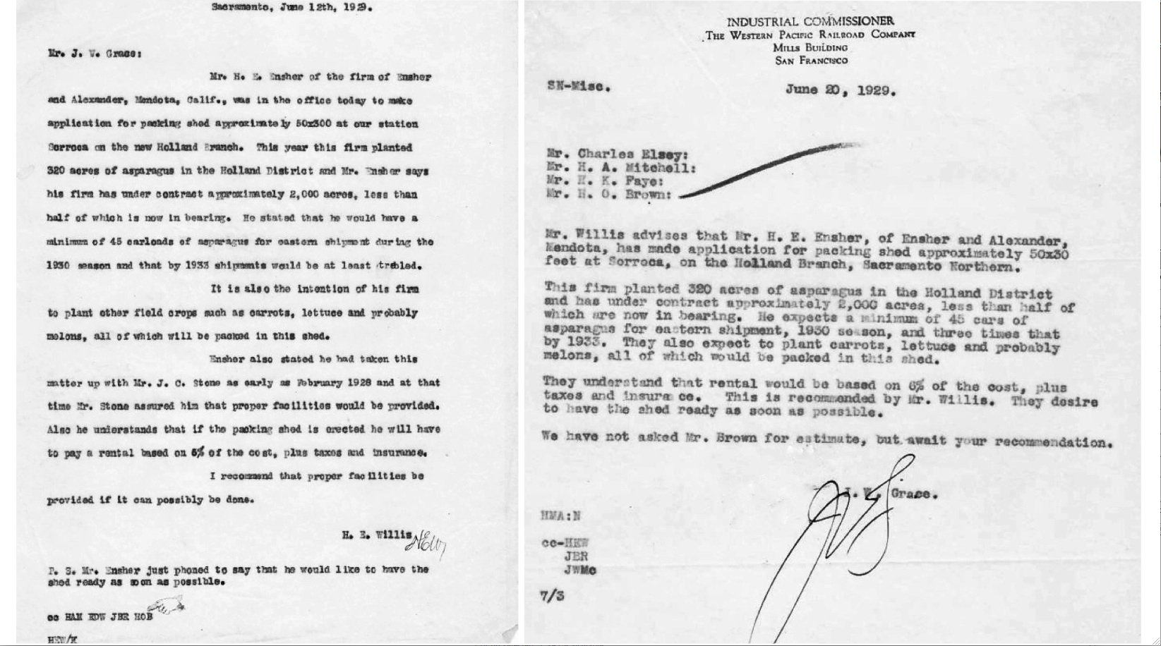
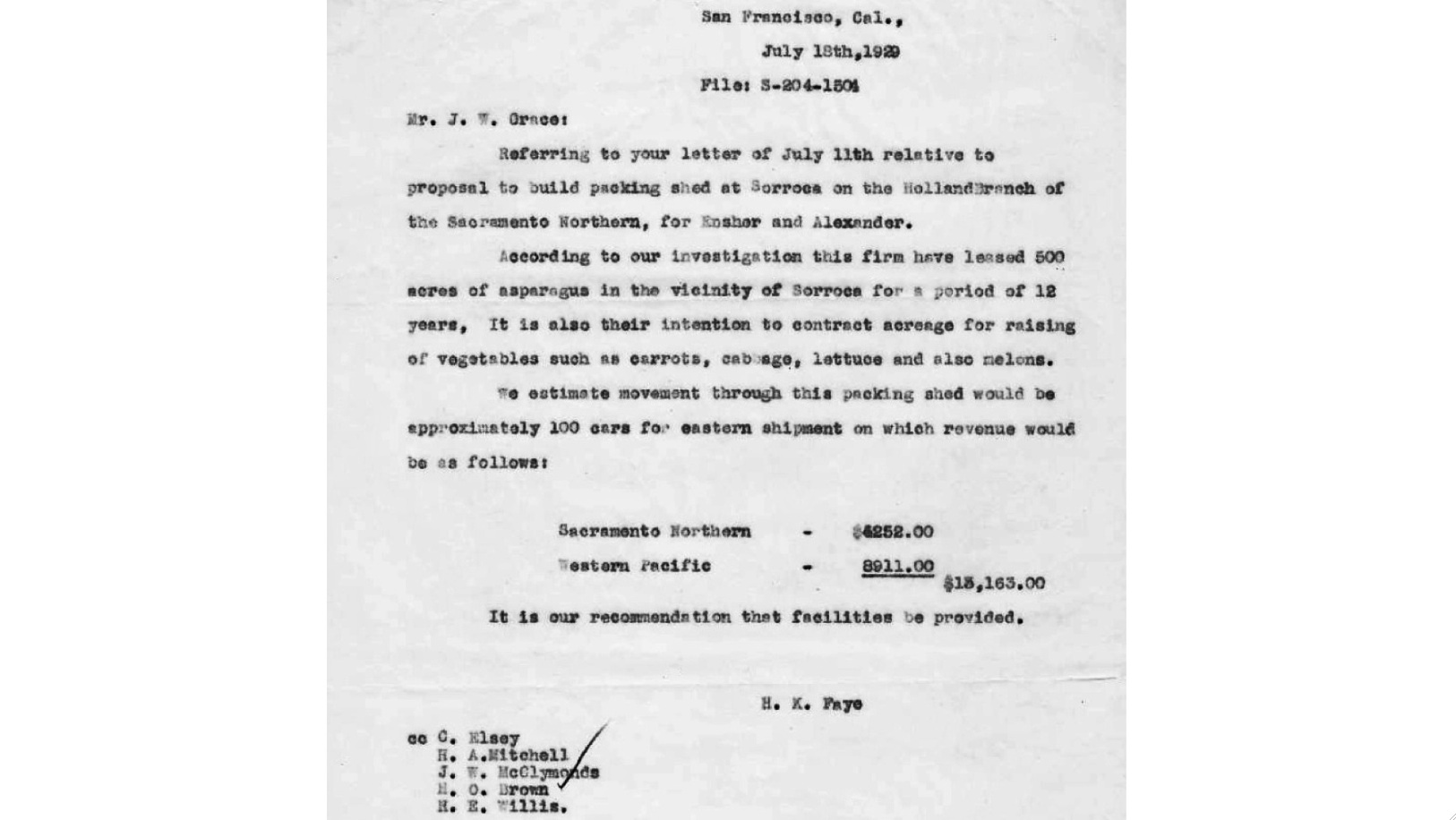
This firm was there at the outset in 1929, these internal correspondences providing the go-ahead to build them a storage facility at Sorroca.
L224-120-Courtesy BAERA, Western Railway Museum Archives, (Image 26 of 41)
Further information is provided here to support this firm’s entry at Sorroca. If you haven’t caught on by now, the WP would be making out quite nicely for the next forty years picking up the loaded cars delivered to them by the SN in Sacramento after this initial shed construction payment.
L224-125-Courtesy BAERA, Western Railway Museum Archives, (Image 27 of 41)
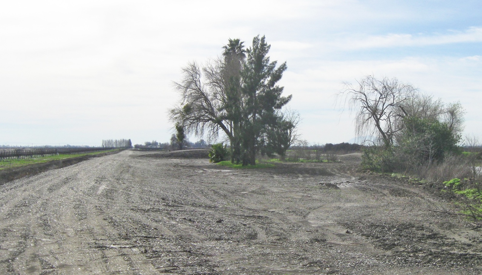
A south view from Courtland Rd. at the Sorroca facilities in 2015. The land here has never been developed. Although replacing the storage facilities here would be allowed, locals Dick Marshall and Steve Barsoom commented that any home built here would require to be on 12-foot stilts after the Federal Emergency Management Agency condemned the levees in the panhandle circa 2009.
L224-130-Stuart Swiedler Photo, (Image 28 of 41)
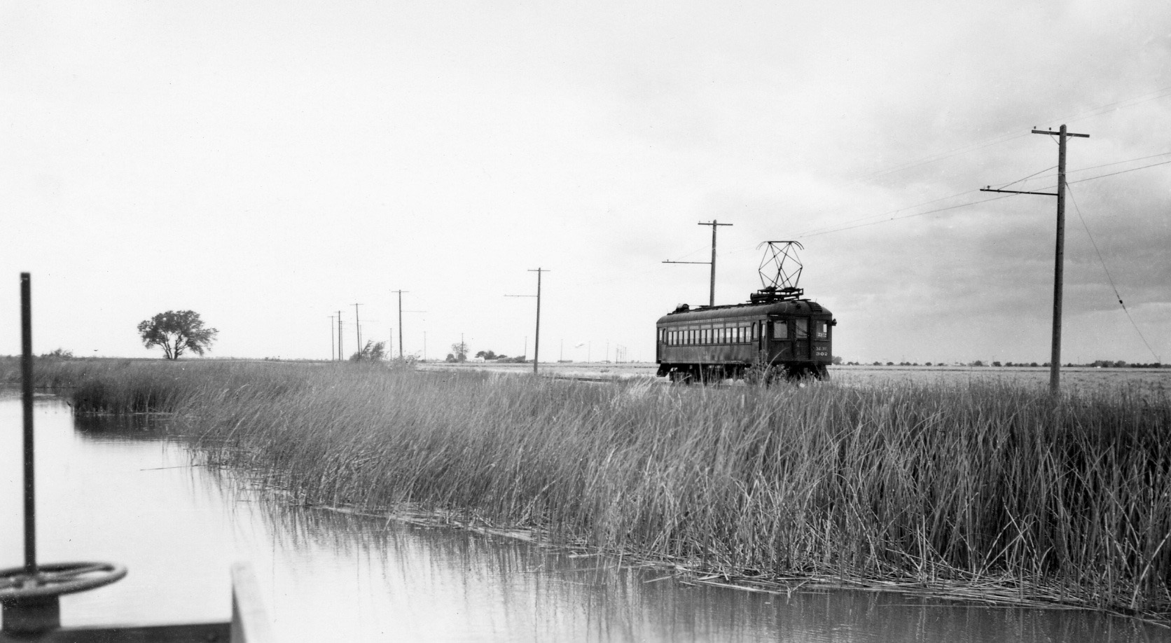
This matched south view from a SN inspection trip with MW 302 in May 1948 documents that at least one conventional-appearing home resided near the main packing house. Several locals commented on the warehouse being lit all night during the asparagus spring harvest in the 1960s.
L224-135-Courtesy BAERA, Western Railway Museum Archives, 85163sn, (Image 29 of 41)
More of a southeast look at the same scene, although this image of MW 302 was not dated, but shares details with the May 1948 inspection.
L224-140-W.S. Billings Collection Courtesy BAERA, Western Railway Museum Archives, 85155sn, (Image 30 of 41)
Another undated view of MW 302, but this one looks to the north, the sheds to be visited next time far away in the distance.
L224-145-W.S. Billings Collection Courtesy BAERA, Western Railway Museum Archives, 85159sn, (Image 31 of 41)
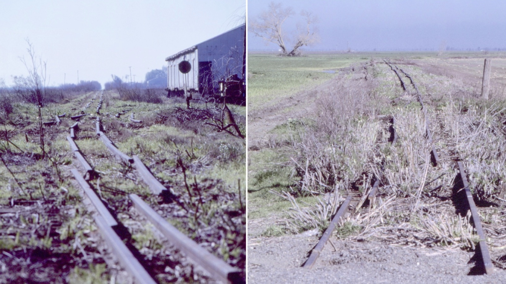
Along with this photographic documentation of the rails removed at Valdez on Feb. 7, 1986 shown previously, Dave Stanley produced a similar set at Sorroca to the south, left, and the north, right.
L224-150-Dave Stanley Photos, Courtesy Dave Stanley, Copyright 2018, (Image 32 of 41)
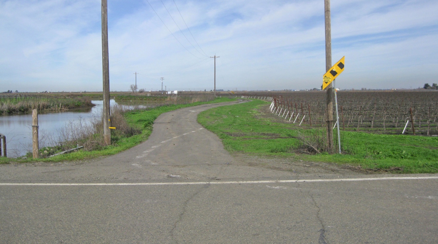
The best find here in 2015 was in the road, here from Courtland Rd. looking north. As will be appreciated, this paved segment doesn’t follow the right-of-way as pictured in the last image.
L224-155-Stuart Swiedler Photo, (Image 33 of 41)
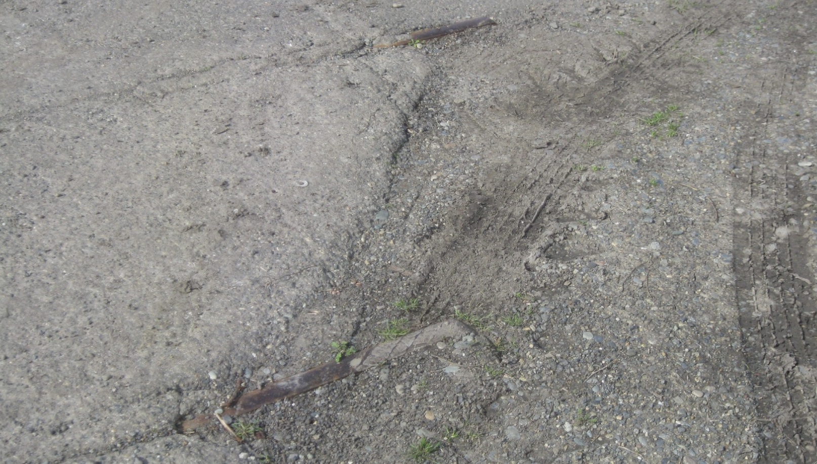
But in case that picture did not exist as to the direction of the right-of-way, to quote a more recent twist on an old proverb, the proof is in the pudding.
L224-160-Stuart Swiedler Photo, (Image 34 of 41)
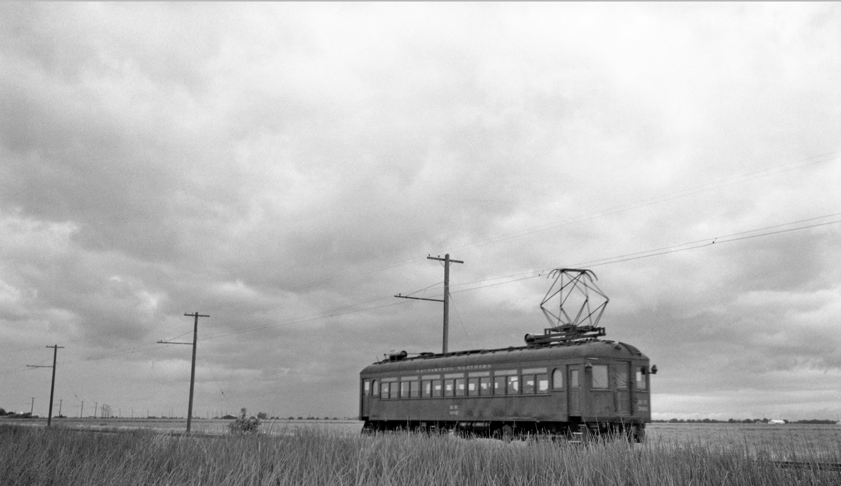
With the sky clouding up in May 1948, better to board MW 302 to head north to the next destination.
L224-165-Courtesy BAERA, Western Railway Museum Archives, 85161sn, (Image 35 of 41)
Staying along the Main Drainage Canal, Silverdale was reached at N. Courtland Rd.
L224-170-Courtesy BAERA, Western Railway Museum Archives, 64588 , (Image 36 of 41)
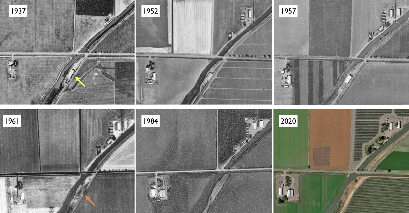
Very few details about Silverdale were uncovered. Extra north-oriented aerials are shown to document that the main storage facility, yellow arrow, did not make it to 1961. UC Davis Refs: 1937, ABB-50-18, 8-18-1937; 1957, ABB 70-T-95, 9-18-57; UCSB Refs: 1952, ai-abc_2k-20, 9-28-1952; 1961, cas-sac_2-85, 6-29-1961; 2020, Google Maps.
L224-175-Multiple Contributors, (Image 37 of 41)
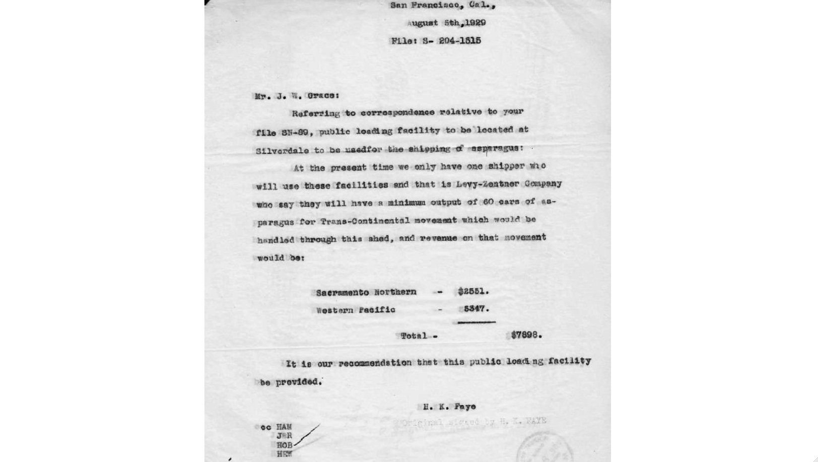
According to the 1957 Western Pacific, WP, Circular No. 167-E, J.H. Green and Joe Ropper shipped their vegetables from this location with a capacity of 4 boxcars, but the original client was Levy-Zentner. Local Greg Merwin remembers the warehouse as a wooden structure with a corrugated galvanized roof.
L224-180-Courtesy BAERA, Western Railway Museum Archives, (Image 38 of 41)
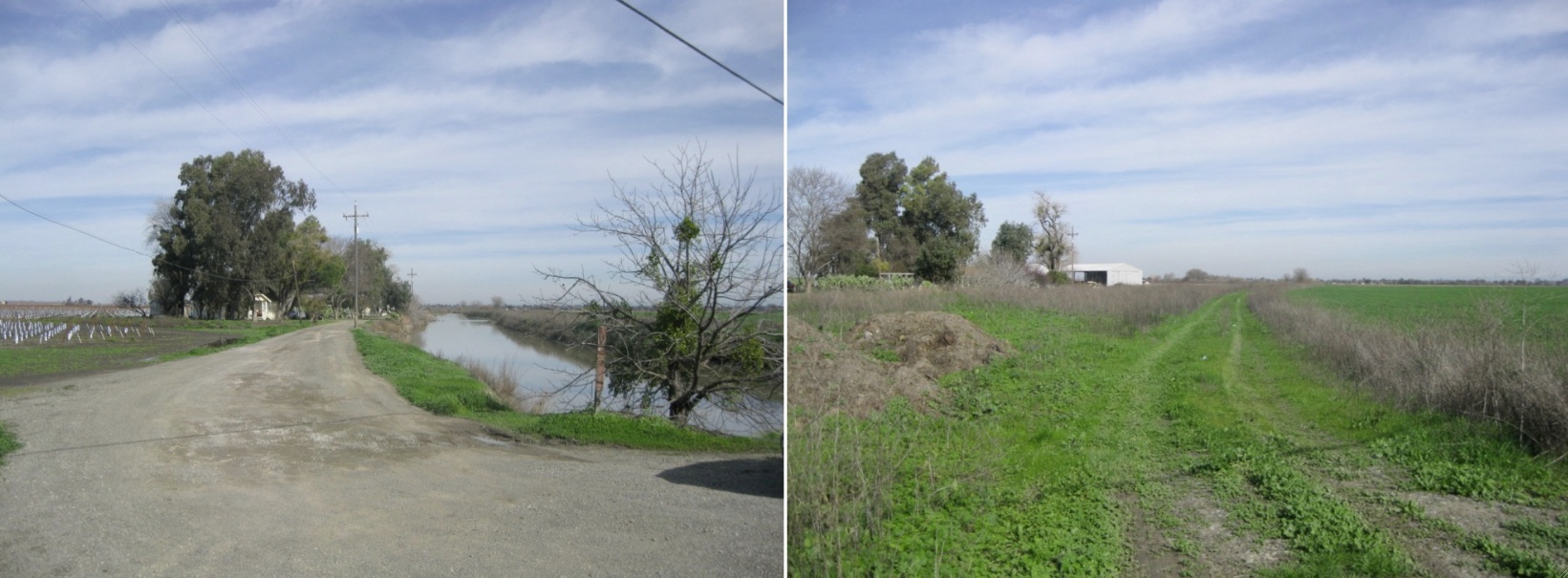
A south view from 2015 of the right-of-way from N. Courtland Rd. shows the small walk bridge over the drainage canal.
L224-185-Stuart Swiedler Photo , (Image 39 of 41)
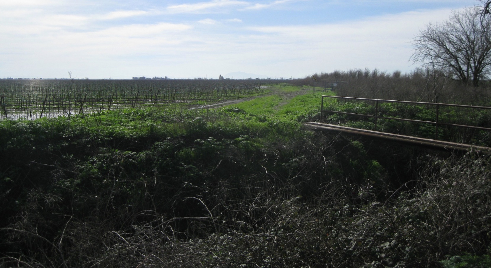
No railway artifacts were noted as documented in this detail of the south view of the Silverdale SN grounds in 2015, with Mount Diablo looming in the background set in a foreground of a vineyard, part of the areas growing wine industry.
L224-190-Stuart Swiedler Photo, (Image 40 of 41)
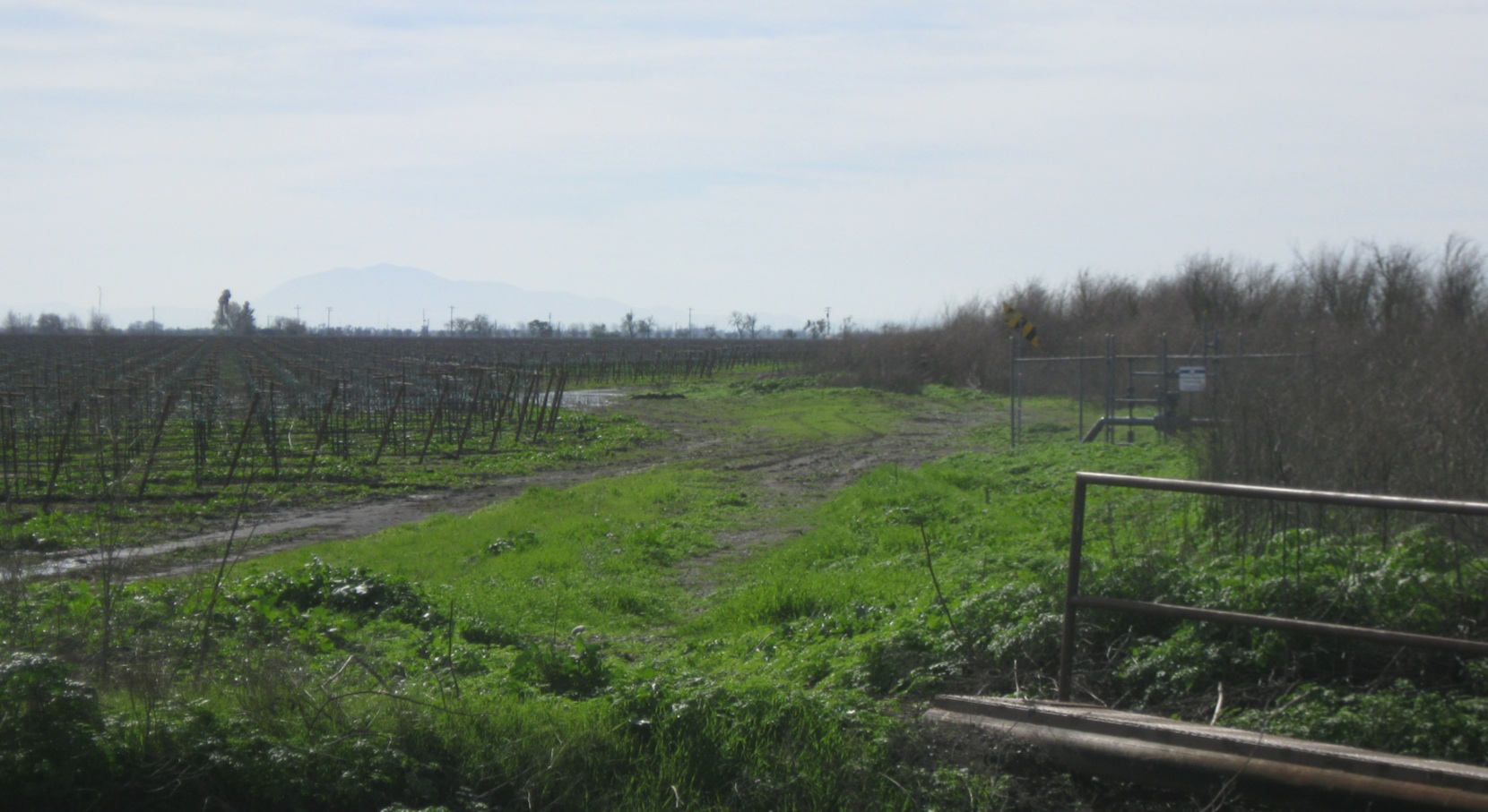
To the north-northeast in 2015, it is not known if the facility to the west of the drainage, left, had any business with the SN. The right-of-way, right, starts its gentle curve to the next destination, Greendale.
L224-195-Stuart Swiedler Photo, (Image 41 of 41)