Has Anyone Seen Galindo?
Dudley Westler took this image on board the Mar. 30, 1952 excursion as it proceeded north to Avon on the SPSRB. The proximity of the train to water on its eastern flank and the position of Mount Diablo is consistent with the train near the SP flag stop at Galindo. Where was Galindo, and was this area incorporated into the Iron Horse Trail (IHT?)
L196-05-Dudley Westler Photo, Courtesy BAERA, Western Railway Museum Archives, 119452sp, (Image 1 of 28)

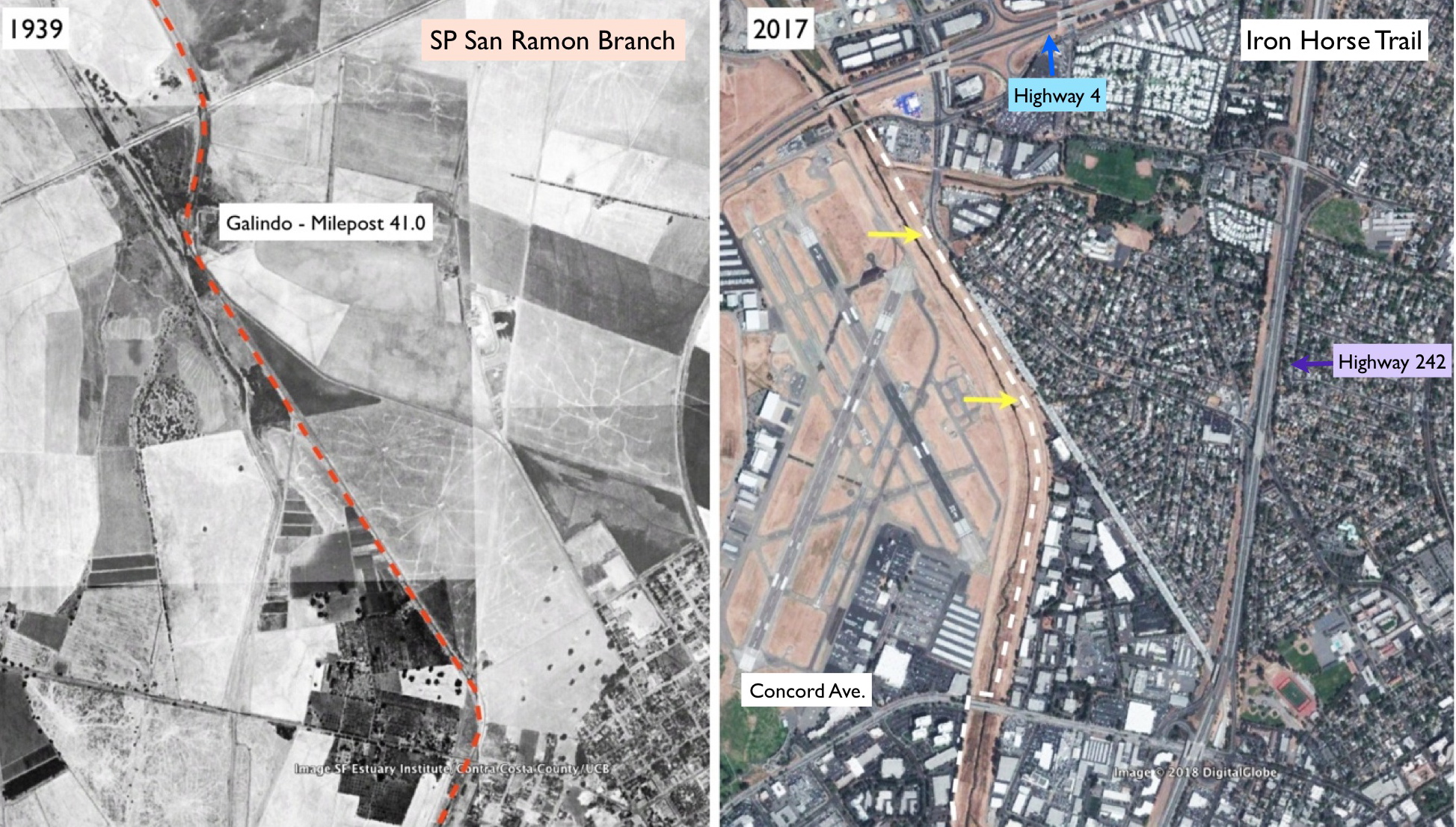
This two-panel figure summarizing the area between Highway 4 and Concord Ave. in Concord provides all the answers, specifically that the IHT was not created from the SPSRB right-of-way (ROW) in this area, although the section south of Galindo marked by the yellow arrows in the right panel shows that the two paths were very close. Now for the evidence to support this conclusion.
L196-11-Courtesy Google Earth, (Image 2 of 28)
First to understand the relationship of Highway 4 to the SRSRB, north of the start of the IHT. This west view from Oct. 7, 1975 shows the construction of the present Highway 4 heading east toward the grade crossing of the SPSRB with the highway’s precursor, the Arnold Industrial Highway. Details to follow.
L196-16-Copyright California Department of Transportation, C5491-6, (Image 3 of 28)
This detail from the west view from Oct. 7, 1975 shows the ROW of the SPSRB. An annotated version follows.
L196-20-Copyright California Department of Transportation, C5491-6, Detail, (Image 4 of 28)
An annotated version west view from Oct. 7, 1975 shows the ROW of the SPSRB from north, blue arrow, to south, green arrow, with the grade crossing marked by the red arrow.
L196-21-Copyright California Department of Transportation, C5491-6, Detail, (Image 5 of 28)
The maximum resolution of the area at the grade crossing, west view from Oct. 7, 1975.
L196-25-Copyright California Department of Transportation, C5491-6, Detail, (Image 6 of 28)
Next an east view from Oct. 7, 1975 of the Arnold Industrial Highway grade crossing, left, the Olivera Rd. grade crossing, right, and the outdoor movie theater providing a key marker for this area. Today, Highway 4 passes over this area.
L196-30-Copyright California Department of Transportation, C5491-9 , (Image 7 of 28)
A detail of the east view from Oct. 7, 1975 of the two grade crossings ...
L196-35-Copyright California Department of Transportation, C5491-9, Detail, (Image 8 of 28)
... and further south the culverted creek that empties into the Walnut Creek.
L196-40-Copyright California Department of Transportation, C5491-9, Detail, (Image 9 of 28)
Back to a slightly earlier east view from Oct. 29, 1974 to look at the area near the creek that was culverted by the 1970s.
L196-45-Copyright California Department of Transportation, C5025-3 , (Image 10 of 28)
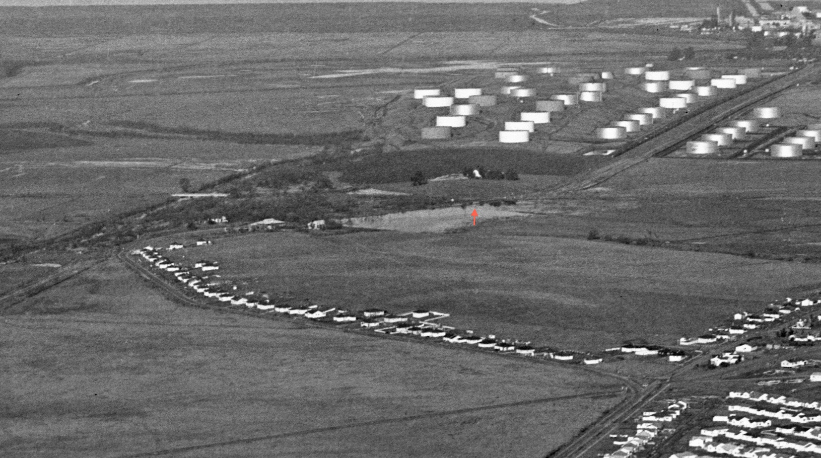
According to the Board of Equalization (BOE) figure in Irma Dotson’ book, there were several important SP-related landmarks at the Galindo flag stop, starting with a 64-foot trestle, a pump house, a reservoir, and heading south, a 328-foot spur, all gone by the time this east view from Oct. 29, 1974 was taken. The grade crossing for Solano Way is not obvious from this view.
L196-50-Copyright California Department of Transportation, C5025-3, Detail, (Image 11 of 28)
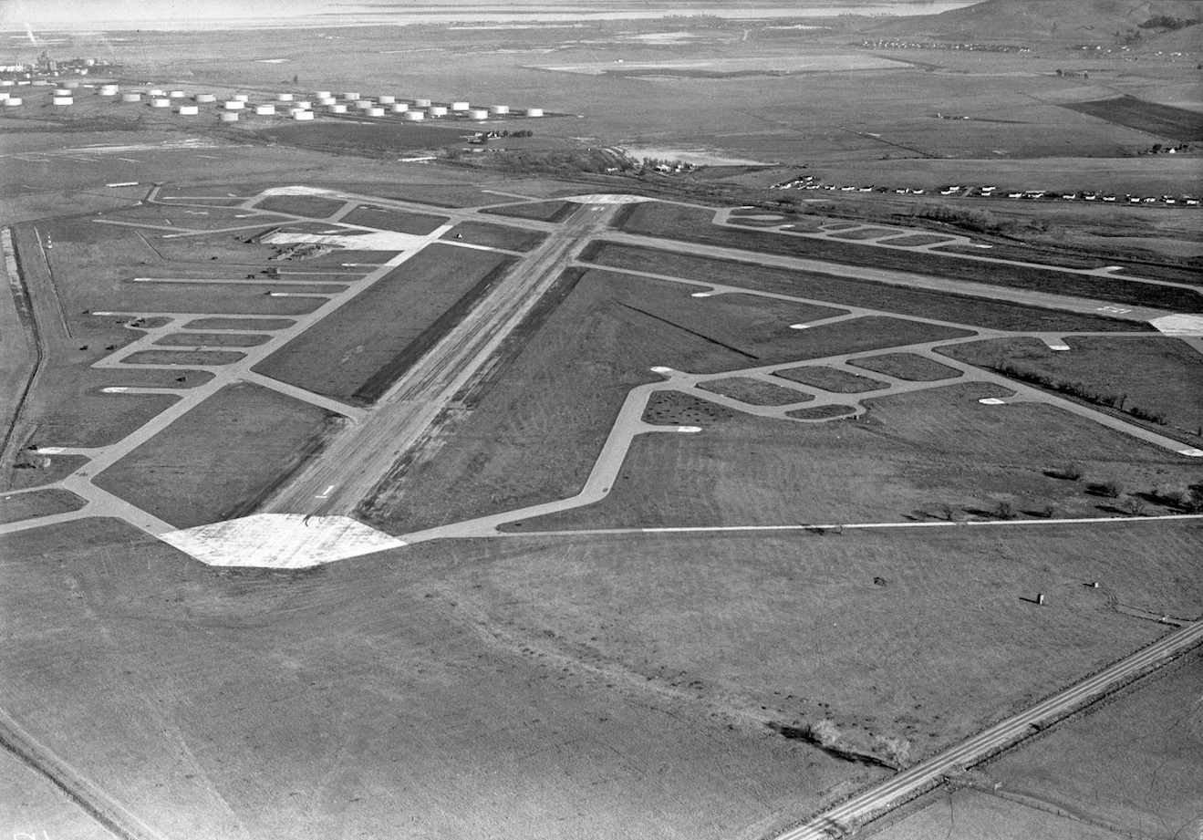
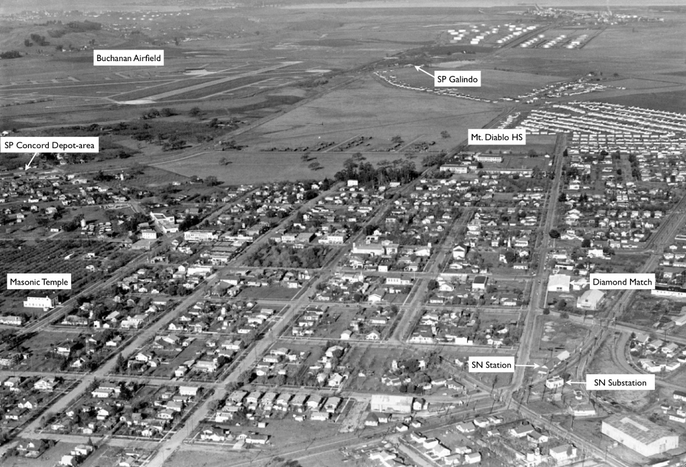
The location of important SP-related landmarks begins with this circa 1946 northeast oblique taken over Buchanan Airfield, now the Concord Airport.
L196-55-Sappers Collection, Courtesy BAERA, Western Railway Museum Archives, 81978cv , (Image 12 of 28)
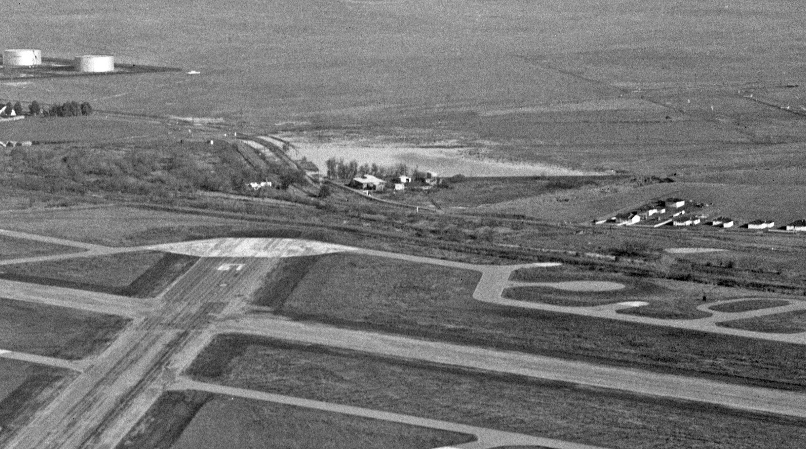
This detail is from the circa 1946 northeast view of Galindo. The structure running in front of the larger building corresponds to the location of the spur in the BOE figure. The existence of a trestle that should be located to the north or left of the buildings is equivocal.
L196-60-Sappers Collection, Courtesy BAERA, Western Railway Museum Archives, 81978cv, Detail , (Image 13 of 28)
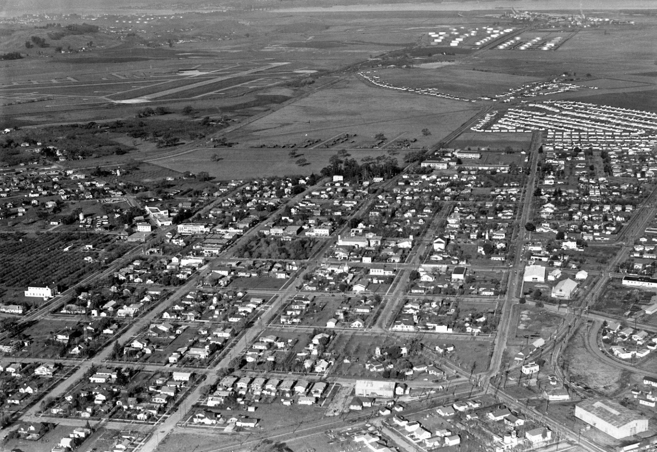
A second distant view of Galindo may be seen on this north-facing oblique circa 1946 over central Concord. Go to the next image for an annotated version.
L196-65-Sappers, Collection, Courtesy BAERA, Western Railway Museum Archives, 81980cv, (Image 14 of 28)
An annotated version of the north-facing oblique circa 1946 showing central Concord. Unfortunately, the Victorian ranch home built in 1856 for East Bay pioneer Don Francisco Galindo and his wife, Maria Dolores Manuela Pacheco Galindo is just off the left edge of this image.
L196-66-Sappers, Collection, Courtesy BAERA, Western Railway Museum Archives, 81980cv, (Image 15 of 28)
A detail of the SP Galindo flag stop area from the north-facing oblique circa 1946 is shown. Is that or is that not a trestle marked by the red arrow? It is in a position consistent with the BOE map. No additional history or close-up images of this area showing a trestle have been found.
L196-70-Sappers, Collection, Courtesy BAERA, Western Railway Museum Archives, 81980cv, Detail, (Image 16 of 28)
Based on this detail from a northeast view from Dec. 14, 1970, the trestle has been filled in or bypassed, and the position of the grade crossing can be appreciated.
L196-75-Copyright California Department of Transportation, C3285-7, Detail , (Image 17 of 28)
A annotated version of the northeast view from Dec. 14, 1970 shows the that the trestle has been filled in or bypassed, red arrow, and the position of the grade crossing, blue arrow.
L196-76-Copyright California Department of Transportation, C3285-7, Detail , (Image 18 of 28)
From a southern view, the same area from Dec. 14, 1970.
L196-80-Copyright California Department of Transportation, C3285-16, (Image 19 of 28)
A detail of this southern view from Dec. 14, 1970 shows the railway crossing Solano Way definitively, blue arrow.
L196-85-Copyright California Department of Transportation, C3285-16, Detail, (Image 20 of 28)
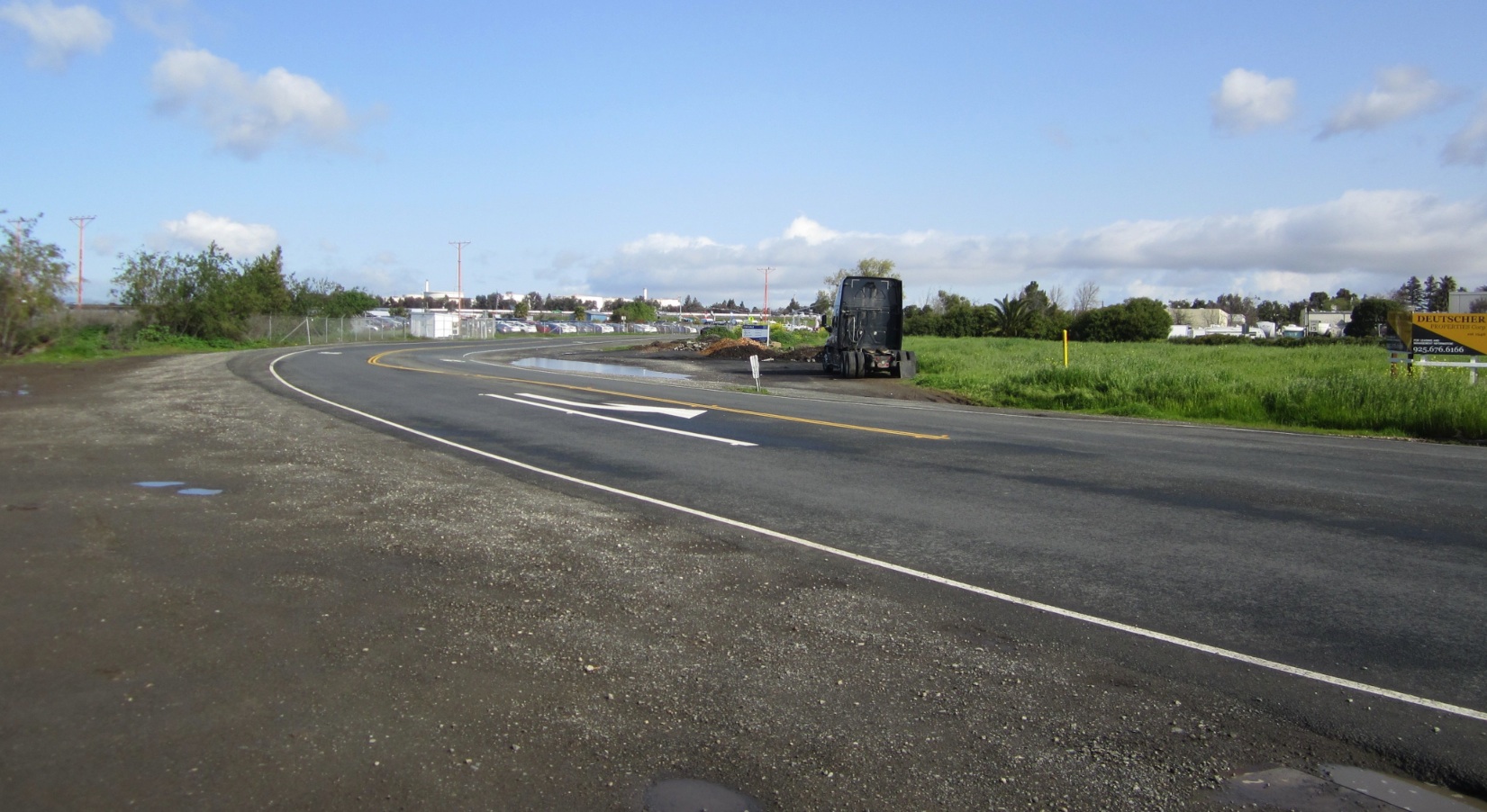
A north view from 2019 at the site of the Solano Way grade crossing. At this date there is no evidence of the crossing in the asphalt.
L196-90-Stuart Swiedler Photo, (Image 21 of 28)
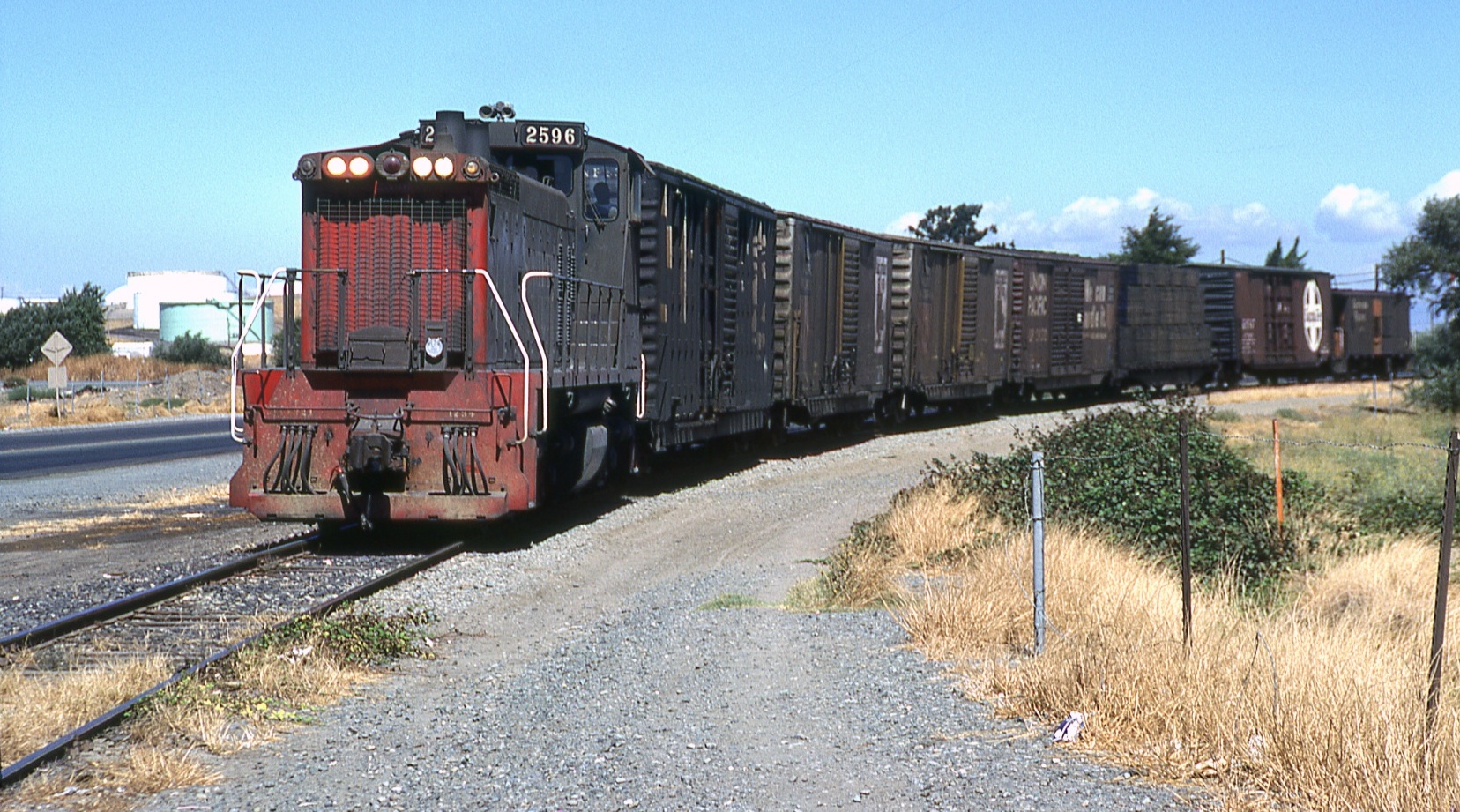
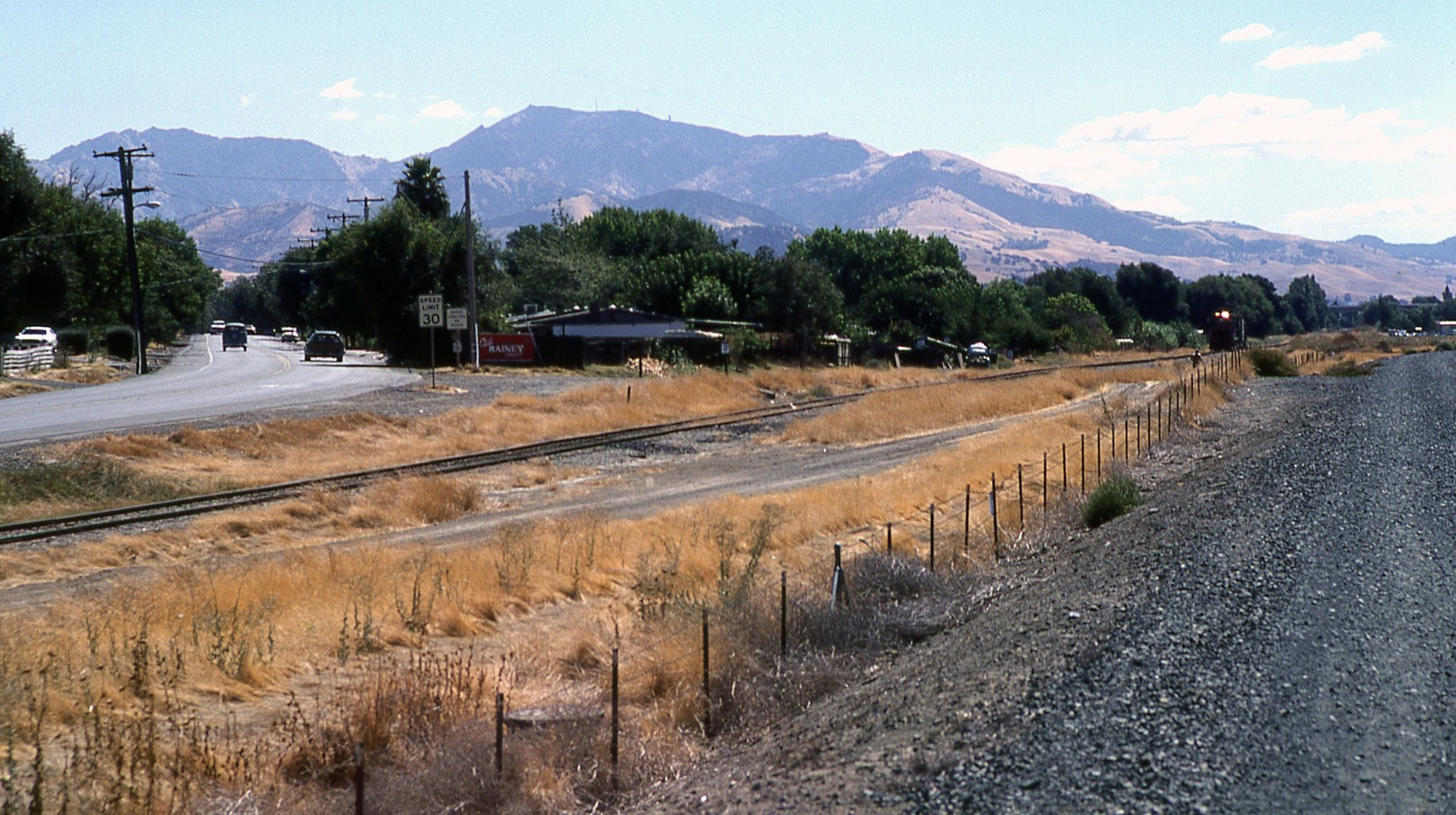
SP 2596 continues south from Avon on Sept. 7, 1978 in this north view, negotiating the curve with Solano Way.
L196-95-Wayne Monger Photo, Courtesy Wayne Monger, (Image 22 of 28)
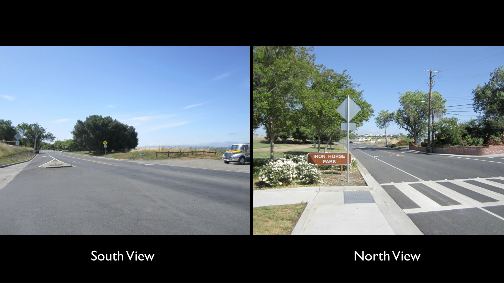
The south view from 2017 shows the fence marking where the SPSRB completed the grade crossing, today into Iron Horse Park.
L196-100-Stuart Swiedler Photos, (Image 23 of 28)
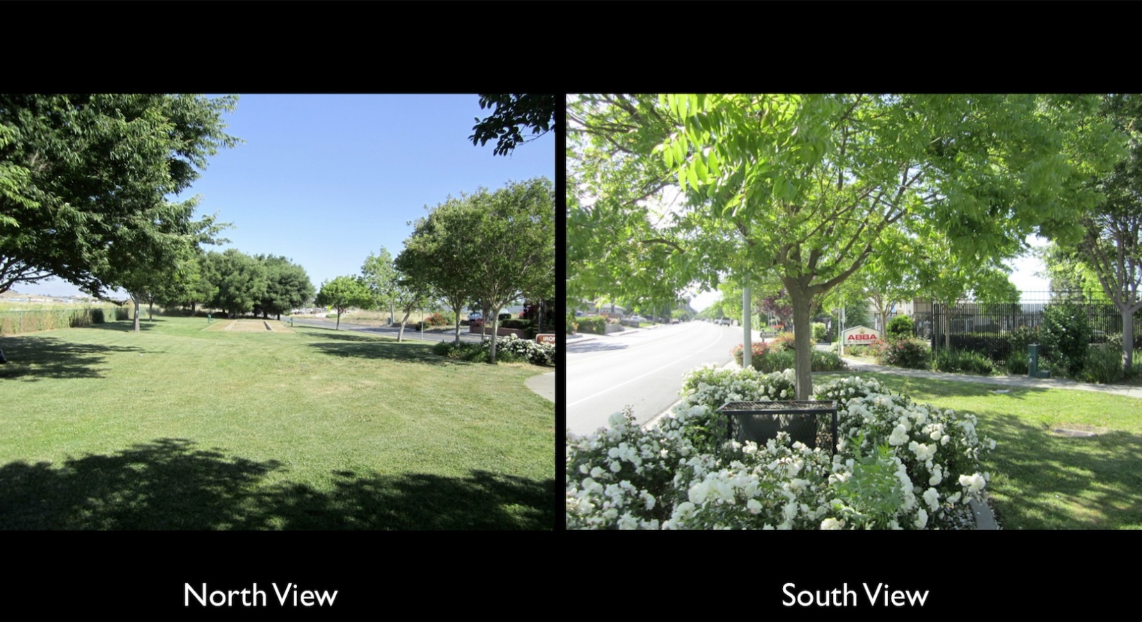
Within the park in 2017, the ROW has been replaced in part by a bocce court as shown in the north view. To the south, the ROW was purchased by a self-storage company soon after its abandonment, these units continuing where the track once existed all the way to Concord Ave.
L196-105-Stuart Swiedler Photos, (Image 24 of 28)
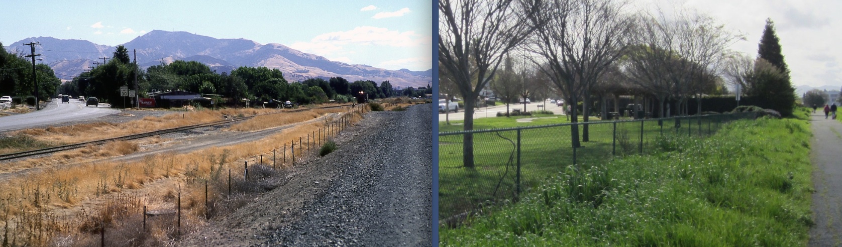
Wayne Monger’s south view from Sept. 14, 1978 documents definitively that the future IHT was not placed on the SPSRB ROW in the area covered in this presentation, although they run side-by-side for a short distance. The IHT at this point was an unnamed gravel path separated from the ROW by a fence, the product of the Army Corp of Engineers widening of the Walnut Creek beginning in 1963.
L196-110-Wayne Monger Photo, Courtesy Wayne Monger, (Image 25 of 28)
Side-by-side views comparing south of the Solano Way grade crossing pre-IHT on Sept. 14, 1978, left, with post-SPSRB in 2017, right.
L196-115-Wayne Monger Photo, Courtesy Wayne Monger, and Stuart Swiedler Photo, (Image 26 of 28)
This north view from Mar. 3, 1969 shows the railroad ROW from the position of Highway 4, blue arrow, until Concord Ave., red arrow. As verified in this update, the IHT was built along the reworked Walnut Creek and has nothing to do with the SPSRB between these two points. Next time on this subject, the southern portion of Concord.
L196-120-Copyright California Department of Transportation, 15606-36 , (Image 27 of 28)
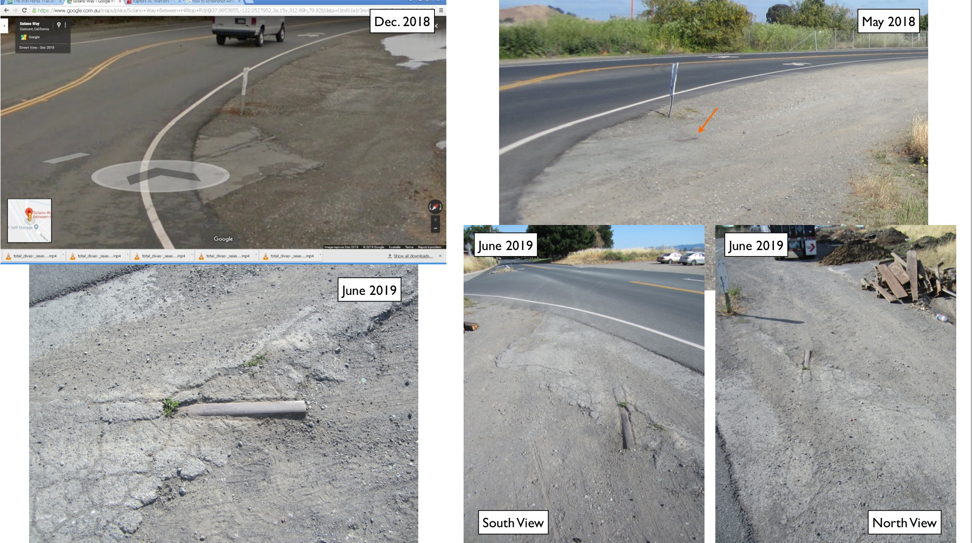
Credit to Jack Taylor for using a Dec. 2018 Google image to spot a small section of rail just to the north of where the Solano Way grade crossing began. It was there in May 2018, but missed. A return trip with a broom in June 2019 properly documented what may be the last piece of surviving rail excluding Avon and Radum from the SPSRB where the track was expected to have been removed.
L196-125-Jack Taylor Google Image, Stuart Swiedler Photos, (Image 28 of 28)