The Merge at the Curve
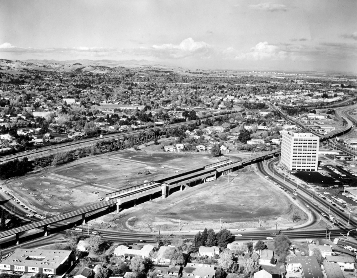
Its 1972, and the finishing touches to the Walnut Creek BART station are in progress in this east view. One Ygnacio Center, a high-rise at 1990 N. California Blvd. built in 1971, stands out prominently. This presentation will focus on the joining of the BART right-of-way to that of the SN.
L77-05-Courtesy Planning Division, City of Walnut Creek , (Image 1 of 23)

This north view through Walnut Creek on April 4, 1953 shows the core of the city delineated by the SN right-of-way as it crosses Alpine Rd. in the lower left corner, and wraps past Walden Rd. in the upper right corner. No freeway, BART or N. California Blvd. as yet.
L77-10-Copyright California Department of Transportation, 3299-1 , (Image 2 of 23)
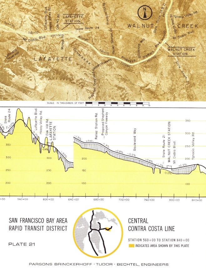
Engineering reports as late as 1961 had BART taking over the SN right-of-way close to the Lafayette shelter near Moraga Blvd at the Lafayette loop, and following the SN route through to Concord. Full Ref. - Engineering Report to SF Bay Area Rapid Transit District, June 1961, prepared by Parsons, Brinckerhoff, Tudor, and Bechtel.
L77-15-SFBART Document, Plate 21, Courtesy BAERA, W Railway Museum Archives , (Image 3 of 23)
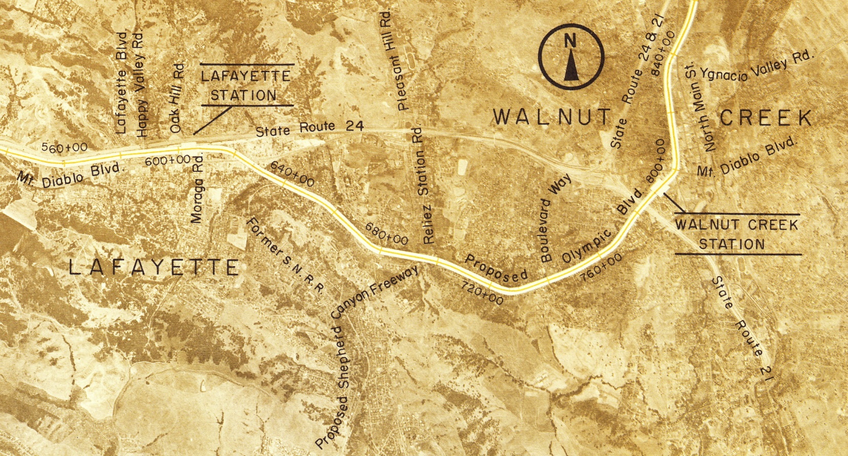
This plan was never adopted, of course, as BART’s eventual path between Highway 24 insured the shortest distance to Oakland or San Francisco. Detail from L77-15.
L77-20-SFBART Document, Detail Plate 21, Courtesy BAERA, W Railway Museum Archives , (Image 4 of 23)
By 1960, the City of Walnut Creek had already renamed Oakland Boulevard past the now reconfigured Ygnacio Valley intersection as N. California Blvd. with a vision to the south to extend the latter to Mt. Diablo Blvd. after the anticipated abandonment of the SN.
L77-25-Courtesy Planning Division, City of Walnut Creek , (Image 5 of 23)
The path of the Walnut Creek section of the I-680 freeway is taking shape in this northeast view from Feb. 13, 1958. For orientation, Mount Diablo Blvd. can be seen in the bottom right corner. The resulting significant loss of homes may be appreciated relative to L77-10 from 1953.
L77-30-Copyright California Department of Transportation, 5845-4 , (Image 6 of 23)
A detail of L77-30 marks points along today’s N. California Blvd. as follows: at the SN Walnut Creek depot, then Walnut Avenue, now Civic Dr. adjacent to the Lesher Center, red arrow; at the SN-Ygnacio Valley Road grade crossing, green arrow; at the SN-Main St. grade crossing, blue arrow.
L77-35-Copyright California Department of Transportation, 5845-4 Detail , (Image 7 of 23)
This comparison shows the approach of the SN right-of-way to the N. Main St. crossing in the left panel from Mar. 3, 1952 versus that for BART from Nov 27, 1968 in the right panel. Pringle Ave. marks the area for the SN-BART merge. Left, CALTRANS file 2481; Right, Greenwood and Associates Photo, Panel 27 of 51.
L77-40-Copyright Ca. Dept. of Transportation and Courtesy Planning Division, City of Walnut Creek, (Image 8 of 23)
The key section of the SN-BART union has changed much from the north view from Feb. 13, 1958. Pringle Ave, red arrow, extends to Main St. and now has a curve, the south portion of N. Short Street, black arrow, has been incorporated into N. California Boulevard. The north portion, purple arrow, survives, today as just Short St.
L77-45-Copyright California Department of Transportation, 5845-9 Detail , (Image 9 of 23)
Detail of the curve at the merge in a south view from Jan. 12, 1960. The portion of freeway south of N. Main Street is just months away from opening.
L77-50-Copyright California Department of Transportation, 7226-3 Detail , (Image 10 of 23)
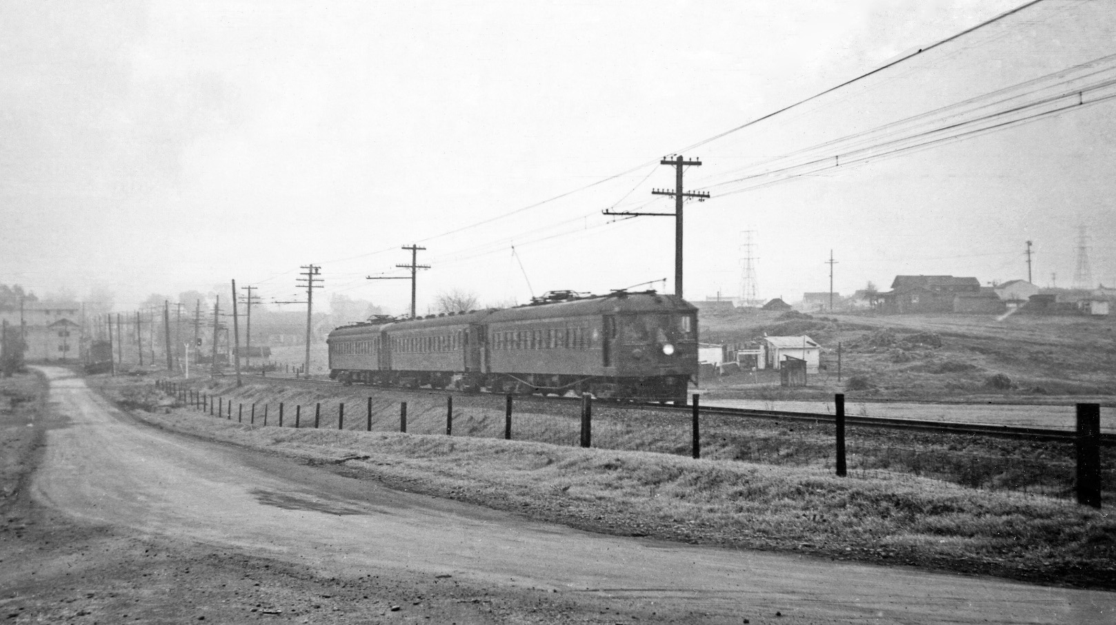
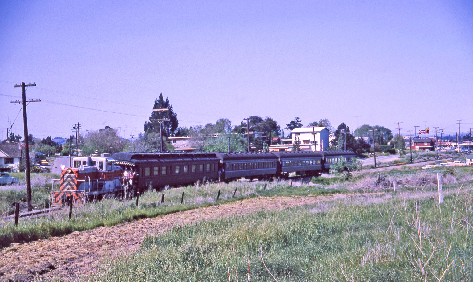
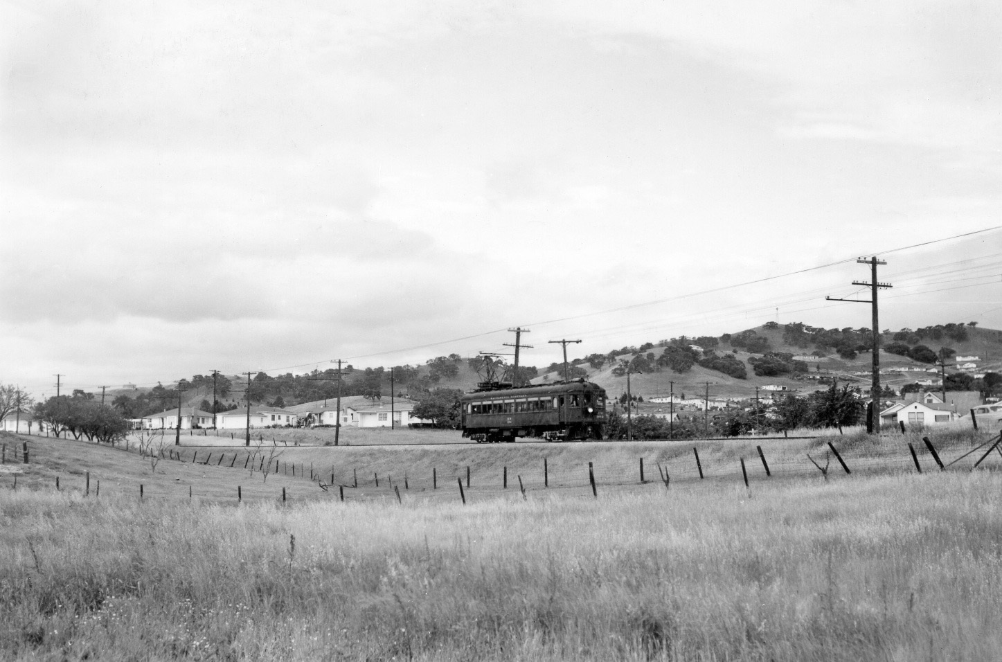
This undated, south view of a three-car train is the only image identified from the passenger era that documented the section of track between Davis St. (now Ygnacio Valley Rd.) grade crossing and N. Main Street.
L77-55-Collection of EL Estacaille, Courtesy BAERA, Western Railway Museum Archives, 72396sn, (Image 11 of 23)
This north view aerial detail documents two important markers for lining up images from the freight era on the curve. The black arrow identifies a line of trees, and the yellow arrow the rising shoulder to the east, or right, of the right-of-way.
L77-60-Copyright California Department of Transportation 5845-4 Detail , (Image 12 of 23)
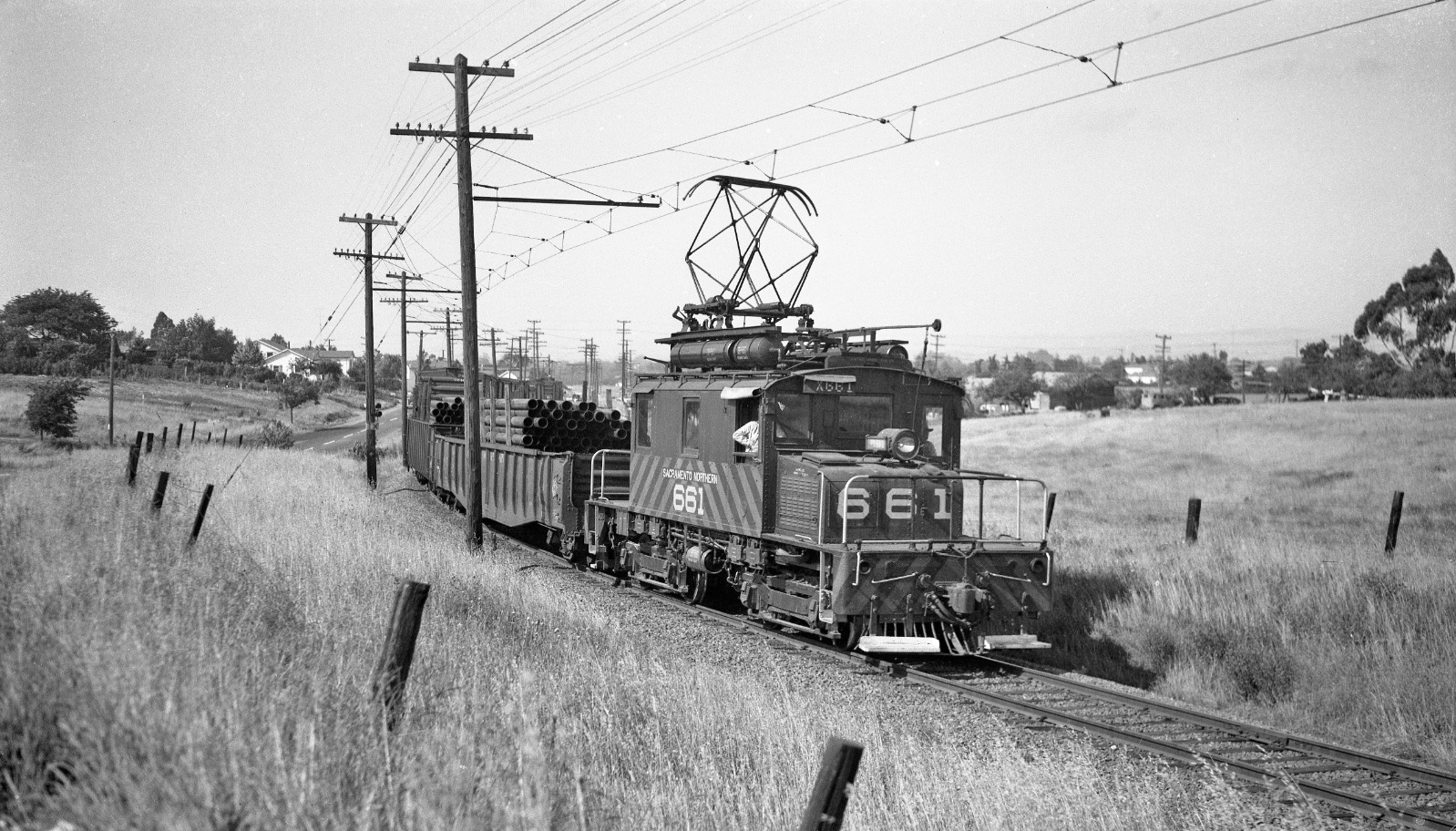
Now with ground-based images from the freight era, SN 661 rounds the curve with pipe heading toward the Walnut Creek depot circa 1950.
L77-65-Tom Gray Photo, Courtesy Tom Gray , (Image 13 of 23)
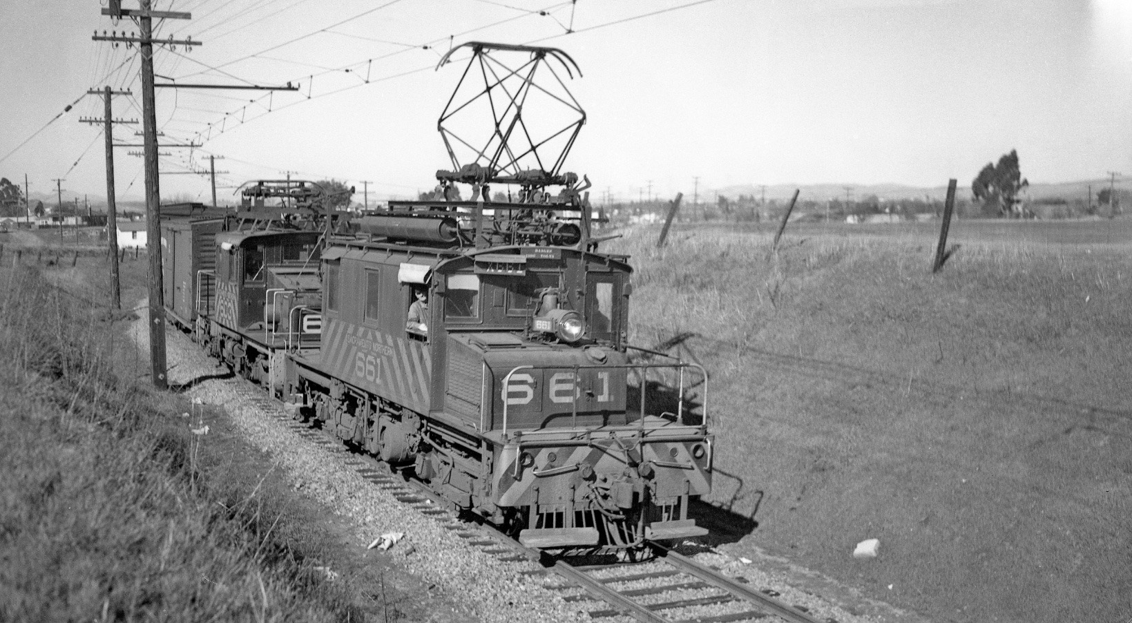
The raised eastern wall beside SN 661 and 603 in this north view from Feb. 11, 1950 tells us this freight is relatively closer to the Walnut Creek depot relative to the train in L77-65.
L77-70-Tom Gray Photo, Courtesy Tom Gray , (Image 14 of 23)
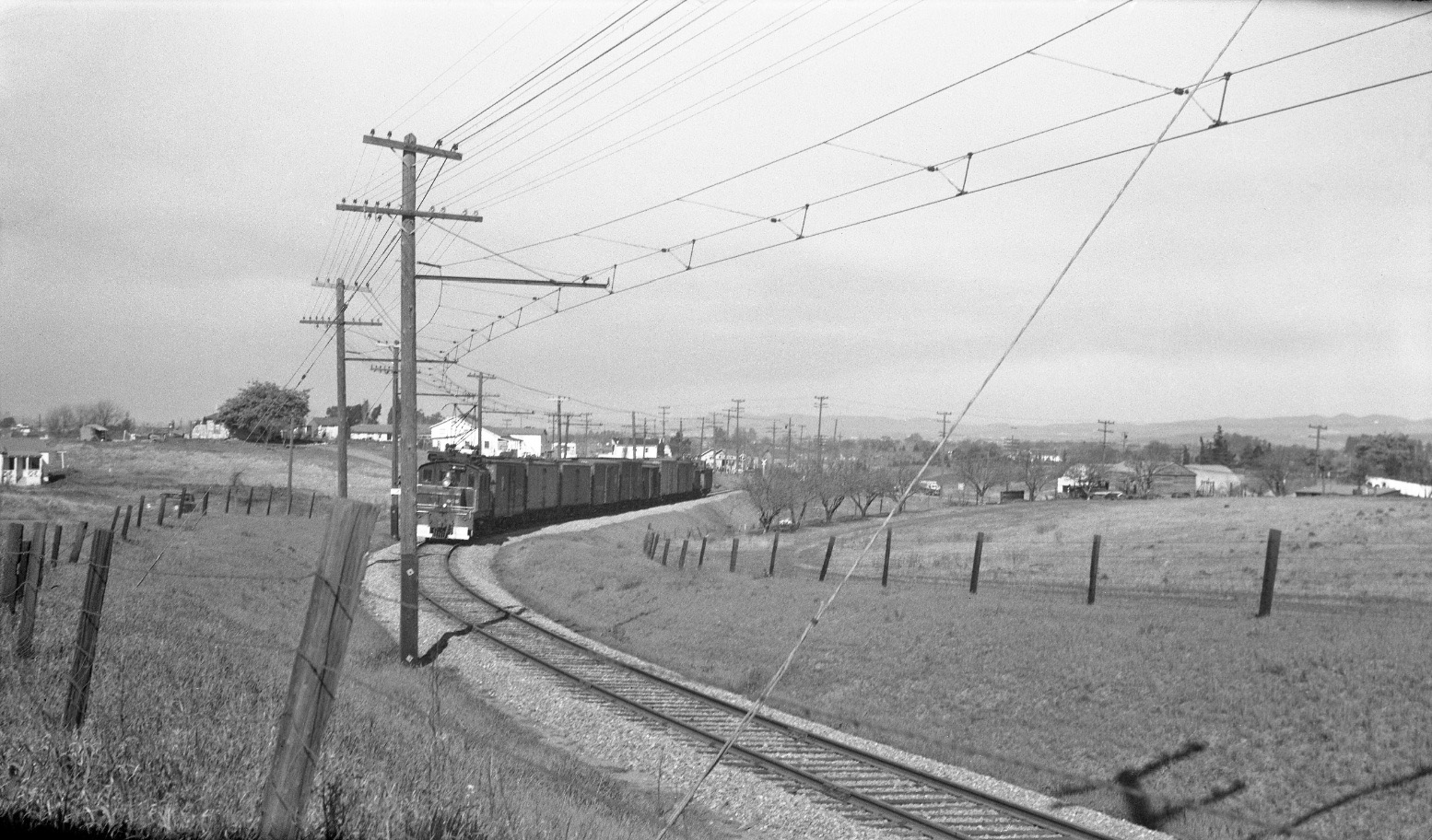
Moving further northeast from the previous two images, Tom Buckingham took the defining image for the curve in this late 1940s northeast image with SN 605. Note the row of trees and the crossbuck in the background marking the N. Main Street crossing.
L77-75 Tom Buckingham Photo, Courtesy BAERA, Western Railway Museum Archives, 54298sn , (Image 15 of 23)
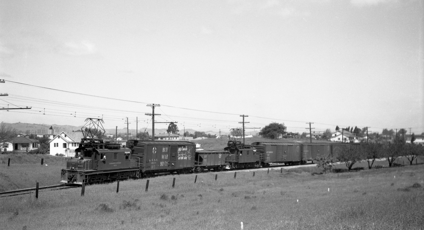
It is SN 605 again by the row of trees, but this time we know for sure it is June 1947 in this west view. This image provides a rare glimpse of the homes to the west of the curve in the 1940s. The “Buy War Bonds” on the AT&SF boxcar adds a nice touch.
L77-80-Arthur Lloyd Photo, Courtesy Arthur Lloyd, (Image 16 of 23)
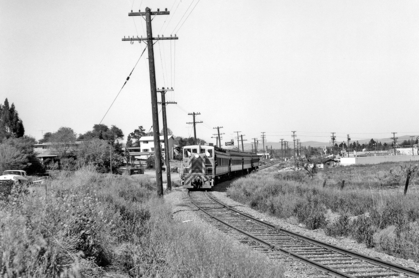
Now Apr. 12, 1964, and a more northerly view relative to L77-80, the row of trees is reduced to a single survivor during an “End of an Era” excursion with SN 143 as the SN right-of-way is officially handed over to BART. So far this update has ignored Stan’s Brick House, the red building in the background, but not for long.
L77-85-Victor B Dubrutz Photo, Courtesy BAERA, Western Railway Museum Archives, 71841sn, (Image 17 of 23)
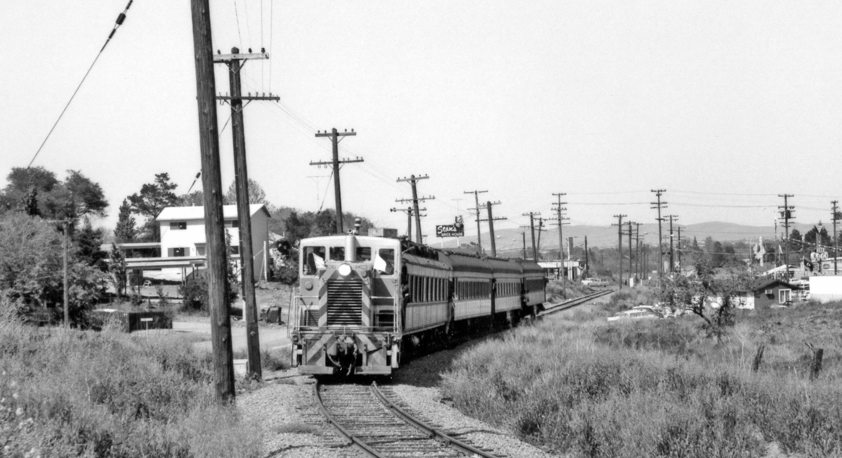
Another view of the surviving tree, the N. Main St. crossing and Stan’s during an “End of an Era” excursion with SN 143, Apr. 12, 1964.
L77-90-Courtesy BAERA, Western Railway Museum Archives, 71857sn, (Image 18 of 23)
A detail from L77-90 as a reminder that Stan’s Brick House and the N. Main St. crossing will be featured next in these updates.
L77-95-Courtesy BAERA, Western Railway Museum Archives, 71857sn Detail, (Image 19 of 23)
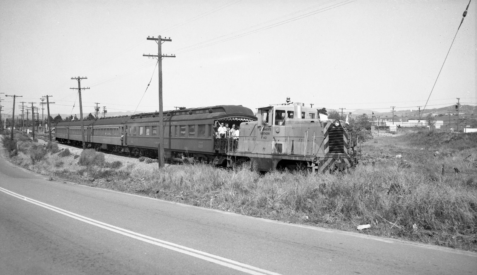
Another from the Apr. 12, 1964 “End of an Era” excursion with SN 143, views more to the east are highlighted with Tom Gray expertly capturing the N. Main St. crossbuck in the background of this northeast view.
L77-100-Tom Gray Photo, Courtesy Tom Gray , (Image 20 of 23)
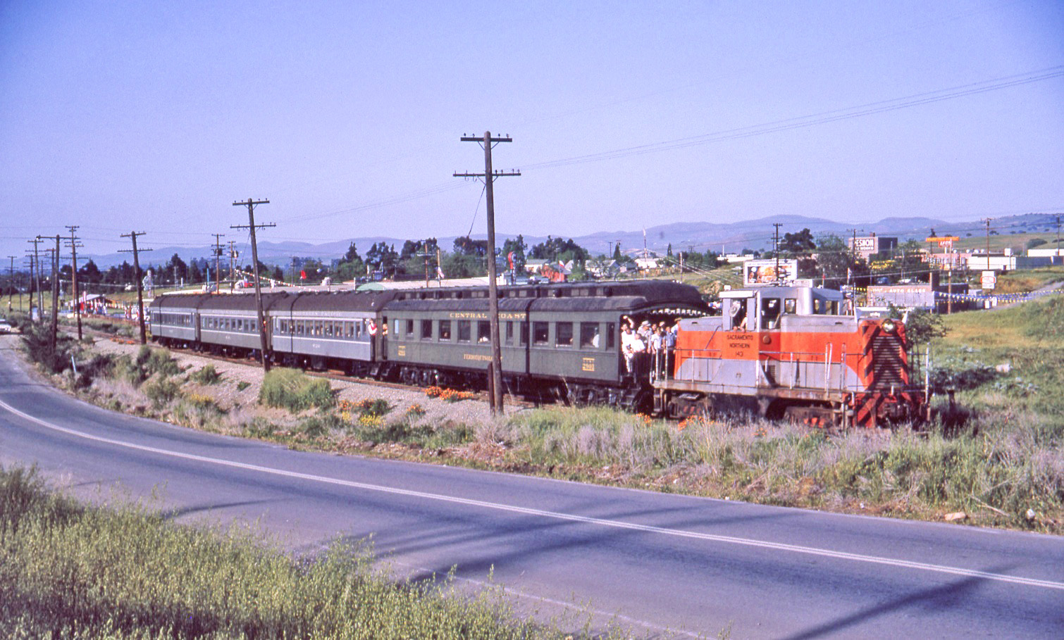
An image almost identical in position from L77-100, this northeast view was taken from a slightly higher vantage point providing additional details toward N. Main St. Here the rail designations on the one Central Coast and three Southern Pacific passenger cars are very prominent.
L77-105-Victor B Dubrutz Photo, Courtesy BAERA, Western Railway Museum Archives, 71836sn, (Image 21 of 23)
In addition to the row of trees being a helpful guide for location of this area, the contour of the Lafayette hills to the west is also very distinctive as seen in this west view of MW 302 as it nears Main St. circa 1950.
L77-110-WS Billings Collection, Courtesy BAERA, Western Railway Museum Archives, 70093sn, (Image 22 of 23)
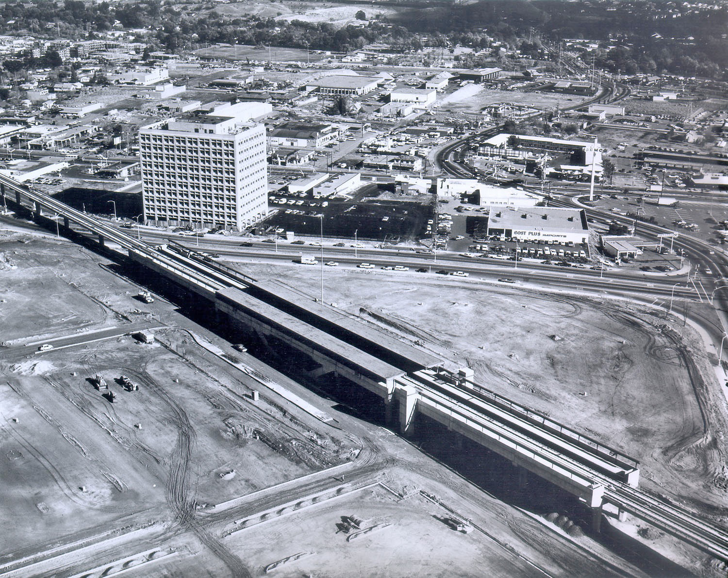
Now full circle to the start, complementing L77-05, a circa 1972 north view of the final conversion of the curve where today BART meets N. California Blvd. near Pringle Ave., without a single trace of the SN’s former presence.
L77-115-BART Photo 30, Courtesy John Harder, (Image 23 of 23)