The Orchards, the Tower, and Start of Olympic Boulevard

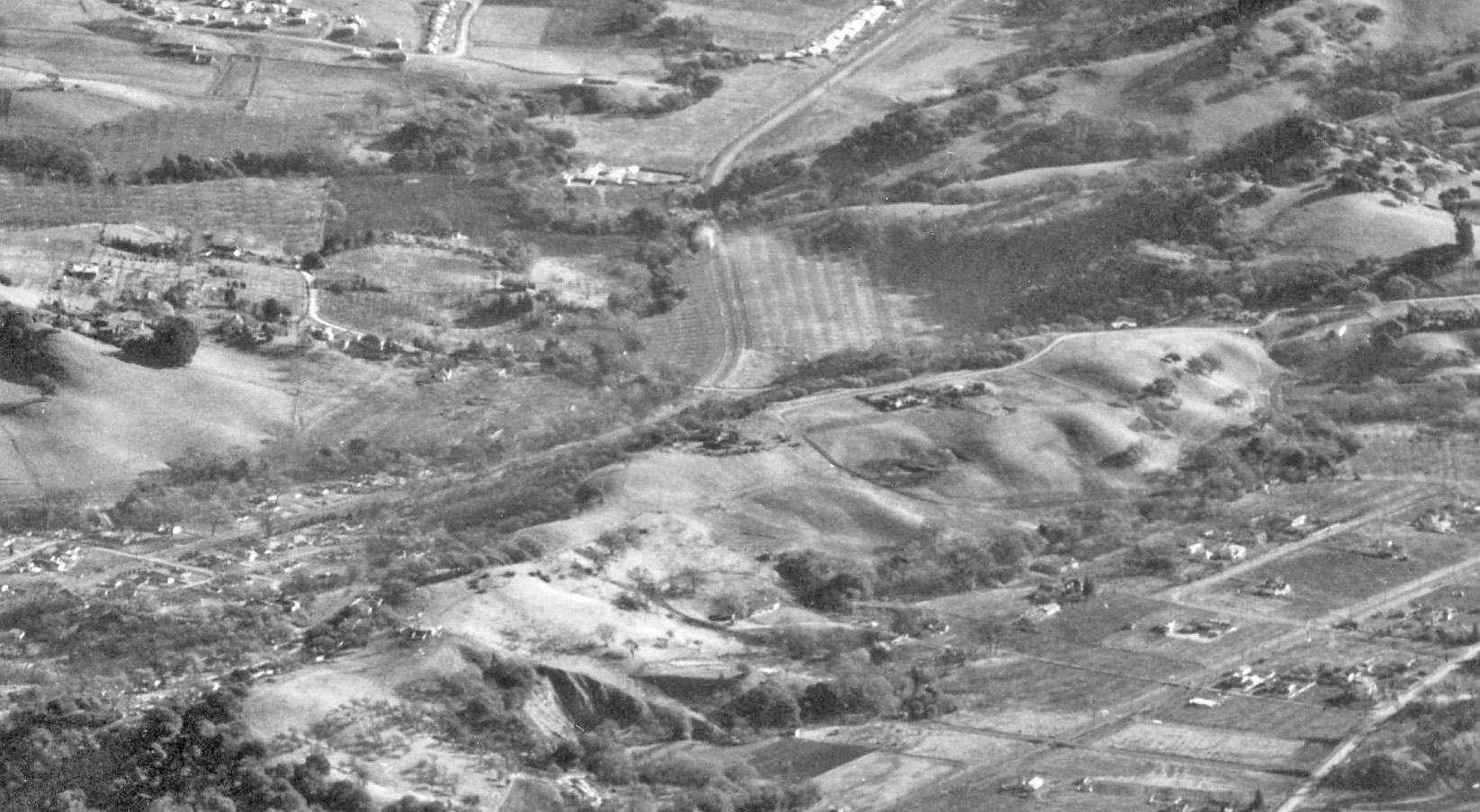
The southeast section of Lafayette of interest begins east of the SN grade crossing at Reliz Station Rd., one of the last portions along the railway to be developed. Orchards persisted until the final east end of the Lafayette-Moraga Trail was completed decades after SN abandonment. East view, Dec. 31, 1946.
L85-05-RL Copeland Photo, Courtesy Contra Costa County Historical Society, 7348 Detail, (Image 1 of 12)

A yellow arrow is added to L-85-05 demarcating the section and direction of view of the images emphasized in this review. East view, Dec. 31, 1946.
L85-06-RL Copeland Photo, Courtesy Contra Costa County Historical Society, 7348 Detail, (Image 2 of 12)

Between 1940 and 1958, orchards persisted south of Las Trampas Creek, white arrows, until Andraesen Dr. was added sometime after WWII. The yellow circle marks the Reliez Station Rd. grade crossing, the yellow arrow marks the SN right-of-way, and the orange arrow the electrical transmission tower to be discussed next.
L85-10-Courtesy Contra Costa County Historical Society, 13560 and 13563 Details, (Image 3 of 12)

The electrical transmission towers of the Great Western Power Company remain intimately involved with the SN, as a source of power, the shared set of investors and directors, and their place as invaluable landmarks in image location. The tower at Olympic Oaks Dr., southeast view, is a prime example of the latter.
L85-15-Stuart Swiedler Photo , (Image 4 of 12)

Olympic Blvd. is just two lanes at its western end, here an east view showing where the Lafayette-Moraga Trail deviates from the SN right-of-way. Much is obscured by trees, but the tower provides a key landmark for the next image.
L85-20-Stuart Swiedler Photo, (Image 5 of 12)

Compare the last image with this 1925 east view of the right-of-way, free of roads and trees, as a three-car San Francisco-Sacramento Short Line train sits on a track in the empty field, creek to the left, oaks to the right hillside, and Mount Diablo visible in the distance.
L85-25-Courtesy John Harder Collection, (Image 6 of 12)

Stepping back in space to the west to the grade crossing, and ahead in time to 1941, the area adjacent to the second generation shelter marked as “Raliez” now shows trees on either side of SN 1014, seen here in an east view.
L85-30-Vernon Sappers Collection, Courtesy BAERA, Western Railway Museum Archives 70091sn, (Image 7 of 12)

Some further evidence of the orchards from an east view from July 27, 1940, as a passenger dismounts from the rear of SN 1017 that sits west of the grade crossing, allowing a truck to pass but obscuring a view of the small shelter.
L85-35-Vernon Sappers Collection, Courtesy BAERA, Western Railway Museum Archives, 51852sn , (Image 8 of 12)

Now to a late 1940s excursion, north view, as MW 302 rounds the curve along the north orchard ...
L85-40-Vernon Sappers Collection, Courtesy BAERA, Western Railway Museum Archives 70090sn, (Image 9 of 12)

... as it comes to a stop at the Reliez Station Rd. grade crossing, a late 1940s excursion, north view. Great view through the orchard all the way to the present location of Pleasant Hill Rd. intersection.
L85-45-Addison Laflin Photo, Courtesy BAERA, Western Railway Museum Archives, 70089sn, (Image 10 of 12)

The freights had their opportunity to traverse the orchards and transmission tower, here in a east view of SN 661 and second motor from Feb. 11, 1950.
L85-50-Alvon Thoman Photo, Courtesy BAERA, Western Railway Museum Archives, 54185sn, (Image 11 of 12)

One final freight led by SN 654, northeast view from 1956, approaching the grade crossing that today marks the western end of Olympic Boulevard.
L85-55-Dave Gumz Photo, Courtesy BAERA, Western Railway Museum Archives 55847.10sn, (Image 12 of 12)