The Port Chicago Highway Crossing

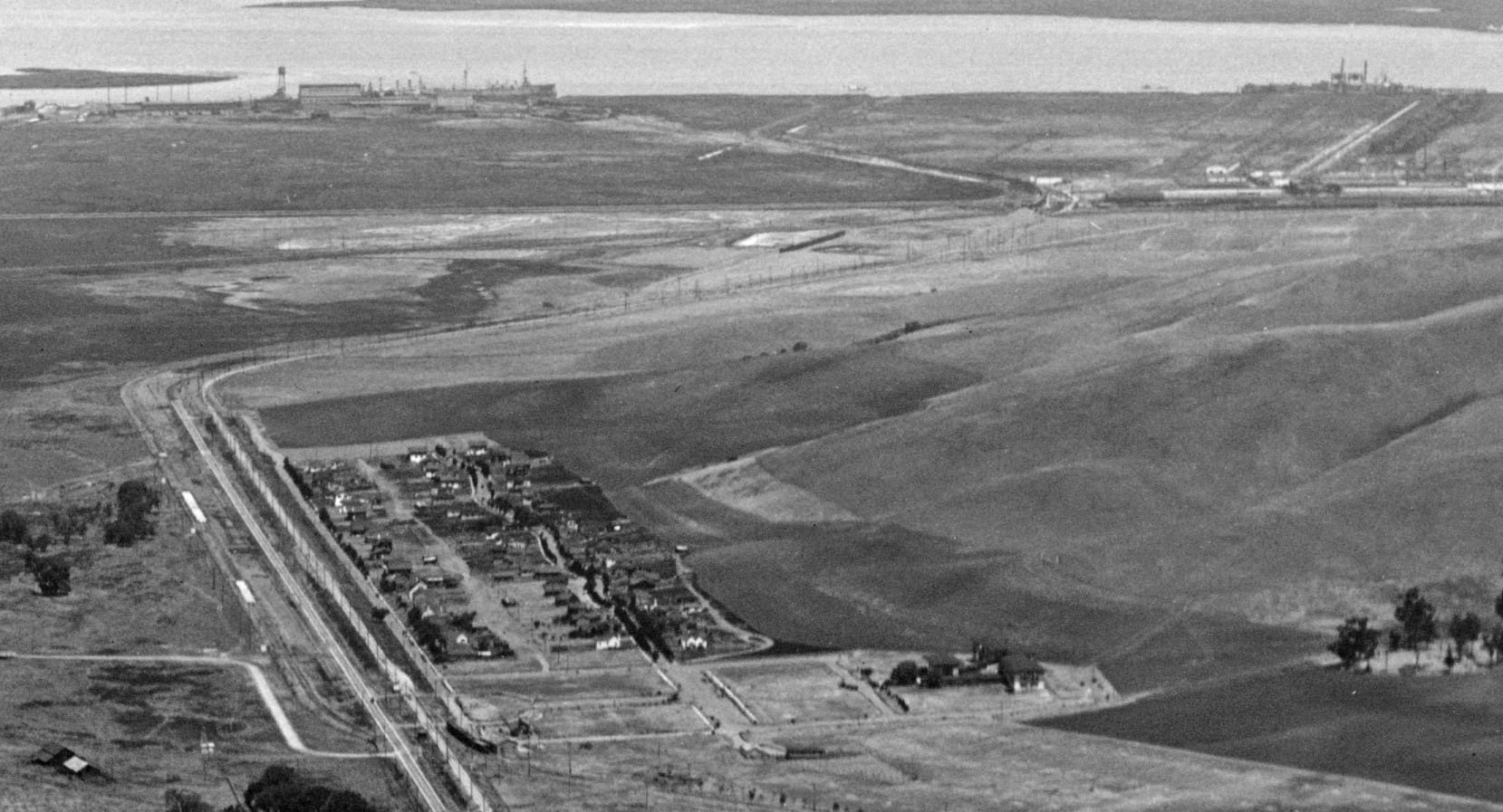
Once north of Clyde, the SN made a sharp right to the east as seen in this circa 1929 north view aerial accompanied by the county road to be later named the Port Chicago Highway and the Bay Point and Clayton RR to the west, respectively, in that order. Ref: API 563_6_BOX 59113.
L141-05-George Russell Photo, Courtesy California State Lands Commission , (Image 1 of 14)

To join the Santa Fe, Southern Pacific and Bay Point and Clayton Railroads in Bay Point, the SN had one major crossing, that with the future Port Chicago Highway seen in this northeast view circa 1929. This image is a detail of a larger image that will be the subject of a historical review of “Burgess’ Bridge” in the History Special Topics section to follow. Ref: API 563_8_BOX 59114
L141-10-George Russell Photo, Courtesy California State Lands Commission, (Image 2 of 14)

This crossing is no longer active as the Port Chicago Highway was closed by the Navy in 1995 north of Clyde and west of Nichols. To the right or west of the fence is the military-built road, Kinney Blvd. and the the converted Bay Point and Clayton right-of-way officially taken over by the Navy in 1946. Southwest view, 2016.
L141-15-Stuart Swiedler Photo, (Image 3 of 14)

Not much has changed from the same southwest view of Apr. 12, 1964, except for the presence of auto traffic, here held up by the End-of-an-era excursion train by this point past the crossing and heading to Pittsburg.
L141-20-Ted Wurm Photo, Courtesy BAERA, Western Railway Museum Archives, 95963sn, (Image 4 of 14)

Images of actual freight traffic at the crossing in the diesel era were not forthcoming save this Jan. 1969 southwest view from Ted Benson of SN 147 leading the “Pittsburg Road Switcher” in the rain. The condition of the crossbuck reveals all.
L141-25-Ted Benson Photo, Courtesy Ted Benson, (Image 5 of 14)

Moments before image L141-20 was taken, this was the scene at the crossing with SN 143 and excursion cars heading north, southwest view, April 12, 1964.
L141-30-Tony Perles Photo, Courtesy BAERA, Western Railway Museum Archives, 85027sn, (Image 6 of 14)

There were no images found of passenger-era trains at the crossing, so this southwest view with SN 1005 and Salt Lake and Utah 751 circa 1956-1957 will represent that decade ...
L141-35-Tom Gray Photo, Courtesy Tom Gray, (Image 7 of 14)

... and this one of MW 320 on excursion circa 1948, southwest view.
L141-40-Addison Laflin Photo, Courtesy BAERA, Western Railway Museum Archives, 103824sn, (Image 8 of 14)

This spot would have been ideal for photographing freight, particularly the bomb trains heading to the inland Naval weapons station or empties on the return toward Sacramento. Here, a freight approaching the crossing in a southwest view of SN 604 and 603 on May 13, 1950.
L141-45-Fred H Matthews, Jr. Photo, Moreau Collection, Courtesy BAERA, Western Railway Museum Archiv, (Image 9 of 14)

And another long freight circa 1950 with SN 653, southwest view.
L141-50-Dave Gumz Photo, Courtesy BAERA, Western Railway Museum Archives, 106897sn, (Image 10 of 14)

Once past the crossing, it was a straight shot to the Port Chicago freight interchange. SN 605 is the rear motor in this north view of the freight seen in L141-45, May 13, 1950. Note the presence of the Kinney Blvd.-Naval freight bridge along the left border.
L141-55-Fred Matthews Photo, Moreau Collection, Courtesy BAERA, W. Railway Museum Arch., 82758sn, (Image 11 of 14)

Days before the end of electric service, Feb. 25, 1957, SN 652 reaches the east side of the crossing in this northeast view. If this freight looks familiar, it should, as EK Muller chased it toward Oakland and it has appeared many times in these updates.
L141-60-EK Muller Photo, Courtesy BAERA, Western Railway Museum Archives, 79016sn, (Image 12 of 14)

Bay Point and Clayton RR aficionado Steven Lane is running on the path to the west of the crossing in this north view having been given the opportunity to follow the purported SN connection with “Burgess’ Bridge”, the focus of the next part of this journey through the North Coast.
L141-65-Stuart Swiedler Photo, (Image 13 of 14)

SN 661 sets to cross the Port Chicago Highway grade crossing, north view, circa 1950.
L141-70-Robert P. Townley Photo, Courtesy Robert P. Townley, (Image 14 of 14)