The Steps to Northvale
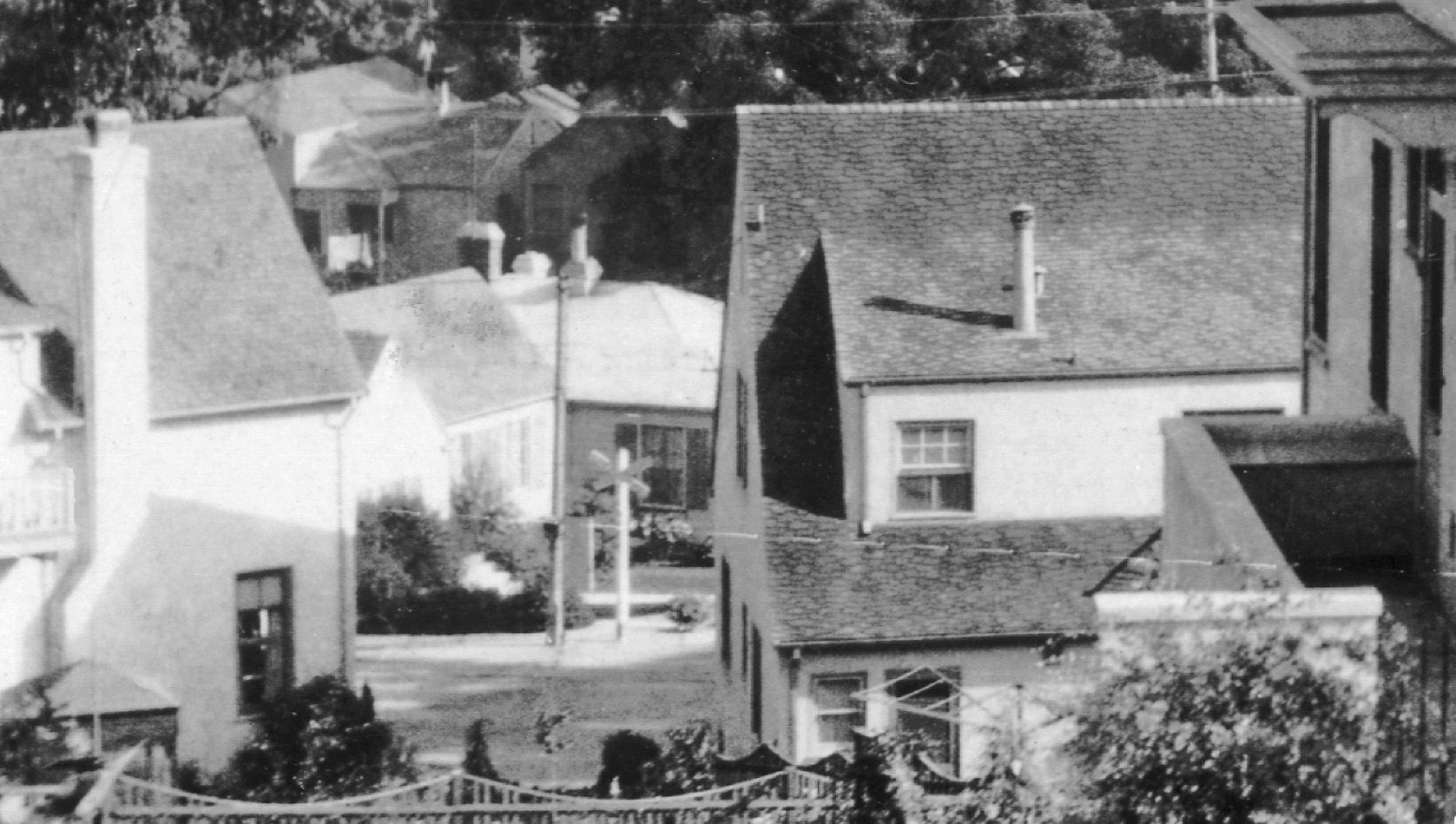
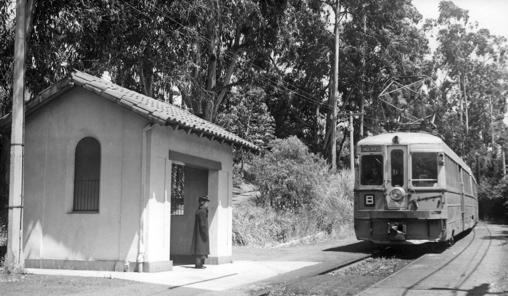
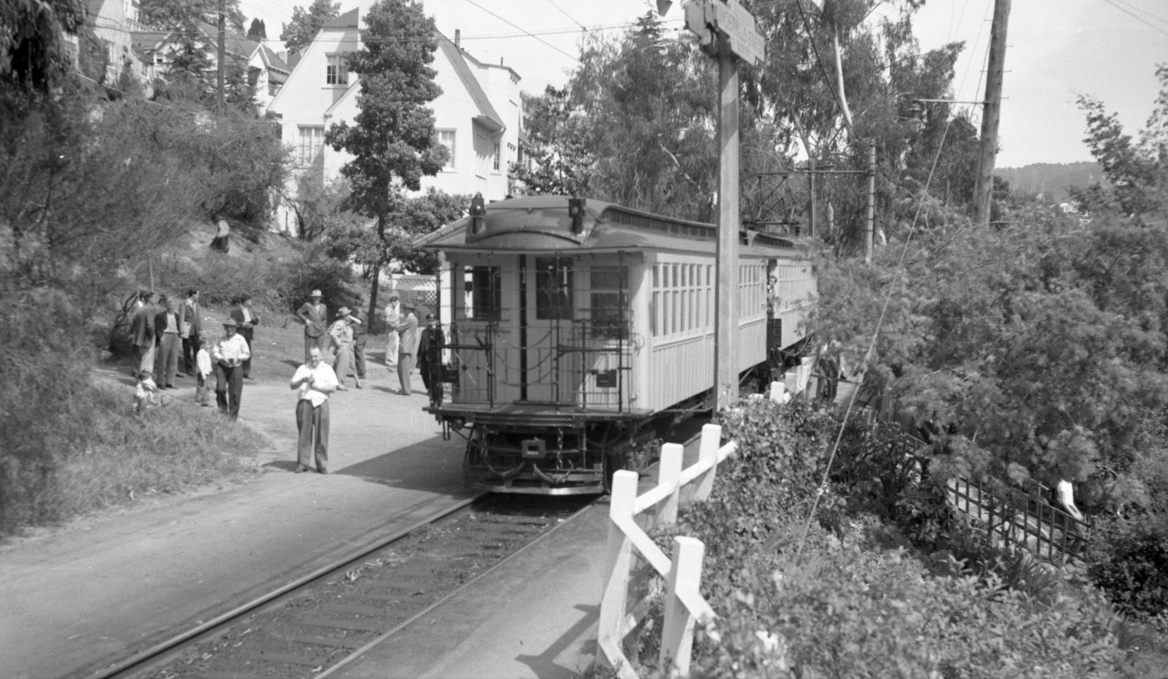
A pre-1950s northeast view of a Key System bridge unit awaits passengers at the Northvale station. Where was this station, why was its location forgotten, and why is this location important today?
L172-05-Moreau Collection, Courtesy BAERA, Western Railway Museum Archives, 93108ks, (Image 1 of 44)

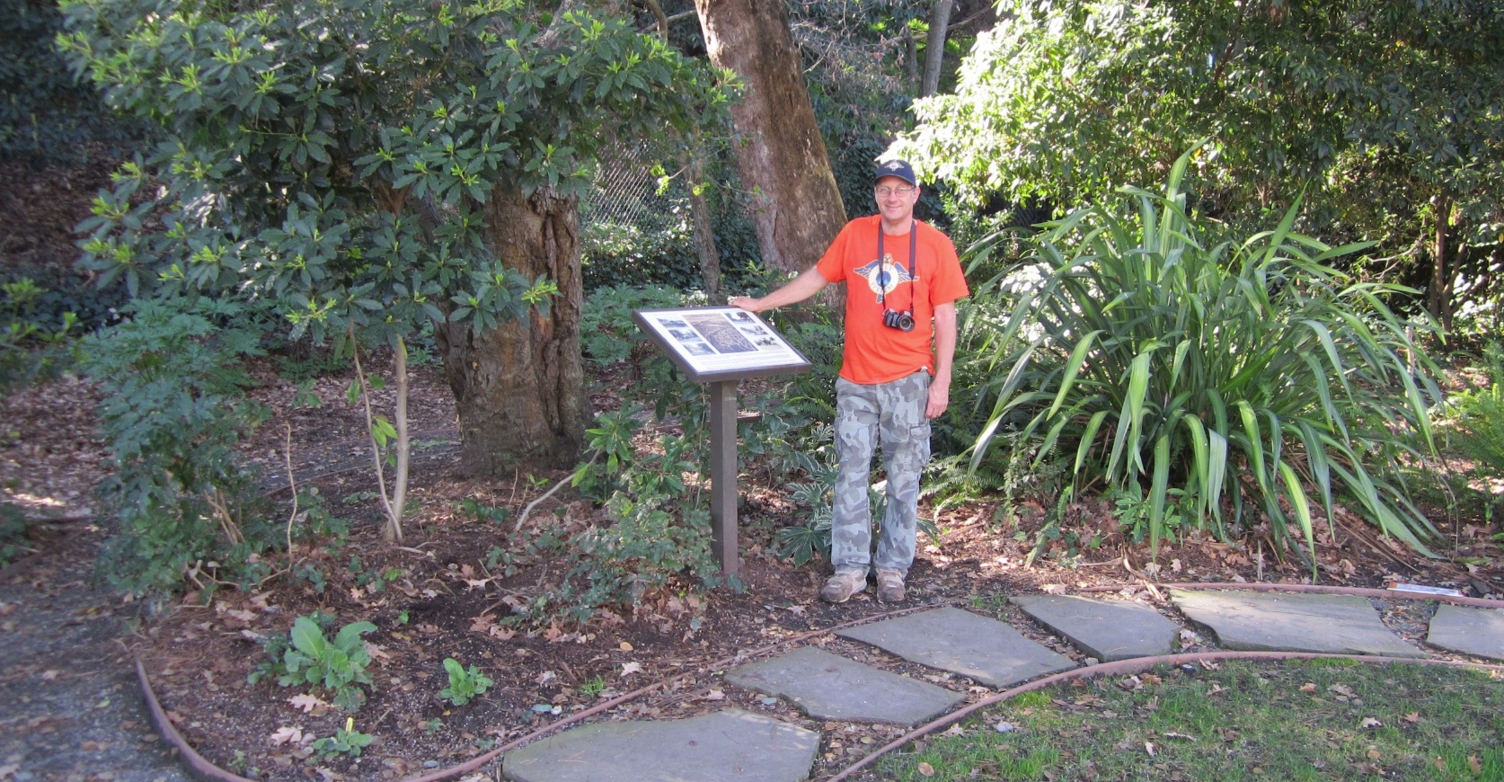
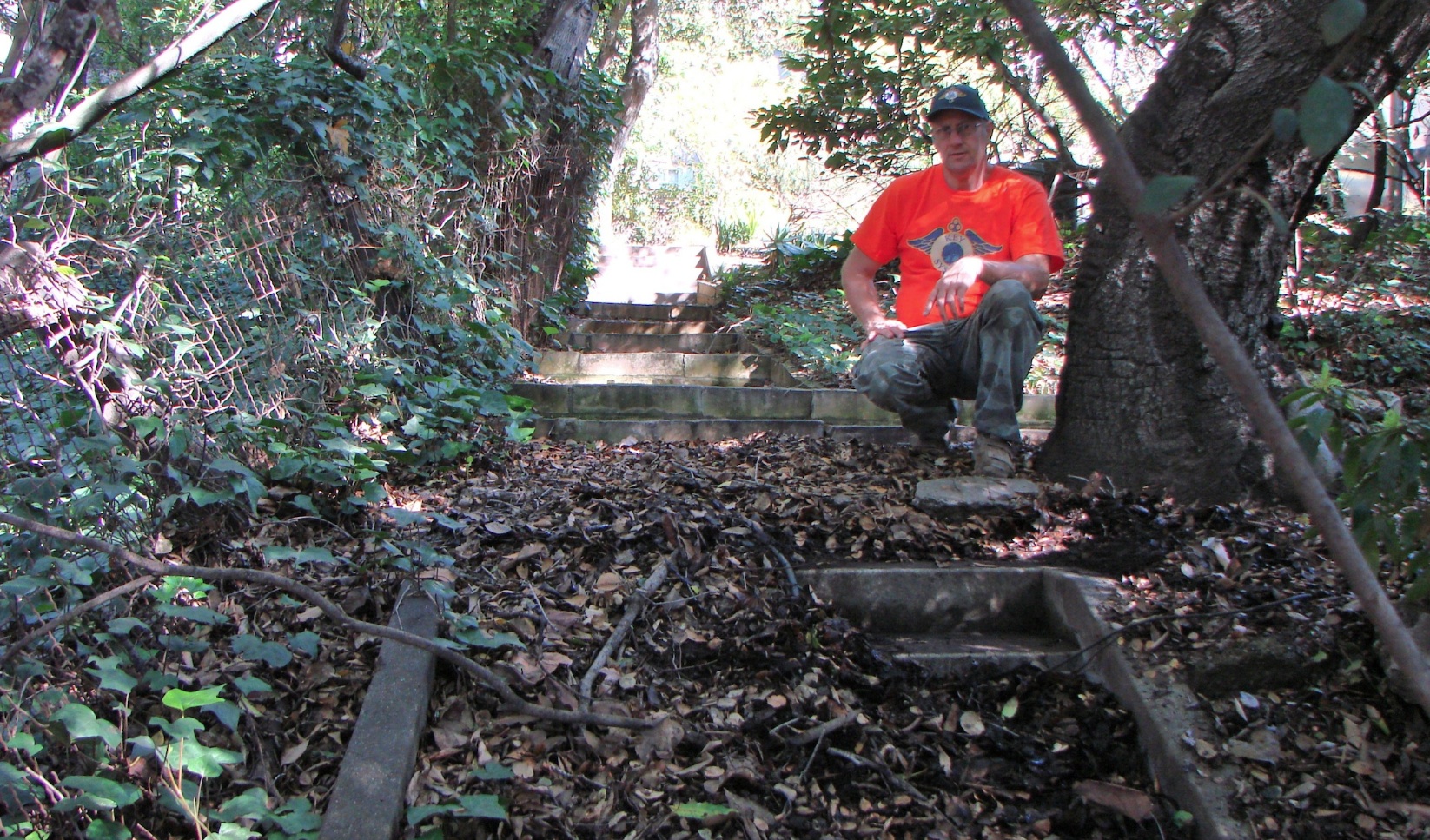
A good person to ask would be Ron Hook, a volunteer at the Western Railway Museum who specializes in the history and photographic documentation of the Key System streetcar and transbay service. Ron stands next to an exhibit at Warren Hook Park, named after his father, a noted member of the community. The park sits at Trestle Glen and Brookwood Rds, coincidentally across where commuters took the stairs up the hill to the Northvale station.
L172-10-Stuart Swiedler Photo, (Image 2 of 44)
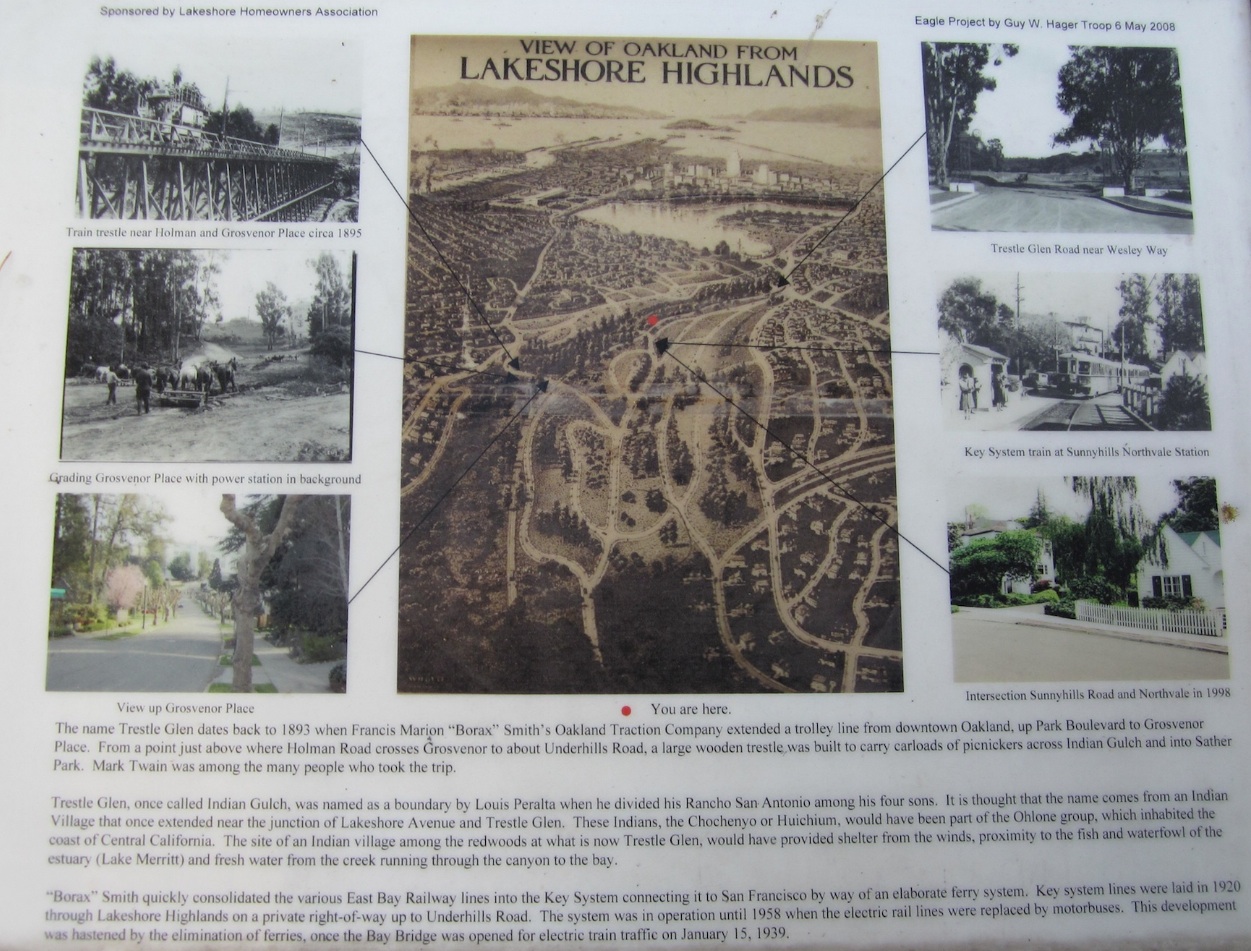
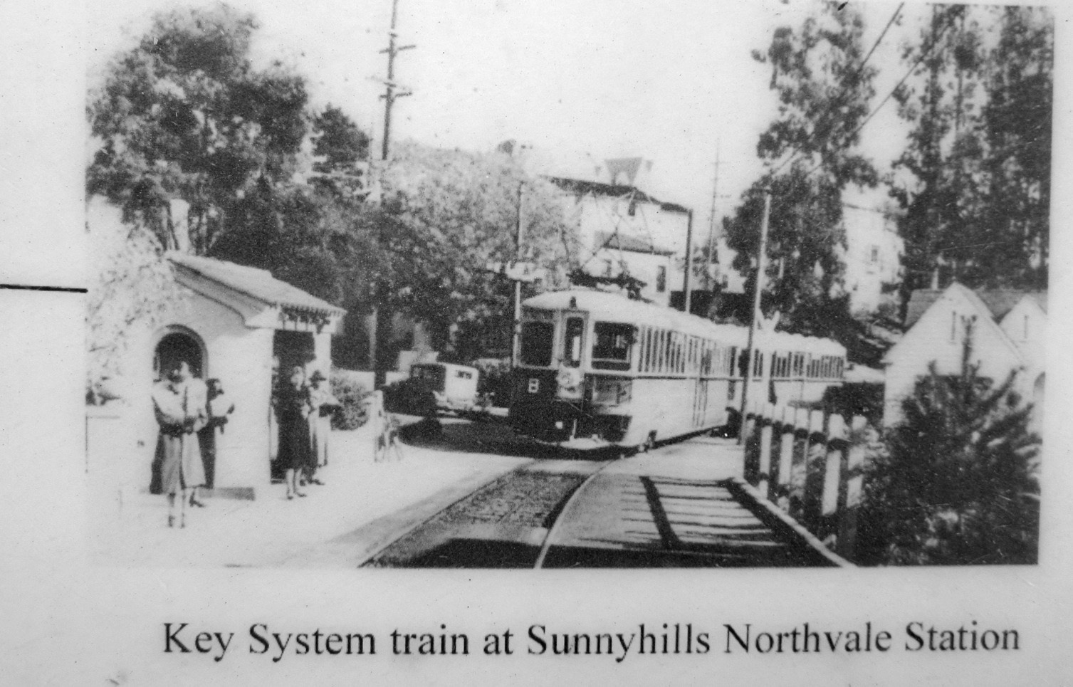
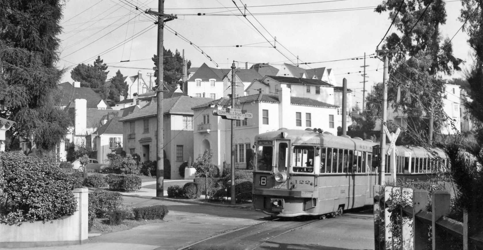
The well-conceived and well-meaning exhibit provides the basic history of the area, but contains one inaccuracy on the bottom right two panels by concluding a picture of a Key B train at the intersection of Sunnyhills Rd. is stopped at the Northvale station. Unlike the other B-line stops, with the exception of the terminal Underhills station, the location of the Northvale station was most likely forgotten because it wasn’t at a street intersection.
L172-15-Stuart Swiedler Photo, (Image 3 of 44)
The legend for this close-up of the train image in the exhibit is incorrect, but first why this should have particular meaning to Ron Hook and growing up in Trestle Glen, or as it was initially called 100 years ago, Lakeshore Highlands.
L172-20-Stuart Swiedler Photo, (Image 4 of 44)
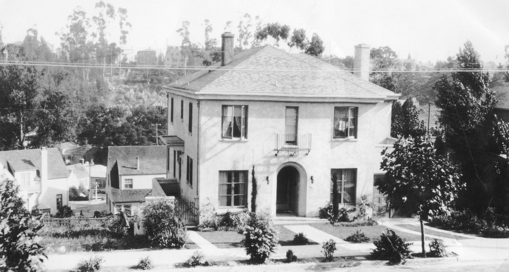
Ron Hook’s maternal grandparents lived at 869 Rosemount Rd. since the mid-1920s during early development of the Lakeshore Highlands neighborhood. Ron Hook grew up in this home. To the right, or west of the home along the right edge in this south view, is a staircase that takes you down to Northvale Rd., just short of its east end at Sunnyhills Rd. The importance of this can be seen to the left, or east, of the house, and shown in detail next.
L172-25-Ron Hook Collection, Courtesy BAERA, Western Railway Museum Archives, 111174ks, (Image 5 of 44)
This detail of the south view from L172-25 shows a Key B-line crossbuck and overhead wire pole at the Sunnyhills Rd. grade crossing, the closest access to the train from this home.
L172-30-Ron Hook Collection, Courtesy BAERA, Western Railway Museum Archives, 111174ks, Detail, (Image 6 of 44)
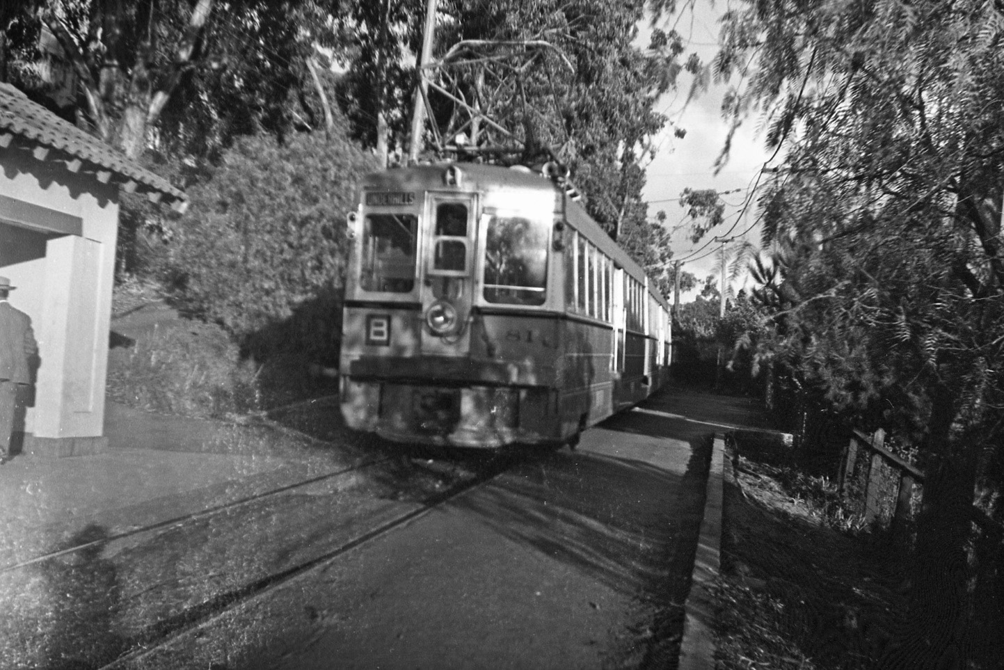
If only this east view could be substituted for the one in the exhibit at Hook Park, then the legend would have described the Sunnyhills station site, not the Northvale station. The corner of the station shelter can be seen on the left edge of the image. Ron Hook was lucky enough to have boarded a train heading to San Francisco at this location as a toddler.
L172-35-Richard Jenevein Photo, Courtesy BAERA, Western Railway Museum Archives, 127298ks, (Image 7 of 44)
The confusion for the station names has been unconsciously reinforced by images and present day appreciation of east views at the Sunnyhills Rd. grade crossing, today as an obvious path of the right-of-way to the east. This now serves as the entry to nos. 867 and 869 Sunnyhills Rd. There is no dearth of images with the home at 865 Sunnyhills Rd. featured, to the right or south of the path.
L172-40-Stuart Swiedler Photo, (Image 8 of 44)
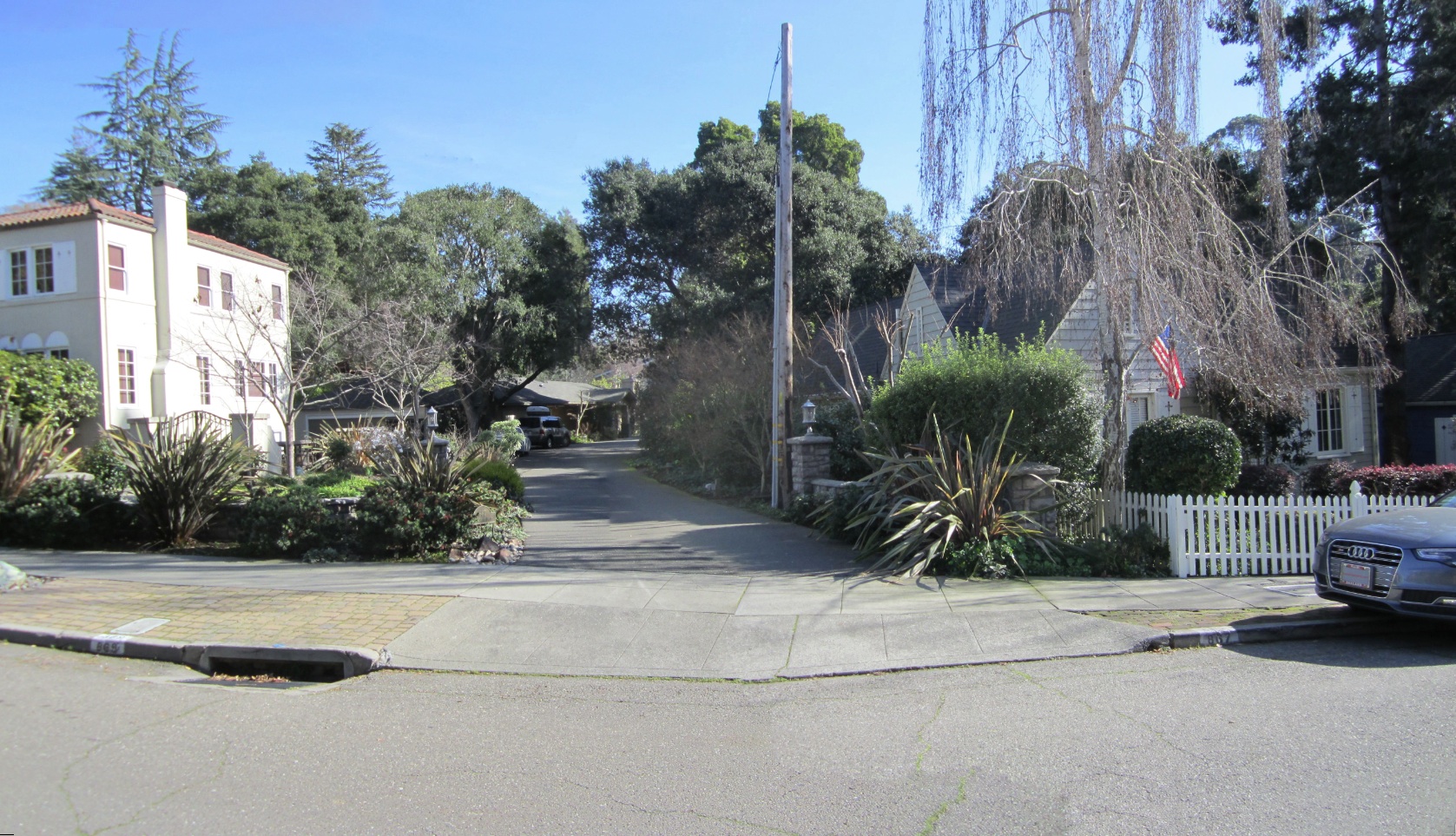
Turning around 180 degrees, and much less obvious, is the westward path of the right-of-way, today marked by the double garage of no. 865 Northvale Rd., left, the most easterly house added once the right-of-way was filled with homes. Numbering this home and the one across the street both as no. 865 is confusing, although the sign for this home can only be seen walking up Northvale Rd.
L172-45-Stuart Swiedler Photo, (Image 9 of 44)
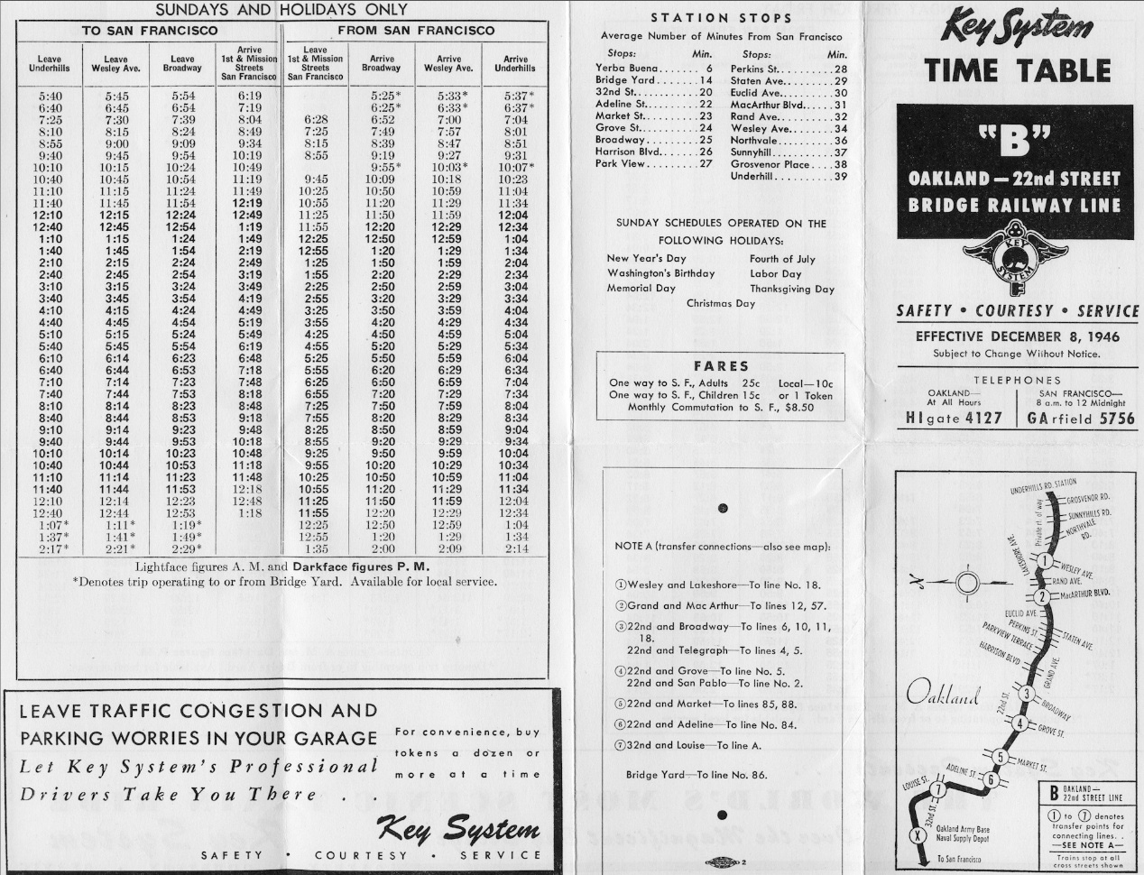
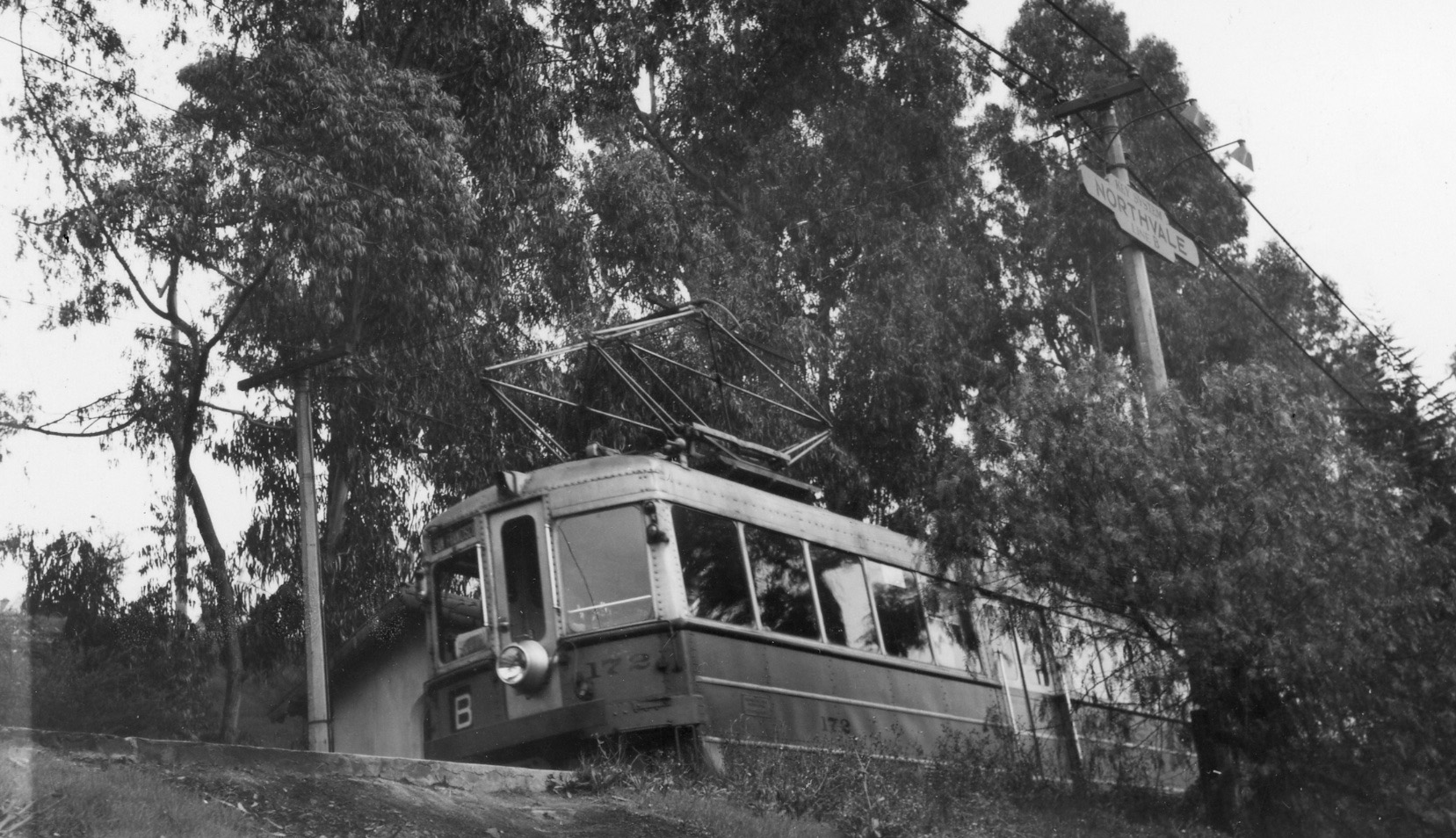
Where exactly was the Northvale station? This timetable from 1946 indicates it was to the west of Sunnyhills station, only 36 minutes away from the Transbay Terminal once the Key trains started using the Bay Bridge in Jan. 1939. Given that Northvale Rd. is only one block long, the location of the shelter for the Northvale station should be simple to deduce.
L172-50-Courtesy BAERA, Western Railway Museum Archives, 93108ks, (Image 10 of 44)
Remembering what was seen in the first image of this presentation of the Northvale station, this 1938 north-oriented aerial can be used to indicate certain landmarks. Northvale Rd. is easy to spot during Key System B-line operation as its south portion contained no homes, no longer the case. To aid this review, proceed to the annotated version that follows.
L172-55-Harrison Ryker Photo, Courtesy California Department of Transportation , (Image 11 of 44)
Annotated version of L172-55.
L172-56-Harrison Ryker Photo, Courtesy California Department of Transportation , (Image 12 of 44)
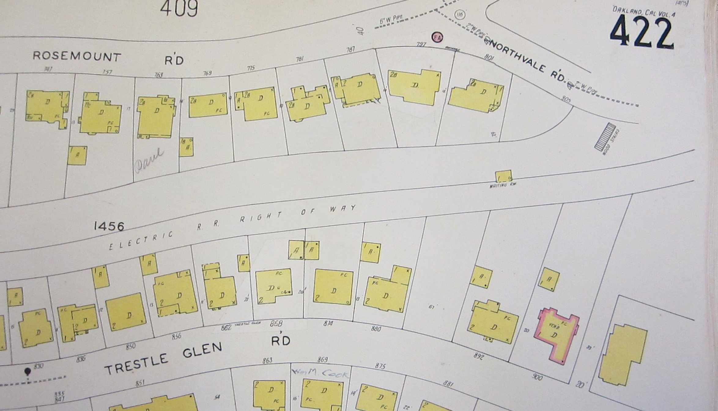
This north-oriented Sanborn map from the 1929 version indicates the location of the station shelter and the wood stairs to access the shelter from the north. Note that prior to 1950, the lot at no. 886 Trestle Glen Rd. was empty, as was that for no. 811 Northvale Rd. The 20 foot-wide corridor leading to the permanent steps to the station shelter is to the east of no. 900 Trestle Glen Rd.
L172-60-Sanborn Map, Courtesy Oakland Cultural Heritage Survey, Oakland City Planning Department, (Image 13 of 44)
This detail is from a July 10, 1951 north-oriented aerial was contracted by the California Dept. of Public Works, Division of Highways, the immediate precursor to today’s California Dept. of Transportation, or CALTRANS, to assess a route for the future Highway 580. The image was probably taken by Clyde Sunderland based on a time clock in the corner of the full image. An annotated version follows.
L172-65-Copyright California Department of Transportation, 2218-16, Detail, (Image 14 of 44)
Annotated version of L172-65. Private paths to the station shelter increased after the construction of no. 886 Trestle Glen Rd. and no. 811 Northvale Rd. Building Permit B30267 was issued on June 2, 1950 for no. 886, with a cost of construction of 23,700 dollars. Building permit B20397 was issued in 1948 to M. F. Steffensen to build a 3-story, 7-room house at no. 811 Northvale. Metropolitan Builders were the contractors and Lenard Ford of Walnut Creek was the architect. The cost of construction was 21,000 dollars.
L172-66-Copyright California Department of Transportation, 2218-16, Detail, (Image 15 of 44)
Ahead to Apr. 8, 1953 and Sunderland is now producing low oblique views as a right-of-way for Highway 580 is under review. This first aerial faces west looking toward Lakeshore Ave. from a point just west of Sunnyhills Rd. A detail follows.
L172-70-Copyright California Department of Transportation, 3300-28, (Image 16 of 44)
This detail from Apr. 8, 1953 provides all the landmarks followed so far, and even an additional path behind no. 892 Trestle Glen Rd., white arrow. The only disappointment is that the wood stairs down from Northvale Rd. cannot be visualized.
L172-75-Copyright California Department of Transportation, 3300-28, Detail , (Image 17 of 44)
This second aerial from Apr. 8, 1953 has a more northwesterly view just east of Sunnyhills Rd. A detail follows.
L172-80-Copyright California Department of Transportation, 3300-29 , (Image 18 of 44)
This detail from Apr. 8, 1953 complements what has been shown previously. The white arrows mark clearings through the trees that follow a path from the station shelter to the aforementioned steps or a separate path up to Northvale Rd.
L172-85-Copyright California Department of Transportation, 3300-29, Detail , (Image 19 of 44)
For completeness, this southeast view from Apr. 8, 1953 provides another angle to evaluate the area surrounding the station shelter. A detail follows.
L172-90-Copyright California Department of Transportation, 3300-27 , (Image 20 of 44)
The shelter and the approach to it from Northvale Rd. are obscured by the large number of trees in this section from this angle in this detail from Apr. 8, 1953.
L172-95-Copyright California Department of Transportation, 3300-27, Detail, (Image 21 of 44)
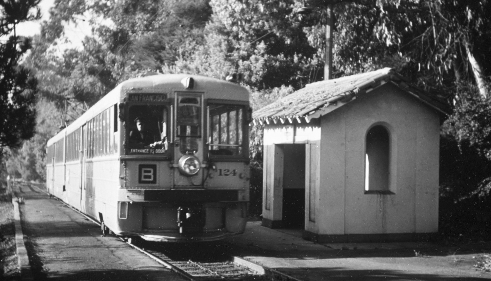
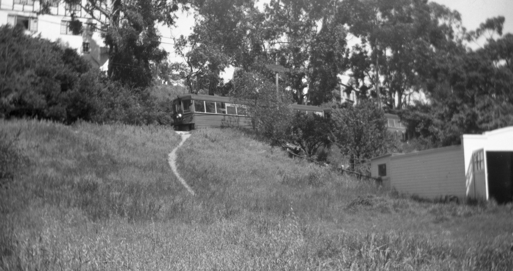
Next a series of ground views of the station shelter during B-line operation starting with this late 1950s west view of unit 124 heading to Underhills station despite what the train placard indicates. Note the position of the pole relative to the shelter, the border to the left or south of the train. Further west is the white fence present in all of the aerials.
L172-100-Moreau Collection, Courtesy BAERA, Western Railway Museum Archives, 82834ks , (Image 22 of 44)
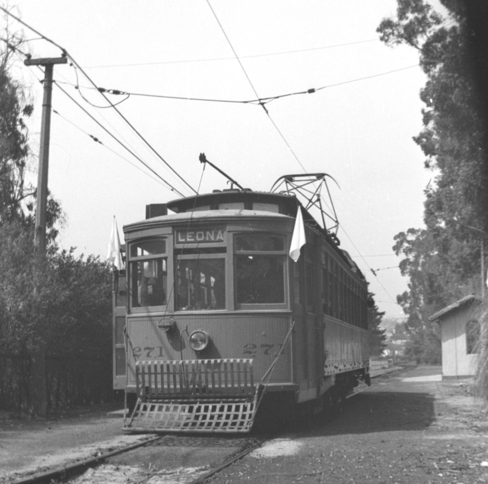
Slightly more toward the southeast, this view of Key 271 on excursion, Mar. 29, 1942, provides a nice view of a pole to the south, as well as the aforementioned white fence seen behind the car.
L172-105-Beverly Bell Coll., Courtesy BAERA, Western Railway Museum Archives, 127239ks, (Image 23 of 44)
This east view of unit 147 from May 25, 1942 shows the clear path from the shelter up to Northvale Rd.
L172-110-Wilbur C . Whittaker Photo, Courtesy John Harder, (Image 24 of 44)
In addition to the path, this east view of unit 181 on the rear of a train that has just left off a passenger and is heading to Underhills shows the southern border separating the right-of-way from the lot of the home at no. 892 Trestle Glen Rd.
L172-115-Roy Healy Photo, Courtesy BAERA, Western Railway Museum Archives, 121980ks, (Image 25 of 44)
To conclude, an oblique northeast view of unit 172 taken before any home backed the station shelter.
L172-120-Richard Jenevein Photo, Courtesy BAERA, Western Railway Museum Archives, 12649ks, (Image 26 of 44)
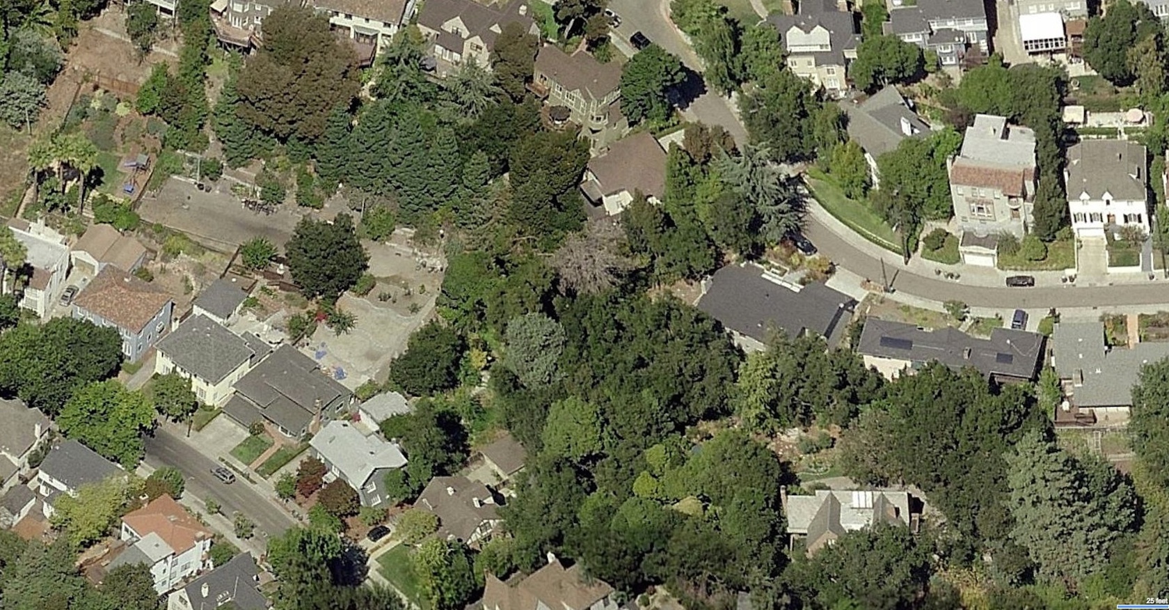
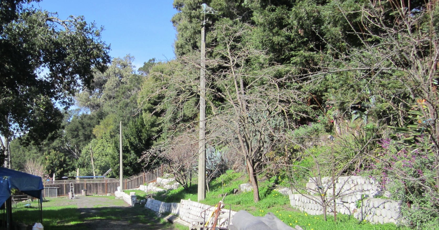
So far, the location of the Northvale station and why it has been forgotten have been addressed. Why is this location important today? The simple answer is that this section of former Key System right-of-way is well preserved based on the relics remaining. From this northwest view from 2017, the three consecutive poles remaining illustrate the level of preservation of this section of right-of-way.
L172-125-Courtesy Bing Images, (Image 27 of 44)
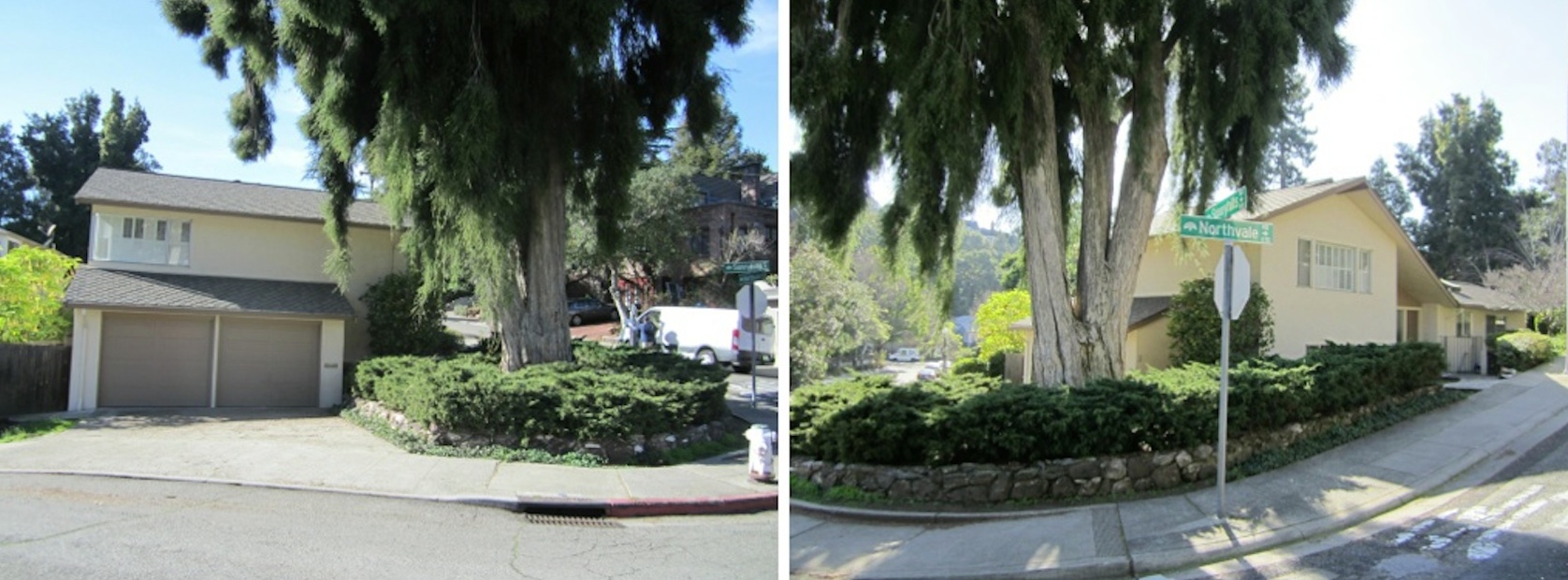
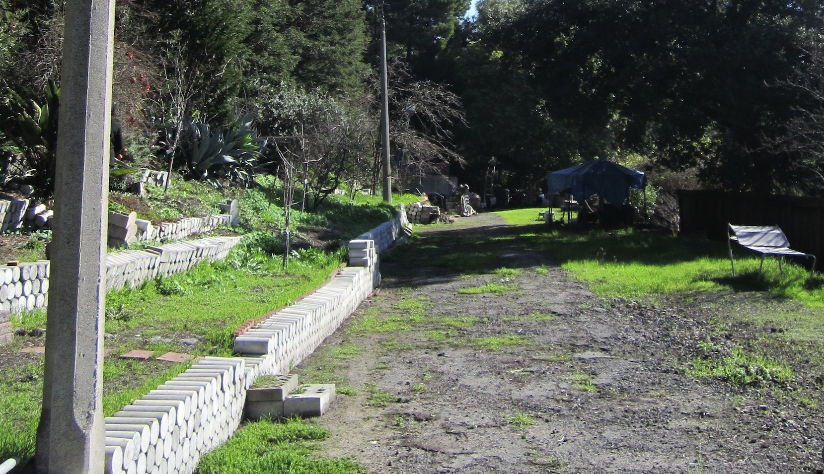
The three poles visible extend from behind no. 886 Trestle Glen Rd. in this west view from 2018. The two immediate neighbors to the west of no. 886 probably declined to purchase the abandoned section of right-of-way, allowing the occupants of no. 886 to acquire this land-locked property and retain the two poles and much more ...
L172-130-Stuart Swiedler Photo, (Image 28 of 44)
Shown here is an east view of the two poles behind no. 886 from 2018. Ron Hook made the following measurements: station platforms were 9 feet wide and the ballasted area was 8 feet. The poles were every 90 feet and they were cast at 30 feet. From the base to where the indent was on each pole was 8 feet, so they were sunk 5-6 feet into the ground.
L172-135-Stuart Swiedler Photo, (Image 29 of 44)
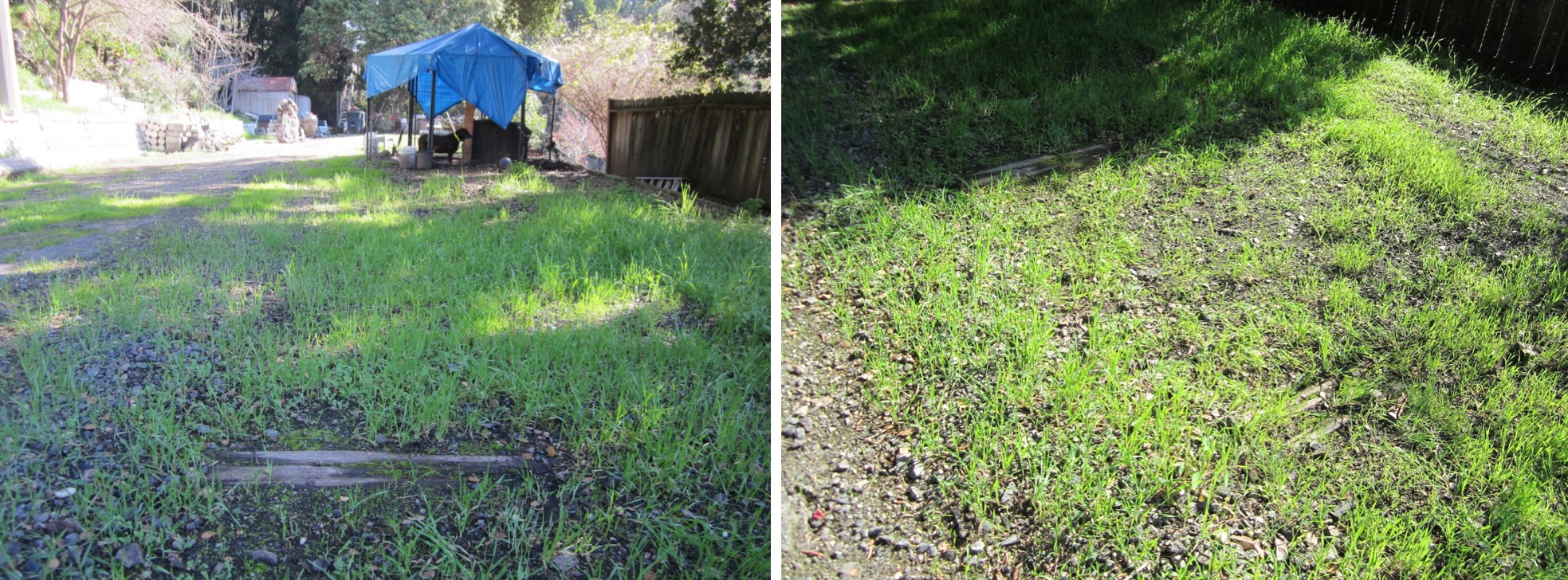
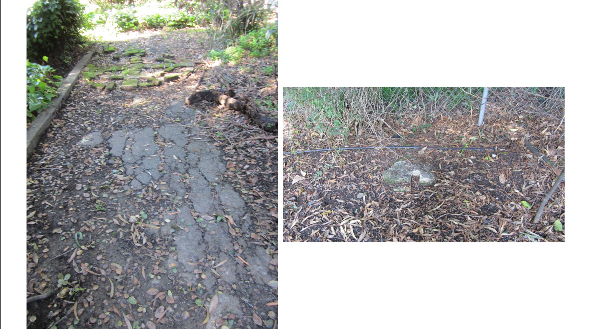
The remainder of what appears to be two railway ties in this southeast view, right, and the positioning of these remnants in an east view, left, both from 2018.
L172-140-Stuart Swiedler Photos, (Image 30 of 44)
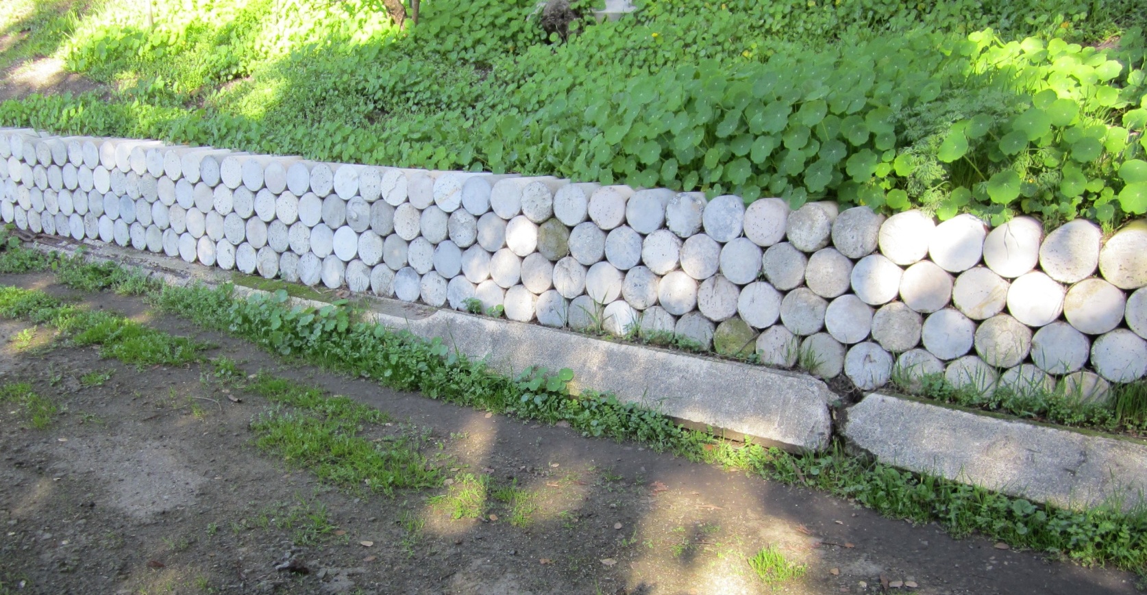
Although present in other sections of the abandoned B-line right-of-way, this northwest view shows how parts of two poles have been adapted to serve as decorative borders.
L172-145-Stuart Swiedler Photo, (Image 31 of 44)
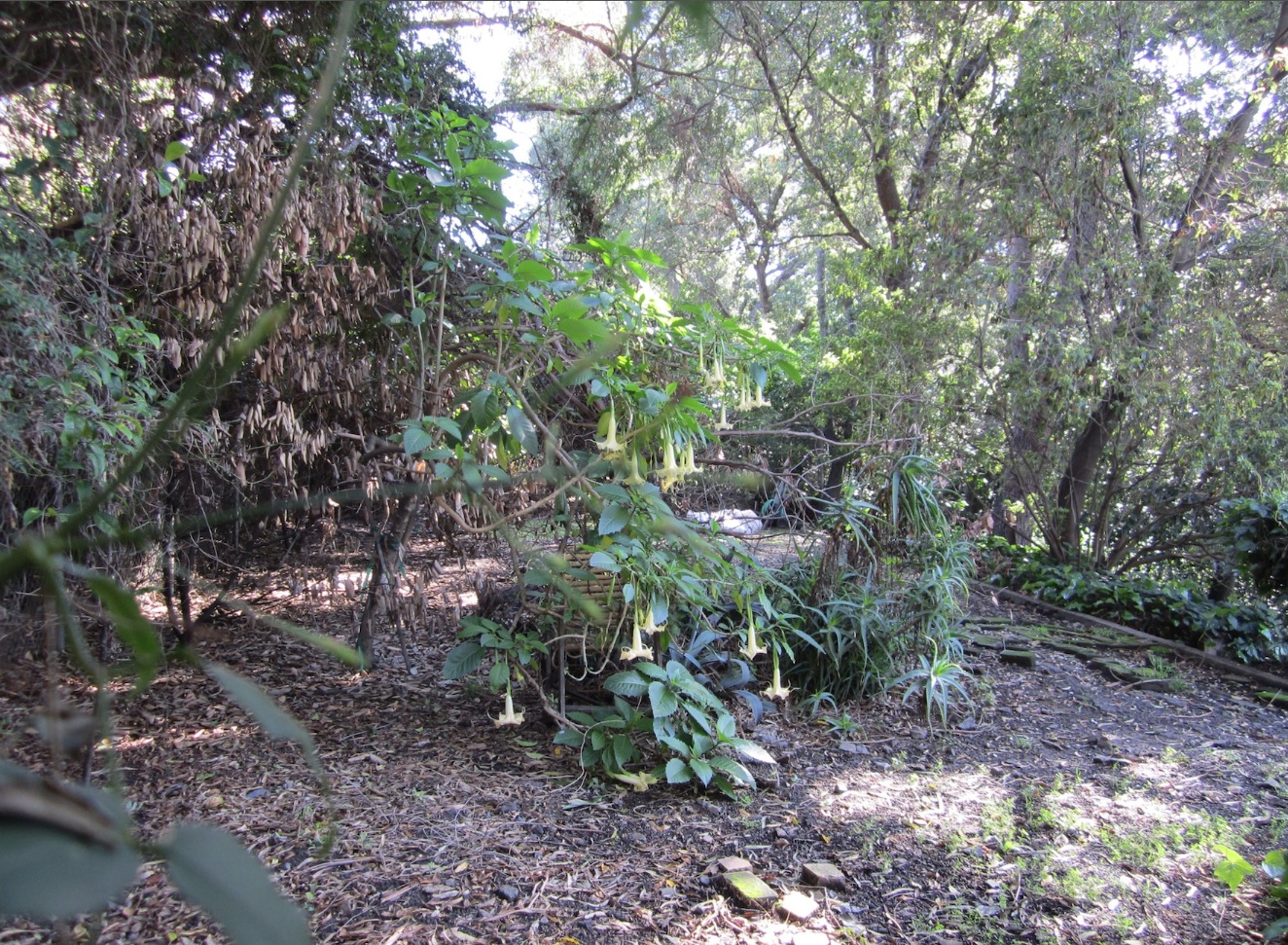
The spot where the Northvale shelter once sat behind no. 892 Trestle Glen Rd. is now a jumble of plants. East view, 2018.
L172-150-Stuart Swiedler Photo, (Image 32 of 44)
Part of the foundation between the track and the southerly border of the right-of-way is shown here in a west from 2018, left. In the right panel, possibly the base of the pole positioned to the northwest of the shelter.
L172-155-Stuart Swiedler Photos, (Image 33 of 44)
The construction of the home at no. 886 Trestle Glen Rd. seen to the left in this north view from 2018 prevented the composing of an “after” shot to the “before” one seen in L172-05. The garage door of no. 892 trestle Glen Rd. has been changed to a roll-up type, and the home above at no. 801 Northvale Rd. has been substantially altered from its appearance in the 1950s as well.
L172-160-Stuart Swiedler Photo, (Image 34 of 44)
The last remaining questions relate to the paths or stairs to the station shelter. This north view from the rear of no. 886 Trestle Glen Rd. are not the original stairs seen in the previous aerial images, and were added by the current occupants post 1970 following the path created on this lot by the original owners.
L172-165-Stuart Swiedler Photo, (Image 35 of 44)
The most prominent stairway exclusive to the B-line in Trestle Glen was at Underhills as seen along the right edge of this east view from an excursion trip of Mar. 27, 1949. Only the bottom few steps of this long staircase remain behind no. 1318 Trestle Glen Rd., the land from the former street approach now part of that lot.
L172-170-Jack Perry Photo, Courtesy BAERA, Western Railway Museum Archives, 92673ks, (Image 36 of 44)
A north-facing aerial from July 10, 1951 shows of the Underhills station area and the long set of steps from Trestle Glen Rd. Go on to the annotated version next.
L172-175-Copyright California Department of Transportation, 2218-17, Detail, (Image 37 of 44)
Annotated version of L172-175, a north-facing aerial from July 10, 1951.
L172-176-Copyright California Department of Transportation, 2218-17, Detail, (Image 38 of 44)
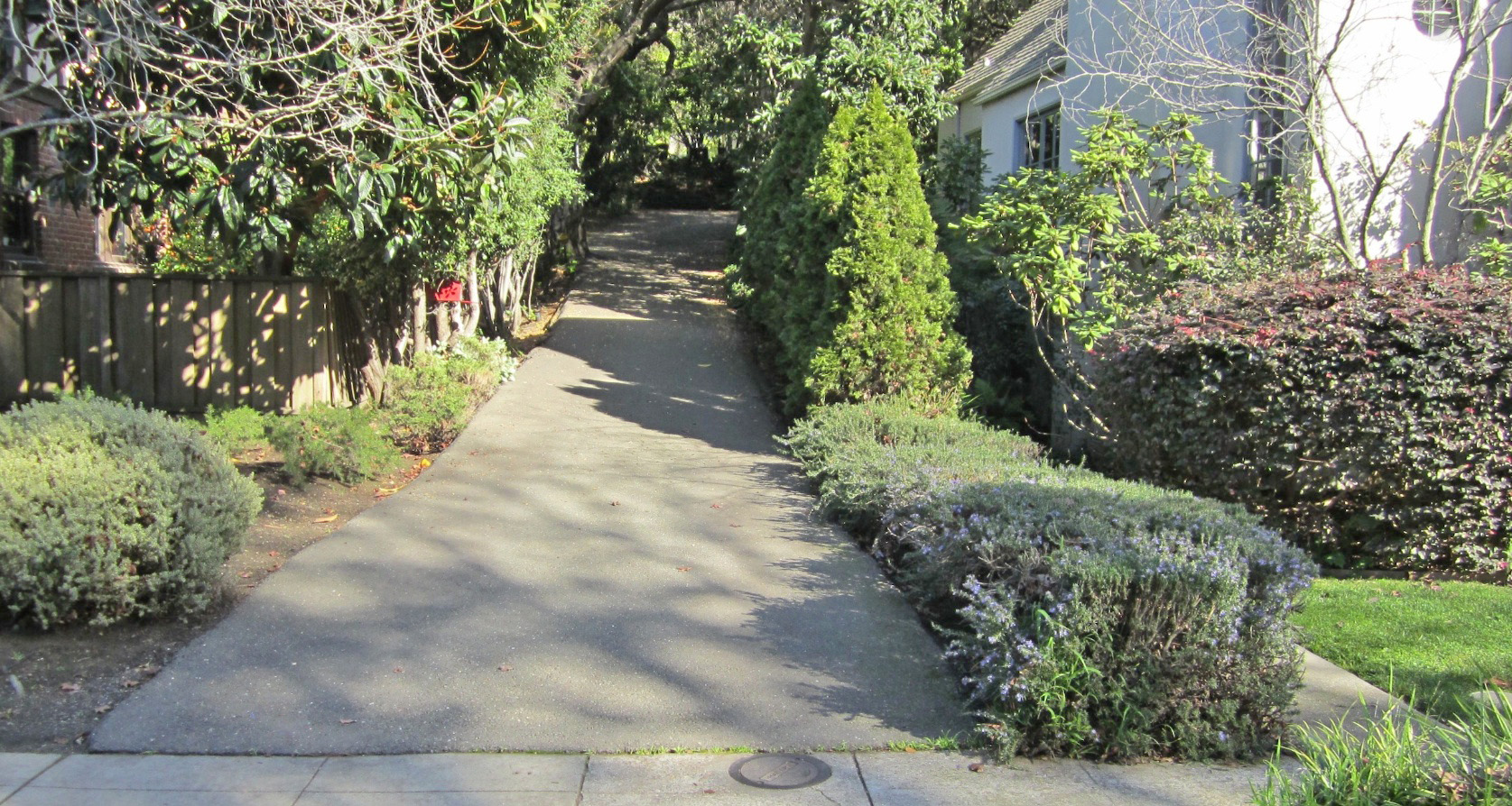
Which takes us to the 20-foot wide corridor to the east of No. 900 Trestle Glen Rd., seen in this north view from 2018. This now serves as the driveway approach to no. 904, the home set back and tucked between the creek and the B-line right-of-way.
L172-180-Stuart Swiedler Photo, (Image 39 of 44)
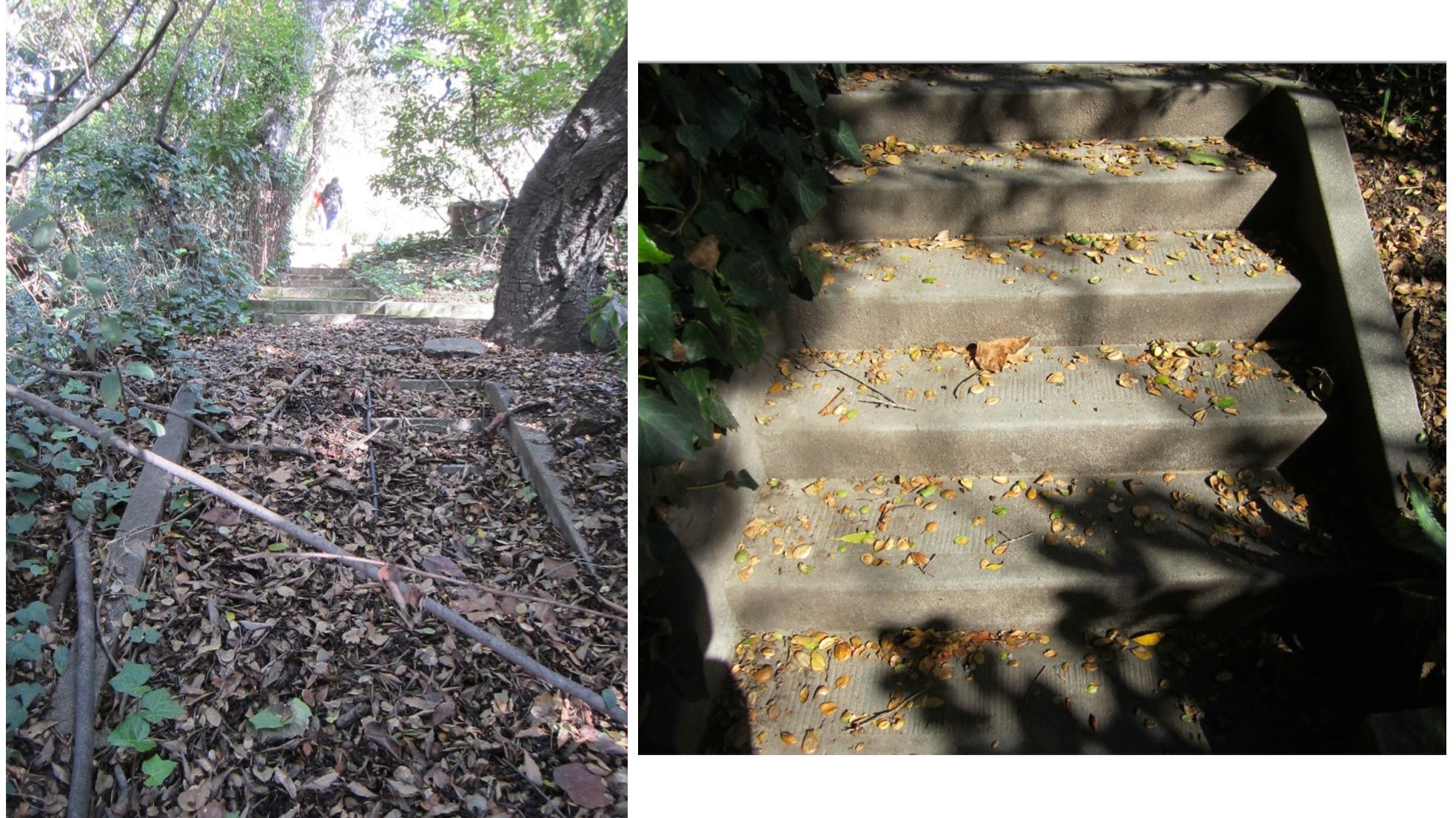
Following up the driveway, and to the left side, are the first set of original Key System steps, left panel, followed by a set of stairs added by the occupants of no. 904 seen in the background of this image. Above these stairs are another set of Key System stairs, right panel.
L172-185-Stuart Swiedler Photos, (Image 40 of 44)
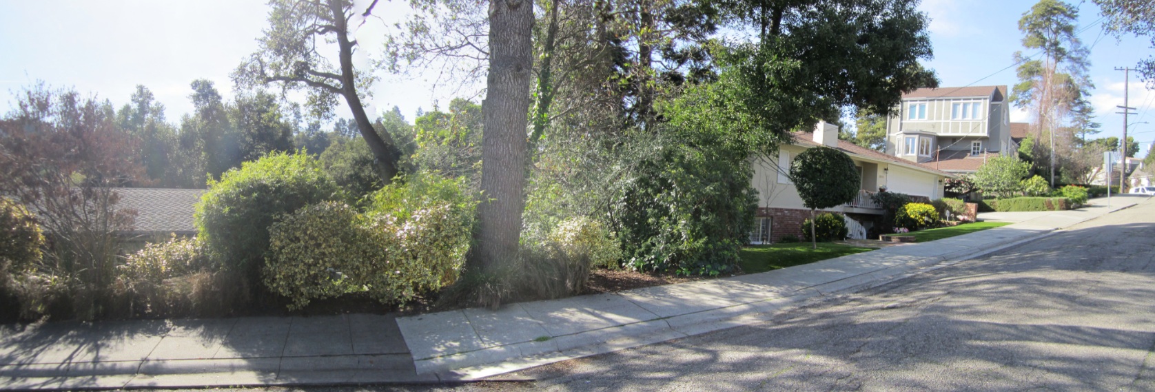
The big mystery that remains is the exact location of the stairs and path from Northvale Rd. down to the station shelter. This panoramic northwest image facing nos. 811 and 801 approximates where the path may have started, but only folks such as Ron Hook’s mom, Emily Hook, who took the path know for sure.
L172-190-Stuart Swiedler Photo, (Image 41 of 44)
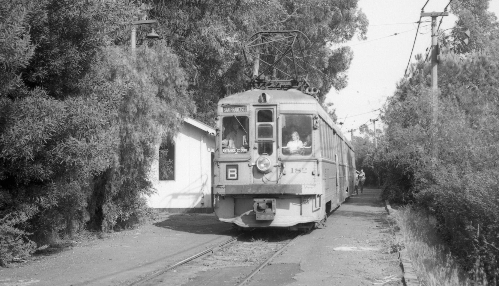
Unit 182 is heading to San Francisco crammed with riders in this east view at the shelter from Apr. 19, 1958. Trains ran until the early AM hours of the next day, and that would mark the end of Key System electric train service. Much appreciation to the neighbors on Trestle Glen Rd. who provided access to their property. Please respect their privacy. To Gail Lombardi and Betty Marvin for home construction details. And to the efforts of Ron Hook for driving this archeological dig.
L172-195-EK Muller Photo, Courtesy BAERA, Western Railway Museum Archives, 114199ks, (Image 42 of 44)
And a special thank you for the collaborative efforts of Ron Hook for driving this archeological dig.
L172-200- Stuart Swiedler Photo, (Image 43 of 44)
A bonus north-oriented aerial image from July 10, 1951 with all five Key system B-line station shelters in Trestle Glen from left to right – Wesley, Northvale, Sunnyhills, Grosvenor and Underhills. Forgotten, but very much there today.
L172-205-Copyright California Department of Transportation, 2218-17, Detail, (Image 44 of 44)