Transformation of the Linden Street Corridor at the Emeryville-Oakland Border, Part 2, 45th to 55th Street
This update continues the photographic documentation of the transformation of Linden St. from an interurban railway-industrial corridor in the 20th century to a high density residential enclave in the 21st century. It will continue north from where the last update ended at 45th St.
L276-05-Stuart Swiedler Photos, (Image 1 of 39)

The area to be reviewed is seen on the left in a north view from Apr. 8, 1953. An enlarged view on the right shows the Key System interurban private right-of-way from Tower 3 at Adeline St. and Yerba Buena Ave., red arrow, to the position of the since removed Tower 4, yellow dot, and the area where the three interurban lines dispersed, orange arc. The update begins at 45th St., indicated by the green line.
L276-10-Copyright California Department of Transportation, 3300-6 copy, (Image 2 of 39)
A detail from the previous north view from Apr. 8, 1953 allows for identification of the structures to be discussed. What was known prior to the mid-1930s as the Key Northbrae or Sacramento St. line, would be renamed the H line, as with the Claremont, later E line, and Shattuck or Berkeley line, later F line. These lines will be identified by the letter designations in this presentation regardless of the timeline. See the next image for an annotated version.
L276-15-Copyright California Department of Transportation, 3300-6, Detail, (Image 3 of 39)
No. 15, Aluminum Cooking Utensil Co.; no. 16, residences no. 4508 and no. 4514 Linden St.; no. 17, Remar Bakery; no. 18, No. 964 46th St., Key Lumber and Supply Co.; no. 19, Temescal Creek overpass; no. 20, Santa Fe Elementary; no. 21, Key E line tracks; no. 22., Key F line tracks; no. 23, former site of H Line 54th St. station shelter; no. 24, abandoned right-of-way of Key H Line; no. 25, Santa Fe Track; no. 26, site of former Key Tower 4; no. 27, 5403 Adeline St.; no. 28, 943 53rd St.; no. 29, 930 54th St.; white arrow, Santa Fe spur to Remar Bakery; orange arrow, Santa Fe spur to Aluminum Cooking Utensil Co.
L276-20-Copyright California Department of Transportation, 3300-6, Detail, (Image 4 of 39)
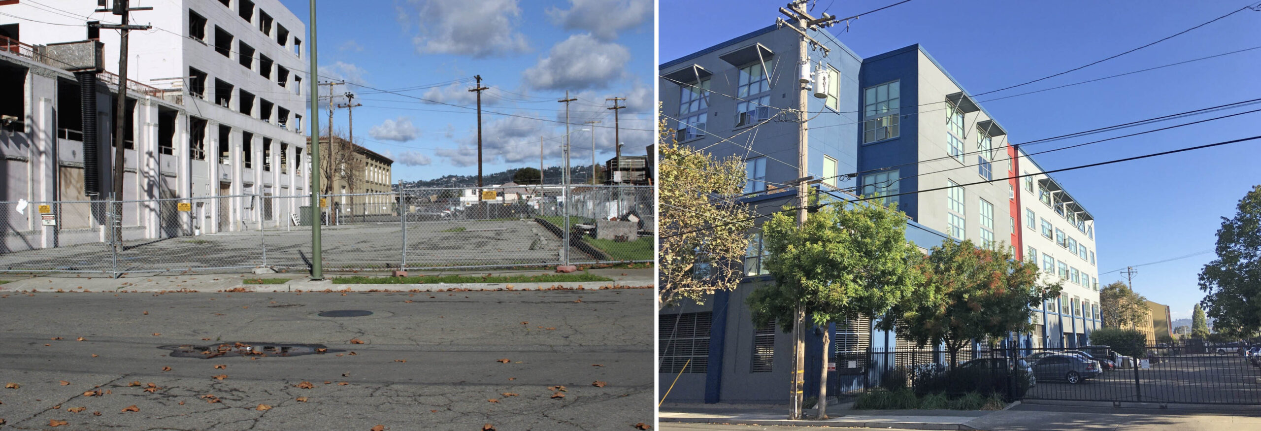
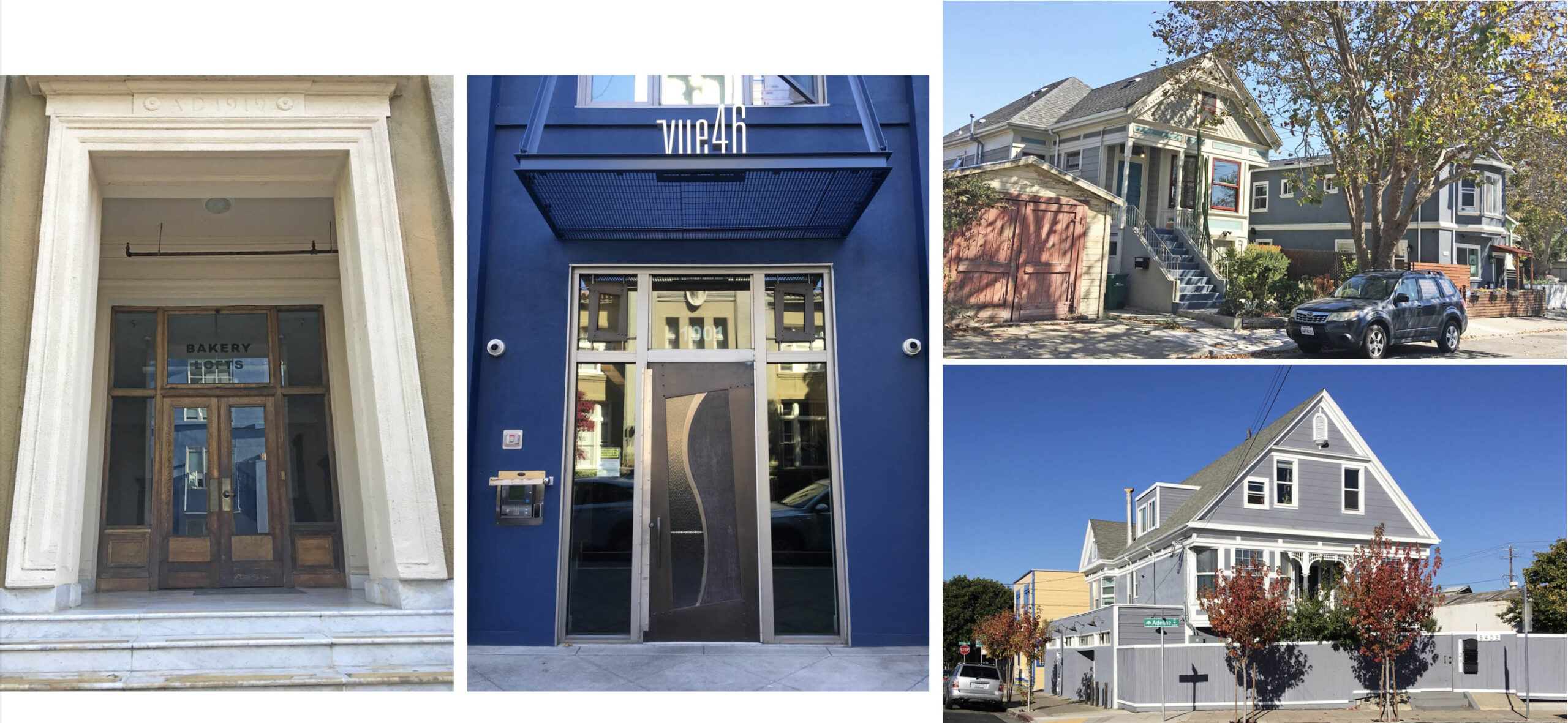
Looking northeast at 45th St. and Linden St. on Nov. 27, 2004, left, marks the progress on the conversion of the ex-Aluminum Cooking Utensil Co., later Flecto Co. plant at 1000 46th St. to Vue46, the residential condo-apartment completed in 2008, Levin Menzies and Associates of Walnut Creek, Kwan Henmi Architects of San Francisco and Barry Swenson Builders of San Jose. The same northeast view in 2022, right panel, reveals how the height of the south side of the building was increased.
L276-25-John Harder Photo, Courtesy John Harder, l, Stuart Swiedler Photo, r, (Image 5 of 39)
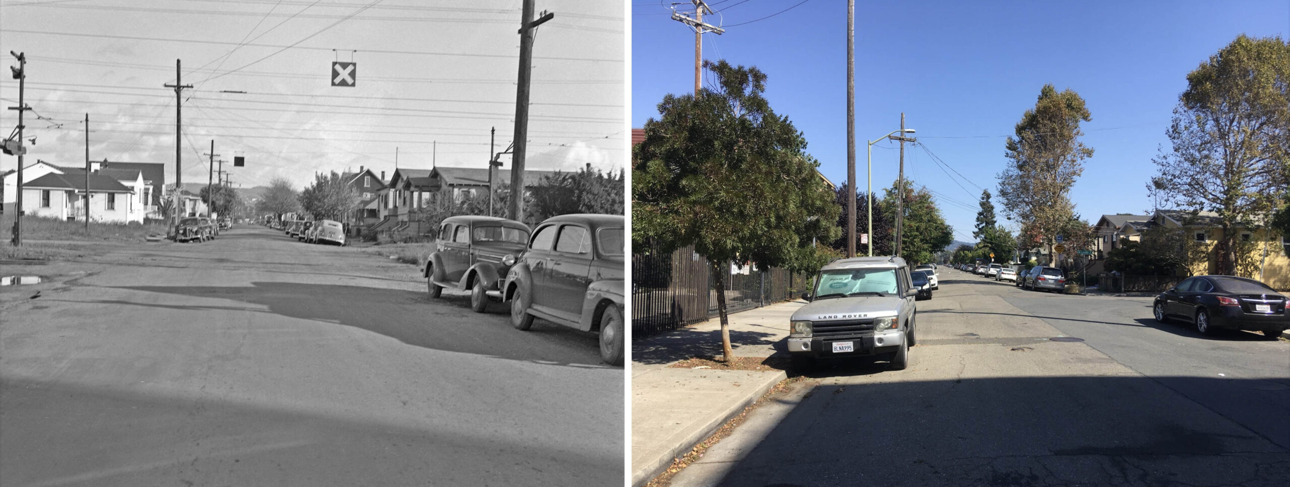
Across from Vue46 are two residences, labeled no. 16 on L276-20, that date back to the early Key era. The very well maintained Victorian at no. 4514, turquoise arrow, appears in the 1911 Sanborn map as the only structure on the block, but with the address no. 4590. Number 4508 appeared after this date, and has since had its exterior revised. Note how Linden St. has been repositioned to the east side of the cut relative to the 44th-45th Sts. section where it is shifted to the west.
L276-30-Stuart Swiedler Photo, (Image 6 of 39)
This southwest view from 1939 just north of 46th St. documents the presence of the E line stop. On the west side or right, Aluminum Cooking Utensil Co., building no. 15, first appeared in the 1926 directory, later listings designating it as its Pacific Coast Foundry Division. As shown here, the original two-story building did not fill the northwest corner with Linden St. A vertical aerial not shown from from Aug. 1939 confirms this. Along the left edge is a sliver of no. 4514 and all of no. 4508 Linden St.
L276-35-Key Official Photo, Moreau Coll., Courtesy BAERA, Western Railway Museum Arch., 125544ks, (Image 7 of 39)
Sometime in circa 1940, as shown in a similar southwest view from the late 1940s, an extension to 46th St. was made to the building that included three additional stories. Wear-Ever cookware products are still on the market in 2022 as part of a French firm. Flecto Company, noted for creating Varathane, moved here from 209 Brush St. in 1971. A better view of no. 4514 and of no. 4508 Linden St. can be appreciated along the left edge.
L276-40-Key Official Photo, Courtesy John Harder , (Image 8 of 39)
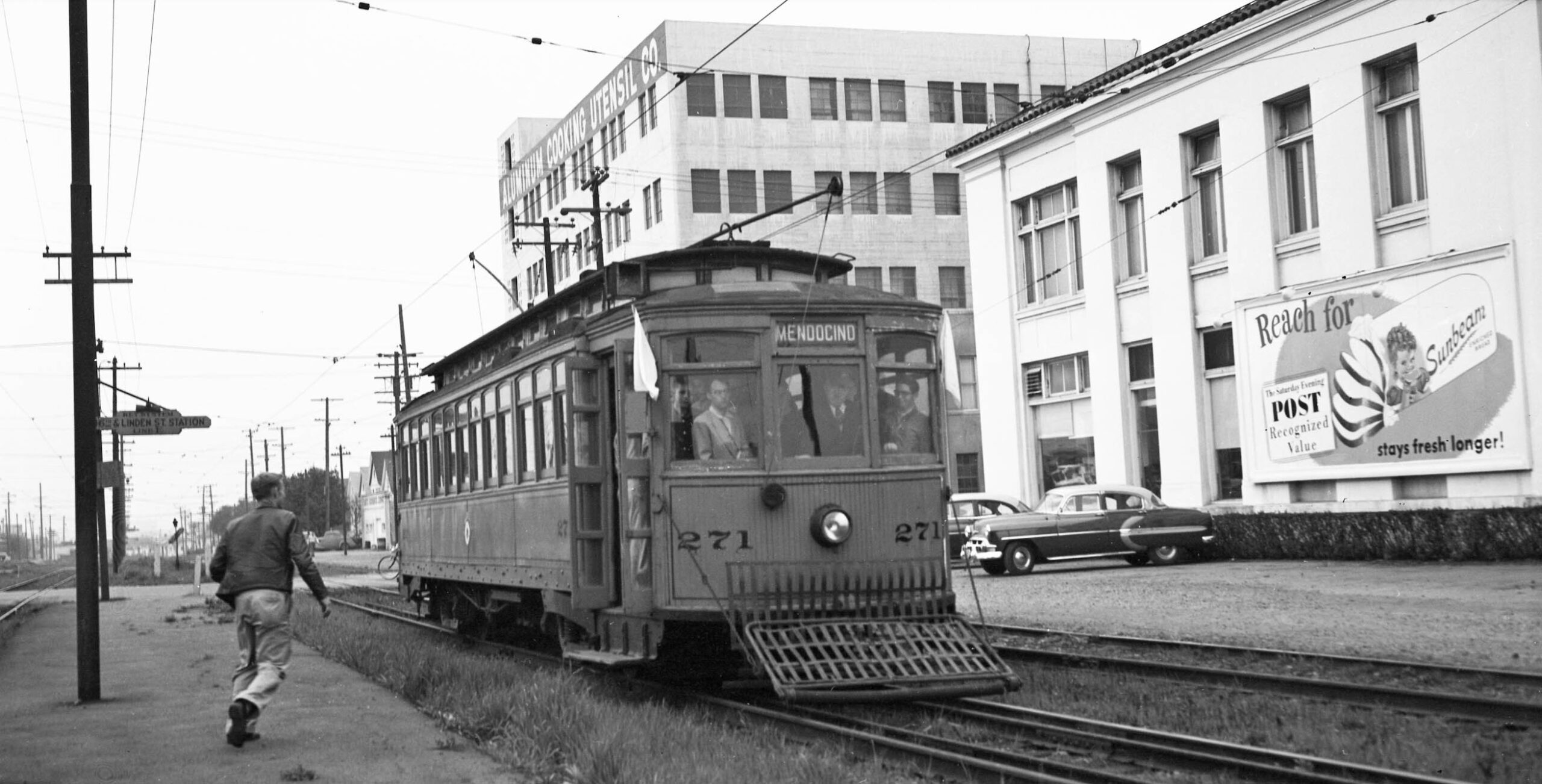
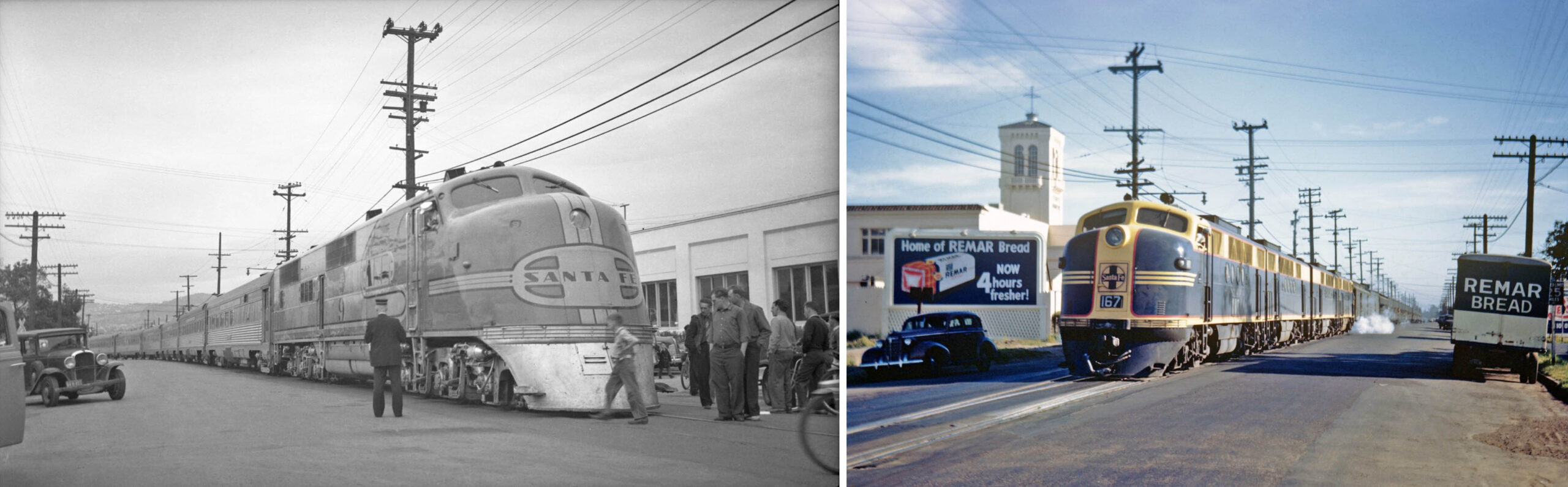
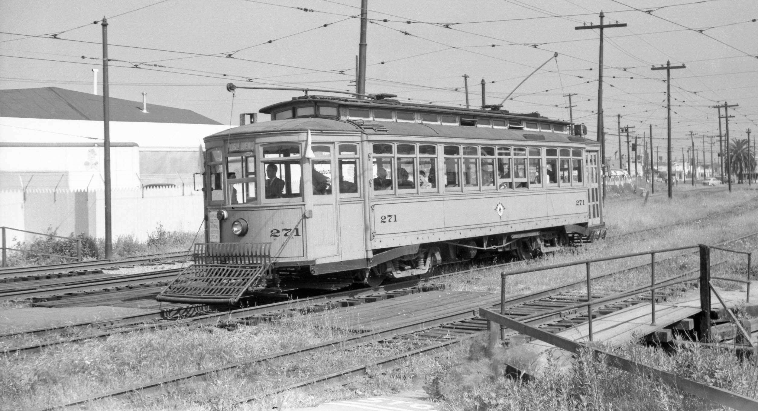
Addison Laflin’s southwest view of Key 271 at the 46th St. stop during a Mar. 3, 1954 excursion includes the signage added to Aluminum Cooking Utensil Co., and introduces Remar Bakery on the north side of 46th St., at that time making Sunbeam Bread.
L276-45-Addison Laflin Photo, Courtesy BAERA, Western Railway Museum Archives, 77429ks, (Image 9 of 39)
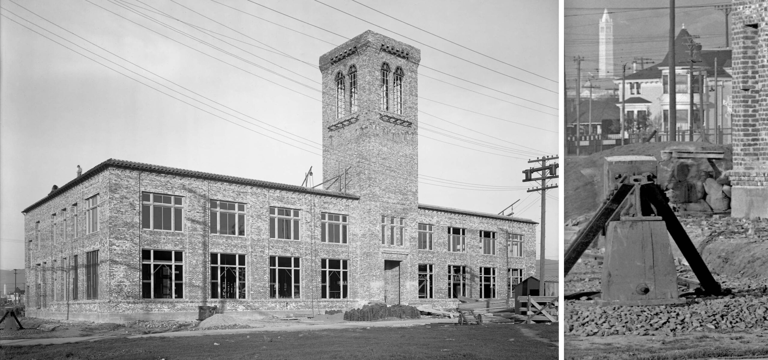
The Remar Bakery building was completed on the former site of the Hutchison Construction Co. in 1919. The architects were W. H. Ellison and Frederick Whitton. Joined by Golden Sheaf of Berkeley in 1922 to form Golden Sheaf-Remar Co., it operated as a bakery until 1988. The north view on the left from ca. 1918 during construction provides interesting details on the left margin, detailed in the right panel. The Santa Fe spur was in place, possibly aiding in construction, and some architectural views lost and still seen in 2022 can be appreciated in the distance.
L276-50-Sappers Collection, Courtesy BAERA, Western Railway Museum Archives, 52210ev, (Image 10 of 39)
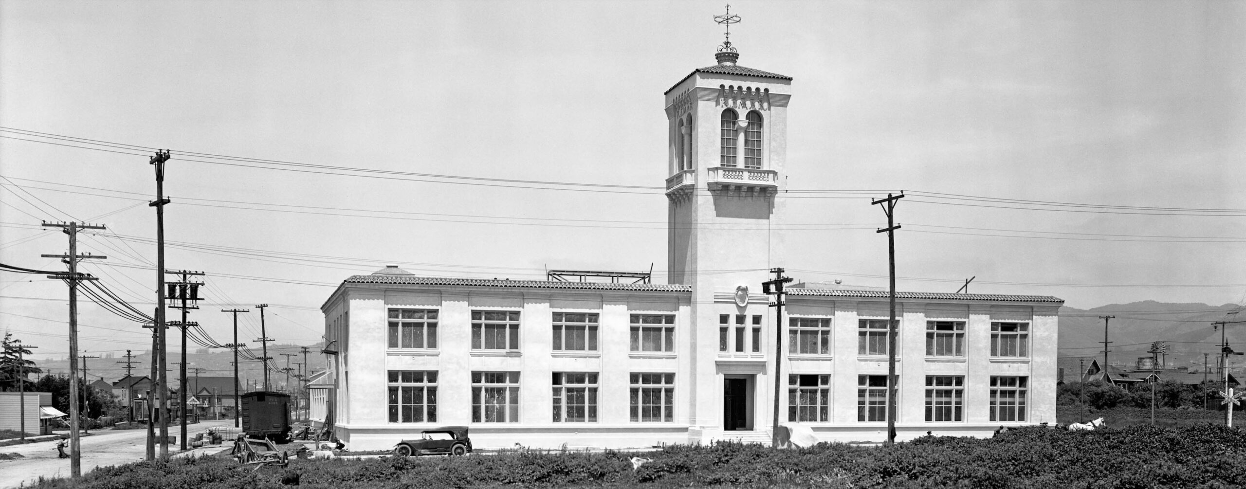
Shown here is the bakery in a northeast view just prior to completion in 1919. What was actually baked in his building changed with time. Between 1930-1950, Interstate Bakers Corp. was formed with myriad mergers and takeovers, creating the largest independent baker in the U.S., and Remar would be purchased sometime in the 1950s-1960s. As for the building, the 1944 reverse directory listed Best Baking Co., Golden Sheaf Remar Co., Maryland-Pacific Cone Co., and Remar Baking Co., but over the years it had also been occupied by the Continental Baking Company, and the San Francisco Herb and Natural Food Company.
L276-55-Sappers Collection, Courtesy BAERA, Western Railway Museum Archives, 51934ev, (Image 11 of 39)
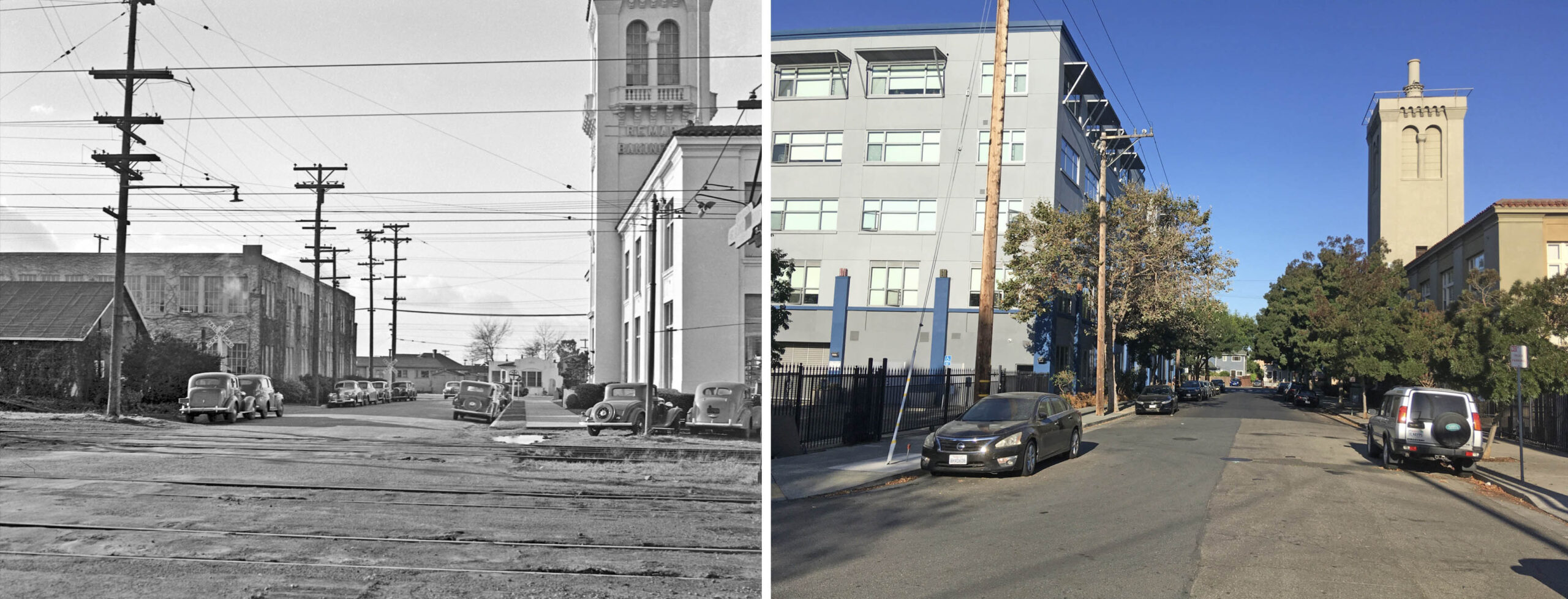
Two northwest views up 46th St. toward Adeline St. are shown, on May 11, 1941, left, and in Sept. 2022, right. Madison Park purchased the bakery in 1998 and would transform and add to the original structure to create Bakery Lofts, 4700 Adeline St., FCGA Architects and West Builders. Madison Park certified the property with the National Park Service as a historic landmark when the project was completed in 2002, National Register of Historic Places no. 02000328.
L276-60-Key Official Photo, Courtesy John Harder, l, Stuart Swiedler Photo, r, (Image 12 of 39)
Two complementary southeast views down 46th from west of Linden St., on May 11, 1941, left, and in Sept. 2022, right. Unlike Green City Lofts on 41st. St. which was built from scratch and neatly divided with a separation between Oakland and Emeryville, both Vue46 and Bakery Lofts built out and up from the existing structure, making the division between the cities less transparent for determining, for example, which school district occupants would attend.
L276-65-Key Official Photo, Courtesy John Harder, l, Stuart Swiedler Photo, r, (Image 13 of 39)
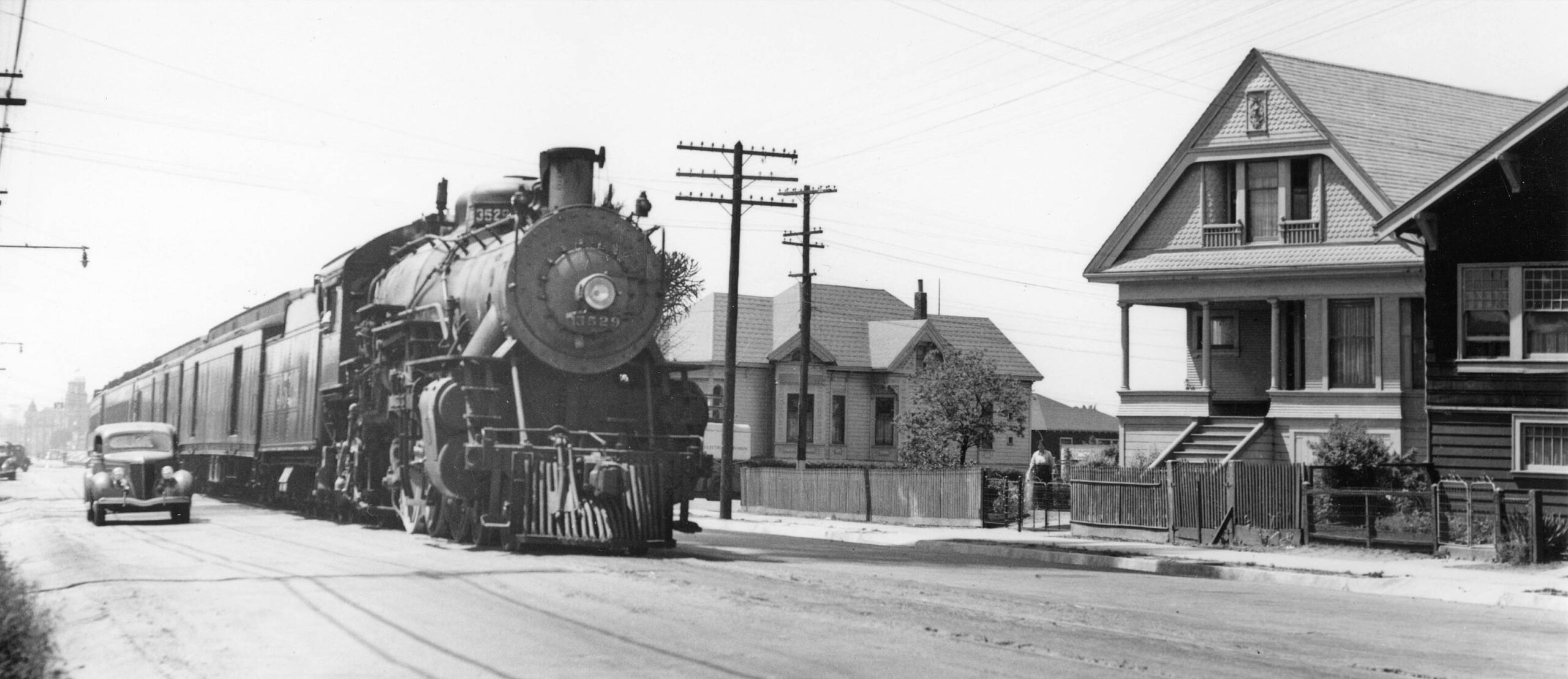
This section of Adeline St. did not have streetcar service, but had passenger and freight service dating back to 1880. Adeline St. was originally equipped with a narrow gauge double-track created by the California and Nevada Railroad, CNRR, in 1880, but the Alameda County Board of Supervisors reduced it to one track in 1884 after merchants protested. Ralph Demoro’s 1938 southwest view shown here is at Adeline St. and 41st St., with ATSF 4-6-2 steam locomotive 3529 on eastbound “Scout” service. The exteriors of the house to the right of the locomotive, and the one along the right edge remain in 2022.
L276-70-Ralph Demoro Photo, Courtesy BAERA, Western Railway Museum Archives, 68291atsf, (Image 14 of 39)
Two northeast views up Adeline St. at 46th St. are shown here, 1951 on the left, 2022 on the right. In their efforts to secure the CNRR’s right-of-way to form the Key Pier, Borax Smith and Frank Havens, through their Realty Syndicate, worked with the Santa Fe to get the latter into Oakland from Richmond in 1904, terminating in Emeryville at 40th St., with an assist from M.A. De Laveaga. The complex details are most accurately described in Erle Hanson’s “California and Nevada Railroad”, R and S Printers, 1988. When Remar was converted to Bakery Lofts, an additional floor was added to the northern section as shown here.
L276-75-Key Official Photo, Courtesy John Harder, l, Stuart Swiedler Photo, r, (Image 15 of 39)
After taking over the CNRR’s right-of-way, the Santa Fe was never able to convince the East Bay cities to add a second track. The Santa Fe delivered freight, here shown in a south view from 1938, until the Interstate Commerce Commission agreed to allow the railroad to shift its freight traffic to the SP tracks and abandon the 9.2 mile line south of Richmond in 1978.
L276-80-Ralph Demoro Photo, Courtesy John Harder, (Image 16 of 39)
The Santa Fe ran passenger trains along Adeline St. until June 15, 1958, when Golden Gate and Chicago-bound Chief services were pared back to Richmond. The Santa Fe were among the earliest to switch from steam to diesel engines, evidenced on the left with a Golden Gate train originating from Bakersfield sitting along Remar Bakery at Adeline St. and 47th St. in 1941, northeast view. The right panel shows an eastbound troop train in 1945, southwest view. Ref: Addison Laflin Coll., l; Erle Hanson Photo, Moreau Coll., r
L276-85-Courtesy BAERA, Western Railway Museum Archives, 45159atsf, l, 89998atsf, r, (Image 17 of 39)
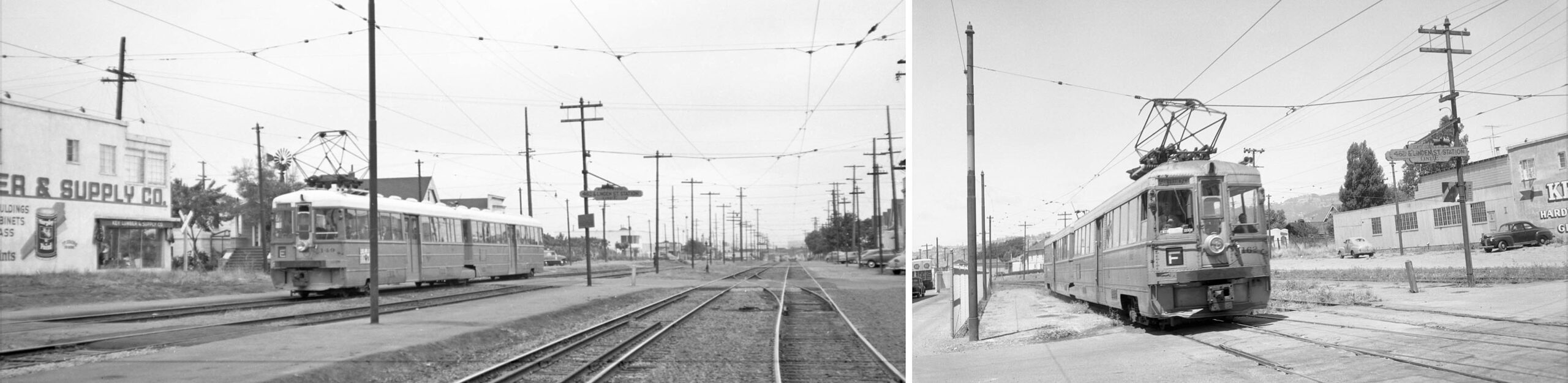
Back to Linden St. and 46th St., combining Fred Matthews southwest view of a KS 149, E line from the late 1940s, left panel, with Vic DuBrutz’s northeast view of KS 162, F line, July 13, 1957, right panel, indicate that the large building at no. 964 46th St. was occupied by Key Lumber and Supply Co., the initial listing in the 1946 directory and still there in 1967. Bakery Lofts 2 is at that spot in 2022. Ref: Moreau Coll., l
L276-90-Courtesy BAERA, Western Railway Museum Archives, 98167ks, l, 71368ks, r, (Image 18 of 39)
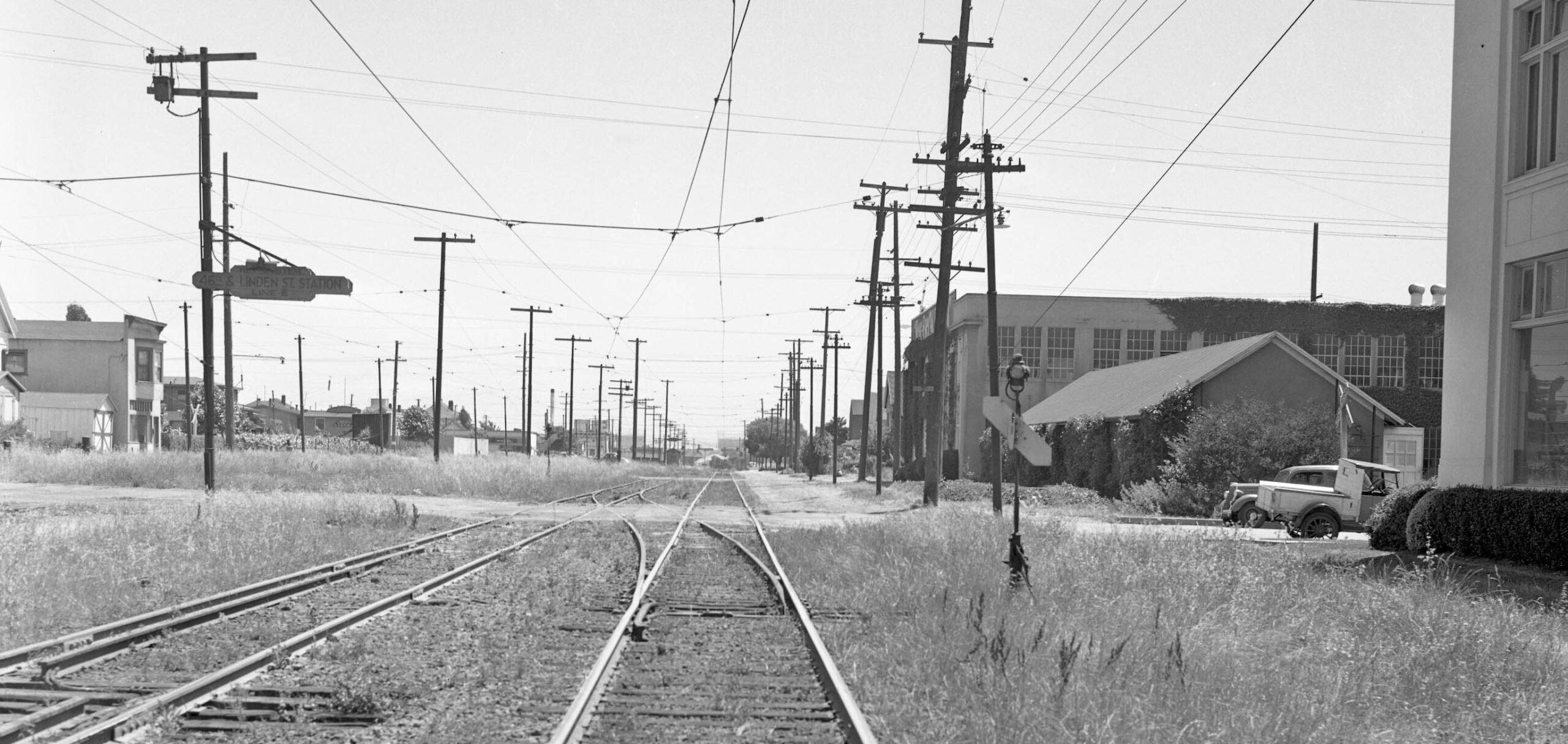
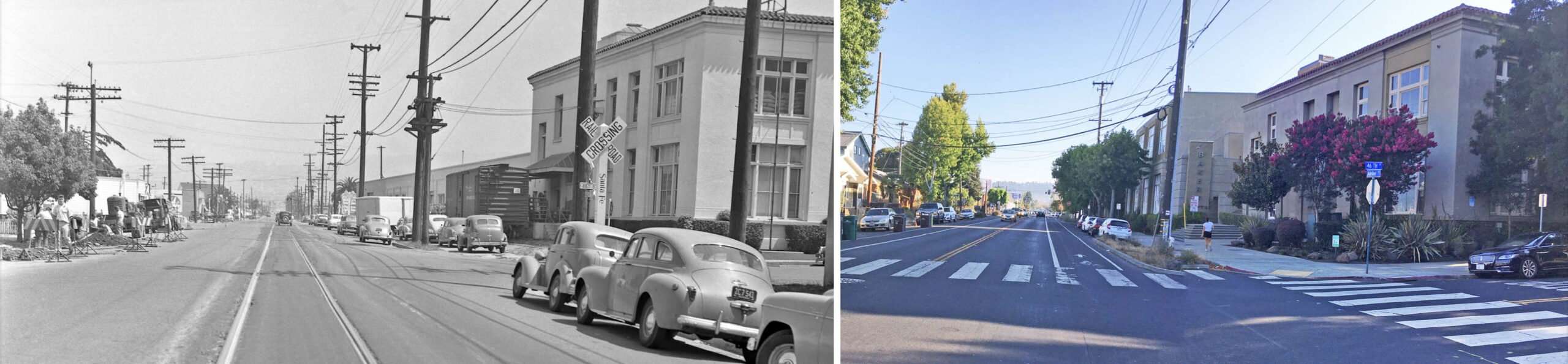
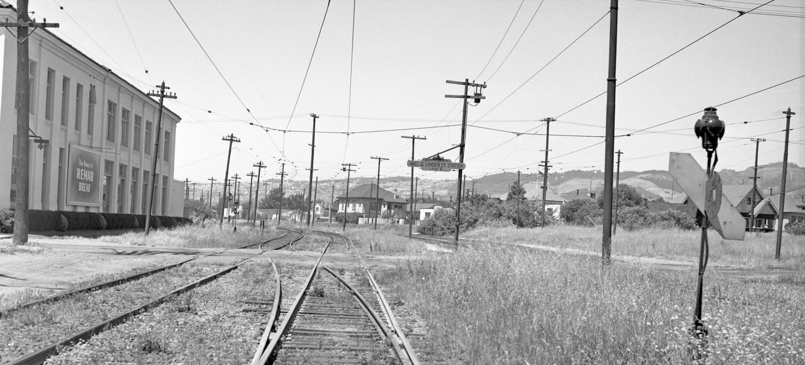
Now facing northeast in 1939 just south of 46th St., Linden St. ended at this point dating back to at least 1876 based on maps. Beyond 46th St., 52nd St. comes in from the east, essentially at the level of 47th St., along with Temescal Creek, the Emeryville-Oakland border. The section between 46th-53rd Sts. became part of the bakery property when a vacation of public access was granted by Oakland City in 1962. The large house, center, is no. 943 53rd St., present in the 1912 Sanborn map with two empty lots to the east.
L276-95-Key Official Photo, Moreau Coll., Courtesy BAERA, Western Railway Museum Arch., 125543ks, (Image 19 of 39)
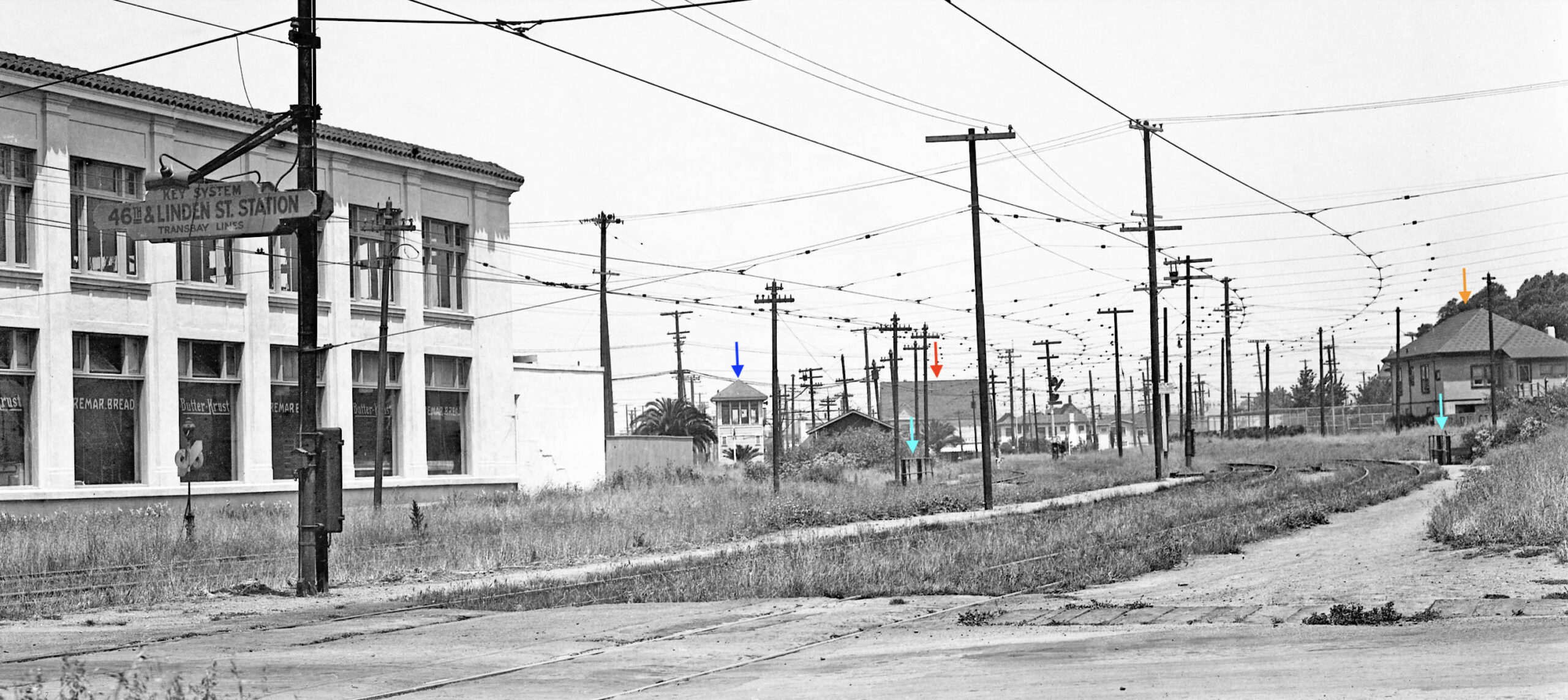
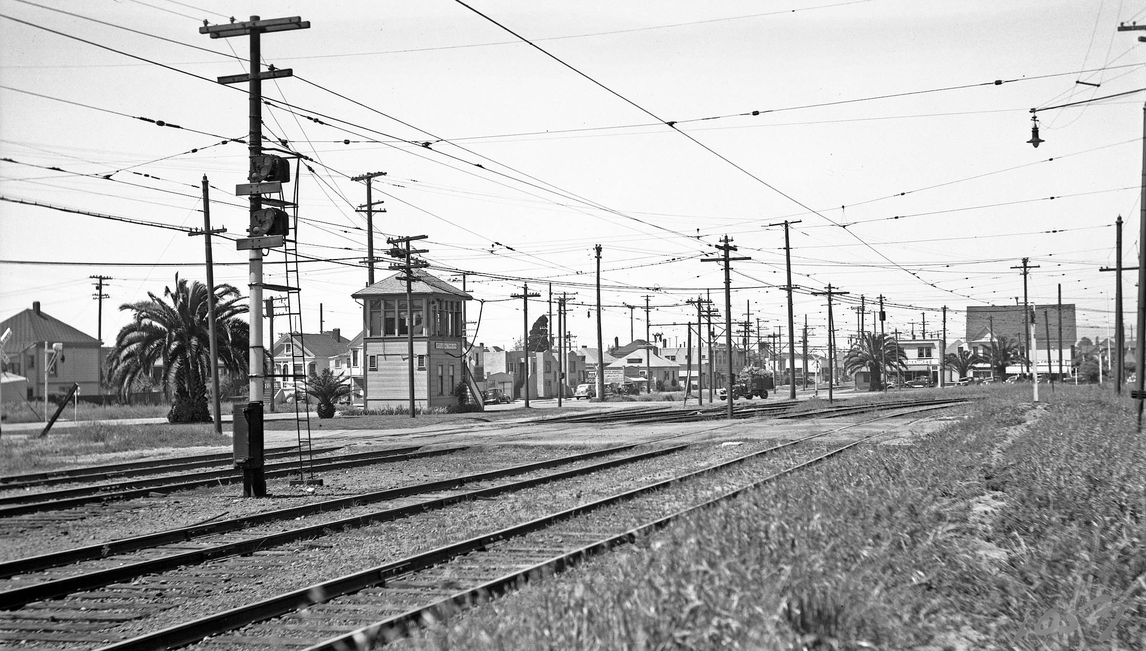
Now on 46th St. and viewing north in 1934, several landmarks structures are prominent. In the foreground, the two turquoise arrows mark the railing of the Key overpass of Temescal Creek. The orange arrow points to no. 943 53rd St., while the red arrow marks 5403 Adeline St., to be discussed soon. The first look at Key Tower 4 beside a prominent palm tree is marked by the blue arrow.
L276-100-Key Official Photo, Sappers Coll., Courtesy BAERA, Western Railway Museum Arch., 171251ks , (Image 20 of 39)
A closer look at the interurban overpass of Temescal Creek is provided in this north view of KS 271 on excursion on the E line track on May 22, 1955. The culvert between Martin Luther King Way and Adeline St. was not placed until ca. 1983.
L276-105-Fred Matthews Photo, Moreau Coll., Courtesy BAERA, Western Railway Museum Arch., 97840ks, (Image 21 of 39)
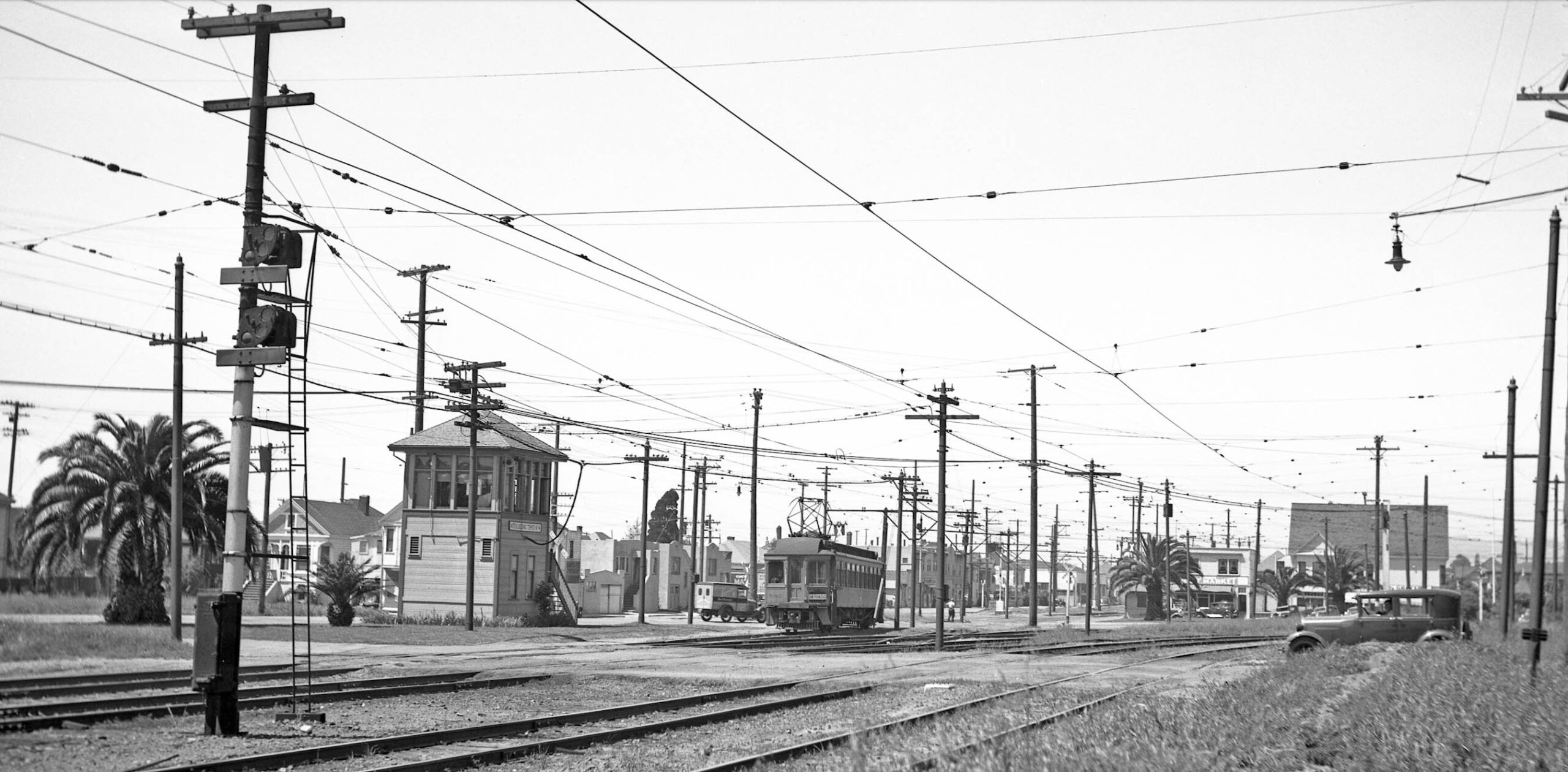
Back to a detail of the north view from Apr. 8, 1953, the Sunbeam Bread sign on the top of Remar Bakery and the Key crossing of Temescal Creek form the lower or south edge. Note Santa Fe Elementary School, John J. Donovan’s 1914 version, replaced in 1960. The orange arrow points to no. 943 53rd St., the red arrow marks 5403 54th St., and the blue one to the former site of Tower 4. The two tracks of the E line, green arrow, and those for the F line, yellow arrow, have no interchanges. The tracks for the H line have been removed from Lowell St., black arrow, while the single Santa Fe Track remains, white arrow.
L276-110-Copyright California Department of Transportation, 3300-6, Detail, (Image 22 of 39)
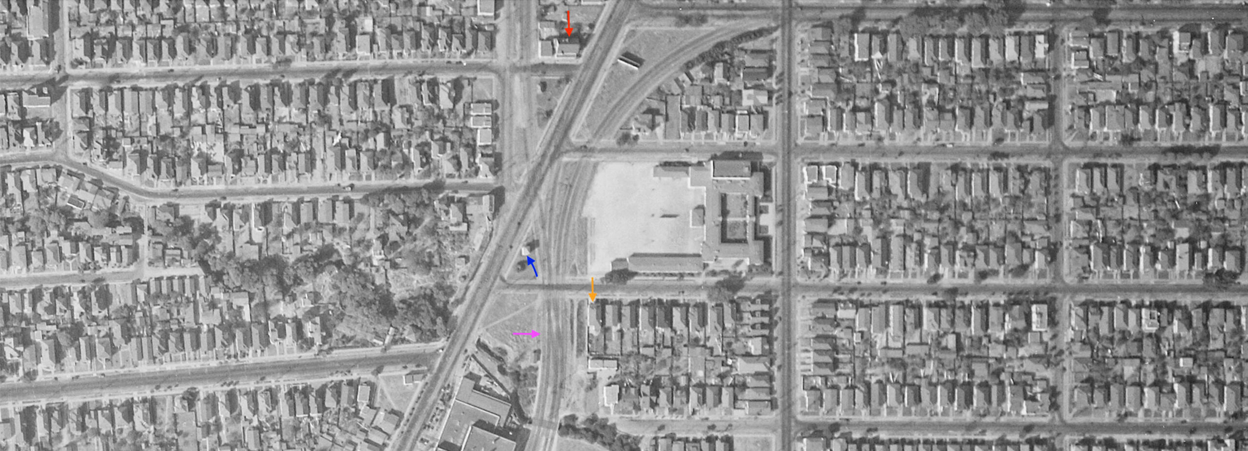
Same scene from a vertical view, but back to 1931. Same arrow designations as previous, but Tower 4 is now designated by the blue arrow. The H line tracks are present, and in 1931 that line emanated from the tracks used by the E line, creating a situation where two tracks had to cross the F line tracks, pink arrow. Harre Demoro explains in “The Key Route” that this unfavorable configuration was corrected by 1933, when the H line was switched to sharing track with the F line.
L276-115-c-1820 55, Courtesy of UCSB Library Geospatial Collection, (Image 23 of 39)
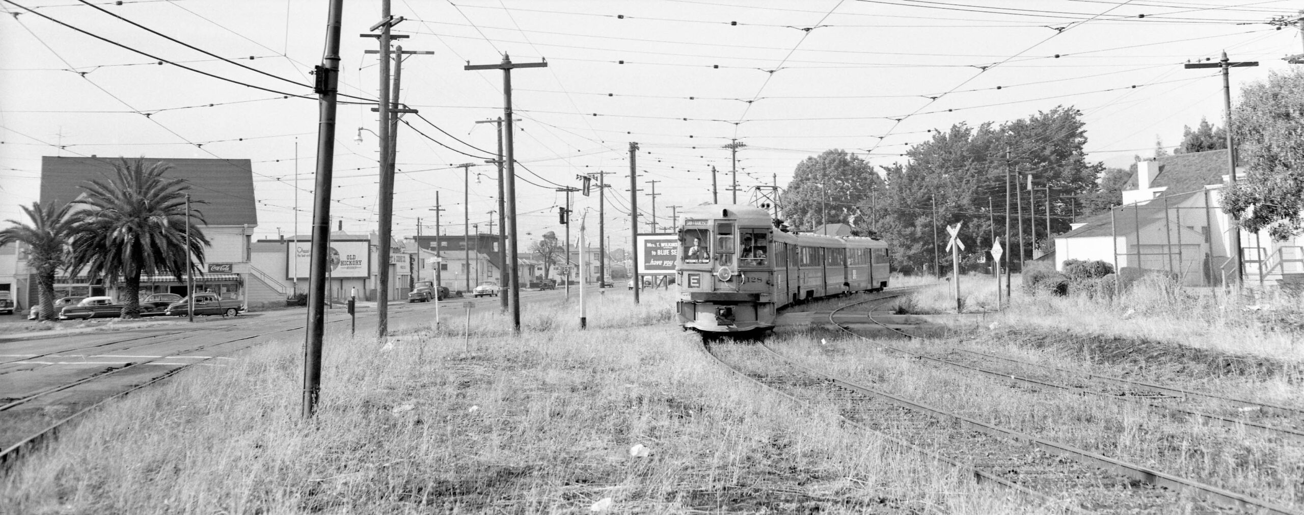
Next, a closer look at the three Key interurban lines as they separated from one another at 53rd St. This southeast view from June 1955 by Fred Matthews shows KS 128 leading a two-unit E line train across 54th. St. in a northeast view. Note the poor condition of the adjacent F line tracks on Adeline St. to the left or west, and the presence of storefronts along the south side of no. 5403 Adeline St.
L276-120-Fred Matthews Photo, Aitkins Coll., Courtesy BAERA, Western Railway Museum Arch., 162222ks, (Image 24 of 39)
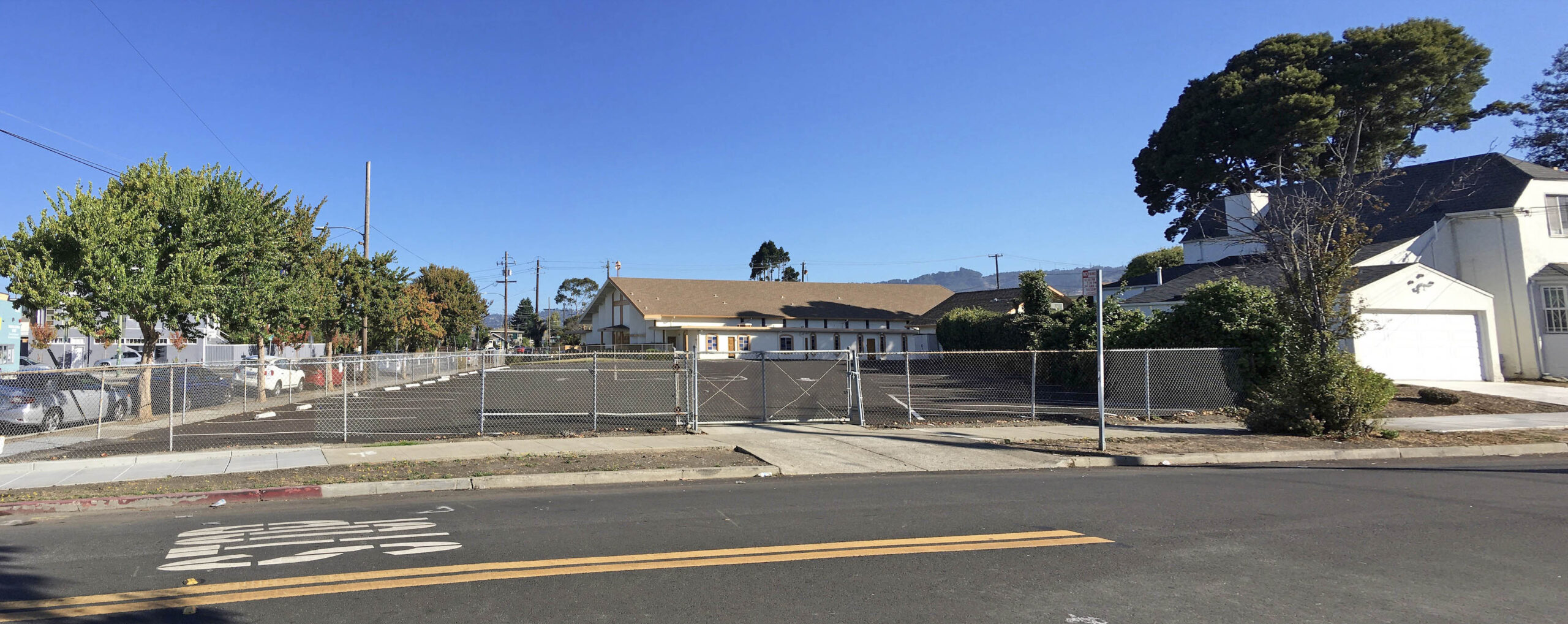
In 2022, the same northeast view shows that the E line path is now a parking lot for the Bethany Baptist Church, the latter opening in 1964. The storefronts along the south side of no. 5403 Adeline St. are long gone.
L276-125-Stuart Swiedler Photo, (Image 25 of 39)
Another view at 54th St., this time a south view from Peter Kyhn on June 6, 1946 with KS 106, line E crossing 54th St. with the Santa Fe School yard in the background.
L276-130-Peter Kyhn Photo, Courtesy BAERA, Western Railway Museum Archives, 128510ks, (Image 26 of 39)
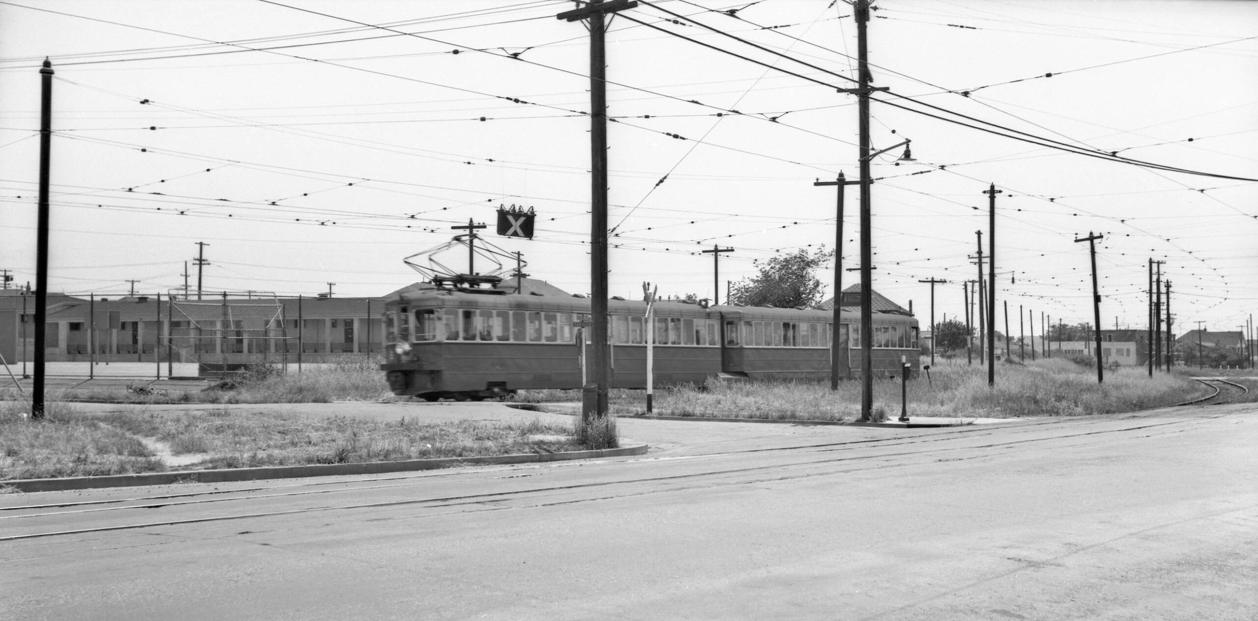
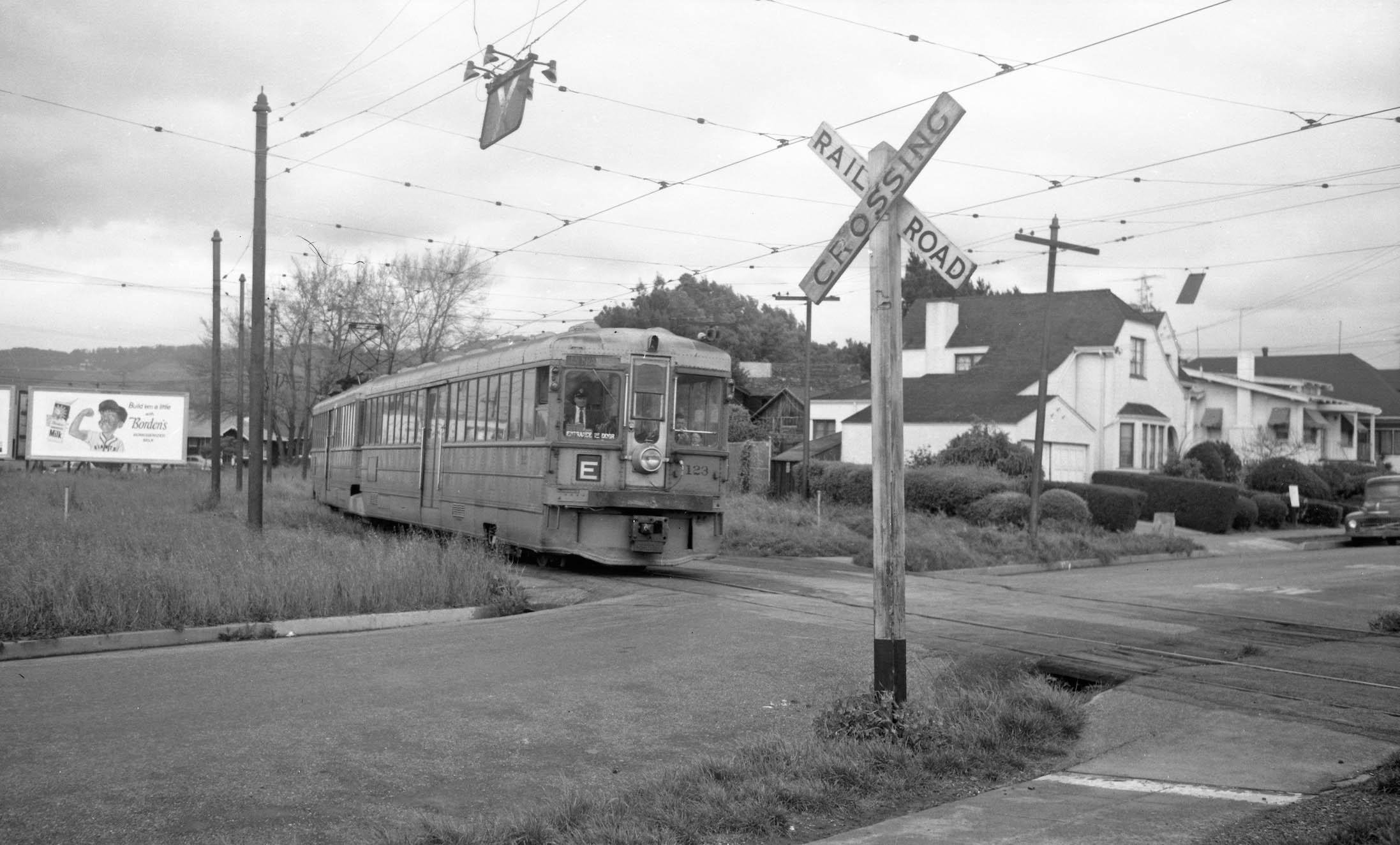
The E line right-of-way was another popular spot for billboards. Here behind or to the north of KS 123, E line, crossing 54th St. on May 5, 1958 with no. 930 54th St. on the east flank the board reads, “Build ‘em a little with Borden’s Homogenized Milk.”
L276-135-Jack Perry Photo, Courtesy BAERA, Western Railway Museum Archives, 92520ks, (Image 27 of 39)
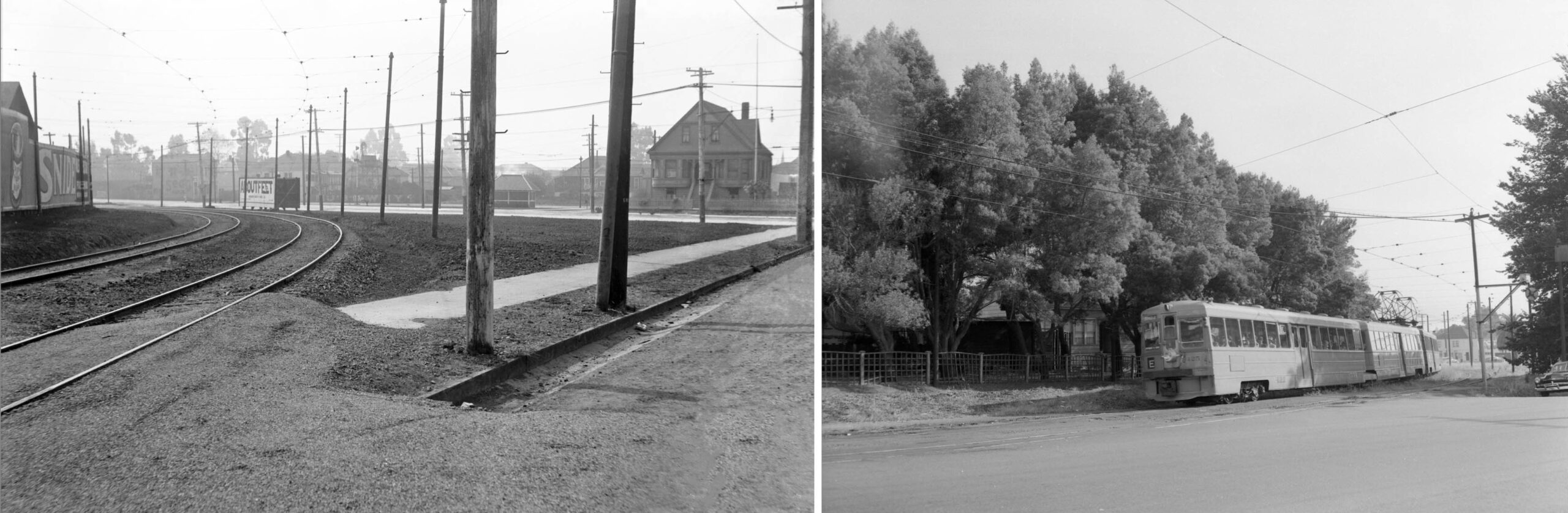
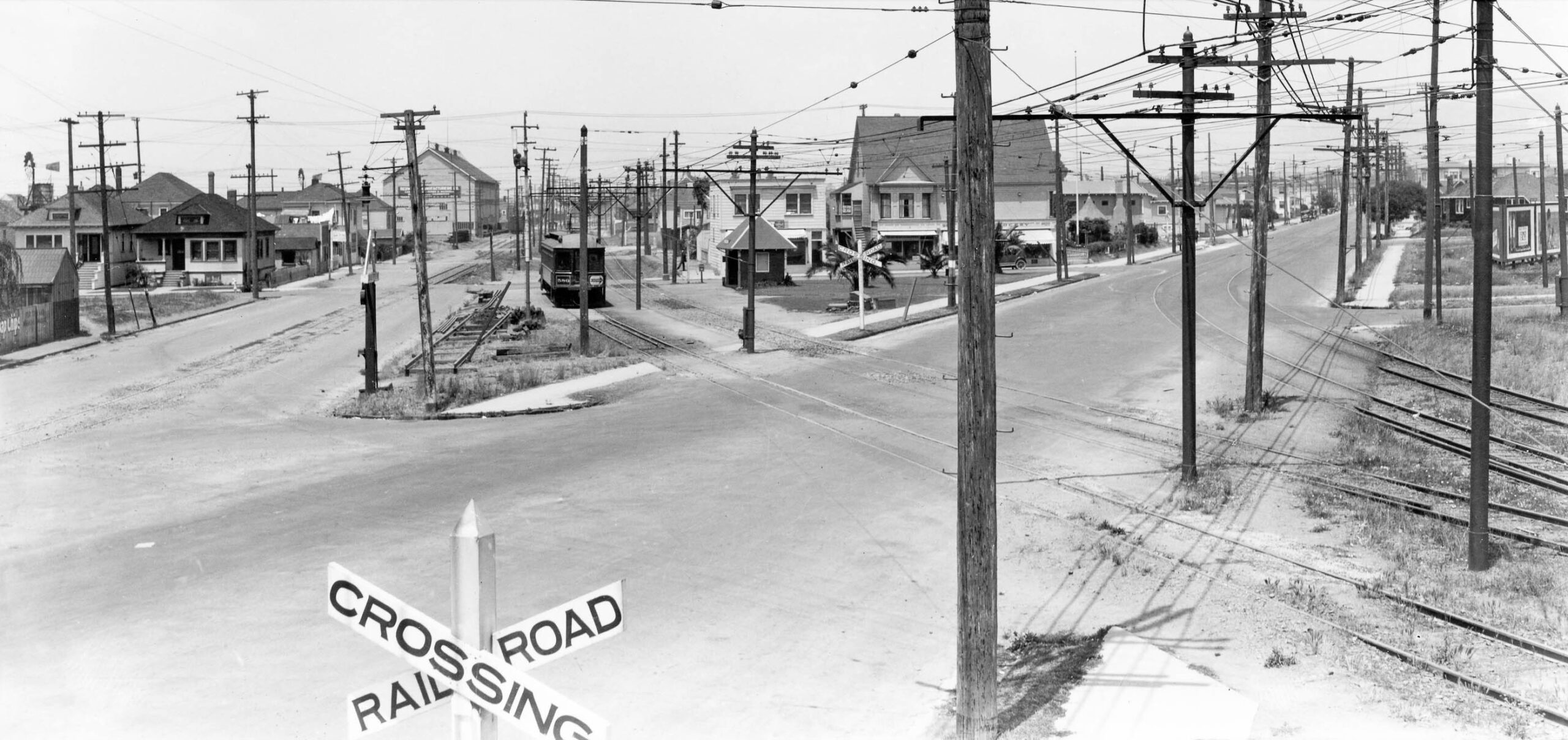
Finally, two west views of the E line on the final curve onto 55th St. just west of Market St. The left panel shows the right-of-way in 1918. Note no. 5403 Adeline along the right edge. The main residence appears in the 1902 Sanborn, the adjoining commercial space, nos. 942 and 948 54th St. appearing after 1912. The 1938 reverse directory lists no. 942 54th as Midway Market and Grocery, and no. 948 as 54th St. Market. The right image is from June 1955, trees having long replaced the wall of billboards. Ref: Key Official Photo, Sappers Collection, l; Fred Matthews Photo, Aitkins Coll., r
L276-140-Courtesy BAERA, Western Railway Museum Archives, 25408ks, l, 162218ks, r, (Image 28 of 39)
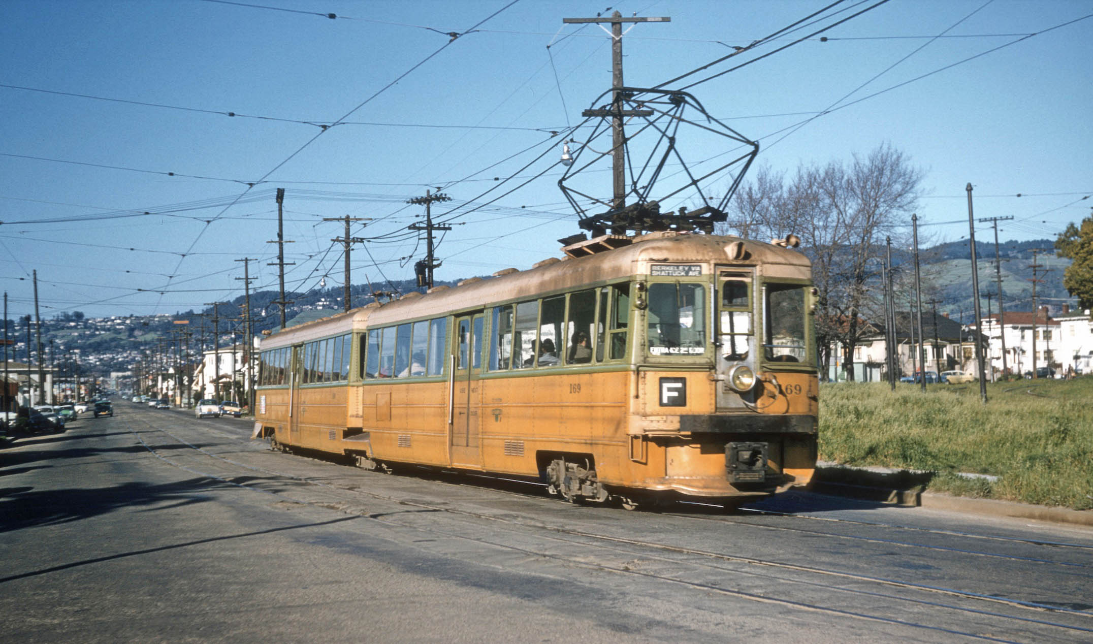
Now to the F line, here in a northeast view on Adeline led by KS 169. The poles to the right or east are from the E line’s final curve onto 55th St. Another example of the poor condition of the rails, the date, Mar. 1, 1958.
L276-145-Clark Frazer Photo, Courtesy the Krambles-Peterson Archive, (Image 29 of 39)
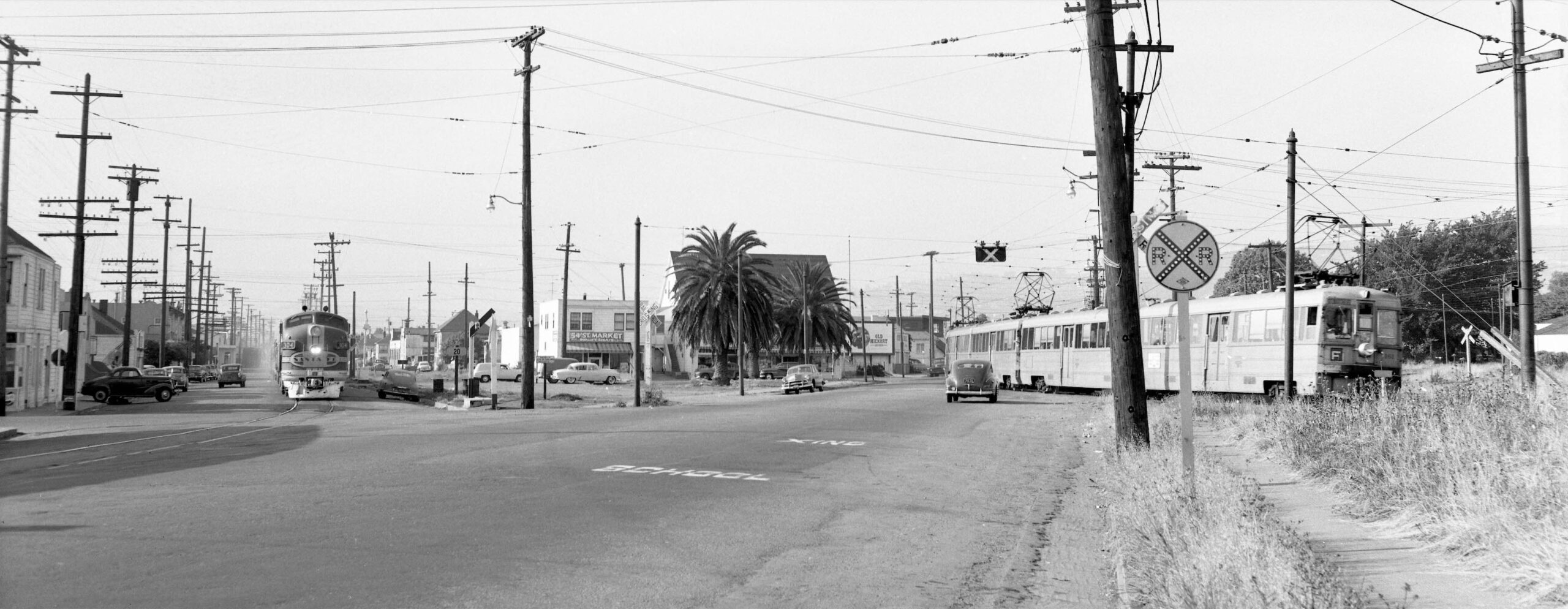
As the Key F line approaches the private right-of-way at 53d St., Santa Fe diesel 304 approaches the intersection of Lowell and Adeline Sts. in June 1955. The two markets associated with no. 5403 Adeline St. can be appreciated along 54th St., and the abandoned right-of-way of the H line is still unoccupied. The sign to the left of the palm tree states ‘Property City of Oakland.’ The big mystery is how many tries did it take Fred Matthews to catch the two trains passing each other.
L276-150-Fred Matthews Photo, Aitkins Coll., Courtesy BAERA, Western Railway Museum Arch., 162206sn , (Image 30 of 39)
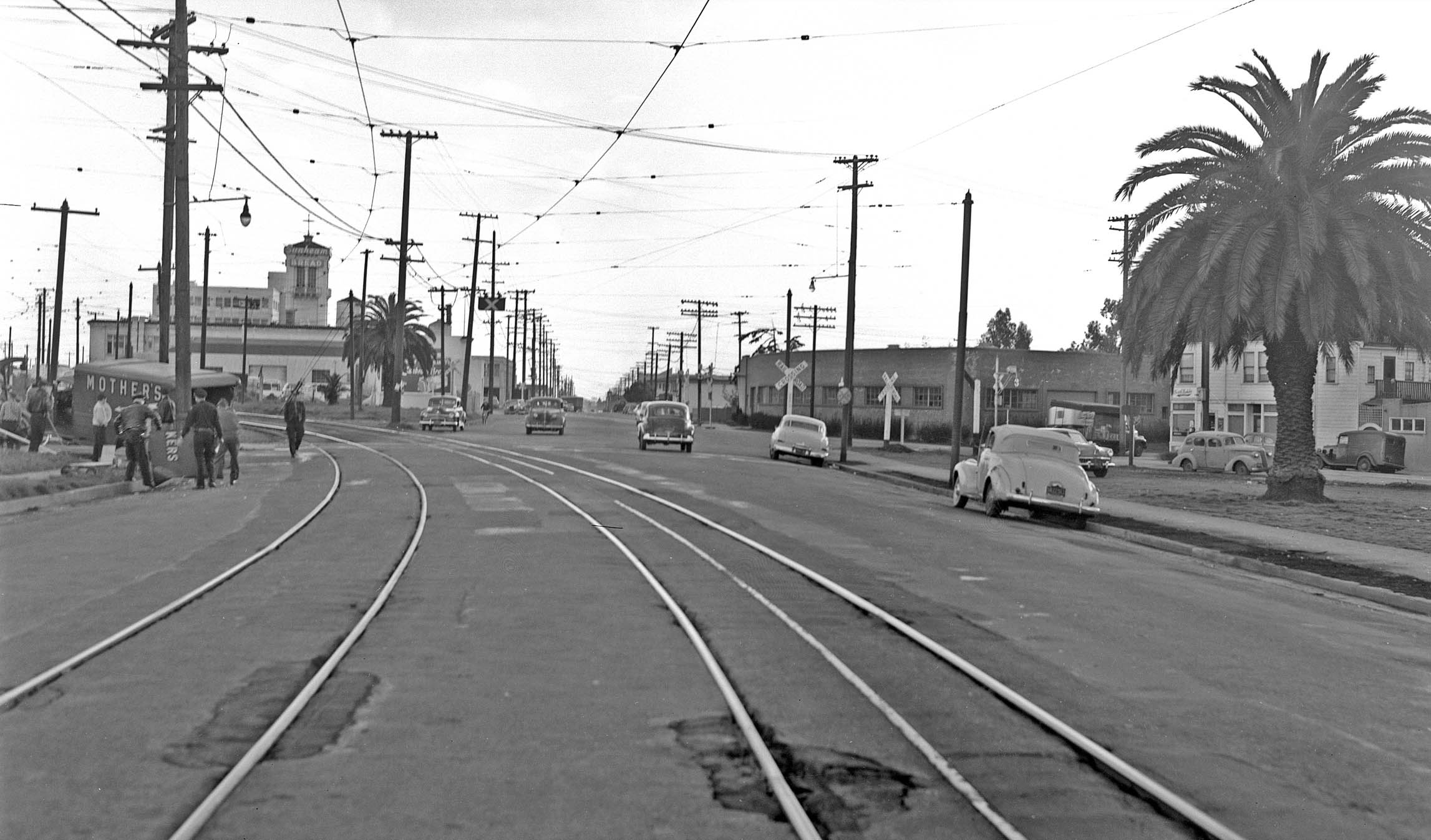
A southwest view down Adeline St. from the early 1950s at 54th St. shows the result of a collision of a Mother’s Bakery truck with F line unit 132.
L276-155-Key-System Photo, Courtesy John Harder, (Image 31 of 39)
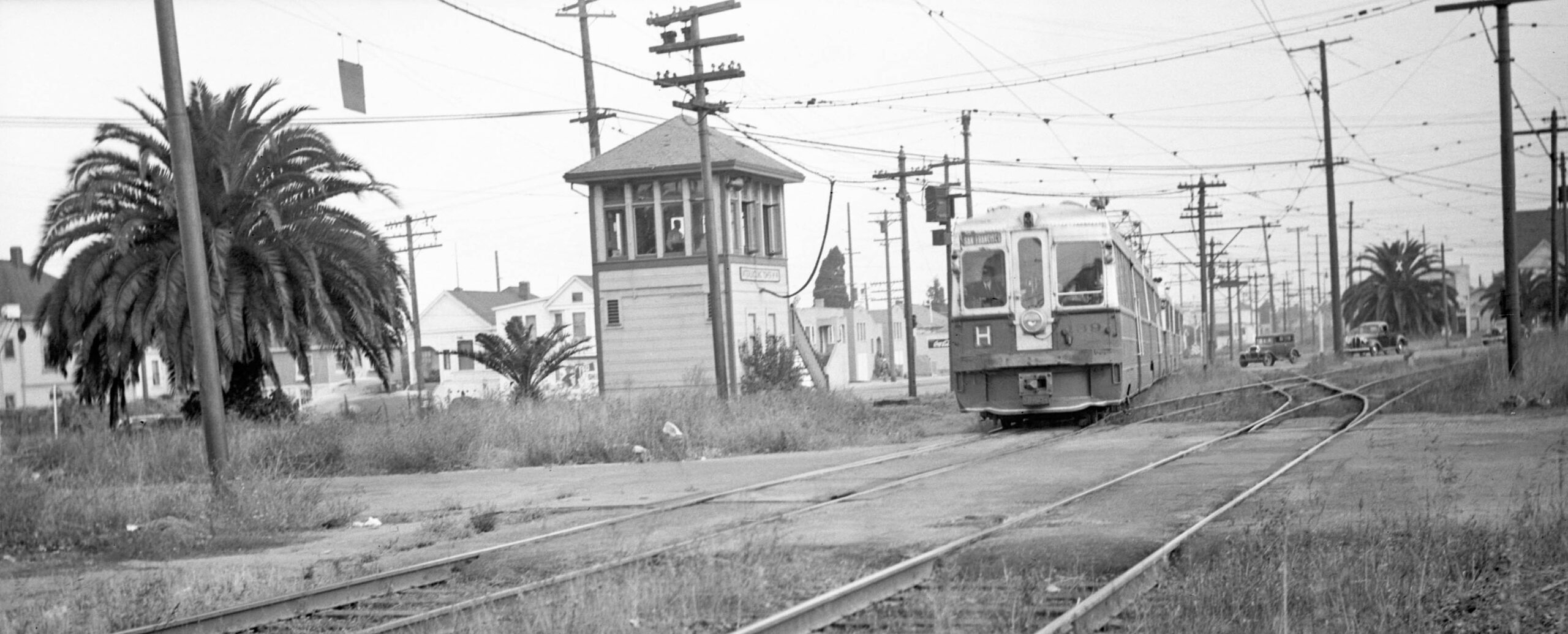
KS 139, line H approaches 53rd St. under the watchful eye of the Tower 4 operator in this north view from July 21, 1941, five days prior to abandonment of the line. The joining of this line with the F line tracks occurred in 1933, and the change in the designation from Northbrae line to H line ca. 1935-1936 when the Key introduced the articulated, two-compartment, “bridge units”, produced in part by salvaged parts from older cars.
L276-160-Sappers Collection, Courtesy BAERA, Western Railway Museum Archives, 94920ks, (Image 32 of 39)
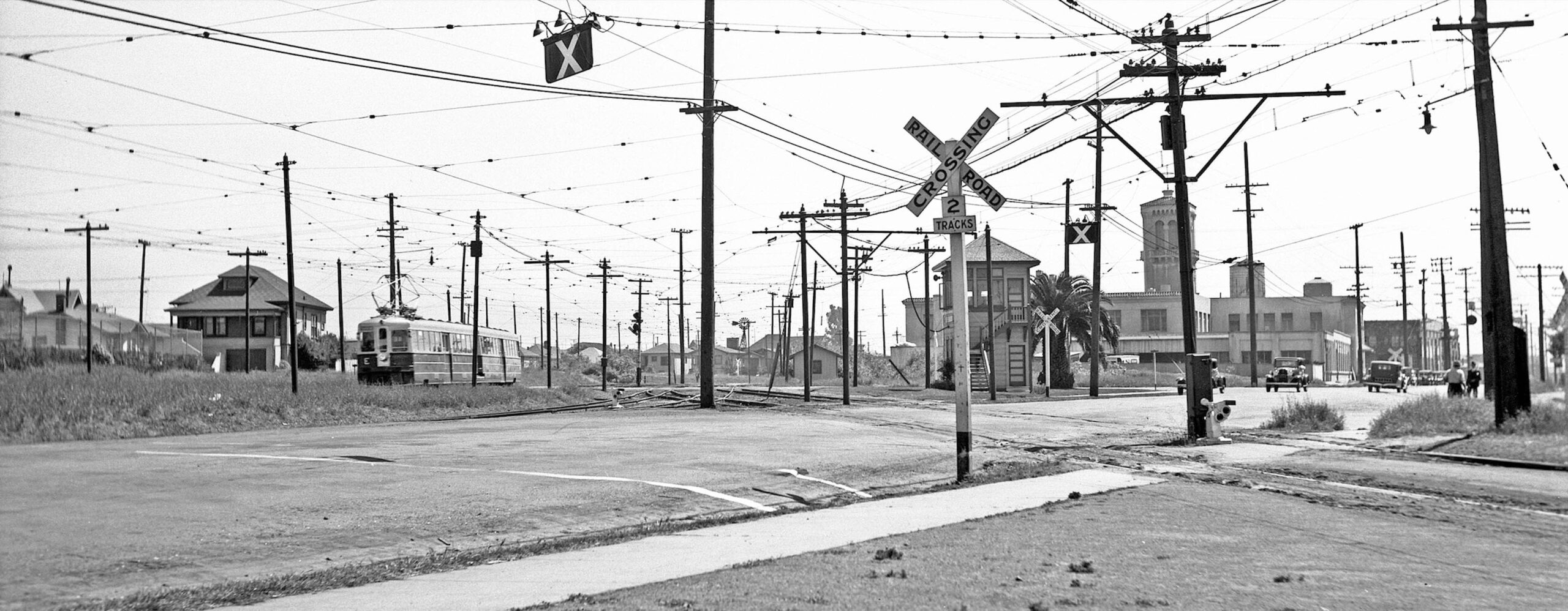
Ralph Demoro provided a panoramic record of the Tower 4 area in two images taken on May 11, 1937. This first south view taken along Adeline St. and the H line grade crossing shows an E line interurban crossing 53rd St., with no. 943 53rd St. to its left or east. A structure that cannot be accounted for is the tower to the right of the Remar Bakery tower, possibly a short-lived tower on the cookware factory between 1932-1938 based on several aerials views.
L276-165-Ralph Demoro Photo, Courtesy John Harder, (Image 33 of 39)
Reversing field on May 11, 1937, Demoro took this north view of the tower sans trains. Five palm trees are in view, a trademark finding traceable to Borax Smith, as are Midway Market and Grocery and the 54th St. Market along the south flank of no. 5403 Adeline St. by the right or east border. As a matter of history, interlocking Tower 4 was put in service on Mar. 3, 1912
L276-170-Ralph Demoro Photo, Courtesy John Harder, (Image 34 of 39)
This north view appears almost identical to the previous image, but the year is 1933, and a car waits for a train to pass the tower and cross 53rd. St. As a matter of history, the H line began service on Nov. 11, 1911, just beating the opening of the SP’s competing California St. line to Thousand Oaks that began service on Dec. 22, 1911. Both interurbans satisfied the needs of real estate speculators, but had very poor ridership.
L276-175-Key System Photo, Courtesy John Harder, (Image 35 of 39)
Back to 1923, a north view from Tower 4 up Lowell St., with the H line and Santa Fe tracks as centerpieces. The train is passing the 54th St. Station shelter. The California St. line was operational until Mar. 25, 1933 when the Railroad Commission eliminated competition between the two companies. The H line survived, but its terminal portion along Hopkins St. in Berkeley was abandoned in favor of the California St. line section between Rose St. and Monterey Ave., the last stop at Thousand Oaks not being included.
L276-180-Sappers Collection, Courtesy BAERA, Western Railway Museum Archives, 67985key, (Image 36 of 39)
The palm tree and shelter area, as well as most of the H line right-of-way, was filled with buildings by 1965. John Harder’s north view from Nov. 27, 2004 up Lowell St. looks about the same as it has for the past half century. Refer to the 1965 aerial at the end of this presentation.
L276-185-John Harder Photo, Courtesy John Harder, (Image 37 of 39)
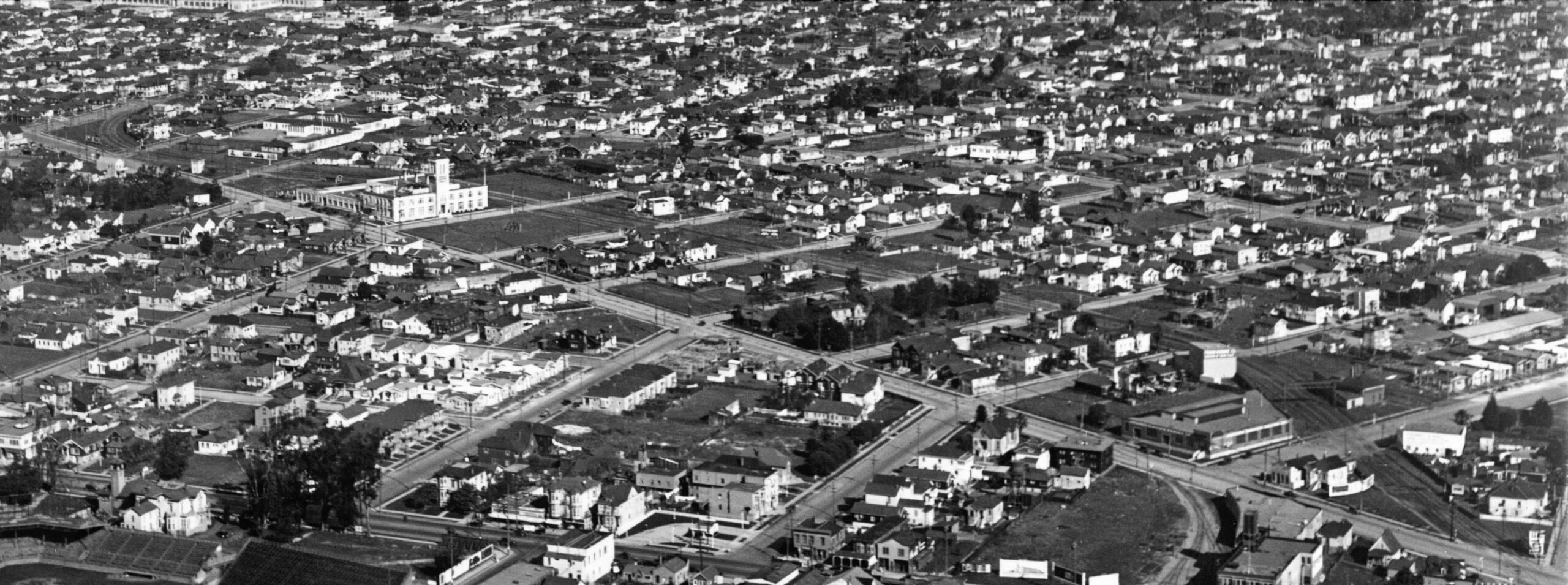
Reflecting on everything that has been revealed about the interurban corridor along Linden St. and adjacent Adeline St. is brought to light in this George Russell aerial east view. The presence of a sliver of University High School, later City or Merritt College, located along the upper left edge, dates the view from at least 1923, and the absence of the Aluminum Cooking Utensil Co. building to 1925, at the latest.
L276-190-George Russell Photo, Courtesy the Califronia State Lands Commission, API 651 16 BOX 94, (Image 38 of 39)
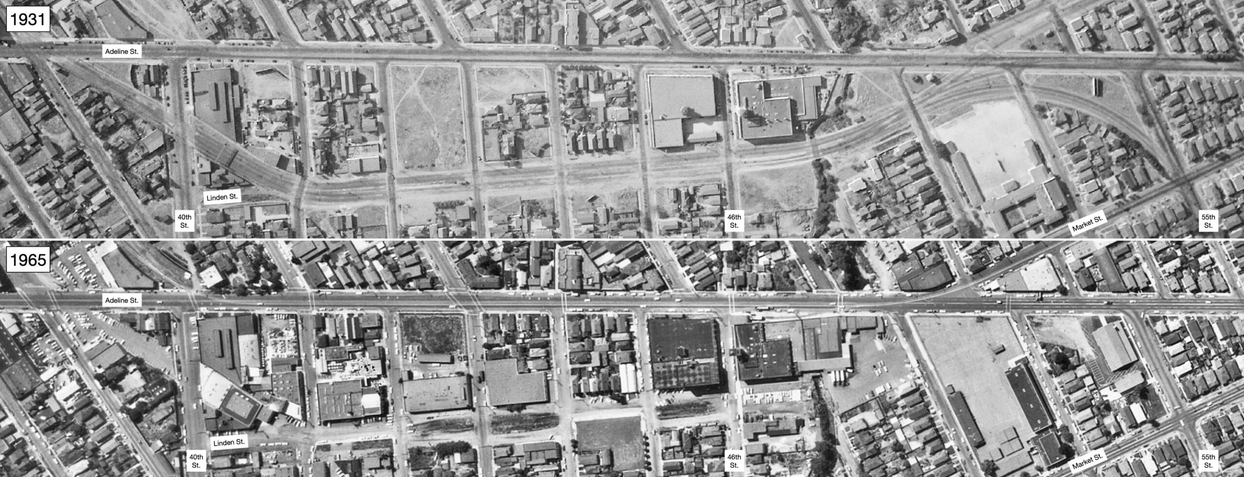
And for those interested in the changes at every spot along the area reviewed, matching 1931 vs. May 18, 1965 vertical aerials are provided here. Appreciation to John Harder for images and insights, to Ron Hook who maintains the Key System albums at the Western Railway Museum, and to Betty Marvin of the Oakland Cultural Heritage Survey for Sanborn maps.
L276-195-c-1820 55, upper, c-1820 55, lower, Courtesy of UCSB Library Geospatial Collection, (Image 39 of 39)