Building a Freeway
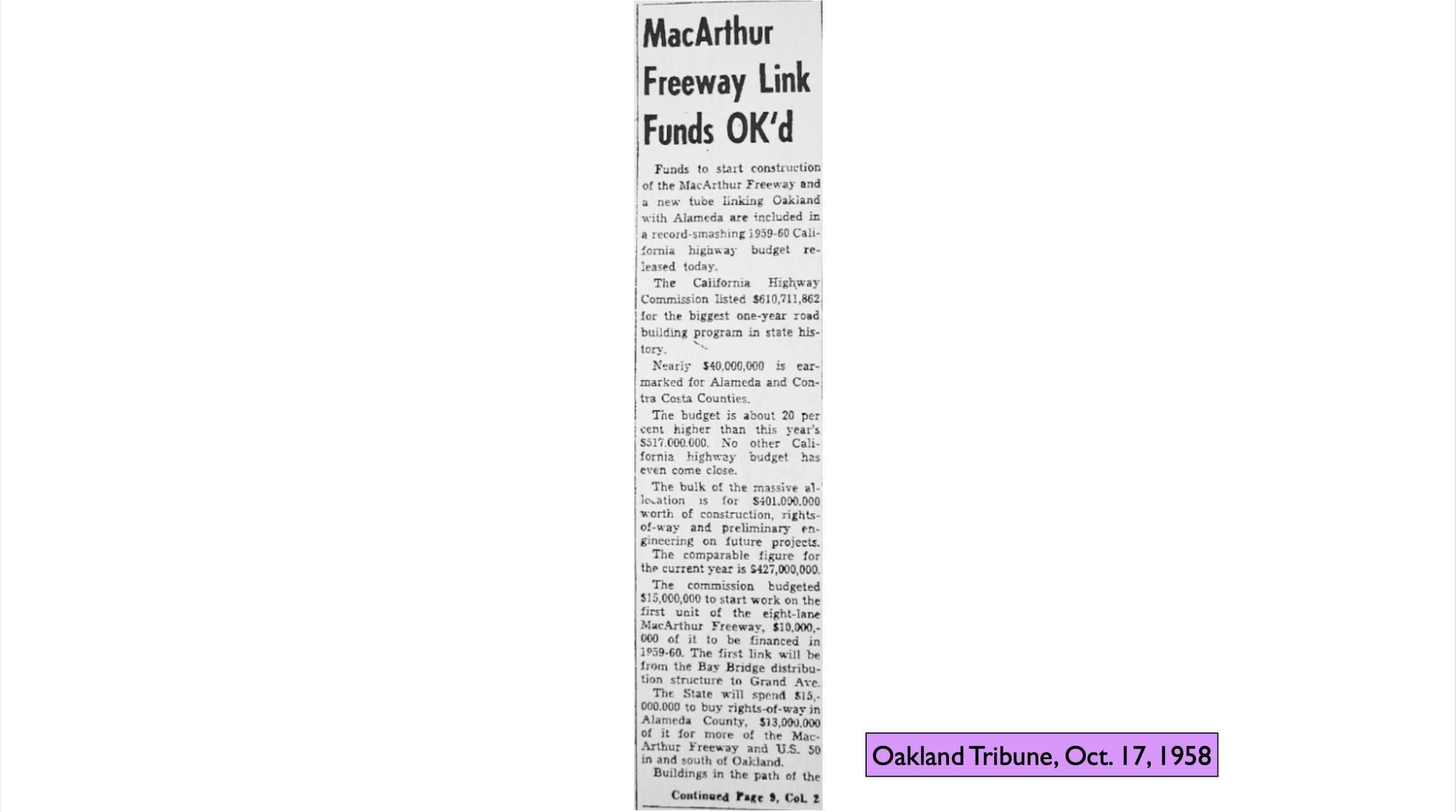
The timing could not have been better for all the highways envisioned for the East Bay when the Eisenhower Administration convinced Congress to pass the Federal-Aid Highway Act of 1956. To Eisenhower, the need for roads tied into defense and evacuation, which is why the act was also called the National Interstate and Defense Highways Act. The 26 billion dollar price tag was the largest public works project undertaken up to that time in the US.
L246-05-Courtesy Oakland History Room, Oakland Public Library, (Image 1 of 35)

The construction of the first portion of Highway 580 or the MacArthur Freeway will be covered in this update, summarized in this map from Apr. 1954.
L246-10-Copyright California Department of Transportation, 5223, (Image 2 of 35)
These images from Jan. 1, 1959 document the clearing of properties between Louise St. and Broadway. The east view, left, shows the California Hotel, designed by Clay N. Burrell and the Sommarstrom Bros., opened in 1930, and placed on the National Register of Historic Places in 1988. The west view, right, shows our marker for Broadway, the Lyons Building, also designed by Burrell, along with C.E. Richardson.
L246-15-Copyright California Department of Transportation, 6400-3, l, 6400-2, r, (Image 3 of 35)
This east view from early 1959 shows the process of clearing structures in progress east of Broadway, the detail on the right with the path of the future highway indicated by the yellow line. Important to note that the Lyons Building in 2021 houses the Video Game Museum-Museum of Art and Digital Entertainment.
L246-20-Copyright California Department of Transportation, 6400-3 with Detail, (Image 4 of 35)
A west view showing the same area east of Broadway in the initial stage of being cleared in early 1959.
L246-25-Copyright California Department of Transportation, (Image 5 of 35)
The next set of images from July 12, 1960 continue the construction sequence, beginning with this west view east of San Pablo Ave. A detail follows.
L246-30-Copyright California Department of Transportation, 7584-6 , (Image 6 of 35)
This west view detail from the previous image confirms the origins of the freeway coming off the bridge flyover at Louise St. By 1960, passenger service by the Key System and Santa Fe to this juncture had ceased. What remained was the Oakland Terminal Railway and the Santa Fe freight operations.
L246-35-Copyright California Department of Transportation, 7584-6, Detail, (Image 7 of 35)
Further east, these two images from July 12, 1960 document the beginnings of building the road between Broadway and San Pablo Ave. Details follow.
L246-40-Copyright California Department of Transportation, 7584-5, l, 7584-7, r, (Image 8 of 35)
This detail from the previous east view panel starts west of Peralta St. and shows the beginnings of the overhead structure east of that street. Note the California Hotel sign reads Hotel California, the details of which were not investigated, but the latter name has not been used since at least 1988. Clawson Elementary School at 3240 Peralta St. is seen in the bottom right corner, since converted to condominiums.
L246-45-Copyright California Department of Transportation, 7584-7, Detail, (Image 9 of 35)
Complementary to the last image is this west view detail taken east of Telegraph Ave. The California Industrial Home and Orientation Center for the Adult Blind avoided the highway right-of-way running between 35th and 36th Sts., but it would soon be engulfed in the construction of the MacArthur Maze. This subject is covered in detail in the presentations, “In the Way of the MacArthur Maze, Parts 1 and 2.”
L246-50-Copyright California Department of Transportation, 7584-5, Detail, (Image 10 of 35)
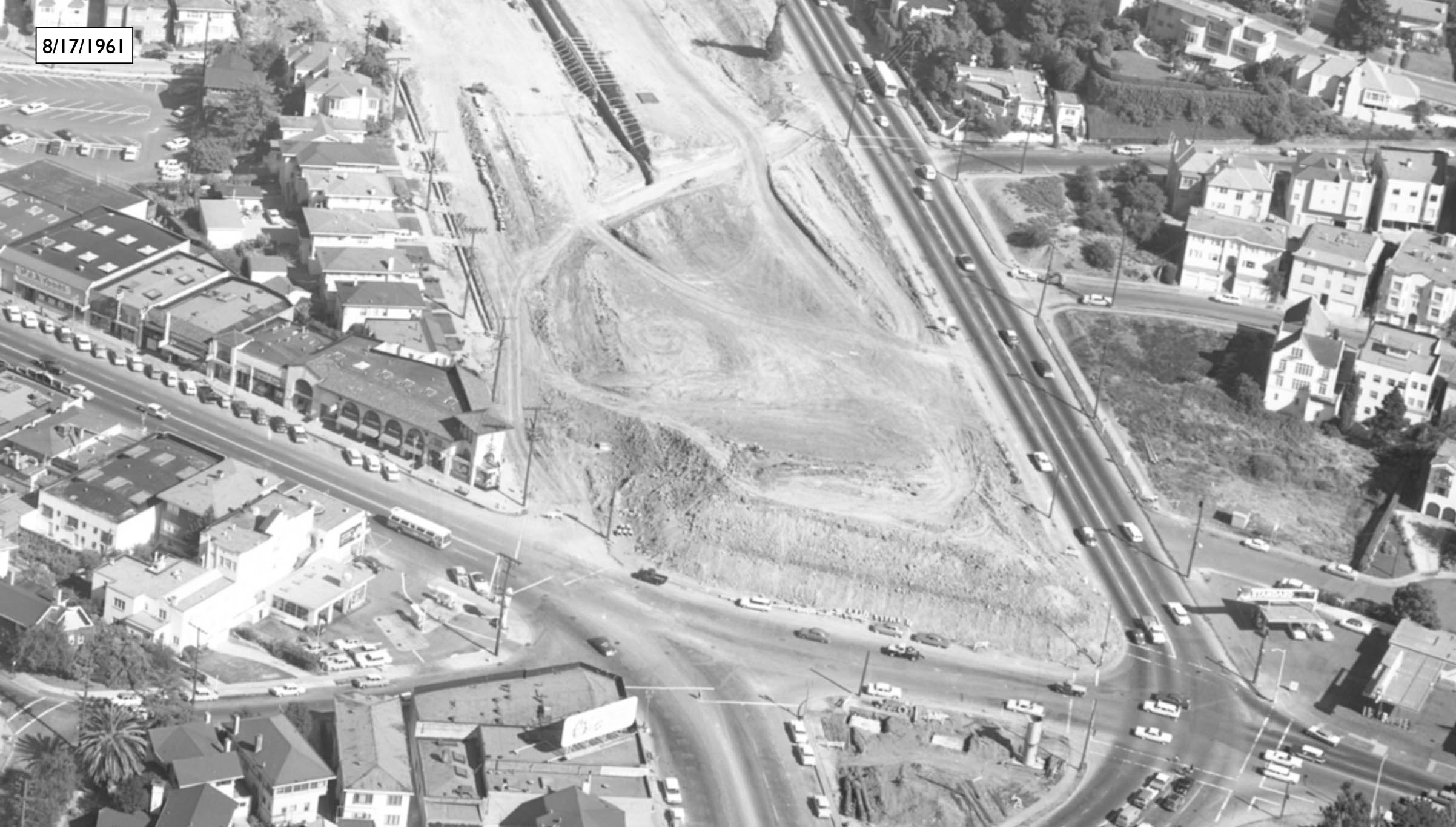
Moving further east, but maintaining a view to the west on July 12, 1960, the beginnings of overpass construction may be appreciated east of Broadway.
L246-55-Copyright California Department of Transportation, 7584-1, (Image 11 of 35)
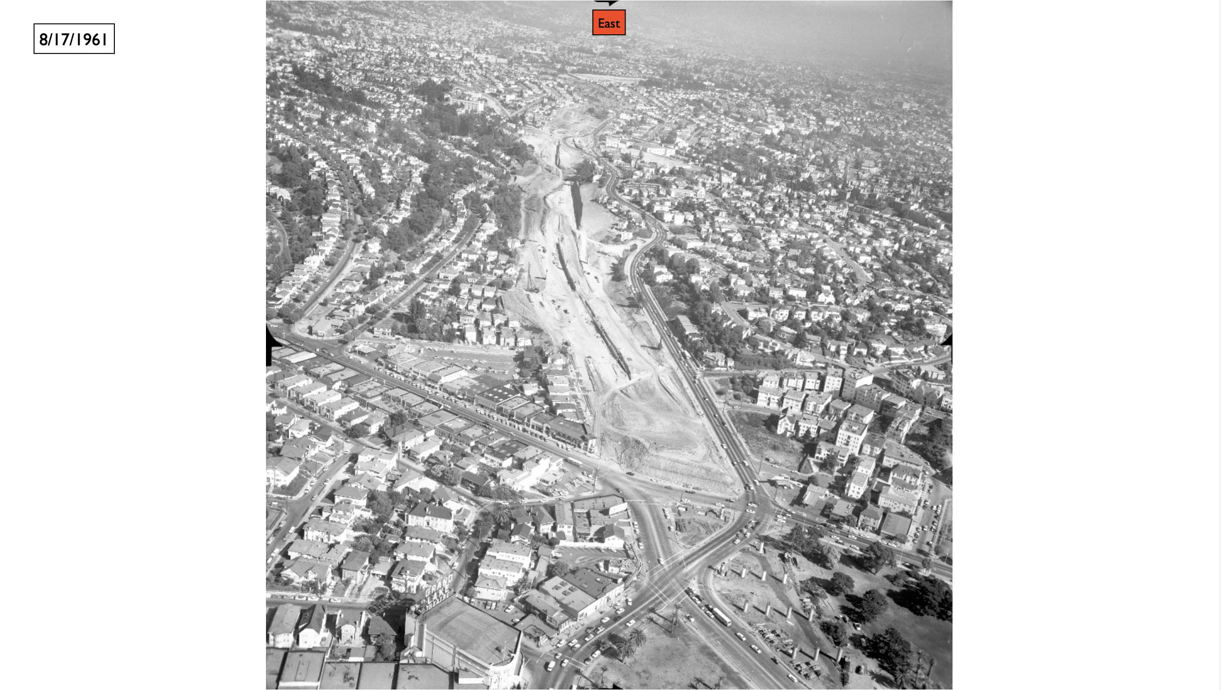
Now turning to the east, the Lakeview Elementary School is enclosed in the orange box in this sweeping view from Broadway to Grand Ave. on July 12, 1960.
L246-60-Copyright California Department of Transportation, 7584-4, Detail, (Image 12 of 35)
Since the freeway split from the bridge approach at Louise St., the path has avoided MacArthur Blvd. In this east view from Apr. 11, 1961, this separation could not be maintained and resulted in a detour of the boulevard. A detail follows.
L246-65-Copyright California Department of Transportation, 8075-5, Detail, (Image 13 of 35)
As indicated in this detail from the previous image from Apr. 11, 1961, the turquoise arrow marks a car on the temporary rerouted detour for the boulevard as the overpass for Harrison St. and Oakland Ave. is being set in place.
L246-70-Copyright California Department of Transportation, 8075-5, Detail, (Image 14 of 35)
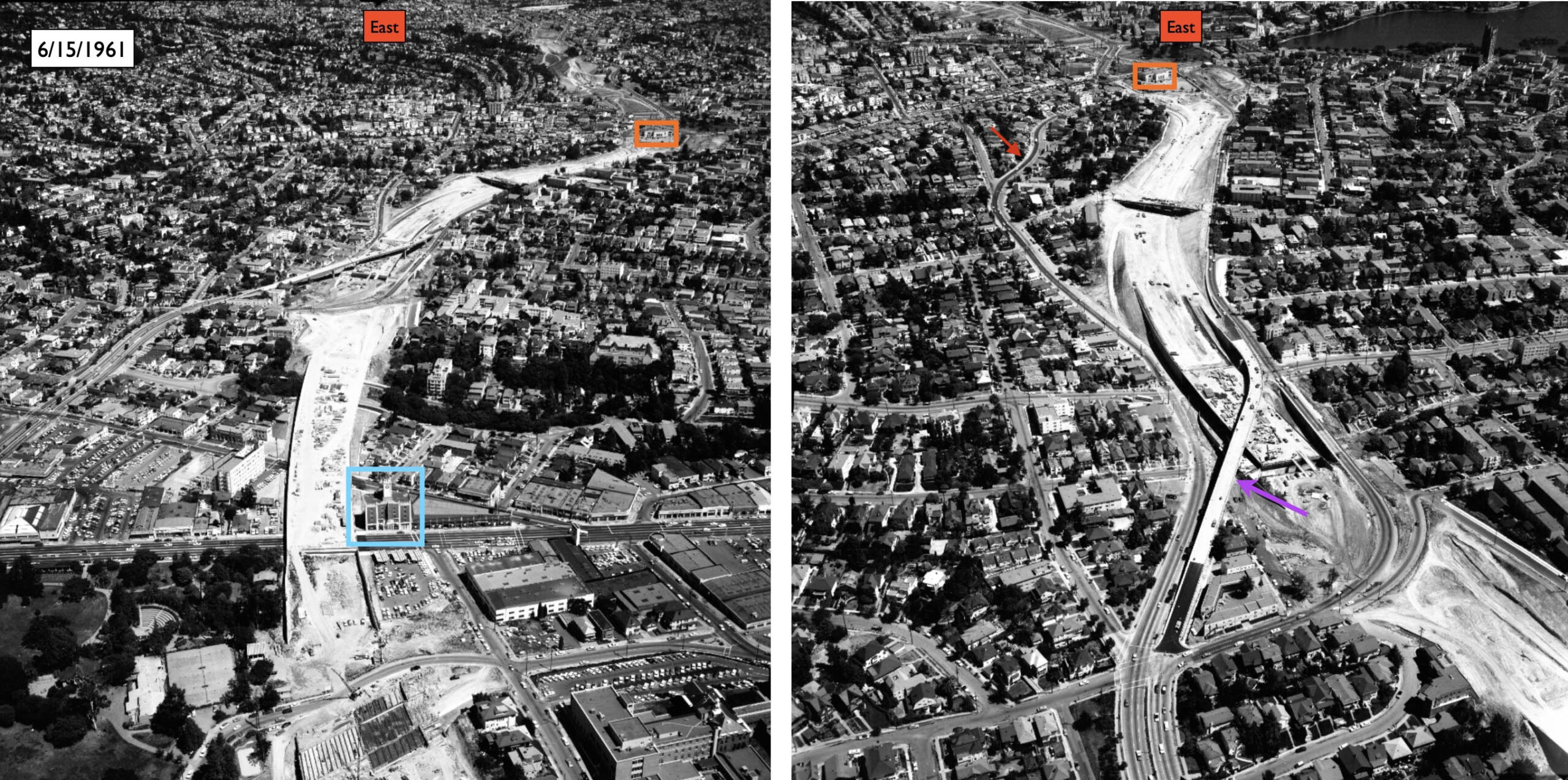
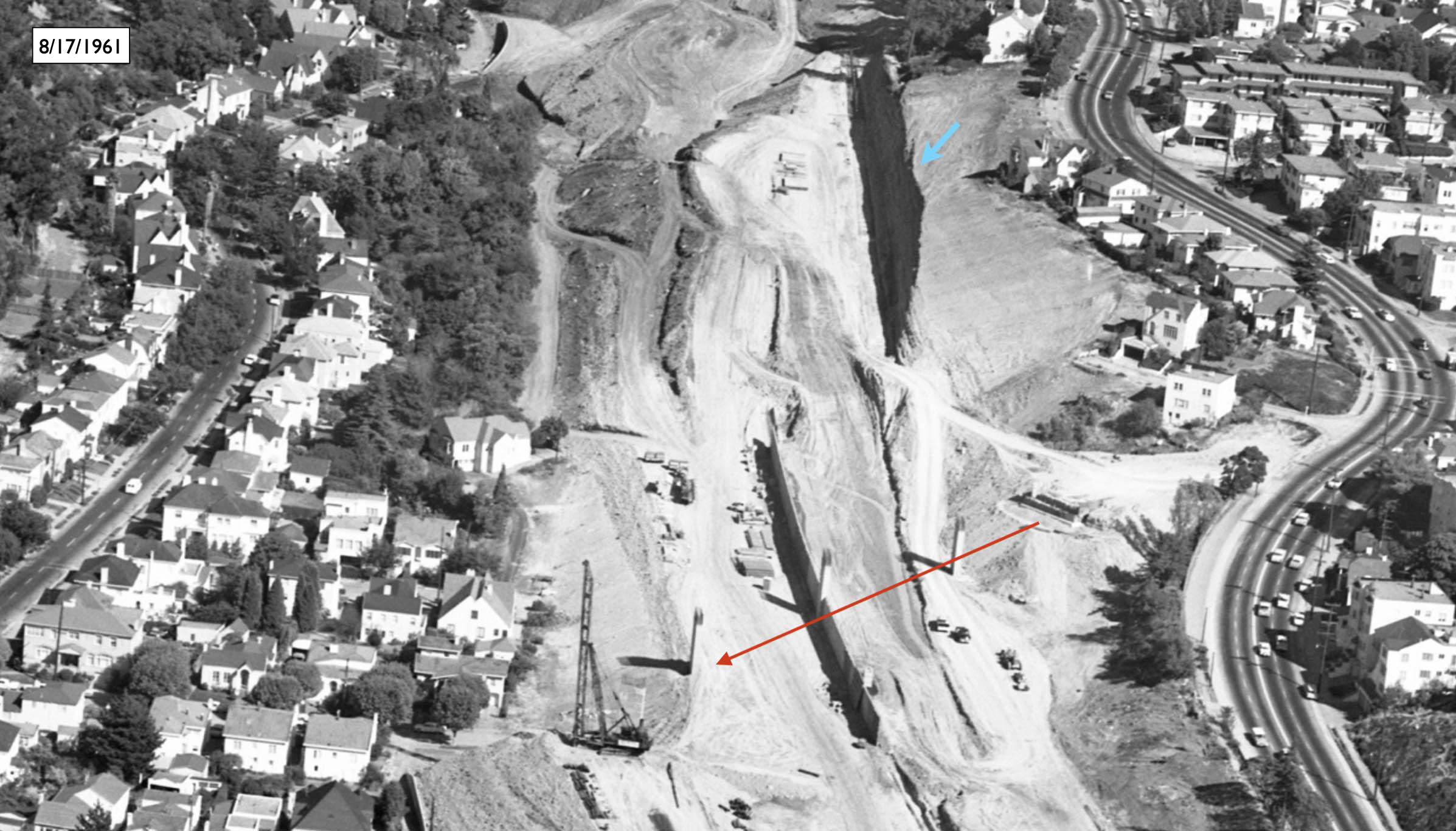
In this two part set of east views from June 15, 1961, the creation of the new MacArthur Blvd. eastbound flyover is seen in place, purple arrow, to allow the boulevard to continue to Grand Ave. Not so lucky were the westbound lanes that would be incorporated within the freeway and reemerge as the Harrison St. offramp heading west. In these images, westbound traffic is using Santa Clara Ave., red arrow.
L246-75-Ed Brady-Aerospace Photo, Courtesy BAERA, Western Railway Museum Archives, 149852ov, (Image 15 of 35)
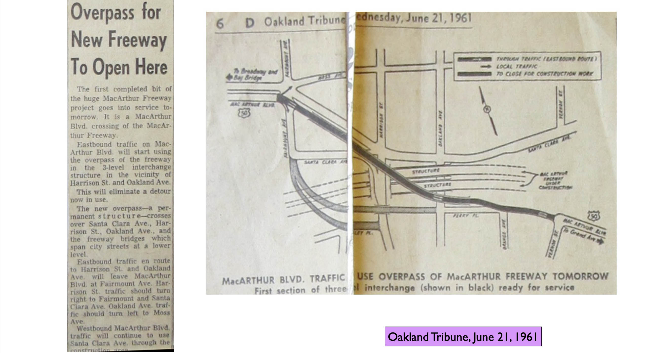
Within a week, the opening of the new MacArthur Blvd. eastbound overpass of the freeway was announced.
L246-80-Courtesy Oakland History Room, Oakland Public Library, (Image 16 of 35)
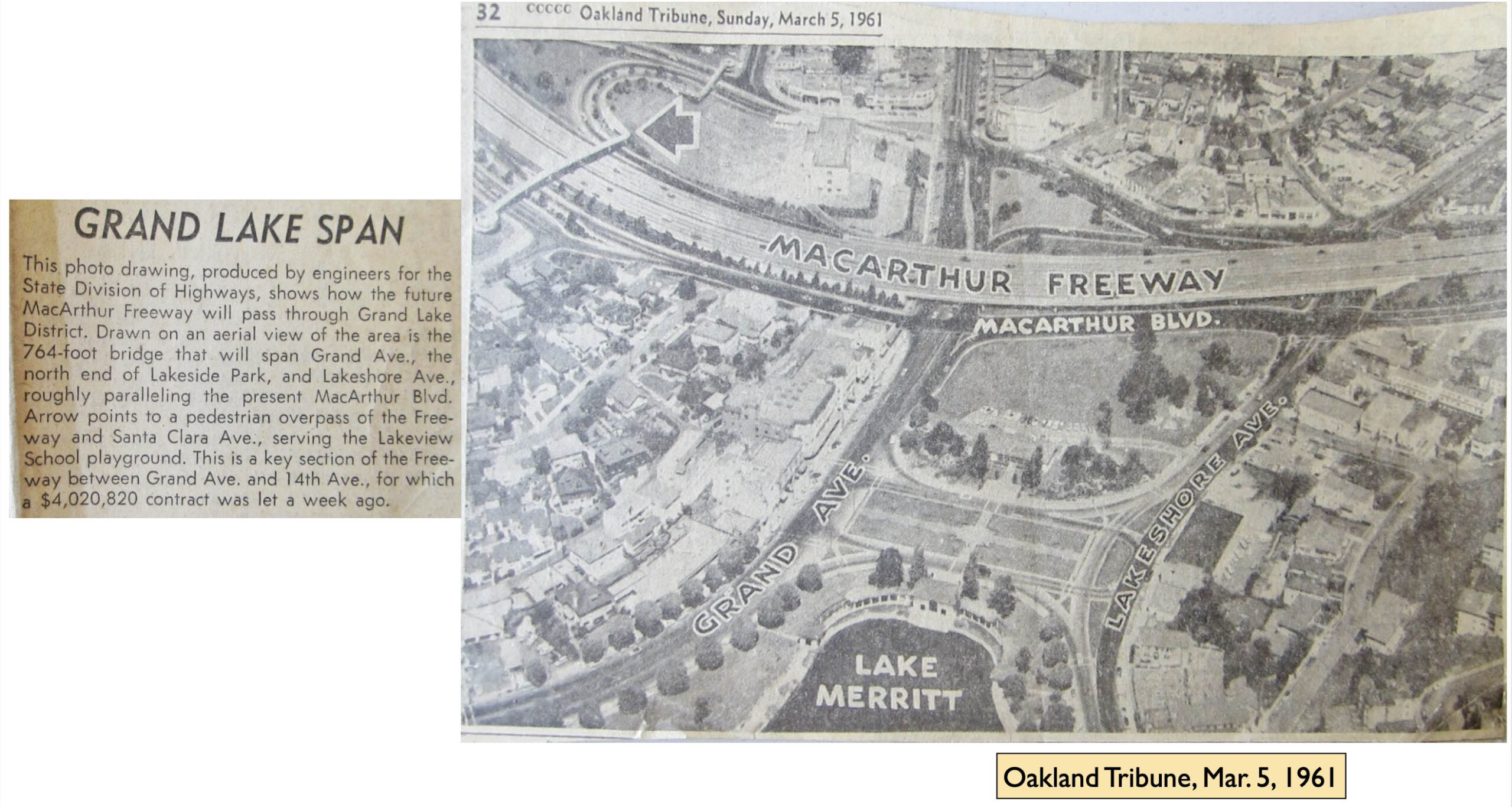
Moving further east, more details about the area in the Grand Ave. vicinity were announced in 1961. In particular, the placement of the pedestrian overpass over the highway and Santa Clara Ave.
L246-85-Courtesy Oakland History Room, Oakland Public Library, (Image 17 of 35)
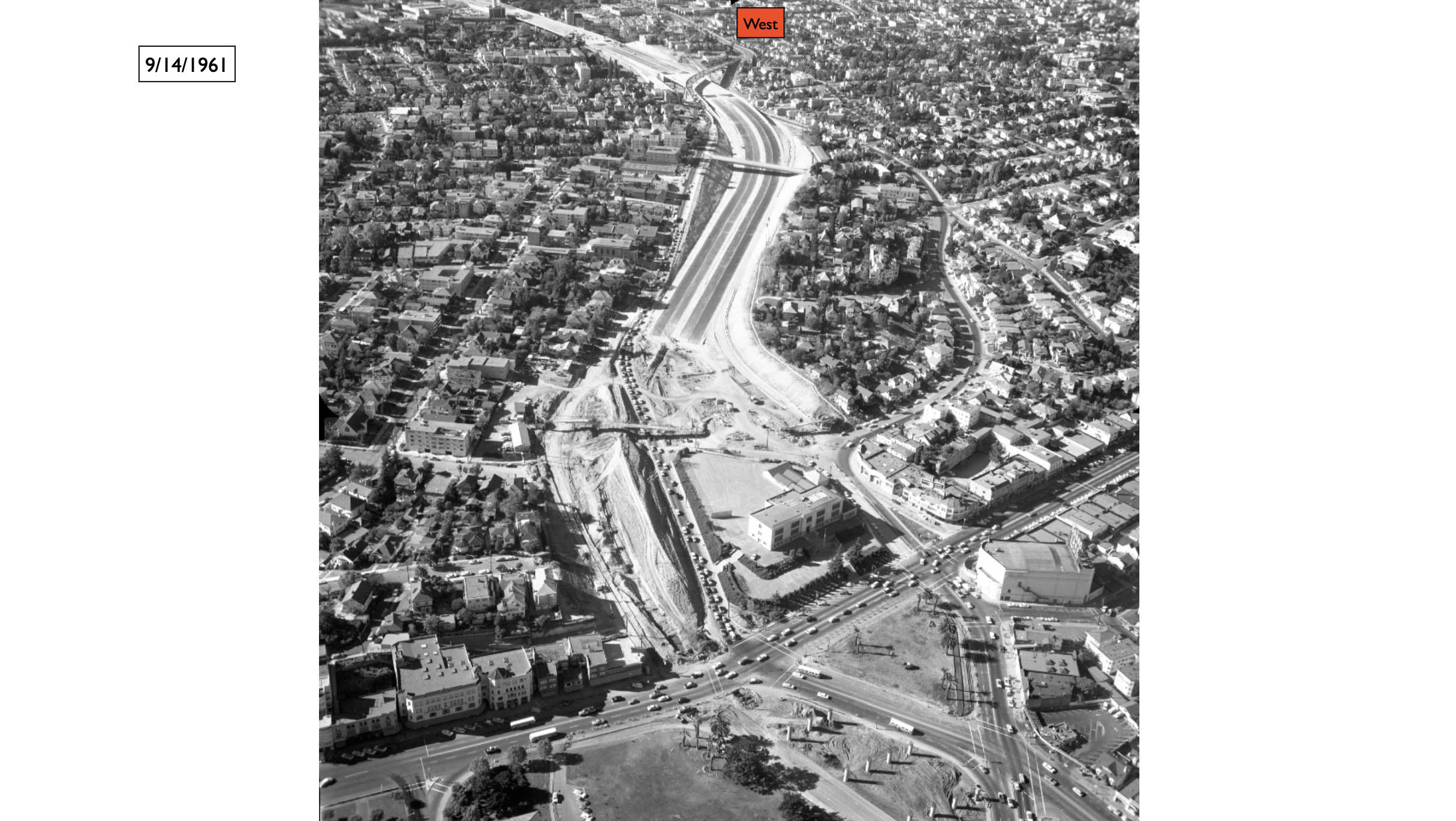
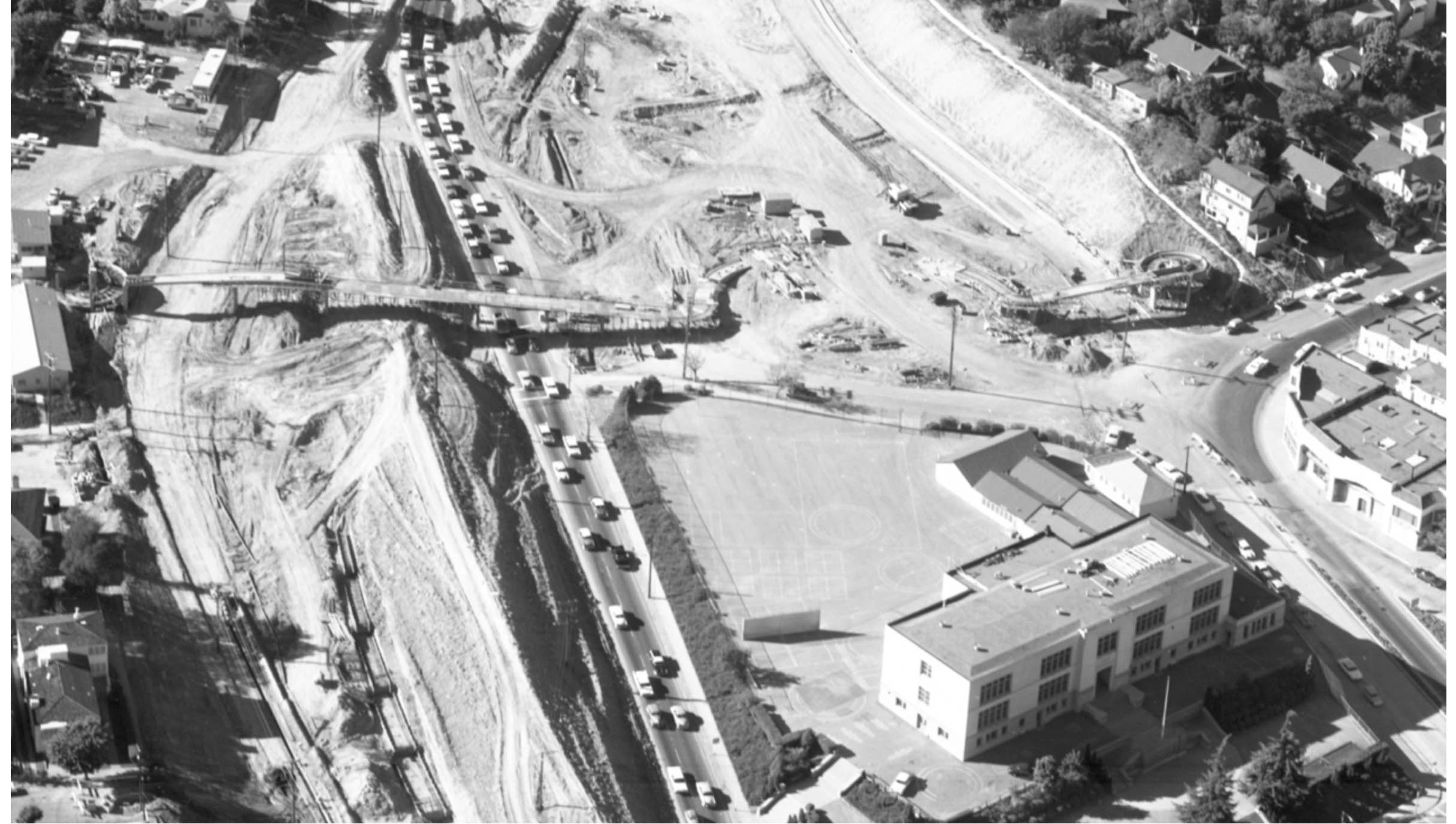
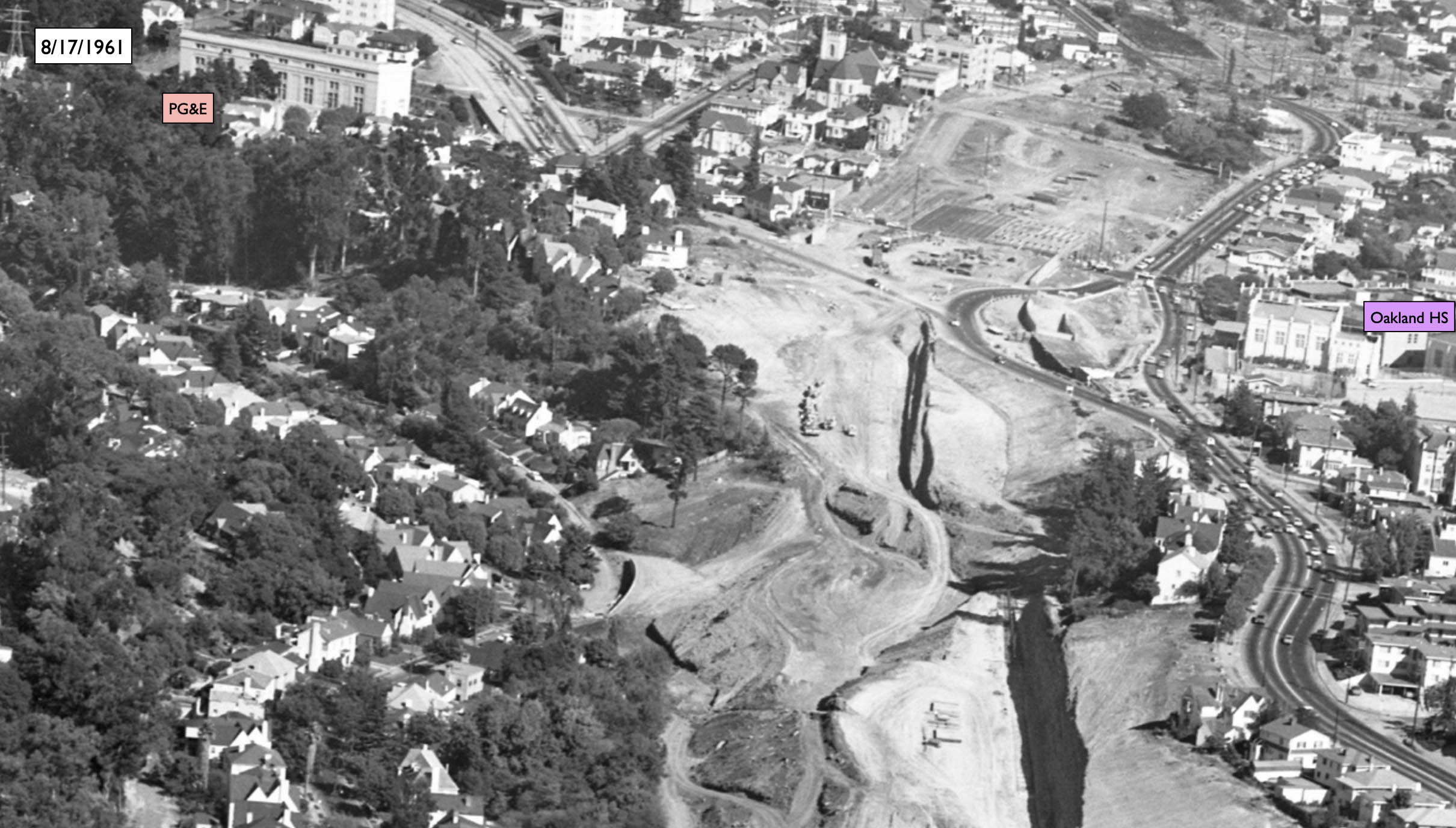
This west view from Sept. 14, 1961 centers on the area just west of the elementary school. A detail follows.
L246-90-Ed Brady-Aerospace Photo, Courtesy BAERA, Western Railway Museum Archives, 150529ov , (Image 18 of 35)
This detail of the west view from Sept. 14, 1961 shows the pedestrian overpass in the midst of construction.
L246-95-Ed Brady-Aerospace Photo, Courtesy BAERA, Western Railway Museum Archives, 150529ov, Detail, (Image 19 of 35)
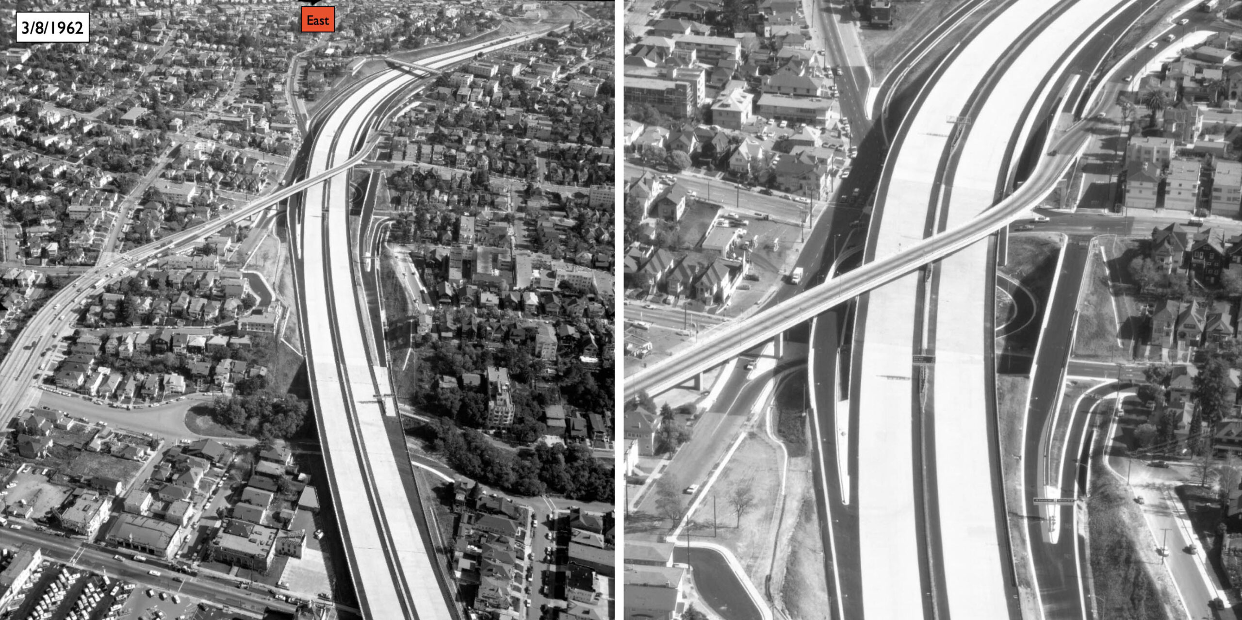
Ahead to Mar. 8, 1962, the left panel and the detail in the right panel show the completion of the highway to just short of Grand Ave.
L246-100-Ed Brady-Aerospace Photo, Courtesy BAERA, Western Railway Museum Archives, 150550ov with D, (Image 20 of 35)
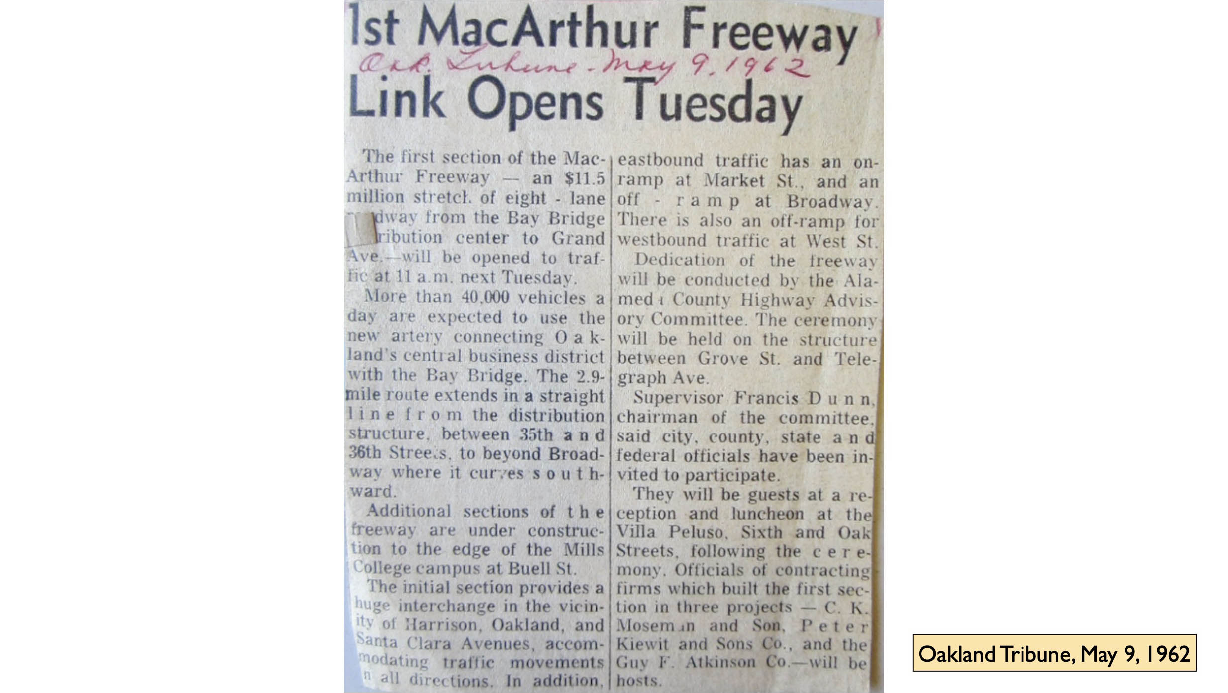
The previous image coincided with the announcement one day later of the opening of the segment of highway to Grand Ave. set for May 15, 1962.
L246-105-Courtesy Oakland History Room, Oakland Public Library, (Image 21 of 35)
Now back in time to an east view from July 12, 1960, and consideration for the portion of road between Grand Ave. and Park Blvd., with Lakeview Elementary as the marker enclosed by the orange rectangle.
L246-110-Copyright California Department of Transportation, 7584-3, (Image 22 of 35)
A detail of the previous image shows the clearing of structures on the entire block east of Lakeshore Ave. between MacArthur Blvd. and Lake Park Ave.
L246-115-Copyright California Department of Transportation, 7584-3, Detail, (Image 23 of 35)
Advancing to Apr. 11, 1961, the right-of-way through Trestle Glen has been cleared. The highway’s path was dictated in part by the steep hillside below MacArthur Blvd, turquoise arrow. The final choice preserved MacArthur Blvd., but as will be shown soon, not in its entirety in terms of westbound lanes.
L246-120-Copyright California Department of Transportation, 8075-5, Detail, (Image 24 of 35)
Continuing east on Apr. 11, 1961, this east view marks the progress through Park Blvd. Details follow.
L246-125-Copyright California Department of Transportation, 8075-6, (Image 25 of 35)
This first detail from the previous image shows the entry way that allowed for the preservation of 734 Stratford Rd., gold arrow. Unrelated to the highway, but of interest, the labels indicate the addresses and permit dates for three homes on Longridge Rd., reflecting the availability of land when the Key System B-line right-of-way was abandoned. No. 671 had been the first home on the south side, marking the end of the two-track segment of the interurban line.
L246-130-Copyright California Department of Transportation, 8075-6, Detail, (Image 26 of 35)
This second detail of the east view from Apr. 11, 1961 documents that clearing of structures for several blocks east of Park Blvd. had already been completed.
L246-135-Copyright California Department of Transportation, 8075-6, Detail, (Image 27 of 35)
This final detail of the east view from Apr. 11, 1961 provides clues as to the future right-of-way for the highway into East Oakland.
L246-140-Copyright California Department of Transportation, 8075-6, Detail, (Image 28 of 35)
Four months later, this east view returns to Grand Ave.-Lakeshore Ave. interval and the early stages of setting the highway overpass supports.
L246-145-Ed Brady-Aerospace Photo, Courtesy BAERA, Western Railway Museum Archives, 149858ov, Detai, (Image 29 of 35)
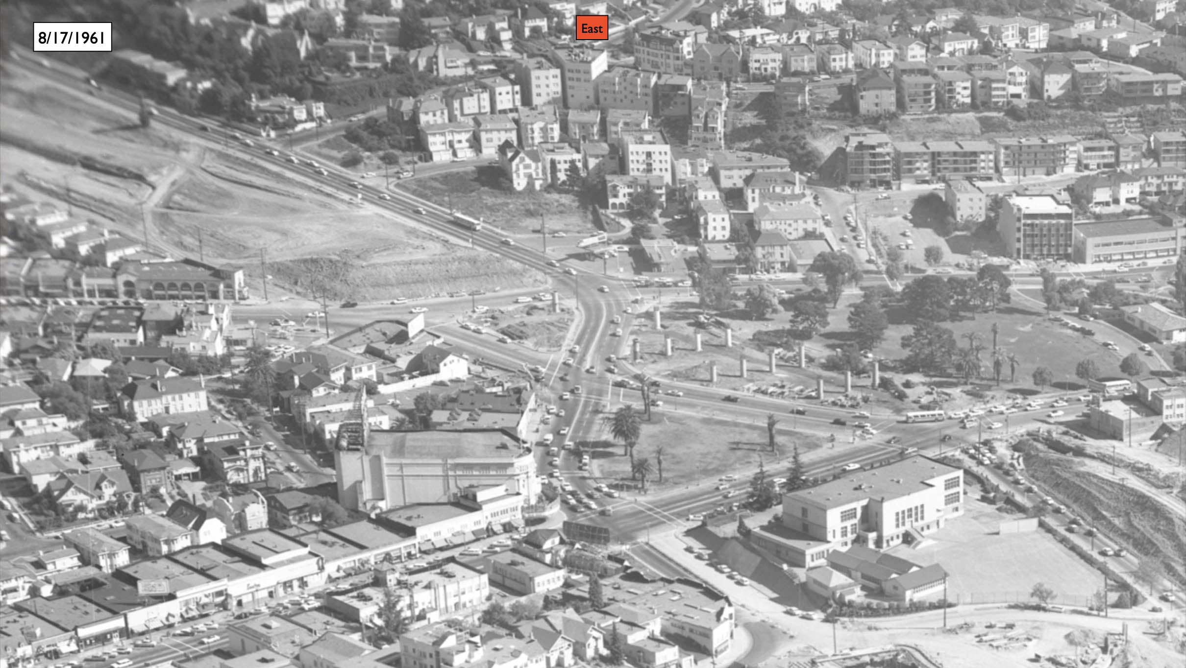
Next to examine the progress in mid-Aug. 1961 of the area through Trestle Glen, east view.
L246-150-Ed Brady-Aerospace Photo, Courtesy BAERA, Western Railway Museum Archives, 149858ov, (Image 30 of 35)
The first detail starting from the west shows the sharp demarcation of the clearing at Lakeshore Ave.
L246-155-Ed Brady-Aerospace Photo, Courtesy BAERA, Western Railway Museum Archives, 149859ov, Detai, (Image 31 of 35)
Further east, the hillside featured previously has been squared-off, turquoise arrow, to allow for the road placement. The red arrow begins where the future flyover of the westbound lane of MacArthur Blvd. will separate from the eastbound lane.
L246-160-Ed Brady-Aerospace Photo, Courtesy BAERA, Western Railway Museum Archives, 149859ov, Detai, (Image 32 of 35)
On to Park Blvd., where highway construction disrupted the road. Note the construction of the base of the overpass for that road.
L246-165-Ed Brady-Aerospace Photo, Courtesy BAERA, Western Railway Museum Archives, 149859ov, Detai, (Image 33 of 35)
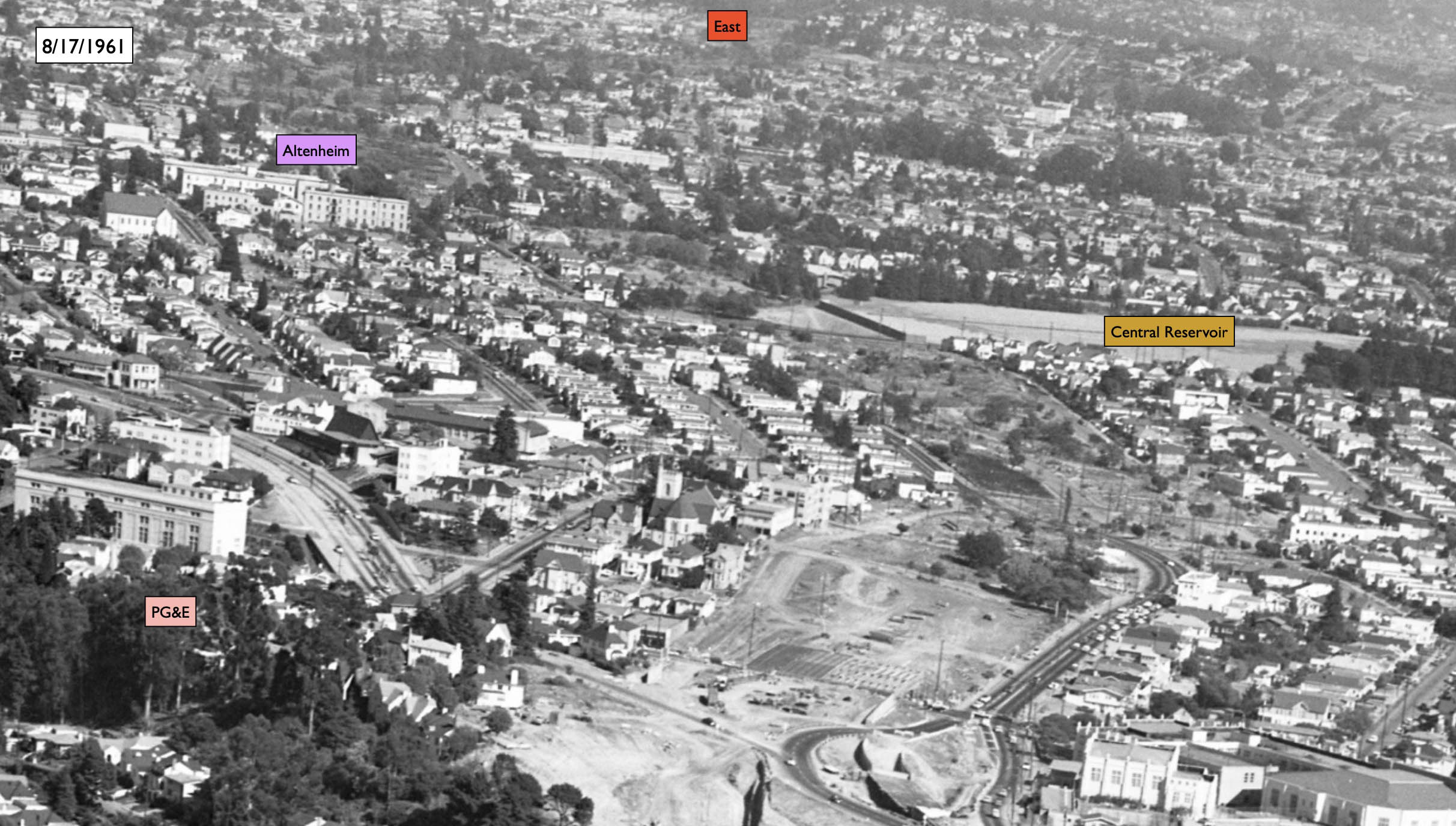
The last detail of the east view from Aug. 17, 1961 shows the early changes east of Park Blvd. into East Oakland.
L246-170-Brady-Aerospace Photo, Courtesy BAERA, Western Railway Museum Archives, 149859ov, Detail, (Image 34 of 35)
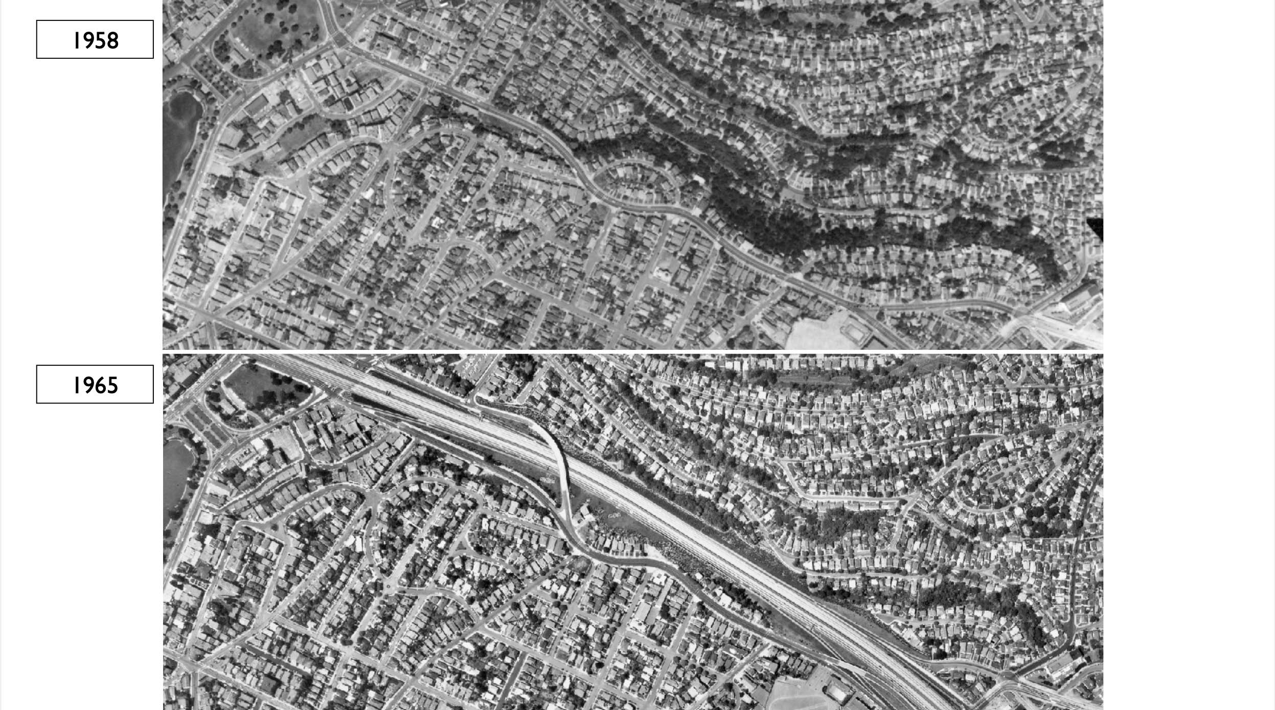
The Oakland Tribune of Sept. 26, 1962 announced the opening of the highway to Park Blvd. Ref: Left: but-1958_4v-77, 8/13/1958; Right: cas-65-130_6-111, 5/14/1965
L246-175-Courtesy University of California Santa Barbara Library, Special Research Collections, (Image 35 of 35)