Interurban Routes
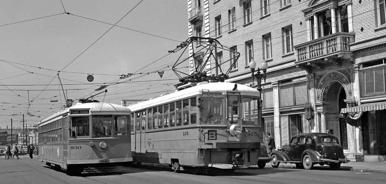
Key System, KS, car 115 on the B line and car 930 on the 18 line sit on Grand Ave. on the east side of Broadway in 1948. The building to the north or right, 80 Grand Ave., no longer exits. Permit no. 43900 issued Dec. 9, 1919 lists construction costs of 140k dollars. The architects for this 5 story apartment with stores on the ground level were Edward Sommarstrom and J. Hinkel, Sommarstrom Bros., Richardson and Burrell.
L228-05-Leon Bonney Photo, Courtesy John Harder, (Image 1 of 36)

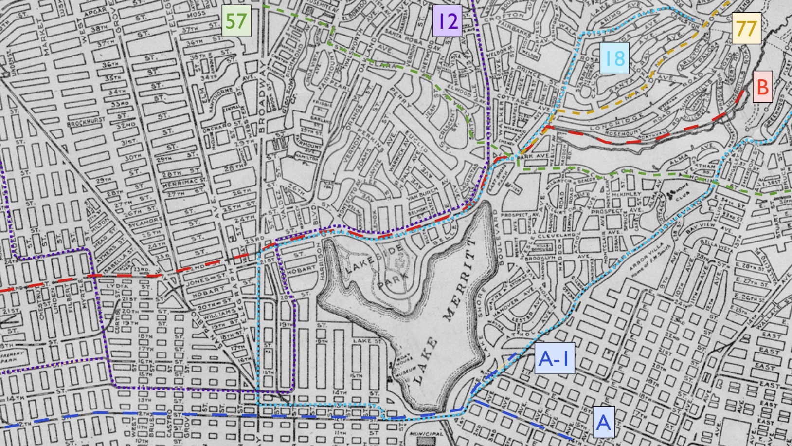
These are the interurban, streetcar and bus lines superimposed on a 1921 map that will be considered in the next two updates. First to tackle the interurban lines.
L228-10-Modified Central National Bank Map, Courtesy BAERA, Western Railway Museum Archives, 83537 , (Image 2 of 36)
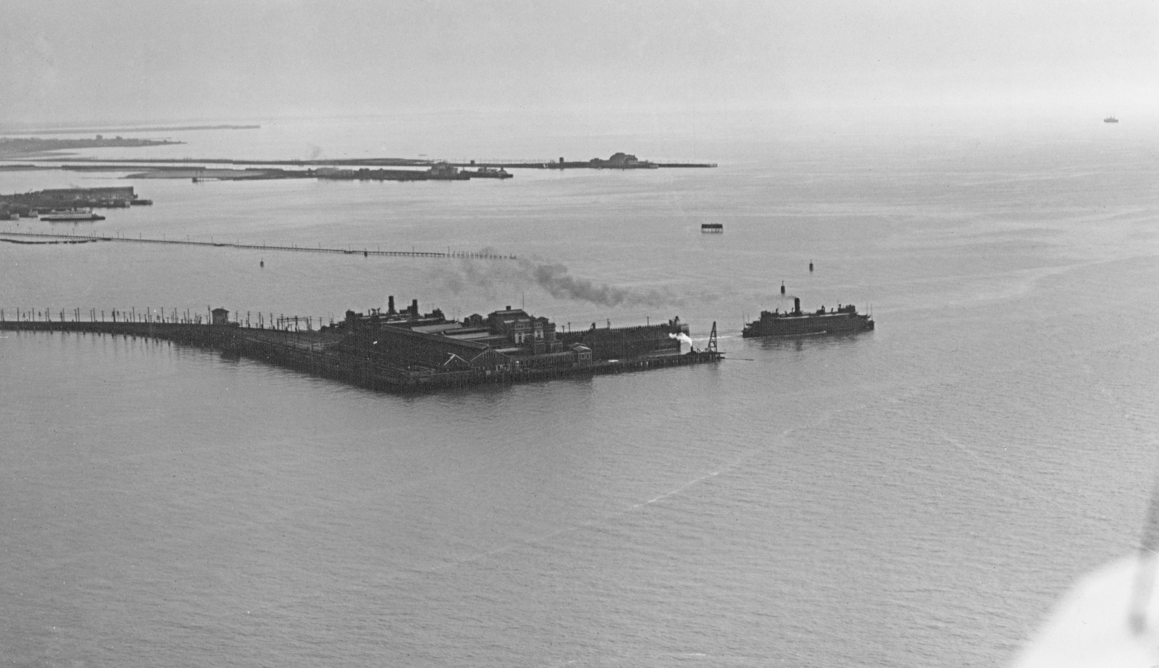
Before the Bay Bridge opened to interurban traffic in 1939, the Poplar Street Line, later renamed line A in 1934, and the 22nd St. Line, later renamed line B in 1934, were accessible to San Francisco by ferry to the Key Pier. This ca. 1930 undated northeast view is of the original pier prior to the fire in 1933 that damaged it. Ref: 002 SLC_650_NoDate_13
L228-15-George Russell Photo, Courtesy the California State Lands Commission, Detail , (Image 3 of 36)
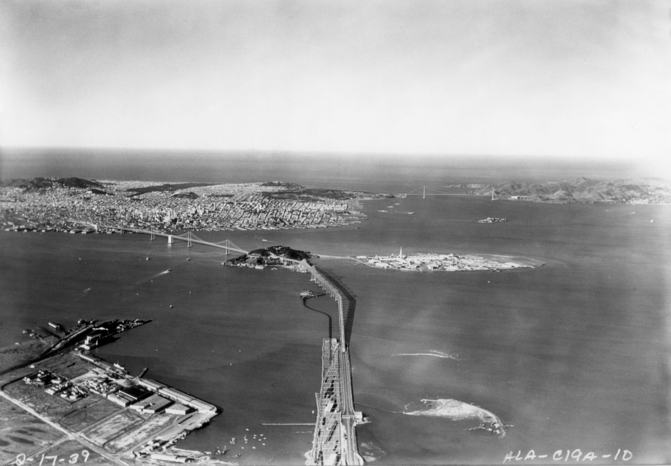
A west view from 1939 when both bridge and pier coexisted.
L228-20-Courtesy El Cerrito Historical Society, (Image 4 of 36)
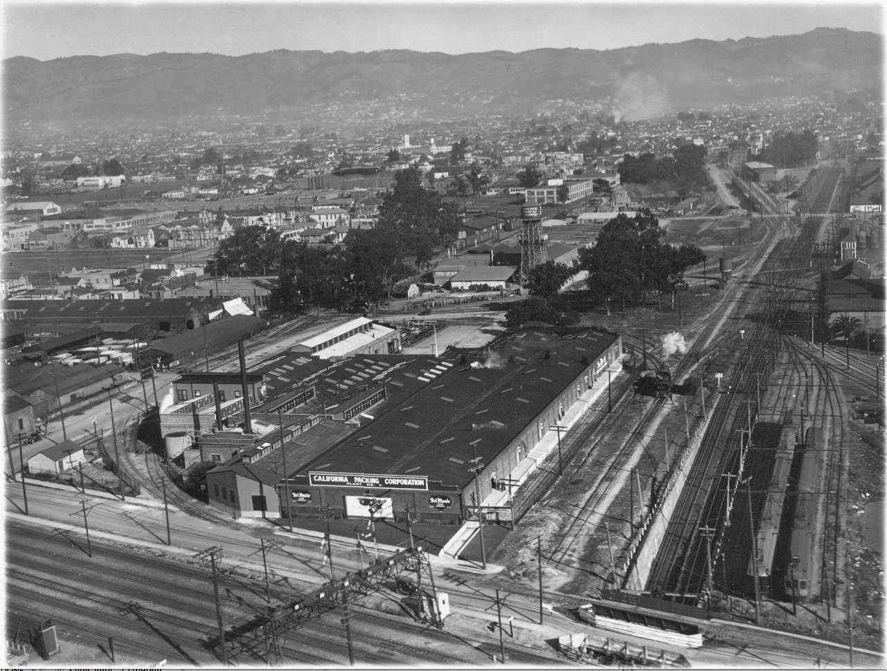
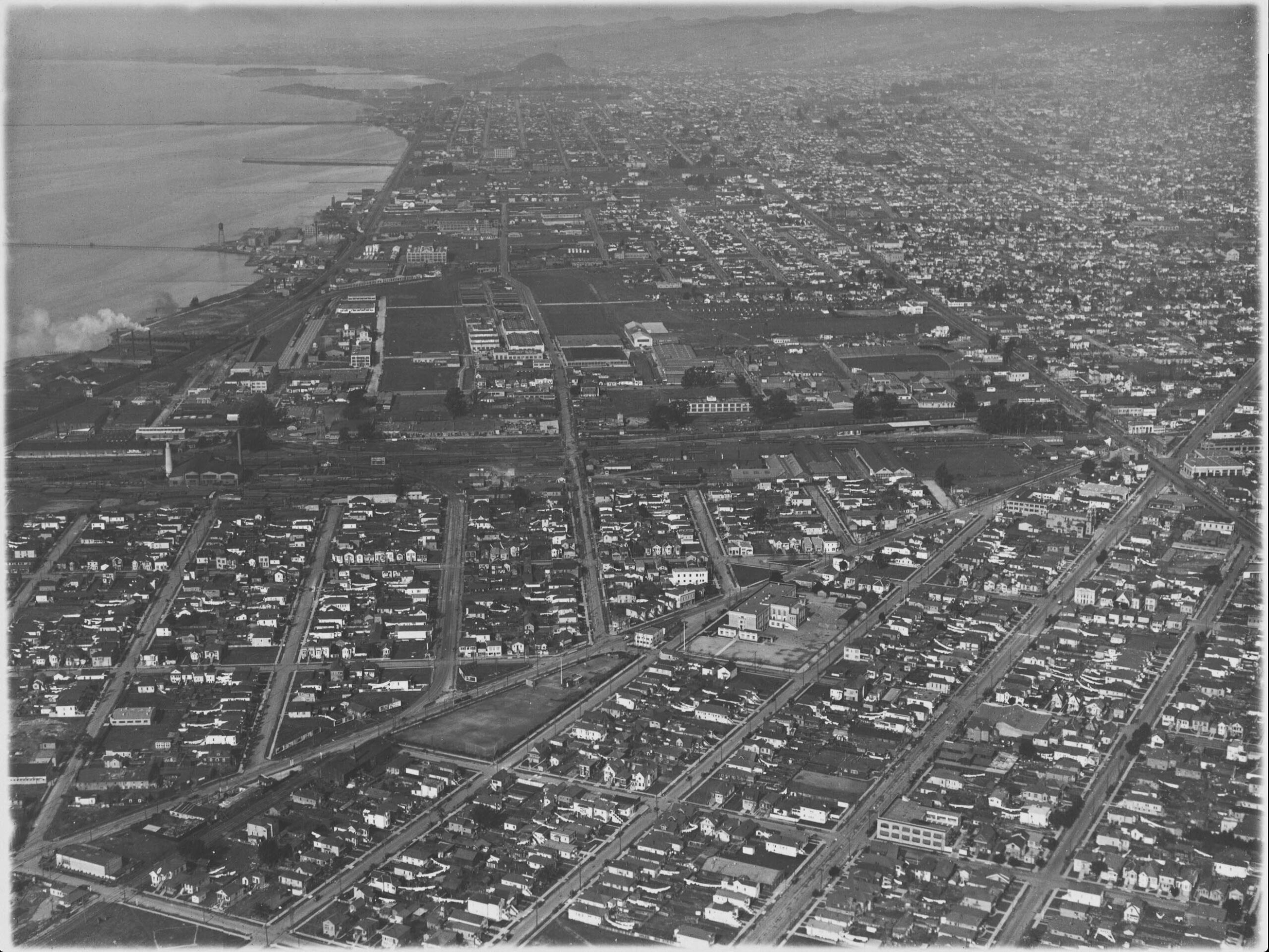
Either way, trains proceeded east under the Southern Pacific right-of-way, visible along the lower edge, then joined by the Santa Fe on the north or left flank as seen in this circa 1930 east view. Ref: SLC_651_NoDate_74
L228-25-George Russell Photo, Courtesy the California State Lands Commission, (Image 5 of 36)
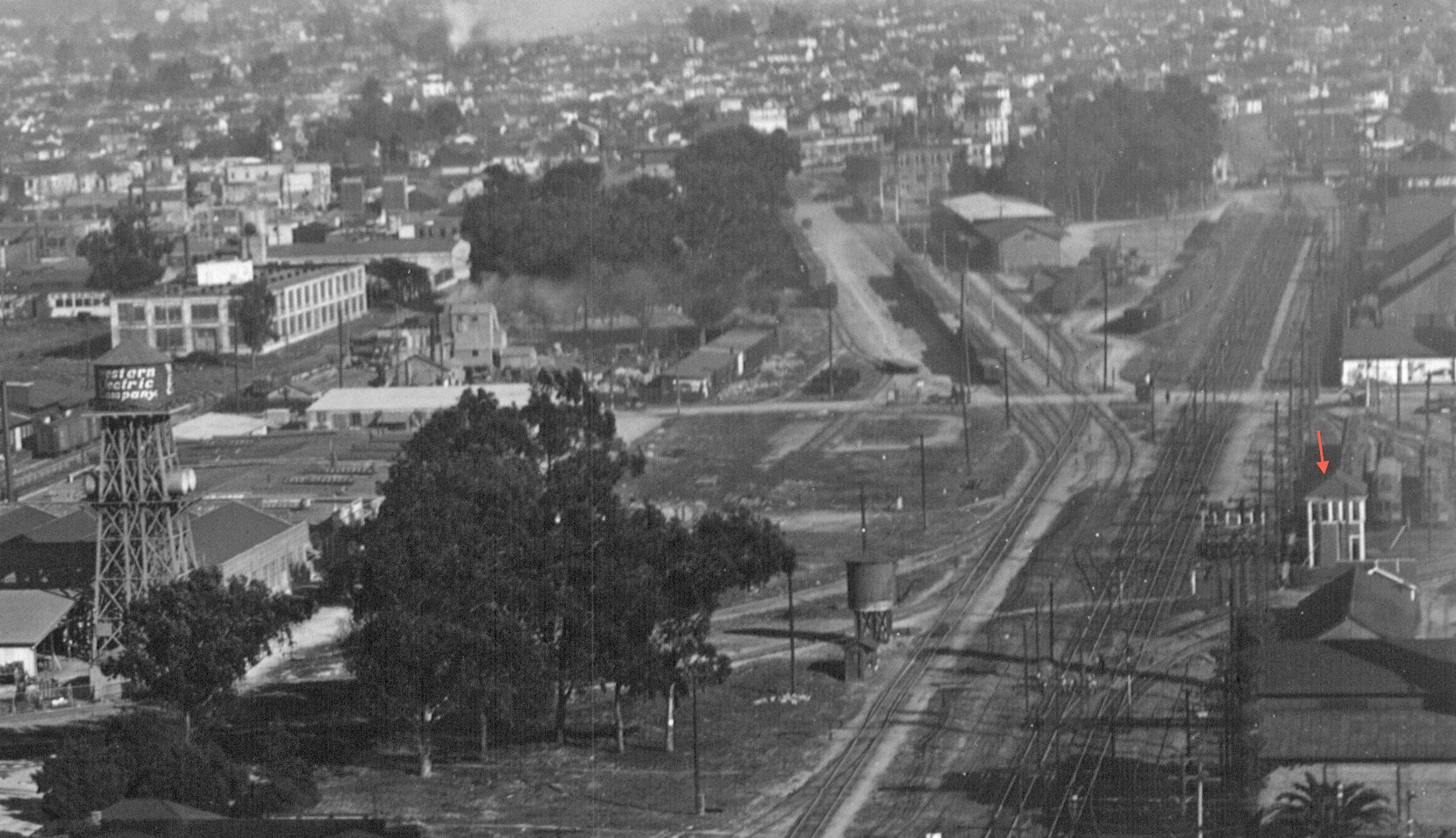
This detail of the previous east view circa 1930 shows where the route of the A and B lines diverged to the south to Louise St., doing so by utilizing the switch tracks just west of an overseer perched in Tower 2, red arrow. Ref: SLC_651_NoDate_74
L228-30-George Russell Photo, Courtesy the California State Lands Commission, Detail , (Image 6 of 36)
This north view circa 1930 then shows the two-track line from Tower 2 until it crossed Peralta St. onto Poplar St. Ref: SLC_651_NoDate_8
L232-31-George Russell Photo, Courtesy the California State Lands Commission, (Image 7 of 36)
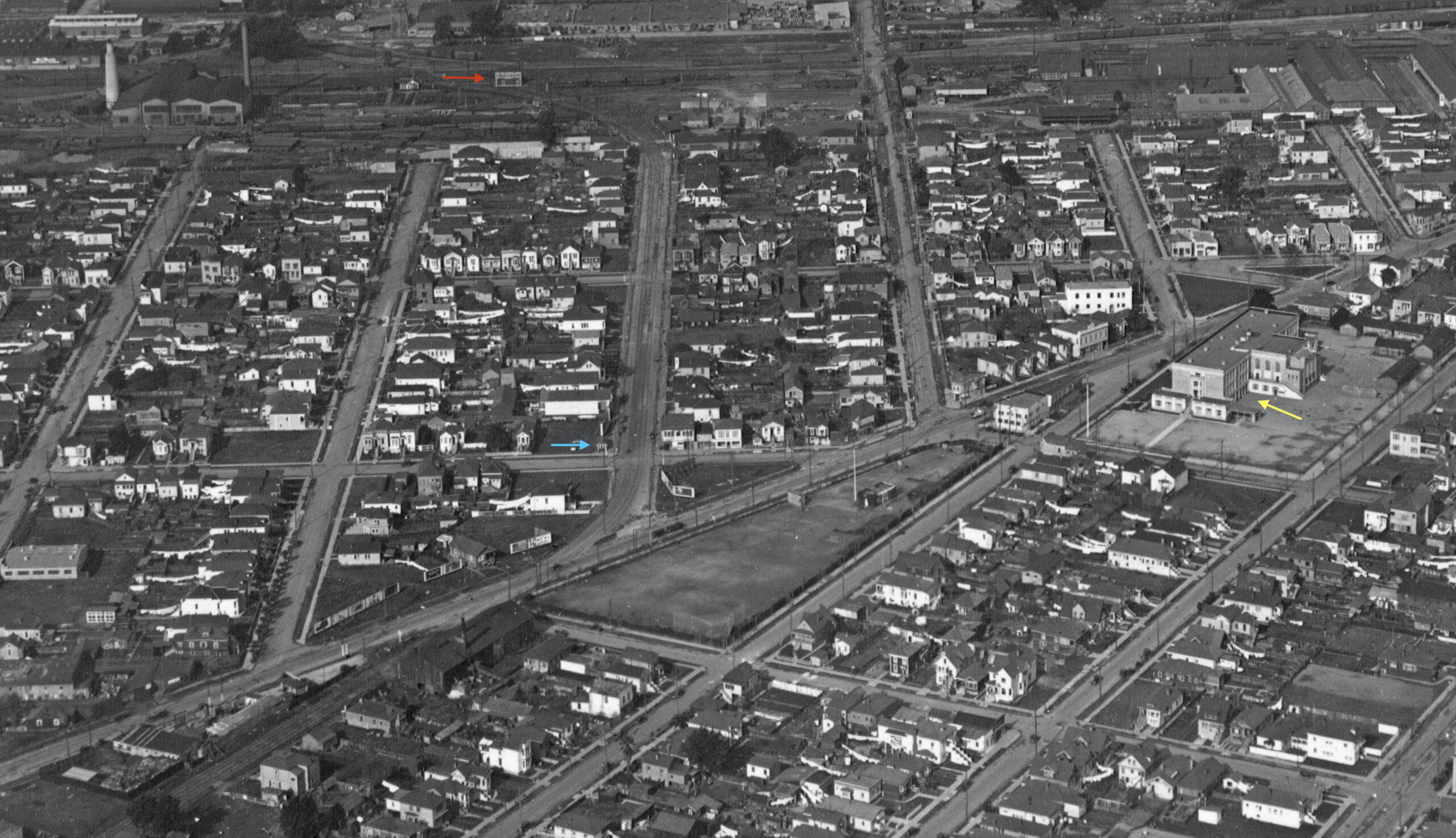
This detail from the north view circa 1930 shows Tower 2, red arrow, and the train shelter at 32nd St. and Louise St., turquoise arrow. The large building marked by the yellow arrow is Clawson Elementary School at 3240 Peralta St., built during the pre-WWI school construction initiative, and since having been converted to condominiums. Ref: SLC_651_NoDate_8
L232-33-George Russell Photo, Courtesy the California State Lands Commission, Detail, (Image 8 of 36)
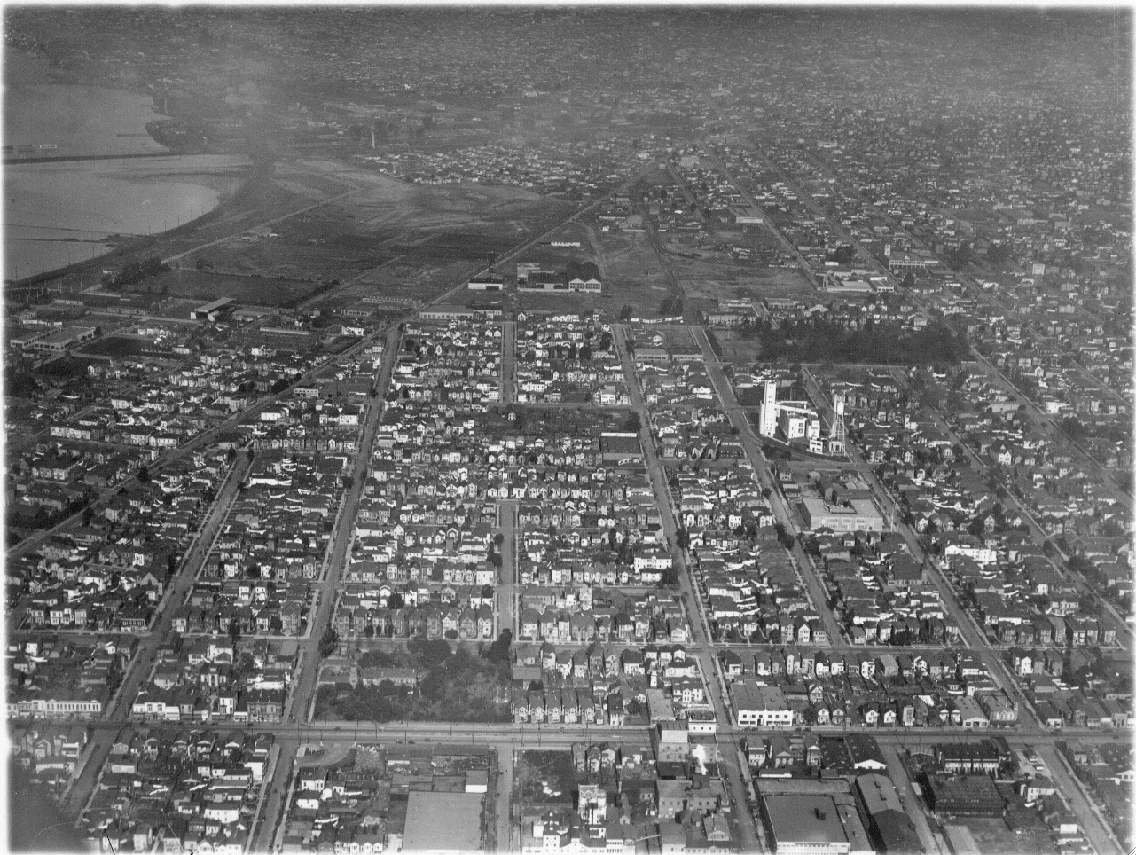
This circa 1930 north view shows the route of the two interurbans to their diversions from Poplar St. Ref: SLC_651_NoDate_11
L228-35-George Russell Photo, Courtesy the California State Lands Commission , (Image 9 of 36)
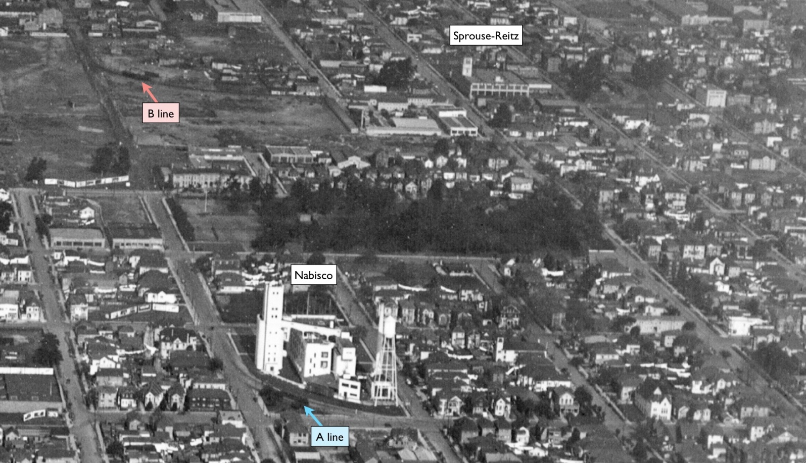
A detail of this north view circa 1930 shows trains on both lines after leaving Poplar St.; 22nd St. for the B, and 12th St. for the A. The two important buildings are still around in 2020; 2200 Adeline St. and 22nd St., now West Grand, was built for Sprouse-Reitz five-and-dime in 1925, and Nabisco Co. on 12th and Poplar St., built in 1917 for Shredded Wheat, and sold to Nabisco in 1927.
L228-40-George Russell Photo, Courtesy the California State Lands Commission, Detail, (Image 10 of 36)
To add some color, a B line train ready to leave Poplar St. in a north view from Feb. 1952 ...
L228-45-Alan Atkins Photo, Courtesy BAERA, Western Railway Museum Archives, 161059ks, (Image 11 of 36)
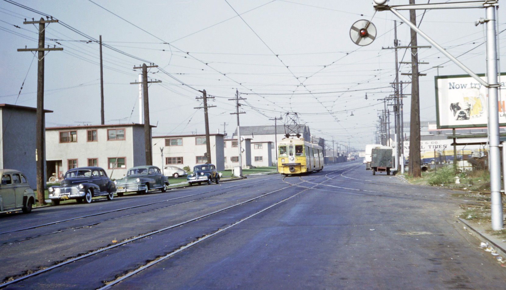
Once on 22nd St., later renamed West Grand, it was a straight shot to Lake Park Ave. This detail from the image to follow, an east view from Apr. 8, 1953, shows a B-line unit just east of Grove St., later renamed Martin Luther King, Jr. Way. Find it on the B-line route in the entire aerial view to follow.
L228-55-Copyright California Department of Transportation, 3301-6, Detail , (Image 12 of 36)
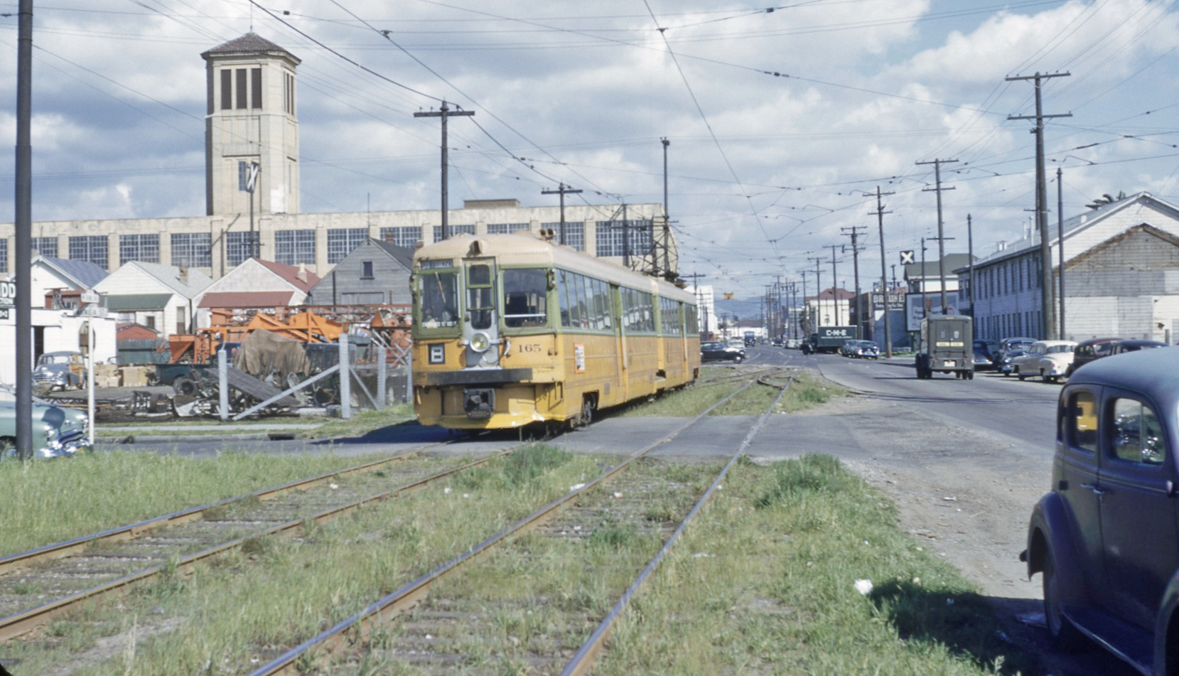
... and KS car 165 B line unit heading west where the short private right-of-way began at Magnolia St., east view ca. 1949 with the Sprouse-Reitz building in the background.
L228-50-Robert Hanft Photo, Courtesy BAERA, Western Railway Museum Archives, 114231ks , (Image 13 of 36)
An east view from Apr. 8, 1953 just east of Grove St. showing the entire B-line route into Trestle Glen.
L228-60-Copyright California Department of Transportation, 3301-6 , (Image 14 of 36)
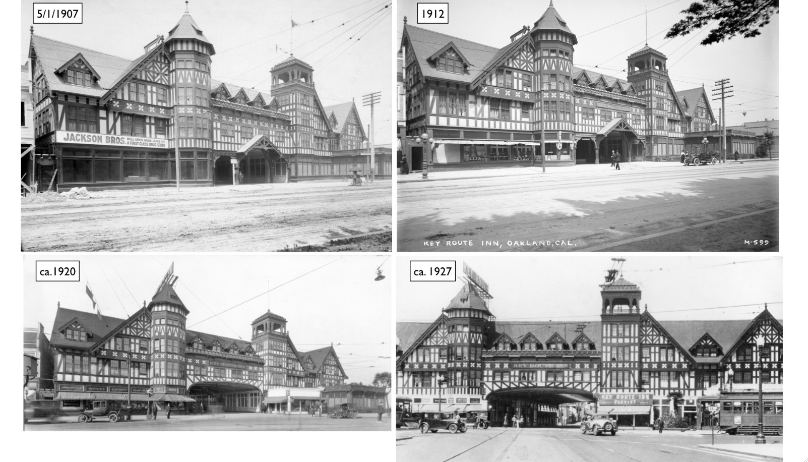
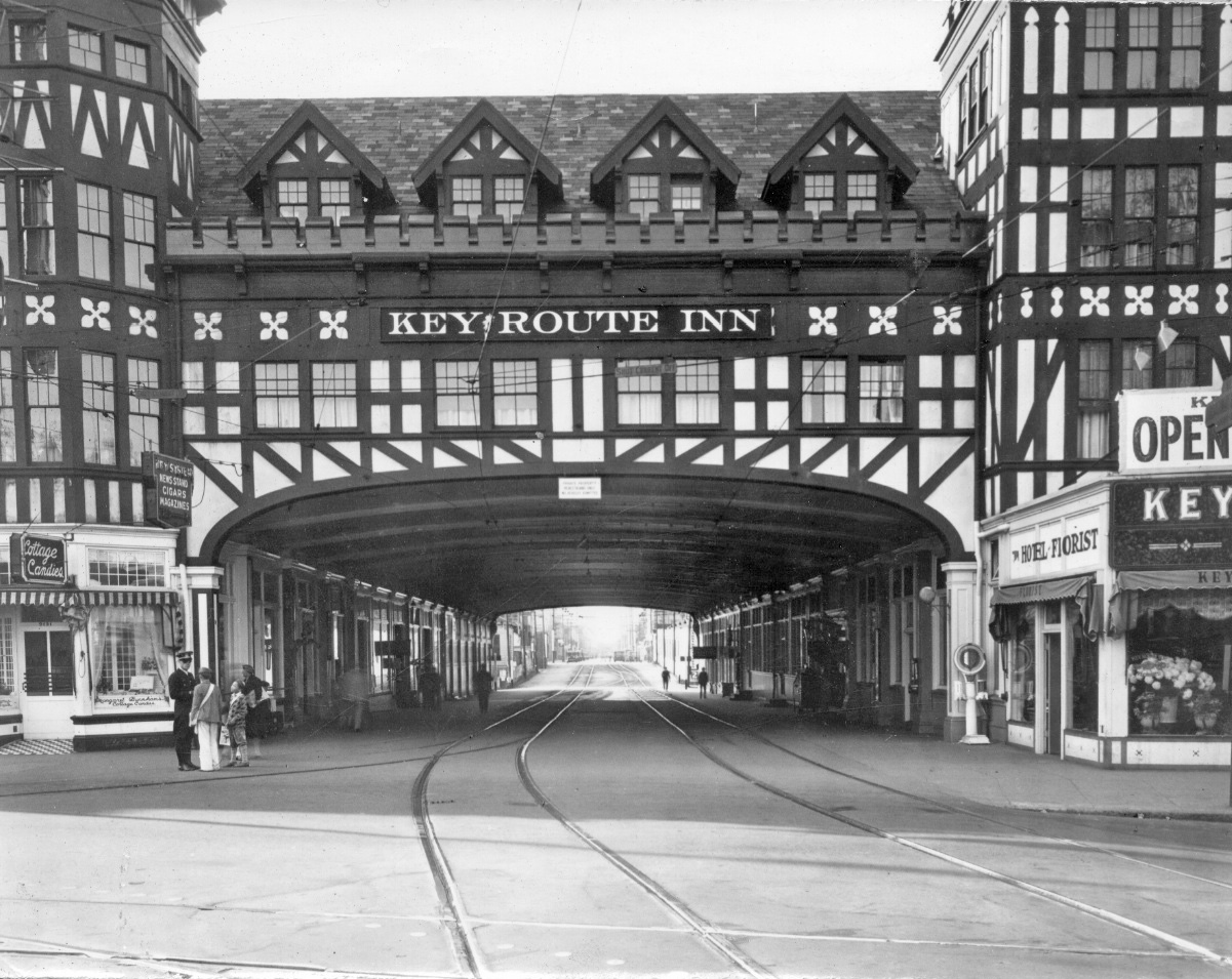
The original B line extended only as far to the east as the Key Route Inn on Broadway, shown here in west-northwest views at different times through to its extension onto Grand Ave. The inn opened May 6, 1907. Ref: top right, W.E. Gardneir Photo, Sappers Coll. 17152ks; top left, Sappers Coll., 115033ks; bottom right, Sappers Coll. 17162ks; bottom left, Tom Gray Coll., 155334ks
L228-65-Courtesy BAERA, Western Railway Museum Archives, (Image 15 of 36)
A west view from Broadway ca. 1920 of the train-related interface.
L228-70-Moses L. Cohen Photo, Sappers Coll., Cortesy BAERA, W. Railway Museum Arch., 217164ks, (Image 16 of 36)
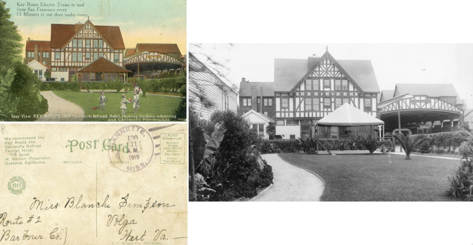
This east view circa 1920 of the rear of the building captures the amenities at the inn, also captured in a postcard.
L228-75-Courtesy BAERA, Western Railway Museum Archives, 132021ks, (Image 17 of 36)
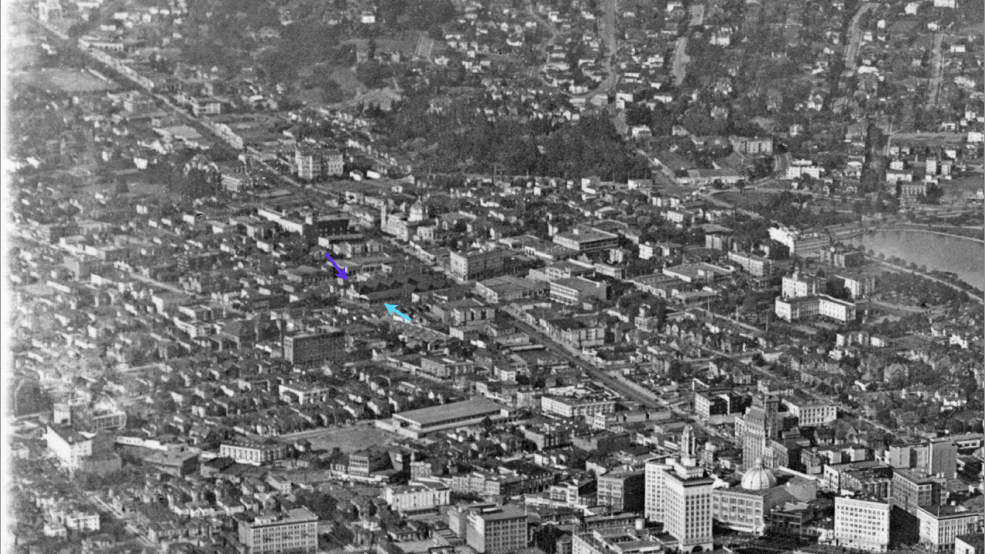
Much rarer are aerial views of the inn, such as this one from the early 1920s. The purple arrow marks the inn, the turquoise arrow the adjacent train shed. Ref: API 653_6_BOX 94
L228-80-George Russell Photo, Courtesy the California State Lands Commission, Detail , (Image 18 of 36)
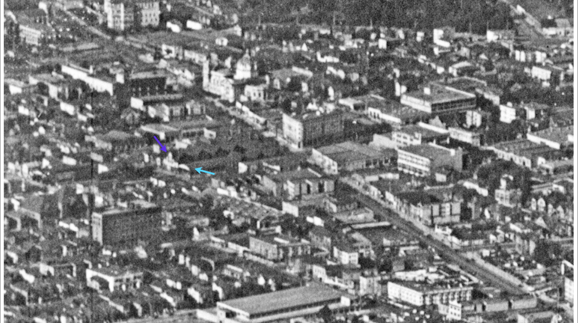
A closer north view ca. 1920s as indicated in the previous legend. Ref: SLC_653_NoDate
L228-85-George Russell Photo, Courtesy the California State Lands Commission, Detail , (Image 19 of 36)
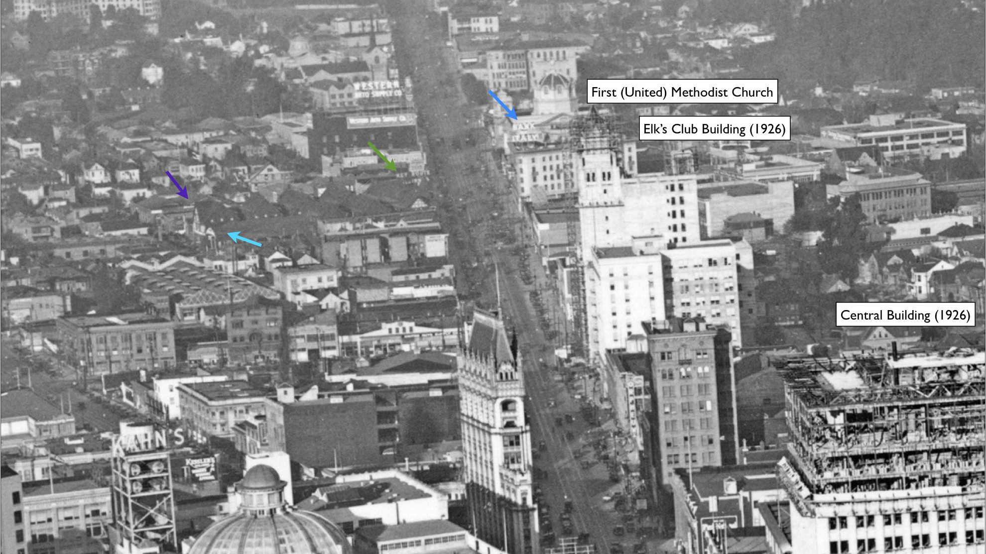
Ahead to ca. 1926 based on the skyline construction, with the inn sign showing, green arrow, and the Bank of Italy sign atop 80 Grand Ave. The Central Building, or Central Bank Building, marks Broadway and 14th St., the First Methodist Church, Broadway and 24th St., the latter destroyed in a fire in 1981. Ref: API 651_34_BOX 91
L228-90-George Russell Photo, Courtesy the California State Lands Commission, Detail , (Image 20 of 36)
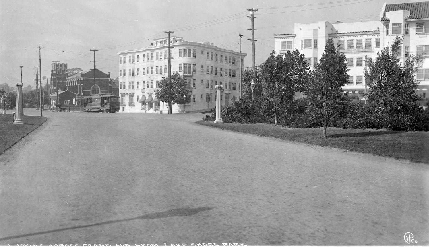
A northwest view, undated circa 1920s, from Lakeside Park shows Grand Ave. with KS 155 heading west having just past the two apartment buildings at Parkview Terrace that still stand in 2020. St. Paul's Church, built in 1912, is also unchanged.
L228-95-Eston Cheney Photo, Courtesy BAERA, Western Railway Museum Archives, 161062ks , (Image 21 of 36)
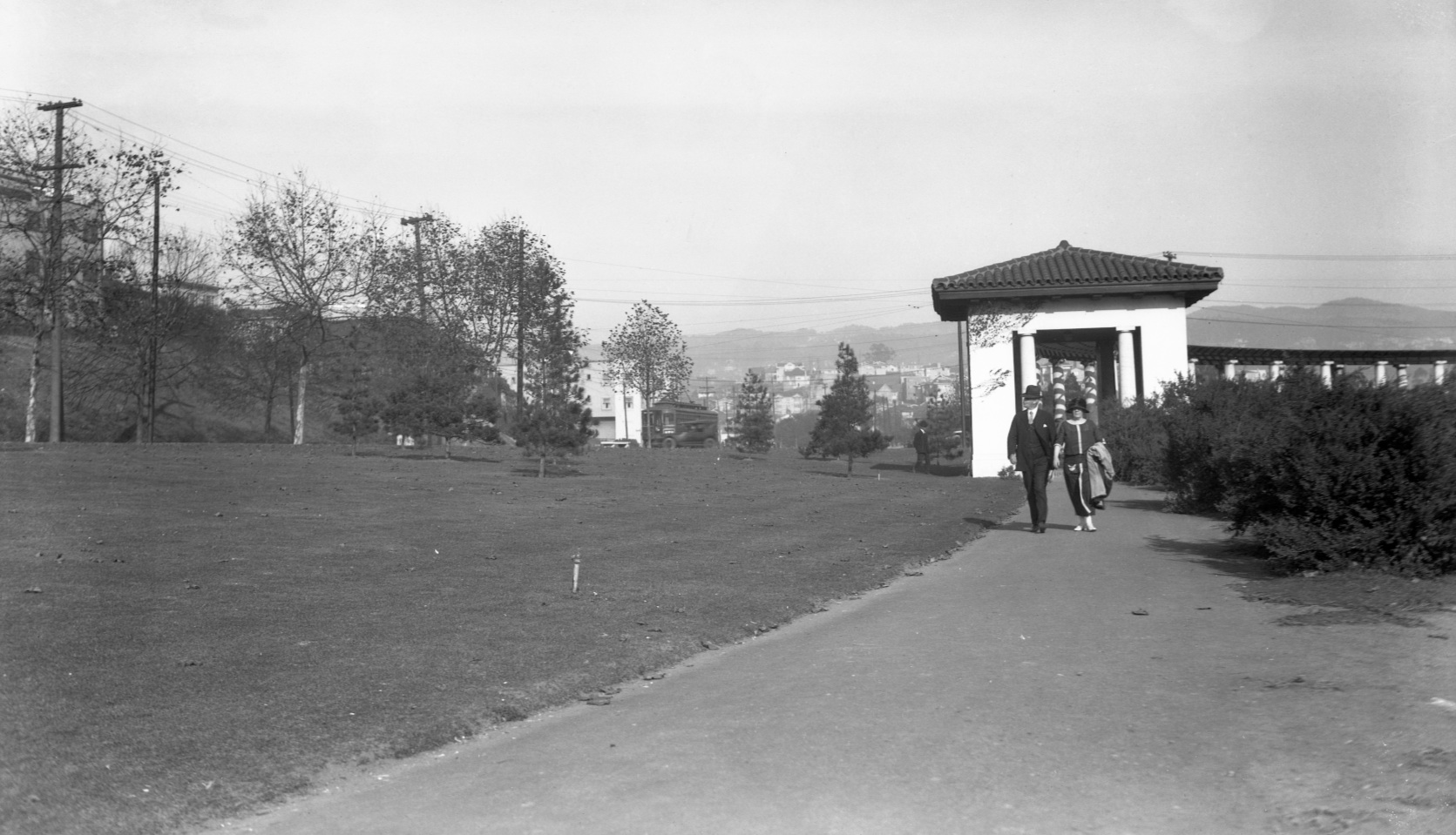
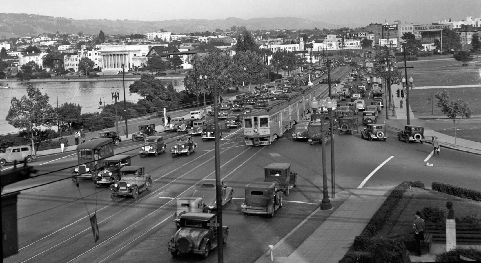
Further east at Grand Ave. and El Embarcadero, an east view of the Lake Merritt path toward the promenade with a KS car heading east in the distance circa 1925.
L228-100- Sappers Collection, Courtesy BAERA, Western Railway Museum Archives, 118916ov, (Image 22 of 36)
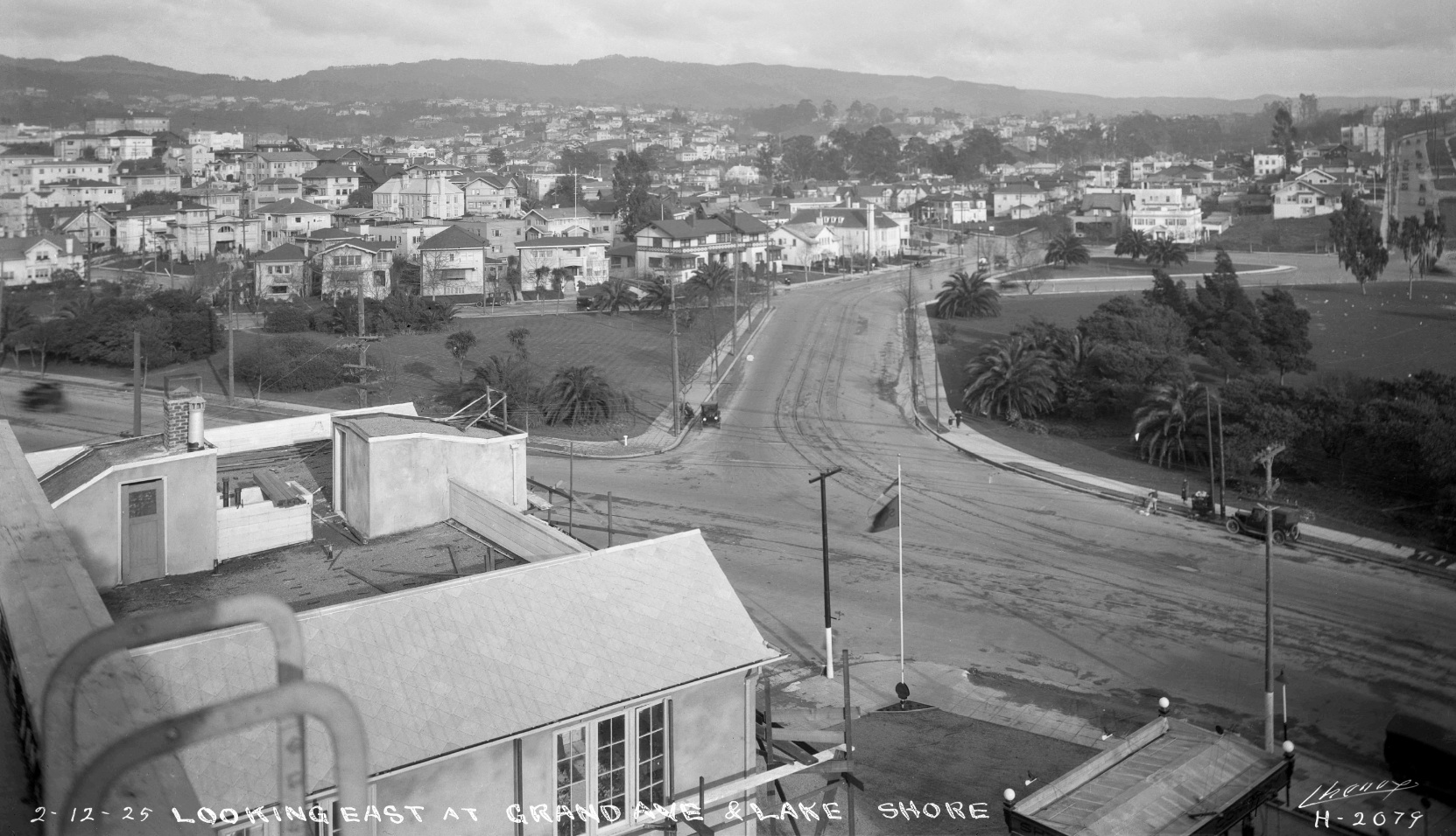
Heading further east on Grand Ave., B trains split to the right onto Lake Park Ave., the tracks seen in this east view on Feb. 12, 1925. The Grand Lake Theater would be built the following year as commercial enterprises began extending north along Grand Ave.
L228-105-Eston Cheney Photo H-2079, Courtesy John Bosko Archives, (Image 23 of 36)
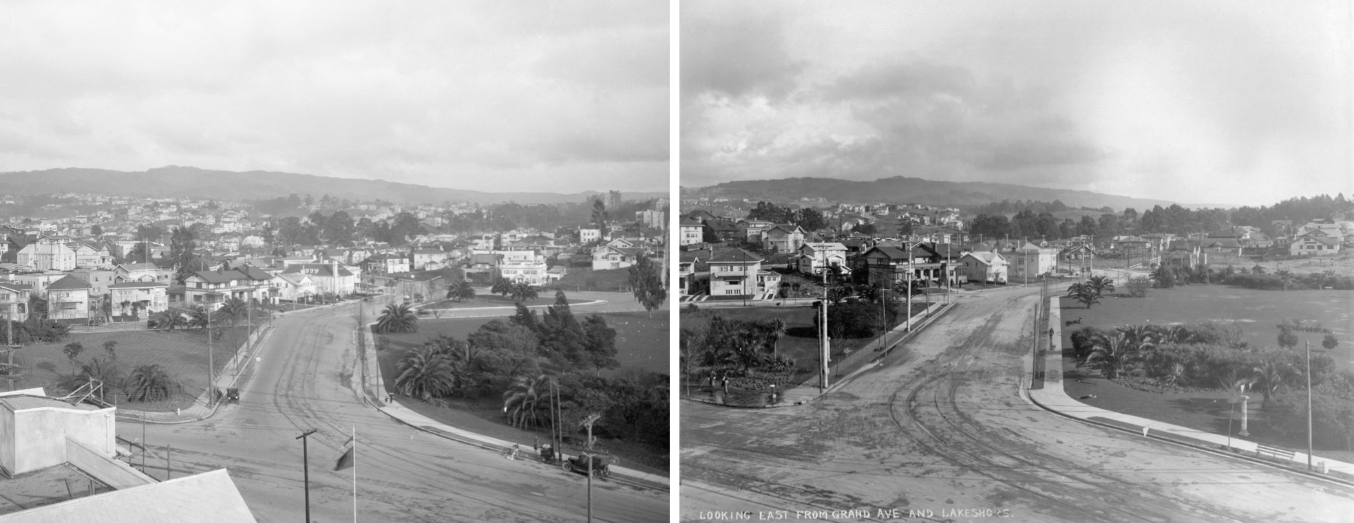
Setting the previous image, left, against one from a time prior to the extension of the B train through Trestle Glen to Underhills, right, the double-track from Grand Ave. added to a single one heading east on Lake Park Ave. The juxtaposition of the images reveals the addition of homes and roads along this edge of the Lake.
L228-110-Eston Cheney Photos, Courtesy John Bosko and Oakland Cultural Heritage Survey, (Image 24 of 36)
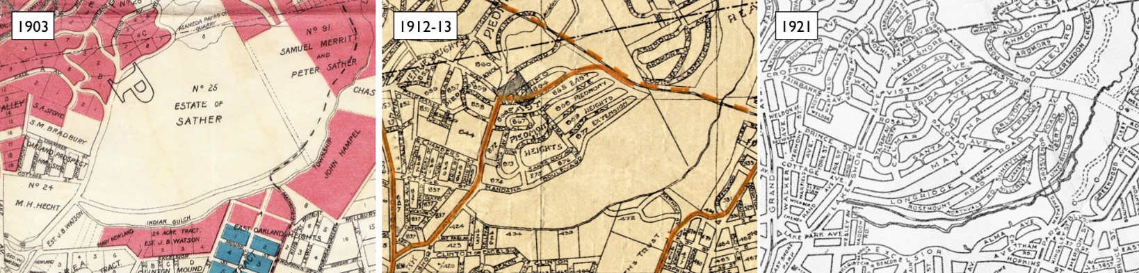
The extension of the B line into Trestle Glen by 1921, far right panel, followed the development of an intricate network of streetcars around the lake, central panel, preceded by the single Oakland Transit Co. Trestle across the Sather estate property, far left.
L228-115- Maps Courtesy John Bosko and BAERA, Western Railway Museum Archives , (Image 25 of 36)
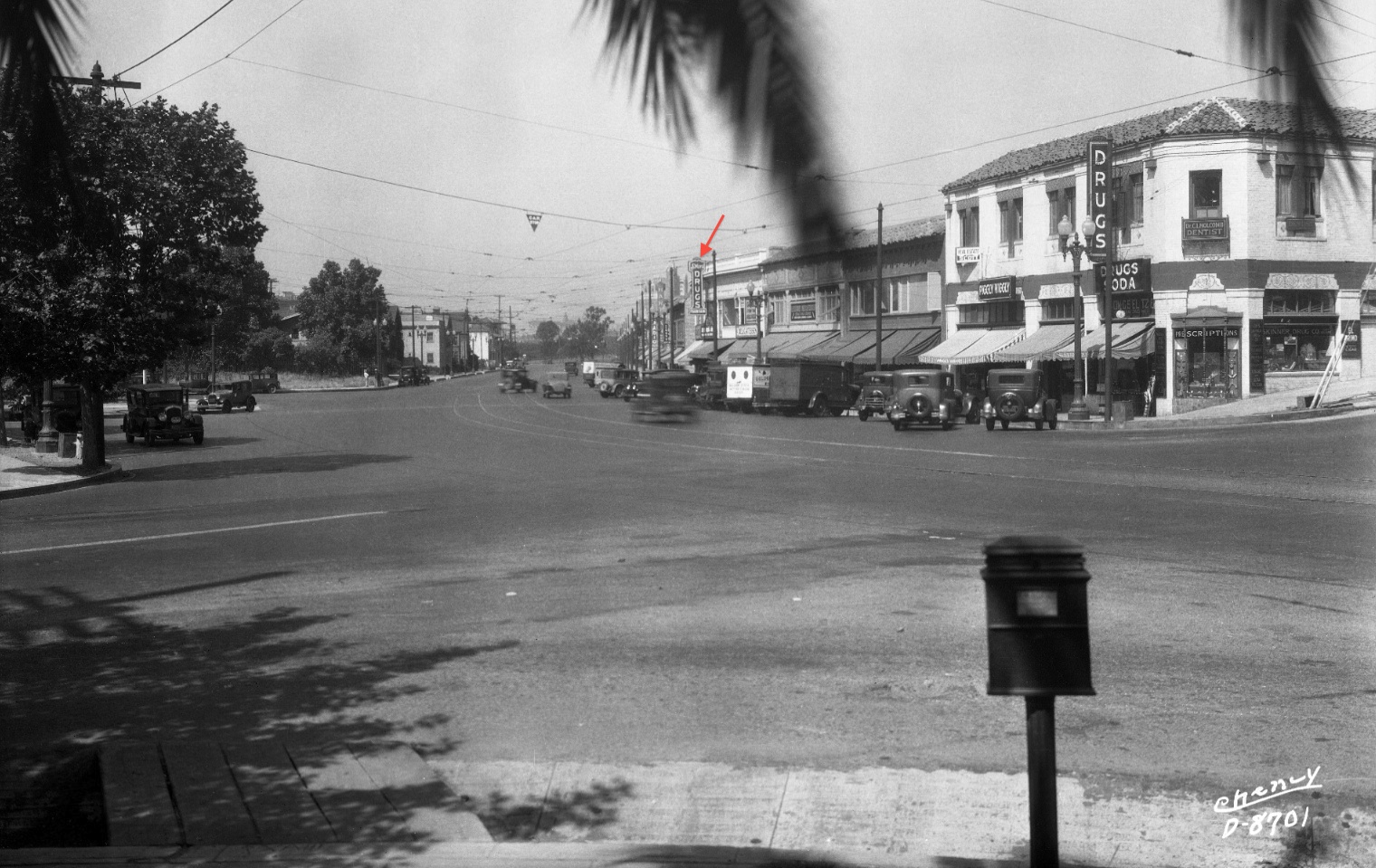
The success of Lakeshore Highlands development took its toll on homes on Lakeshore Ave. Pressure from the homeowners in the Highlands and other builders such as Frank Malley brought commercial entities primarily to the west side of Lakeshore Ave. beginning in the fall of 1927 with no. 3407, Stier’s Drugs, red arrow. This south view circa 1935 documents this change.
L228-120-Eston Cheney Photo D-8701, Courtesy John Bosko Archives , (Image 26 of 36)
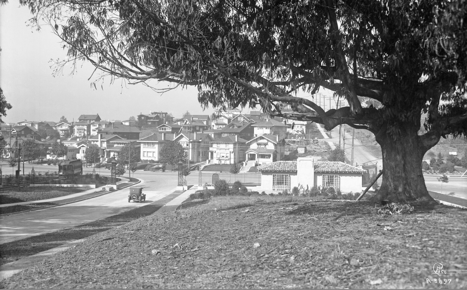
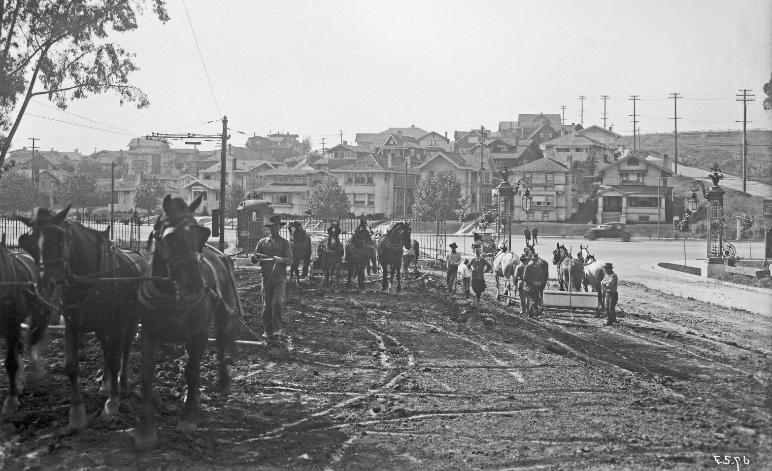
The residential nature of Lakeshore Ave. can be appreciated in this west view circa 1919. The 22nd St. line was extended to Wesley Ave. on July 19, 1919, just as development of Lakeshore Highlands was begun. Left-to-right, a KS car at the Wesley stop, a car on Longridge Rd., the Lakeshore Highland Co. sales office designed by Louis Christian Mullgardt, and Mandana Blvd., respectively.
L228-125-Eston Cheney Photo A-3897, Courtesy BAERA, Western Railway Museum Archives, 15067ks, (Image 27 of 36)
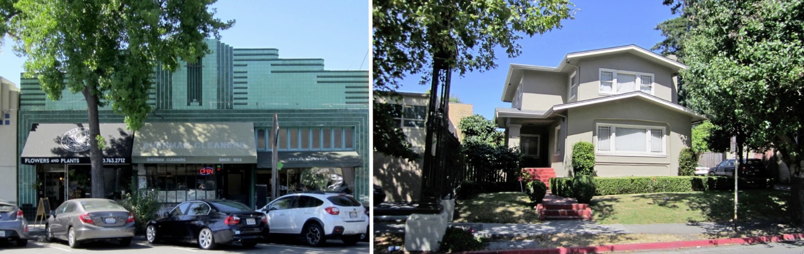
If curious to see a home from Lakeshore Ave. in 2020, subtract Sherman Cleaners, left, and replace it with 624 Trestle Glen Rd. It was moved from No. 3249 Lakeshore to this location based on a permit filed to move the home for 750 dollars on Nov. 11, 1936. It would be the first house on the north side of Trestle Glen Rd., right, easy to find if you look for the gates to that road.
L228-130-Stuart Swiedler Photos, (Image 28 of 36)
Extension of the 22nd St. line to Underhills Rd. took place on Nov. 8, 1920. West view, circa 1920.
L228-135-Courtesy BAERA, Western Railway Museum Archives, 15357ks, (Image 29 of 36)
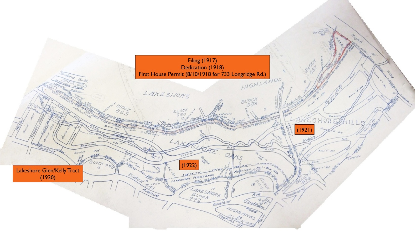
For more information on the development of Lakeshore Highlands and the Key System, refer to presentations “Trestle Glen 1922” and “The Steps to Northvale” located on the History page of the website.
L228-140-Thomas Block Book of Oakland, Courtesy Oakland History Room, Oakland Public Library, (Image 30 of 36)
The A line served the southern edge of Lake Merritt. After the B line turned from Poplar St. onto 22nd St., the A continued to 12th St. and turned by the Nabisco factory, seen here in this detail from an east view from Aug. 7, 1955. Find it on the A-line route in the entire aerial view to follow.
L228-145-Copyright California Department of Transportation, 4503-1, Detail, (Image 31 of 36)
An east view from Aug. 7, 1955 just east of Grove St. showing the entire A-line route to the lake.
L228-150-Copyright California Department of Transportation, 4503-1, Detail, (Image 32 of 36)
An A interurban train begins its journey over the 12th St. dam in an east view, circa 1935. When the Southern Pacific abandoned its 7th St. line to Havenscourt in 1941, the A was extended using a connector from tracks on E. 14th St. at 46th Ave. to the tracks on Bond St., later renamed Bancroft Way, in the Melrose district.
L228-155-Sappers Collecton, Courtesy BAERA, Western Railway Museum Archives 24707ks, (Image 33 of 36)
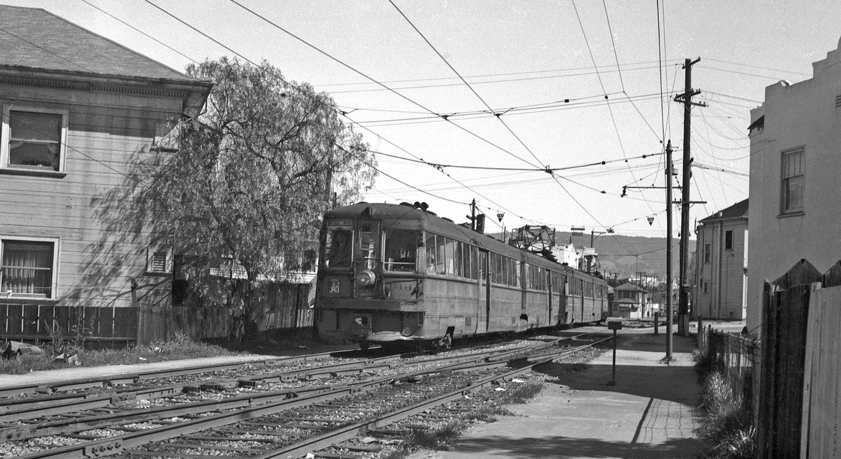
Some A trains continued to run to the terminal at 3rd Ave. and East 18th St. and were designated as A-1. An A-1 train is seen in a northeast view between 1st Ave. and E. 15th St. on the private right-of-way, renamed 1st Ave. Pl. once the rails were removed. The date is Mar. 1946, and A-1 service would be abandoned later that year.
L228-160-Waldemar Sievers Photo, Courtesy John Harder , (Image 34 of 36)
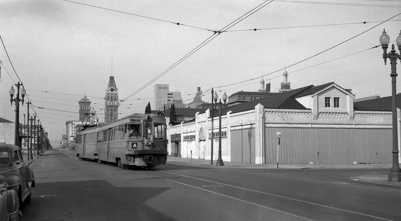
Although bus service had always supplemented or replaced evening, Sunday and holiday service of the extended A line, service was cut back to 12th and Oak St. in Oct. 1950, and replaced beyond that point entirely by bus service. KS 172 is shown in a west view in 1957 at 12th. and Madison St., just west of the Alameda County Court House.
L228-165-John Harder Photo, Courtesy John Harder, (Image 35 of 36)
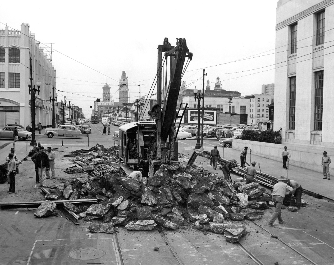
As Demoro summarizes in “The Key Route”, the cutback of the A trains to this junction was part of a larger plan to reconstruct the 12th St. dam to one-way traffic, and reflected the disinterest of the KS to contribute financially to the project. This west view from Apr. 8, 1952 shows track removal at 12th and Oak St. along side of the court house.
L228-170-Commercial Studios Photo, Courtesy BAERA, Western Railway Museum Archives, 14271, (Image 36 of 36)