Intro and Roadmap
Left, Key System or KS 271 leads an excursion eastbound on Grand Ave. with an inbound B unit 156 at its side, Mar. 7, 1954. Right, the same area in 2019. Both southwest views.
L227-05-Addison Laflin Photo, Courtesy BAERA, W. Railway Museum Arch., 76320ks, and Stuart Swiedler, (Image 1 of 26)

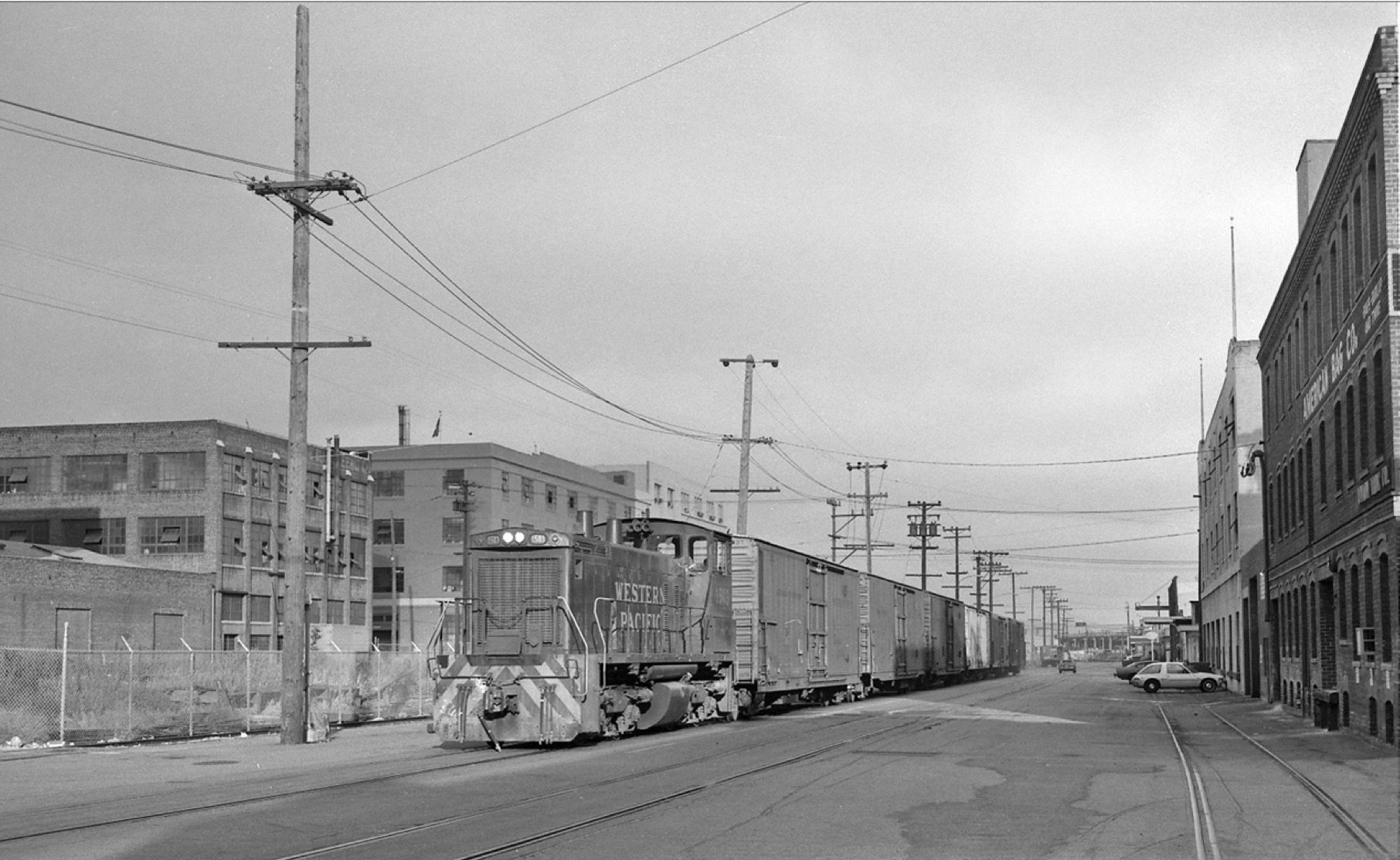
This series of presentations is based on the Oakland Heritage Alliance-sponsored Feb. 20, 2020 presentation at the American Bag Building. Southeast view, WP 1503 navigates 3rd and Harrison Sts. and the American Bag Building in a southeast view from 1980.
L227-10-John Harder Photo, Courtesy John Harder, (Image 2 of 26)
The following organizations and individuals who contributed to the presentation are acknowledged.
L227-15-Stuart Swiedler Figure, (Image 3 of 26)
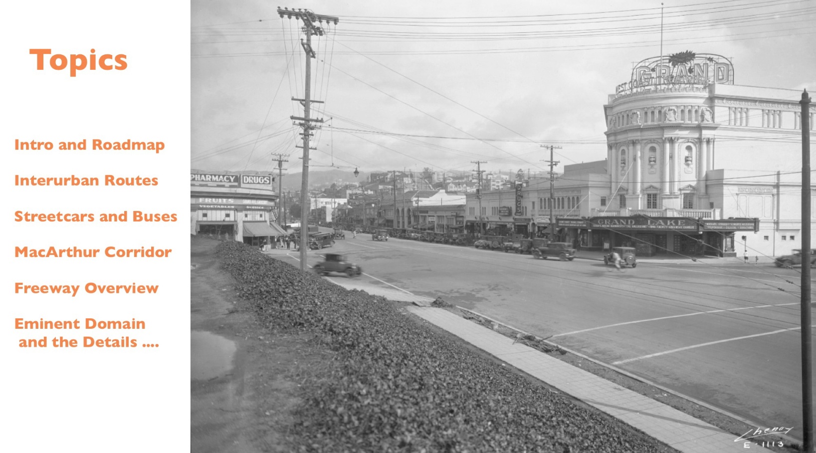
The topics to be covered over several presentations are listed here in this northeast view from 1926 or later based on the marquee of the newly opened Grand Theater advertising the movie “Michael Strogoff” among other live musical entertainment the theater specialized in during the early years.
L227-20-Eston Cheney Photo E-1113, Courtesy BAERA, Western Railway Museum Archives, 39139, (Image 4 of 26)
To begin, a roadmap to chronologically indicate the important events impacting transportation corridors to and from the Lakeshore area.
L227-25-Stuart Swiedler Figure, (Image 5 of 26)
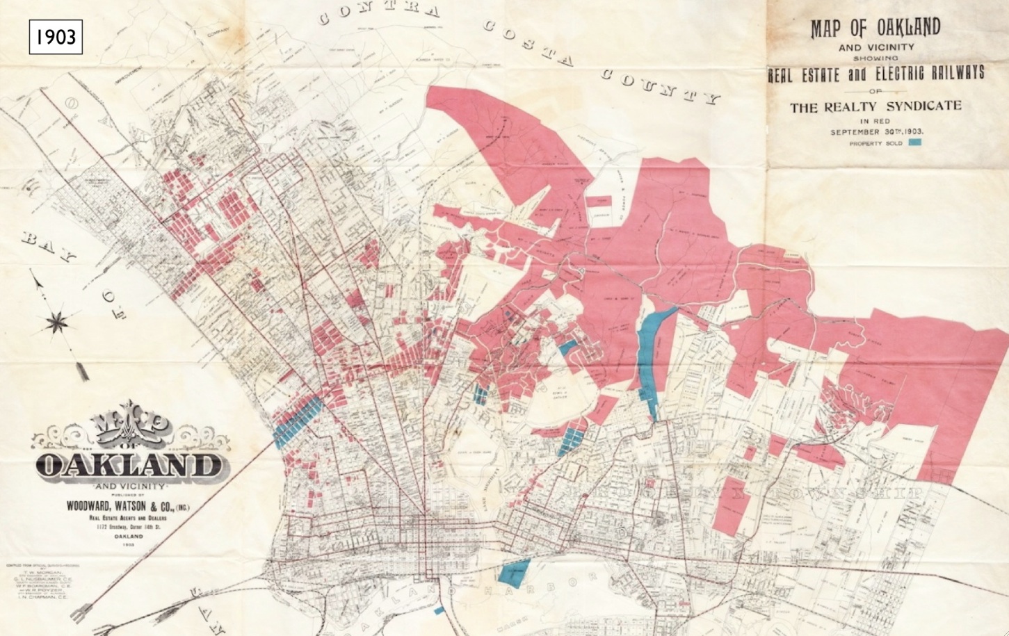
A map of Oakland from 1903 shows the paucity of direct routes beyond the southern edge of Lake Merritt. See detail to follow.
L227-30-Woodward, Watson and Co. Map of Oakland, John Bosko Collection, Courtesy John Bosko, (Image 6 of 26)
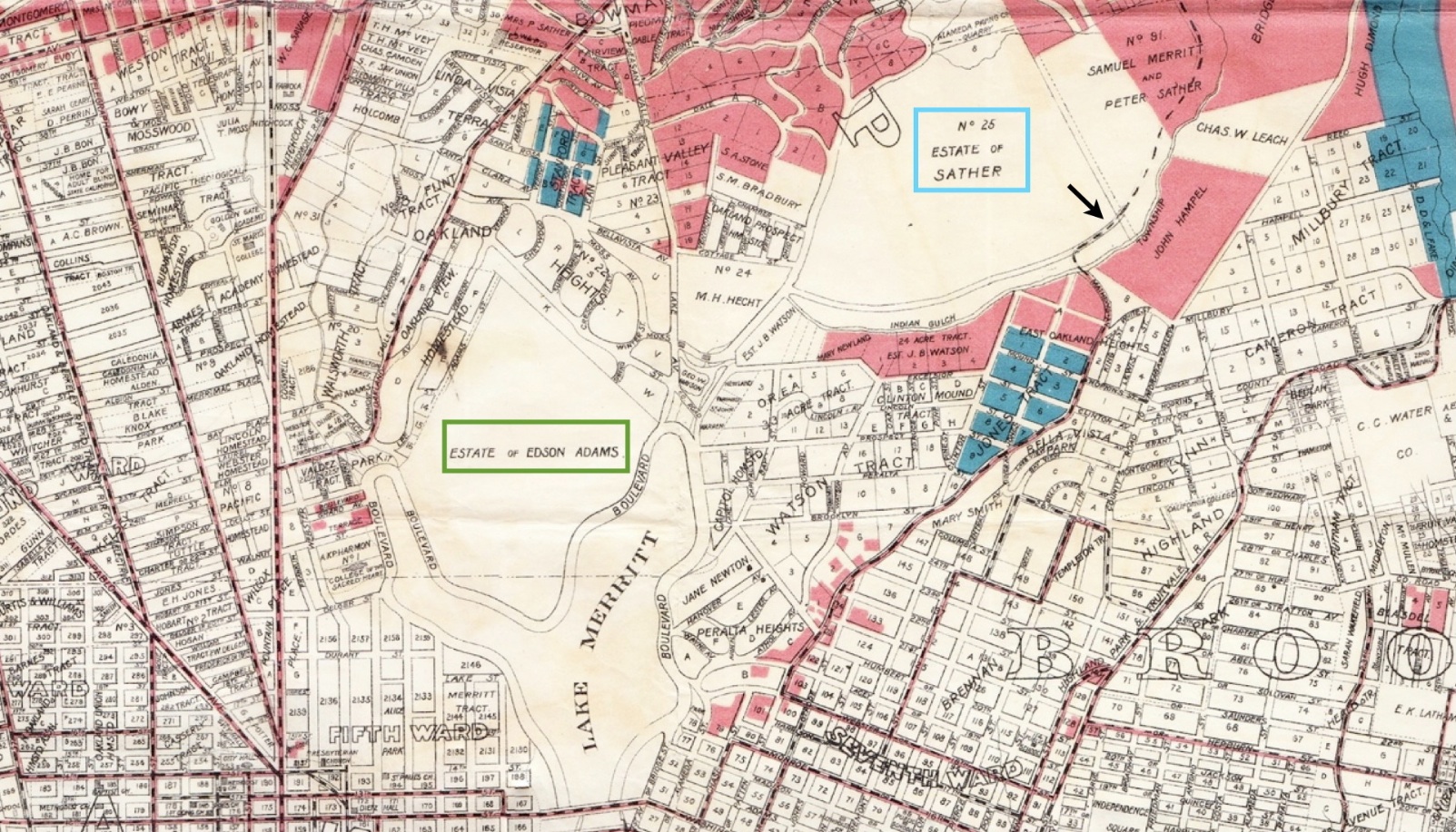
The Adams and Sather Estates essentially cut off direct traffic coming from Oakland to the north side of the lake as the 20th century began. The one exception is indicated by the arrow, images to follow.
L227-35-Woodward, Watson and Co. Map of Oakland, John Bosko Collection, Courtesy John Bosko, (Image 7 of 26)
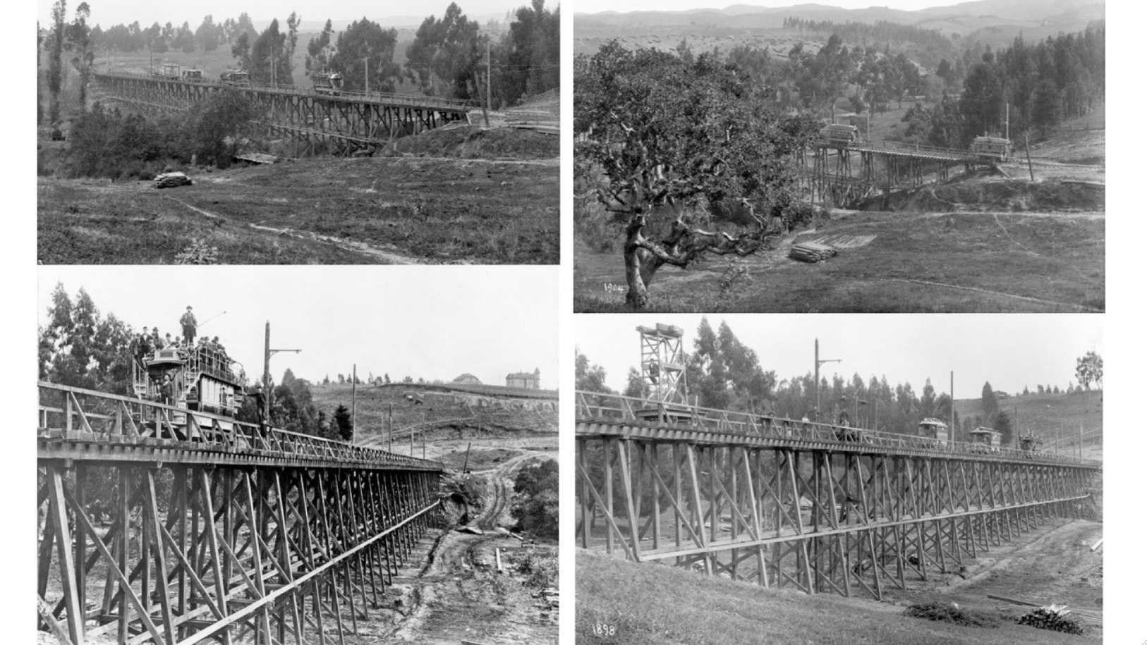
Four views of the large trestle that would give the area one of its distinctive names, “Trestle Glen”, operated by Borax Smith’s East Oakland Street Railroad Co., Oakland Transit Co. and other namesakes between 1893 and 1906. The exact location often debated, the previous map casts its vote.
L227-40-Courtesy BAERA, Western Railway Museum, 12322eosr, 11529eosr, 11528eosr, (Image 8 of 26)
Ahead to the impact resulting from the mass migration from San Francisco post earthquake, and the effective expansion efforts of Frank K. Mott, Oakland’s 35th mayor. See detail to follow.
L227-45-Realty Bonds and Finance Co. Map, John Bosko Collection, Courtesy John Bosko , (Image 9 of 26)
Evolution of the Broadway intersection at 22nd St., purple circle, followed the formation of Grand Ave., and allowed for increased streetcar routes, orange lines, around the lake. Note the division of the Adams Estate to park and homes, the creation of Piedmont Heights-Crocker Highlands with Mandana Blvd. as the lowest boundary, green arrow, and replacement of the trestle over the Sather property with Matthews Ave., yellow arrow.
L227-50-Realty Bonds and Finance Co. Map, John Bosko Collection, Courtesy John Bosko , (Image 10 of 26)
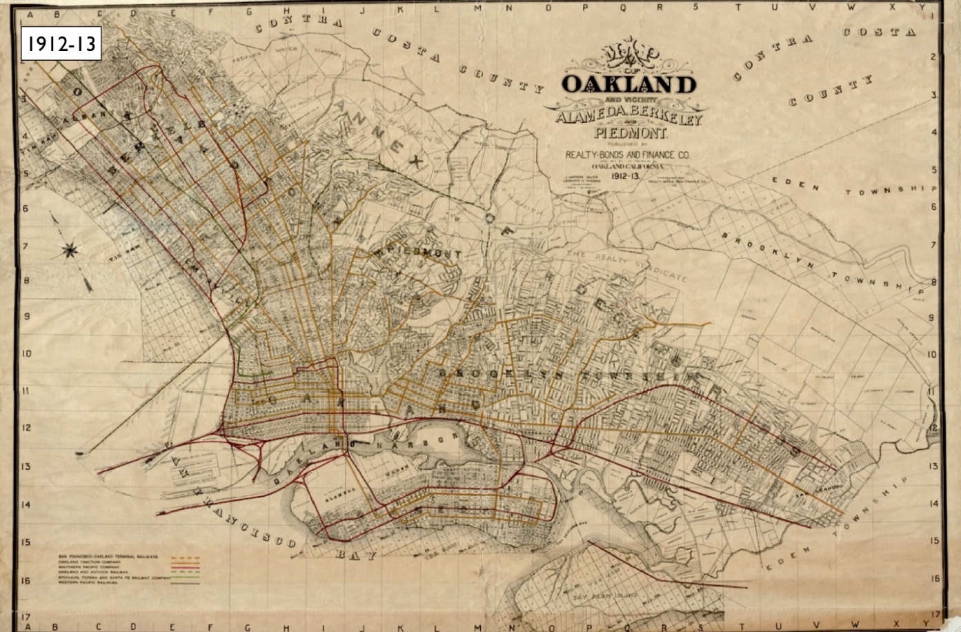
By the time this map was drawn up in 1921, the Key System had already expanded its interurban line, purple arrow, into Trestle Glen. Roads to the north of the line helped drive home sales in Lakeshore Highlands throughout the next two decades.
L227-55-Central National Bank Map, Courtesy BAERA, Western Railway Museum Archives, 83537 , (Image 11 of 26)
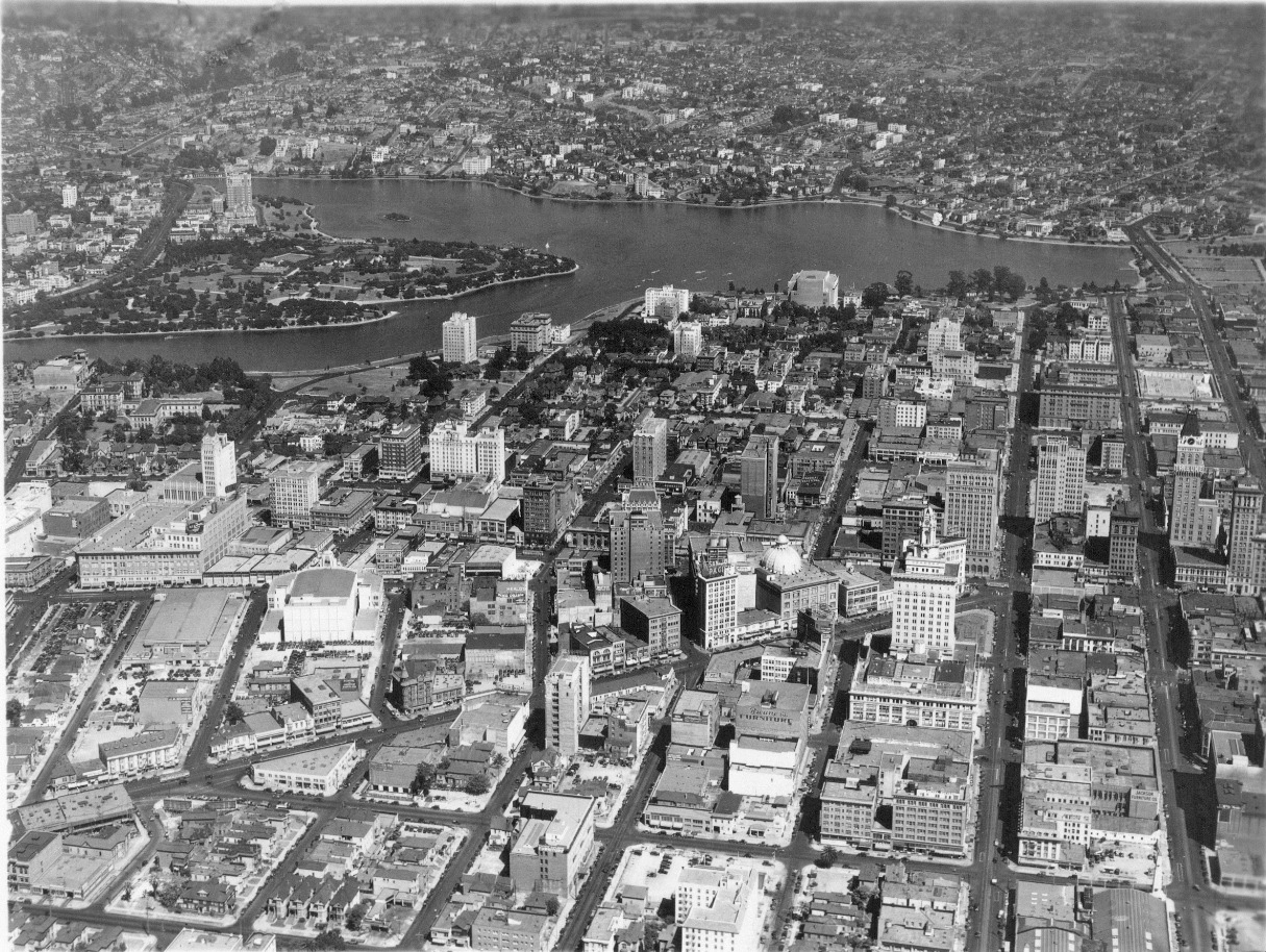
By the end of the 1920s, the footprint of Oakland’s downtown grid was essentially complete. Annotated detail to follow ... Ref: SLC_653_NoDate_27
L227-60-George Russell Photo, Courtesy the California State Lands Commission, (Image 12 of 26)
Fox Theater, 1, from 1928, completed 2nd H.C. Capwell Department Store, 2, opened in 1929, now Uptown Station. The Elks Club Building, 5, between 19th-20th, later known as Hotel Carillon, William C. Knowles architect, demolished in 1966. I Magnin, 3, and Paramount Theater, 4, both from 1931, The buildings behind to the lake, 6, belonged to the College of the Holy Names until they sold the site to Kaiser Co. in 1957. Ref: SLC_653_NoDate_27
L227-65-George Russell Photo, Courtesy the California State Lands Commission, (Image 13 of 26)
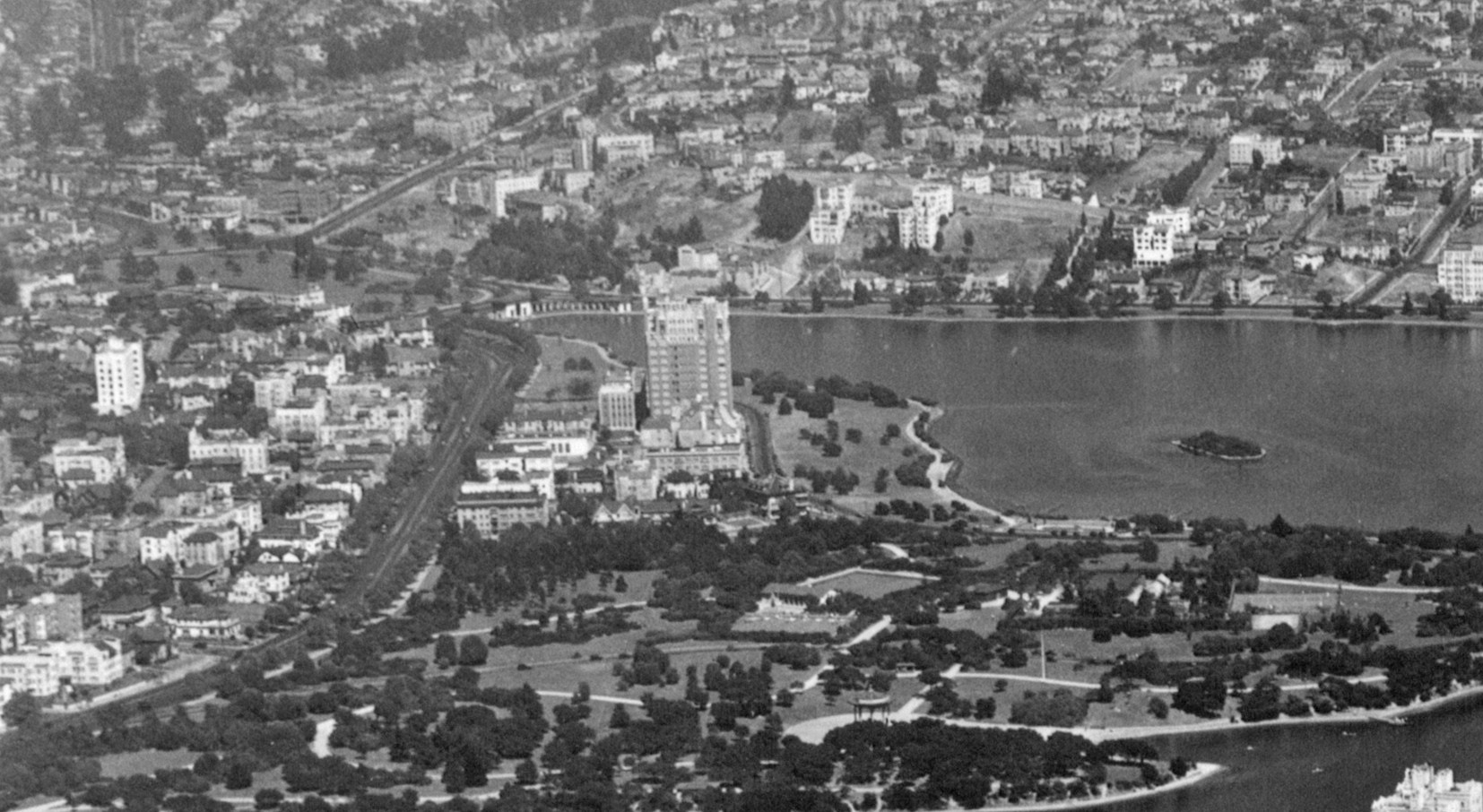
Further east along the north side of the lake is the Art Deco Bellevue-Staten Apartment Building completed in 1929 based on a design by Herman Carl Baumann. It is on the National Register of Historic Places. To the left or north, Grand Ave. with the double-track of the Key System is evident. Ref: SLC_653_NoDate_27
L227-70-George Russell Photo, Courtesy the California State Lands Commission, Detail, (Image 14 of 26)
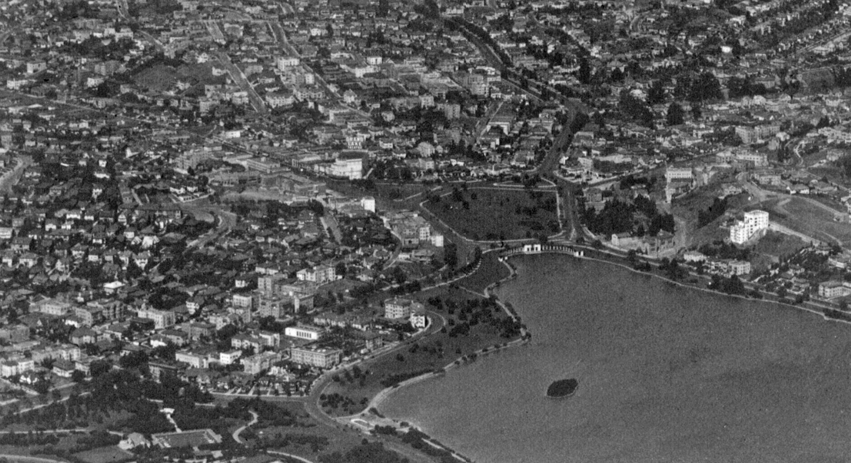
The Grand Lake Theater’s monumental sign dates the image to no earlier than early 1926, when the theater designed by the Reid Brothers was opened. The Bellevue-Staten Building is absent, so it is before 1929. Ref: SLC_653_NoDate_10
L227-75-George Russell Photo, Courtesy the California State Lands Commission, Detail, (Image 15 of 26)
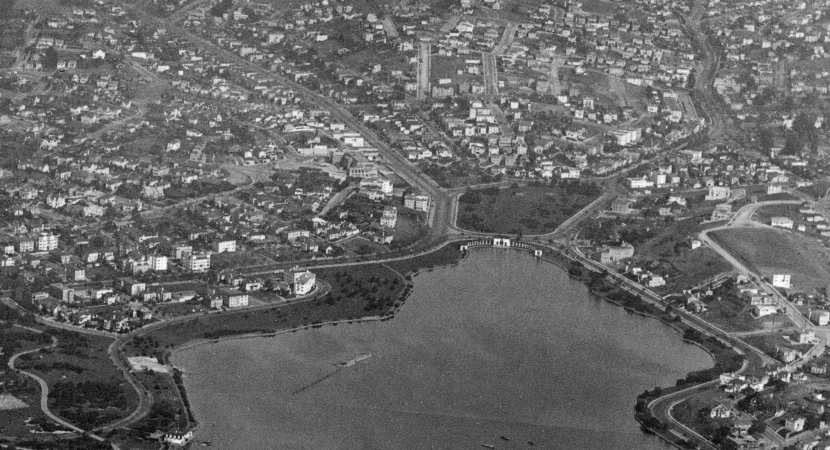
This earlier northeast view shows less buildings, and no Grand Lake Theater. Ref: API 653_9_BOX 940
L227-80-George Russell Photo, Courtesy the California State Lands Commission, Detail, (Image 16 of 26)
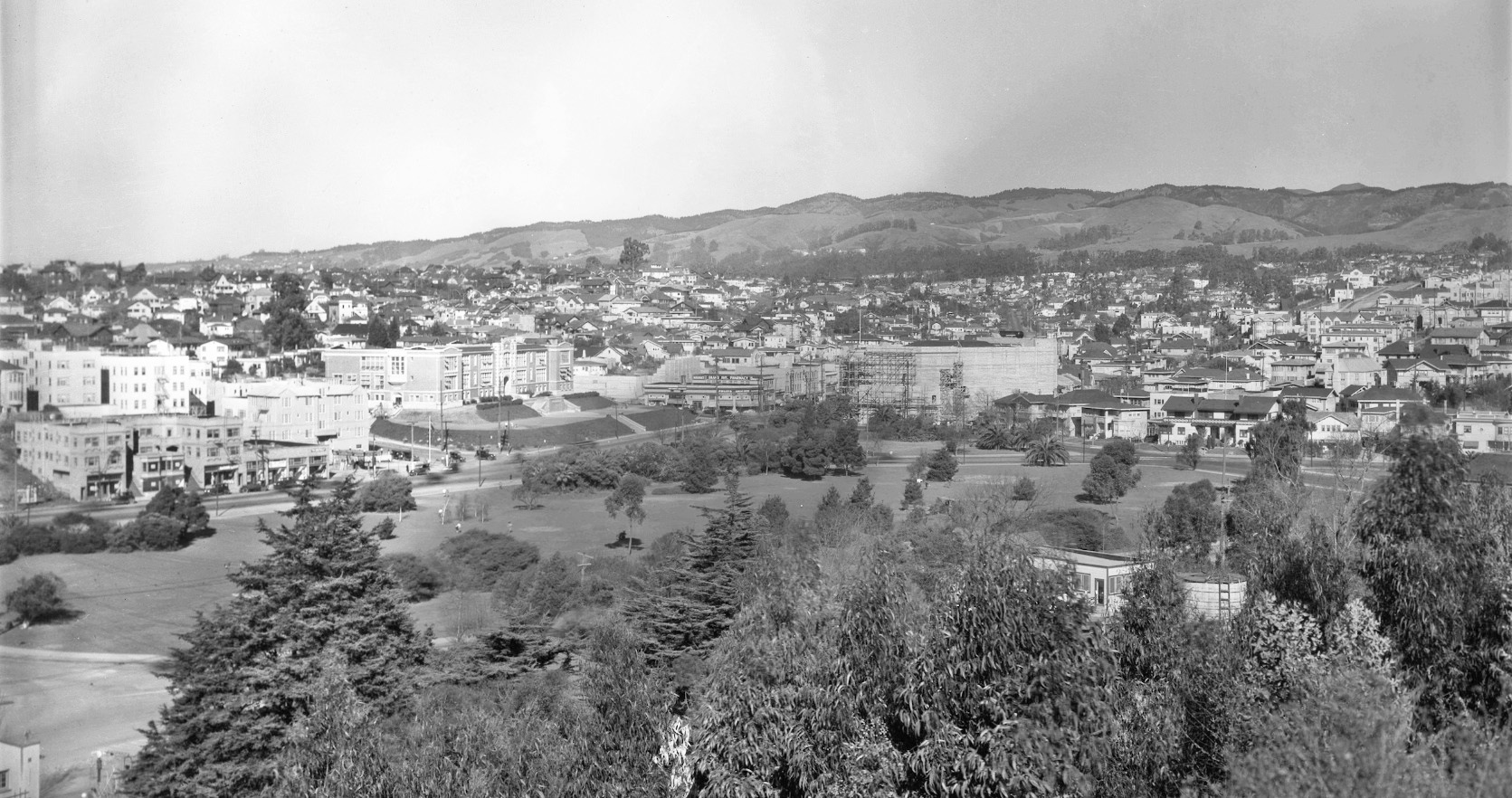
This panoramic north view shows scaffolding around the theater as it was being completed circa 1925-1926. Next, a closer look at what was around the theater at that time.
L227-85-John Bosko Collection, Courtesy John Bosko, (Image 17 of 26)
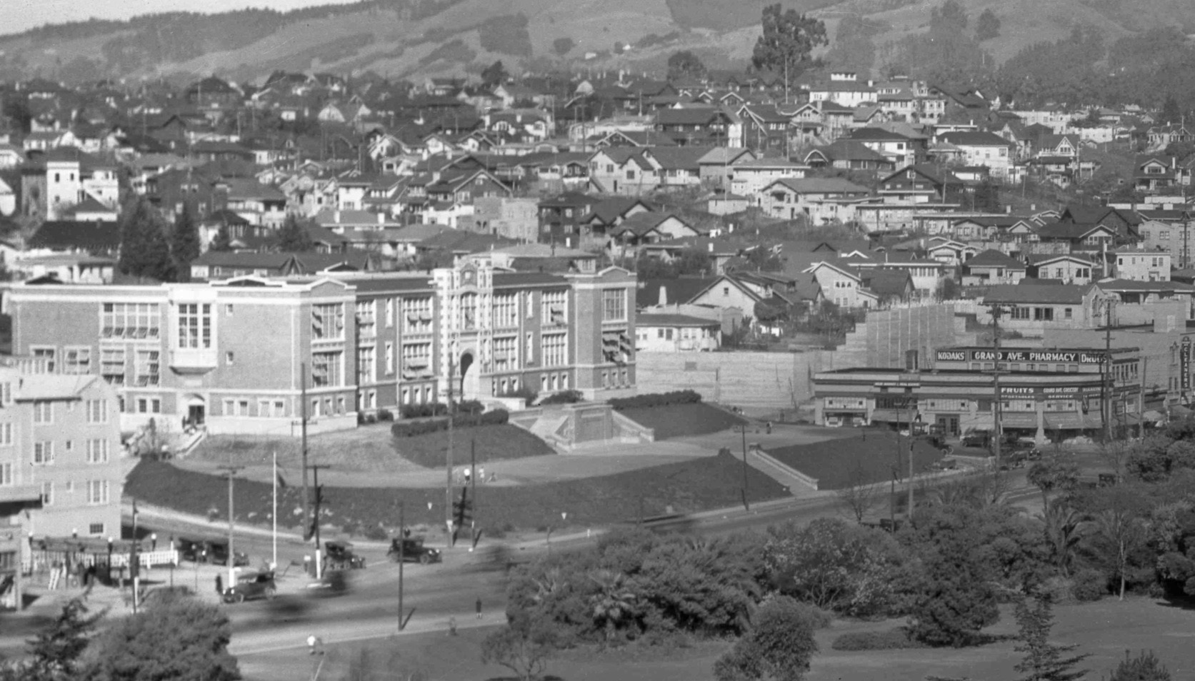
The west portion of the image shows Lakeview Elementary School with its original dark exterior. Opened in 1913, it was closed as a standard elementary school circa 2013, and has been used for administrative offices, and then leased to a charter school.
L227-90-John Bosko Collection, Courtesy John Bosko, Detail, (Image 18 of 26)
The homes along Lake Park Ave. to the east of the theater are all gone, except for no. 504 Lake Park Ave., occupied in 2020 by the Heart and Dagger Saloon and no. 480, hidden behind no. 474, QTea Bar in 2026. The large chalet-like structure to the left was the home of Walter G. Manuel, banker, merchant, real estate operative, Oakland City Councilman and President of the Board of Park Commissioners. The building was built in 1908 and designed by C. W. Dickey, architect of the Claremont Hotel. Thanks to Vincent Raines for pointing out no. 480
L227-95-John Bosko Collection, Courtesy John Bosko, Detail, (Image 19 of 26)
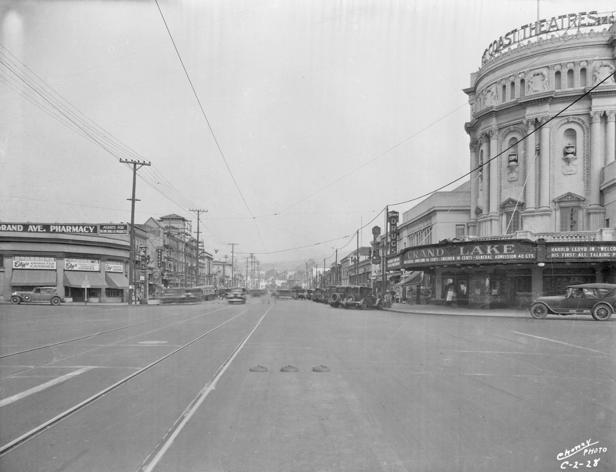
Harold Lloyd stars in Welcome Danger, his first talkie, 1929, northeast view. Note Stier’s Drug. Their other outlet was the first business on Lakeshore Ave. in 1927. Ref: Sappers Collection
L227-100-Eston Cheney Photo C-2-28, Courtesy BAERA, Western Railway Museum Archives, 39140, (Image 20 of 26)
As previously mentioned, the theater originally showed live shows as well as movies. On the latter, “The World at Her Feet” is a lost 1927 silent film comedy starring Florence Vidor. Northeast view, May 4, 1927.
L227-105-Sappers Collection, Courtesy BAERA, Western Railway Museum Archives, 37127ov, (Image 21 of 26)
Further east and looking north, the absence of the Grand Lake and Parkway Theaters date the image to sometime before 1926 as the latter opened in 1925. This image does show the Key System Central Car Barn between 2nd and 3rd Aves., and 16th and 18th Sts. A detail follows. Ref: SLC_653_NoDate_11
L227-110-George Russell Photo, Courtesy the California State Lands Commission, Detail, (Image 22 of 26)
Opened for business by the Oakland Traction Co. in 1906, the car barn was closed in 1948, and the small shopping center that replaced it still has the Lucky Supermarket, but better known for the former site of the Merritt Bakery. Ref: SLC_653_NoDate_11
L227-115-George Russell Photo, Courtesy the California State Lands Commission, Detail, (Image 23 of 26)
A comparison of the fate of the car barn from 1939 versus 2020. The red dot marks Lucky Supermarket, the blue dot Lakeside Senior Housing. First Ave. Pl. and 3rd Ave., white circles, served as private right-of-ways for the streetcars and interurbans. Ref: top, c-5750_289-63, 1939
L227-120-Courtesy U.C. Santa Barbara Library, Special Research Collections, Detail and Google Maps , (Image 24 of 26)
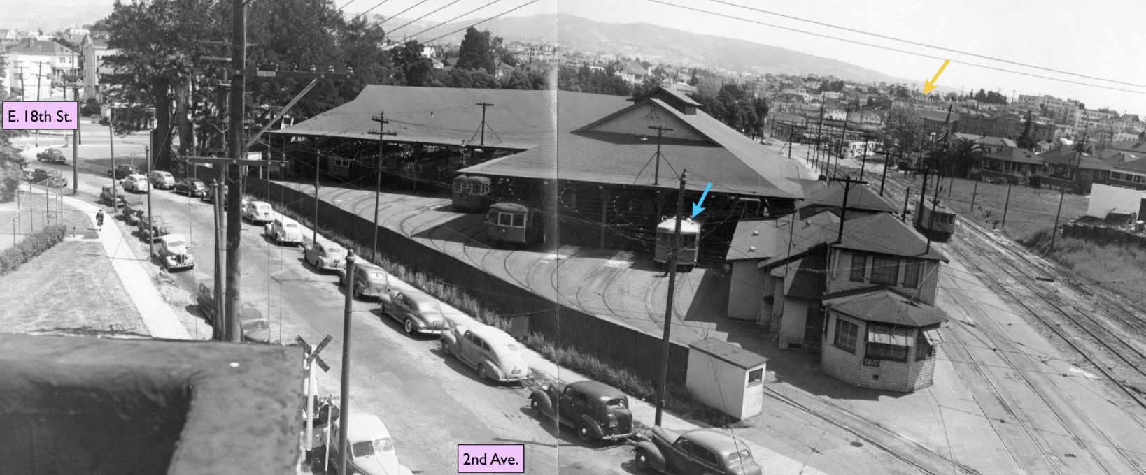
A northeast view of the southwest face of the car barn. The white roof of a Key car, turquoise arrow, tells you it is 1947 or 1948. Th Parkway Theater Opened in Sept. 1925, the gold arrow points to the Parkway Theater sign. Ref: Commercial Studios, Photographers, RL Cohen Co, GL.9717, 116 Franklin St., Oakland, CA
L227-125-Sappers Collection, Courtesy BAERA, Western Railway Museum Archives, 161058ks , (Image 25 of 26)
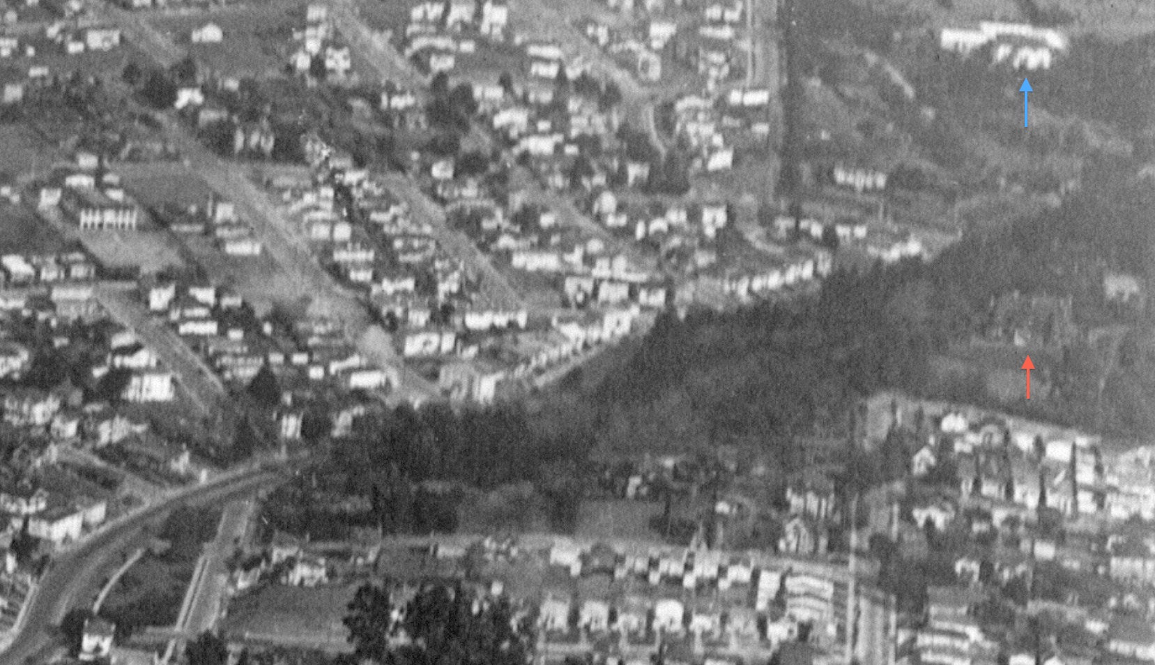
While on a Key System note, further east from the previous image along Park Blvd. reveals the Oak Hall mansion of Arbor Villa, the home of Francis Marion “Borax” Smith, red arrow. The villa survived until 1931. Mary Smith’s Home Club, blue arrow, was the centerpiece for the Home for Friendless Girls, built in 1904, and torn down to build the third incarnation of Oakland HS, groundbreaking in 1926, opened in 1928. Ref: SLC_653_NoDate_11
L227-130-George Russell Photo, Courtesy the California State Lands Commission, Detail, (Image 26 of 26)