Trestle Glen 1922
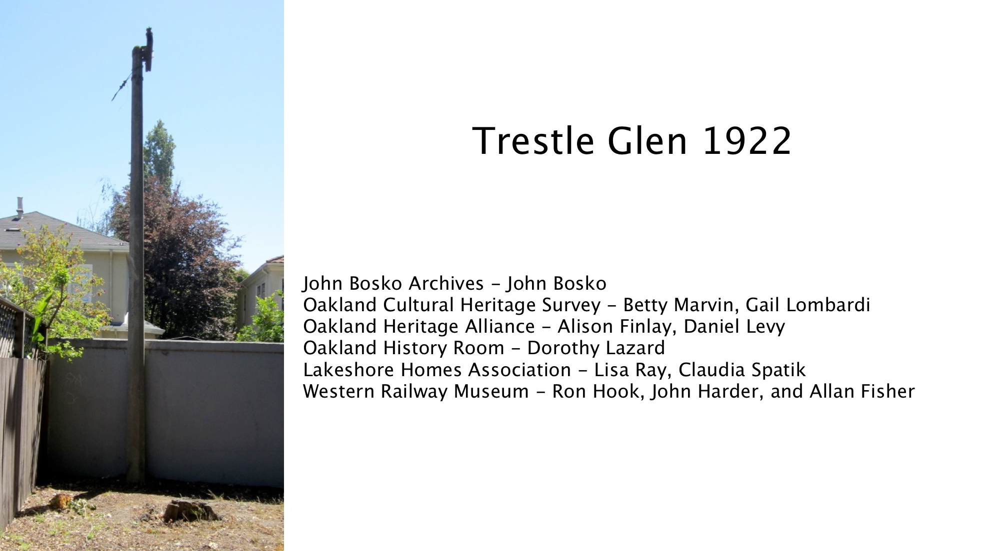
The only remaining publicly-accessible Key System B-line pole within the gates of Trestle Glen is tucked in the southeast depths of the lot behind 3410 Lakeshore Ave. on the Longridge Rd. side. Here listed are the contributors to images or information used in this presentation to mark the July 15, 2017 Oakland Heritage Alliance tour.
L154-05-Stuart Swiedler Photo, (Image 1 of 27)

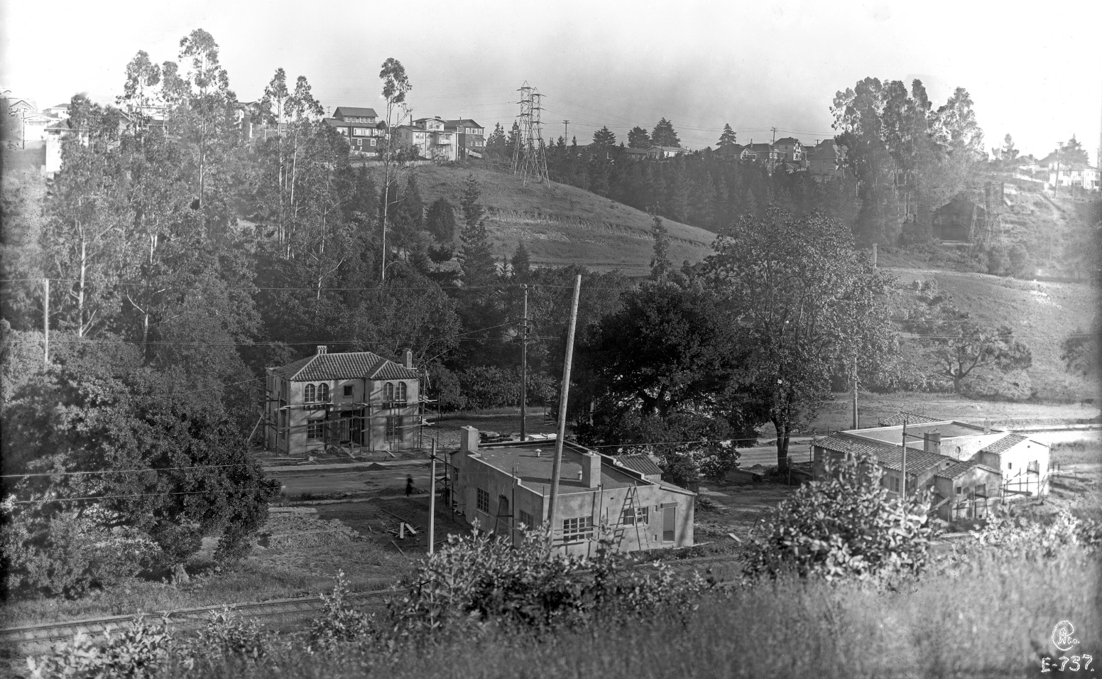
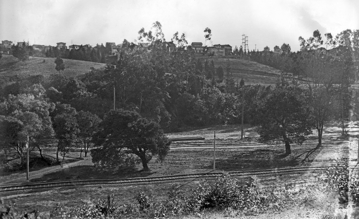
The focus will be this Eston Cheney’s photo denoting a “transition moment in time”. A annotated version will appear later in this presentation. In the meantime, images to support the historical events.
L154-10-Eston Cheney Photo E-737, Courtesy John Bosko Archives , (Image 2 of 27)
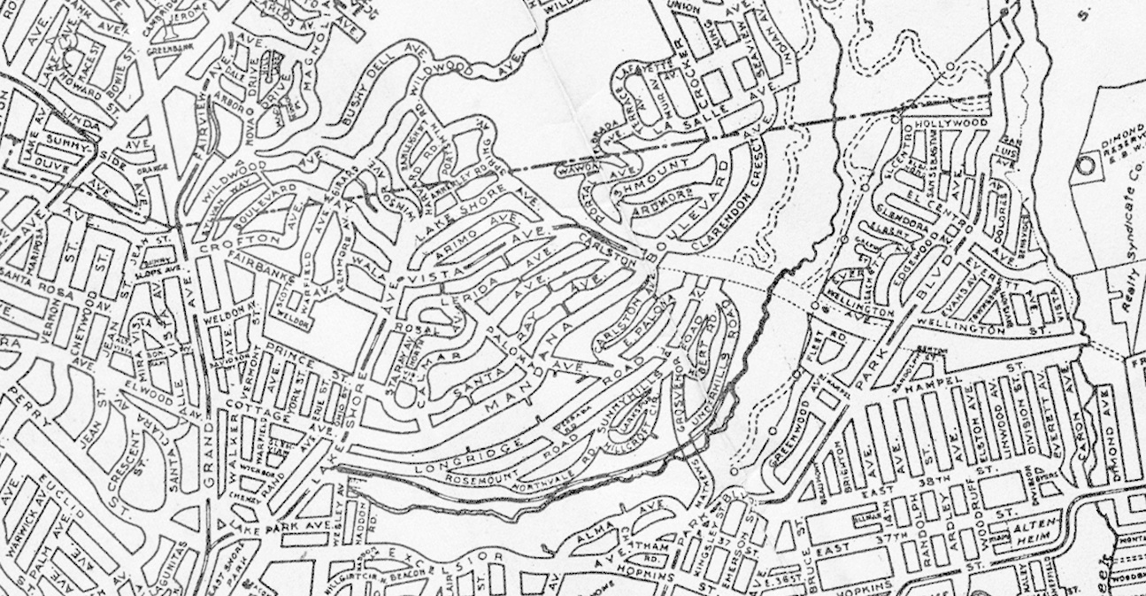
This map from 1902-03 displays the Realty Syndicate’s tightening grip around the land still in the possession of Peter Sather’s widow, Jane. She had allowed it to be used as a public park since her husband’s death in 1886, but upon her passing in 1904, the Reality Syndicate would take control.
L154-15-Realty Syndicate Map, Courtesy John Bosko Archives, (Image 3 of 27)
Four views of the large trestle that would give the area one of its distinctive names, “Trestle Glen”, operated by Borax Smith’s East Oakland Street Railroad Co., Oakland Transit Co. and other namesakes between 1893 and 1906. The exact location often debated, the map at L154-15 casts its vote.
L154-20-Courtesy BAERA, Western Railway Museum, 12322eosr, 11529eosr, 11528eosr, (Image 4 of 27)
This map from 1912 and 1913 shows the northern section of the Sather estate filled in with the East Piedmont and East Piedmont Extension tracts, or as some would call it, Crocker Highlands. The tract was completed in map form and actively soliciting homeowners by Wickham Havens and Walter H Leimert circa 1911.
L154-25-Realty Bonds and Finance Co. Map, Courtesy John Bosko Archives, (Image 5 of 27)
Oakland was unable and then unwilling to obtain the remainder of the Sather estate as a city-owned public park, so Wickham Havens filed with the city to develop Lakeshore Highlands in 1917 with Mandana Blvd. to the north and Excelsior to the south. Walter H Leimert would begin the process of actual homesite building after the June 16, 1918 public dedication in the glen for the new residential park.
L154-30-Central National Bank Map, Courtesy BAERA, Western Railway Museum Archives, 83537a, (Image 6 of 27)
This east view along Lakeview Avenue on Feb. 12, 1925 is to document the residential nature of the neighborhood to the west of the new development. The Grand Lake Theater would be built the following year as commercial enterprises began extending north along Grand Avenue.
L154-35-Eston Cheney Photo H-2079, Courtesy John Bosko Archives , (Image 7 of 27)
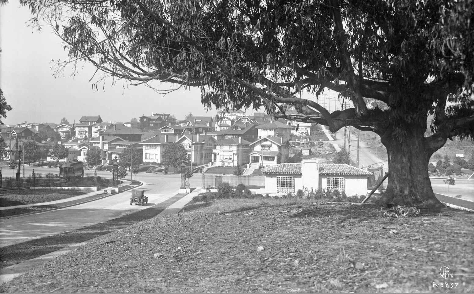
This west view of residential Lakeshore Ave. showing left-to-right, a Key System car at the Wesley station, a car on Longridge Rd., the Lakeshore Highland Co. sales office designed by Louis Christian Mullgardt, and Mandana Blvd., respectively. The date is circa late 1917 to mid-1919 when the train was extended east to Underhills.
L154-40-Eston Cheney Photo A-3897, Courtesy BAERA, Western Railway Museum Archives, 15067ks, (Image 8 of 27)
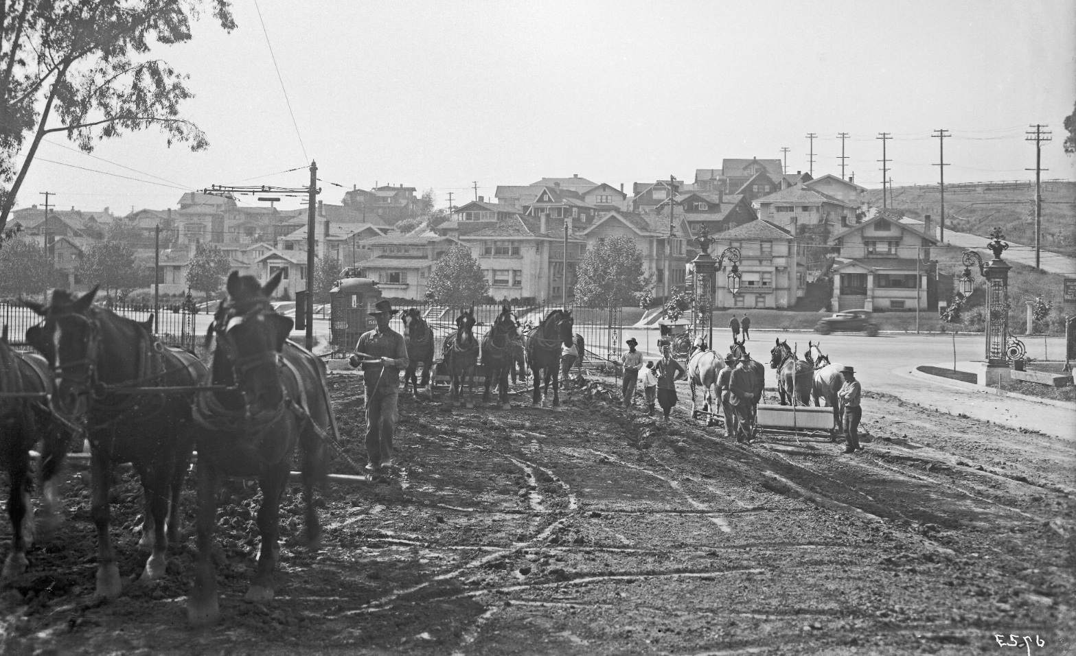
An east view of a similar scene, now with the entrance to still undeveloped Cavanaugh Rd., the original name for Trestle Glen Rd., to the right or south. The workers are focusing on the connection of the 22nd St. Line, the original name for the B-line until 1934, with the E-line streetcar, the original name for the no. 18 streetcar until 1928. The Praire-style of the homes on Mandana Blvd. will contrast with the Period Revival-style of the new residential tract.
L154-45-Eston Cheney Photo E-607, Courtesy BAERA, Western Railway Museum Archives, 15346ks, (Image 9 of 27)
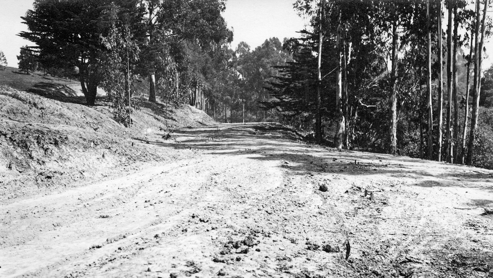
Grading the Key B-line extension at the future Trestle Glen Rd. and Lakeshore Ave. circa 1917, west view.
L154-50-Courtesy BAERA, Western Railway Museum Archives, 15357ks, (Image 10 of 27)
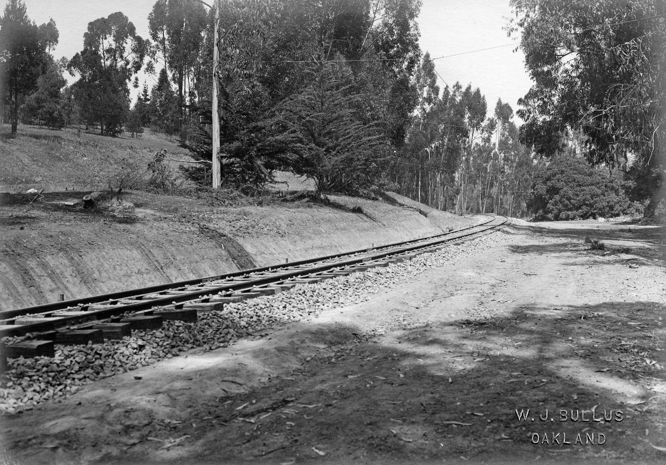
Construction of the private Key right-of-way in Trestle Glen, east view dated Apr. 5, 1917 from the future location of the Northvale station shelter, just east of where today’s Northvale Rd. comes off Rosemount Rd.
L154-55-WJ Bullus Photo, Courtesy BAERA, Western Railway Museum Archives, 17294ks, (Image 11 of 27)
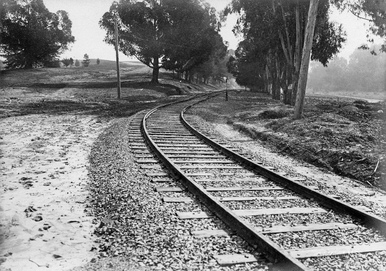
As the grading continued, track was set down, here an east view dated Mar. 3, 1917, east of Lakeshore Ave. showing a small spur track . Note the graded dirt paths for the future Trestle Glen Rd. to the right, and Longridge Rd. to the left.
L154-60-WJ Bullus Photo, Courtesy BAERA, Western Railway Museum Archives, 108353ks, (Image 12 of 27)
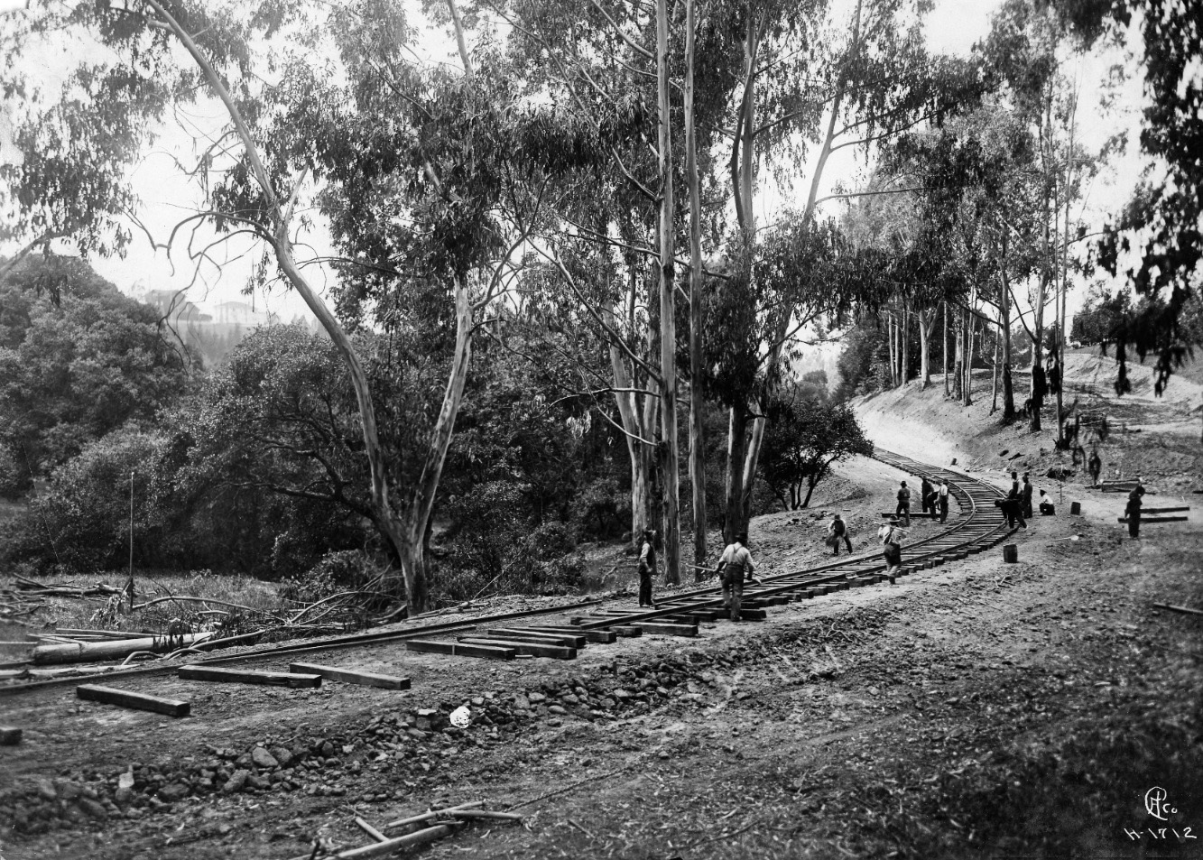
A work crew is shown laying ties and track for the private right-of-way in Trestle Glen. This west view would be the future location of the Sunnyhills station shelter on the curve. The east end of the graded path for Northvale Rd. is evident, but Sunnyhills Rd. initially was built north of the tracks, a grade crossing and extension south coming after 1925.
L154-65-Eston Cheney Photo H-1712, Courtesy BAERA, Western Railway Museum Archives, 17299, (Image 13 of 27)
Initial construction appears complete for the future B-line, this photo dated May 11, 1917. According to Demoro in “The Key Route”, the intial construction suspended the trolley wire from trees where possible until permanent poles were placed one year later.
L154-70-WJ Bullus Photo, Courtesy BAERA, Western Railway Museum Archives, 108352ks , (Image 14 of 27)
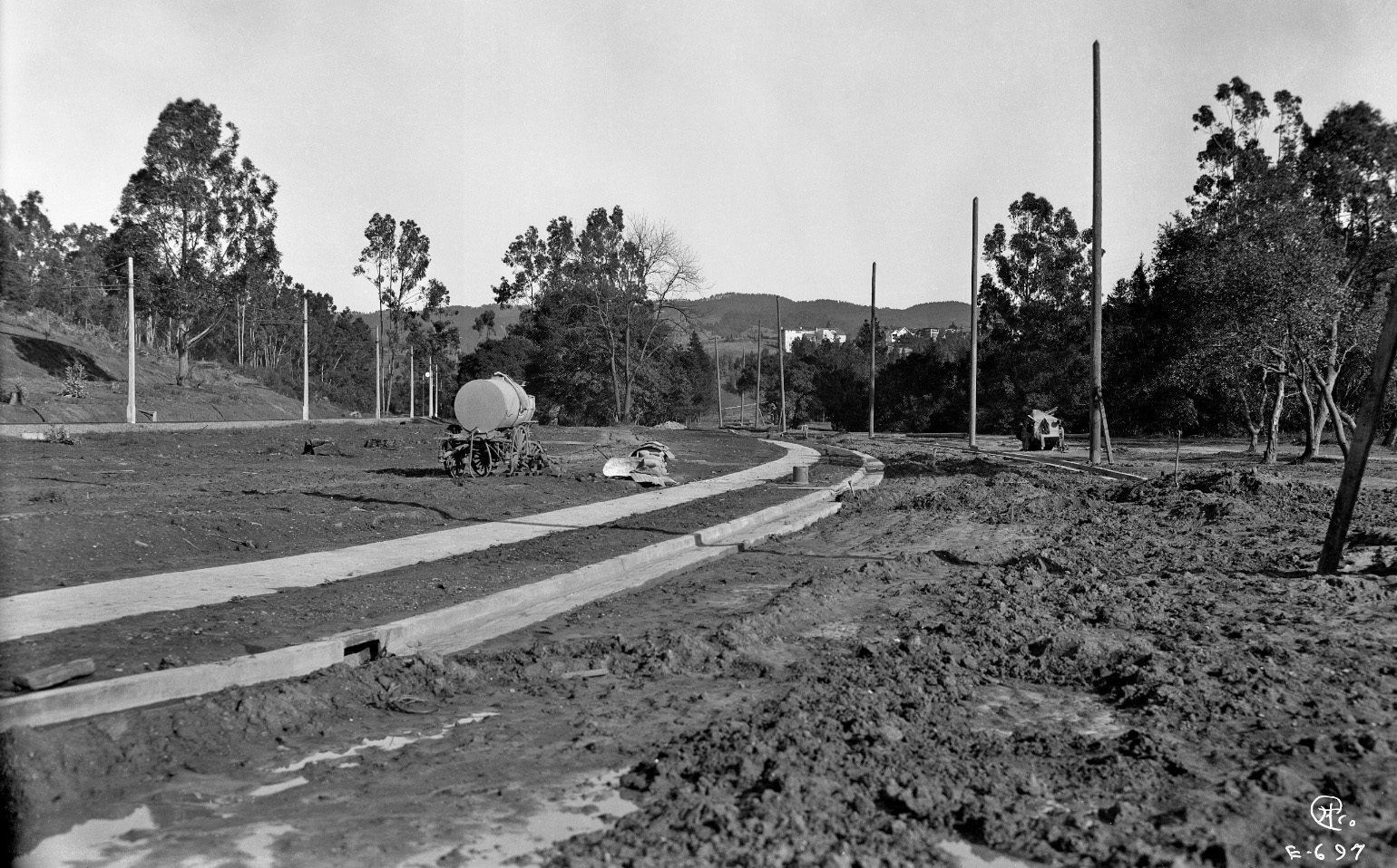
The tracts along the future Trestle Glen Rd. were open for development in several waves from 1920-1922, with nos. 600-900 Trestle Glen Rd. in the Lakeshore Glen tract, 1920, nos. 900-1198 in the Lakeshore Oaks tract, 1922, and nos. 1200-1471 in the Lakeshore Hills tract, the latter pictured here in an east view circa 1921, approximately at today’s Grosvenor Pl. crossing.
L154-75-Eston Cheney Photo E-697, Courtesy John Bosko Archives, (Image 15 of 27)
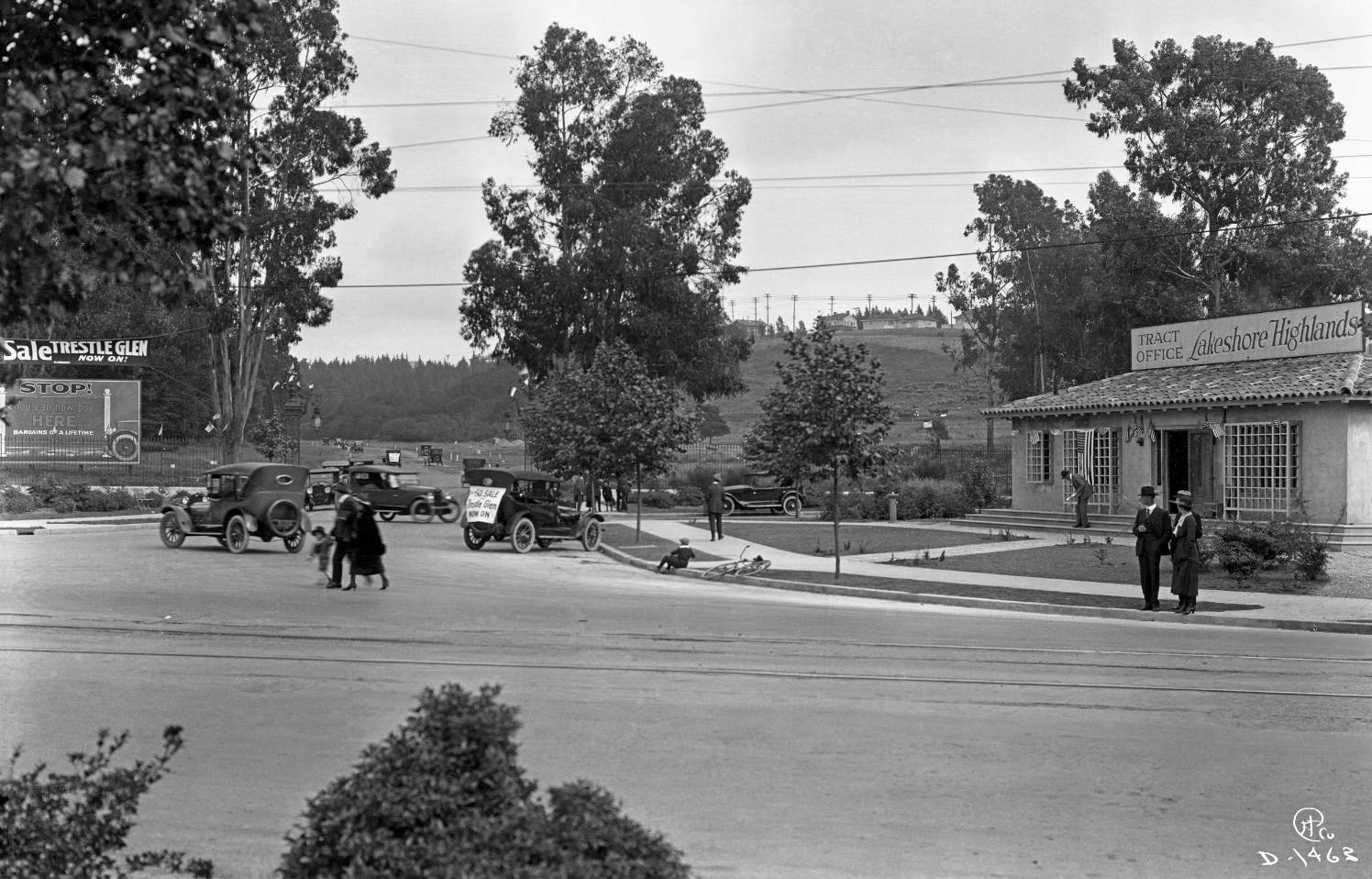
Now ahead to 1922, the sales office for the Lakeshore Highlands Company having been moved south from the site seen in L154-40 to a position south of the future trestle Glen Rd. is surrounded by activity indicating a special event is in progress. East view from Lakeshore Ave.
L154-80-Eston Cheney Photo D-1463, Courtesy John Bosko Archives, (Image 16 of 27)
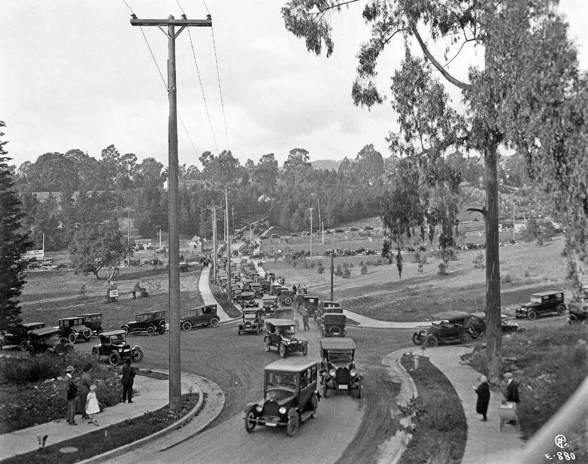
The event taking place in this north view into Trestle Glen is of the California Complete Homes Exposition in the fall of 1922. This occasion was special in that ten fully decorated model homes were said to have been shown to tens of thousands of perspective buyers. The street heading down to the festivities was the extension of Grosvenor Pl. now southerly to Matthews Ave.
L154-85-Eston Cheney Photo E-880, Courtesy John Bosko Archives, (Image 17 of 27)
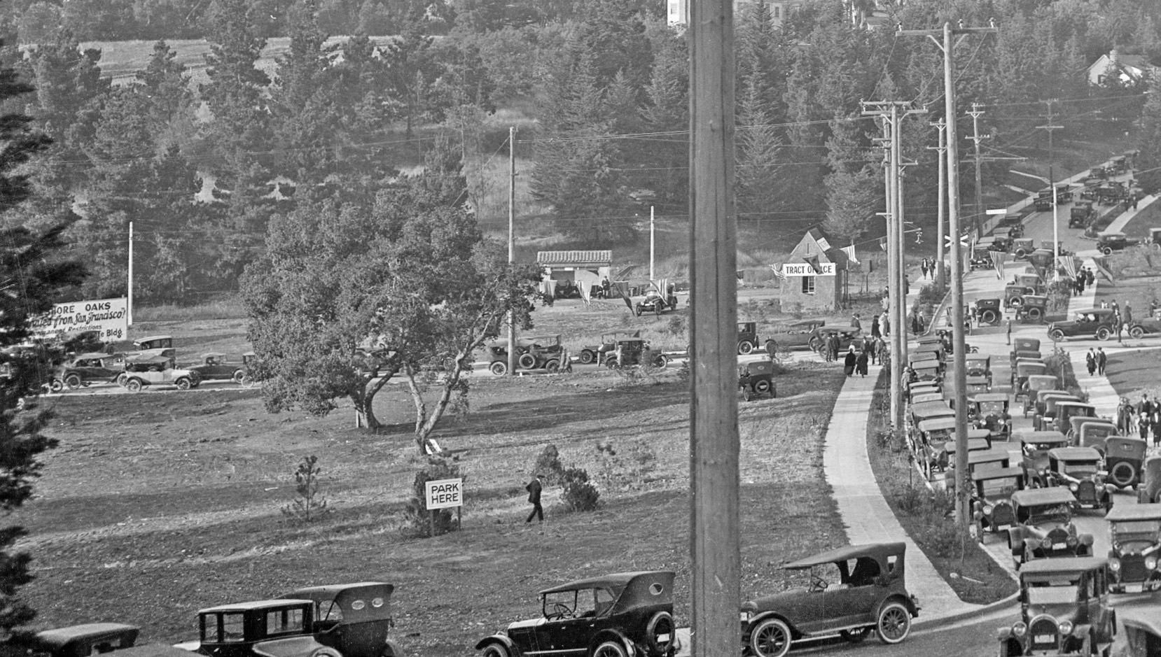
A detailed look shows a sign for Lakeshore Oaks at the far left, where no homes had yet been built based on permit searches and the block books, and the Key B-line Matthews station shelter, that would later be changed to Grosvenor. Also in view is the tract office, as well as the continuation of Grosvenor Pl. up to Underhills Rd.
L154-90-Eston Cheney Photo E-880, Courtesy John Bosko Archives, Detail, (Image 18 of 27)
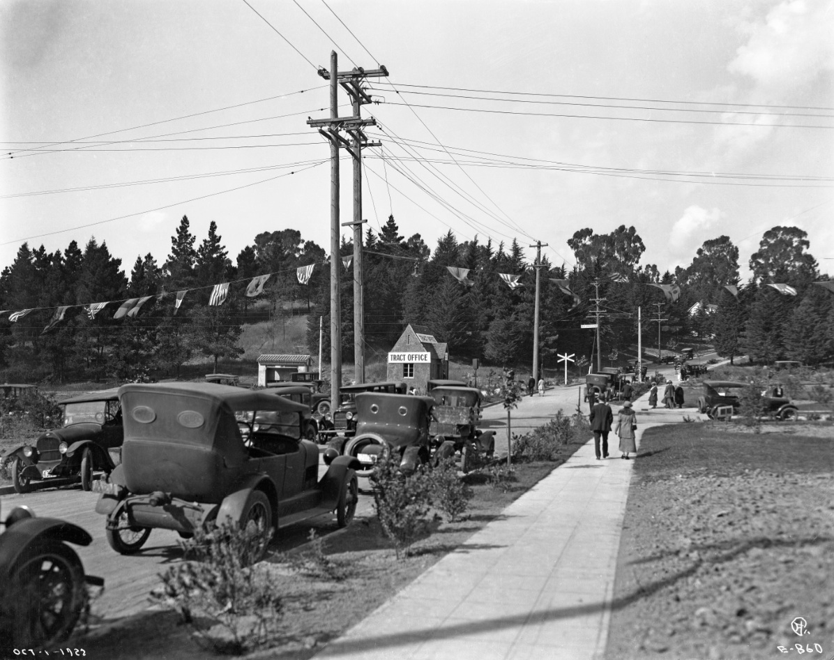
Eston Cheney also took this north view prior to the one in L154-85, and here the negative was dated Oct. 1, 1922.
L154-95-Eston Cheney Photo E-860, Courtesy John Bosko Archives, (Image 19 of 27)
This third image of the same festivities shows a streetcar at the station, and a home on the adjacent hill marked by the red arrow, 1012 Sunnyhills Rd. Based on the block books, the house at 1012 Sunnyhills was built during 1921-22, while the house to the west, absent in this image, was built in the 1923-24 timeframe. The prominent home to the east or right of 1012 is 1006 Hubert Rd., completed in 1920.
L154-100-Courtesy BAERA, Western Railway Museum Achives, (Image 20 of 27)
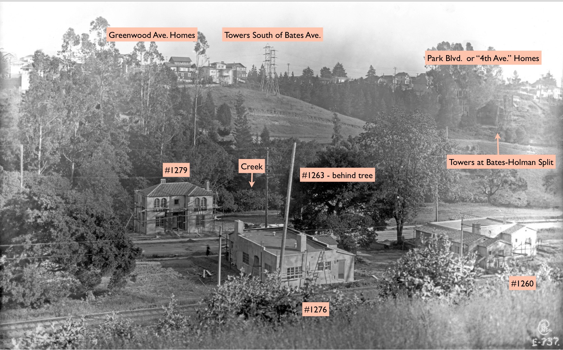
Now a “pre-” image of the “transition moment in time” L154-10. The earliest permit filings on the future Trestle Glen Rd. were nos. 656, 786 and 851, granted in Lakeshore Glen in Nov. 1921, while the rest were in Lakeshore Hills; 6 spec homes by owner and builder John B. Peppin, nos. 1339, 1357, 1407, 1415, 1423 and 1431 in Dec. 14, 1921; 4 spec homes, nos. 1260, 1263, 1276 and 1279 on Mar. 13, 1922 with WH Leimert Co., owner, Axel Cederborg, builder, and Walter Reed and William Corlett, architects.
L154-106-Eston Cheney Photo E-700, Courtesy John Bosko Archives, (Image 21 of 27)
This annotated version of the “transition moment in time” shows the 4 spec homes built by Oakland Highlands President Leimert, sometime between the March permit dates and the California Complete Homes Exposition in the fall of 1922. Eston Cheney had to have stood on the hill above Underhills Rd., not far from the terminus of the Key B-line to obtain this image.
L154-110-Eston Cheney Photo E-737, Courtesy John Bosko Archives , (Image 22 of 27)
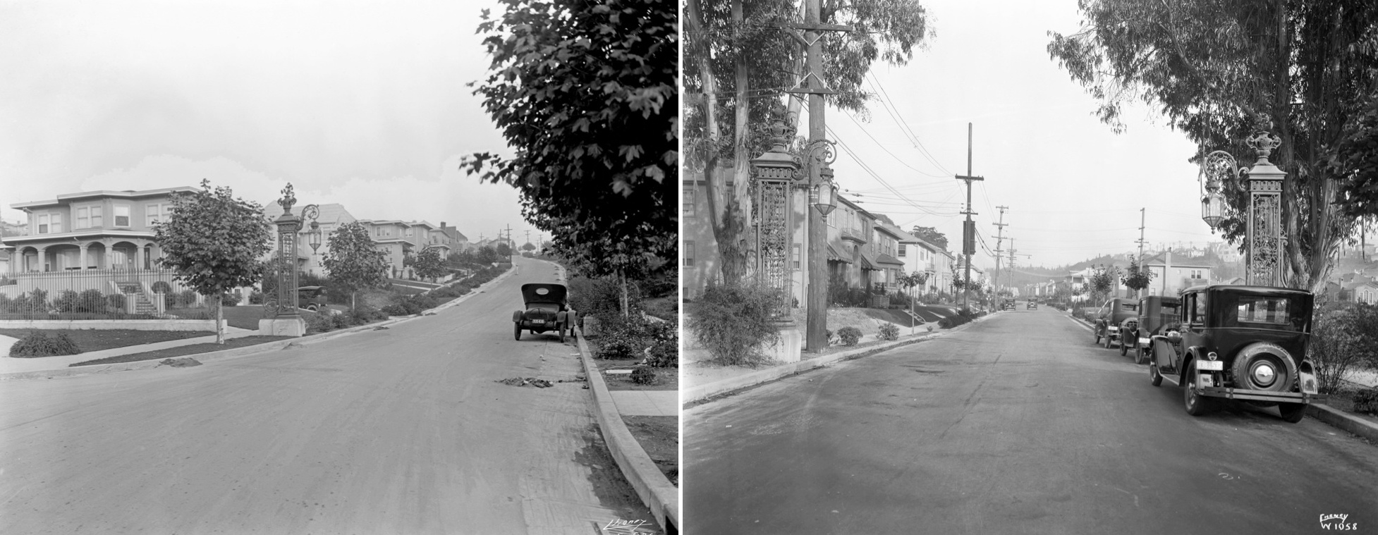
From that fall of 1922, building on Trestle Glen Rd. quickly caught up to that started on Longridge Rd. in late 1918, here documented by matching mid-1920s east views based on car license plates of Longridge Rd., left, and Trestle Glen Rd., right. Appreciate that no homes could be built on the south side of Longridge Rd. due to the presence of two tracks for the Key B-line.
L154-115-Eston Cheney Photo W 1058, Courtesy John Bosko Archives, (Image 23 of 27)
A very informative diagram from the block of 1925 provides the progress of the Lakeshore Highlands development, including the position of the creek, much of which had endured the first wave of culverts.
L154-120-Thomas Block Book of Oakland, Courtesy Oakland History Room, Oakland Public Library, (Image 24 of 27)
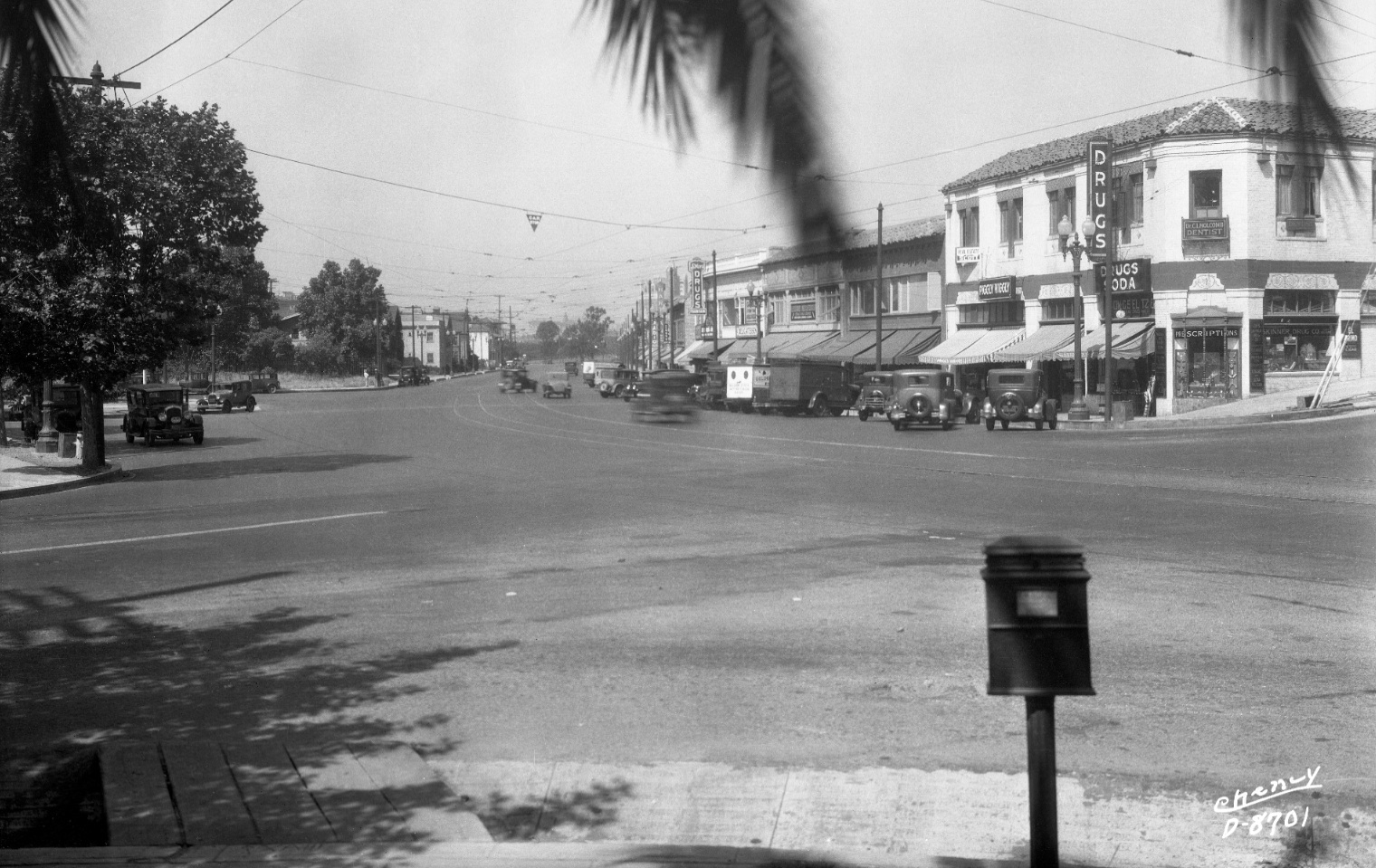
One side-note is that the success of the residential park development took its toll on homes on Lakeshore Ave. Pressure from the homeowners in the Highlands and other builders such as Frank Malley brought commercial entities primarily to the west side of Lakeshore Ave. beginning in fall of 1927 with no. 3407, Stier’s Drugs. This south view circa 1935 documents this change.
L154-125-Eston Cheney Photo D-8701, Courtesy John Bosko Archives , (Image 25 of 27)
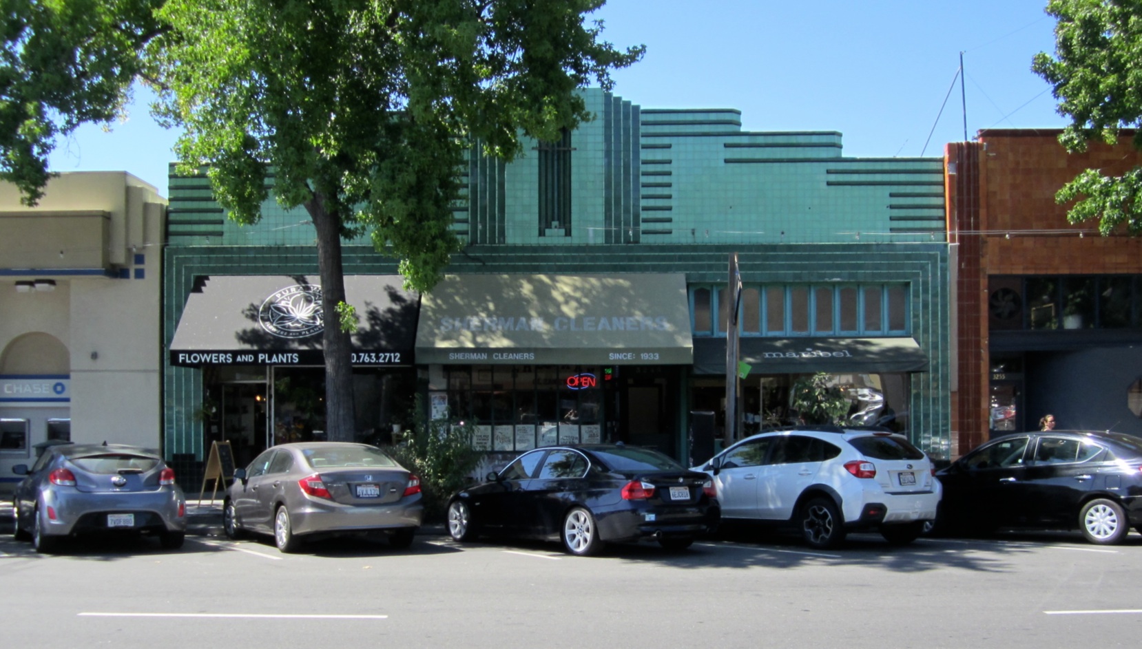
This 2017 west view of 3247-3249-3251 Lakeshore Ave. shows the work of C. M. Hill and Salisbury, builders of the street's small-scale tiled Art Deco buildings during the depression with Oakland architects Chester Miller and Carl Warnecke. The image is of note in that Shermans’ Cleaners at no. 3249 states “since 1933”.
L154-130-Stuart Swiedler Photo, (Image 26 of 27)
Sherman Cleaners could not have been at that location since 1933, because this home at 624 Trestle Glen Rd., first house on the north side, was moved from No. 3249 to this location based on a permit filed to move the home for 750 dollars on Nov. 11, 1936.
L154-135-Stuart Swiedler Photo, (Image 27 of 27)