Trestles in the Trees
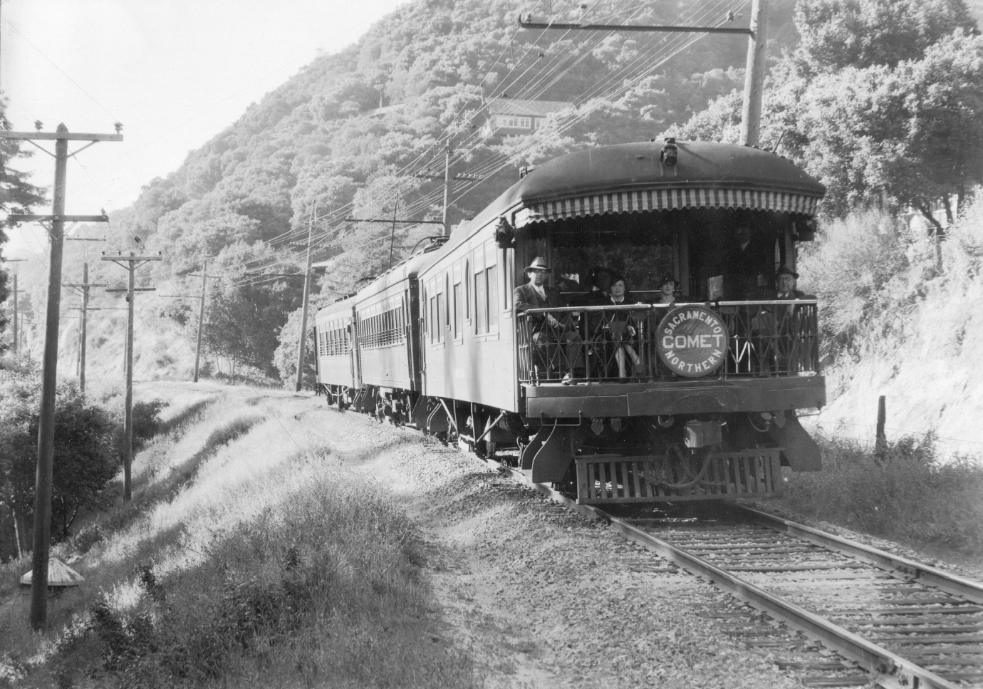
From the observation deck of the Moraga on the three car SN Comet, the first topic is trestles in an effort to reconstruct the unincorporated area of Canyon. SN photographers and rail workers called this area Redwood Canyon, and the utilities and scientists, Upper San Leandro Canyon or Upper Canyon of the San Leandro Creek. More on the undated image shown in the Landmark "Sequoia ..."
L16-05-Bert Ward Photo, Sappers Collection, Courtesy BAERA, WRM Archives, 44133sn, (Image 1 of 16)

The SN outposts or stations at Eastport, Wilcox, Sequoia, Canyon and Pinehurst on this updated map from 1964 are lined up with a high level aerial from Jul. 30, 1939 as a reference. The current Canyon School, the purple circle, and the US Post Office, orange circle, have been added. Aerial BUT-BW-283-80 provided by East Bay Municipal Utility District. Note the two-car train at Pinehurst.
L16-10-Courtesy BAERA, WEstern Railway Museum Archives, 77723, and EBMUD , (Image 2 of 16)
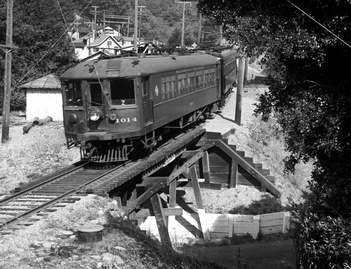
Starting from the northwest, SN 1014 sits mid-trestle with the Eastport SN outpost seen in the backgound of this northwest view from 1940. The underlying road was either known as Redwood Canyon Road or Snake Road, but by the 1950s it was united in name with its extension to the the south of Canyon Road, Pinehurst Road.
L16-15-Wilbur C. Whittaker Photo, Courtesy Garth Groff, (Image 3 of 16)
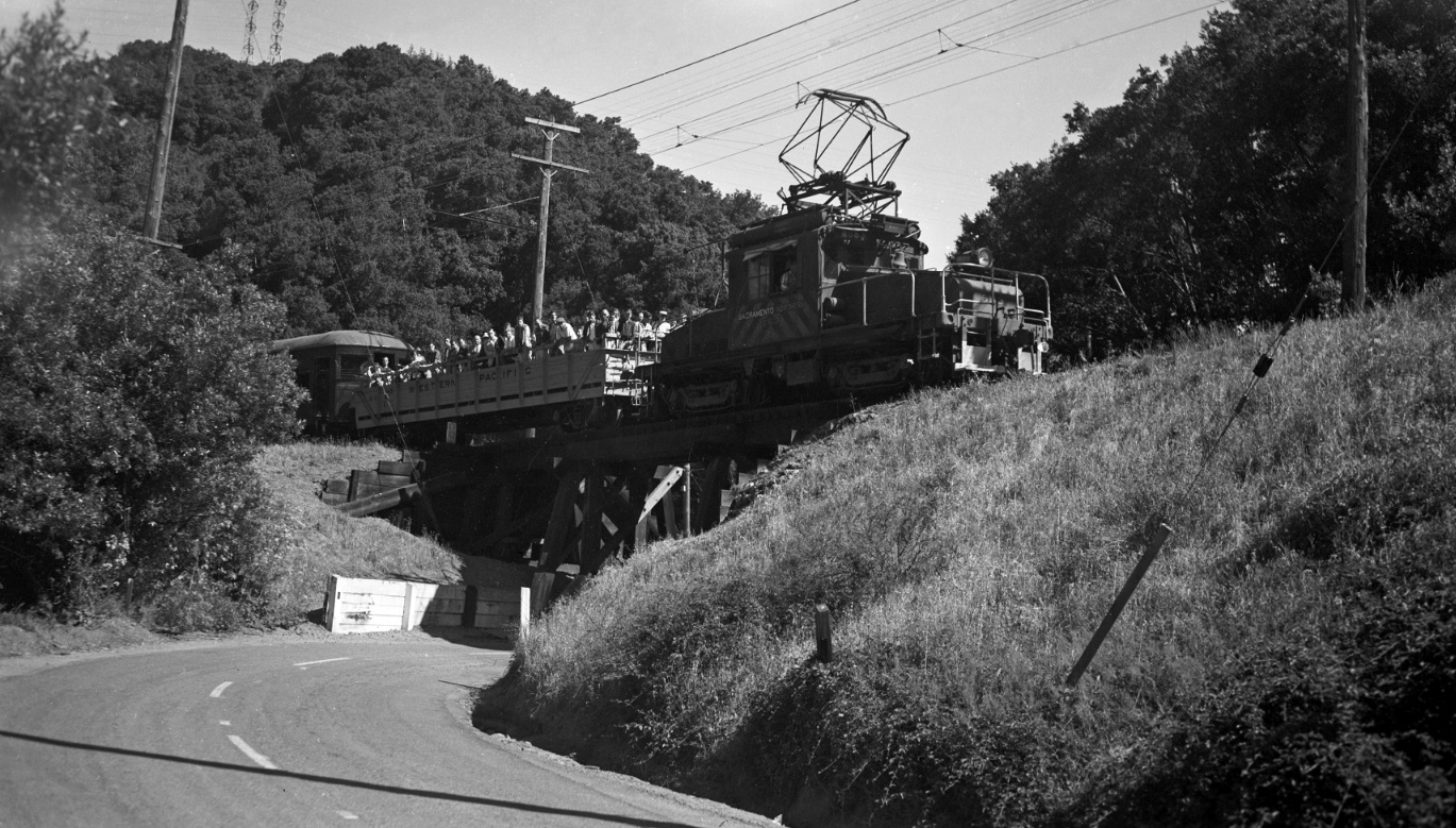
The white retaining walls can be appreciated in this June 1956 excursion as SN 653 has just left Eastport and heads southeast in this northwest view over the Pinehurst Road trestle at Eastport. The 14 mile marker is visible just below the observation car. Note the electric towers to the northwest.
L16-20-Tom Gray Photo, Courtesy Tom Gray , (Image 4 of 16)
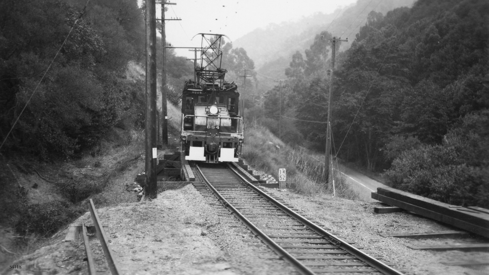
The mile 14 marker pinpoints this undated southeast image of SN 654 as it approaches the trestle and Eastport. Pinehurst Road is seen to the west. The stripes on the motor would suggest a date of mid-1940s or later.
L16-25-Courtesy BAERA, Western Railway Museum Archive, 54118sn, (Image 5 of 16)
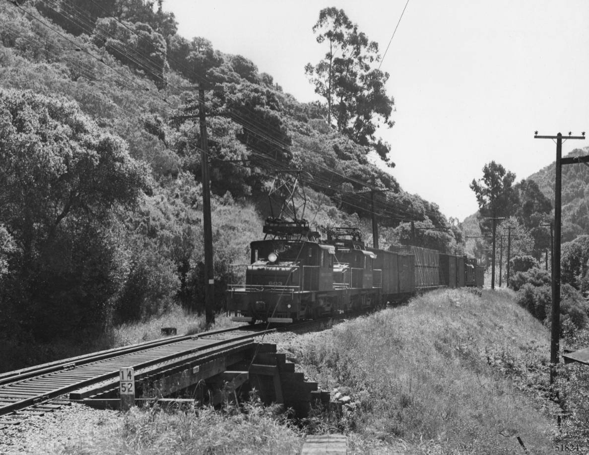
A more southerly angle provides a view down the canyon in the early 1940s as SN 603 and mate 604 pull their load toward Eastport. The function of the structure to the lower right of the image is unknown. Large Eucalyptus trees provide additional markers for the area.
L16-30-Don Olsen Photo, Courtesy BAERA, Western Railway Museum Archive, 51824sn , (Image 6 of 16)
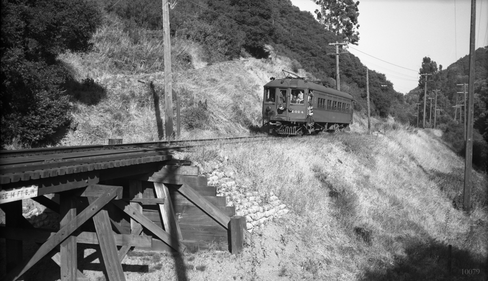
The Eucalyptus trees confirm the location as this southeast view of SN 1014 heading toward Eastport. The scene indicates something special is in the air, and, indeed, it is June 30, 1941 and the last day of passenger service. Note the 14 foot 6 inch clearance indicated on the trestle, absent in the previous post-passenger era image.
L16-35-Charles Savage Photo, Courtesy BAERA, Western Railway Museum Archive, 10079sn, (Image 7 of 16)
Further southeast down the canyon is yet another trestle in this northwest view of SN 1016 leading three car train number 2 toward Moraga from May 26, 1940. Appreciate the proximity of the trestle to Pinehurst Road and that the breach in the right-of-way continues to road level. More on this trestle in the Landmark “The Man Who Mistook a Driveway for A Creek”.
L16-40-Wilbur C. Whittaker Photo, Courtesy Garth Groff, (Image 8 of 16)
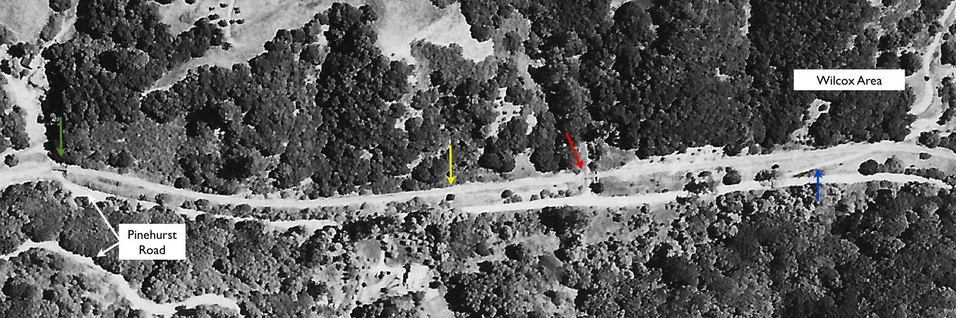
This aerial from Apr. 1957 shows a trestle, red arrow, that is southeast of the trestle over Pinehurst Road at Eastport, green arrow. The yellow arrow marks the SN right-of-way, and the road up to the Wilcox flagstop is in blue. Today, the latter is the way to John McCosker Ranch Road.
L16-45-Courtesy HJW Geospatial Inc, Pacific Aerial Surveys, Oakland CA, (Image 9 of 16)
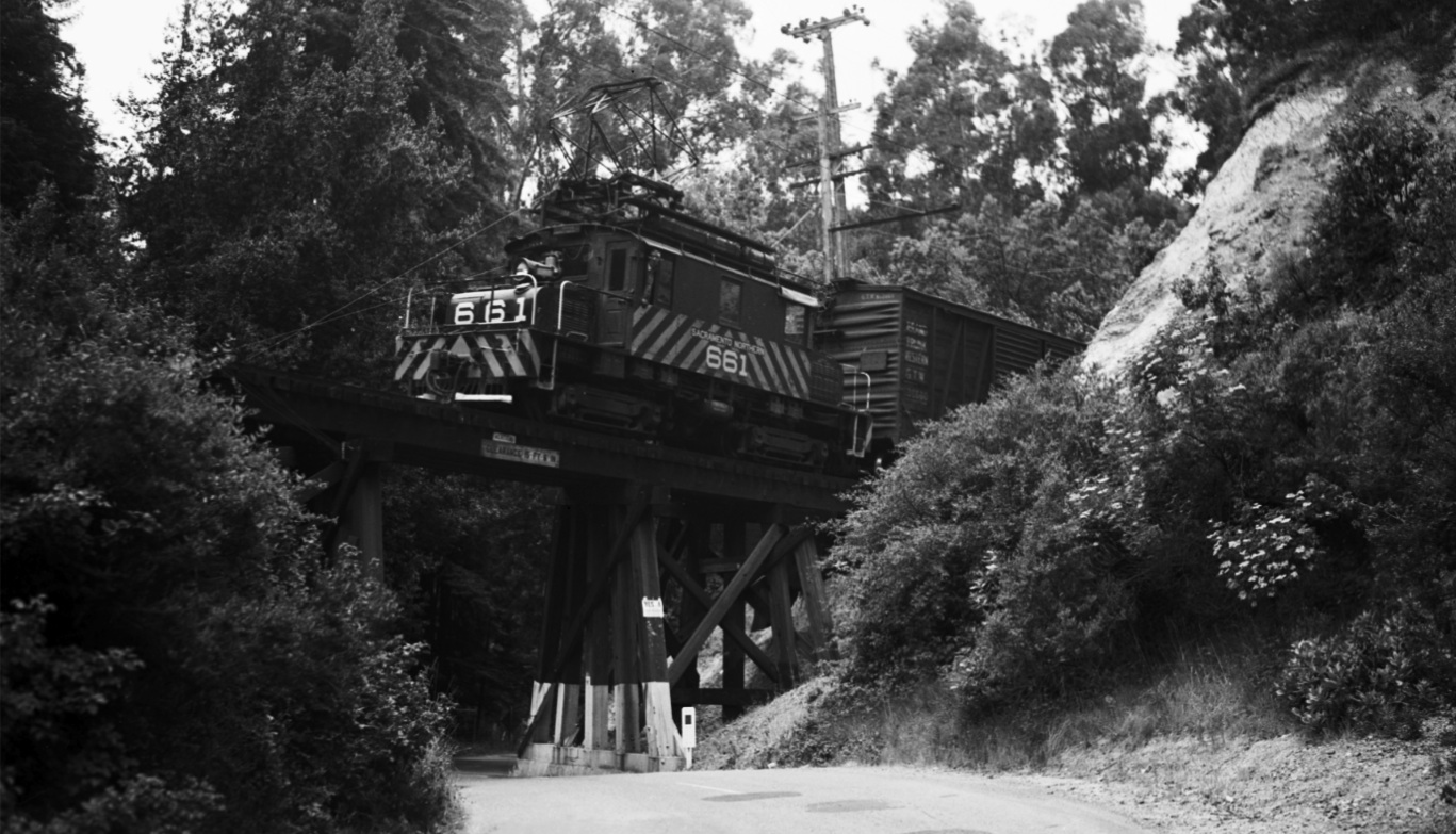
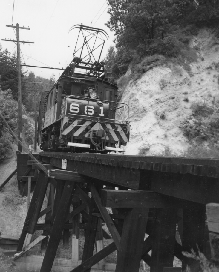
Towering over Canyon Road just east of its intersection with Pinehurst Road is the third trestle of note, here with SN 661, west view on May 31, 1952. Note the 15 feet 6 inches clearance sign. Hidden by the dense forest, this structure was not convincingly captured on aerial photographs.
L16-50-Tom Gray Photo, Courtesy Tom Gray , (Image 10 of 16)
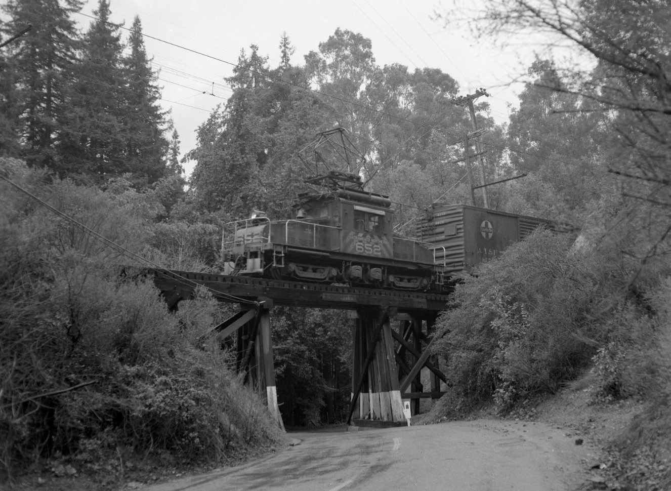
The last freight before south-end abandonment with SN 652 in the lead slowly navigates the trestle on Feb. 28, 1957, west view.
L16-55-Fred Matthews Photo, Courtesy Anonymous Donor , (Image 11 of 16)
While Tom Gray captured the image L16-50, Al Thoman preserved this moment with SN 661. The 16 mile sign marks the northwest corner of the trestle. North view, May 31, 1952.
L16-60-Alvon J. Thoman Photo, Courtesy BAERA, Western Railway Museum, 14274sn, (Image 12 of 16)
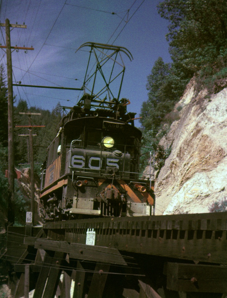
Another image from the same photographer at the same spot with SN 605 and 606, but this time it is a nice sunny Apr. 22, 1950 and the color image shows off the motors’ stripes
L16-61-AJ Thoman Photo, Courtesy AJ Thoman, (Image 13 of 16)
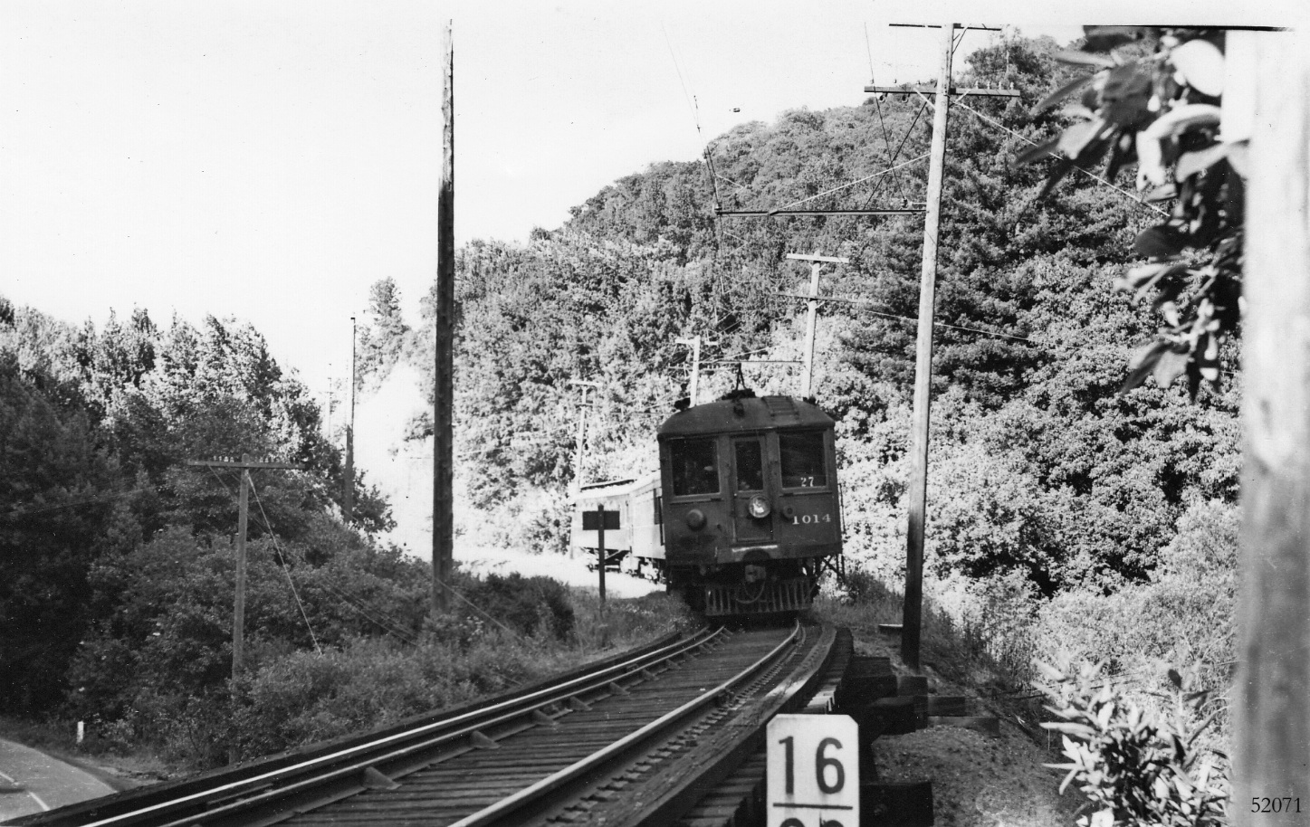
SN 1014 is about to lead three car train 27 from the east across Canyon Road as it heads back to Oakland in this undated southeast image from the pre-mid 1941 passenger train era. Appreciate that this area was known as Pinehurst, and not to be confused with the trestle at mile 14 at Eastport over Pinehurst Road. Canyon Road is seen at the left.
L16-65-Courtesy BAERA, Western Railway Museum Archive, 52071sn , (Image 14 of 16)
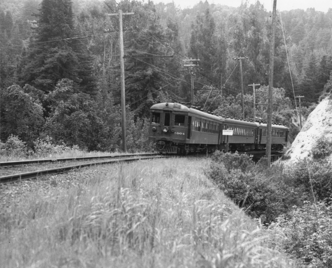
The final view of the trestle over Canyon Road shows SN 1004 leading train 4 toward Moraga, west view, 1937. Before the train reaches what is today the border with Moraga, it will cross one additional area that had been a trestle in the early Oakland, Antioch & Eastern era. More on that at a separate time.
L16-70-Wilbur C. Whittaker Photo, Courtesy Garth Groff , (Image 15 of 16)
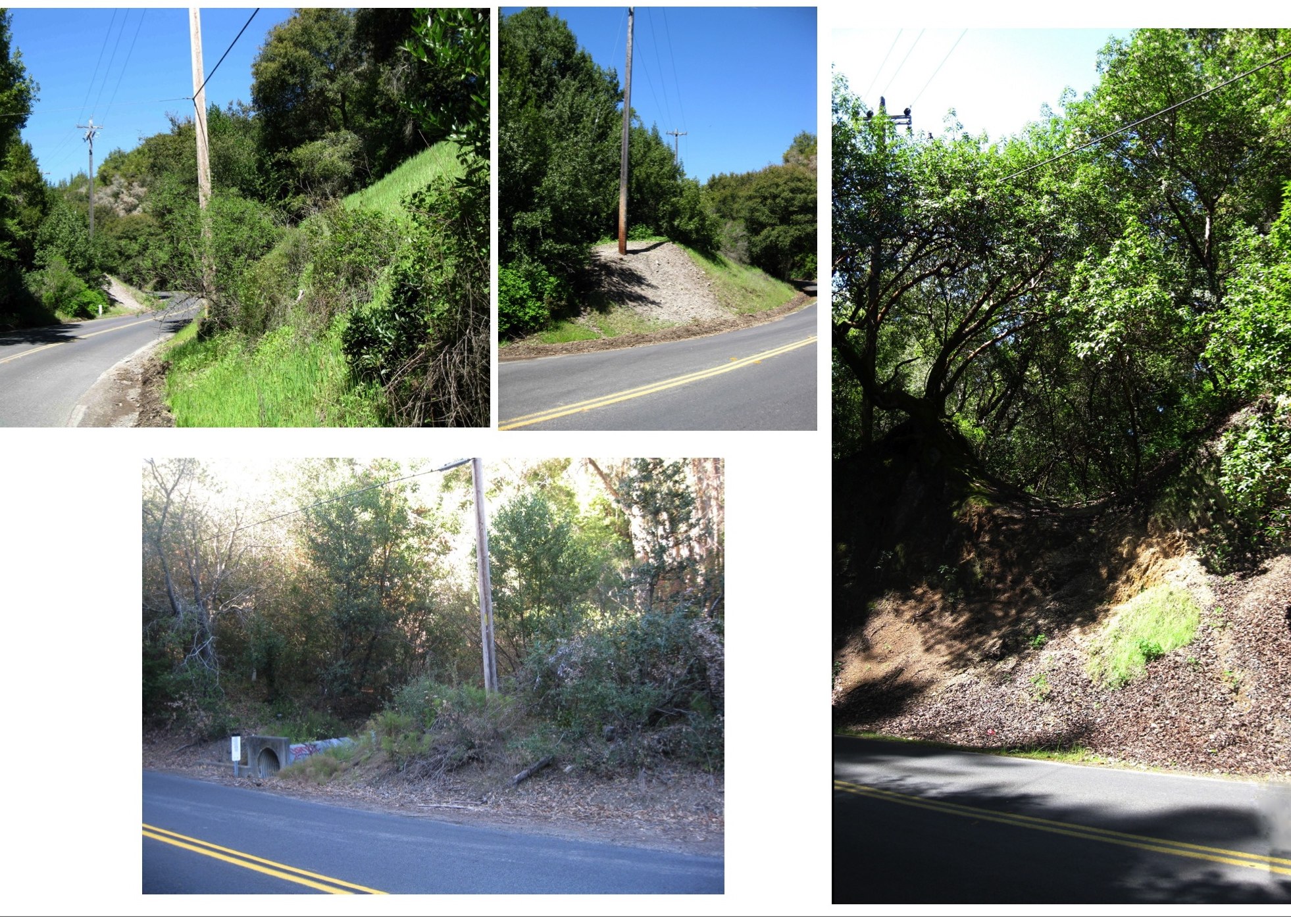
A walk along the SN right-of-way shows the state of the sites of the trestle over Pinehurst Road at Eastport, north view top left and center, the northern abutment of the trestle over Canyon Road, right, and the only candidate site for the trestle along Pinehurst Road between Wilcox and the mile marker 14, northeast view bottom left.
L16-75-Stuart Swiedler Photos, (Image 16 of 16)