Tunnel Tales
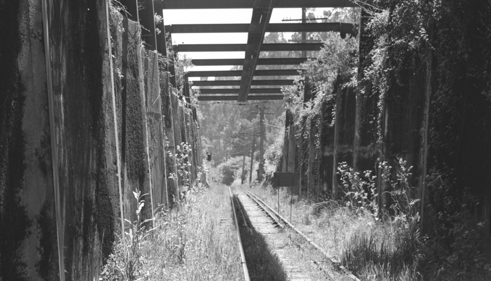
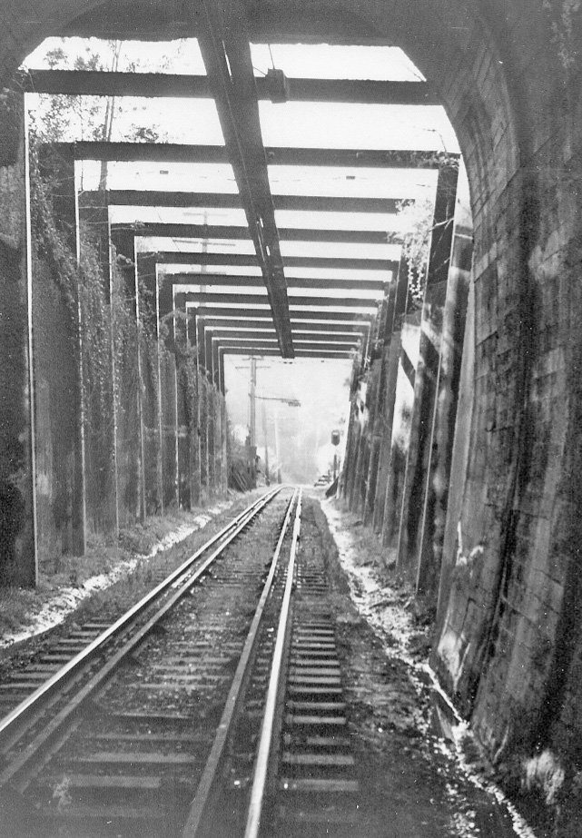
John Harder’s stirring image from the abandoned SN tunnel in mid-1957 with a southwest view is a lead-in to many stories involving this place of intrigue, so much so that there are many more stories than actual documented events.
L111-05-John Harder Photo, Courtesy John Harder, (Image 1 of 20)

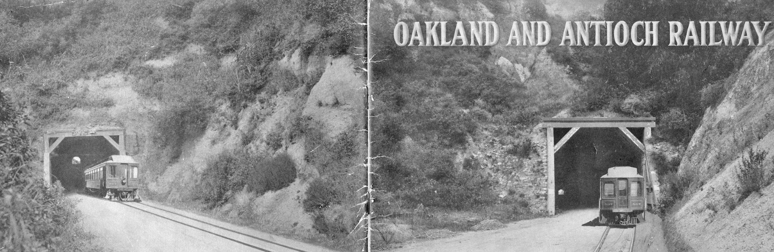
Robert Burgess promoted the new Oakland and Antioch Railway with a pamphlet from his Bond and Mortgage Dept. from the First National Bank Building in San Francisco. The front and back cover show a passenger train leaving the Broadway or Kennedy tunnel, although it doesn’t state this. This was contrived, probably by printers Payot, Stratford and Kerr, pre-photoshop, of course.
L111-10-Courtesy BAERA, Western Railway Museum Archives , (Image 2 of 20)
Use of the Kennedy Tunnel was less desirable due to the 4.5% grade for over 3 miles on Tunnel Rd., plus it was the major route between Central Alameda and Contra Costa Counties. The descent on the Contra Costa side would have been even more problematic.
L111-15-Courtesy Stuart Swiedler, (Image 3 of 20)
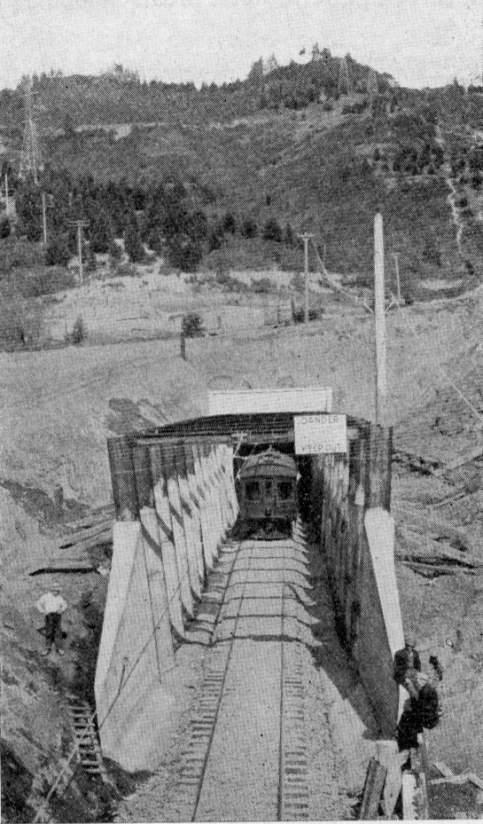
More history. From the onset, retaining walls were built to keep the surrounding earth from collapsing on the right-of-way. Northeast view. Ref: Electric Journal, Vol X, No. 10, Oct. 1913, Page 919.
L111-20-Electric Journal, Courtesy BAERA, Western Railway Museum Archives , (Image 4 of 20)
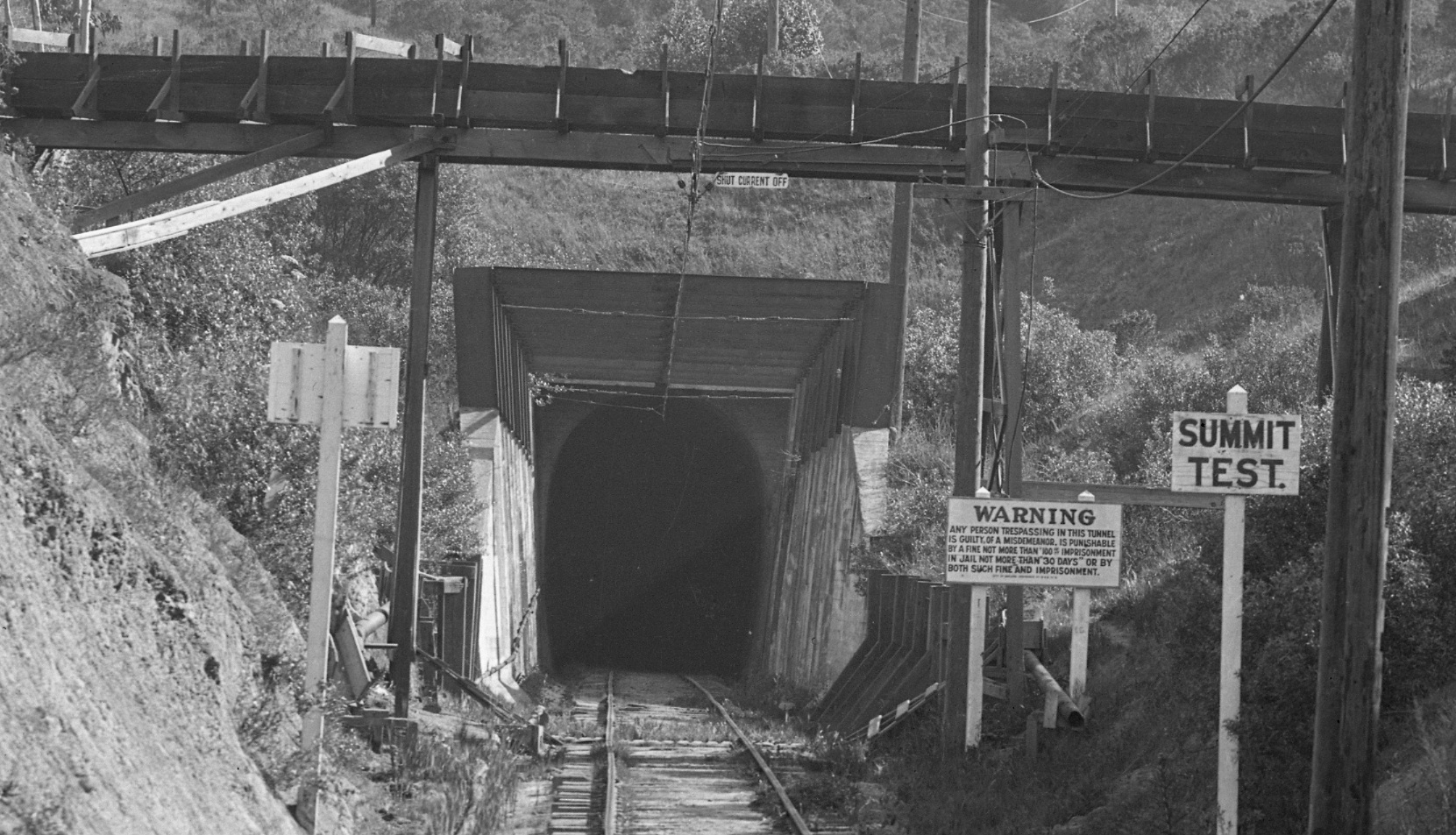
In the early 1920s, Shepherd Canyon Creek was rerouted over the right-of-way for a time, and finally buried. It is not known how this impacted the railway’s challenges with wet conditions. Northeast view, circa 1923.
L111-25-Vernon Sappers Collection, Courtesy BAERA, Western Railway Museum Archives, 26062sn, Detail, (Image 5 of 20)
Water that accumulated at the tunnel edges flowed downward to Contra Costa County. Some say after the tunnel was abandoned and sealed, ranchers in Canyon collected the water at Eastport. No images documenting this story has been found.
L111-30-Grahame Hardy Collection, Courtesy California State Railroad Museum, CSRM 33367, (Image 6 of 20)
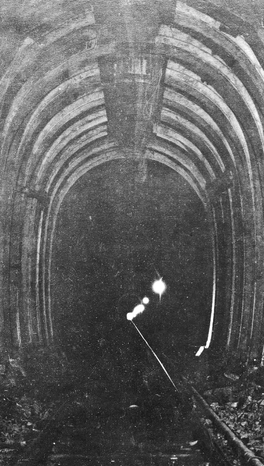
From the onset, a continuous concrete lining was added in places primarily near the west portal where timbers could not hold the wet soil. In the 1920s, pre-cast concrete liners were added to strengthen other sections. See “Spur Stories I - the Early Years” Landmark for images of these units at the Chabot Canyon yard.
L111-35-Courtesy BAERA, Western Railway Museum Archives, (Image 7 of 20)
Image ca. 1920s of a section of the tunnel interior with pre-cast concrete liners.
L111-40- Courtesy BAERA, Western Railway Museum Archives, 89629sn, (Image 8 of 20)
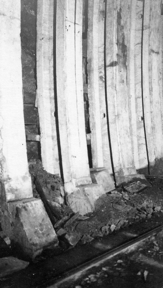
Another view of the newly inserted pre-cast concrete liners against the timber-supported wall.
L111-45-Courtesy BAERA, Western Railway Museum Archives, 89631sn, (Image 9 of 20)
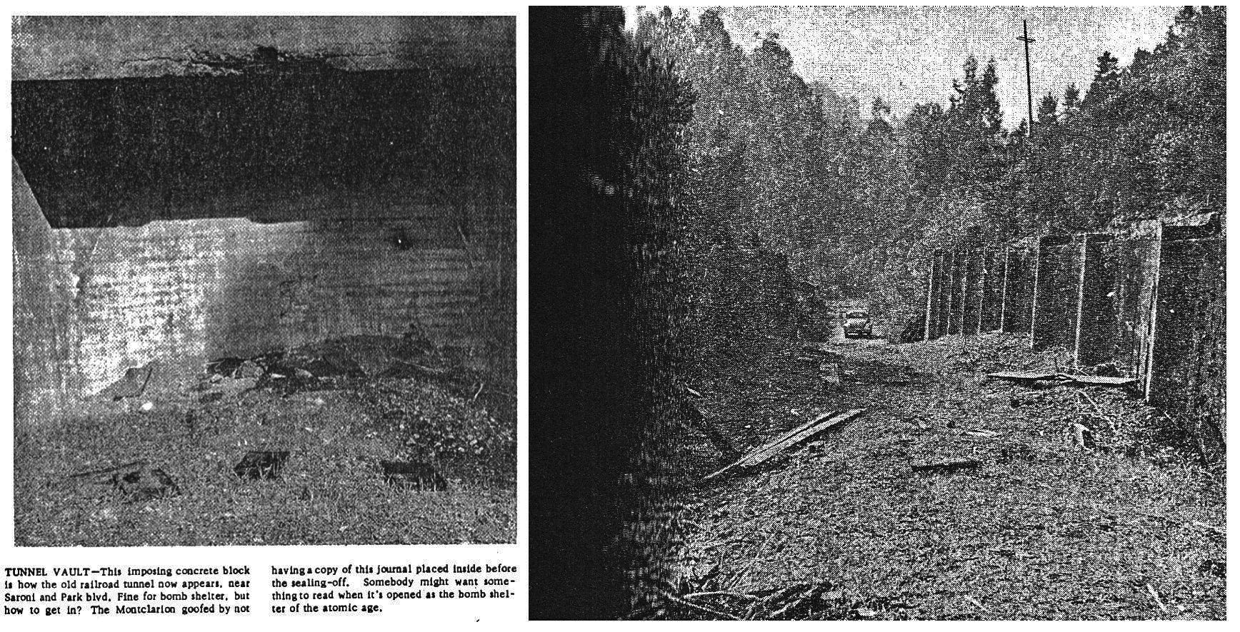
Most of the interesting stories about the tunnel occurred after it was sealed. Northeast view, Apr. 22, 1960.
L111-50-Copyright California Department of Transportation, 7453-10, Detail, (Image 10 of 20)
The Montclarion from Dec. 11, 1957 provides the proof that the west portal was sealed sometime in the second half of 1957. A comparable image for Eastport has not been found. By 1980, it is said an “avalanche” buried the portal at Eastport.
L111-55-Courtesy Oakland History Room, Oakland Public Library , (Image 11 of 20)
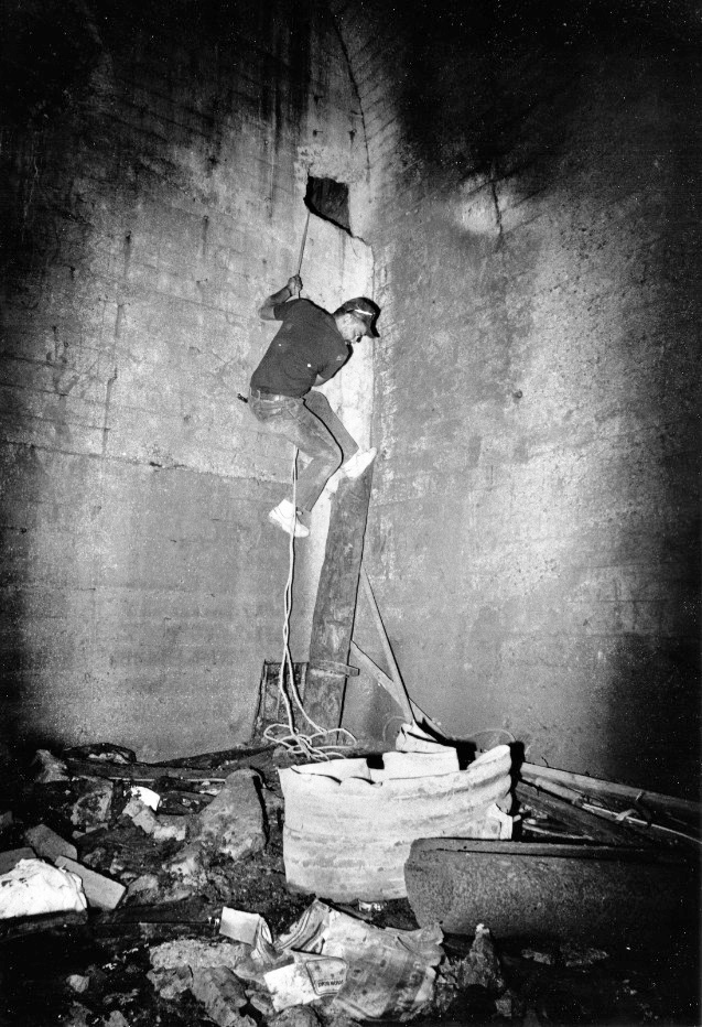
Many folks claim that they have been in the tunnel after it was sealed, but only Robinson Foster and at least one other individual seen in this image can back up their claim for an Oct. 2, 1987 foray unequivocally.
L111-60-Robinson Foster Photo, Courtesy BAERA, Western Railway Museum Archives, 88438sn, (Image 12 of 20)
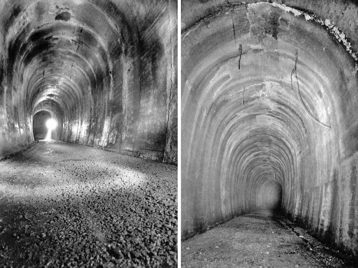
The images show continuous concrete walls, a feature adjacent to both portals. The crack in the ceiling allows positioning the two images. If you believe the image on the left shows the portal wall where the light source is located, then this would be the west portal based on the shape of the curve of this section.
L111-65-Robinson Foster Photos, Courtesy BAERA, Western Railway Museum Archives, 88433sn, 88439sn, (Image 13 of 20)
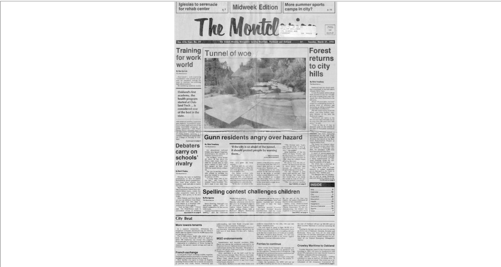
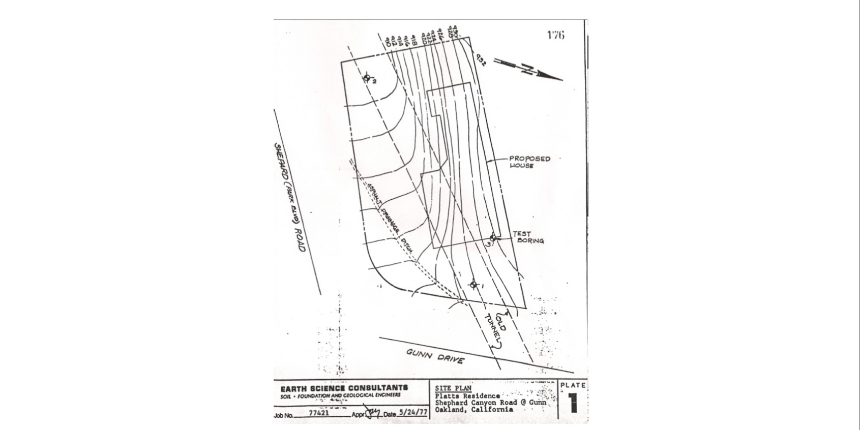
This tunnel tale involves 6801 Gunn Drive. On December 12, 1976, Robert G. Platts purchased the unimproved lot of 6801 Gunn Drive from the State of California in the Oakland Hills for $11,500. The chain of title disclosed the existence the of abandoned SN railway tunnel which passed approximately 40 feet underneath the property, although Platt claims he was unaware of this until five months later, when he applied for a building permit.
L111-70-The Montclarion, Courtesy BAERA, Western Railway Museum Archives, (Image 14 of 20)
A consulting engineer recommended the house be placed on a reinforced grid capable of resisting settlement effects, even though the tunnel appeared to be in "relatively good condition." The report also contained the disclaimer that they could not "guarantee the stability or performance of this or any hillside site.” The position of the tunnel relative to the proposed house foundation is shown from the microfilmed court record.
L111-75-Superior Court of California, County of Alameda, Records Office 556458-3 , (Image 15 of 20)
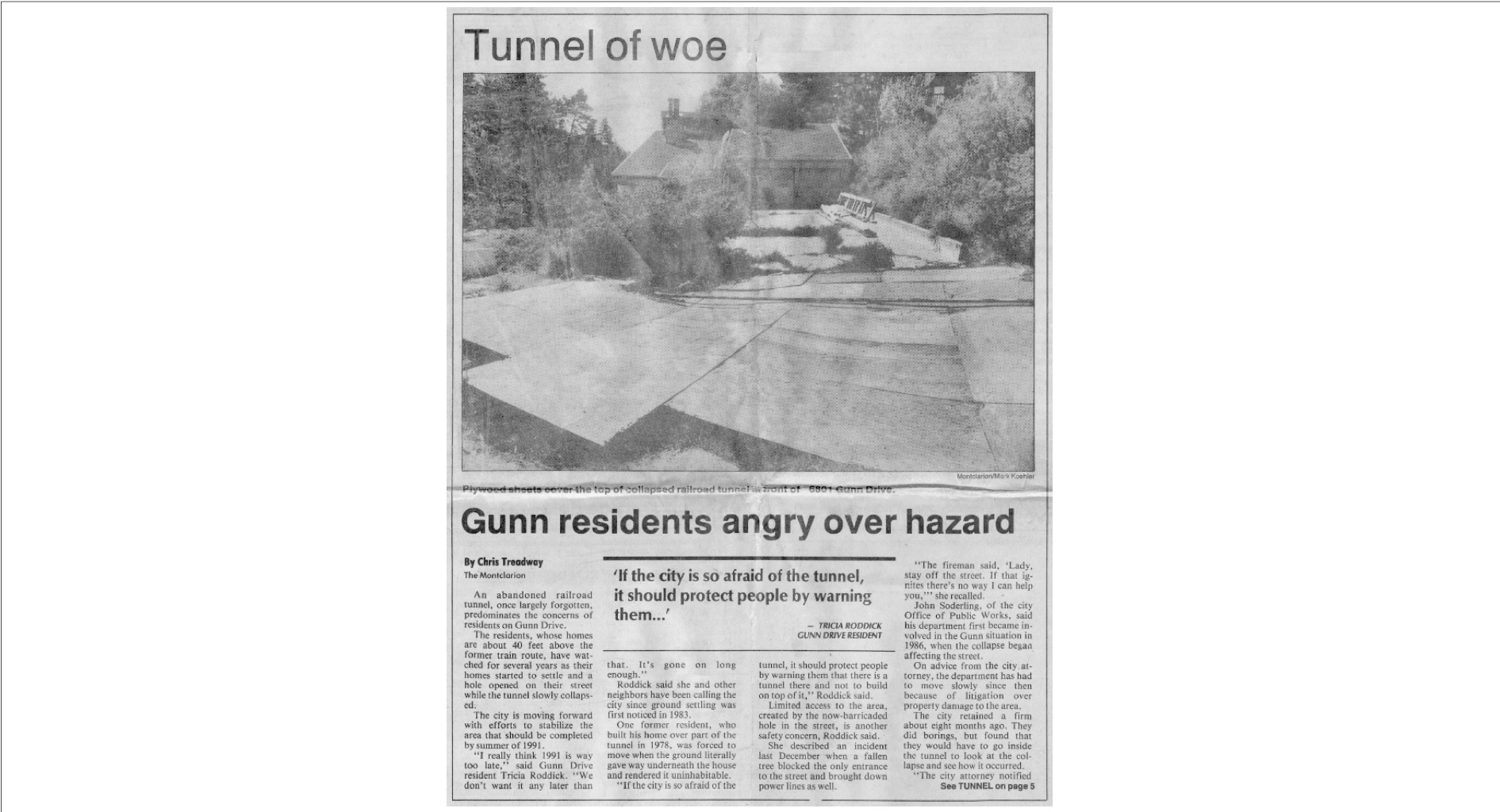
House construction began in August 1977 after the owner refused adding the recommended support. Four months later, a portion of the land subsided. Fill was deposited to repair the subsidence and construction was completed in May 1978. Four years later, during an extremely rainy January 1982, the court records note that the “earth collapsed beneath the house, destroying it.” Platts alleged that this was caused by the collapse of a portion of the abandoned tunnel.
L111-80-The Montclarion, Courtesy BAERA, Western Railway Museum Archives , (Image 16 of 20)
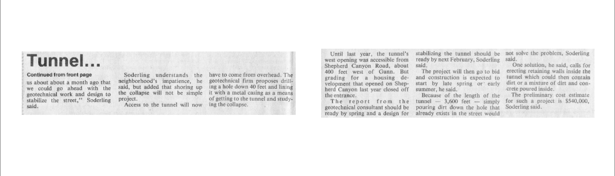
Platts sued the Sacramento Northern Railway in 1982, no longer an entity but now part of Union Pacific through the WP, on the basis that “A former owner of an underground tunnel easement who removed subjacent support from the surface land may be liable for property damage to the surface owner even after the owner transfers the property.” Platts did not prove this to be the case, and lost at trial and in the subsequent appeal in 1988, as the SN showed it had actually strengthened the tunnel supports from its original construction.
L111-85-The Montclarion, Courtesy BAERA, Western Railway Museum Archives , (Image 17 of 20)
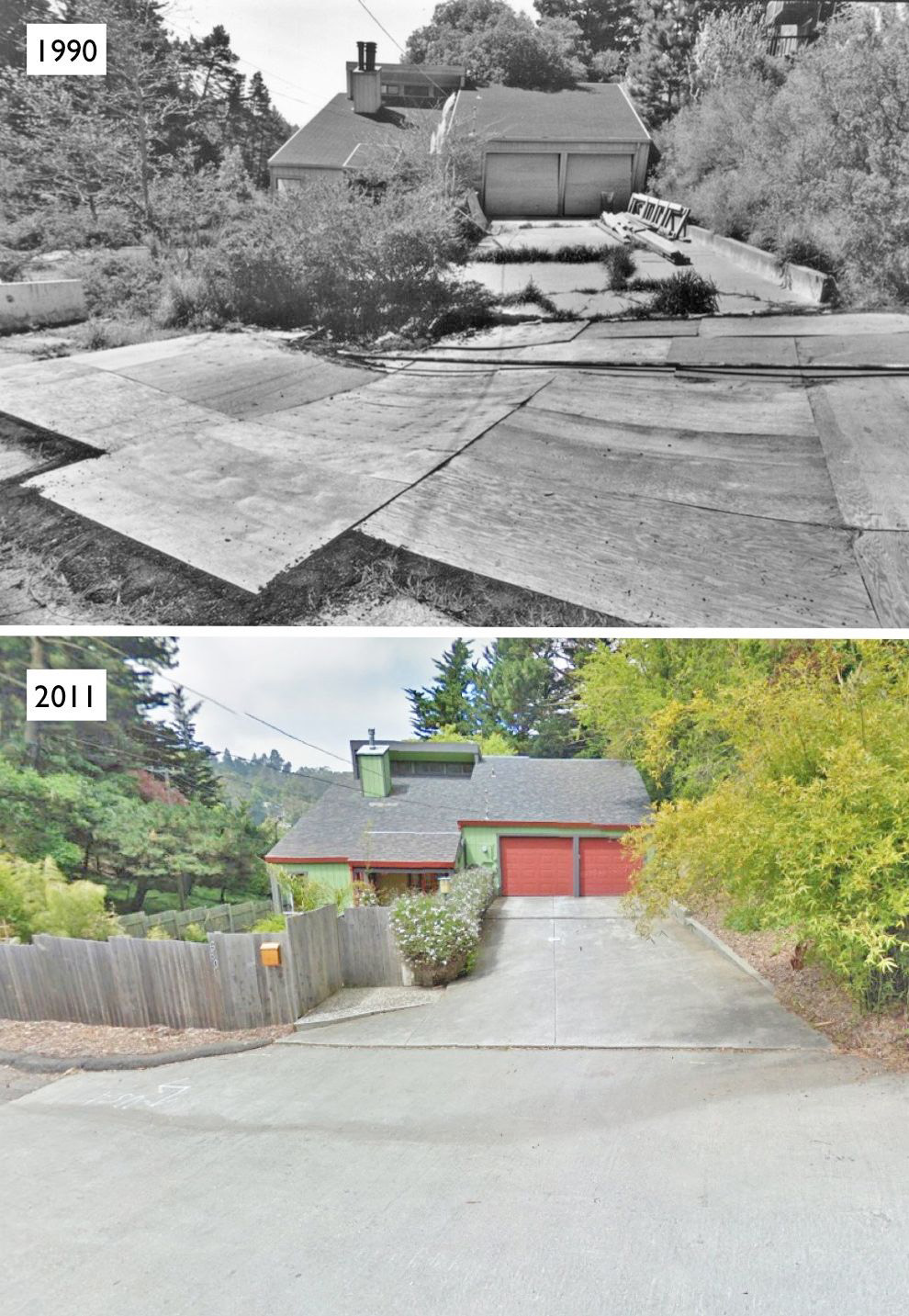
The Mar. 21, 1990 image compared to today is of interest since there is no record in the city files confirming extensive repairs to the 1977 home, and Platts continued to live in the house during this entire period. Back to 1957, after six months of nonuse, SN's easement interest in the tunnel reverted to the surface landowner, pursuant to the original grant deed to the Oakland and Antioch. By Oct. 8, 1958, the owner was the State of California.
L111-90-Mark Koehler photo, Courtesy El Cerrito Historical Society, and Stuart Swiedler Photo , (Image 18 of 20)
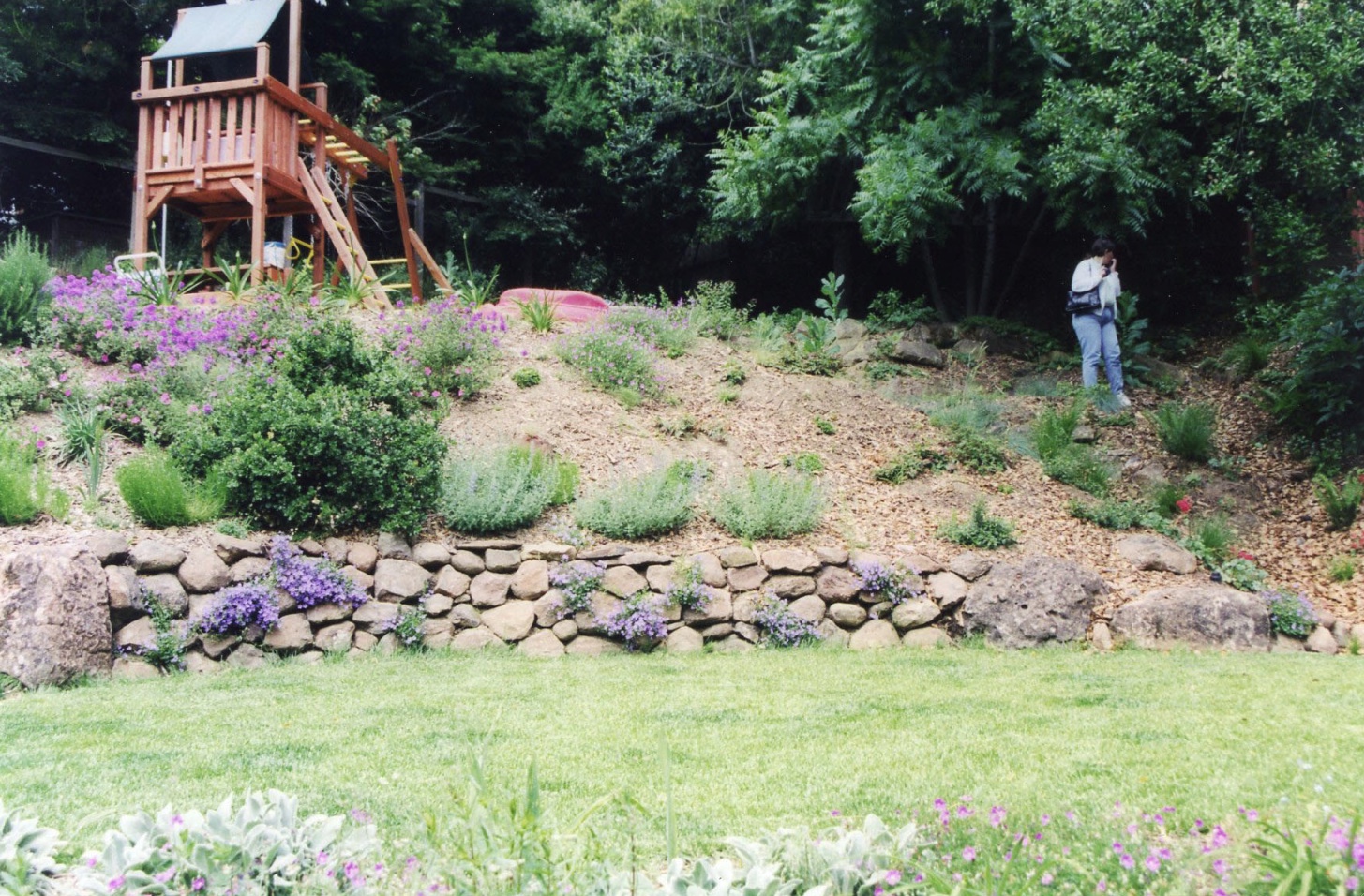
No need to check in the backyard where the tunnel portal is buried. Evidence for its existence can be seen in this image from 2002. Some say that when originally buried in the early 1990s, the top of the tunnel served as a bench for the first home owners. Without any photographic documentation, this recollection gets added to the many other tunnel tales. Much appreciation to Bruce Eldridge for the photo.
L111-95-Bruce Eldridge Photo, Courtesy Bruce Eldridge, (Image 19 of 20)
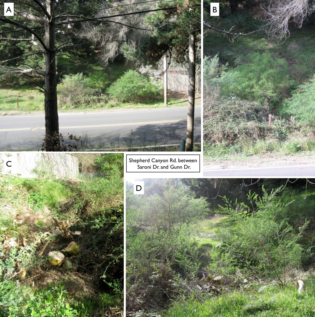
If you go to the empty lot between between Saroni Dr. and 6801 Gunn Dr. on Shepherd Canyon Rd., there is evidence for a hole that may lead to who knows where ...
L111-100-Stuart Swiedler Photos, (Image 20 of 20)