Unsustainability -1920-1933 – George Russell’s Flight Over The Shattuck LInes
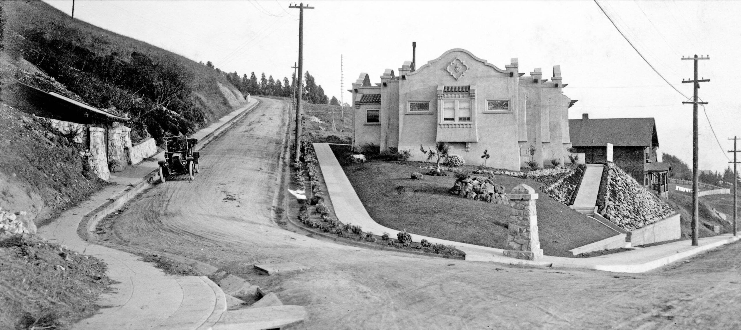
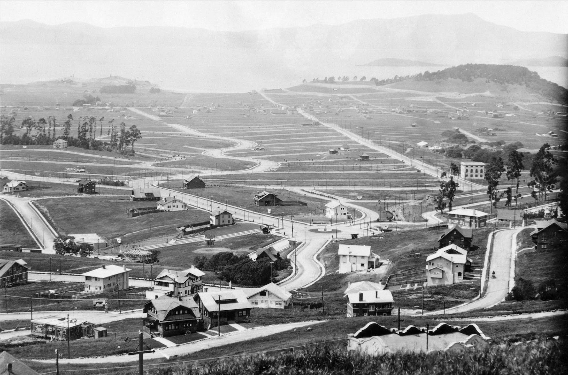
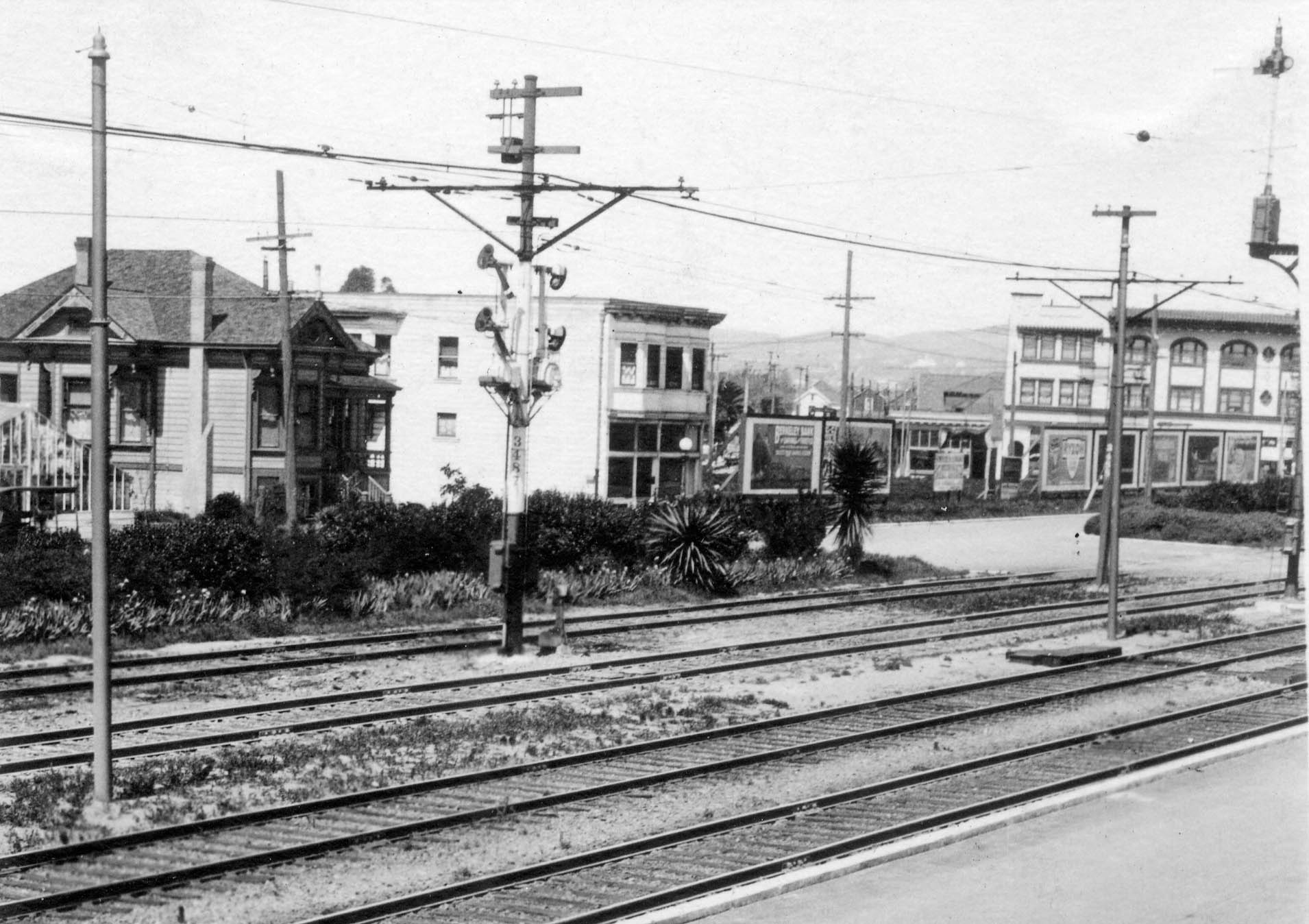
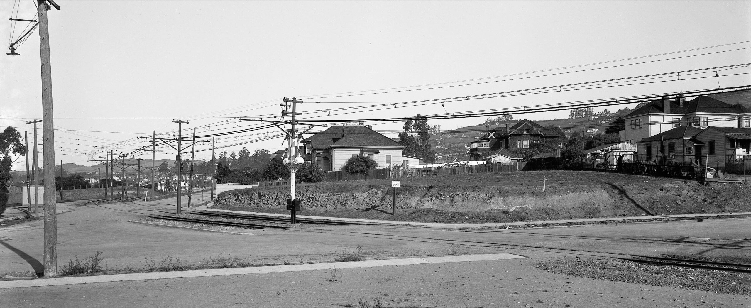
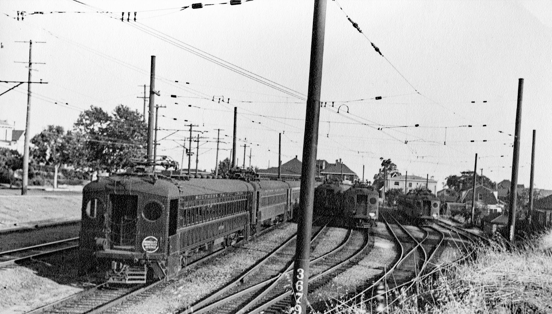
The last update recapping the 1910s revealed the economic perils of a private company to start an electric railway. The era from 1920-1933 made it more evident that maintaining competition between two companies in a defined geographic area was unsustainable. This update starts with a south view showing Keith Ave., left, splitting off from Spruce St. ca 1900s. No. 1035 Spruce St. is in the Cragment neighborhood, but inches from Northbrae. Note the same style Northbrea-type pillar at the intersection. This one is absent in 2026.
L348-02-Vernon Sappers Collection, Courtesy BAERA, Western Railway Museum Archives, 252230bv, (Image 1 of 42)

This west view above Northbrae taken from above no. 1035 Spruce St. on Apr. 27, 1912 was shown previously to provide a general idea of the low population density in Northbrae when the Southern Pacific, SP, Oakland, Alameda and Berkeley, OA&B, suburban railway began service that year. The image nicely captures the Mission-style gable of the house
L348-05-SP Photo, Courtesy BAERA, Western Railway Museum Archives, 55597oa&b, (Image 2 of 42)
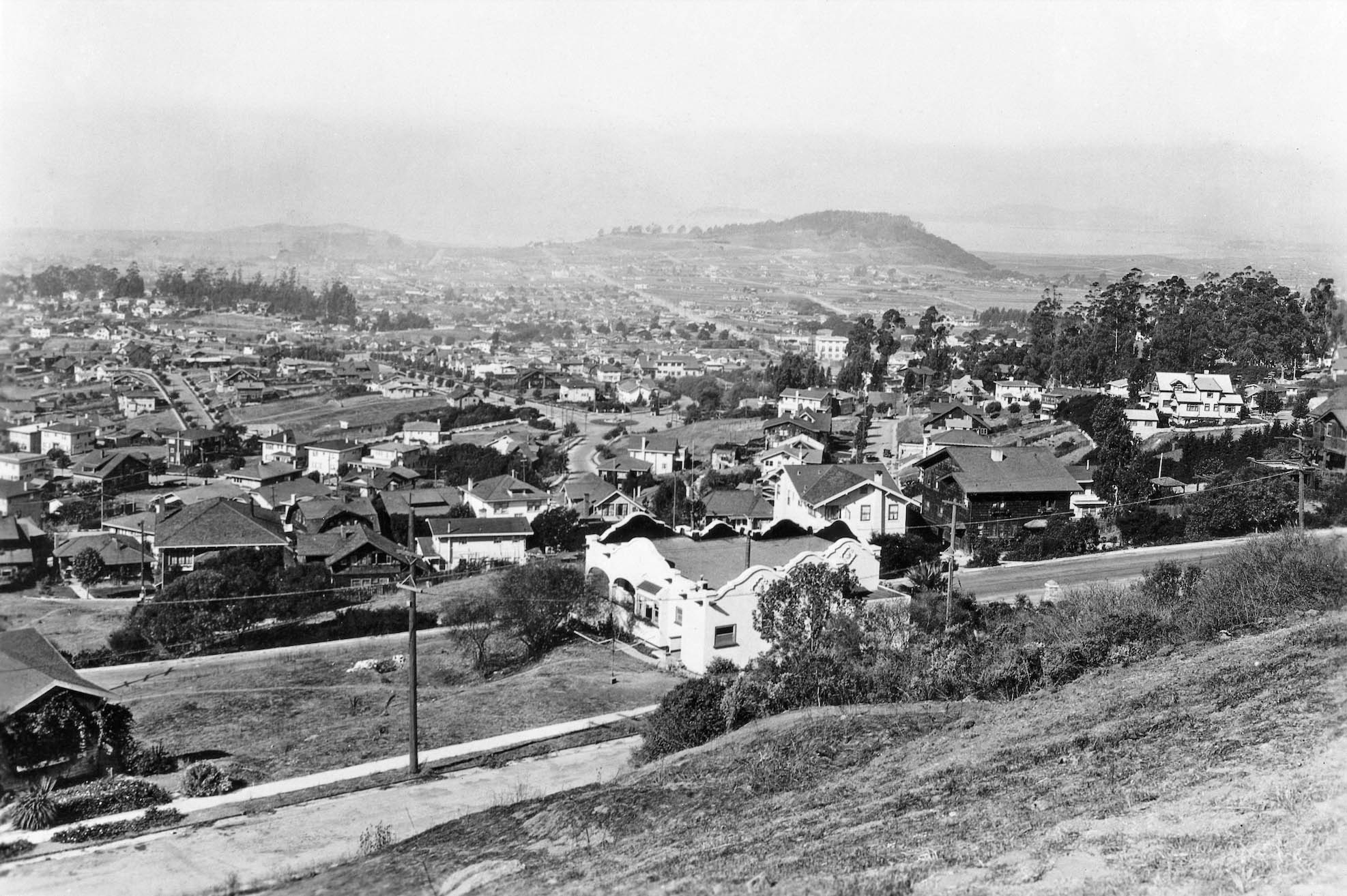
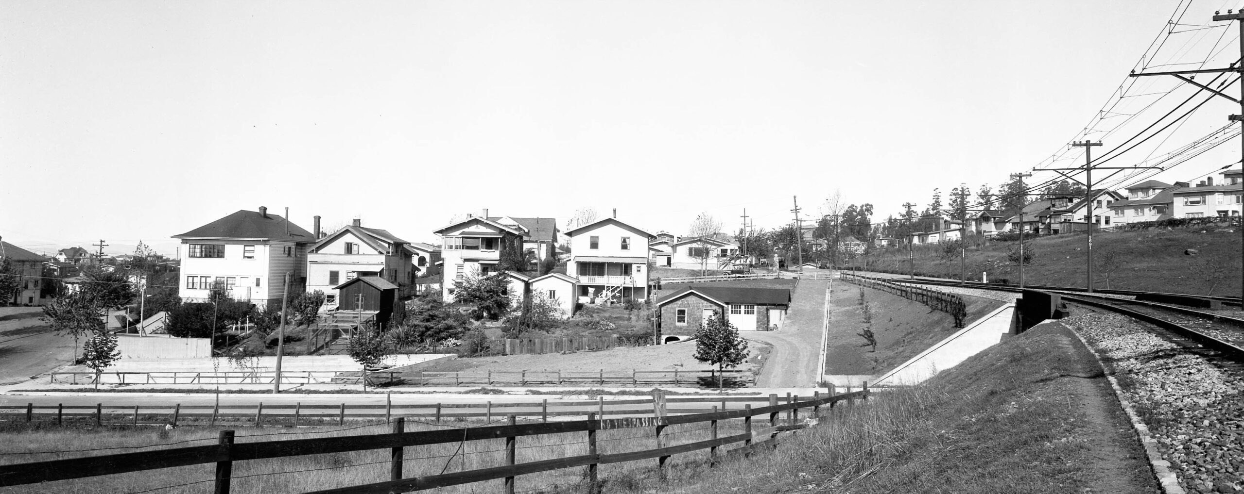
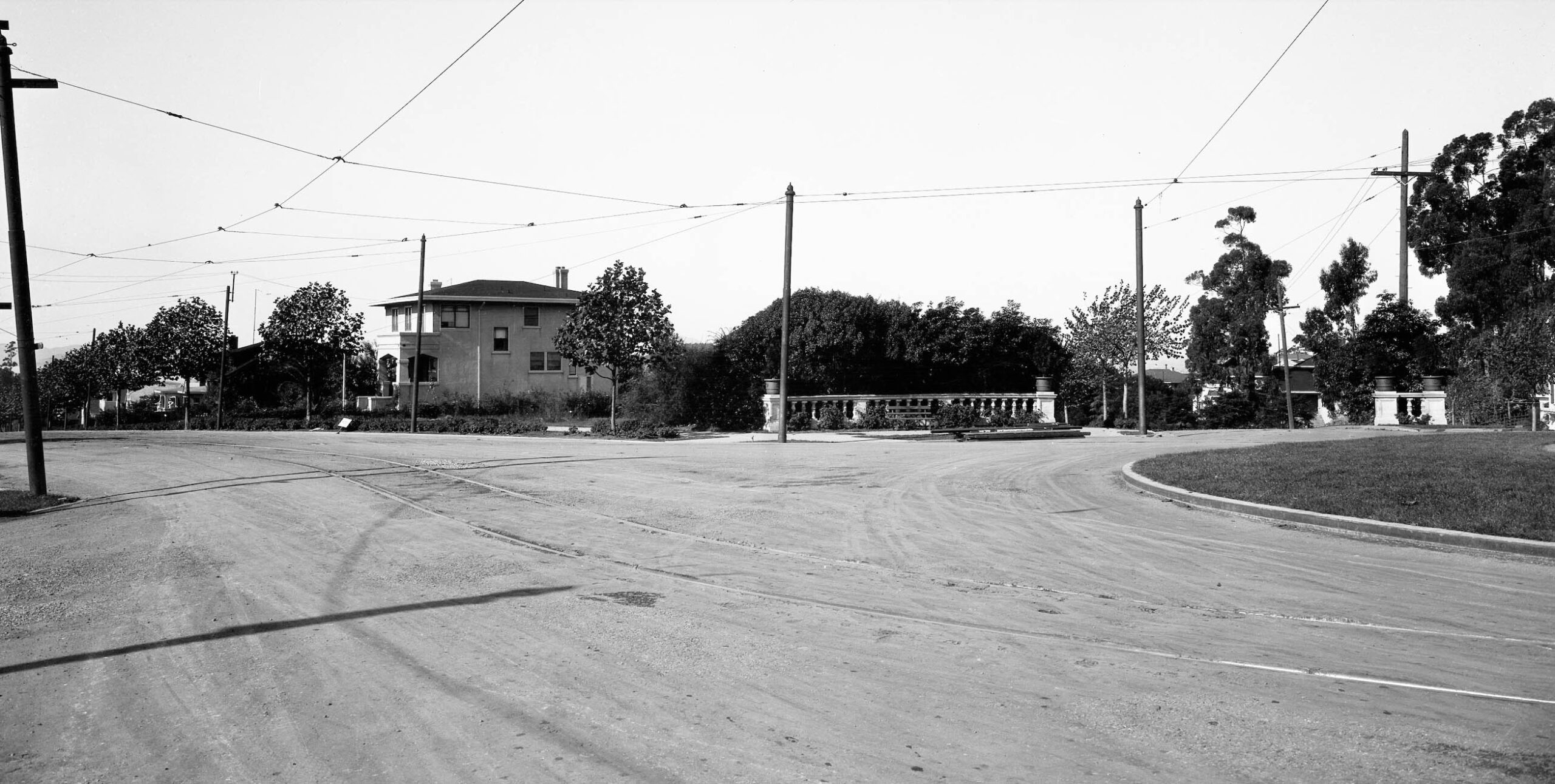
The SP and Key System, Key, may have been fighting a losing battle for profitability, but a similar west view from Oct. 6, 1920, this time featuring all of no. 1035 Spruce St., shows that Mason-McDuffie had transformed the hills into a thriving residential. neighborhood.
L348-10-Sappers Collection, Courtesy BAERA, Western Railway Museum Archives, 25748bv, (Image 3 of 42)
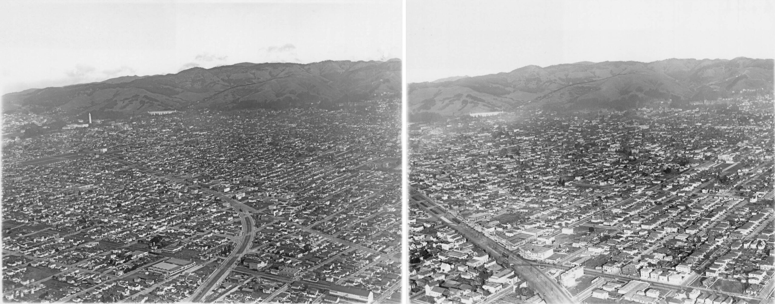
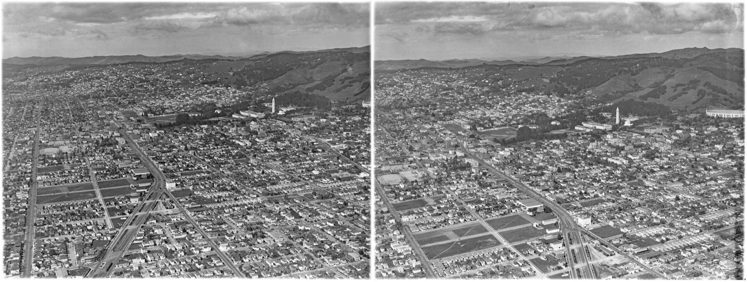
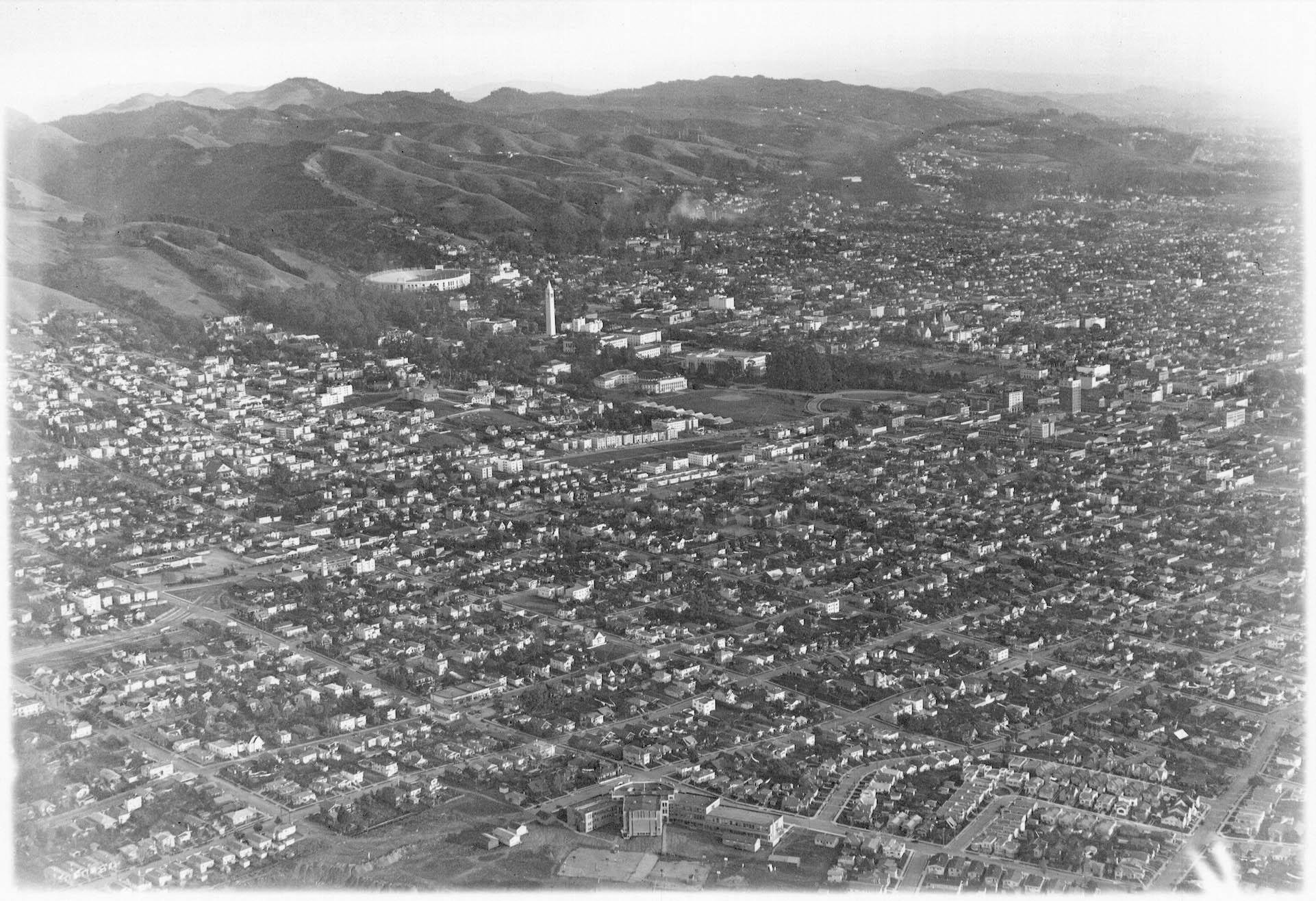
George Russell flew his airplane over the Adeline St.-Shattuck Ave. corridor between the mid-to-late 1920s and 1931 documenting the development of the area. Presented here are two northeast views starting with the SP right-of-way on Stanford Ave. as it approached the Key on Adeline St. Images of the two Shattuck lines in the 1920s are uncommon, so Russell’s aerials will be become important documentation of the area during this era and will be used extensively in this presentation along with identification of City of Berkeley building landmarks. Click here for the entire list.
L348-15-George Russell Photo, Courtesy California State Lands Commission, SLC_644_NoDate_23, l, 21, r, (Image 4 of 42)
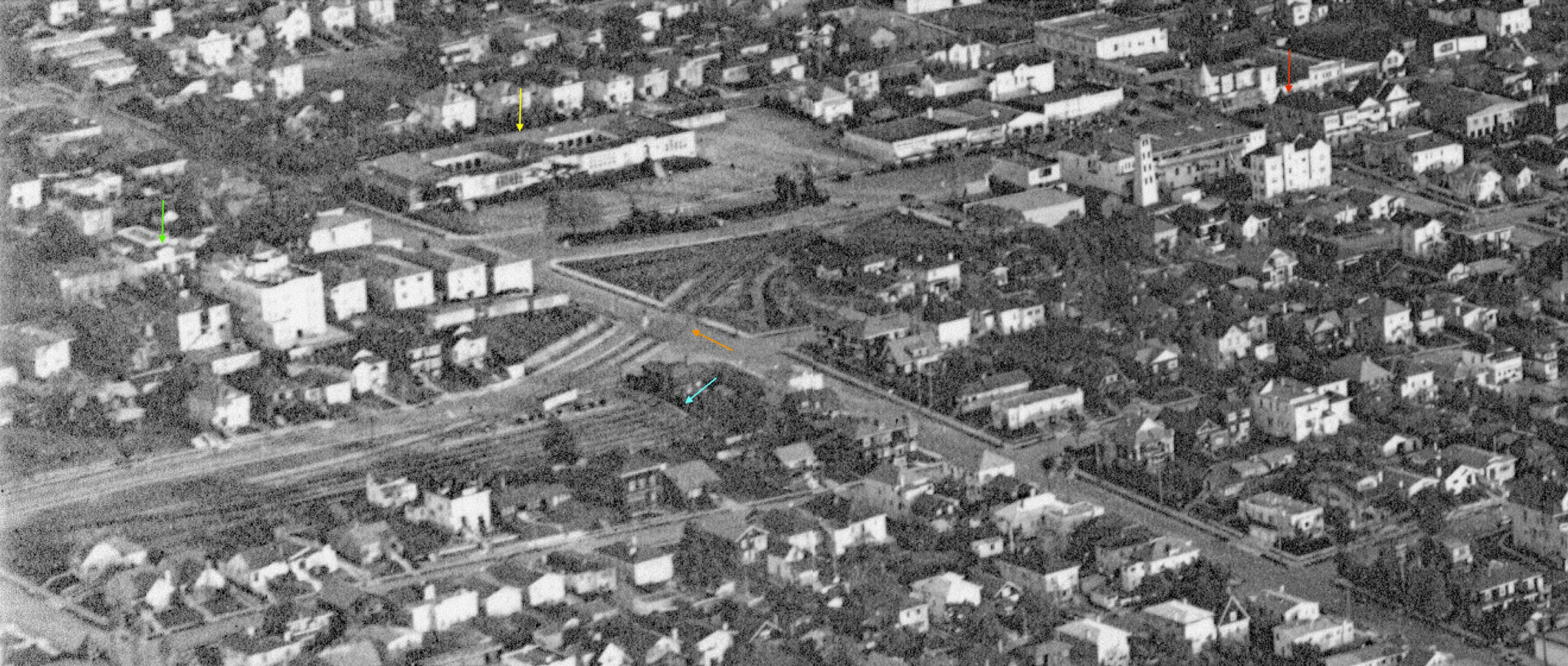
This detail has Golden Gate Tower along the lower edge and displays the SP sending off tracks to California St. Note the single car train on the SP after it has diverged from Adeline St. heading west on Stanford Ave.
L348-20-George Russell Photo, Courtesy California State Lands Commission, SLC_644_NoDate_23, Detail, (Image 5 of 42)
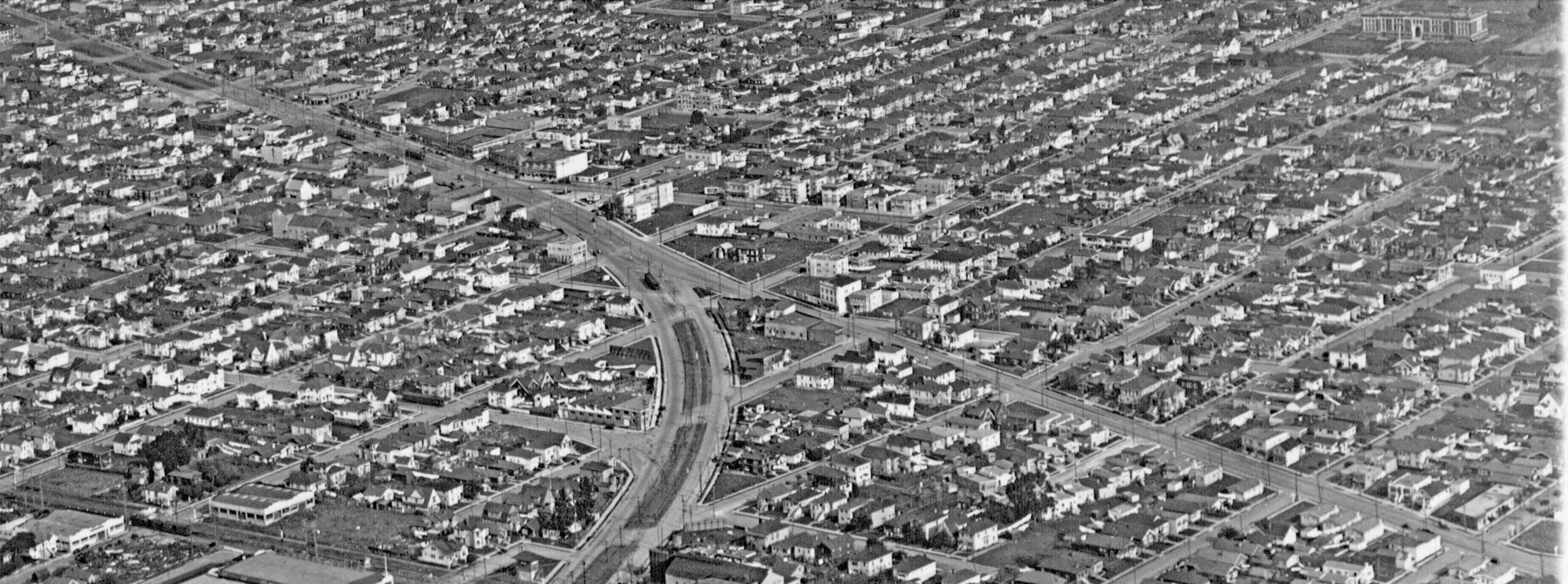
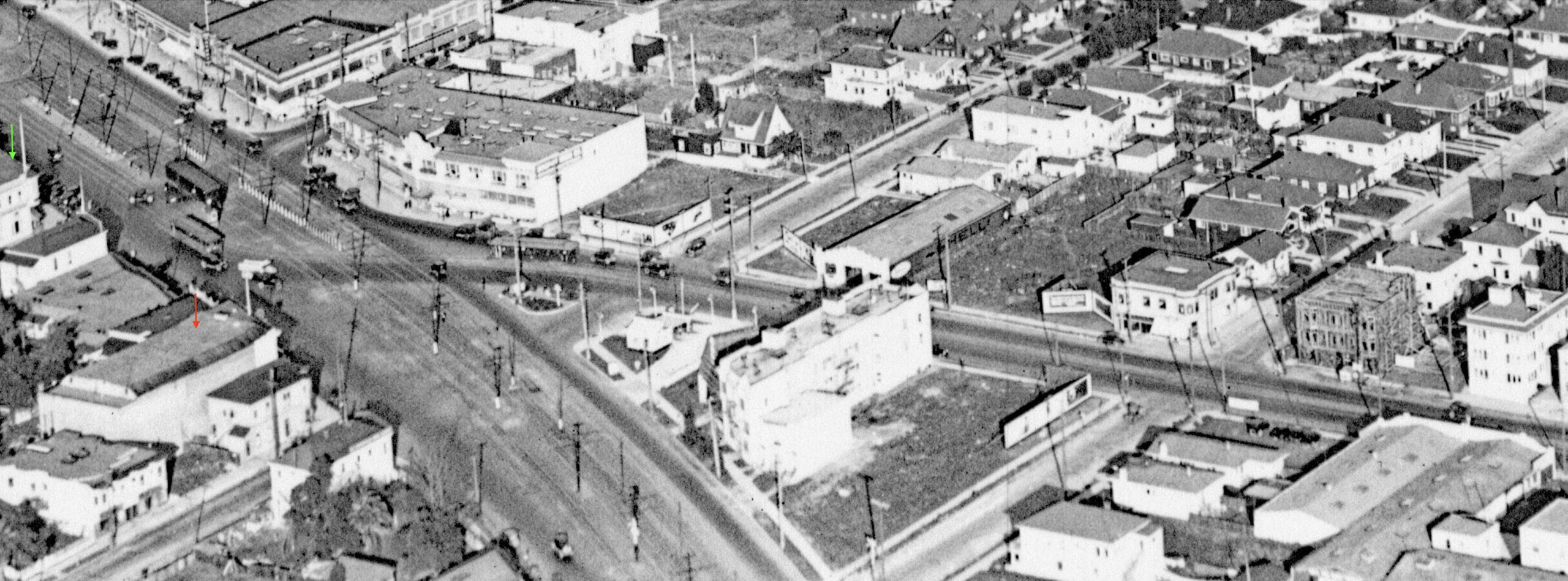
This detail shows two Grove St. streetcars ready to cross the four tracks of the SP and Key Shattuck lines. An SP single car train sits at the Alcatraz Ave. or South Berkeley stop as it was called then in the bustling Lorin District. BART and Martin Luther King Jr. Way have eliminated almost all of the buildings on the east side up to the first building on the northeast corner of Adeline St. and Alcatraz Ave. Two landmarked survivors in 2026: no. 3332, Lorin Theatre, Hiram Lovell and James Plachek, Architects, 1912, redesigned in 1920, red arrow; no. 3286, South Berkeley Bank, later Wells Fargo, John Galen Howard and John Debo Galloway, Architects, 1906, green arrow.
L348-25-George Russell Photo, Courtesy California State Lands Commission, SLC_644_NoDate_21, Detail, (Image 6 of 42)
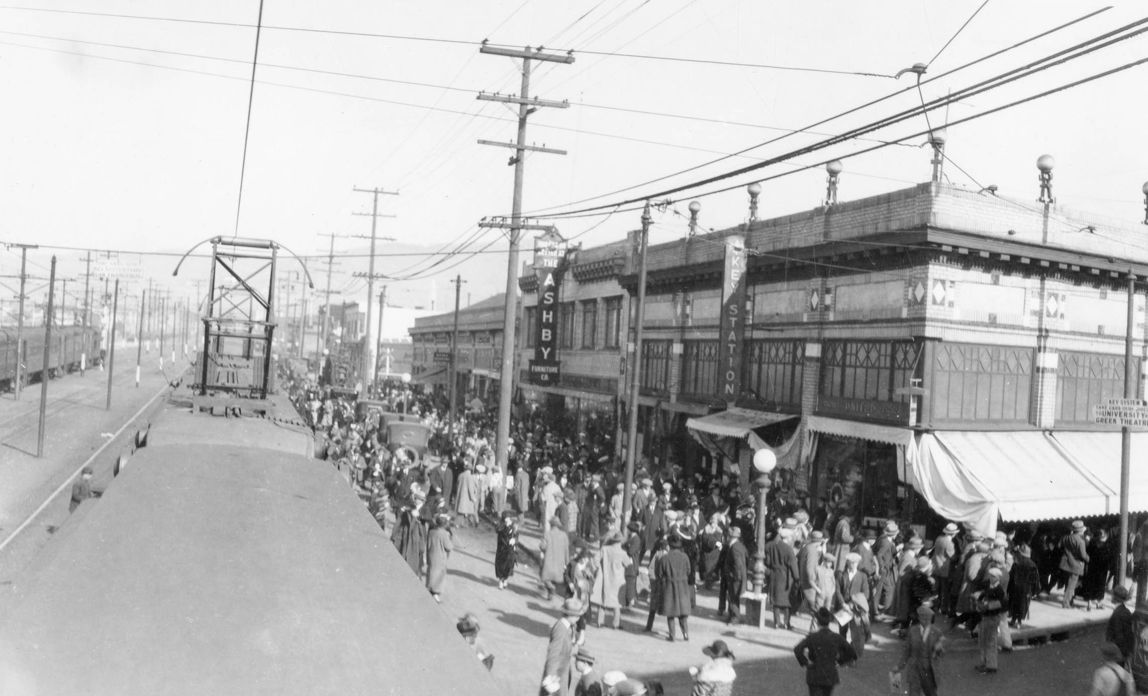
Key System employee William Everard Gardiner climbed up between cars of a Key Shattuck Ave. line train to catch the crowd most likely in the process of transferring to the local Alcatraz streetcar line to get them to Memorial Stadium for the Cal-Stanford football game on Nov. 22, 1924. All the buildings seen here up to Harmon St. in this northeast view are gone. Stanford rallied from a 20-6 deficit with five minutes to go to tie the game 20-20 to preserve both teams’ undefeated records, but Stanford was selected by committee for the Rose Bowl.
L348-30-W. E. Gardnier Photo, Harry Aitkin Collection, Courtesy BAERA, Western Railway Museum Archives, 163627ks, (Image 7 of 42)
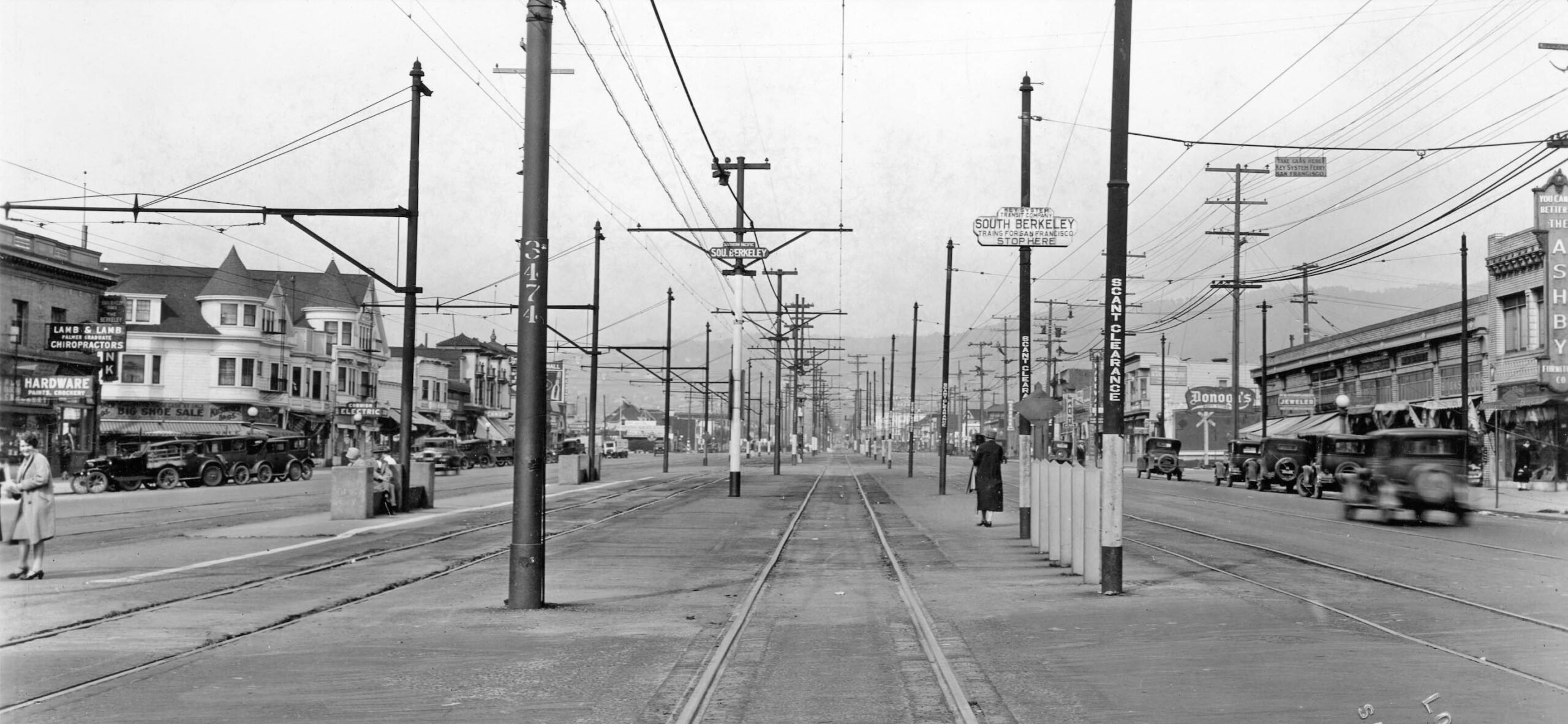
It was six tracks across at South Berkeley for the Grove St. streetcar, SP and Key Shatuck lines, left to right, a northeast view on Mar. 12, 1928. The two Victorian buildings on the northwest corner with Harmon St. toward the left edge should be very familiar to those in 2026, the turn-of- the-century no. 3198 on the corner (not an official landmark), and no. 3228, the “Carlson’s Block” building to the north. Although the date of 1904 is still indicated on its gable, the City of Berkeley landmarks list dates it to 1903 with William Wharf and C. Ekman, Architects.
L348-35-H. M. Fish Photo, Lorin Silleman Collection, Courtesy BAERA, Western Railway Museum Archives, 204230oa&b, (Image 8 of 42)
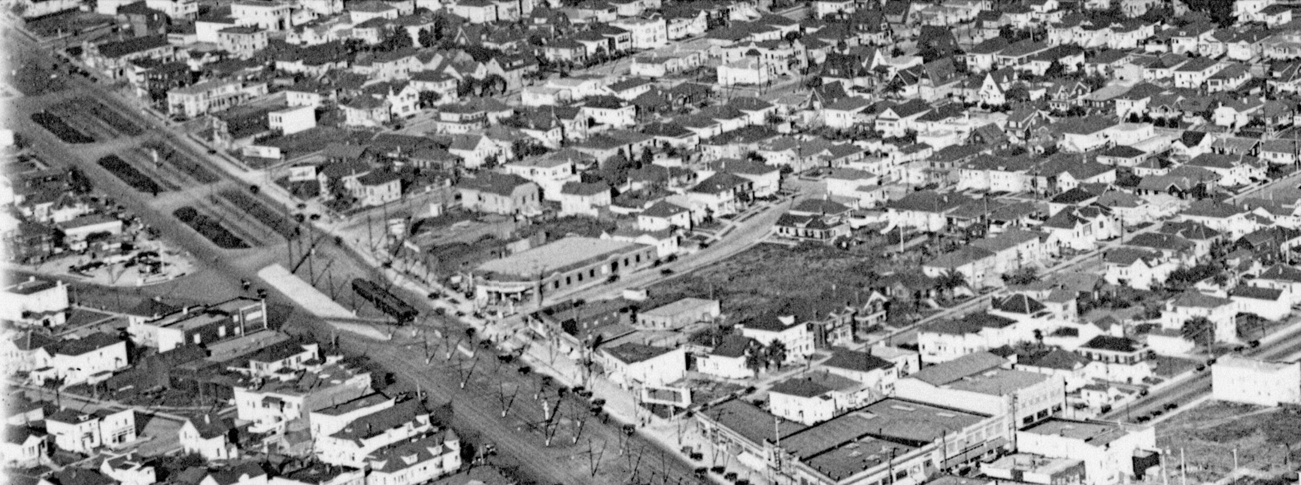
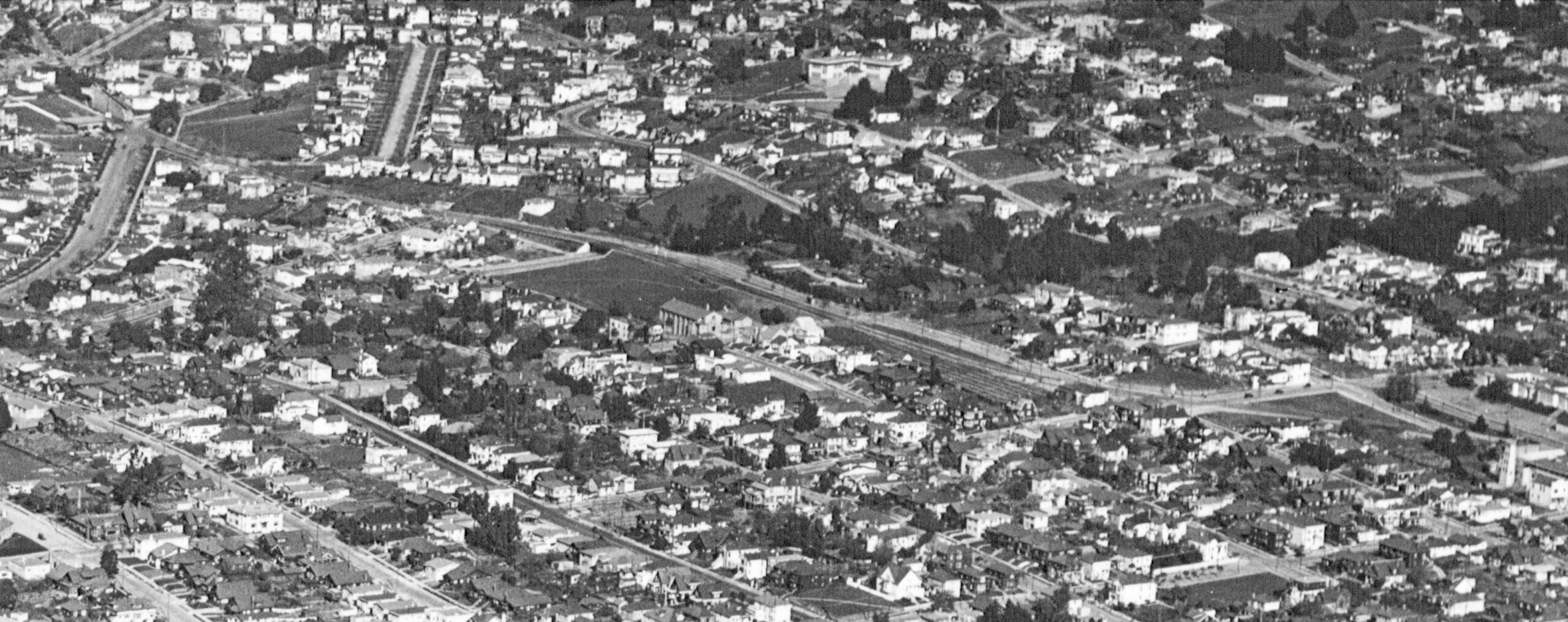
This detail from the previous Russell aerial shows the next portion of Adeline St. to be explored starting at Harmon St. Northeast view, late 1920s. Note that the Key tracks are on unimproved road past Woolsey St., red arrow, creating a private right-of-way, ROW.
L348-40-George Russell Photo, Courtesy California State Lands Commission, SLC_644_NoDate_21, Detail, (Image 9 of 42)
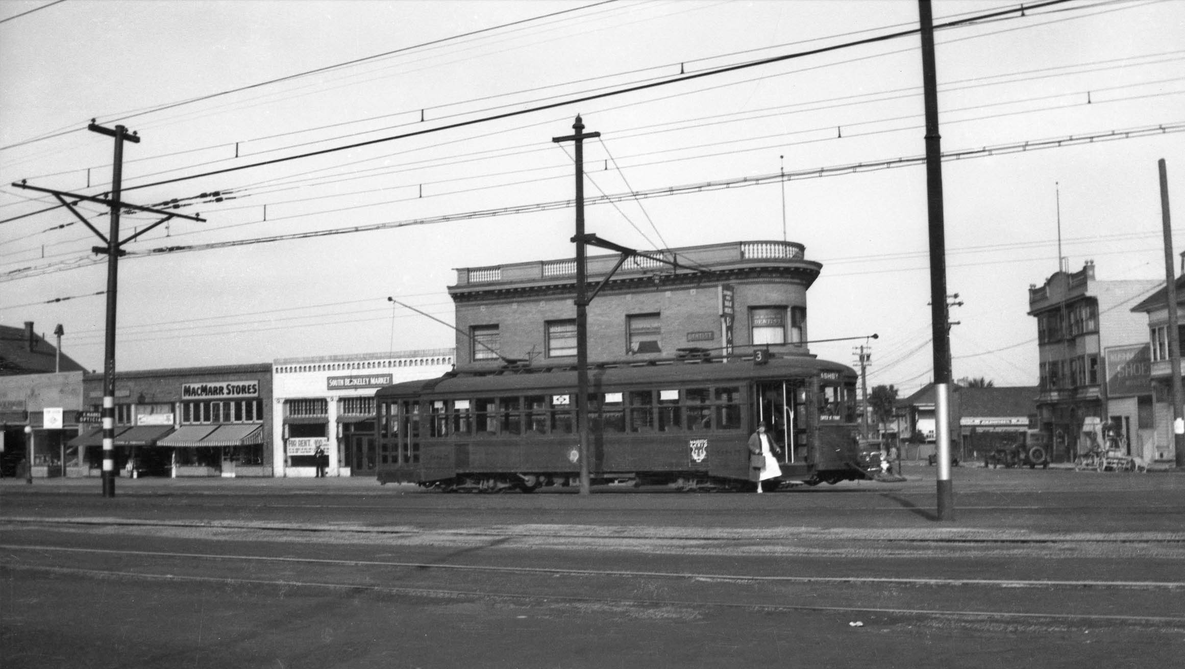
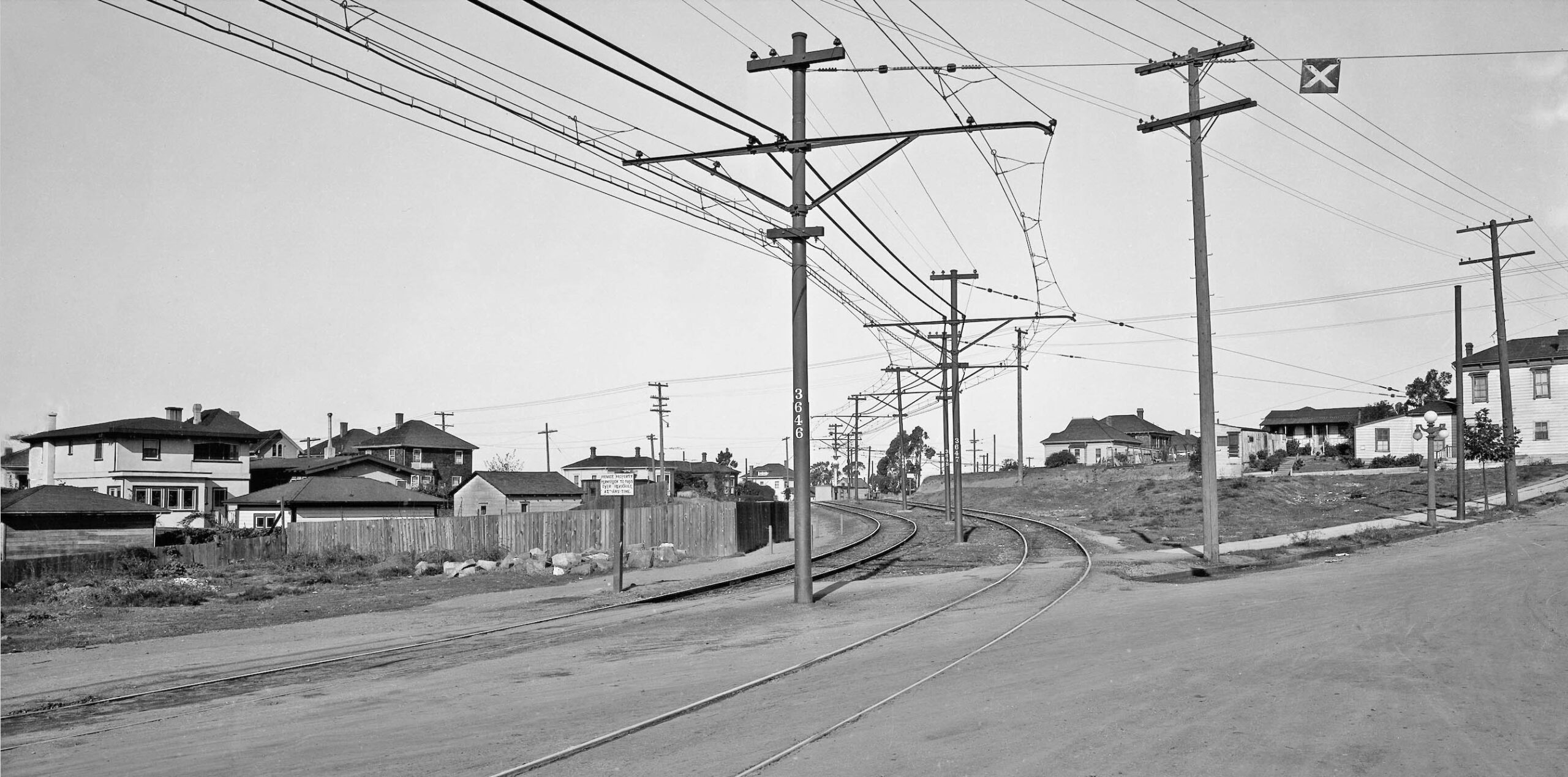
A KS 900 series Line 3 heads northbound at Adeline St. and Harmon St. in this west view across the SP and Key Shattuck lines from 1930. This portion of Adeline St. hasn’t changed a bit in 2026. The Berkeley landmark on the corner at no. 3250 is the India Block, Alfred W. Smith, Architect, 1903.
L348-45-Sappers Collection, Courtesy BAERA, Western Railway Museum Archives, 143908ks, (Image 10 of 42)
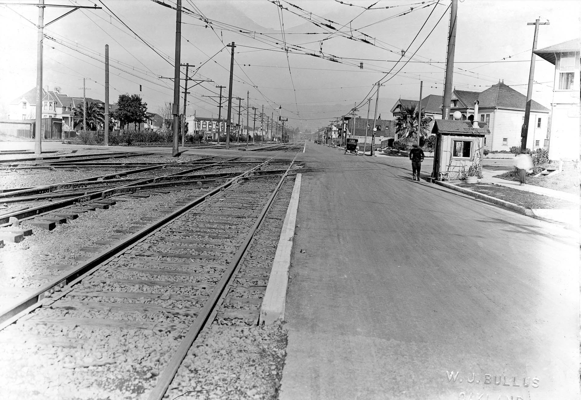
Now back to ca. 1920 and this northeast view shows the SP tracks crossing the Key tracks to send off the Ellsworth St. line. Note the switchman, the switchman’s shanty and a portion of the Woolsey St. Tower. Unlike the previous Russell aerial showing unimproved road bed for the Key beginning at Woolsey St., this earlier ground shot shows the private ROW extending south of Woolsey St. for both railways at this date. With the Ashby Station area in view, note the distinctive building in the distance with the large arched windows to the left or west of the tracks. For more on the Ellsworth line, click here.
L348-50-W. J. Bullus Photo, Courtesy BAERA, Western Railway Museum Archives, 162080oab, (Image 11 of 42)
This 1922 north view at Adeline St. and Ashby Ave. shows the dual private ROW. At best, the two buildings starting off the left edge would not have survived the late 1960s when the land for the BART Ashby Station complex was being prepared. The building off the right edge, in contrast, survives as a bright red structure in 2026. The Webb Block, a Mission Revival-style structure at nos. 3075 Adeline St.-1985 Ashby Ave., was built in 1905, designed by architect Charles W. McCall and commissioned by Christopher Webb. It has served as an important outpost for the antique district since the 1930s. For more, click here.
L348-55-Key Official Photo, Sappers Collection, Courtesy BAERA, Western Railway Museum Archives, 78607ks, (Image 12 of 42)
These two George Russell aerials bring the review all the way to downtown Berkeley. The large white 1920s industrial-era building in both images is the Bekins Building, not a Berkeley landmark.
L348-60-George Russell Photo, Courtesy California State Lands Commission, SLC_644_NoDate_31, l, 35, r, (Image 13 of 42)
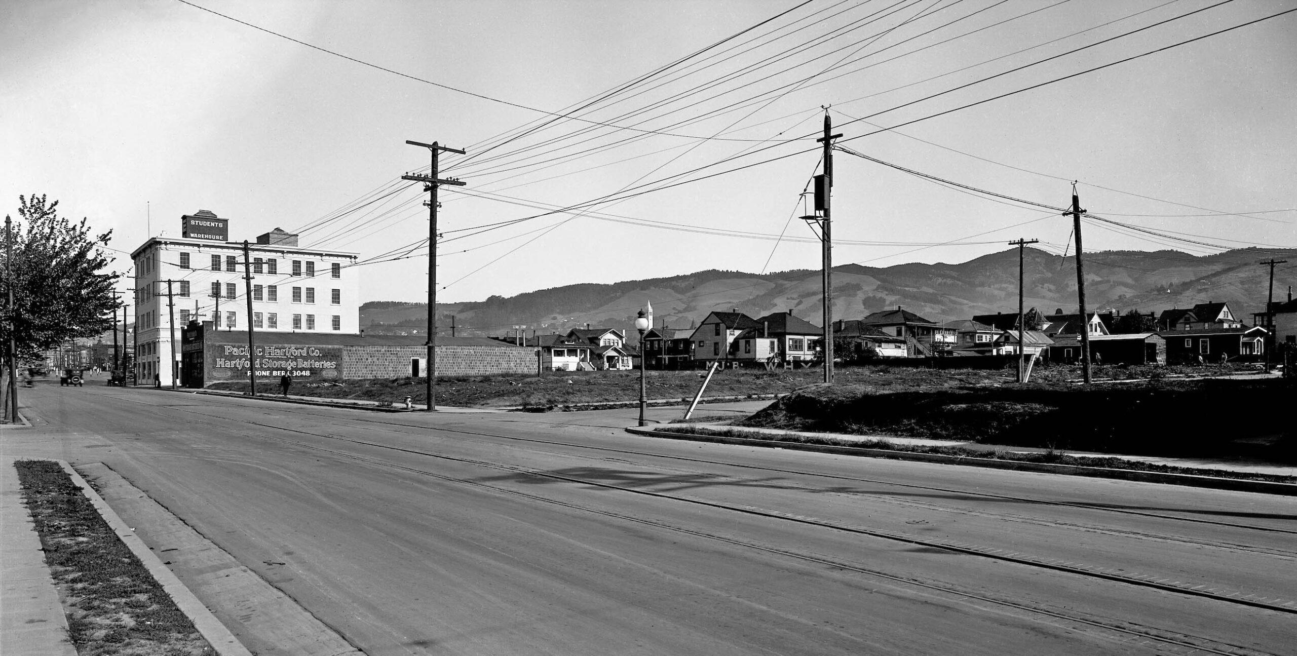
This northeast view ca. 1922 shows the Shattuck Ave. streetcar tracks at Stuart St. and the Bekins Building in the distance with the sign “Students Warehouse” on the roof, preceding the “Bekins” name seen in the previous aerial. Bekins Van Lines was founded in 1891 in Sioux City, Iowa, by two young Dutch immigrant brothers, Martin and John Bekins. In 1895 the brothers moved to Los Angeles, and opened an office in an old van there. For more, click here,
L348-62-SP Official Valuation Photo P-229, Sappers Collection, Courtesy BAERA, Western Railway Museum Archives, 76030oa&b, (Image 14 of 42)
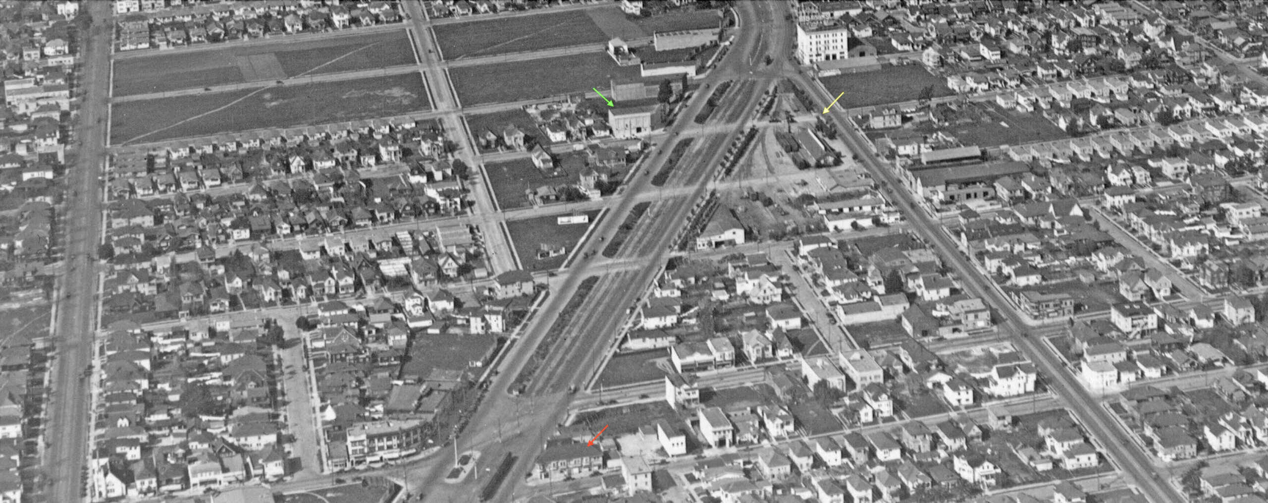
Along with the Webb Block and Bekins Building, this detail from the previous Russell aerial shows two City of Berkeley landmarks that are present in 2026. The red arrow points to The William Clephane Corner Store at no. 3027 from 1905 designed by C. M. Cook. The green arrow marks the Frederick H. Dakin Warehouse at no. 2750 from from 1906 designed by Walter H. Ratclliff and George T, Plowman, Architects. Finally, the yellow arrow directs the view to the SP yard between Adeline St. and Shattuck St., in 2026 occupied by the Berkeley Bowl Marketplace, Walgreens, and the Honda dealer parking lot.
L348-65-George Russell Photo, Courtesy California State Lands Commission, SLC_644_NoDate_31, Detail, (Image 15 of 42)
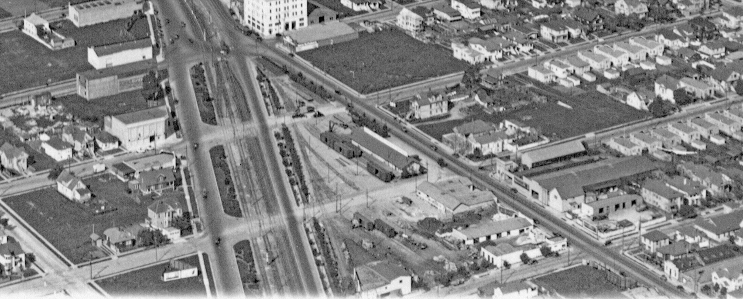
This detail from the previous Russell aerial shows a closer view of the Dakin Warehouse and the SP yard. Note all the track crossings of the SP mainline to access the yard and interchange its tracks, and the reduction of the Key mainline to one track as the Shattuck Ave. streetcar line enters from the east. Plus the Shattuck Ave. streetcar by the Bekins Building, and the Key Shattuck interurban on the mainline. One lingering question is what businesses, if any, utilized the SP yard?
L348-70-George Russell Photo, Courtesy California State Lands Commission, SLC_644_NoDate_35, Detail, (Image 16 of 42)
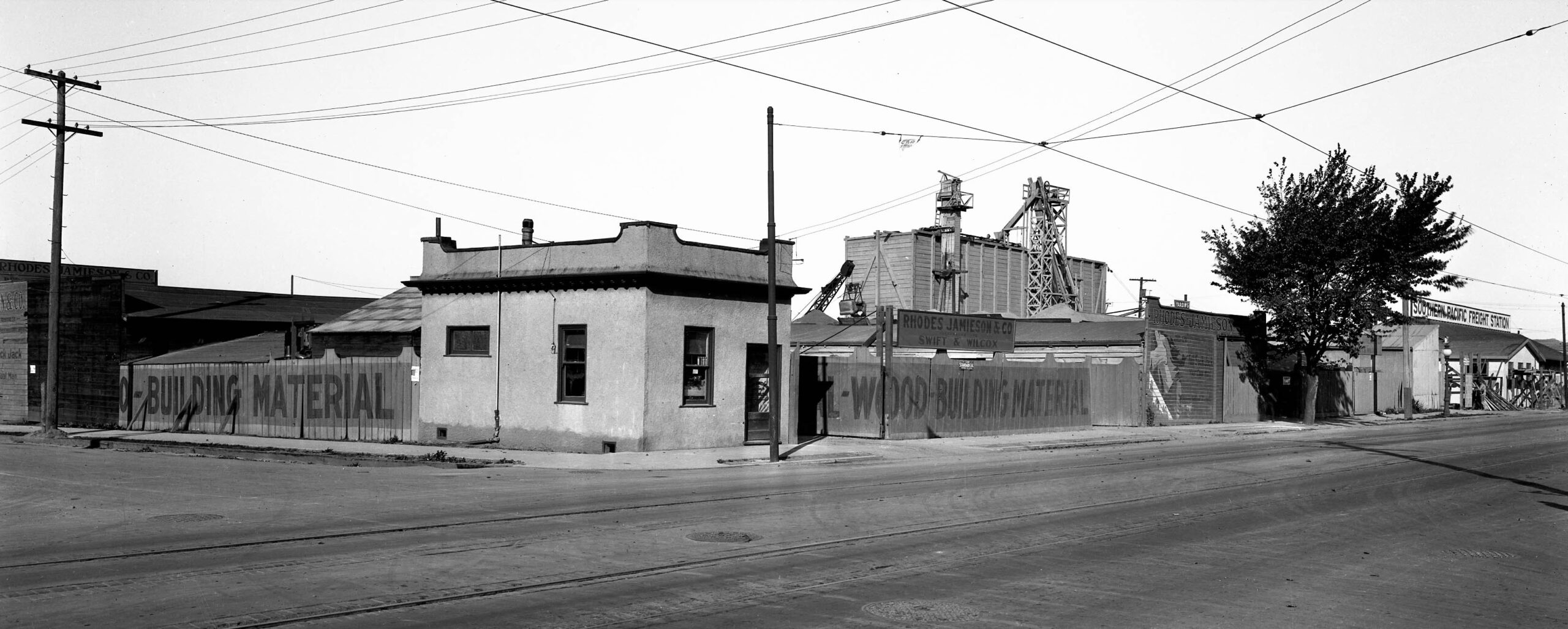
This ca.1923 northwest view Shattuck Ave. and Russell St. shows Rhodes-Jamieson at the southern end of the yard, and the SP freight station at the north end toward Ward St. The tracks are from the Key System Shattuck Ave. streetcar line. Directories list this site for Rhodes-Jamieson only until 1925, and it is not known who took over the space. As for the SP freight station, Contra Costa Building Materials Co. would eventually take over that building, but in the 1920s they were was still at no. 808 Gilman St.
L348-75-SP Official Valuation Photo P-227, Sappers Collection, Courtesy BAERA, Western Railway Museum Archives, 76031oa&b, (Image 17 of 42)
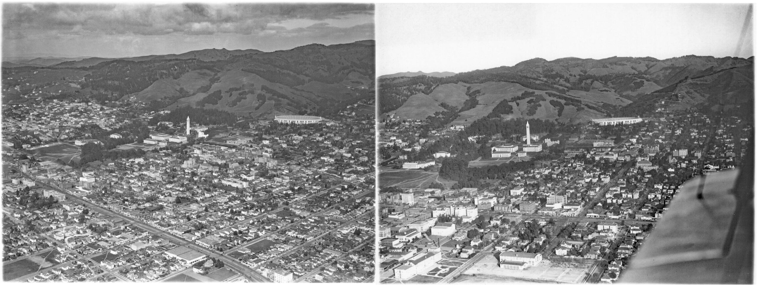
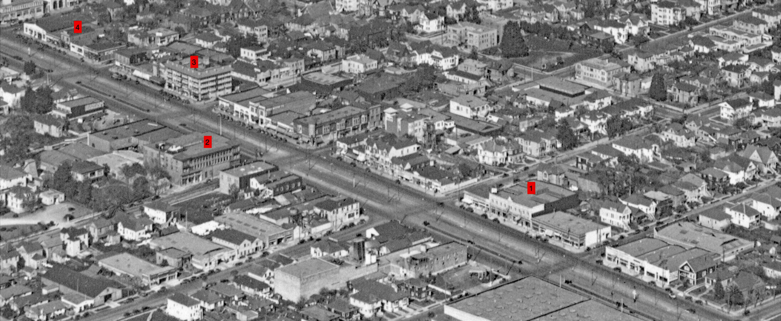
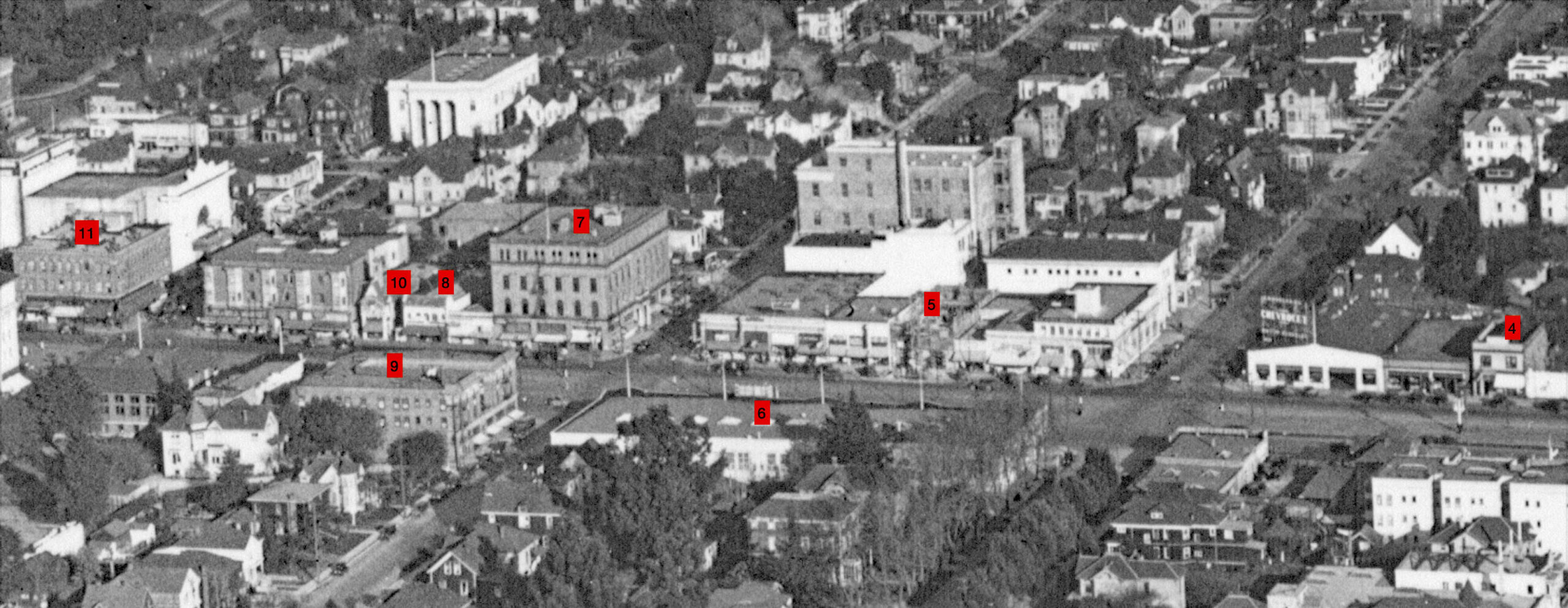
Moving to Shattuck Ave., two more George Russell aerials from the mid-late 1920s. The one on the left will be used to focus on Shattuck Ave. between the Bekins Building and halfway downtown, while the right one will continue to the SP main Berkeley downtown station on its left border. The one on the right shows Berkeley High School along the lower edge with the gymnasium across from the athletic fields built in 1922.
L348-80-George Russell Photo, Courtesy California State Lands Commission, SLC_644_NoDate_38, l, 44, r, (Image 18 of 42)
1, no. 2571, The Shuman Block, McDougall Brothers, Architects, 1906, The Berkeley Free Market, by mid-century auto showroom with artists such as Richard Diebenkorn and Elmer Bischoff living in artist studios on the top floors is not a landmark. 2, no. 2484, Barker Building, A. W. Smith, Architect, 1905. 3, no. 2429, Morrill Apartments, George F. King, Architect, 1911. 4, no. 2375, Wallace Clark Building, Architect unknown, 1894.
L348-85-George Russell Photo, Courtesy California State Lands Commission, SLC_644_NoDate_38, Detail, (Image 19 of 42)
4, no. 2375, Wallace Clark Building, Architect unknown, 1894. 5, no. 2323, Fidelity Savings Bank, Walter H. Ratcliff, Jr. and Walter Sorenson, Architects. 1925, Under Construction. 6, no. 2300, Corder Building, James L. Plachek, Architect, 1921. 7, No. 2295, Masonic Temple, later, Crocker Bank, William Wharff, Architect, 1905. 8, no. 2277, The Hezlett’s Silk Store Building, later Tupper and Reed Building, Master and Hurd, Architects, 1925. 9, no. 2276, Morse Building, later Pasand Hotel Donogh Arms, Dickey and Reed, Architects, 1906. 10, no. 2271, Tupper and Reed Building, William R. Yelland, Architect, 1925. 11, no. 2231, Brooks Apartment Building, Meyers and Ward, Architects, 1906. Note there is no UA Theater until 1932, next to 9
L348-90-George Russell Photo, Courtesy California State Lands Commission, SLC_644_NoDate_44, Detail, (Image 20 of 42)
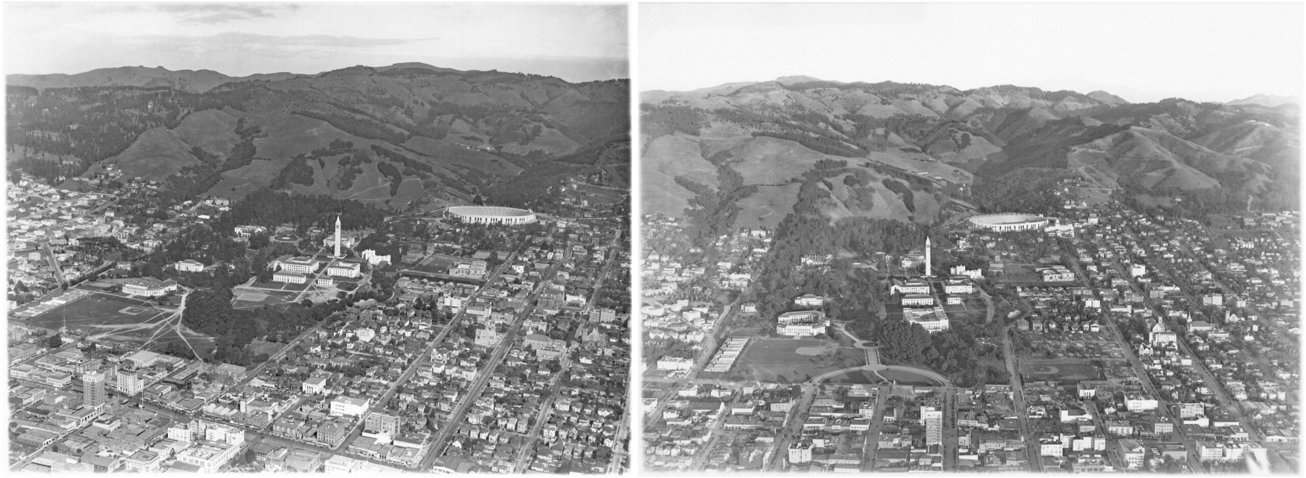
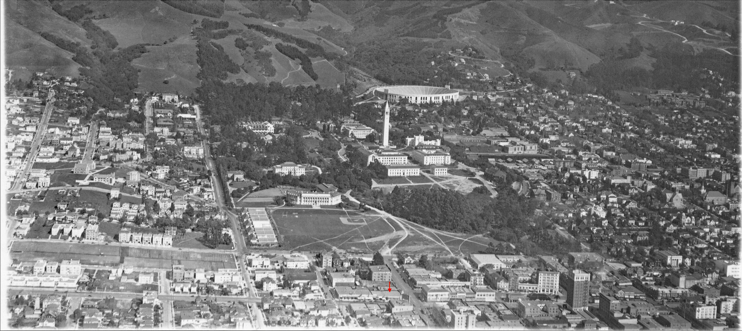
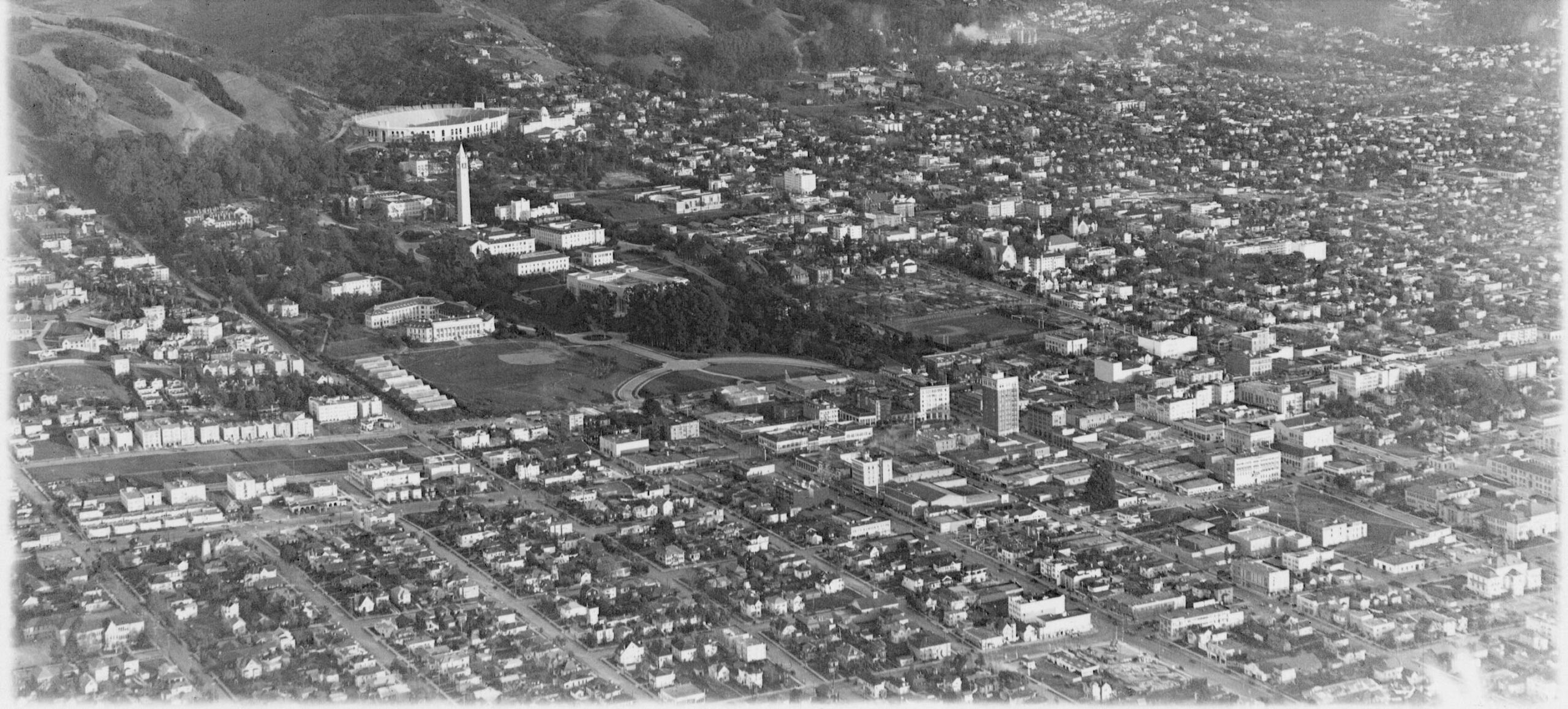
Two more aerials from George Russell to cover the core of downtown Berkeley. The northeast view on the left shows the SP Downtown Berkeley Station on the left border. It is similar to the previous two, and here the Fidelity Savings Building is completed. The east view on the right is ca. 1931. Valley Life Sciences Building was completed in 1930 and is present here. The area north of Bancroft Ave. up to Allston Way has been partially cleared, and contains a baseball diamond. Edwards Stadium would not be completed until 1932, and Evans Baseball diamond a year later.
L348-95-George Russell Photo, Courtesy California State Lands Commission, SLC_644_NoDate_45, l, 43, r, (Image 21 of 42)
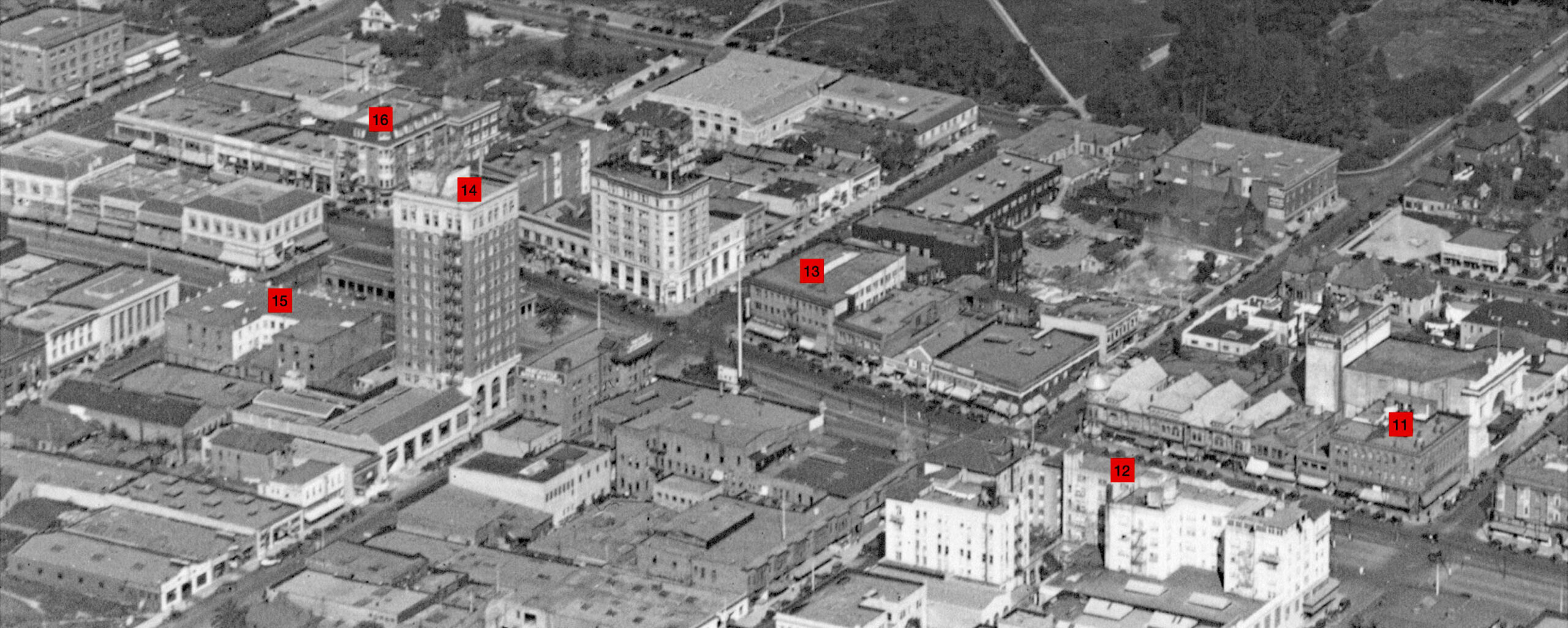
Starting at Kittredge St. right margin: 11, no. 2231, Brooks Apartment Building, Meyers and Ward, Architects, 1906. 12, 2200-2240, Shattuck Hotel, Walter H. Ratcliff, Jr., & Benjamin McDougall, Architects, 1909. 13, no. 2161, The Wright Block, William Knowles, Architect, 1906. 14, no. 2140, American Trust Building, Walter H. Ratcliff, Jr., Architect, 1925. 15, no. 2100, Francis K. Shattuck Building, Louis Stone and Henry Smith, Architects, 1901. 16, no. 2045, Studio Building, F. H. Dakin, Architect, 1905.
L348-100-George Russell Photo, Courtesy California State Lands Commission, SLC_644_NoDate_45, Detail, (Image 22 of 42)
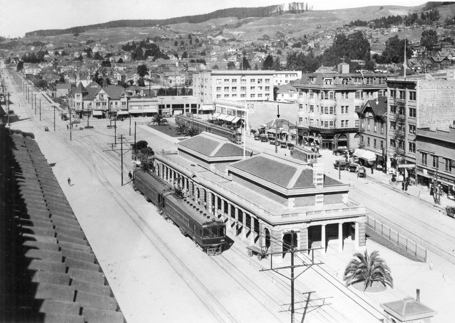
Back on the ground ca. 1920, this northeast view shows the SP downtown passenger station front and center with a Shattuck line train at the stop. Behind the station are the Key facilities, the much more modest Key passenger station is marked by a black arrow. Borax Smith touch is seen in the planted palms. The Odd Fellows Hall at the corner of Addison St., white arrow, no. 2101, will be replaced by another structure by 1928. The real estate firm Mason-McDuffie Co. occupying the Studio Building across Addison St. since 1906 will move to the new building that year bearing the firm’s name. The new building will be featured shortly.
L348-105-Courtesy BAERA, Western Railway Museum Archives, 165268oa&b, (Image 23 of 42)
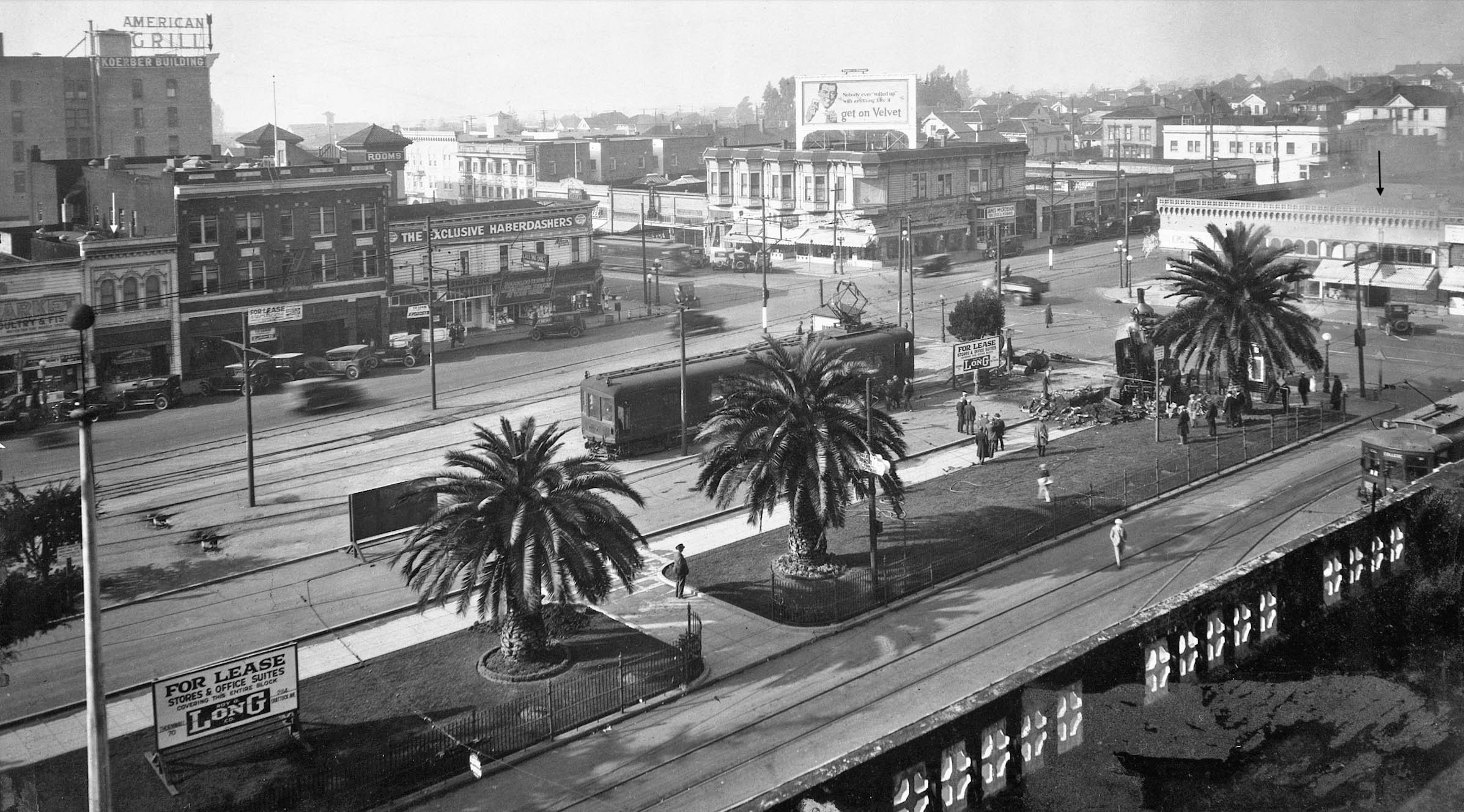
The so-called mail spur north of the SP station is seen from a northwest view in the early 1920s taken from the fourth floor roof of the Studio Building. The sign is advertising for store or office space leases as Shattuck Square will be soon developed in 1925. The mail spur would be moved to Center St. when this was completed. This view also shows the Hayward Building at no. 2014 Shattuck Ave., white arrow, James L. Plachek, Architect, from 1917. Across University Ave., no. 1987, MacFarlane Building, Earle Betz-Lawton & Vezey, Architects, 1925, black arrow.
L348-110-Sappers Collection, Courtesy BAERA, Western Railway Museum Archives, 20227ks, (Image 24 of 42)
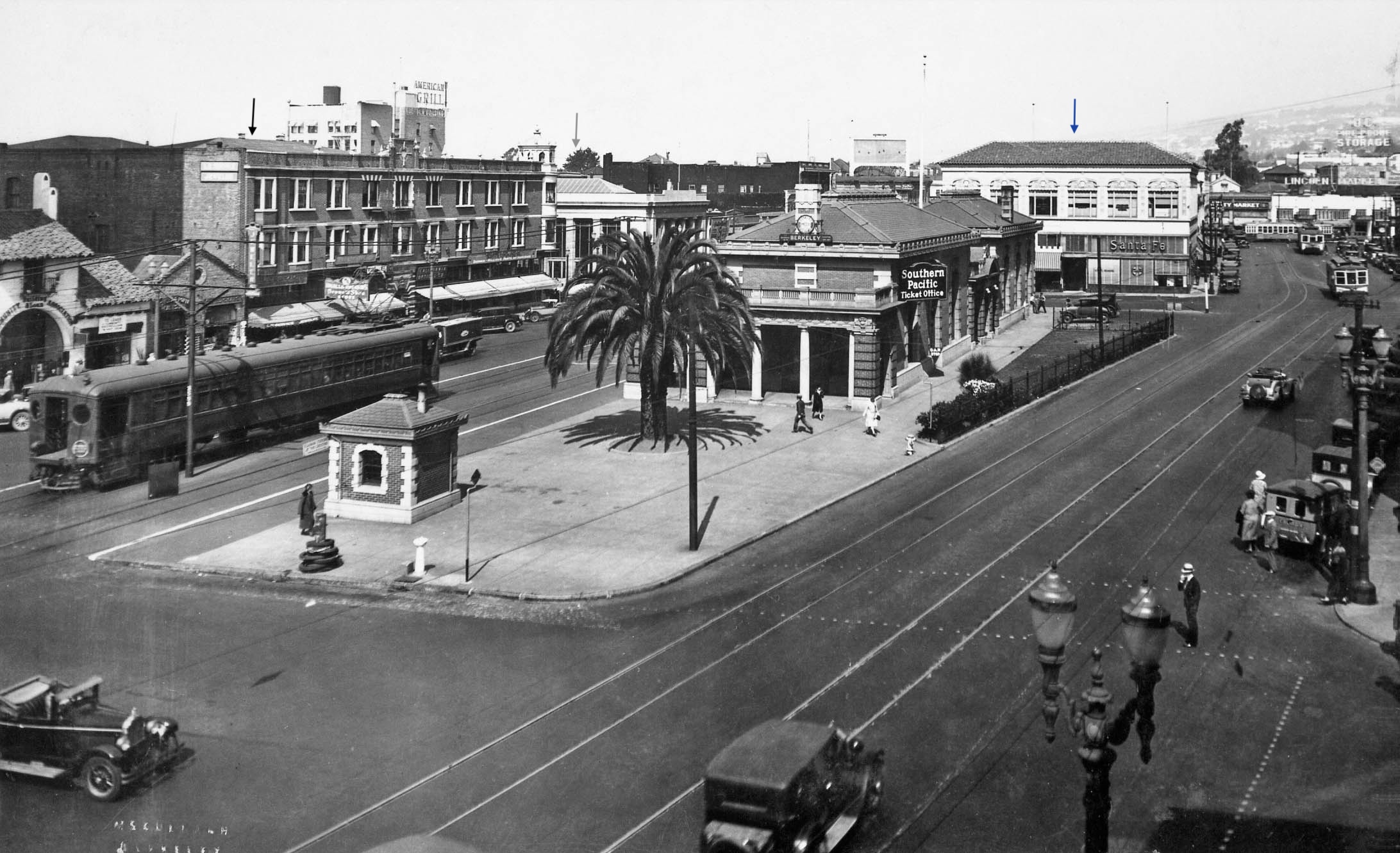
Moving along to a point when Shattuck Square has been completed, blue arrow, this northwest view was taken from the south side of the Addison St. intersection. Note here the SP train at the station has the new round portal windows added for safety during collisions. The black arrow marks the Francis K. Shattuck Building, noted above. A mansard-style fourth floor was added in 1998 during a renovation. The gray arrow marks the College National Bank, Charles McCall, Architect, from 1923, razed in order to construct the Kress Store at no. 2036 Shattuck Ave., the latter not completed until 1933. Click here for more.
L348-115-Sappers Collection, Courtesy BAERA, Western Railway Museum Archives, 20224oa&b, (Image 25 of 42)
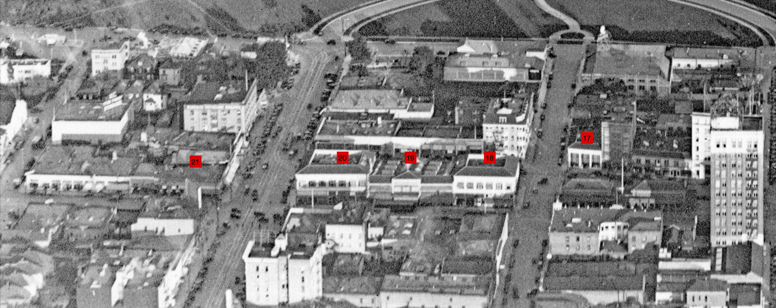
Back to the previous George Russell aerial ca. 1931 that showed the space cleared for the soon to be built athletic fields along Bancroft Way. 17, 2101 Shattuck Ave., Mason-McDuffie Co., Walter H. Ratcliff, Jr., Architect, 1928. This is the building mentioned earlier that the Mason-McDuffie Co. would occupy in 1928. 18-20, nos. 82, 64 (Roos Bros. Building) and 48 Shattuck Square, Timothy Pflueger and James Miller, Architects, 1926. 21, no. 1987, MacFarlane Building, has been introduced above. A new six-story mixed-use building has recently been constructed on top of and behind the historic exterior.
L348-120-George Russell Photo, Courtesy California State Lands Commission, SLC_644_NoDate_43, (Image 26 of 42)
The last entry, the MacFarlane Building, has advanced the flight over Shattuck Ave. to the north side of University Ave. That building is marked by a red arrow in this Russell aerial from the mid-1920s. At this juncture, only the SP line continued north. As can be appreciated in this image continuing north just short of Virginia St., note the empty lots along Shattuck Ave. within a few blocks north of University Ave.
L348-125-George Russell Photo, Courtesy California State Lands Commission, SLC_644_NoDate_42, (Image 27 of 42)
A similar Russell aerial toward the southeast taken ca. 1931 up to and including Virginia St. shows a few more structures added to the east side of Shattuck Ave.
L348-130-George Russell Photo, Courtesy California State Lands Commission, SLC_644_NoDate_37, (Image 28 of 42)
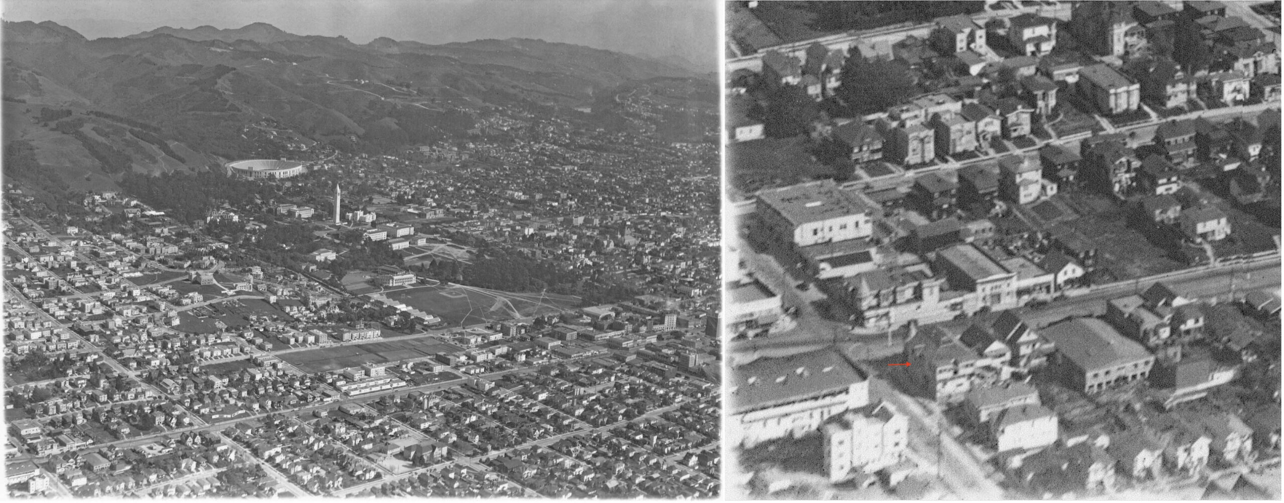
Back to the mid-1920s, Russell’s survey by air of Shattuck Ave. continues with another southeast view. The left edge includes Vine St., and at the southwest corner is seen the Capitol Market at no.1500 Shattuck Ave. or no. 2044 Vine St. It was built in 1891 by Alphonso H. Broad, possibly also the one who designed the structure. This is marked by the red arrow on the detail on the right.
L348-135-George Russell Photo, Courtesy California State Lands Commission, SLC_644_NoDate_36, (Image 29 of 42)
Continuing north, this southeast view highlights the UC campus ca. 1931, and along the bottom edge center, James Garfield Middle School at the time, but renamed Martin Luther King, Jr. Middle School in 1968.
L348-137-George Russell Photo, Courtesy California State Lands Commission, SLC_644_NoDate_29, (Image 30 of 42)
This detail from the previous image starts at the upper right at Vine St. where the last detail left off with Capitol Market at no. 1500 Shattuck Ave. or no. 2044 Vine St., red arrow. The SP Shattuck line can be seen swinging over from Shattuck Ave. to Henry St., crossing Rose St. in the process, orange arrow, and then following Henry St. with the SP yard, turquoise arrow, on its west flank. The yellow arrow marks the original landmark James Garfield Middle School, no. 1414 Walnut St., Ernest Coxhead, Architect, 1915, in 2026 the East Bay Jewish Community Center. For completeness of the Shattuck Ave. landmark survey, the green arrow points to no. 1335, Captain Slater House, Thomas J. Welsh, Architect, 1894.
L348-138-George Russell Photo, Courtesy California State Lands Commission, SLC_644_NoDate_29, (Image 31 of 42)
This east aerial view from the late 1920s starts with the SP Shattuck line leaving Shattuck Ave. for Henry St. on the right margin, and finishing with the portal for the Northbrae tunnel on the left margin. The SP yard and Eunice St. overpass are prominently seen in this image.
L348-139-George Russell Photo, Courtesy California State Lands Commission, SLC_644_NoDate_52, (Image 32 of 42)
S.P. Valuation Photos from ca. 1923 will now provide the ground images to correspond to what was seen on the previous aerial. Above Vine St., the SP ROW began its approach to Henry St. at Rose St. and the private ROW, northwest view. The semaphore may be appreciated in the distance after the track makes the curve.
L348-140-SP Official Valuation Photo P-209, Sappers Collection, Courtesy BAERA, Western Railway Museum Archives, 75827sp, (Image 33 of 42)
After the grade crossings at Rose St., the semaphore, and the crossing of Henry Street, this north view shows the private ROW paralleling Henry St. on the street’s west flank. Here as well the SP Berryman yard can be seen on the west flank of mainline between Rose St. and Berryman St., in this view extending to the left edge of the image.
L348-145-SP Official Valuation Photo P-210, Sappers Collection, Courtesy BAERA, Western Railway Museum Archives, 75829sp, (Image 34 of 42)
This image is from 10 years later, 1933, but it is the earliest panoramic ground image of the SP Berryman Yard found, a south view from the hill at Berryman St.
L348-147-Jim Lusk Photo, Rick Borgwardt Collection, Courtesy BAERA, Western Railway Museum Archives, 198844oa&b, (Image 35 of 42)
The overpass at Eunice St. was next, where the parallel street name becomes Sutter St. None of these houses remain in 2026.
L348-150-SP Official Valuation Photo unknown no., Sappers Collection, Courtesy BAERA, Western Railway Museum Archives, 75830sp, (Image 36 of 42)
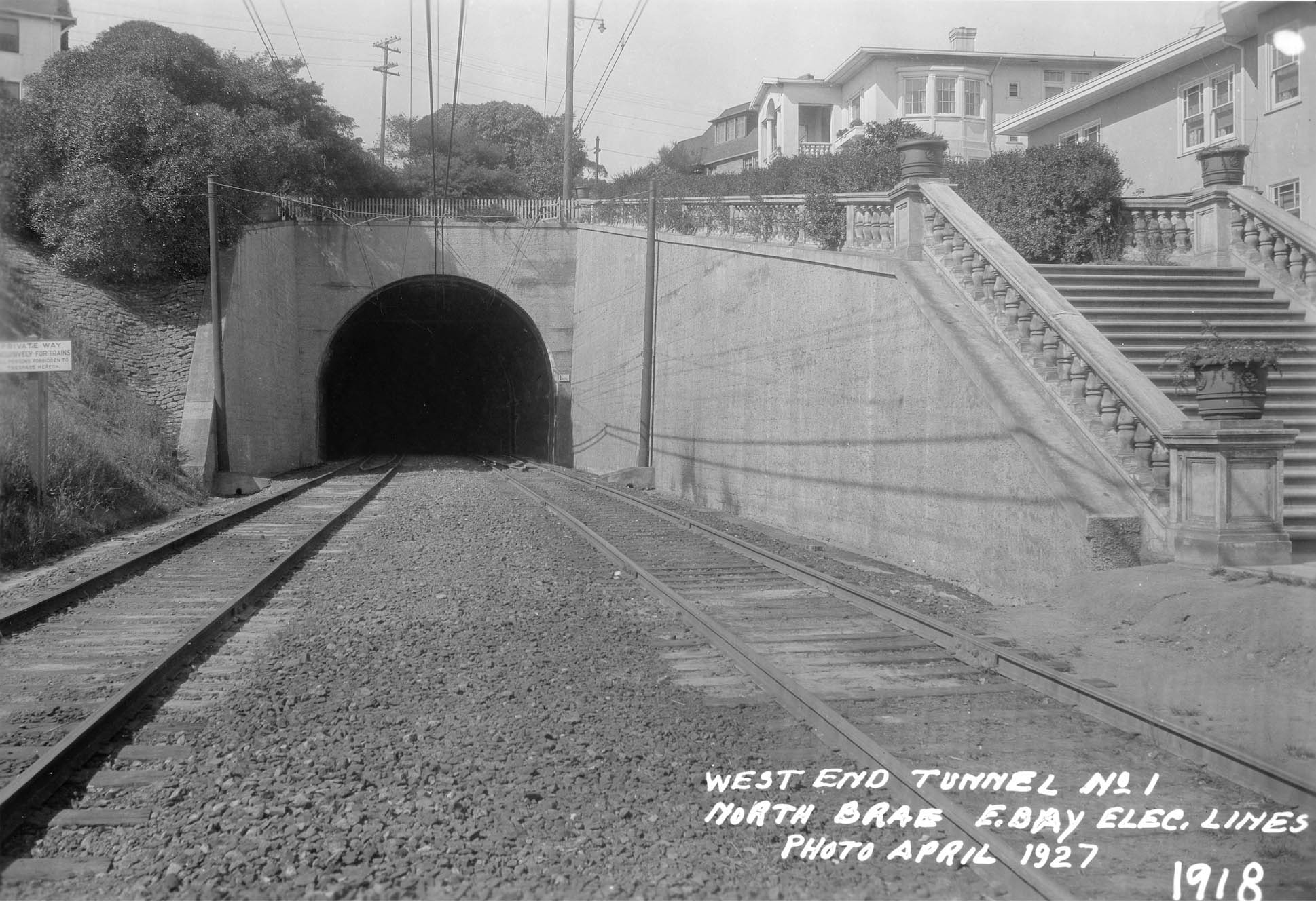
Next, a north view from 1927 at the Sutter St. or south portal of the Northbrae Tunnel, a north view from 1927.
L348-155-Erle Hanson Collection, Courtesy BAERA, Western Railway Museum Archives, 205200sp, (Image 37 of 42)
This northwest view shows the Key streetcar tracks heading up Marin Avenue toward the Circle, Finally a house that can still be recognized in 2026, no. 1987 Marin Ave., but no longer the corner house.
L348-160-SP Official Valuation Photo P-214, Sappers Collection, Courtesy BAERA, Western Railway Museum Archives, 75833sp, (Image 38 of 42)
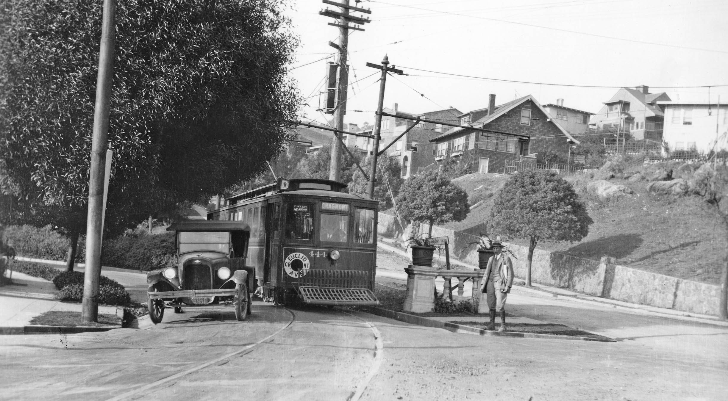
Activity at the Circle is captured in this 1926 north view of Key streetcar 444 ready to leave Arlington Ave.
L348-165-Sappers Collection, Courtesy BAERA, Western Railway Museum Archives, 261754ks, (Image 39 of 42)
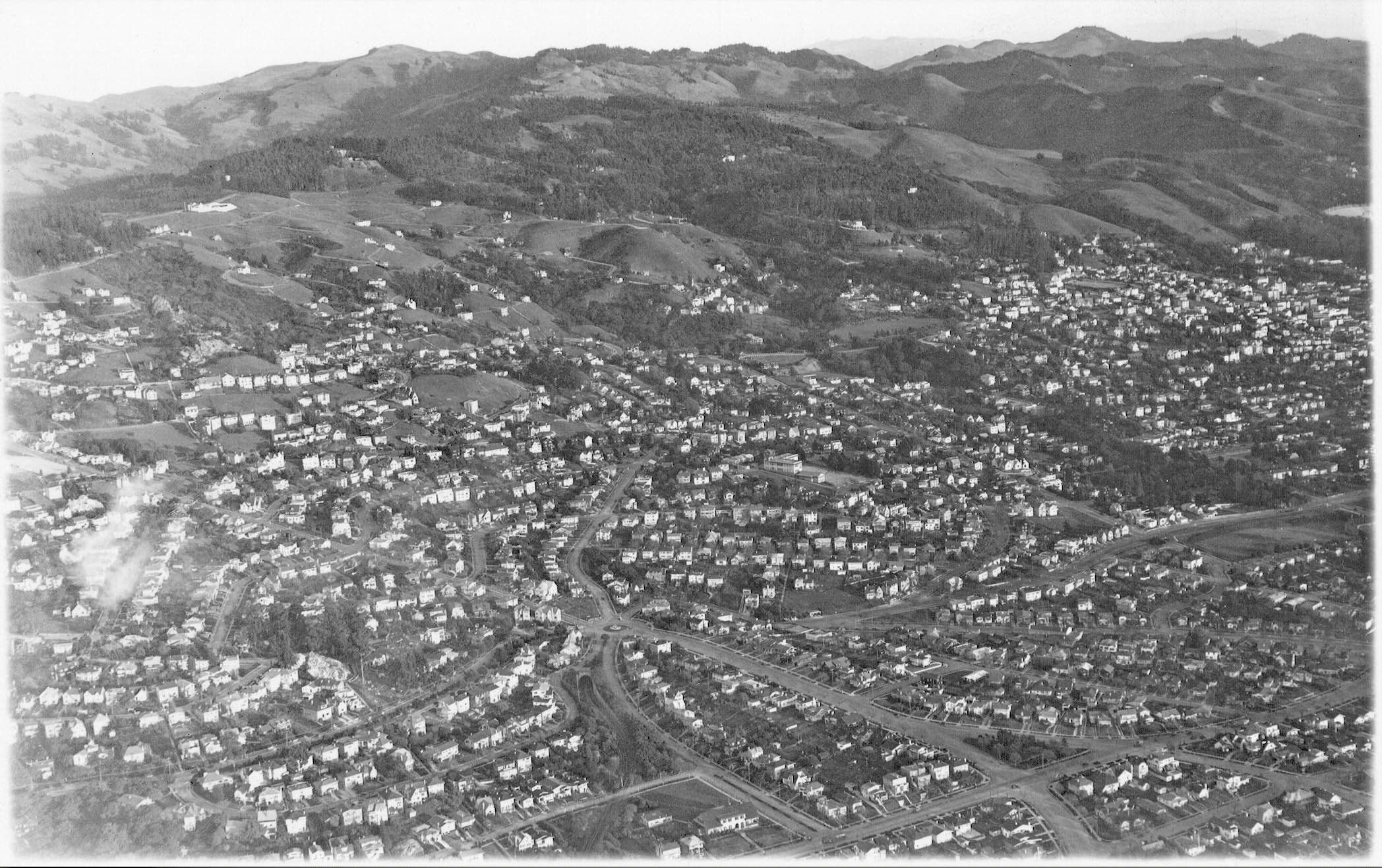
One more George Russell late 1920s aerial showing the Circle and the eastern part of Northbrae viewed to the northeast.
L348-170-George Russell Photo, Courtesy California State Lands Commission, SLC_644_NoDate_55, (Image 40 of 42)
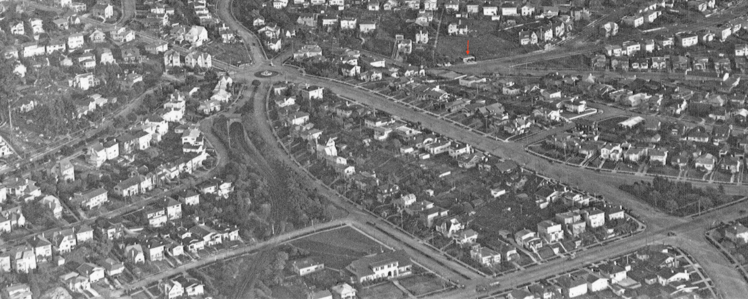
A detail from the previous aerial shows the Solano-side portal of the Northbrae Tunnel and track continuing just short of the Alameda. The red arrow shows the SP shelter at the Northbrae Station just north of where Hopkins St. joins Sutter St.
L348-175-George Russell Photo, Courtesy California State Lands Commission, SLC_644_NoDate_55, Detail, (Image 41 of 42)
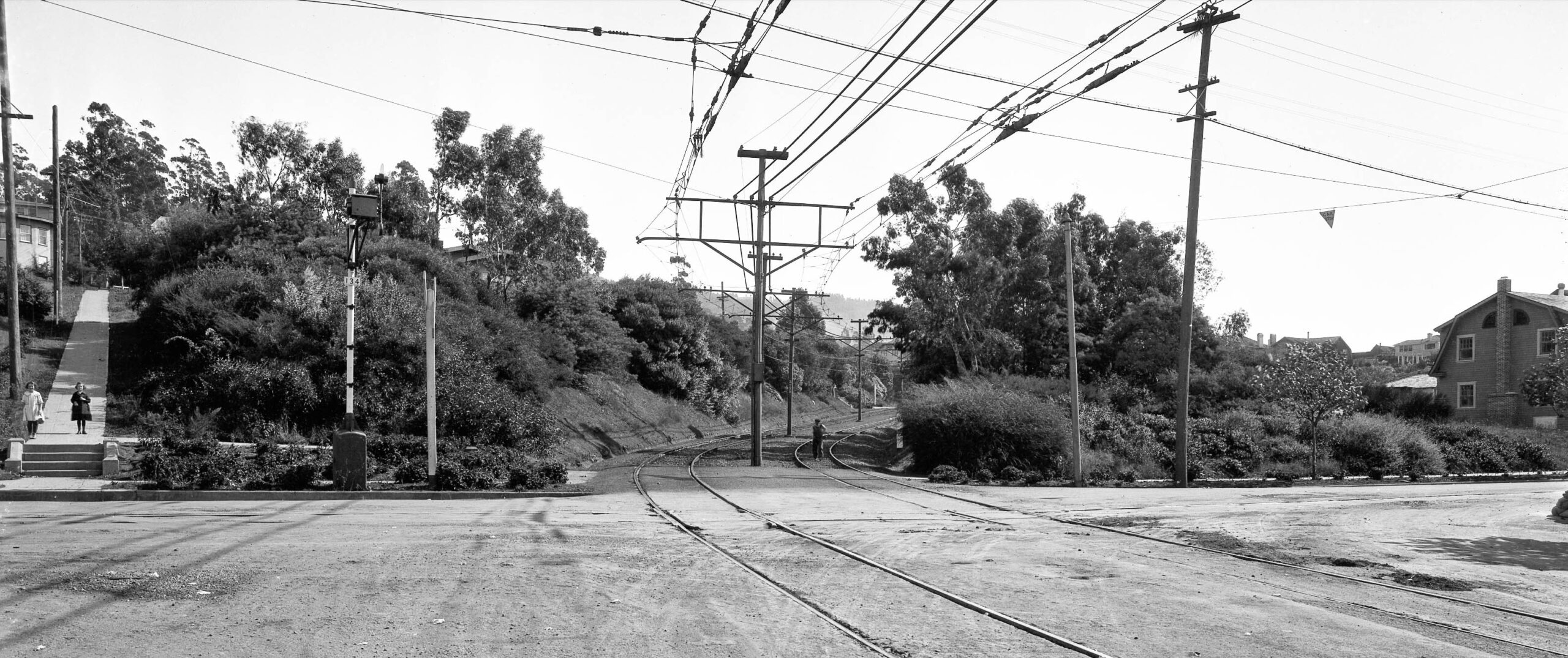
This east view from Solano Ave. shows the Key streetcar tracks on the Alameda being crossed by the SP Shattuck line. Indian Rock Path is seen on the left. Appreciation to Daniella Thompson for architectural information used in this update. Next time, an in-depth review of the Key Northbrae and SP California St. and Ninth St. lines between 1920 and 1933.
L348-180-SP Official Valuation Photo P-216, Sappers Collection, Courtesy BAERA, Western Railway Museum Archives, 75835sp, (Image 42 of 42)