Where Were the Parks in Canyon and Pinehurst?
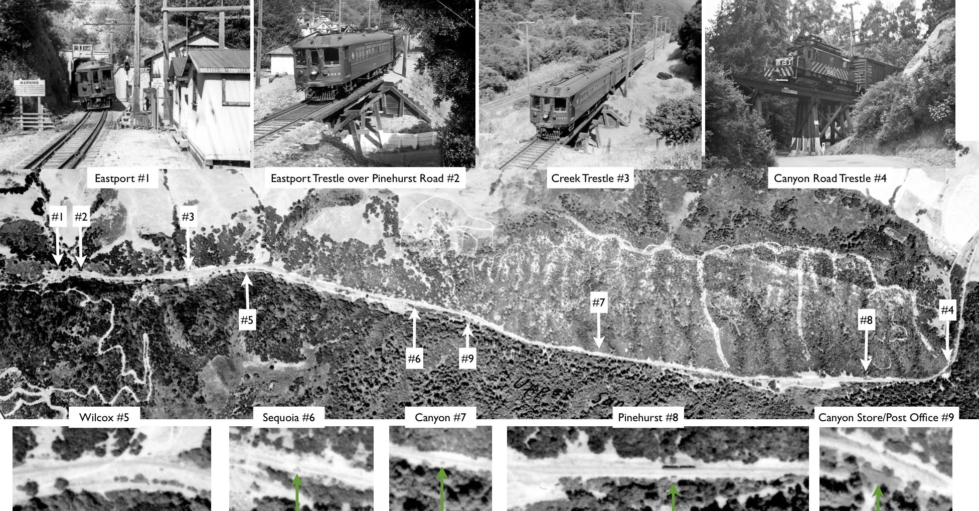
There is much written in books and newspaper articles about the special “picnic” trains that the SN and its precursors scheduled to the Canyon-Pinehurst realm. However, evidence for the location and extent of these enterprises has been largely based on oral histories that are not supported by images or documents. Starting here, vertical aerials are not helpful.
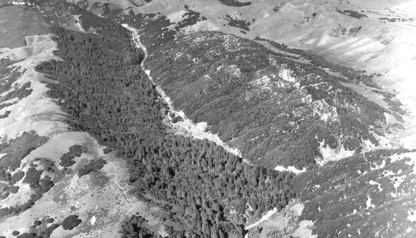
L118-05-USDA, AAA, Western Division Laboratories, BUT BUU-283-80, Panel 79, Courtesy EBMUD and other, (Image 1 of 10)

Oblique aerials such as this northeast facing aerial from 1935 are of no help as well. How much is actually known about these parks?
L118-10-HJW Geospatial Inc, Pacific Aerial Surveys, Oakland CA, Courtesy East Bay Regional Park Dist, (Image 2 of 10)
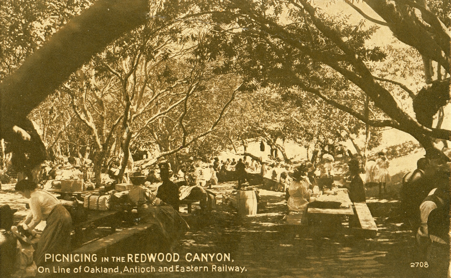
For starters, previously written books and newspaper accounts provide no images showing what these parks looked like. Here is one scene of an unnamed park from an undated postcard published sometime between 1913 and 1920.
L118-15-Courtesy BAERA, Western Railway Museum Archives, 93156sn, (Image 3 of 10)
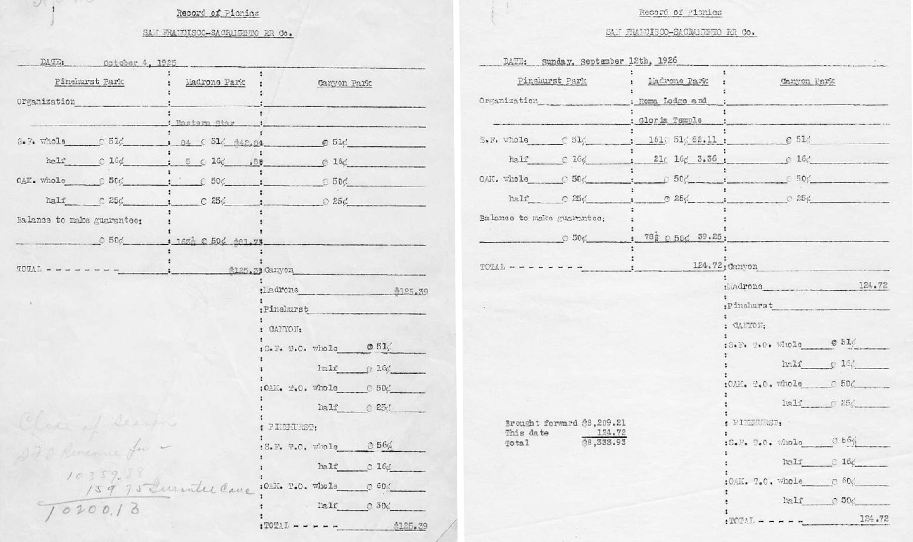
Secondly, although several names have been associated with these parks in oral histories, the two records provided list only three names; Canyon, Madrone and Pinehurst.
L118-20-Courtesy BAERA, Western Railway Museum Archives, 38566sn, (Image 4 of 10)
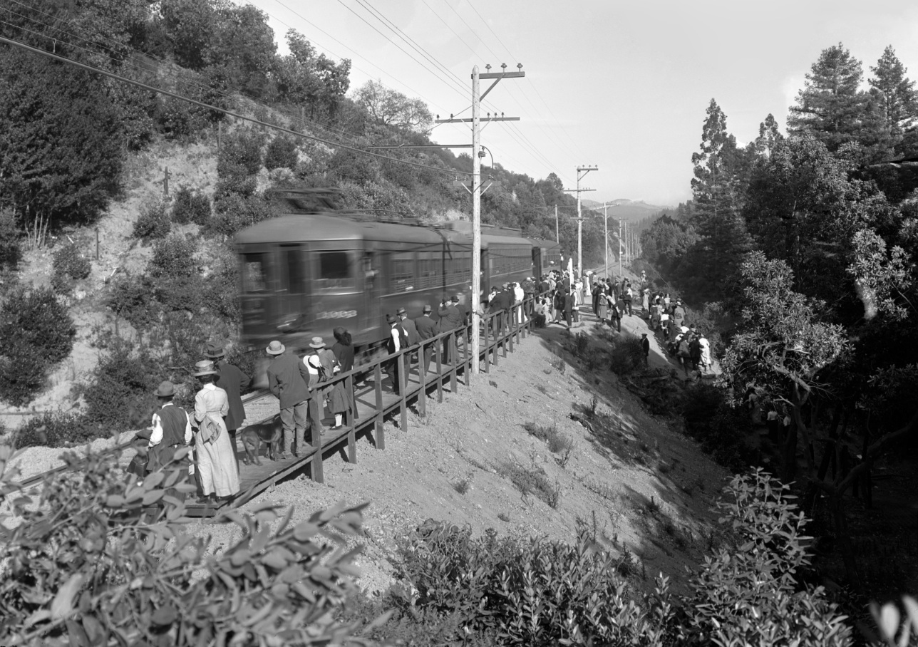
Could the Canyon Park have been near the SN Canyon station since reference to the name “Canyon” was specific for this area in the early 20th century? This southeast view from that train stop would suggest a nearby park, but is there any proof?
L118-25-Vernon Sappers Collection, Courtesy BAERA, Western Railway Museum Archives, 24196oae, (Image 5 of 10)
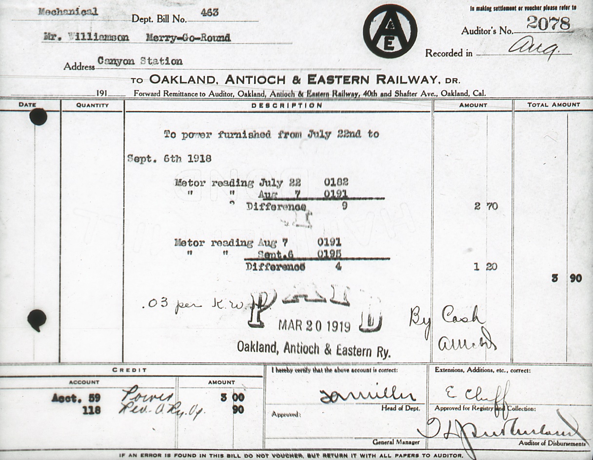
This receipt from 1919 clearly documents the existence of a merry-go-round at this location, but the location relative to the station has not been determined.
L118-30-LL Stein Collection, Courtesy BAERA, Western Railway Museum Archives, 93164sn, (Image 6 of 10)
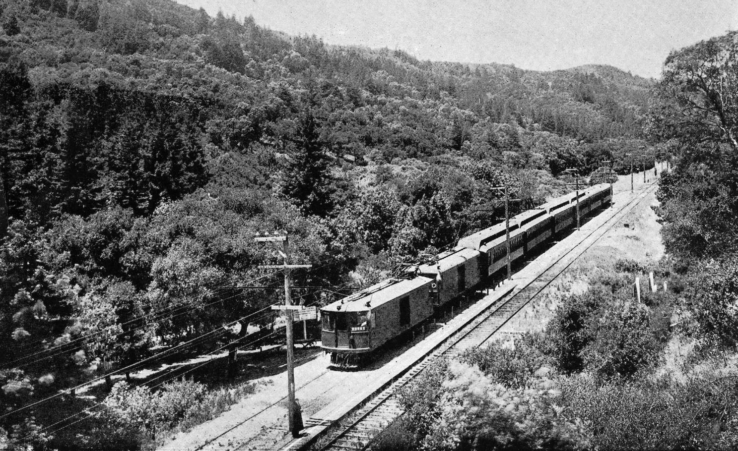
This northwest oblique from an ad with a picnic train at the Pinehurst stop shows a sign to the left of the train and a few picnic tables. Could this section that sits right up against the station be Pinehurst Park?
L118-35-Vernon Sappers Collection, Courtesy BAERA, Western Railway Museum Archives, (Image 7 of 10)
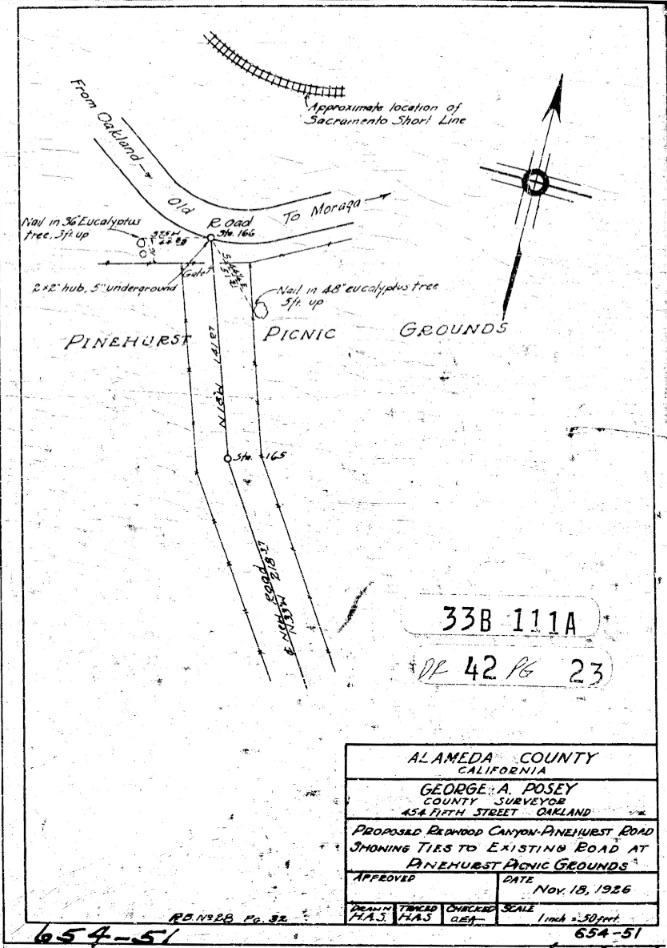
According to this drawing by Alameda County Surveyor George A. Posey from Nov. 18, 1926, the answer is definitely no. The Pinehurst Park was on the western side of the intersection of what is today Pinehurst Rd. and Canyon Rd. More on the significance of Posey assessing this Contra Costa County site in a later update.
L118-40-George Posey Survey, Courtesy Alameda County Public Works, (Image 8 of 10)
This letter from Apr. 20. 1917 reveals that the park adjacent to the Pinehurst station was Madrone Park.
L118-45-Courtesy BAERA, Western Railway Museum Archives, 38566sn, (Image 9 of 10)
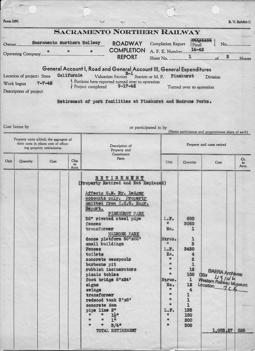
Is there anything else known about these parks? Only that the contents of Pinehurst and Madrone Parks were sold off in 1942. So in total, very little known about these parks that can be definitively documented. More research will be needed.
L118-51-Courtesy BAERA, Western Railway Museum Archives, 43146sn, (Image 10 of 10)